Platform C - Syddyssen


This oak bench and viewing point by the design studio Fokstrot was completed in January 2020 and is. in part, a rethinking of the Copenhagen circular bench but here people face inwards rather than looking out as a place for conversation although there are also good views down the water to Kaninøen - a triangular island that was part of the outer defences of the city - or across the water, and back towards the city and to Christianshavns Vold, with the distinct twisted spire of Vor Frelsers Kirke or Church of Our Saviour.

The platform is less than 100 metres from the heavy traffic of Torvegade - the road down through Christianshavn from Knippelsbro to get over to Amager - but this could be a different world.
Walking from Christianshavn, at the end of the causeway over the water, Syddyssen is to the left, just before Christmas Møllers Plads, and is the footpath along the inner edge of the low outer embankment of the defences.

FOKSTROT

Welcome back ….. Designmuseum Danmark is open

Designmuseum Danmark has been closed to the public for a major restoration of the building but reopened today.

When the pandemic struck, the design museum - like all public buildings in the city - had to close.

It has been said that around 90% of the income for the museum came from visitors to the city and that sudden stop to those tourists, and, as a consequence, to the revenue stream, had an immediate and dramatic impact.

For some time, it had been obvious, even to visitors, that the buildings needed some major work and a carefully-phased programme had already been prepared that meant shutting different galleries in a sequence of repair work that would have extended over many years. However, with the new situation, and with no certainly about when and how Coronavirus restrictions would end, a proposal was made to close the whole museum so that all the repairs and restoration work could be completed in a single campaign.

It seemed dramatic but, as things turned out, proved to be exactly the right call.

Perhaps the most obvious and most talked about work was to take up the distinct but distinctly uneven stone floor through all the ground-floor rooms to install a new under-floor heating system before laying a new floor. Every visitor must remember avoiding the cracks or looking round furtively as, shifting to look at something from a different angle, you made the display move or a case to rattle ..... or was that just me?

The new and highly-polished stone looks far too clean and shiny but I'm sure it will quickly wear in to a more subtle, matt finish.

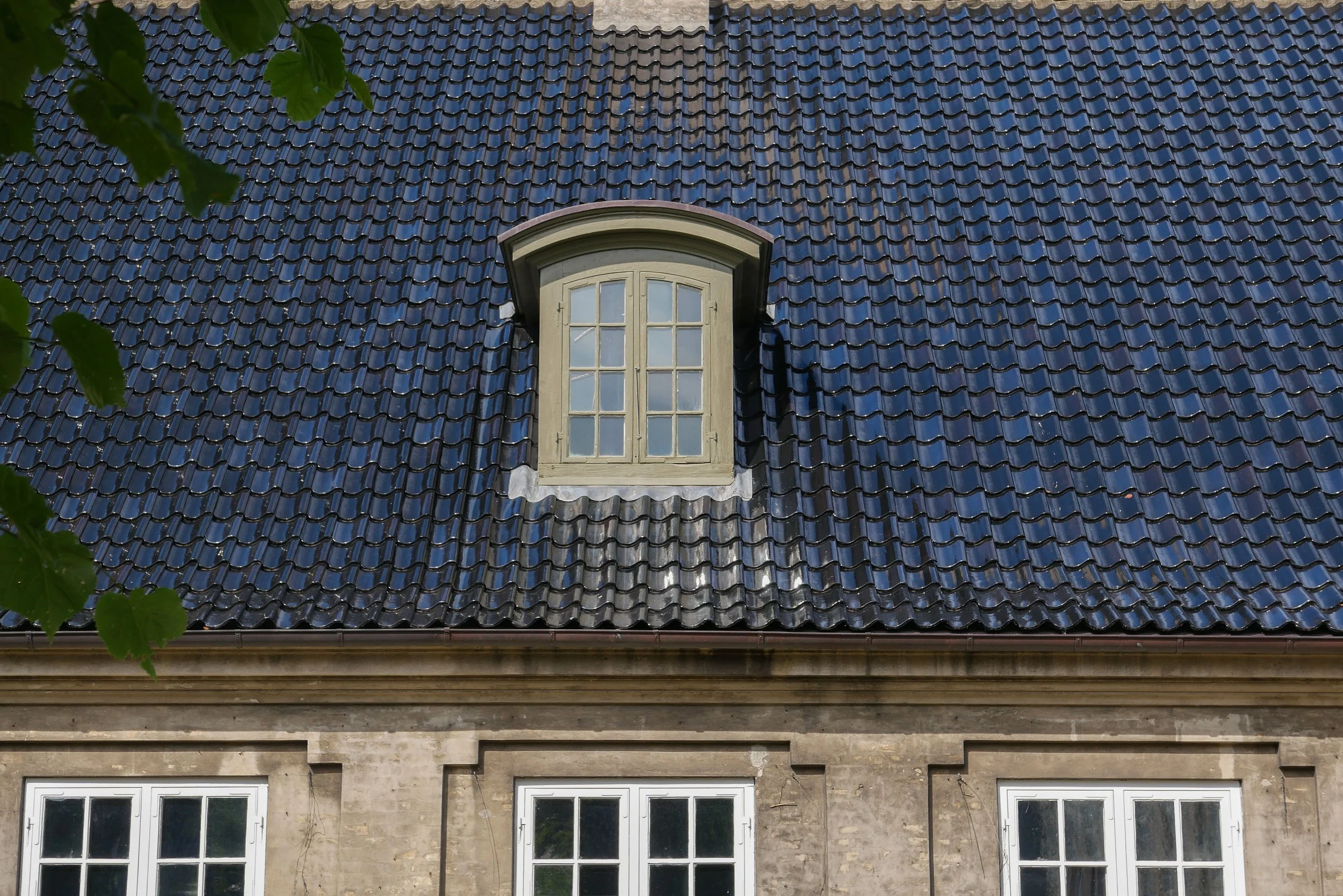
For much of the last two years, looking through the railings, the whole building has been hidden under scaffold and major work has been completed on restoring decorative stone work, including the great pediment over the entrance, and the timber frames of windows and doors and the dormers have been repaired or replaced and repainted so the exterior, now free of the scaffolding, looks superb.

Inside, I was sorry to see that the timber blocks in the passageway through the east range have been replaced but I am sure that these too will settle in and gain some much-needed dust and wear.

In the galleries, walls have been patched or re-plastered and repainted but it is good to see that patina has been kept or recreated .... Danish house painters do amazingly perfect paintwork, even on old walls, but here the slightly uneven surface and the obvious build up and making good of paint layers does give a much softer and much more sympathetic background to the displays.

Some improvements are less obvious but again were crucial ... so large windows along the south side of the building have had secondary glazing added on the inside, and this appears to have special glass to take down the impact of UV so more natural light can be let into the galleries where, in the past, nearly all the windows were shuttered or covered.

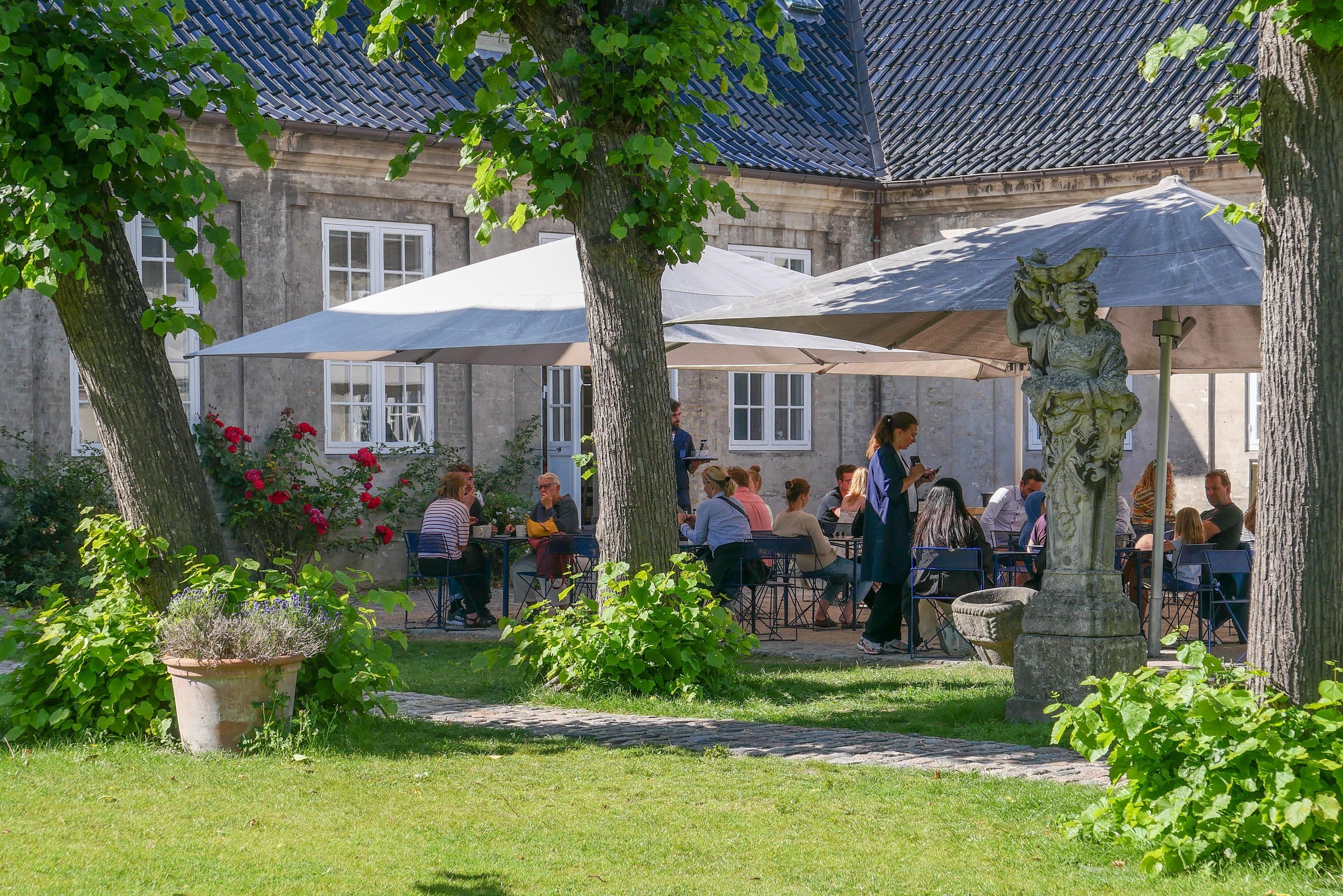
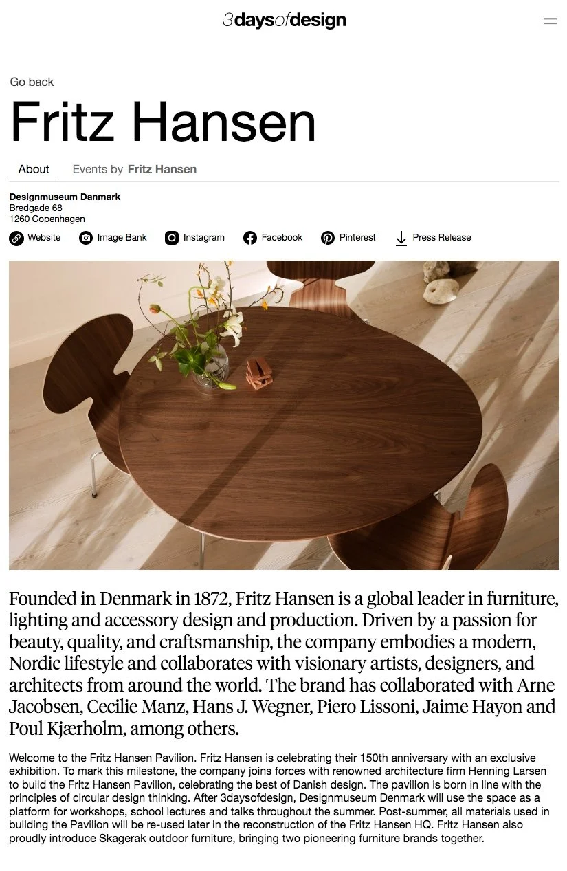
In the great green courtyard, a large, temporary pavilion, built by Fritz Hansen for 3daysofdesign, is still at the centre but the lime trees have survived being at the centre of a building site and the grass is back and the lines marking the joins in the new turf are quickly growing over.

And the restaurant with seats and tables in the sun outside is back so all's right with the World.

Frederiks’ Hospital / Design Museum Danmark - the building


FANG DIN BY / Capture Your City 2022

In collaboration with the Copenhagen Photo Festival, Fang din By - Capture Your City -  is an annual photographic competition and exhibition at the Danish Architecture Center that is now in it's seventh year.

Over 5,300 photographs were submitted and the 56 images for the exhibition were selected by a jury that included the photographer Helena Christensen; the novelist and illustrator Maren Uthaug; the CEO of Copenhagen Photo Festival, Maja Dyrehauge; the photographer, Anders Hjerning and, from the Danish Architecture Center, Tanya Lindkvist.

The theme for the competition this year was Soul of the City and photographers were asked to show "how architecture forms the framework of the lived life."

The winner of the open competition was Tanja Zhigalova with a striking photograph of a woman sitting on the steps of Vor Frue Kirke in the shadow of one of the bronze statues on the west front.

There was a separate competition for schools and first place was awarded to Kaya Lund Jørum who is a pupil at Stokkebækskolen.

Fang din by is at the Danish Architecture Center
on Bryghuspladsen in Copenhagen
from 9 June to 2 October 2022

the photographs will also be shown at other venues including:
Allinge, Bornholm - 9 June to 31 June 2022
Dokk1, Aahus - 1 July to 30 July 2022
Sønderborg library - 1 August to 31 August 2022
Ringe library, Faaborg - 1 September to 2 October

the photograph by Tanja Zhigalova

3daysofdesign 2022

This year,  3daysofdesign - a major design event in Copenhagen - has shifted times and days.

In previous years, studios, design stores and venues opened on the Thursday, around lunchtime, with opening parties or launches for new products on the Thursday evening. Friday was a packed day and then Saturday was slower with a relatively relaxed winding down ending mid afternoon.

This year, it seems more focused because events start on Wednesday morning and run through three complete working days .... so Wednesday 15th June, Thursday the 16th and through to Friday 17 June.

In the past, 3daysofdesign was part serious design event - an open house for visiting buyers and professionals - and part a local celebration for people in the city, who work in the design industry, to show off proudly what they have done recently or reveal what is in the pipe line but it was also a chance to see friends and colleagues. People could meet and socialise and I hope that survives.

The official web site for 3daysofdesign is fantastic and it’s absolutely essential if you want to see as much as possible.

This is a design event for and by designers so it should not be surprising that a lot of effort and thought has gone into the web page and the app but they have deceptively simple graphics for what is a very sophisticated guide that has good photographs and a lot of information .... not just addresses and times, but good pen portraits so anyone can track down new companies or just refresh their memory on the hardy perennials. There are also short Journal entries with some interesting interviews.

On the site, Programme is where you start if you want to organise your time around openings or talks or even - just possibly - to find when and where wine and food will be available.

A section headed Search the Exhibitions is the what-is-where section and, even if you think you know which company is where, remember that companies do splash out on some adventurous one-off venues and smaller companies - particularly if they do not have a base here in the city - will open a pop-up shop or will camp out in a design hotel or an embassy.

This year there are 214 sites ... so you can see that - to have any hope of getting around what you want to see - you have to plan your route or your route march with some care .... even if it is only to be in the right place for the right food or the right booze. Your excuse, in that case, is that good design and good food are close cousins that bring out the best in each other.

The entry in Exhibitions will open up a pen portrait of the designer or the design company along with photographs and links to company sites and Instagram pages and so on .... a great way to get the right background information before trying to chat to a designer or the CEO.

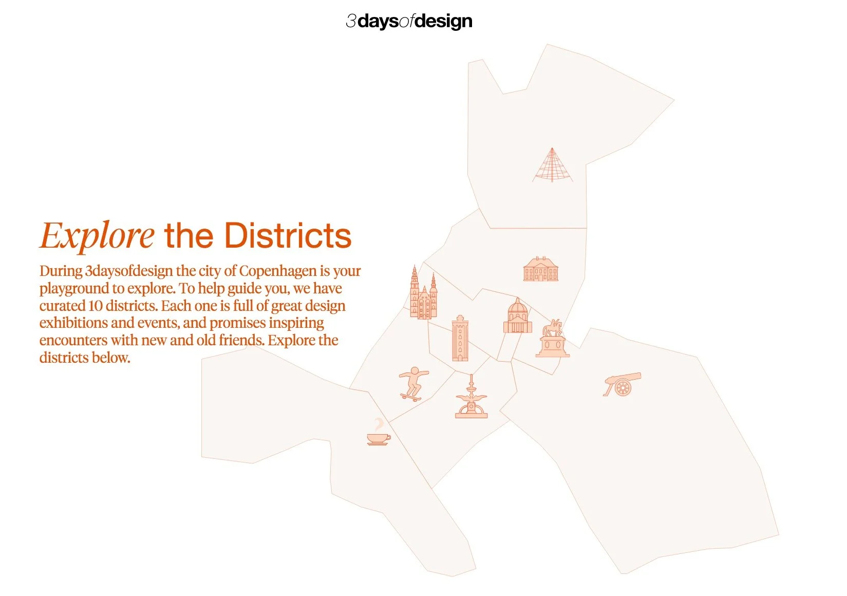
There is a useful section on the site where you can Explore the Districts.

Copenhagen may seem compact - if you compare the city with New York or London or Milan - but remember tourists have suddenly been let loose here so, at the very least, plan your route so you only cut across Strøget and not walk along it.


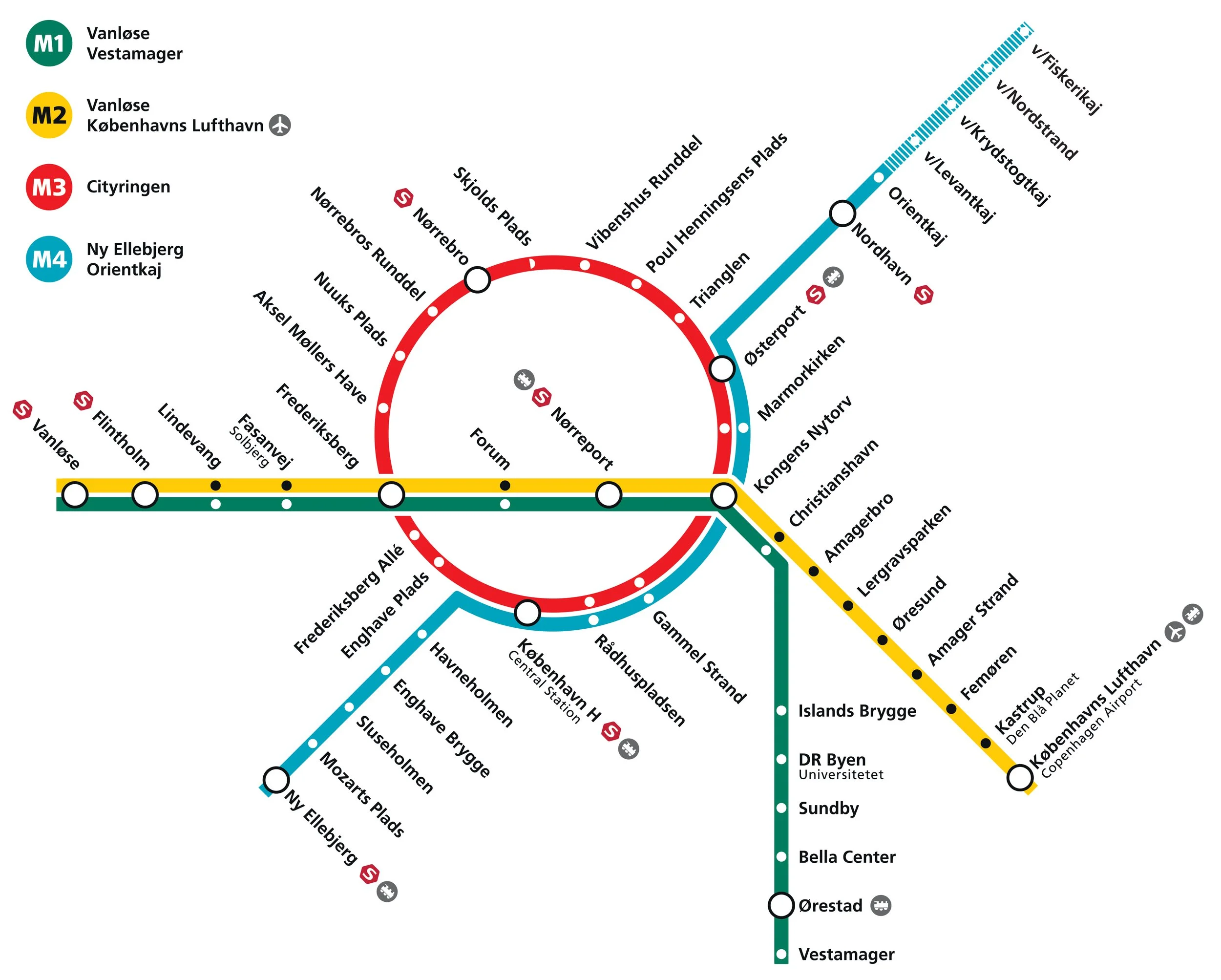
a new metro line across Amager

Reports in newspapers this week suggest that politicians at city hall have agreed on a new route for the next new line to be added to the metro system in Copenhagen.

Identified as the M5 line in previous plans, it is to run from the central railway station to serve Amager and Refshaleøen and the controversial new island of Lynetteholm.

Back in the Autumn of 2020, several options were published by Metroselskabet - the company that runs the metro - as they explored possible ways to extend the metro on from Orientkaj on Nordhavn to the new island of Lynetteholm and then, from there, down to Refshaeløen.

In a tight arc, the new line would have continued across Amager with major interchanges with the existing metro lines at Amagerbro and Islands Brygge before going under the harbour to the central railway station. It was also suggested, in the report, that there was also the possibility to extend the line on from the central station to serve the inner area of Nørrebro and the main hospital.

Two years ago, the priorities were to provide a metro service for the cruise ship terminal on Nordhavn and to serve the proposed housing on Lynneteholm along with an alternative route to reach the centre of the city from Amager that would relieve pressure on the original metro line from the airport and from Ørestad through Christianshavn to Kongens Nytorv that is now close to maximum capacity.

An obvious problem with those schemes was that there was a great gap in the middle where the new island might or might not be constructed ... the loop would only be fully operational when the two stations on Lynetteholm were open and it's housing completed and, current estimates suggest that will be sometime after 2070.

In addition, in order to work at optimal efficiency, any new line should have it's own service centre for it's own trains .... comparable to the service area at Metrovej in Ørestad for the original metro lines and Metro Service between Otto Busses Vej and Vasbygade for trains from the Cityringen.

In this, the most recent proposal for a new metro line from the central railway station, the line would take a wider curve across Amager to serve extensive areas of housing - both new developments and the revitalisation of older housing - where the only public transport is the bus services.

A new metro line from the central station would go under the harbour to a new station at Bryggebroen, at the south end of Islands Brygge, and then on to the existing metro station at DR Byen - rather than the original plan for an interchange at Islands Brygge metro station - and then to a new station on Amagerbrogade - further south than the interchange at the Amagerbro shopping centre proposed in earlier plans - and then on to an interchange at Lergravsparken - where passengers could change trains to get out to the airport. This new route would then continue north, close to the line of earlier route, to Prags Boulevard and Refshaleøen.

An area where the trains from this metro line could be serviced would be constructed out on the island of Prøvestenen.

This new metro line could be completed by 2035 but could then be extended on to Lynetteholm - if and when the island is finished - and, at the city end, the line could be extended on from the central station to inner Nørrebro and Rigshospitalet.

This is an important example of just how plans for major infrastructure projects have to evolve as other problems or other demands come to the fore or as the economic situation dictates.


Bispeengbuen - a new plan

Yesterday, an article in the Danish newspaper Politken reported that planners and politicians in Copenhagen might have come to a decision on the fate of Bispeengbuen - the section of elevated motorway that runs down the border between Frederiksberg and the Nørrebro district of Copenhagen.

One of several major schemes to improve the road system in the city in the late 1960s and 1970s, Bispeengbuen was planned to reduce delays for traffic coming into the city from suburbs to the north west.

At the south end of the elevated section, at Borups Plads, traffic, heading into the city, drops back down to street level and continues first down Ågade and then on down Åboulevard to the lakes and, if it is through traffic, then on, past the city hall, and down HC Andersens Boulevard to Langebro and across the harbour to Amager.

Between the elevated section and the lakes, the road follows the line of a river that, from the late 16th century, had flowed through low-lying meadows - the Bispeeng or Bishop's Meadow - and brought fresh water in to the lakes. In 1897, the river was dropped down into a covered culvert and it still flows underground below the present traffic.

From the start, the elevated section was controversial as it cuts past and close to apartment buildings on either side - close to windows at second-floor level - and the area underneath is gloomy and generally oppressive. Traffic is fast moving and generates a fair bit of noise and it forms a distinct barrier between the districts on either side.

There has been an ambitious plan to drop the road and its traffic down into a tunnel with the river brought back up to the surface as the main feature of a new linear park. The full and very ambitious plan - for ambitious read expensive - was to extend the tunnel on to take all through traffic underground, to Amager on the south side of the harbour.

There has been talk of a less expensive plan to demolish the elevated section, to bring all traffic back down to street level, which would be cheaper but would not reduce the traffic and would leave the heavy traffic on HC Andersens Boulevard as a barrier between the city centre and the densely-populated inner suburb of Vesterbro.

This latest scheme, a slightly curious compromise, is to demolish half the elevated section. That's not half the length but one side of the elevated section. There are three lanes and a hard shoulder in each direction and the north-bound and city bound sides are on independent structures. With one side removed, traffic in both directions would be on the remaining side but presumably speed limits would be reduced - so, possibly, reducing traffic noise - and the demolished side would be replaced by green areas although it would still be under the shadow of the surviving lanes.

It was suggested in the article that this is considered to have the least impact on the environment for the greatest gain ... the impact of both demolition and new construction are now assessed for any construction project.

There is already a relatively short and narrow section of park on the west side of the highway, just south of Borups Plads, and that is surprisingly quiet - despite alongside the road.

On both sides of the road, housing is densely laid out with very little public green space so it would seem that both the city of Copenhagen and the city of Frederiksberg are keen to proceed. Presumably they feel half the park is better than none although I'm not sure you could argue that half an elevated highway is anywhere near as good as no elevated motorway.

The situation is further complicated because the highway is owned and controlled by the state - as it is part of the national road system - so they would have to approve any work and police in the city may also be in a position to veto plans if they feel that it will have too much of an impact on the movement of traffic through the area.

update - Bispeengbuen - 14 January 2020
update - a road tunnel below Åboulevard - 15 January 2020

note:
Given the brouhaha over each new proposal to demolish the elevated section of the motorway, it is only 700 metres overall from the railway bridge to Borups Plads and it takes the traffic over just two major intersections - at Nordre Fasanvej and Borups Allé -  where otherwise there would be cross roads with traffic lights. I'm not implying that the impact of the road is negligible - it has a huge impact on the area - but, back in the 1960s, planners clearly had no idea how many problems and how much expense they were pushing forward half a century with a scheme that, to them, must have seemed rational.

My assumption has been that the motorway was constructed, under pressure from the car and road lobby, as part of a tarmac version of the Finger Plan of the 1940s.

The famous Finger Plan was an attempt to provide control over the expansion of the city, and was based on what were then the relatively-new suburban railway lines that run out from the centre. New housing was to be built close to railway stations and with areas of green between the developments along each railway line .... hence the resemblance to a hand with the city centre as the palm and the railway lines as outstretched fingers.

Then, through the 1950s and 1960s, the number of private cars in Copenhagen increased dramatically and deliveries of goods by road also increased as commercial traffic by rail declined.

I don't know who the traffic planners were in Copenhagen in the 1950s and 1960s but, looking back, they barely appreciated old building or existing communities, and, presumably, looked to LA and, possibly, to the Romania of Nicolae Ceaușescu for inspiration. Their ultimate aim, in their professional lives, seems have been to design a perfect motorway intersection where traffic flowed without any delays.

They wanted to build a motorway down the lakes and when that was thwarted they proposed a massive motorway system that was to be one block back from the outer shore of the lakes - sweeping away the inner districts of Østerbro and Nørrebro - and with new apartment buildings along the edge of the lake - between their new motorway and the lake - that would have formed a series of semi-circular amphitheatres looking across the lakes to the old city. The whole of the inner half of Vesterbro, including the meat market area, and the area of the railway station would have become an enormous interchange of motorways where the only purpose was to keep traffic moving.

We have to be grateful that few of those road schemes were realised but there is also a clear lesson that, however amazing and visionary a major plan for new infrastructure may appear, it can, in solving an immediate problem, create huge problems for future generations to sort out.

approaching the elevated motorway from the south
the motorway from Ågade on the east side
the motorway crossing Borups Allé

the river close to the lakes at Åboulevard but now in a culvert below the road

Bispeengbuen under construction showing how it cut a swathe through the existing neighbourhood - city archive 50675

the earlier proposal to bury the road in a tunnel and bring the river back up to the surface as the main feature of a new linear park

small area of park on the west side of the road

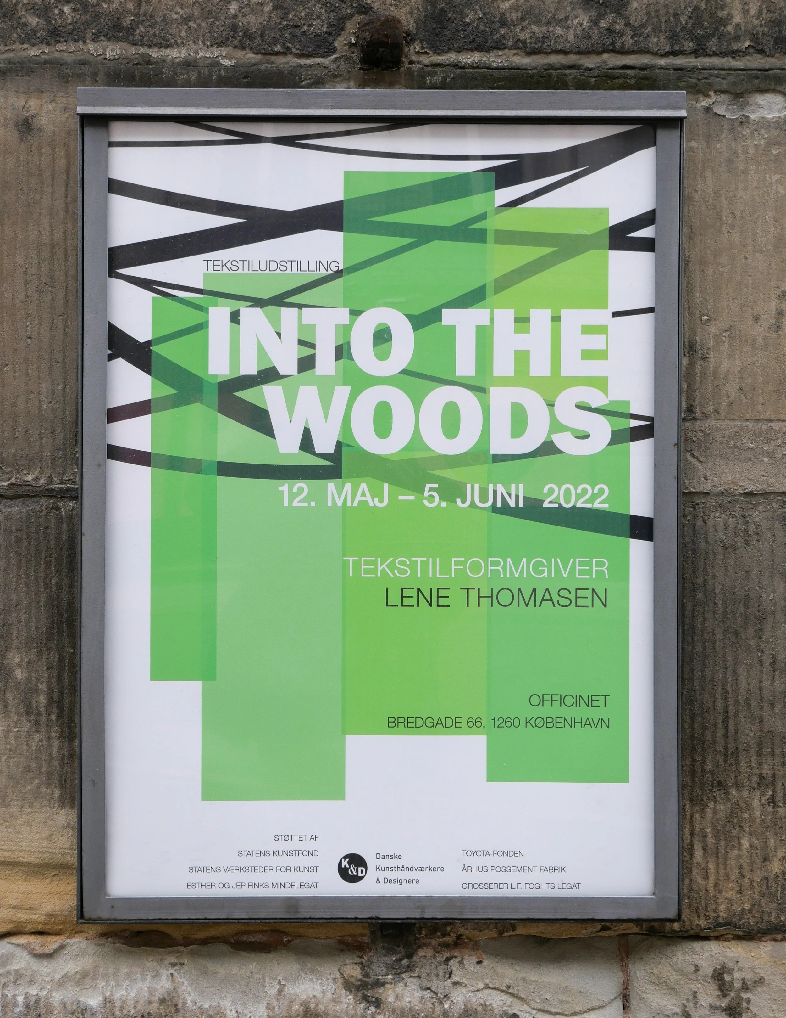
Into the Woods - an exhibition of work by Lene Thomasen

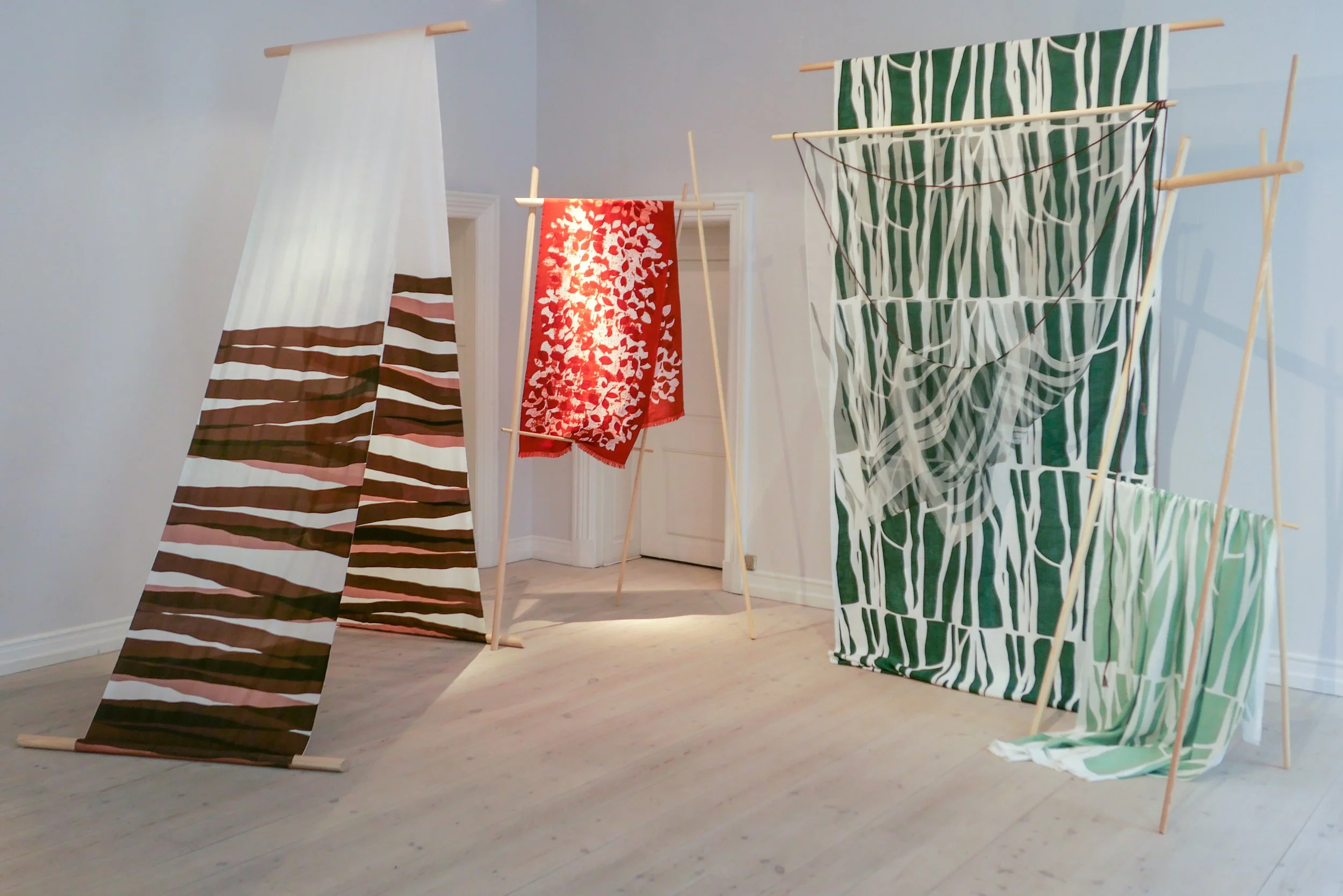
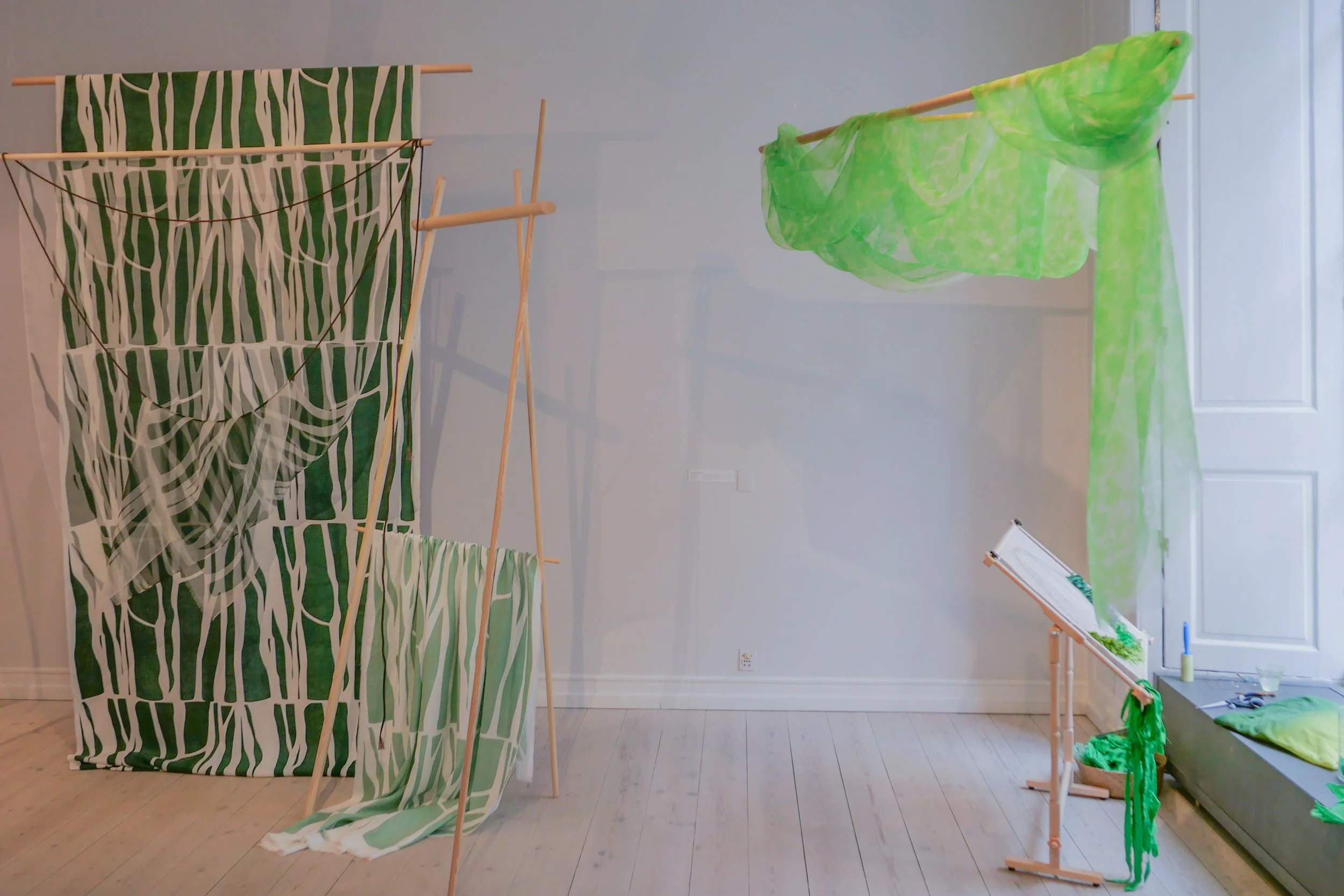
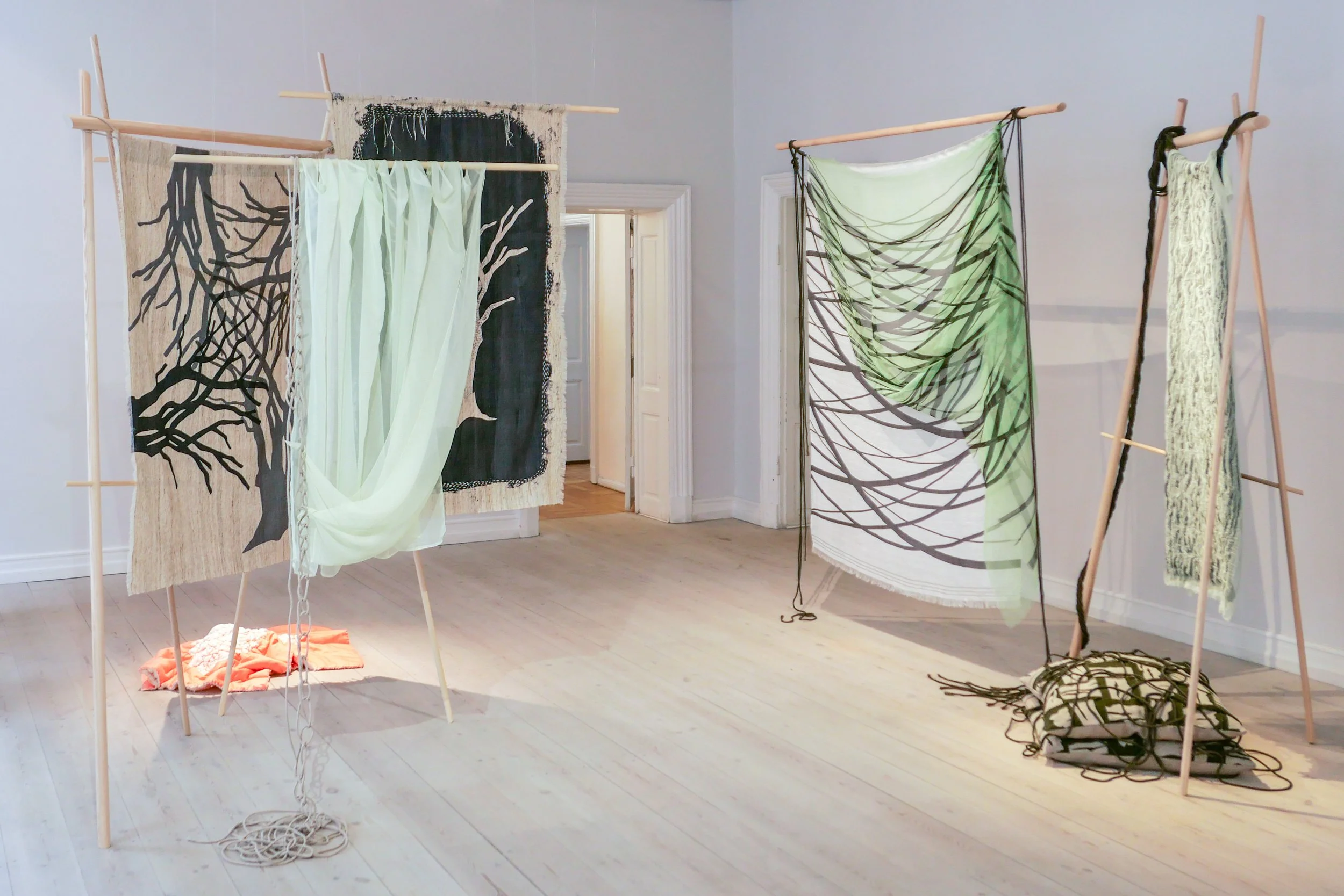
Into the Woods is an installation by the Danish textilformgiver (textile designer) Lene Thomasen at Officinet - the gallery of Danske Kunsthåndværkere & Designere - the Danish Association of Artisans and Designers.

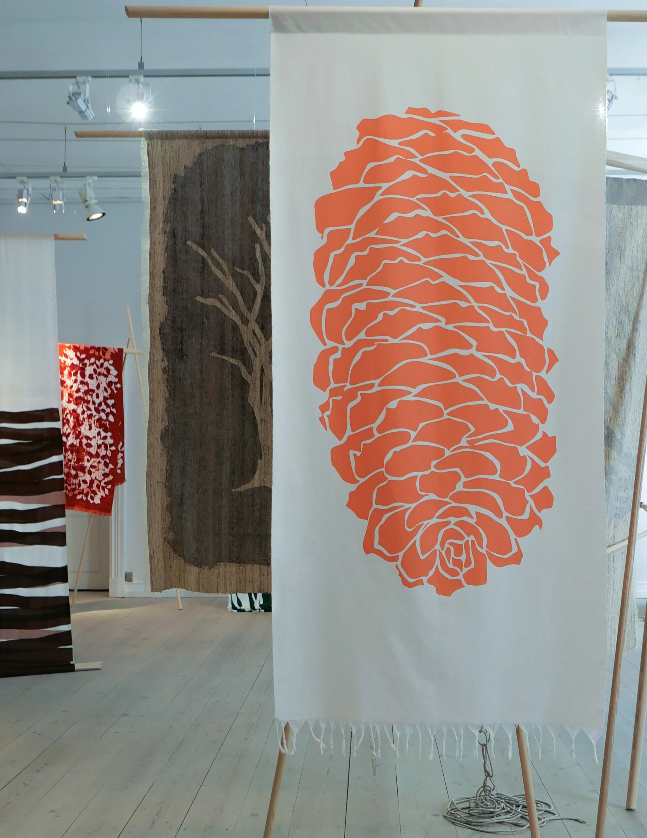
Created over the last year and created specifically for this exhibition, the works were inspired by trees, leaves, moss and, perhaps above all, the layering of light and form and colour found in the natural setting of woodland.

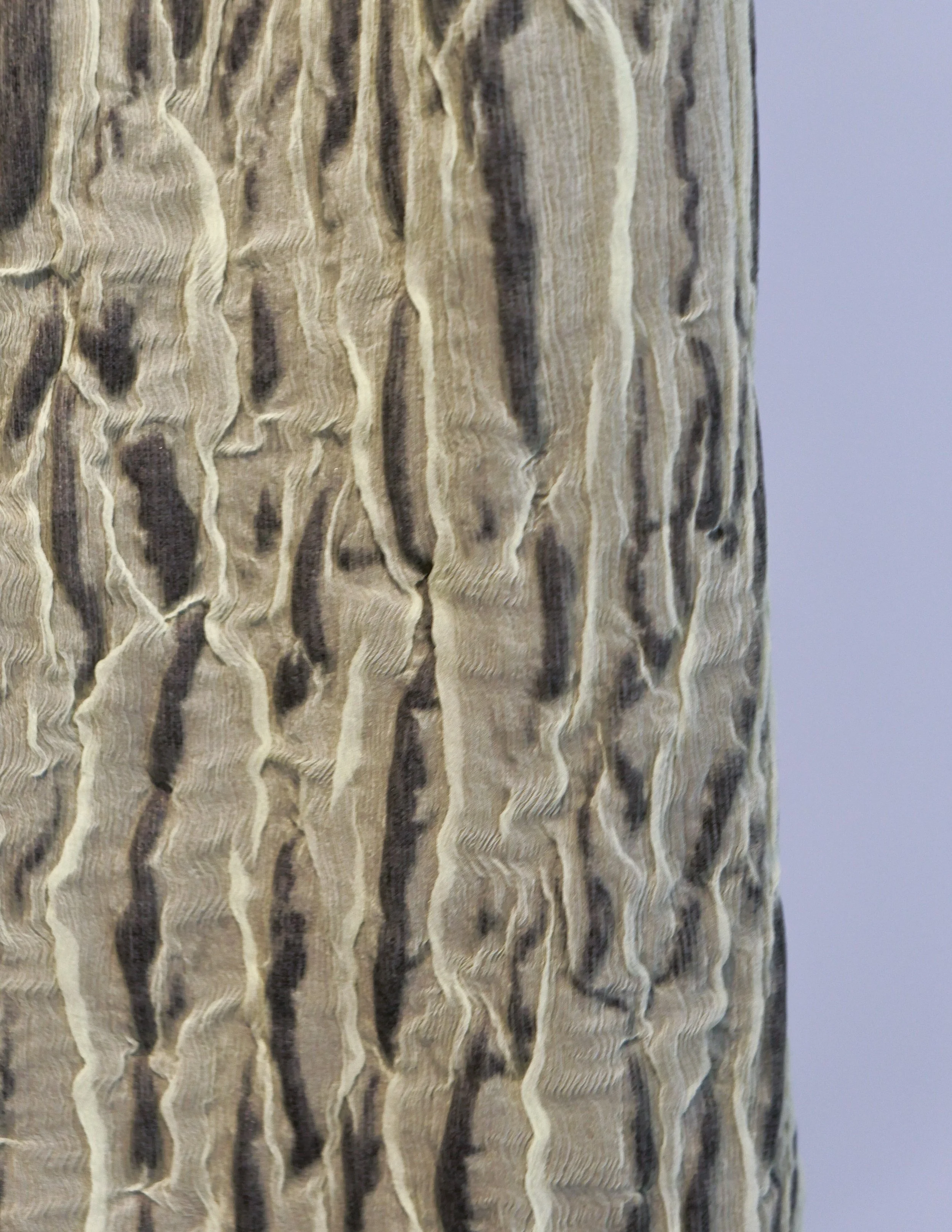
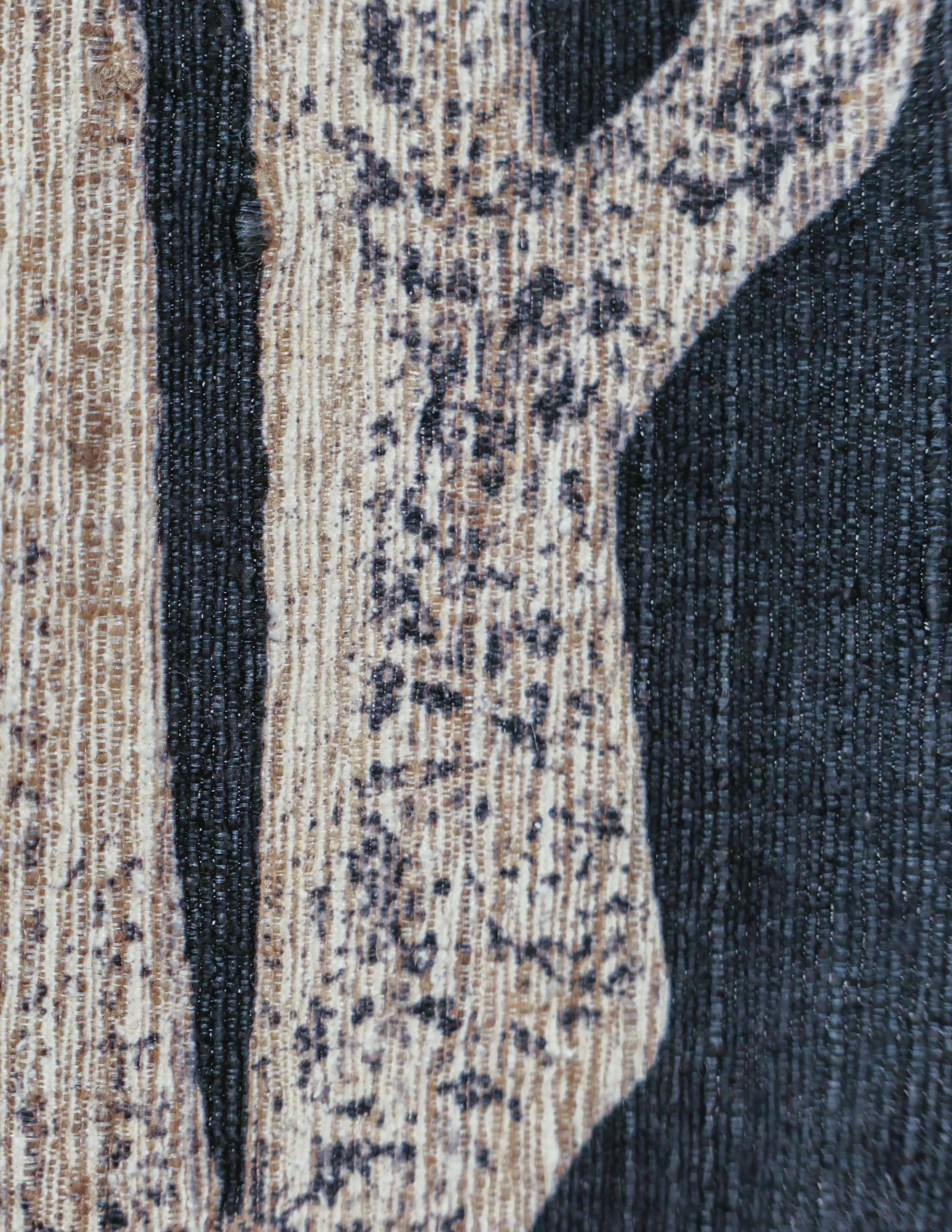
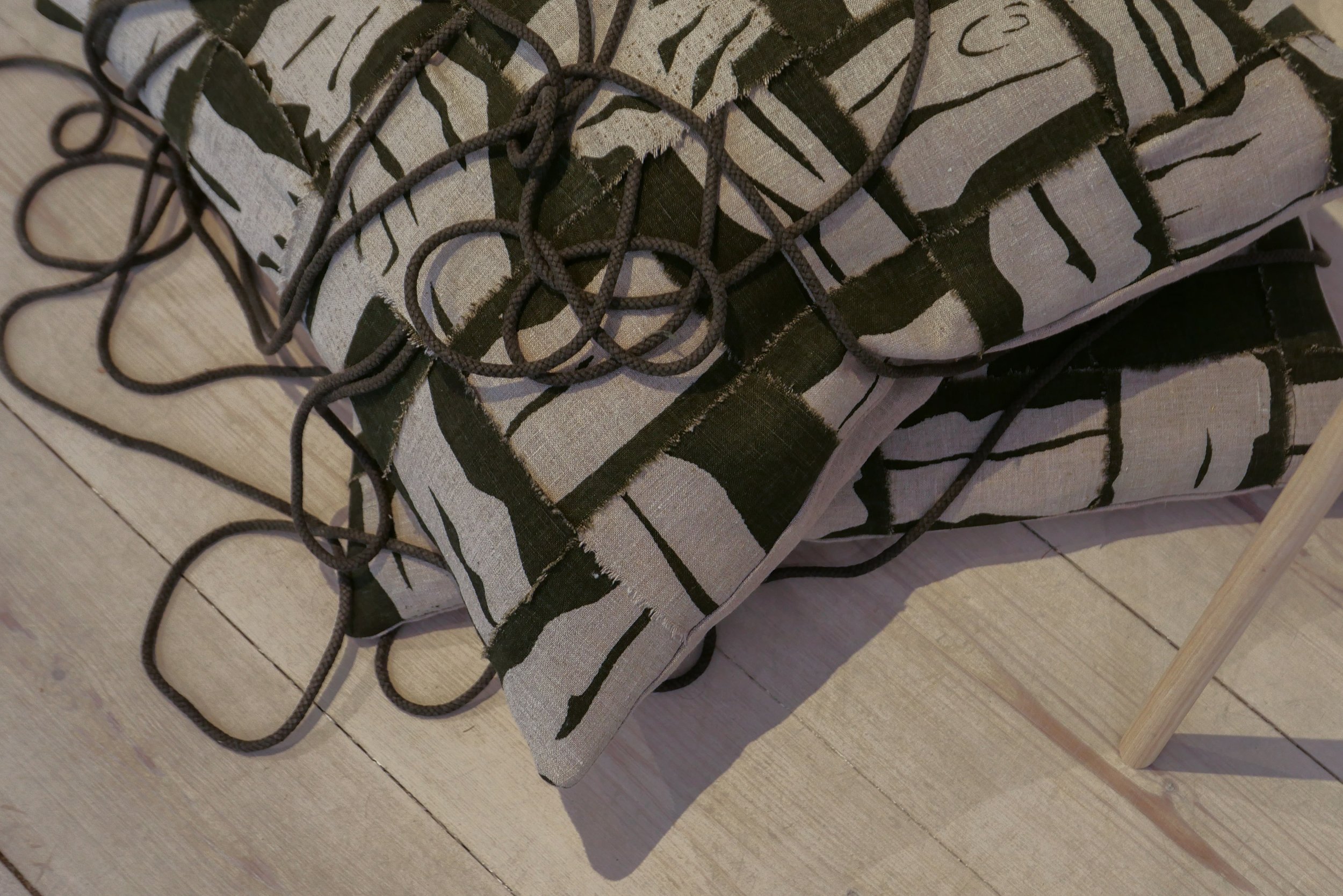
Lene Thomasen is a textile designer who trained at Kolding and now works primarily with screen printing. Works shown here are printed on silk, linen, or cotton and on very fine wool and she uses sheer fabrics and textiles that are layered and draped to create depth and a sense of space with weaving, sewing and gathering, where different materials are combined, for an intriguing and strong sense of volume.

In some works Lene Thomasen applies resist techniques - ways to block the dye reaching the fabric and often used to create texture - for instance by using a temporary coat of wax that is removed after the fabric has colour applied with a squeegee.

Patterns are overlaid or shifted or slightly offset and different intensity of dye are used, again to create a sense of depth, so, for example, to create an interpretation of the dappled light through layers of leaves and branches in the canopy in the woods.

Generally, there can be a temptation to see textile printing as simply a form of graphic design, so flat, but here, with the textiles displayed on wood frames, Lene Thomasen shows that textiles can have a strong presence in three dimensions as the works have to be explored from all angles as you walk around the gallery space.

Into the Woods continues at Officinet until 5 June 2022
Officinet, Danske Kunsthåndværkere & Designere, Bredgade 66, 1260 København K 

Lene Thomasen


knotting strips of fabric through an open canvas base is a technique found not only in this part of Scandinavia but also in the UK and was a traditional and rural way of making rugs … known in some areas as rag rugs because salvaged or worn fabrics - rags - are torn into strips to make a heavy rug often used in front of the fire or hearth of a farm house or cottage
here, some of the strips are velvet so the nap - the short, soft fibres on one side - add to the depth and richness of the effect


Lene Thomasen uses rope or cord in some of these works … not only as part of the way of hanging the textile but they become another layer of the design like vines or aerial roots in the wood

many of the works here are about how patterns overlay …. a large repeat can be off-set, or turned through 90 degrees, or overlaid in a different colour or in a different density of dye, to create an impression of depth, or the same pattern is printed on a fine, almost transparent, fabric that is draped or hung in front

note:
As for many of the artists and designers working towards a major exhibitions at Officinet, Lene Thomasen was able to spend several months at Statens Værksteder for Kunst in Copenhagen.

It is an amazing resource, in an old warehouse - Pakhus at Gammel Dok in the centre of the historic city - where designers and artists, with a scholarship or attachment, can use extensive facilities there that they may not have access to in their own studio or maybe not with the space to work at scale. The workshops also provide an environment for the intense focus and the long hours required for a complicated or demanding project.
The online site for the workshops has pen portraits of artists and projects that include photographs of their work in progress and that gives, at least, an impression of the level of technical skill and the mastery of materials that is at the core of the work of formgivers and crucial to the development or evolution of their work.
Lene Thomasen at Statens Værksteder for Kunst
Statens Værksteder for Kunst

Kvinder skaber rum / Women in architecture - an exhibition at the Danish Architecture Center


A major new exhibition about women architects, planners and designers in Denmark has just opened at the Danish Architecture Centre.

The title - Kvinder skaber rum or Women Create Space - was inspired by an extended essay by Virginia Woolf - "A Room of One's Own" - that was published in 1929. It was based on two public lectures where Woolf discussed free expression and stated that women have to be financially independent if they are to create anything of importance.

In the exhibition - where text is in both Danish and in English - an English title for the exhibition is given simply as Women in Architecture which seems to be much less nuanced than Kvinder skaber rum.

My Danish is poor but I believe rum, as used here, means both room specifically but also space and surely that should be understood as both the tangible space of an actual room but also space in the way we talk about giving people space to grow or space to develop.

So, designing and bringing to reality a room or a series of rooms is a basic and, some would say, the most obvious part of the work of any architect but here 'rum' as space implies that women have also had to create a physical space for themselves as architects - often by establishing their own independent studios.

The first section of the exhibition focuses on seven Danish architects whose work covers the period from 1925 to the end of the century and, generally, concentrates on one specific work or, at most, a few projects for each architect rather than attempting to explore a complete career. These major architects and designers are Ragna Grubb; Hanna Kjærholm; Ula Tafdrup; Grethe Meyer, Karen Clemmenson; Susanne Ussing and Anne Marie Rubin.

There are important interviews with current architects and, for a wider international context, installations by Tatiano Bilbao,, Siv Stangland and Débora Mesa.

read more / review

the opening section of the exhibition on the work of Ragna Grubb … the wallpaper reproduces the design for the restaurant in Kvindernes Bygning

Kvindernes Bygning from Arkitekten in 1939


clapping for Lynetteholm stops

Work on dredging in the entrance to the harbour, for the construction of the man-made island of Lynetteholm, has been stopped because further reports are now required on the environmental impact of dredging polluted sludge from the site and taking it down the coast to the bay at Køge to dump.

There is growing criticism of the new island and it has become a contentious issue in both parliament and in the press because criticisms or, at the very least least concern, from the Swedish government about the construction work and the island itself was not revealed when a construction act for the work was debated and passed in the Danish parliament.

work to start on dredging for the construction of Lynetteholm January 2022

note:
When I wrote about Lynetteholm in the New Year, I had to confess then that I was not sure what the Danish term klapning meant or rather what it means specifically in this context when clearing the sea bed of sludge by dredging.

The word used in all newspaper articles was klapning but dictionaries and Google always gave me clapping as the English translation but neither word was used in general articles on dredging.

Finally I tracked down the answer.

When sludge is dredged up to clear a channel or, as here, to form a stable base for constructing a man-made island, the sand and mud can be loaded onto large open barges or ships and they sail down the coast where, over a designated site, they open large flaps on the underside of the hull to release the sludge. Those flaps can be opened and closed several times to dislodge everything .... hence clapping. Obvious now I know.

looking out from Nordhavn to the Sound
at the centre of the view is Trekroner Fortet - the Three Crowns Fortress - built in the 1780s to guard the entrance to the harbour

the new island will fill the whole horizon beyond the fort with just a narrow channel for boats to enter and leave the inner harbour

by 2070, when building work on the island is set to be completed, this view will be filled by the skyline of new housing for 35,000 people


the Ny Carlsberg Glyptotek in Copenhagen opened on 1 May 1897

Today is the anniversary of the opening of the Ny Carlsberg Glyptotek on 1 May 1897.

The gallery was built to house the art collection of Carl Jacobsen that included French and Danish paintings, sculpture and antique art.

Carl Christian Hillman Jacobsen, born in 1842, was the son of Jacob Christian Jacobsen who had founded the Carlsberg Brewery in 1847. Father and son seem to have had a less than easy relationship and in 1882 Carl Jacobsen opened his own brewery, the Ny Carlsberg brewery, on land adjacent to his fathers brewery.

Carl Jacbsen travelled widely - in part to look at brewing in other countries but also to buy art. His home was at the west end of his brewery, just outside the main gate. As the collection of art grew, he extended and remodelled the villa and in 1882 added a new Winter Garden and in that year opened his collection to the public for the first time.

By 1885 there were 19 galleries alongside the house with a separate and ornate entrance from the road. Fourteen of the galleries were designed by the architect Vilhelm Dahlerup and the last five galleries by the architect Hack Kampmann. Both architects designed major buildings for the brewery.

On 8 March 1888, Jacobsen donated his collection of art to the State and to the City of Copenhagen but with the condition that they provide a suitable building.

After the old gates of the city were dismantled in the 1850s, the defences, with bastions and outer water-filled ditches, had either been levelled or, on the north side of the city, they had formed the starting point for laying out new public parks with new galleries and new museums.

The last stages of the work were on the west side of the old city. The pleasure garden of Tivoli had been founded in 1843 and was then just beyond the defences. By the 1880s, plans were being drawn up to build a new city hall between Tivoli and the old hay market, that had been just inside the old west gate and, initially, Jacobsen hoped that the new gallery for his collection would be close to the new city hall but, in the end, he agreed that the gallery would be built on the site of a ravelin below Holcks Bastion and immediately south of Tivoli.

Visiting the Glyptotek now, with its prominent position on HC Andersens Boulevard, it is difficult to understand why Jacobsen had reservation but an early photograph of the building, taken in 1897 from the tower of a new fire station, shows the Glyptotek isolated and with a water-filled basin close by that was part of a timber yard extending out into the south harbour.

The first stage of the gallery was designed by Vilhelm Dahlerup with a grand entrance front and two wings to the back that framed an open courtyard. Jacobsen’s collection of Danish and French art from the 18th century was displayed in these new galleries.

Then, in January 1899, Jacobsen donated his collection of Antique art to the Glyptotek and the building was extended to the west with new galleries that were designed by Hack Kampmann and Vilhelm Dahlerup designed a Winter Garden in the courtyard that connected the two parts.

an introduction to the historic buildings of the Carlsberg Brewery April 2022

Ny Carlsberg Glyptotek


is the area around Kalvebod Brygge the new hotel quarter of Copenhagen?

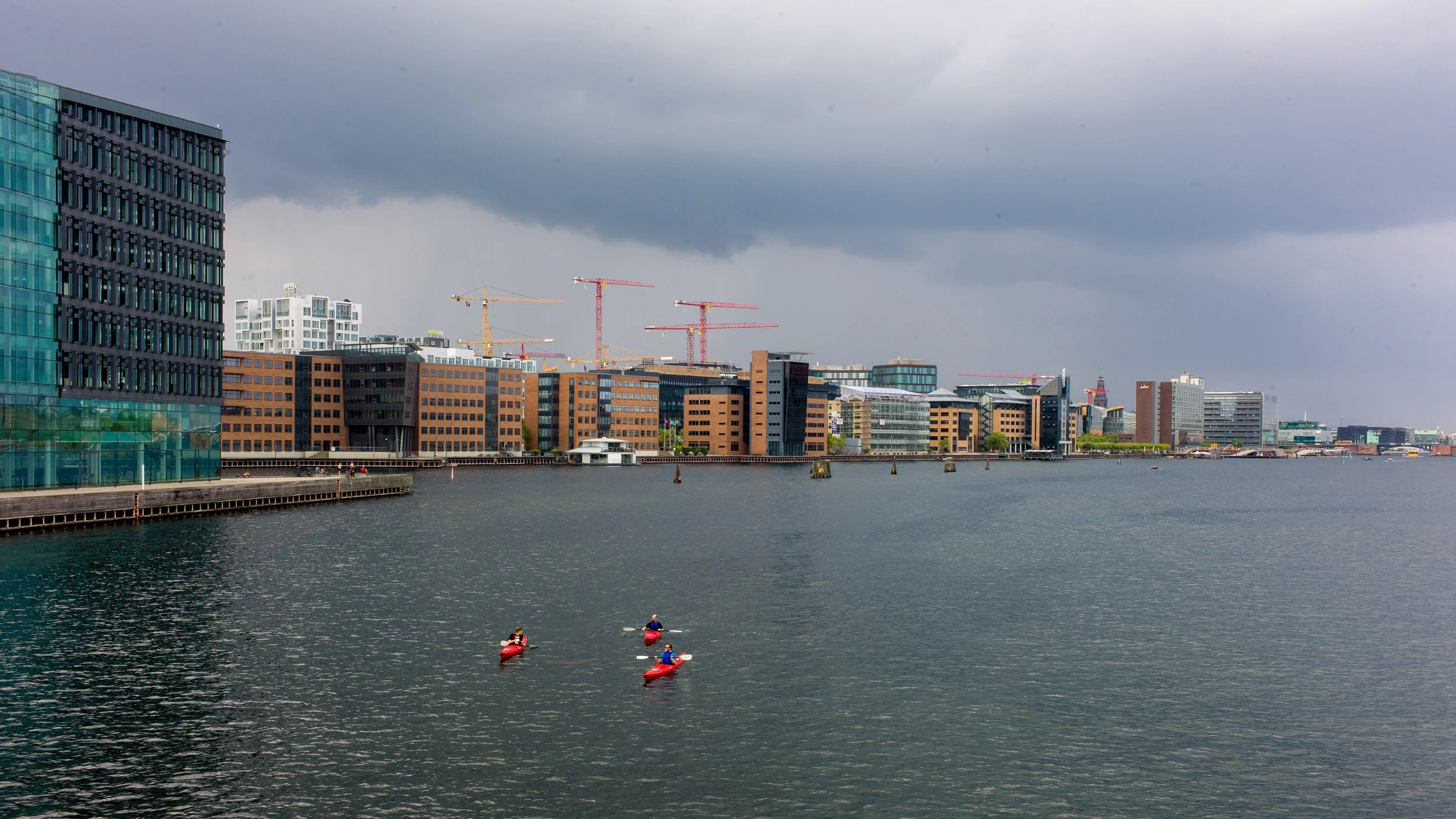
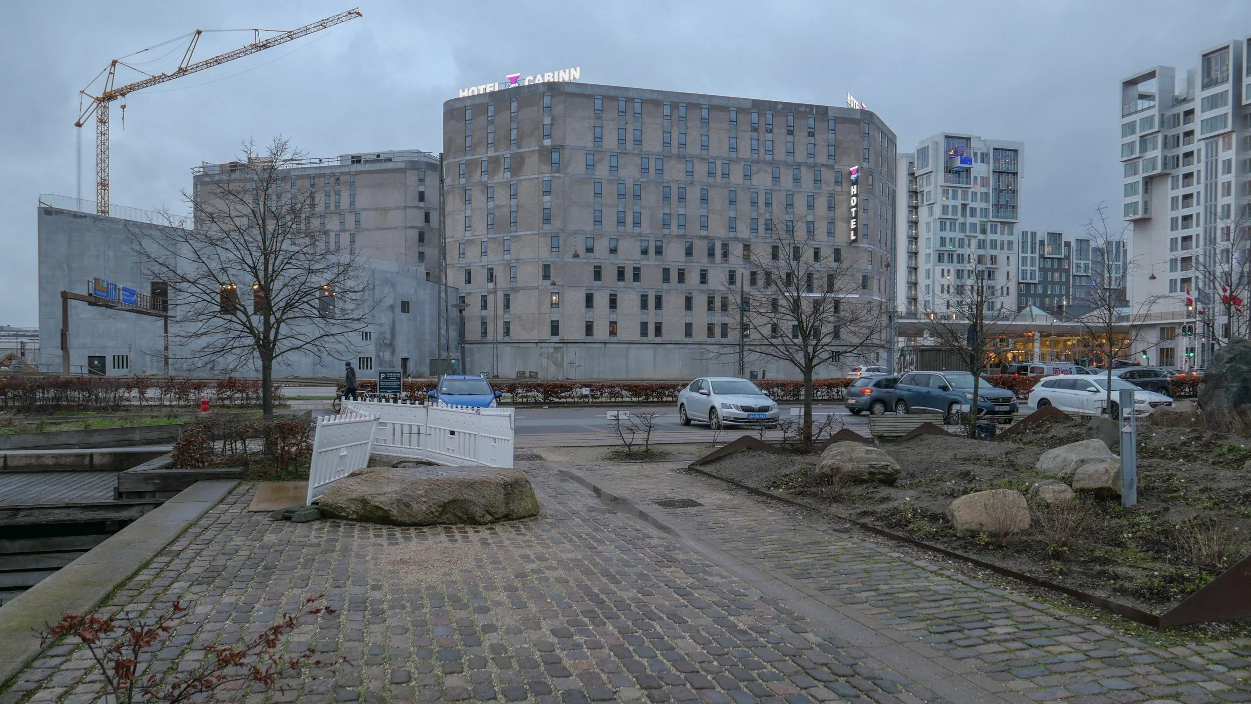
the water front of the south harbour from Amager with the new Hotel Cabinn to the left, the white towers of the Tivoli Congress Center behind the office buildings and the Copenhagen Marriott to the right

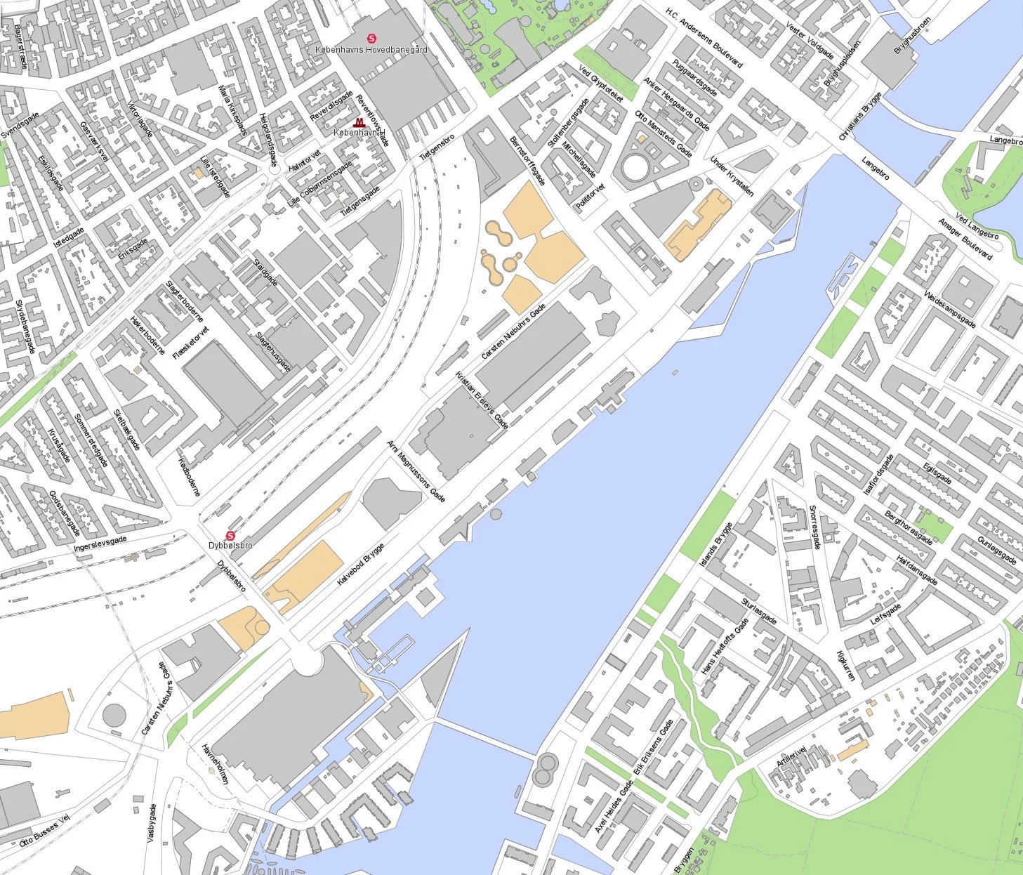
At the city end, Kalvebod Brygge starts just south of HC Andersons Boulevard and Langebro and runs in a straight line to Otto Busses Vej - just beyond the Fisketorvet shopping centre - a distance of 1.6 kilometres. This is a wide and busy dual carriageway that from the 1960s has been the main road into the city from the south.

As part of the first redevelopment of the south harbour, in the 1990s, the quay was extended out into the harbour and a line of fairly characterless office buildings were constructed. The city was almost bankrupt and development of the port was crucial so the development allowed does not not make the most inspired use of the harbour - and certainly not as it is now - although buildings at the city end of Kalvebod Brygge, around a square south of Hambrosgade, are more distinguished.

As an area, the streets and squares north of Kalvebod Brygge form a rather odd shape that is 550 metres deep at the city end - from the harbour along HC Andersens Boulevard to the south-east corner of Tivoli - but the main railway tracks take out a great arc from the north-west side so that at the south end - at Otto Busses Vej - the area is only 200 metres deep from Kalvebod Brygge back to the railway.

The first large hotel in this part of the city was the tower of what is now the Danhostel - on HC Andersens Boulevard, against the south side of Langebro. When it opened in 1955, it was the tallest building in Copenhagen and was called the Europa Hotel.

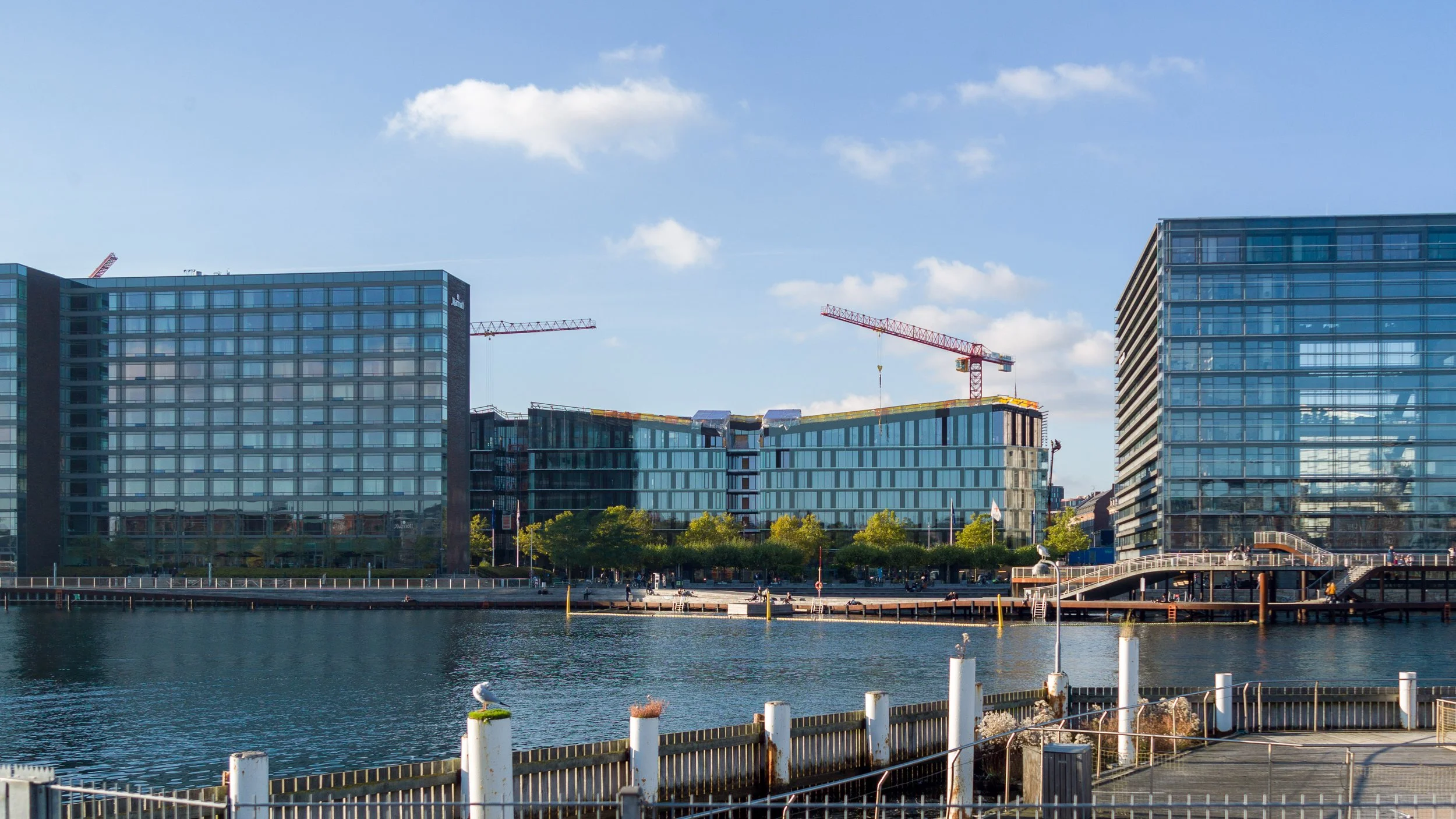
The Copenhagen Marriott, 270 metres from Langebro, was designed by PLH Architects, and opened in 2001 and Copenhagen Island - a large hotel, close to a shopping centre at Fisketorvet designed by Kim Utzon - opened in June 2006.

By far the largest hotel complex is the Tivoli Congress Center, on the railway side of Kalvebod Brygge, with all three large blocks designed by Kim Utzon The Hotel Wakeup and the Hotel Harbour Tower were built in 2009 and the City Tower in 2016.

Recently, two new luxury hotels have opened at the north edge of the area, close to Tivoli, with the Nobis Hotel in the old building of the Danish Academy of Music on HC Andersens Boulevard and Villa Copenhagen in a prominent circa 1900 building that was the offices of Danish Post Office.

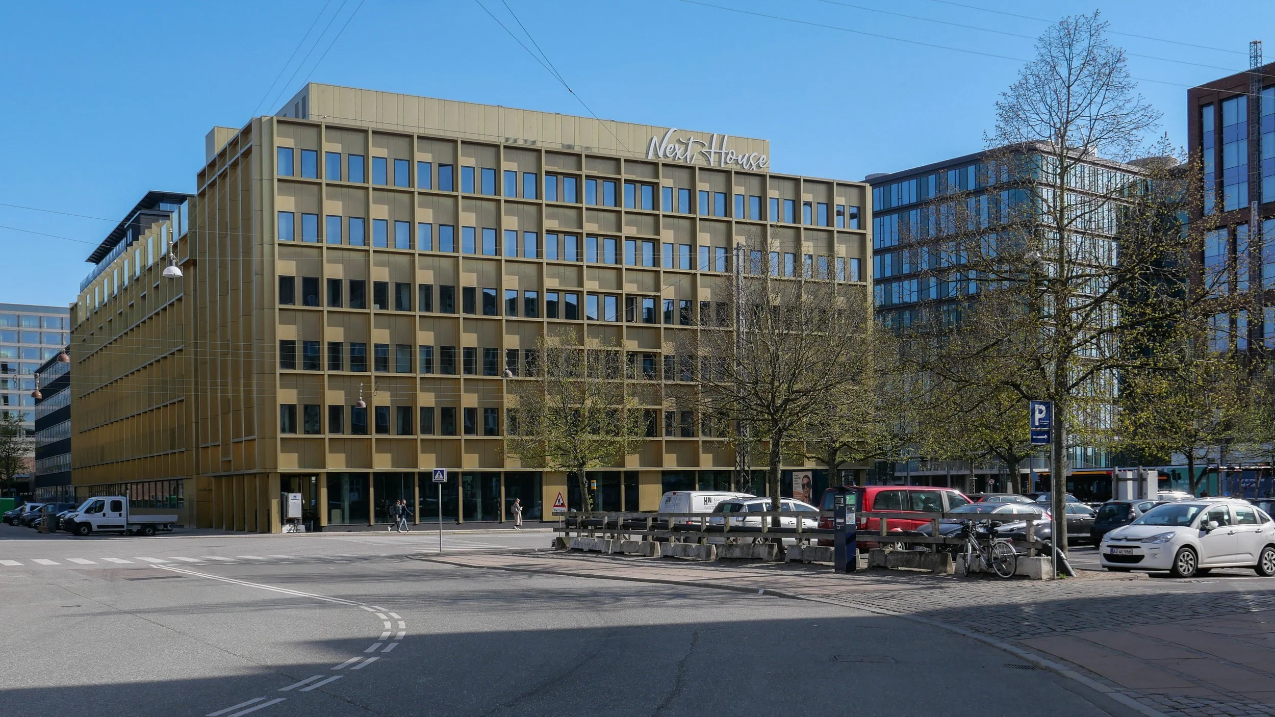
To these have now been added The Cabinn Hotel on Kalvebod Brygge - probably the ugliest building in the city from the last few years - and the recently-opened Next House Hotel, again by Kim Utzon. The next hotel in the area will be the Scandic Spectrum on Kalvebod Brygge by Dissing+Weitling that will open in June.

In a number of posts, I have written that I feel strongly that the dramatic and rapid rise in the number of tourists coming to the city and the construction of a large number of new hotels in the city over the last decade is one of the biggest threats to the character of the Copenhagen but one that is barely discussed by politicians.

The arguments for would probably be the creation of jobs, inward investment and money spent by tourists in the city in shops and at tourist destinations.

My argument against is that the huge number of tourists and, of course, all the passengers from cruise ships - just under a million in 2019 in the year before the pandemic - are swamping the city and changing the character of Copenhagen.

If you think that the number of new hotels around Kalvebod Brygge is hardly a tidal wave then maybe consider the figures. In just this one part of the city, many of the hotels are not just large but several of them are run as hostels with family or group rooms with four or more beds. Obviously that, in itself, is not a bad thing, but In just this part of the city, at a conservative estimate, there are rooms and beds for 13,500 visitors a night if you assume that there could be two people in most rooms. Not all of the rooms will be occupied on any one night but, before the pandemic, Copenhagen had occupancy rates of 80% and I am sure that all the hotels will be aiming to get back to that level as soon as possible now that pandemic restrictions have been eased.

If 13,500 does not sound like a particularly large number of tourists then consider that only 10,000 people are permanent residents in Christianshavn so, just in theory, every single person living in Christianshavn could march over Langebro and, together, they could have a weekend away. I can actually think of better ways to bond and the irony is that, of all the areas in the city, Kalvebod Brygge is probably the least likely part of the city that residents of Christianshavn would visit … unless they were cutting through to Vesterbro.

the first number is rooms and, for the hostel hotels, the second number is beds

Although this area along Kalvebod Brygge is close to Ny Carlsberg Glyptotek and close to Tivoli, there are few other attractions for tourists in the immediate area. The buildings along the quay are some of the most boring modern buildings in the city but the harbour here is relatively wide and sheltered. If city planners want to make a success of this area and if, as they have said, they want to divert tourists away from the key sites, like Nyhavn, that now get very crowded, then they should consider extending pontoons out into the harbour with historic ships moored here and with restaurant ships here rather than in Nyhavn as proposed by some.

There might be an appropriate sailing ship to convert to a youth hostel - so a Copenhagen version of the Af Chapmann in Stockholm - or a group of the Urban Rigger floating shipping containers, designed by Bjarke Ingels as accommodation for students, could be moored here.

In theory, if the pandemic really is beaten and if tourists return, and if hotels get back to 80% occupancy rates, then around 4 million tourists a year could be staying in just this relatively small area of the city so it might be an idea to give them something to see and something to do.

is the growth of tourism in the city a threat? January 2022

Kalvebod Brygge - the main road between the harbour and the railway - before the south harbour was redeveloped

looking north towards Langebro from the cycle and foot bridge that crosses from the shopping centre at Fisketorvet to Amager
the white tower of the Tivoli Congress Center rises above the office buildings along the quay and the Copenhagen Marriott is in the distance

Copenhagen Marriott to the left, on the quay, by PLH Architects 2001
and in the gap - Scandic Spectrum by Dissing+Weitling that will open in June

Tivoli Congress Center - Tivoli Wakeup by Kim Utzon 2009

Tivoli Congress Center - City Tower by Kim Utzon 2016

Hotel Cabinn Copenhagen, 2019 with 1202 rooms and 2,645 beds

Next House, by Kim Utzon 2022

Scandic Spectrum by Dissing+Weitling to open in June 2022


an introduction to Kalvebod Brygge

Planning is about the future. That's in the very word itself. We plan to do something ... planning is not retrospective. But it really is important to understand how we got here - why a street or group of buildings is as it is - to understand how and why what we have is good or bad and to use that to inform what happens next.

The history of Kalvebod Brygge is fascinating and complicated but, in terms of history, all relatively recent and all recorded on the maps produced over the last 100 years or so.

Primarily, the development of the south harbour is a lesson in how economic and political events often move faster than the best-laid plans for our streets and squares and, too often, a complicated scheme of renewal or development can take so long to realise that it is redundant or inappropriate by the time it is completed.


1912

1945

1967

Until the late 19th century, the harbour south of what is now Langebro was a wide bay.

In the middle of the 19th century a new railway from Copenhagen to Roskilde was laid out along the north beach of the bay, along what is now Sønder Boulevard. In commercial terms, the close proximity of water and railways is catnip for development … as much back then in the 19th century as it is now.

First a meat market and gas works were built out into the bay with wharves for the delivery of coal for both the gas works and then for a new electricity works built immediately south of Tivoli. That was superseded in 1932, when the coal-fired power station of HC Ørstedværket opened.

There were wood yards between the harbour and Ny Glyptotek when it was built in the 1890s but these were rapidly replaced with new streets and apartment buildings.

A new central railway station was built in 1911 and the railway was taken out on a wider curve on yet more land claimed from the bay and, for the first time, Bernstorffsgade, between the new station and Tivoli, became a main road though, initially, it did not continue much further than the south-west corner of Tivoli and certainly not as far as the harbour.

At about the same time, so from about 1890, the line of the shore of Amager, opposite, was also being pushed further and further out into the bay and both sides of the approach to Langebro became docks.

If you use the word port it usually conjurers up the image of ocean-going liners but this was docks .... vital, hard working but fairly grubby commercial quays for coal, grain, sand and building materials and soy beans and sugar. The sort of goods carried in freighters.

On the city side, these  commercial docks continued all the way up to Knipplesbro so across where the National Library and BLOX are now.

Rail tracks came off the outside curve of the main railway and ran all the way up the city side as far as Nyhavn and at Langebro the railway crossed over to Amager and ran down quays on the Islands Brygge side … all for goods and not for passengers.

The area where Kalvebod Brygge is now was mainly rail sidings and marshalling yards and, although it might seem incredible now, this was where, around 1969,  the city built the first container port. The main area for transferring containers from ships to railway trucks - then a very new system for shipping goods - was on new yards where the service depot of the metro is now.

There were soon huge new cranes along the quay for transferring containers but it was early days for this new form of shipping and there are accounts of early attempts to pick up and move containers with a fork-lift truck on each side in, what sounds like, a dangerous balancing act or containers were lifted up from the end which blocked the driver’s view of where he was going and it can’t have been that good for the cargo to have the container tipped up at an angle.

There was still a large building of circa 1910 that had been a pig market on the quayside although it had been used as a garage for some time. It was demolished in 1966 and work started on extending Bernstorffsgade down across the site of the market as far as the quay and then a main road, a dual carriageway, was constructed along the quay - and that is what is now Kalvebod Brygge - to be the main fast route into and out of the city.

This was part of wider plans to modernise radically the road system of the old city with wide and fast new roads. It was the period when there were even plans to build a motorway down the lakes as an inner ring road and the period when large blocks of old buildings in the north corner of the old city were demolished and the first glass and steel office buildings were constructed within the old defences.

But events and world economics and technology were moving faster than the plans and the dock was in decline. Not least, the problem was that the docks had to deal with larger and larger ships and these would all have meant the raising of Knipplesbro and Langebro and the opening of the rail bridge at Langebro to let them through. The docks in the south harbour went into decline and the focus turned to large new facilities at Nordhavn and on the expansion of other ports in Denmark

If the office buildings along Kalvebod Brygge can be criticised, it is because they are uninspiring and waste an amazing location but, by the late 1980s and into the 1990s, the city was facing bankruptcy and a new business area and any way to revitalise the harbour was better than any alternative. Award-winning architecture was not a priority.

on the city side, the commercial quays continued as far as Knippelsbro

the pig market that was demolished in 1966 for the extension of Bernstorffsgade as far as Kalvebode Brygge - Copenhagen Archive 42126

construction work for Kalvebod Brygge - Copenhagen Archive 91920
the building immediately below the end of the crane is what is now KB32

Bernstorffsage and Kalvebod Brygge in 1989 - the tower block is now a hotel and the car park to its right is the site of the new Scandic Spectrum hotel
the area of grass to the left is where the SEB offices are now
note the commercial/industrial building north of the police station - the building with a circular courtyard
that site too is now a hotel

det grønne strøg / the green line - the high-level landscape of Kalvebod Brygge

An ambitious plan to create a raised landscape at a high level between new buildings on the railway side of Kalvebod Brygge was set out in the local plan of 2006 where it was described as if it was to be a series of hills.

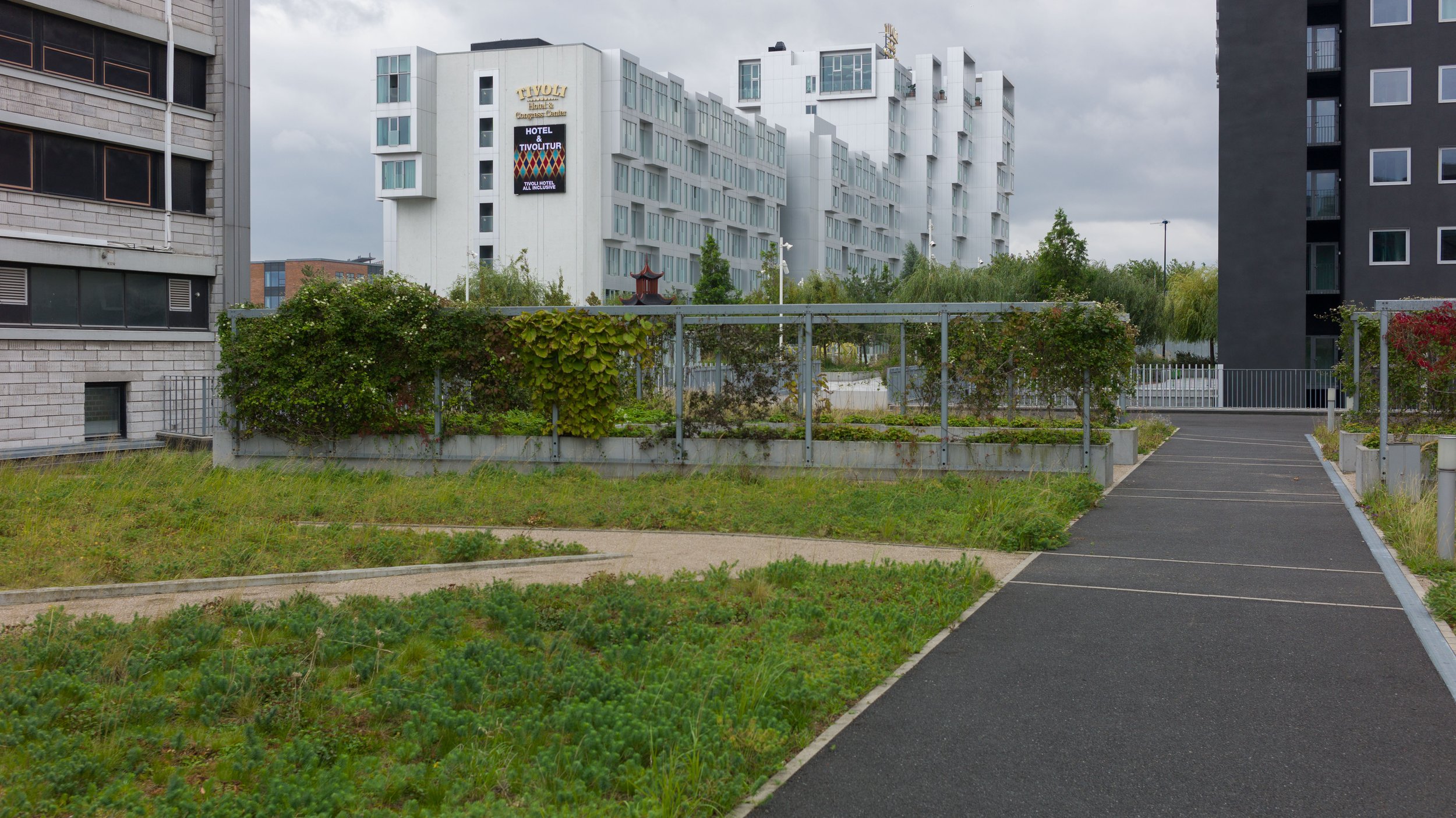
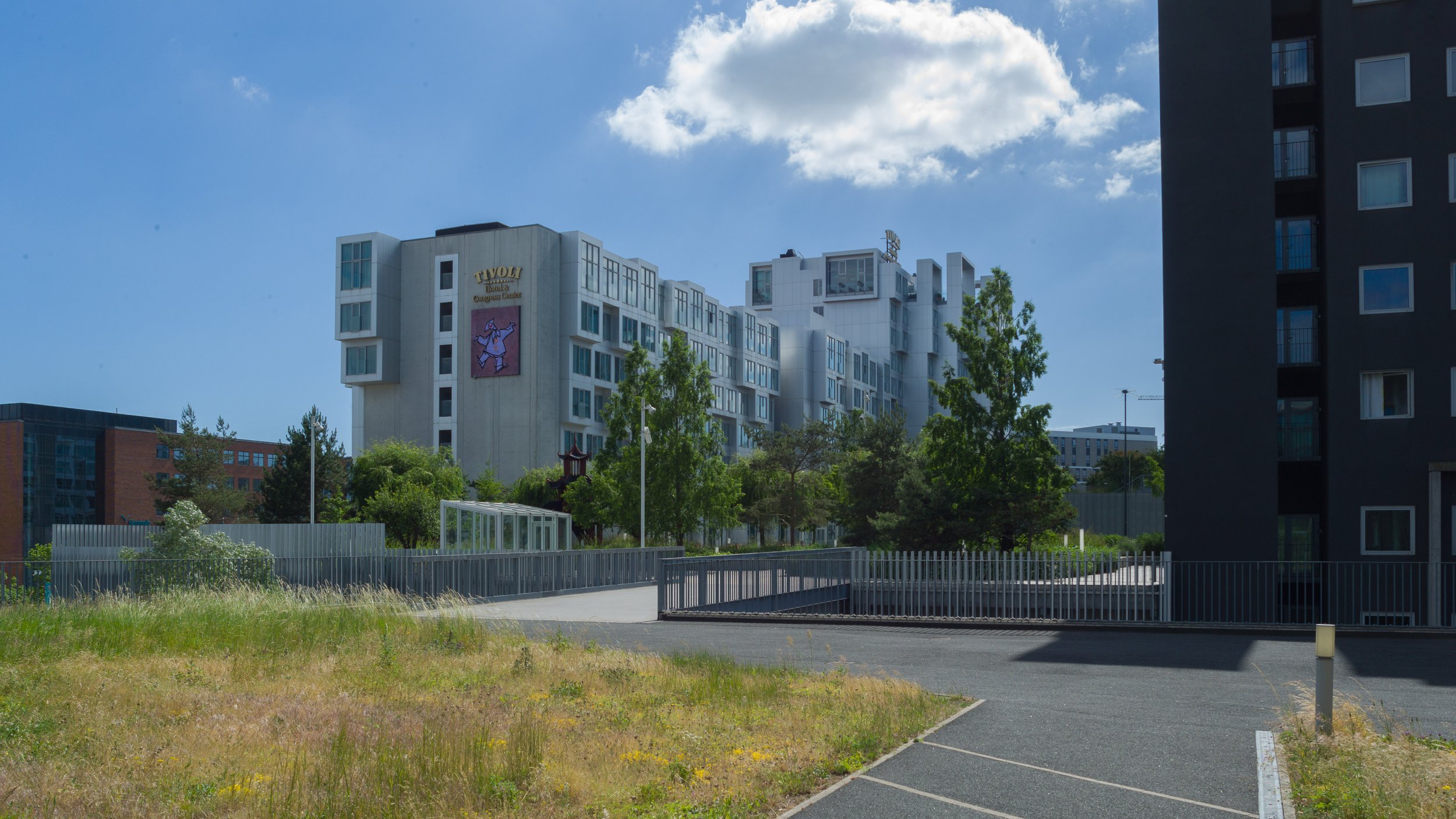
The first part of the gardens, at the north end - with a steep slope up from Bernstorffsgade, between the towers of the SEB offices, was completed in 2009 and the gardens were soon extended on across the roof of a new archive building and through to the Tivoli Hotel and Congress Center. Then the new developments stalled.

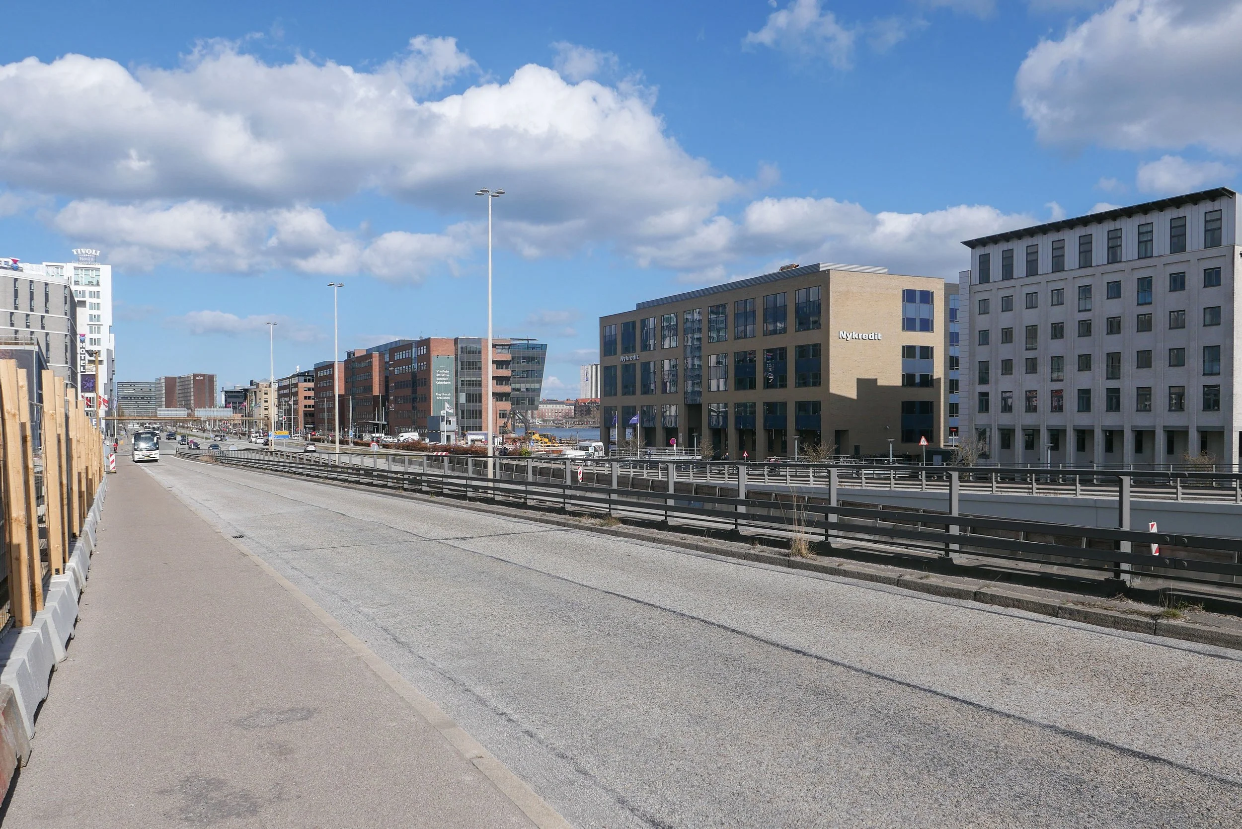
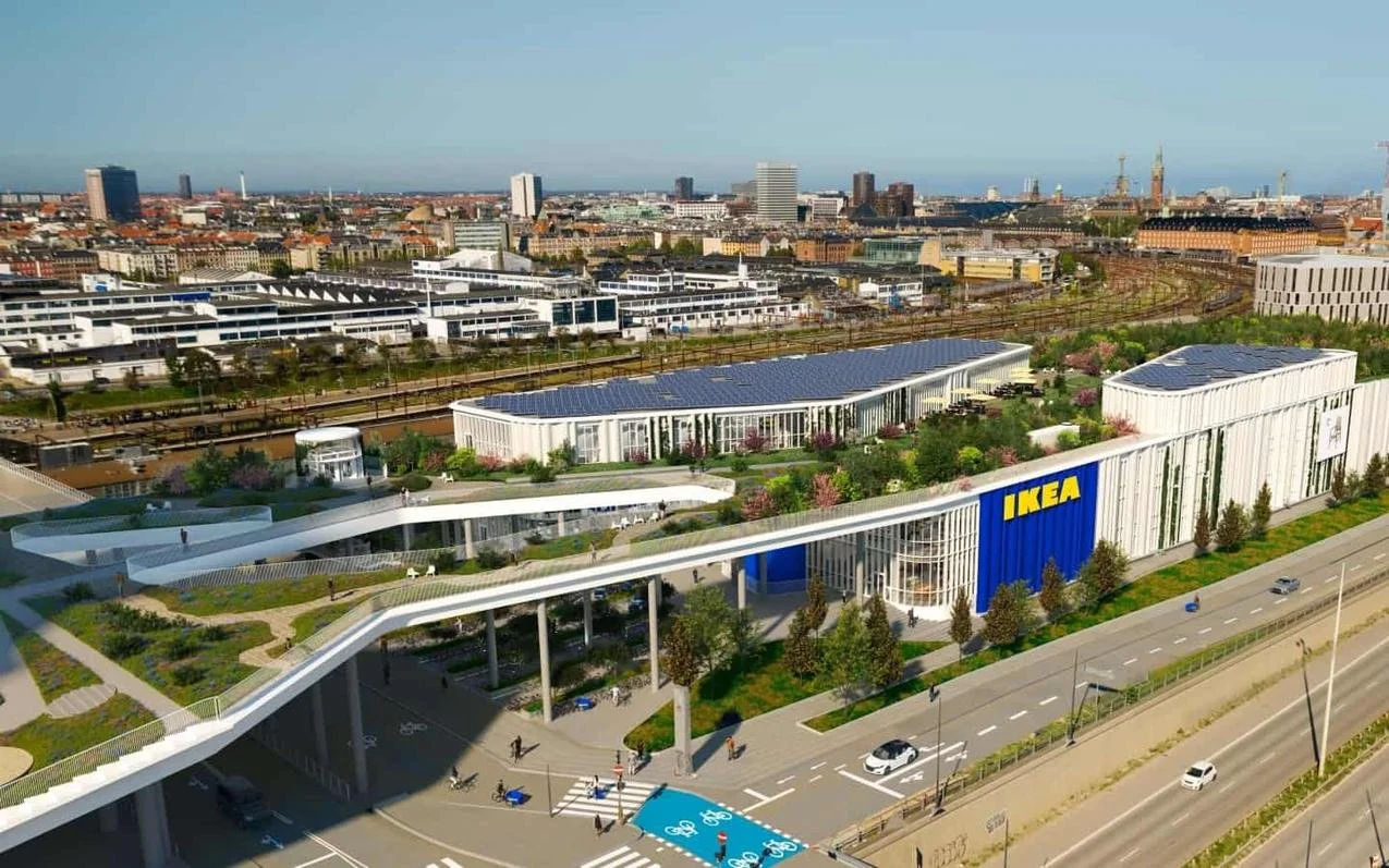
The west end of the landscape gardens, through the Nexus building, has just been planted but construction work on the middle section, across the roof of a new IKEA store, has only just restarted.

All these new buildings, that frame the gardens, are between Kalvebod Brygge and Carsten Niebuhrs Gade and, when finished, the high-level landscape will extend for over a kilometre from Bernstorffsgade to a new railway traffic control tower on Otto Busses Vej.

Lokalplan nr. 403 "Rigsarkivet" 2006

the landscape scheme starts at Bernstorffsgade at the SEB buildings
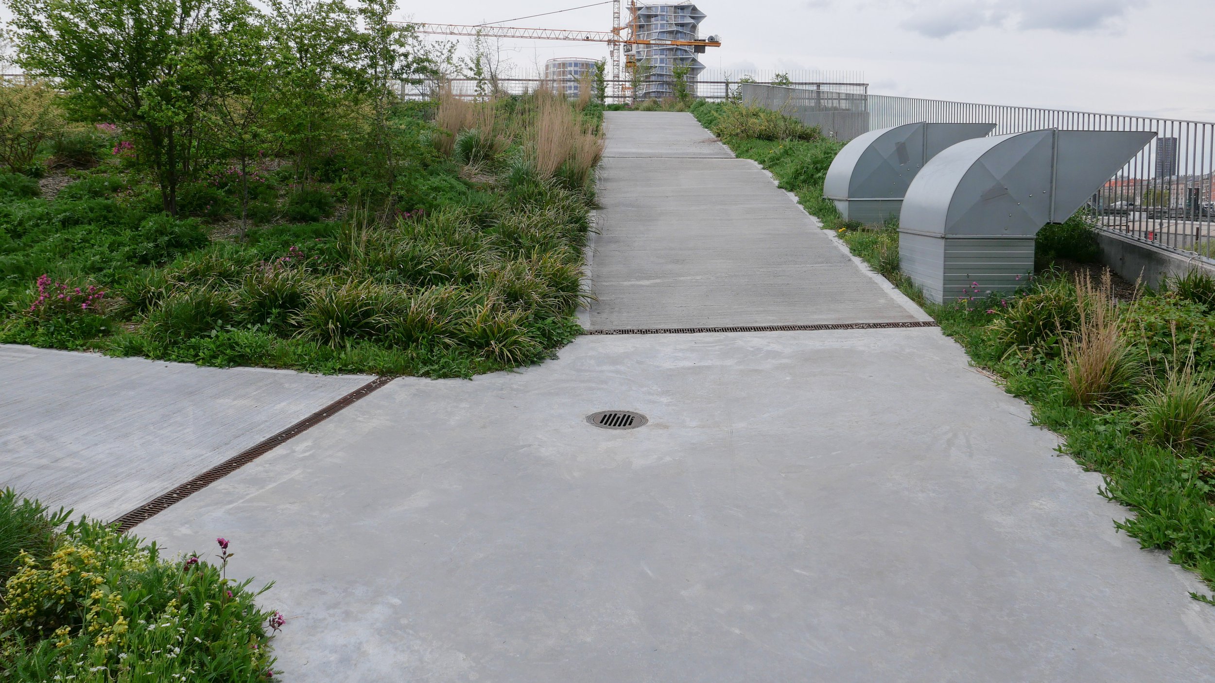
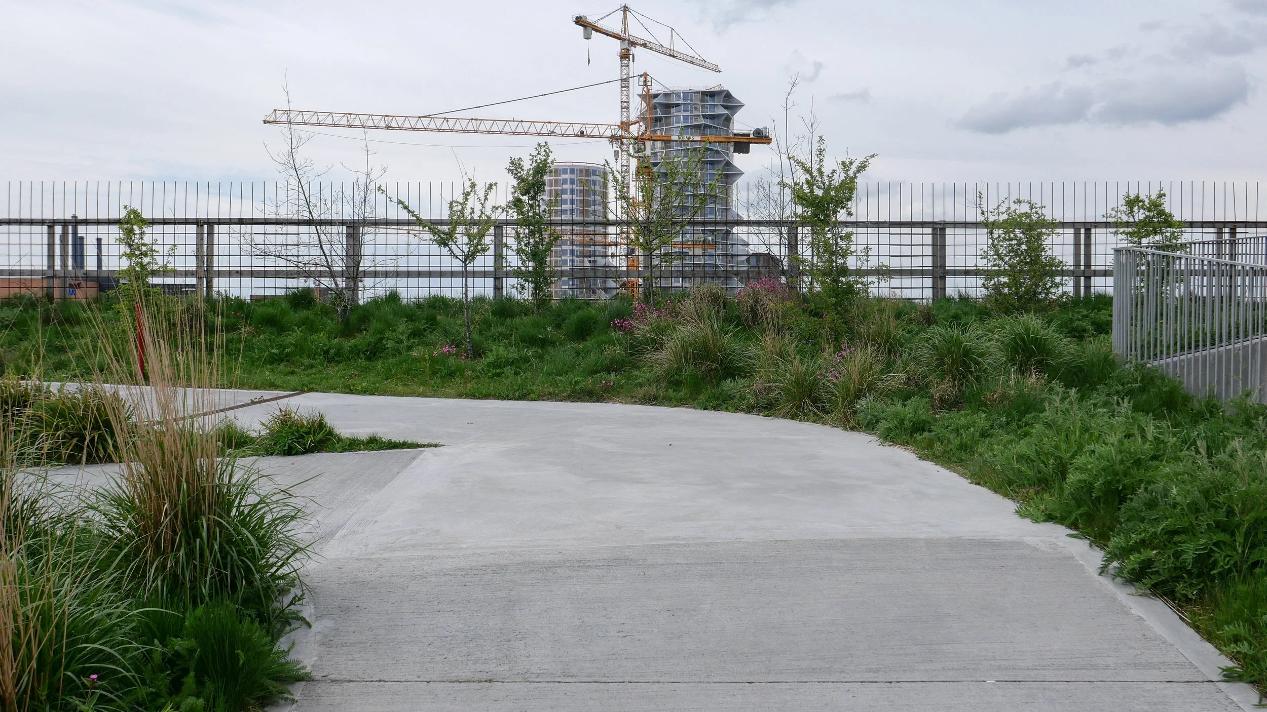
a winding concrete path climbs up a steep slope from the road with well established trees

this sequence of photographs shows the gardens from Bernstorffsgade to Arni Magnussons Gade and the bridges across to Hotel Cabinn

At the city-centre end, at Bernstorffsgade, the landscape starts at street level with pathways twisting from side to side to climb up between the SEB buildings to a point 7 metres above the level of the pavement.

There is then a wide bridge that crosses a service road for the State Archive and the gardens continues between the archive stores on the side towards the railway and a newly-revamped office building, now known as KB32, on the Kalvebod Brygge side. That straight section of garden, 190 metres long and 29.6 metres wide, is 8 metres above the pavement of Kalvebod Brygge.

Maintaining that level, there is a single narrow bridge over another service road before the gardens open out between the towers of the Tivoli Hotel and Conference Centre.

Beyond the Tivoli hotels, there is a slightly odd and over-complicated series of narrow bridges - with handrails that would grace a multi-storey car park - that cross a wider street called Arni Magnussons Gade. It is a dual carriageway that will be the access to a new bus station between Carsten Niebuhrs Gade and the railway.

Here, the landscaped area first forms the canopy over the entrance to the Hotel Cabinn before the garden then climbs up steeply between the two towers of the hotel where it now ends abruptly at a fence before the next section where work has just started on building a new IKEA store.

There, about 17 metres above the pavement of Kalvebod Brygge, the garden or "green lounge" on the roof of IKEA will be level and will cross over Dybbølsbro.

Then, between the two towers of Kaktustårnene or The Cactus Towers designed by Bjarke Ingels, the gardens will drop down at a very steep angle to the entrance level to the two blocks of the new Nexus building and then, between the those two office blocks, drop down again to end at the level of Carsten Niebuhrs Gade.


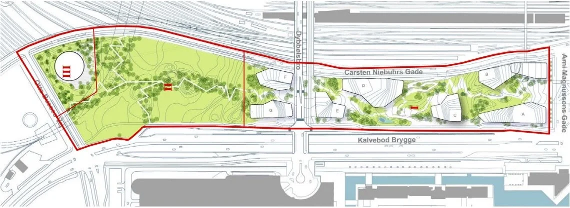
map from 2006 in Kalvebod Lokalplan 403 with the different stages of the development of this area from the SEB site at I through to the IKEA site at IV ….
then, the green line was only to extend as far as the area where Kaktustårnene are, beyond Dybbølsbro, but not the site of the railway control tower

①  Danske Banks Hovedsæde / headquarters for Danske Bank by Lundgaard & Tranberg - under construction
②  SEB Bank & Pensions by Lundgaard & Tranberg 2008-2011 and The City Dune by SLA design studio
③  Rigsarkivet / State Archive by PLH Arkitekter
④  KB32 by Vilhelm Lauritzen Architects and JJW ARKITEKTER completed in 2021
⑤  Tivoli Congress Centre by Kim Utzon 2009-2016
⑥  Hotel Cabinn 2019
⑦  IKEA store by Dorte Mandrup - under construction
⑧  Kaktustårnene / The Cactus Towers by Bjarke Ingels - under construction
⑨  Nexus for Energistryrelsen Trafikstyrelsen and Banedanmark by Arkitema 2014-2019
⑩  Trafiktårnet Øst / Railway control tower by Tranberg Arkitekter 2013-2015

A Bernstorffsgade B Carsten Niebuhrs Gade C Kalvebod Brygge D proposed bus station E Dybbølsbro F Fisketorvet G Metro station opens 2024


the gardens on the steep slope where they climb up between the towers of Hotel Cabinn

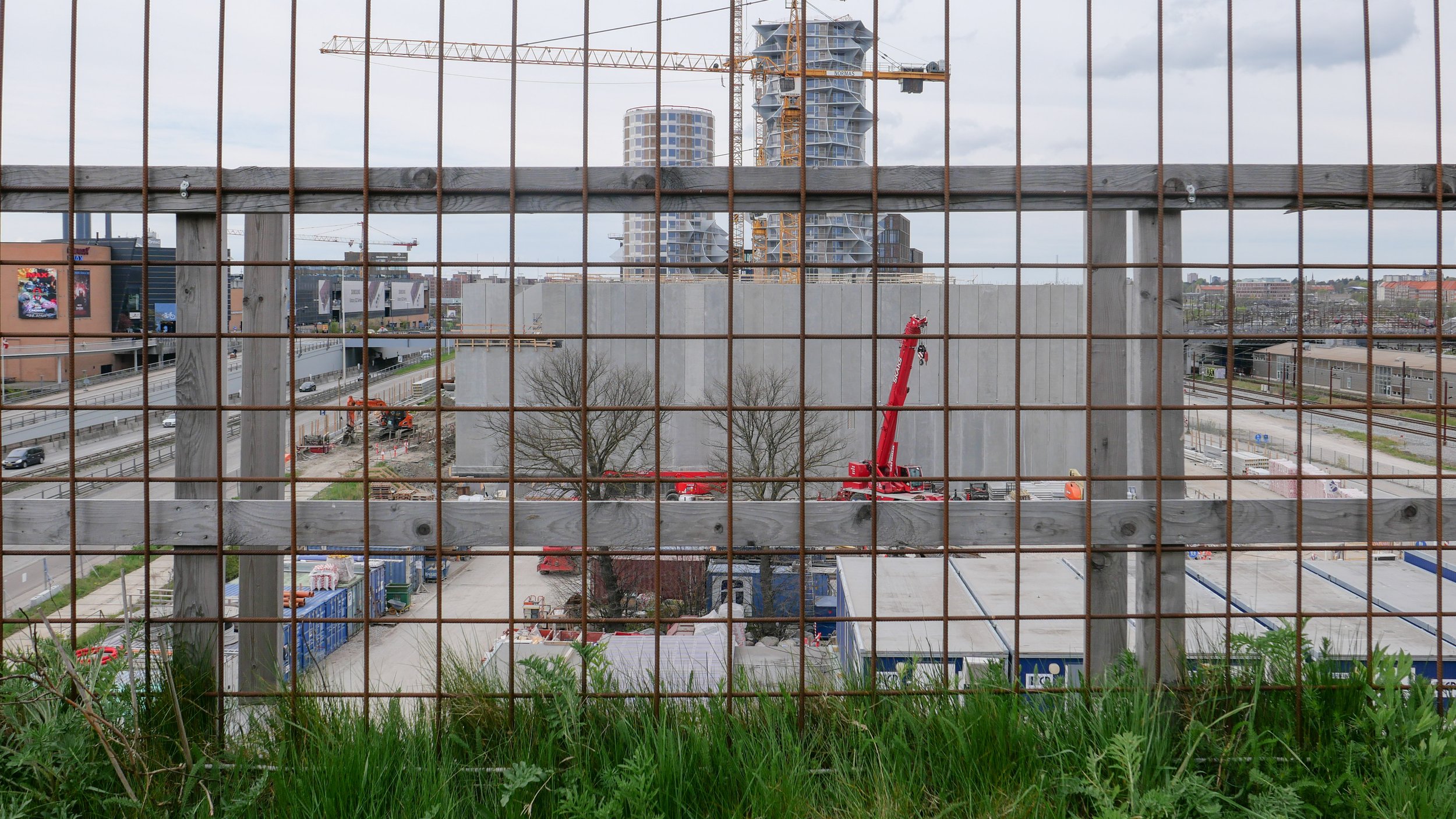
from the bridge over Arni Magnussons Gade, the gardens climb steeply up to a temporary fence where the gardens will continue on over the roof of a new IKEA store


details of the planting and concrete paths on the slope up from Bernstorffsgade between the two SEB buildings by the landscape designers SLA

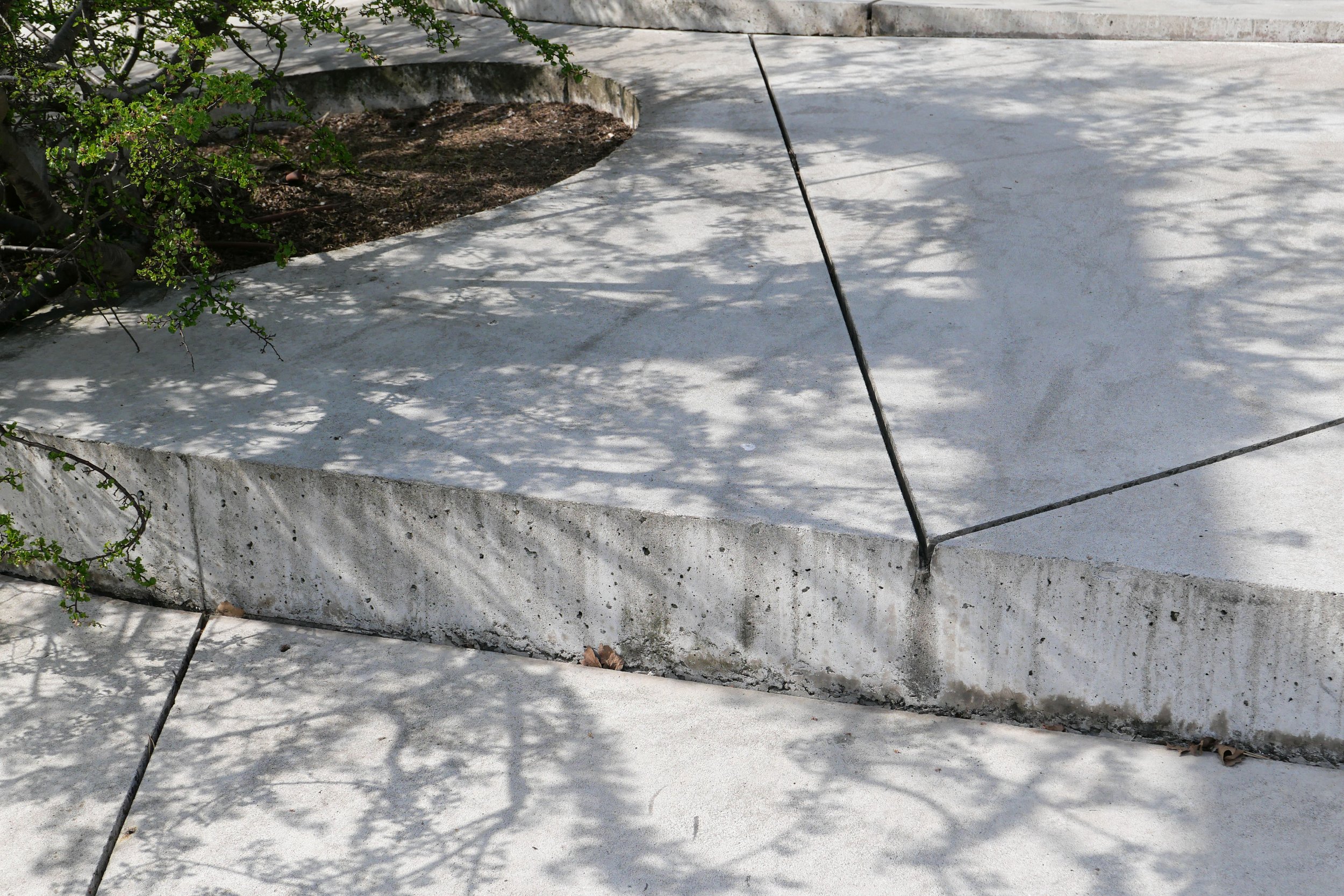
Planting is well-established between the SEB buildings with a good selection of trees, many with decorative bark, and with some that have grown up through large holes in the prominent concrete canopies of the buildings. Narrow slots in the concrete path channel away rain water that is recycled for watering the trees and shrubs.

Across the roof of the archive, the design is more architectural with low planting and trellis that form a sequence of simple spaces with seating. The gardens help control the temperature and internal climate of the archive.

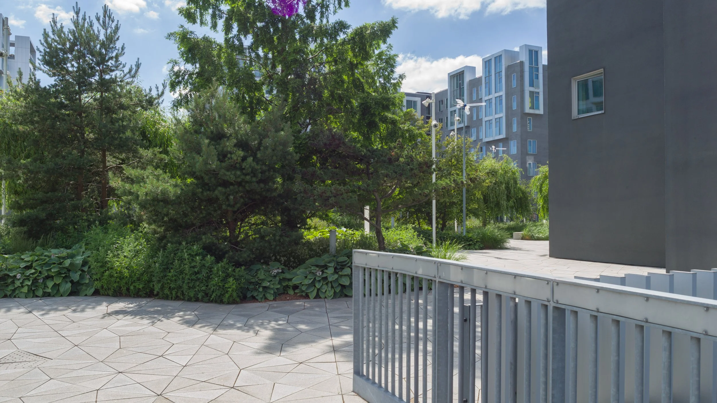
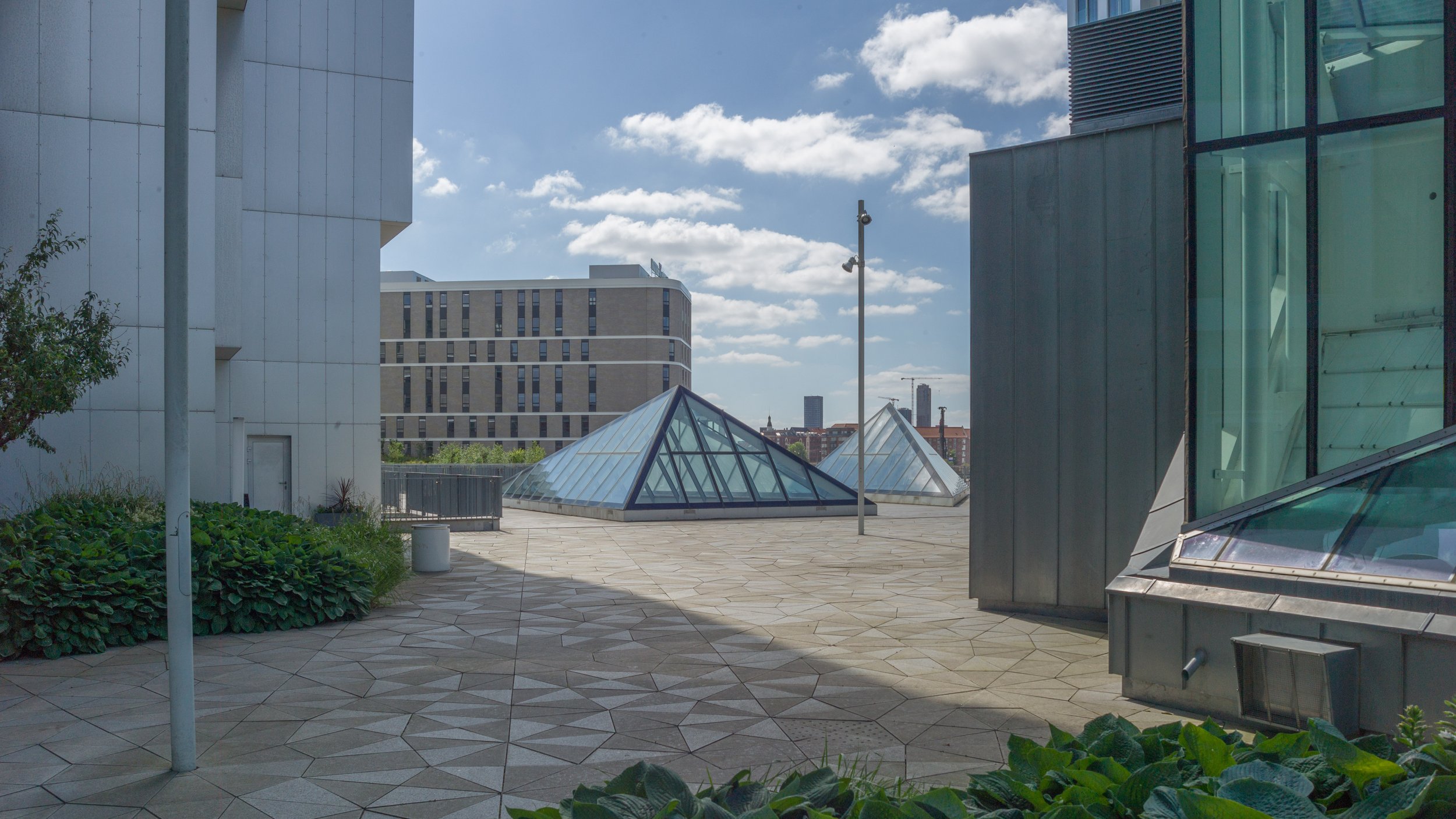
The section through the Tivoli Hotel has well-established shrubs and trees but the spaces could be better used. This is one area that might be treated like public squares and might even be used to host events. It would also be the one place, along the length of the gardens, that might benefit from a small coffee bar or cafe although, generally, the main character of the gardens is that it is quiet or peaceful ... when taking some of these photographs on a Sunday morning, only two people walked through and there were birds singing loudly in the trees.

The steep path up between the towers of Hotel Cabinn has no trees and although the low planting is good - with a variety of leaf types and shrubs - the plants could be in bolder groups, to create a stronger architectural character against the stark buildings, rather than being scattered. There are benches at intervals up the slope where you can take in the views.

At various points through the gardens there are views out between the buildings to the railway and Vesterbro on one side and through to the south harbour on the other.

There are drawings of the proposed garden on the roof of the IKEA store but it is difficult to imagine how the areas of planting will then drop down the steep slope between the Cactus Towers although Bjarke Ingels has produced planted areas at a similar steep angle on the 8 Building in Ørestad and at Copenhill on the roof of the Amager Bakke incinerator.

Where the garden drops down again between the two blocks of the Nexus building, new planting has established itself quickly and there is an interesting concrete rill or channel to take rain water down through the garden.

Back at the city end, when finished, new headquarters for Danske Bank on Bernstorffsgade immediately north of the SEB towers, will have broad flights of steps up between the buildings to a new terrace overlooking the railway and this will be connected to the main landscaping by a bridge over Carsten Niebuhrs Gade between the SEB building and the Archive.

When finished there will be public access for the full length of the high landscape and with steps up to the gardens at several intermediate points.

new steps up to the gardens with Tivoli Hotel to the left and Hotel Cabinn to the right and with the cross road Arni Magnussons Gade between the two hotels


the gardens on the roof over the IKEA store with the two Catus Towers beyond

the far end of the gardens where it drops down between the two blocks of the Nexus building with a view of the new railway control tower beyond


Rigsarkivet / State Archive by PLH Architects 2009

A new store for the holdings of Rigsarkiv - the State Archive - was designed by PLH Architects and opened in 2009.

It was built across the back of the long concrete building of the Danish Railways freight building from the 1960s and was on the site of the train shed of the freight terminal building.

Externally the archive building reads as two parts - a flat-roofed section below and, in fact forming, the high-level landscaped garden and two large warehouse blocks in line with a gap between them on the back of the plot so along Carsten Niebuhrs Gade.

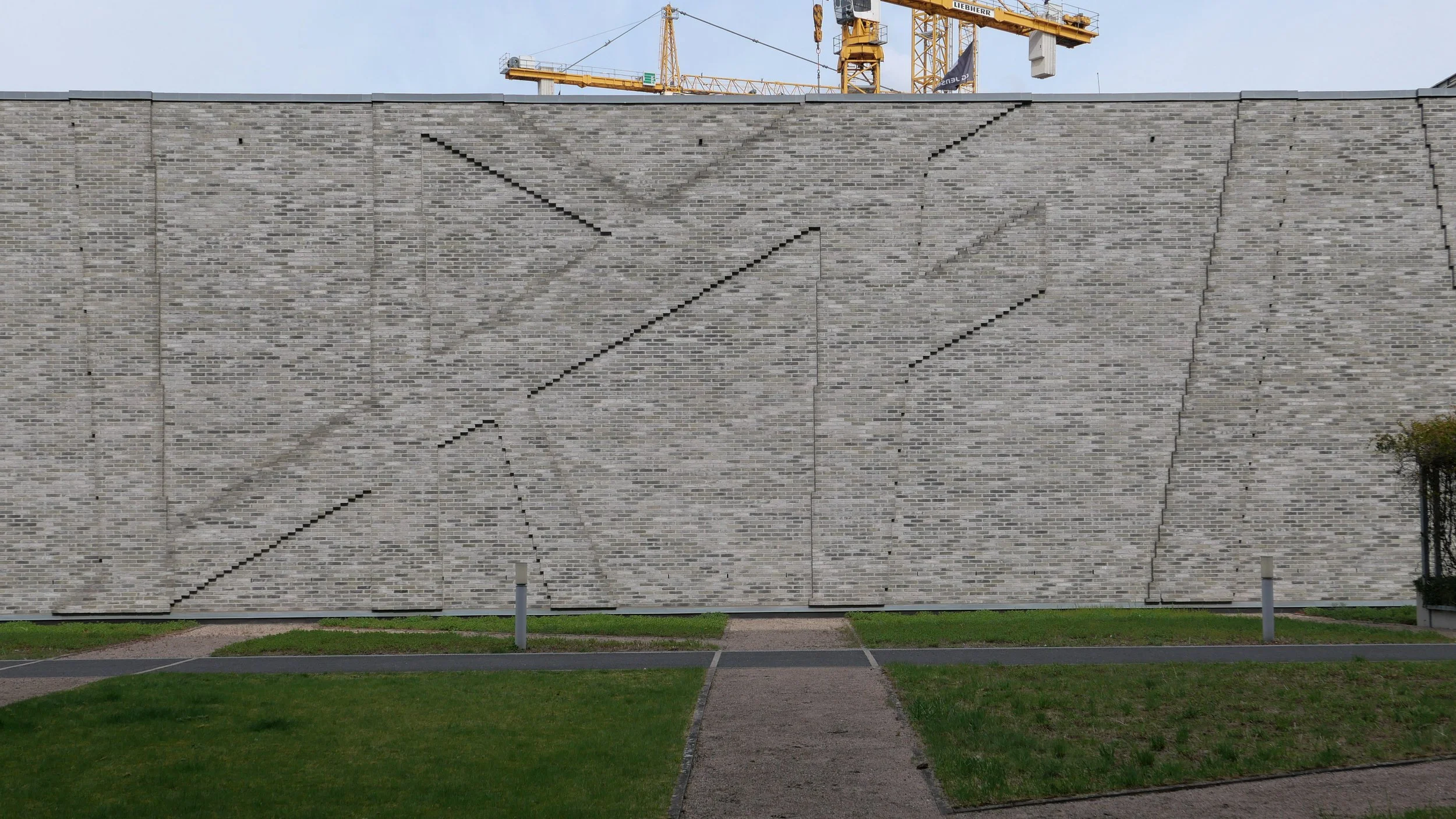
The street facade and the parts of the block visible above the garden are faced in yellow/grey bricks that is enlivened by a shallow but strong relief pattern that is inspired by runic lettering and is created by breaking forward courses of the brickwork by just 6 cm and the graphic effect is created by the shadow.

Inside the two tall blocks, there are enormous storage halls that are 15 metres high with racking that is 12 metres high. In total there are said to be 370 kilometres of shelving in the archive.

Windowless facades and the garden across the roof maintain the temperature and the microclimate of the storage facilities - crucial for the historic documents, books and maps stored here.

The courtyard between the two ranges is 190 metres long and just under 30 metres wide and the garden area is described by the architects as a green street although it is at the level of the second floor so 8 metres above the level of the pavement along Kalvebod Brygge.

The garden is open to the public with access from either the slope up between the buildings of the SEB offices to the north or from the upper garden of the Tivoli Conference Center and Hotels to the south and there is now also a new external staircase at the city end of the main office block that was added as part of the recent and extensive remodelling of the main freight terminal building along Kalvebod Brygge - now known as KB32.

PLH Architects
The National Archive

the two blocks of the archive store from Carsten Niebuhrs Gade


construction work has started for the new IKEA store in Copenhagen

Work has started on the construction of a new IKEA store on Kalvebod Brygge in Copenhagen - the main road running out of the centre and heading to the south west along the north side of the harbour.

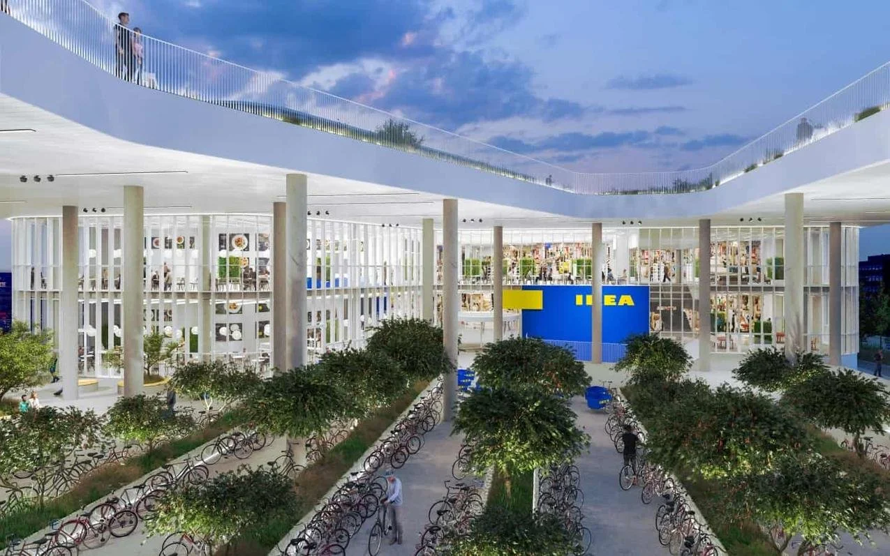
The project, designed by Dorte Mandrup, was put on hold by IKEA for well over a year but parts of the concrete frame and the upper floors are now in place so you can see that it will be a substantial building.

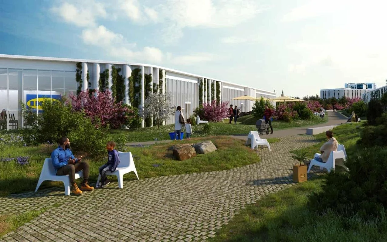
The store will have a large garden across the roof that will continue a raised and landscaped walkway, started over ten years ago. When finished, there will be areas of garden above street level for over a kilometre from the SEB bank building by Lundgaard & Tranberg Arkitektfirma at Bernstorffsgade through to the new Cactus building by Bjarke Ingels - beyond the IKEA building on the west side of the bridge from Dybbølsbro Station to Fisketorvet - and then on to the new railway control tower at Otto Busses Vej.

The roof over the IKEA store has been described as a green lounge and there will be good views from here over the railway lines to Vesterbro to the north and to the city to the east.

Tall and thin concrete columns will support the canopy or bridge taking the garden over the top of Dybbølsbro and this strong vertical emphasis is taken across the main front of the store - on the front towards the railway - and around the pavilions that rise above the garden level.

This is a challenging site between the new Hotel Cabinn to the east and Dybbølsbro to the west - the high-level bridge that crosses from Vesterbro and the suburban railway station to the north to the shopping centre of Fisketorvet and the harbour to the south.

The site is about 65 metres deep and 240 metres from east to west - from the hotel to the bridge with a high raised bank across the south side that is the retaining wall for an exit slipway from Kalvebod Brygge and, to the north, on the other side of Carsten Niebuhrs Gade, are the tracks of the railway running in and out of the main station.

Dorte Mandrup

note: south to the top

left - the west end of the new store
centre - the slip road down to Kalvebod Brygge across the south side of the site
right - down the slip road and the buildings between Kalvebod Brygge and the harbour

friends and former colleagues accuse me of being uncritical of everything and anything if it’s Danish so, to redress the balance, I bring them here to Kalvebod Brygge to show them that Danish architects and planners can get it wrong …. very very wrong


below - the proposed IKEA store from the north with the bridge from Dybbøsbro station on the right and the Cactus building by Bjarke Ingels on the right edge and Hotel Cabinn on the left.
in the foreground is Carsten Niebuhrs Gade - between the main railway line and the IKEA site - and with the new bus station that is proposed for the strip of land against the railway.
Fisketorvet, with its distinct concave entrance, is beyond and the new metro station will be at the south-west end of Fisketorvet so to the far right
beyond the harbour is Amager


a new bus station to be built on Carsten Niebuhrs Gade


In March, Vejdirektoratet / the Danish Road Directorate, confirmed that a new terminal for long-distance buses will be built on the narrow strip of land between Carsten Niebuhrs Gade and the railway lines.

The land is about 500 metres long but only 20 or 25 metres deep from the edge of the road to the boundary fence of the railway so the buses will pull in and park at an angle.

The terminal will open in the Spring of 2023 and will replace bus stops closer to the main railway station that are along the pavement on Ingerslevsgade - the road on the inside curve of the railway tracks.

At Carsten Niebuhrs Gade, there will be 15 stands for buses with waiting facilities for passengers, including toilets and a kiosk, and there will be space for 200 bicycles to be left at the lower level and a lift up to the bridge to transfer to the suburban railway station at Dybbølsbro to the north or to a new metro station at the west end of Fisketorvet - the shopping centre to the south.

A report by the engineering consultants MOE from August 2019, showed details for traffic flow in and out of the bus terminal from Kalvebod Brygge with necessary road markings and lane markings at all the junctions. The bus terminal will deal with 195 buses a day and approximately 1.4 million passengers a year.

When completed, the terminal will be handed over to the city but will be run by the transport company Movia.

Vejdirektoratet
MOVIA

view along Carsten Niebuhrs Gade - looking east from under Dybbølsbro towards the new Hotel Cabinn.
the site for the new bus station and buildings along the railway are to the left and the site of the new IKEA store is to the right. The blank grey rectangle in front of the hotel is the end of the raised walkway waiting to be linked on to the garden across the roof of the IKEA store

Kalvebod Brygge to the top and the railway terrain to the bottom with Tivoli Congress Center, the bridges over Arni Magnussons Gade and Hotel Cabinn to the left and then the site where work on the new IKEA store has restarted and with the bridge from Dybbølsbro station to the Fisketorvet shopping centre on the right
the new bus station will be between the railway and Carsten Niebuhrs Gade


Det Grønne Strøg - the green line - will continue through Kaktustårnene / Cactus Towers

Kaktustårnene or the Cactus Towers at Dybbølsbro will not be finished until the summer and it is still difficult to see how the high landscape of Det Grønne Strøg / the Green Line will transition across from the roof of the new IKEA store - still under construction - and then drop down steeply to the level of the entrance to the NEXUS building.

From the street and from the shopping centre of Fisketorvet, you can see what appears to be a large, square slab of concrete set at a sharp angle at the base of the towers and that forms, in part, the roof of a large, open, lobby or entrance into the towers and supported on high and slender columns. Drawings show that there will be a sharply-winding path dropping down between the towers through planting.

The towers were designed by BIG - Bjarke Ingels Group - and they have experience of forming steep landscapes at 8Tallet in Ørestad and on the roof of the Bakke or incinerator which is steep enough for a ski slope.

When finished this summer, there will be 495 apartments in the towers that are wedge shaped and each has a striking and sharply-angled balcony.

There will be a few apartments with two rooms but most are single studio rooms of just 33 square metres and have been described as providing "Micro Living" so it is slightly ironic that publicity material promotes the location as next to a new IKEA store when the furniture in the apartments is fitted and with little space for anything else. They even seem to have a bed that is, it appears from drawings, to be a mattress on the large windowsill.

Marketing of the apartments is aimed at young, single, people and there will be communal spaces in the towers for meeting and eating but they might also appeal to professionals who want a base for working in the city during the week but return home at weekends.

Copenhagen has a chronic shortage of housing for students and for single young professionals so it will be interesting to see how quickly tenants are found but my guess is that living in Kaktustårnene will be popular and fashionable.

from the entrance to the shopping centre at Fisketorvet with the two round towers of Kaktustårnene still being fitted with balconies but with the lobby area on slender columns in place
straight ahead is Dybbølsbro - the bridge crossing the railway to the suburban railway station and to Vesterbro beyond
Det Grønne Strøg - the Green line - will be carried over the road with a bridge or bridges from the roof of the IKEA store

looking towards Kaktustårnene at the lower level of Carsten Niebuhrs Gade with the first stages of the IKEA building to the left showing just how high above street level the garden across the roof will be
Dybbølsbro runs across the view left to right with the lobby of the entrance and the towers beyond …. the public gardens of the Green Line will continue from the roof of IKEA to the roof of the lobby and then drop down at a sharp angle to the level of the entrance to the NEXUS building beyond

the green line continues through Nexus by Arkitema

Nexus is a large, new building where there are offices for five public agencies … Rail Net Denmark, the Danish Transport Authority, the Danish Road Directorate, the Danish Building Authority and the Danish Energy Agency.

From the air view, you can see that there is a complicated, clover-leaf arrangement of four blocks and each with an atrium. From the streets around and from the central 'courtyard' this underlying arrangement is not so obvious.

There are tight, outward-facing open courtyard on both sides of the building …. so on the north side, towards the railway, there is a relatively narrow courtyard with a main entrance from the street level of Carl Niebuhrs Gade and, on the opposite side, towards Kalvebod Brygge, there is a comparable open courtyard that appears to be primarily a light well for what would otherwise be a large and deep block.

Judging by eye, the south block of the four, has two corners set at right angles - so just one side - the inner side - is set at an angle. Two blocks have a single corner each that is at a right angle - the north block with a 90 degree angle towards the small courtyard on its east side and the east block with one external right angle, towards Fisketorvet. The west block has no right angles so there appears to be a game going on here.

It's partly about how someone understands the relationships of the blocks from the outside as they approach the building and in part its about how the view out from the offices is guided by the angle of the external wall.

Some upper levels step back at each floor and change angle slightly so. again, it is about how the blocks are perceived and it hints, unlike a sheer wall, that the building is turning or twisting. The set backs are too small to make much difference to the shadow thrown by the building.

With the garden through the centre of the building, as part of the green line, the visitor is drawn in by the angles narrowing towards a main entrance to the offices at the upper level but also, from the entrance, the angles opening out beyond shows you the way out and on down.

This is a very sophisticated combination of angles, levels and landscape that control and direct how people see the building but also how they move around and into the building.

Inside, the atriums, staircases, wide public areas and views out to courtyards and so on all suggest a flexible work environment and is very much about people move around even during the working day. This is a stark contrast to 'modern' Danish office buildings of the 1950s and 1960s like Søllerød Town Hall by Arne Jacobsen where the over-riding arrangement in the office building is a spine corridor with single-cell work spaces on either side and that is repeated on each floor.

The landscape of Det Grønne Strøg - the green line - runs through the centre of the building and reads as a steeply sloping green canyon that is quite enclosed with bridges across at upper levels

Workers and visitors coming from either Dybbølsbro and the suburban train station or by bike over the cycle bridge, coming from Islands Brygge, arrive at the top of the green street on the north side and there is a main entrance there but with views down the green landscape that drops down a series of zig-zag concrete paths with a concrete rill that will take rain water down alongside the path.

Through the length of the green line, a key part of the design is that all rain water is captured and reused for the plants and trees.

New planting is attractive but, until it becomes more established, it is difficult to judge but there is a good view down from the top to the new railway control tower beyond.

Arkitema - Nexus


from the air, the grouping of four blocks forms a clover-leaf arrangement with few right angles
the railway is to the North and Kalvebod Brygge and its slip roads to the south
the Cactus Towers are to the north-east and, when completed, Det Grønne Strøg or the Green Line will cross from the roof of the IKEA store - now under construction - and drop down a steep slope before continuing on through the Nexus building to the landscape around the new railway control tower

the SEB towers at the corner of Bernstorffsgade and Kalvebod Brygge were finished in 2011 and this was the first part of the green line completed … it’s where the landscape rises up a steep slope from pavement level to continue across the roof of the archive building
it is obvious that over a decade later, economic imperatives now determine the amount of land that is built on and the area of public space at Nexus is as tight as possible
in the initial Lokalplan of 2006, the Nexus site was set aside to be a park free of buildings but now open land in the city is seen as too valuable to be left fallow


the original scheme for the south or outer end of Det Grønne Strøg - the Green Line - was set out in a Lokalplan
then, what is now the Nexus site, immediately before the circular railway control tower, was to be left open as a park without any buildings
note that all the buildings were to have a dynamic and twisting outline with all upper floors setting back and the angle changing to reduce the oppressive outline of a tall block with sheer sides and to reduce shadow and reduce the impression of height from below
the two blocks set on either side of the green line on the left or south side of Dybbølsbro - labelled F and G - is the site of the two Cactus Towers by BIG that are now close to completion


Trafiktårnet Øst / Traffic Tower East by Tranberg Arkitekter

This is where the raised landscaped gardens of Det Grønne Strøg / The Green Line - drops back down to pavement level.

Det Grønne Strøg starts at the SEB towers over a kilometre away at Bernstorffsgade where a path winds up between two office buildings by Lundgaard & Tranberg and with the steep slope planted with trees.

That section of the landscape climbs up to 7 metres above the pavement and was completed in 2009 so the whole scheme has taken well over a decade to complete. In fact, the idea was conceived in 2006 in the local plan for the development of this area of office buildings and hotels along Kalvebod Brygge and there is still a large break in the middle where work has only just started on building a new IKEA store. That is where the garden will be across the roof of the store at the highest point of the green line.

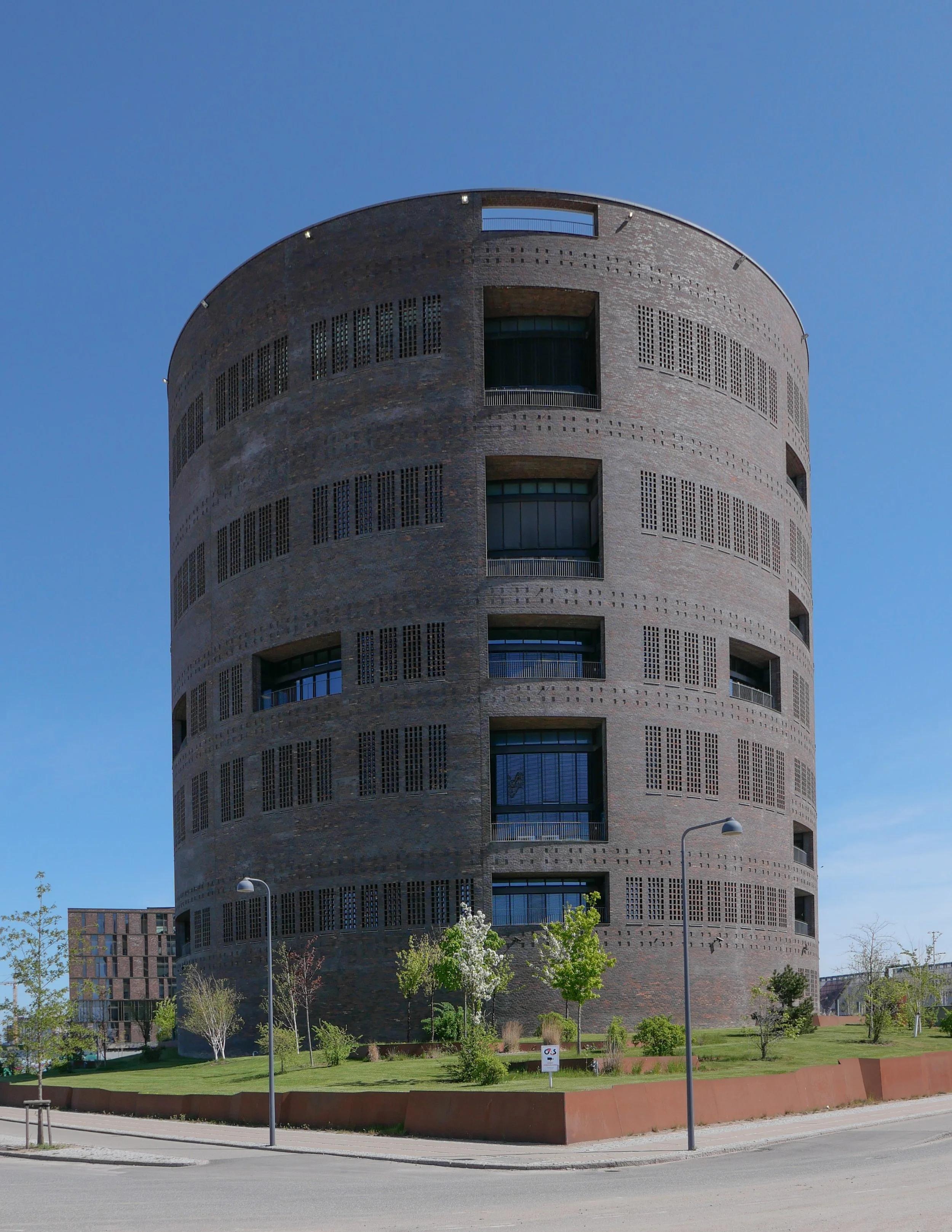
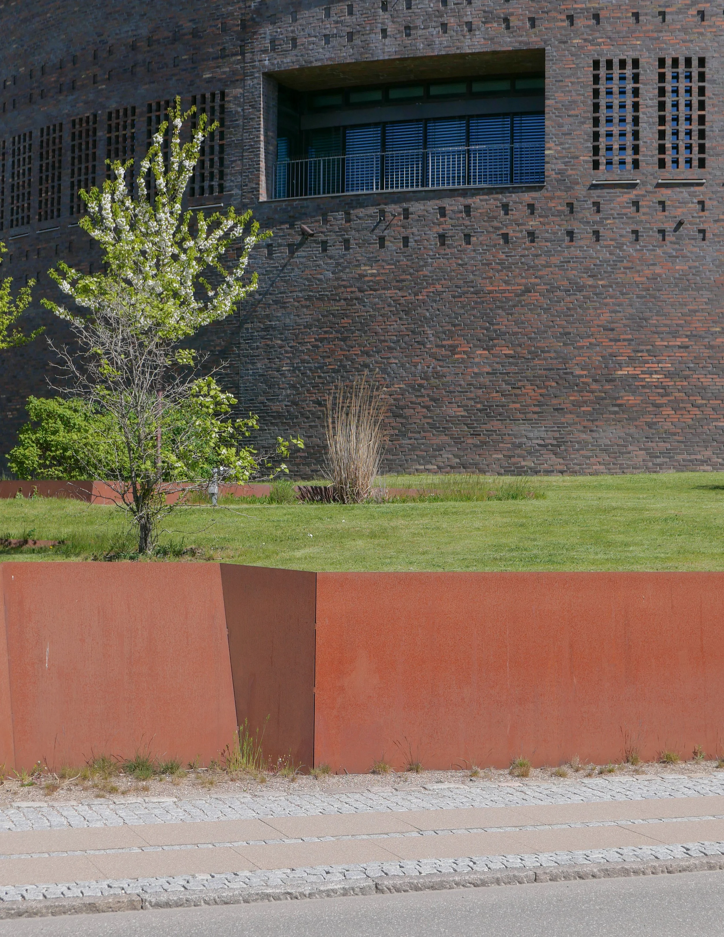
The Traffic Tower is set on a grass mound and, at the outer edge, the landscape is raised just above pavement level with the garden area retained by Corten steel.

The tower is a regional control centre for Danish Railways and is built in dark brick … a reference to the extensive number of railways buildings and stations from the late 19th and the early 20th century that were generally in brick.

Using a brick that is almost mauve but with some bricks that are deep rust in colour gives the brickwork a texture and colour range without which a building of this size would look oppressive.

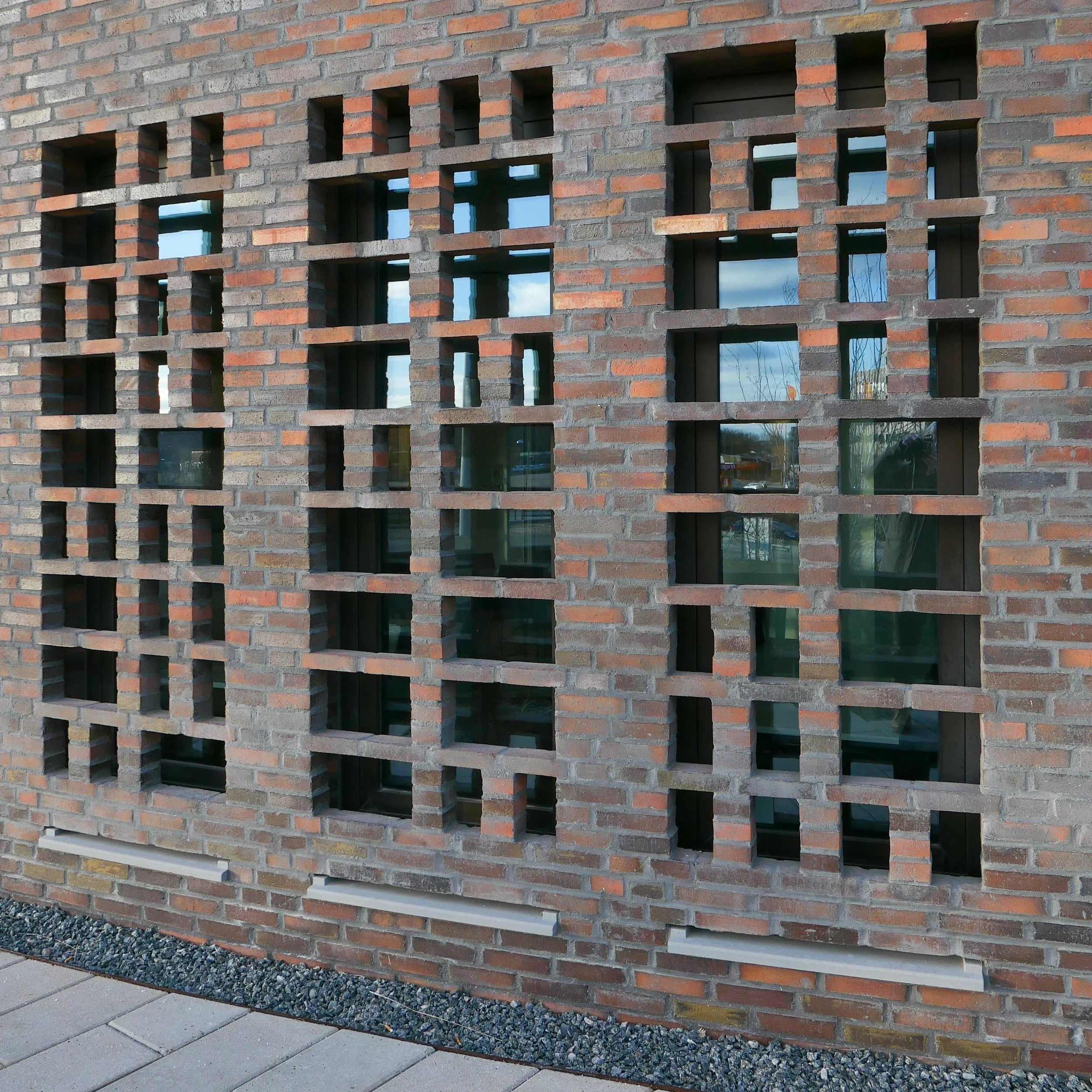
The brickwork is relieved by small, blind, recessed panels but the brick also continues across the windows as open grids that give the tower a more uniform look that emphasises the cylindrical shape and a gives a strong sense of security. These open grids of brick throw an attractive, broken or dappled light across the rooms behind.

The tower rises through nine floors with a double-height control room with balconies and with a high parapet that shields an open area of roof terrace used by staff and visitors.

Inside, the interior is light, mostly white, in contrast to the fortress-like exterior, but with areas of wood slats for acoustic control. There is an atrium that rises up through all nine floors and a dramatic spiral staircase through the full height.

The sculptor Henrik Plenge Jakobsen has created a bronze and steel African mask to the left of the entrance and designed a striking, geometric, tiled floor in the atrium, at the level of the entrance, that continues through into the canteen.

There is a second but smaller version of the tower - with five stories - in Fredericia.

Tranberg Arkitekter
Trafiktårnet Øst, København
Trafiktårnet Vest, Fredericia
Henrik Plenge Jakobsen

Traffic Tower East from the corner of Carsten Niebuhrs Gade and Otto Busses Vej

the garden is higher than the pavement on the north-west and south-west sides of the plot and the ground is retained by Corten creating a barrier between the street and the area of shrubs and trees.
the colour of the steel is a subtle contrast with the brickwork - that has rust-coloured bricks along with mauve - and the raw material is appropriate on what is, after all, an industrial site


plan of the Kalvebod Brygge high landscape with the Traffic Control Tower to the left and the SEB buildings at the right end
from the Local Plan 485 2016

Det Grønne Strøg


the landscape of Det Grønne Strøg starts over a kilometre away from the control tower and, when completed, will run from Bernstorffsgade to Otto Busses Vej.

Lokalplan 485 2016

the small, recessed panels act as a subtle version of string courses in 18th-century architecture by forming a horizontal band that indicates the floor levels and breaks what would otherwise be unbroken vertical emphasis

the large windows of the canteen are treated in a slightly different way with a broken and irregular grid of bricks

bronze mask to the left of the entrance by Henrik Plenge Jakobsen


The railway control tower is 42 metres high and it raises some interesting points about just how high buildings in the city should be and when and why high buildings should or should not be given planning consent.

Curiously, to me the control tower looks taller than its width but, in fact, the diameter is the same as the height so that would suggest that possibly we see and we are aware of height more acutely than width.

There is a fantastic free-hand sketch of an early concept on the architects online site but the idea of a simple cylinder set within a cube suggests that there is a strong geometric framework for the realisation of that idea.

When the green line of a raised landscape through the new buildings along Kalvebode Brygge was first proposed in the Lokalplan of 2006, there was a height restraint or glass ceiling of 36 metres for all the buildings although that was soon increased to a height limit for new buildings of 40 metres .... so very close to the height of the control tower.

Presumably, because this land was on former railway sidings, so potentially polluted, and partly because of the position, close to the city centre but between a busy road and the main railway into the city, this was designated to be a business district rather than being zoned for housing or recreation but the aim was to ….

create an urban business area that appears green and natural’ ...
The green line must clearly appear as the areas "lifeblood" and must clearly make visible the whole underlying idea.

Basically, the green landscape was to be the key element of the area that should be visible and obvious.

However, by 2011, a new Lokalplan had increased the limit on the height of the buildings to 47 metres but the suggestion was still that upper floors should be set back in a series of steps to reduce the visual impact, when seen from below, and to control the amount of shadow thrown across the area and across nearby buildings. It is also obvious that the buildings as realised are larger in terms of footprint than those suggested in the Lokalplan. In realisation, the planted area of the landscape was reduced in area.

The Hotel Cabinn is 32 metres high and the IKEA store will be 26 metres high but several of the buildings along the Kalvebod development have broken through those original height restrictions.

The Tivoli Congress Center is 48 metres high and the two round towers of Kaktustårnene by Bjarke Ingels - now being fitted out and due to open soon - are 60 metres and 80 metres high and the Post Towers, on the site of the old post office buildings at Bernstorffsgade - immediately north of the start of the green line and to be completed by 2027 - will be 67 metres, 93 metres and 115 metres high.

a high-rise tower building not just throws shadows across nearby streets but often disrupts the street pattern of historic areas but it can also have a huge and detrimental impact on views from and along historic streets

Vesterbro is a densely built residential area with apartment buildings that date generally from around 1900
the towers of the new Carlsberg development can be seen as the focal point of many streets and not in a good way
the railway control tower is on the far side of the railway tracks and , because of its relatively modest height - if you call 42 metres modest - it does not loom over the streets that look towards it and the restrained colour of the brickwork reduces the impact
this is the view of the tower from Vesterbro down Arkonagade


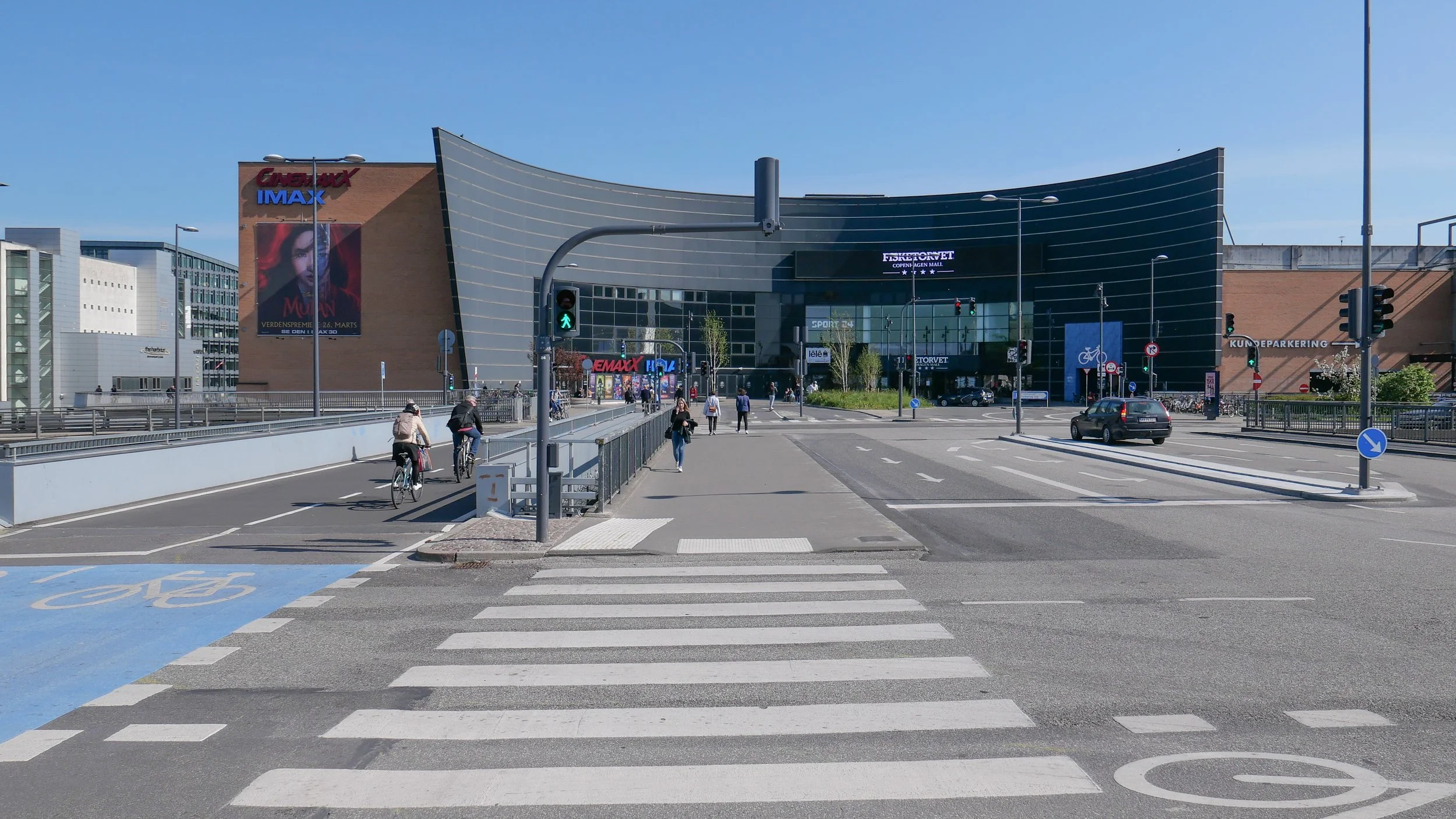
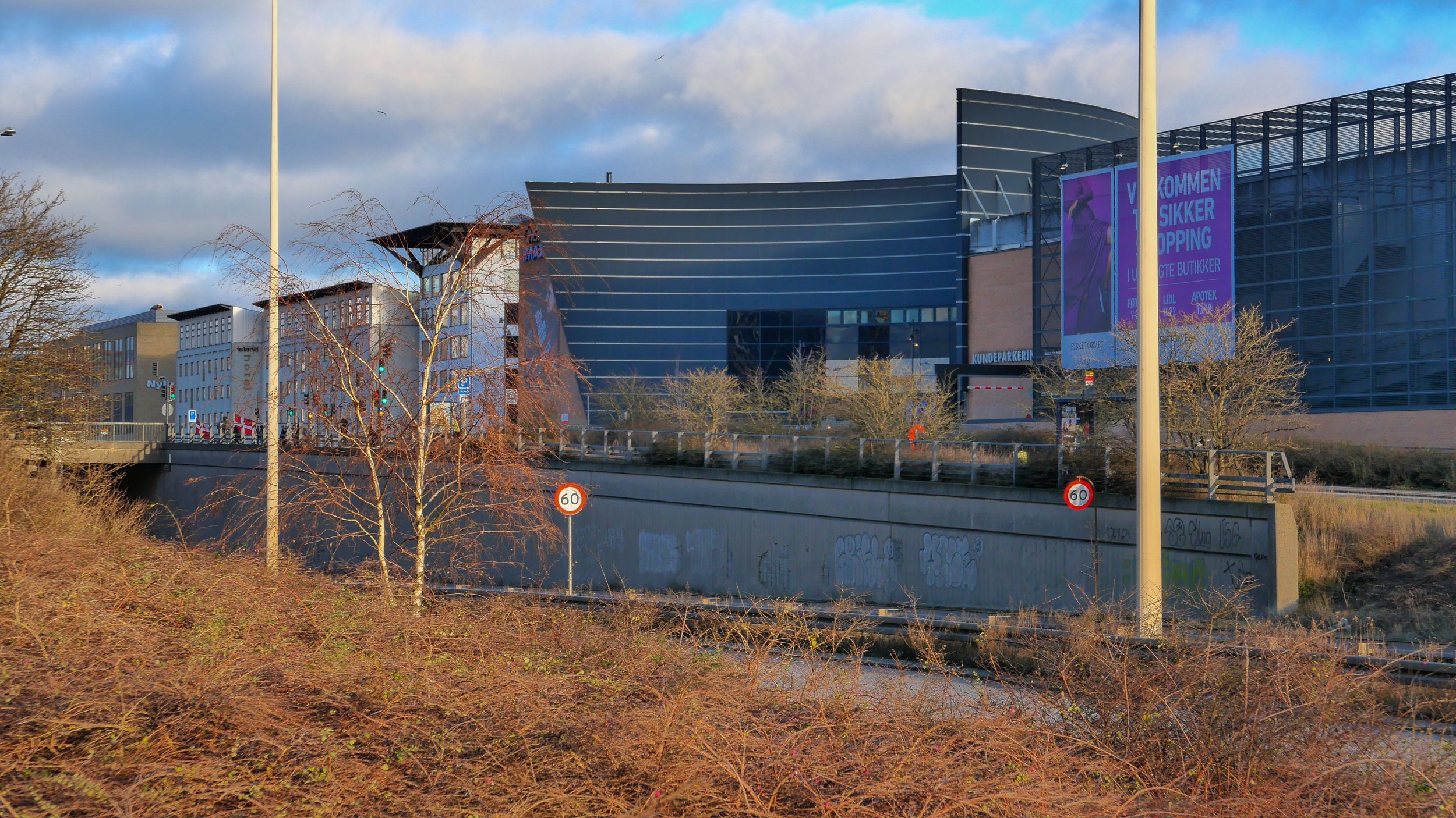
a revamped Fisketorvet

the main entrance on the north-west side is at the end of a long bridge over the main railway tracks from the suburban train station at Dybbølsbro

the main entrance to Fisketorvet from the west … here, Kalvebod Brygge, the main road into and out of the city from the south, is down in an underpass with high retaining walls for the slip roads

Construction work has started on a major revamp and upgrade of the Fisketorvet shopping centre at the south end of the harbour. The restaurant area at the north-east corner of the building is closed and the exterior is now under scaffolding.

There was a fish market for the city here from 1958 through to 1999 when it was moved to the North Harbour.

The shopping centre with a large cinema was designed by Kiehlers Architects and it opened on the site of the fish market in 2000. Inside it is light and really it’s not bad for a large shopping centre from that period with shops on well-lit malls on the level of the main entrance from Dybbølsbro and on the level above and a large supermarket on the south-east side at a lower level that is reached from a quay alongside a canal.

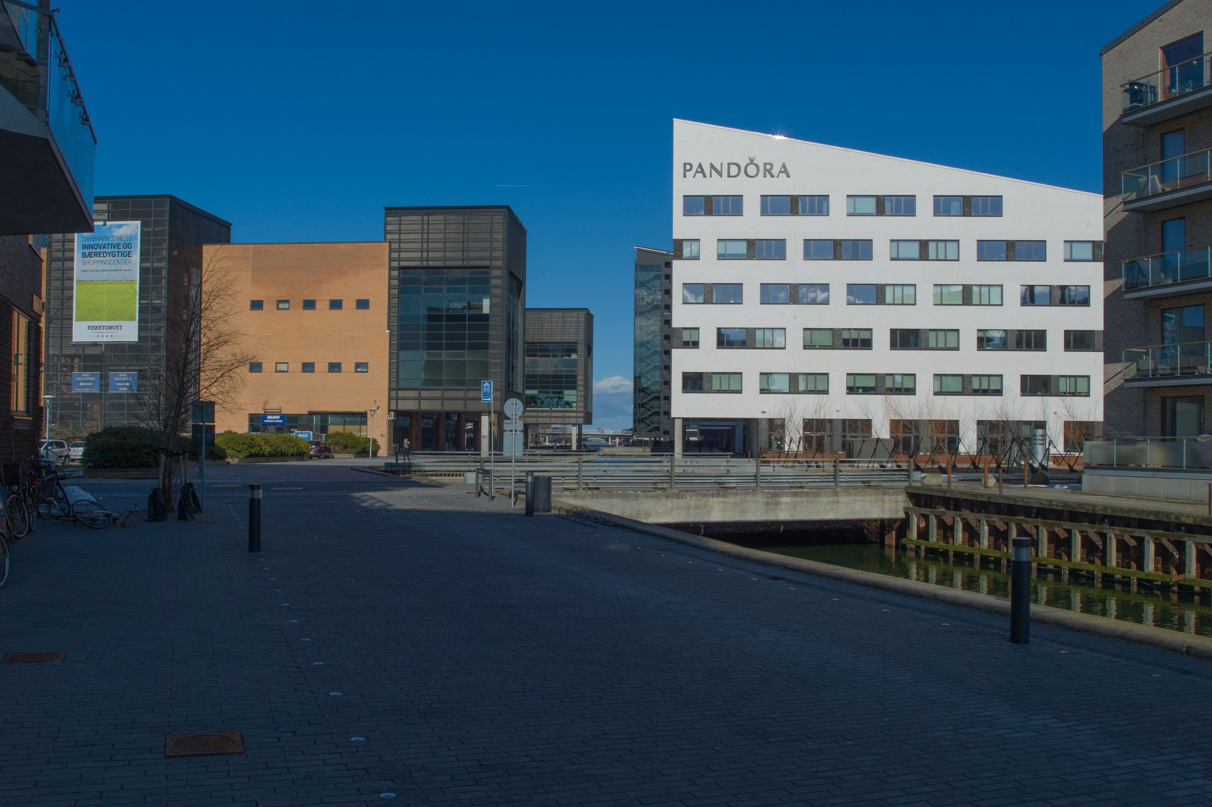
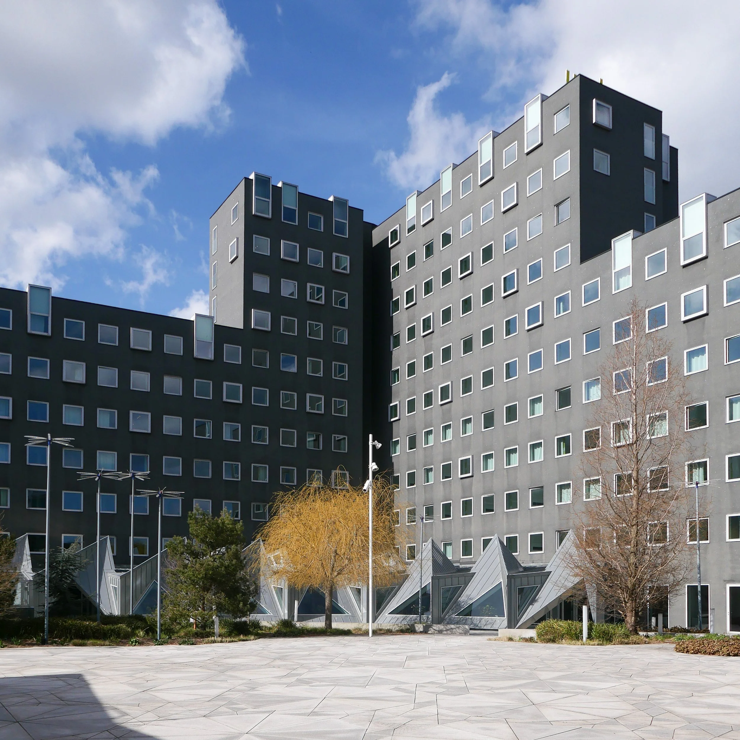
However, the exterior is certainly looking a bit tired and more than a bit dated. A series of six tall dark towers across the south end and down the south-east side towards the canal are stark and oppressive.

A new metro station will open in 2024 at the south-west end of the shopping centre, where there was a car park, and in the last three or four years new apartment buildings have been constructed in this part of the city so, presumably, major investment in the shopping centre, can now be justified.

The centre has a service road at the lowest level, on the side towards Kalvebod Brygge - a dual carriageway with heavy traffic that is a main way in and out of the city from the south - and there was parking at the lowest level. Like so many shopping centres of that period, it was inward looking - so punters were not distracted from the whole spending experience - but the plan now seems to be for new, outward-facing shops that will be built to make the centre more inviting and more open to the community around.

Havneholmen, the sharply-pointed island, has apartment buildings and office blocks built since 2000.
Fisketorvet is the roughly-rectangular block between the island and Kalvebod Brygge - the main road from the south into the city centre … the concave entrance front is obvious at the end of the long bridge over the road and the railway.
the new metro station will be across the south-west end of the shopping centre and is on a new metro line that will open in 2024 to run from the central station out to the south harbour and on to Ny Ellebjerg

Fisketorvet now …. from the north with the harbour for the old gasworks and the cycle bridge … and from the south

proposals by Schmidt Hammer Lassen for remodelling the exterior