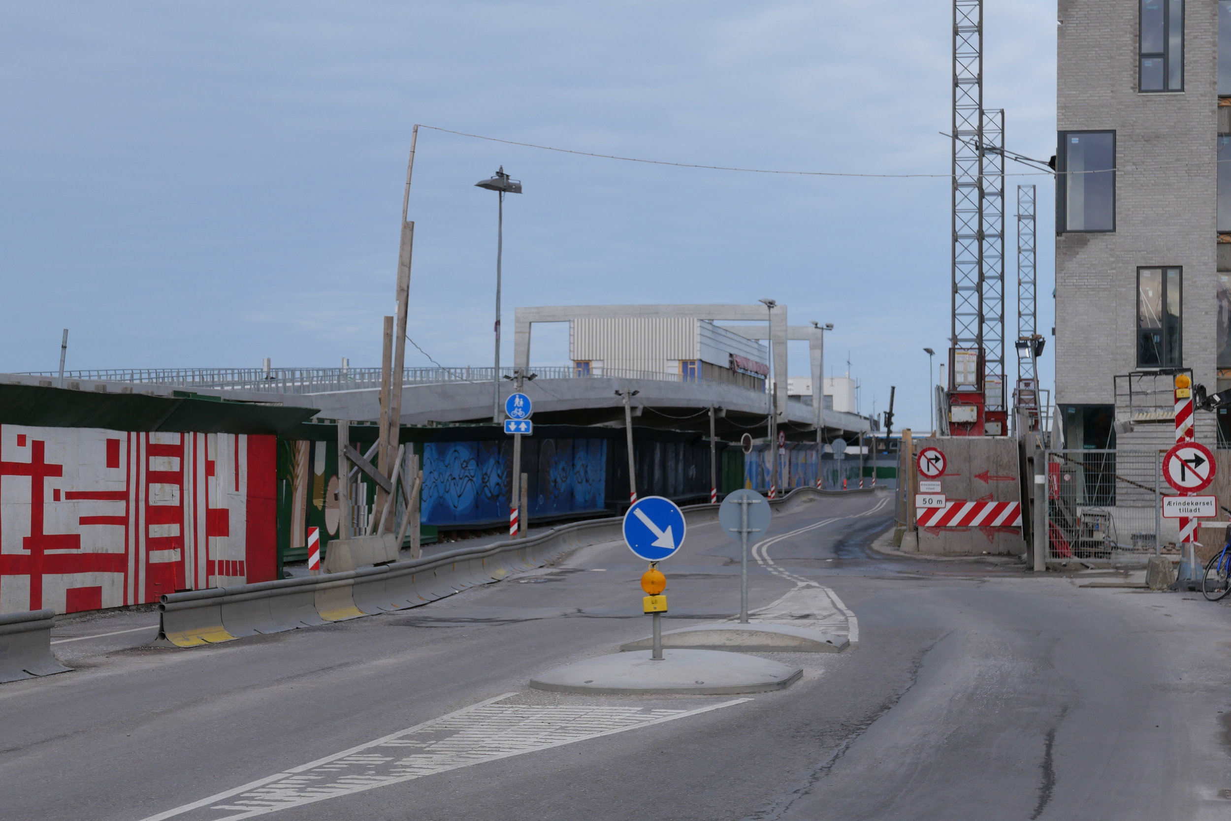
a new metro line across Amager

Reports in newspapers this week suggest that politicians at city hall have agreed on a new route for the next new line to be added to the metro system in Copenhagen.

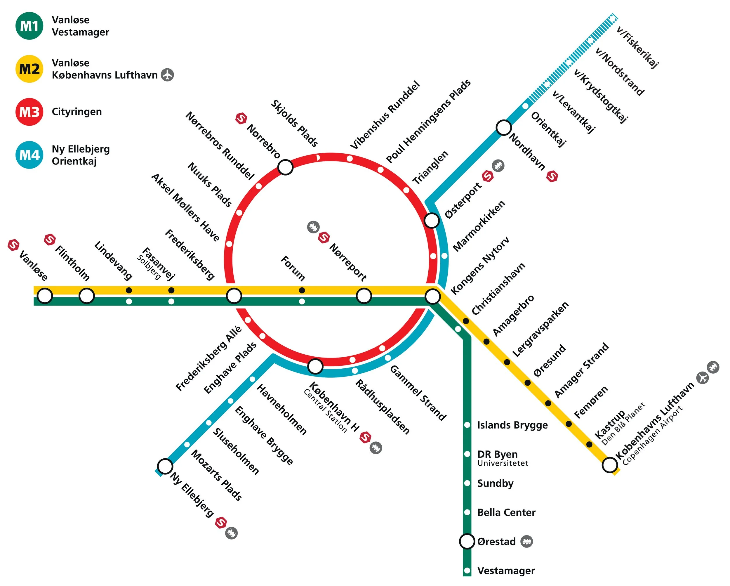
Identified as the M5 line in previous plans, it is to run from the central railway station to serve Amager and Refshaleøen and the controversial new island of Lynetteholm.

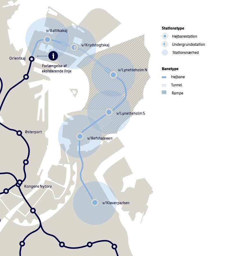
Back in the Autumn of 2020, several options were published by Metroselskabet - the company that runs the metro - as they explored possible ways to extend the metro on from Orientkaj on Nordhavn to the new island of Lynetteholm and then, from there, down to Refshaeløen.

In a tight arc, the new line would have continued across Amager with major interchanges with the existing metro lines at Amagerbro and Islands Brygge before going under the harbour to the central railway station. It was also suggested, in the report, that there was also the possibility to extend the line on from the central station to serve the inner area of Nørrebro and the main hospital.

Two years ago, the priorities were to provide a metro service for the cruise ship terminal on Nordhavn and to serve the proposed housing on Lynneteholm along with an alternative route to reach the centre of the city from Amager that would relieve pressure on the original metro line from the airport and from Ørestad through Christianshavn to Kongens Nytorv that is now close to maximum capacity.

An obvious problem with those schemes was that there was a great gap in the middle where the new island might or might not be constructed ... the loop would only be fully operational when the two stations on Lynetteholm were open and it's housing completed and, current estimates suggest that will be sometime after 2070.

In addition, in order to work at optimal efficiency, any new line should have it's own service centre for it's own trains .... comparable to the service area at Metrovej in Ørestad for the original metro lines and Metro Service between Otto Busses Vej and Vasbygade for trains from the Cityringen.

In this, the most recent proposal for a new metro line from the central railway station, the line would take a wider curve across Amager to serve extensive areas of housing - both new developments and the revitalisation of older housing - where the only public transport is the bus services.

A new metro line from the central station would go under the harbour to a new station at Bryggebroen, at the south end of Islands Brygge, and then on to the existing metro station at DR Byen - rather than the original plan for an interchange at Islands Brygge metro station - and then to a new station on Amagerbrogade - further south than the interchange at the Amagerbro shopping centre proposed in earlier plans - and then on to an interchange at Lergravsparken - where passengers could change trains to get out to the airport. This new route would then continue north, close to the line of earlier route, to Prags Boulevard and Refshaleøen.

An area where the trains from this metro line could be serviced would be constructed out on the island of Prøvestenen.

This new metro line could be completed by 2035 but could then be extended on to Lynetteholm - if and when the island is finished - and, at the city end, the line could be extended on from the central station to inner Nørrebro and Rigshospitalet.

This is an important example of just how plans for major infrastructure projects have to evolve as other problems or other demands come to the fore or as the economic situation dictates.


the if or when and the how much and why of new islands and tunnels under the sea

This week, politicians in Copenhagen have to agree a budget for the city for the next financial period and the main item on their agenda will, presumably, be discussions about moving to the next stage their ambitious plans to construct a large new island across the entrance to the harbour …. a major engineering project that has been agreed in principle by both the national government and by the city and agreed across most political parties.

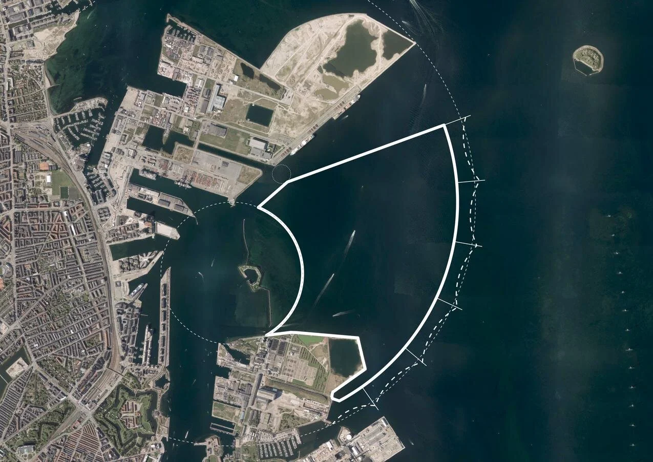
Initial plans set the new island immediately beyond and close to the Trekroner Fort - built in the late 18th century to guard the entrance to the harbour - but the most recent drawings published show that it will now be further out into the Sound and will cover a larger area of about 3 square kilometres. There will be a large park along the eastern edge - planned to be larger than the well used and popular Fælledparken on the north side of the city - with homes on the island for 35,000 people and work there for at least 12,000 people although some assessments have suggested that as many as 20,000 new jobs will be created.

But the new  island is not simply the next version of Nordhavn - just larger and further out - but it is also an integral part of an expansion of traffic infrastructure on this side of the city and there will be extensive flood defences on the east or outer side of the island that faces out across the open Sound …. defences that will be an important part of the protection against storm surges that could flood the inner harbour as the climate changes and as sea levels rise.

The name for the new island - Lynetteholm - was, In part, inspired by the shape with a broad curve to the east side - the side facing out across the Sound - and is from the Danish version of the French word lunette and that has been combined with the Norse word holm for a low island that was usually in a river or estuary and was often meadow.

However, Lynette is not a new name in this area of the outer harbour because it was the name of a curved outer fortress built in the Sound in the 1760s that, with large guns set up there, was an important part of outer defences that protected the entrance to the harbour.

read more

① road link and tunnel to Nordhavn - north of Svanemølle and south of Hellerup
② tunnel to link Nordhavn to Lynetteholm and then on to the bridge to Sweden
③ alternative route for a traffic tunnel below the coast road of Amager
④ route for tunnel from Nordhavn to Sjællandsbroen - bridge over the harbour

⑤ if the elevated motorway at Bispeengbuen is demolished then there is a plan
to construct a road tunnel from Fuglebakken to Amager - including a tunnel
under Åboulevard and under HC Andersens Boulevard and on under the
harbour and possibly as far as Artilerivej


the end of the line for now but from here does the metro go north or east?

60 metres beyond the platform at Orientkaj - this is the end of the line for now

In March 2020, a new section of the metro in Copenhagen opened …. the north end of the new M4 line with new stations beyond Østerport at Nordhavn and Orientkaj.

From Østerport, trains for Orientkaj follow the existing M3 track - the metro inner ring north towards Trianglen - but 500 Metres from Østerport, below the north end of the lakes, they branch off onto the new line and follow a curve to the east.

The new Nordhavn metro station is just under 2 kilometres from Østerport, below ground on the east or sea side of the suburban railway line so it’s on the east side of the suburban train station at Nordhavn and actually on the east side of the main coast road.

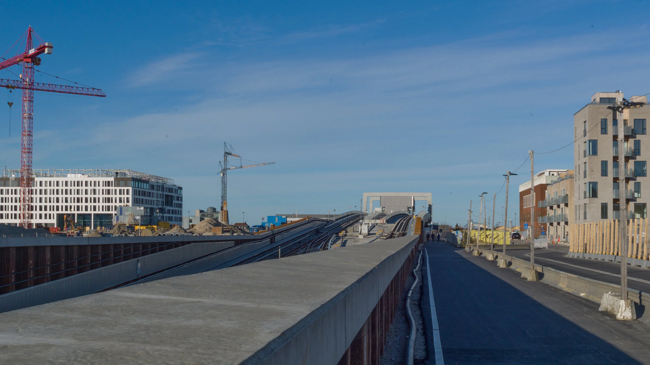
Immediately after the metro station at Nordhavn, trains rise rapidly up a steep slope and up onto a section of elevated track immediately before the second new metro station at the inner end of the Orientkaj dock.

For now, just beyond the platforms of Orientkaj, the track ends abruptly waiting for the next phase of work.

Maps of the metro - even those from as recently as last Spring - show the next stage of the metro line running on to new stations at Levantkaj, Krydstogtkaj, Nordstrand and then, finally, to Fiskerikaj, at the end of the line … so four new stations that will not only serve new housing that will be constructed in the last phase of building for Nordhavn but would also take passengers out to the terminal for cruise ships at Oceankaj.

That new line, as proposed, would form a large curve - running first east out to the cruise ship terminals and then north and west in a large arc - so it has been nicknamed “Lille Spørdmålstegn” or the Little Question Mark.

But now there is a real and a very large question mark over this whole next stage for the metro because all decisions are on hold waiting to see if a recent proposal to construct a large new island for housing across the entrance to the harbour goes ahead.

Constructing that large artificial island would not be completed until 2070 but it is also entangled with a complicated series of planning decisions that have to be made in the next year:

  • A new tunnel is to be built north of Svanemølle power station for road access to Nordhavn from the north but this could be extended down the east side of Amager, in a tunnel, to the airport and the bridge to Sweden. It would not only be a major eastern bypass for the city but would also provide road access to the new island from the north and south.

  • If the island is constructed across the entrance to the harbour then it would also be part of new storm-surge protection to stop water from the Sound flooding into the inner harbour and flooding the inner city. That flood barrier has not been allocated a budget and, already, some have raised doubts about an island being the best form for storm protection.

  • A large and expensive and relatively new sewage and water treatment plant to the east of Refshaleøen would have to be relocated and again that is not in the budget.

  • Because the island would be built out in to the Sound and because a major road bypassing the city would link to the airport and the Øresundsbroen - the rail and road bridge between Copenhagen and Malmo - an eastern ring road should be seen as part of a wider regional transport policy - including a proposal to build a rail and road link at the north end of the Sound, between Helsingør and Helsinborg - so both regional planning and environmental concerns in Sweden have to be taken into account.

This is becoming one of the most complicated and, certainly, the most contentious infrastructure plan for the city.

new metro stations at Nordhavn and Orientkaj
Lynetteholm
the if, when, how much and why of the new island


Forundersøgelse Metrobetjening af Lynetteholm /
Metro Services for Lynnetholm Preliminary Study

If you want to follow and to understand the planning issues that are involved or if you are interested in the engineering problems that will have to be resolved then I would recommend a report from the metro company - Forundersøgelse Metrobetjening af Lynetteholm / Preliminary Investigation of Metro Service to Lynetteholm.

It can be downloaded from their web site and sets out in some detail and with good maps and illustrations, the options and possible routes for extending the metro line on from Ørientkaj.

This is far from a simple matter of drawing lines across a map.

Any new metro lines will have to link into the current service and this means also looking at an opportunity to extend the metro system into parts of the old city that are not served by the current metro lines.

In addition, the current line out to Ørientkaj runs in sections along existing lines and uses existing service facilities but there is now an opportunity to build new depots and to make sure that new services do not have an impact on the running of the existing lines.

Not only could a new service out to the new island form important new and fast links across the city but it will have to thread it’s way through and under or over existing infrastructure and any new interchanges will have to work in a rational way with what is happening in the streets and squares above.

For some new interchanges on the system - like at Islands Brygge - there are three or four options for the site of a new station above ground and several options for how connections and platforms will link below ground.

If the construction of Lynetteholm does get approval, the island will not be completed until 2070 so any new lines or new stations would either have to wait until then or new lines might be phased and built so that the line out to stations on the island would be simply the last stage that closed the loop.

Forundersøgelse Metrobetjening af Lynetteholm /
Metro Services for Lynnetholm Preliminary Study


If Lynetteholm is given a green light then the new island will influence any future extension of the metro


Before the construction of a new island was proposed, this was plan for the new M4 line of the metro system.

It shares a long section of track with the metro ring between the central station and Østerport. A short new section of track out to Ørientkaj has just opened and the long south section of the line that will provide a service out to the south harbour and on to the major railway interchange at Ny Ellebjerg is underconstruction but will not open until 2024.

The new stations will have distinct designs that reflect the character of the areas that they serve. The station at Havneholmen is on the south side of the shopping centre at Fisketorvet and work has started on an extensive restoration and upgrading of the centre. It is also close to the site for a new bus station for the city on Carsten Niebuhrs Gade on a site parallel to the railway and on the opposite side of the tracks to the station at Dybbølsbro.


M4 Blå linje

This option to extend the M4 line to the new island is possibly the most straightforward.

A line out the north coast of Nordhavn might or might not be constructed but the M4 line would be re aligned to go first to a new station at Baltkakaj and then on to the cruise ship terminal and then, when the island was constructed, trains would go in tunnels under the new and constricted entrance channel for the harbour to two new stations on Lyntteholm and then on to Refshaleøen and Klovermarken that are not served by the current metro but will have extensive new areas of development and housing over the next twenty years.

The line could be extended beyond Klovermarken to provide a fast service across the top of Amager and then back under the inner harbour to the central railway station to relieve pressure on the existing metro stations at Christianshavn and Islands Brygge where passenger numbers are close to capacity.


M5 Lilla linje


This option is more radical.

The metro line out to Nordhavn would be completed as planned but there would be a new and potentially faster service out to Lynetteholm directly from Østerport station with a new long tunnel under the inner harbour.

If Lynetteholm gets approval then the plan is for housing for 35,000 people and work for almost as many so passenger numbers would be large.

From Lynetteholm, the new line would also be extended down to Refshaleøen and on across Amager to the central railway station to form a sweeping curve that forms a large reverse C.


M5 Vest Orange linje

This option takes the curve of the new metro line the other way so in effect starts on Lynetteholm (or ends on Lynetteholm as the last stage of a phased construction ending in 2070).

It would serve the major regional hospital - the Rigshospitalet on the south side of Fælledparken - and part of the inner area of Nørrebro that are not served by the current metro lines and with a new interchange at Forum where the exhibition centre may be redeveloped and the line will then go on to the central railway station and again across the top of Amager but in this option it will end at Prags Boulevard where there is extensive new housing.

A new metro station at the central railway station may be constructed on the inner, city side of the railway tracks and would be under Bernstorfsgade …. under the very busy street and the bus station between the railway station and Tivoli.

Whichever option is chosen, it looks as if the citizens of Copenhagen can look forward to 40 years or more of engineering works, earth moving and high green hoardings.


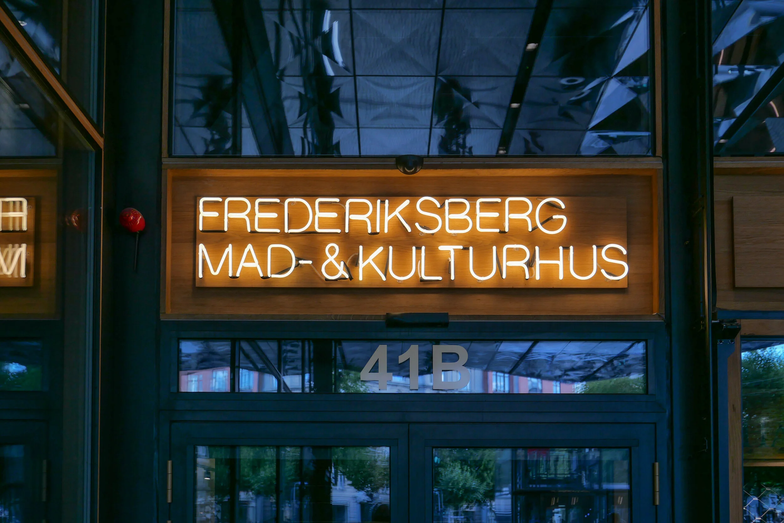
COBE on Frederiksberg Allé

select any image to open as sllde show


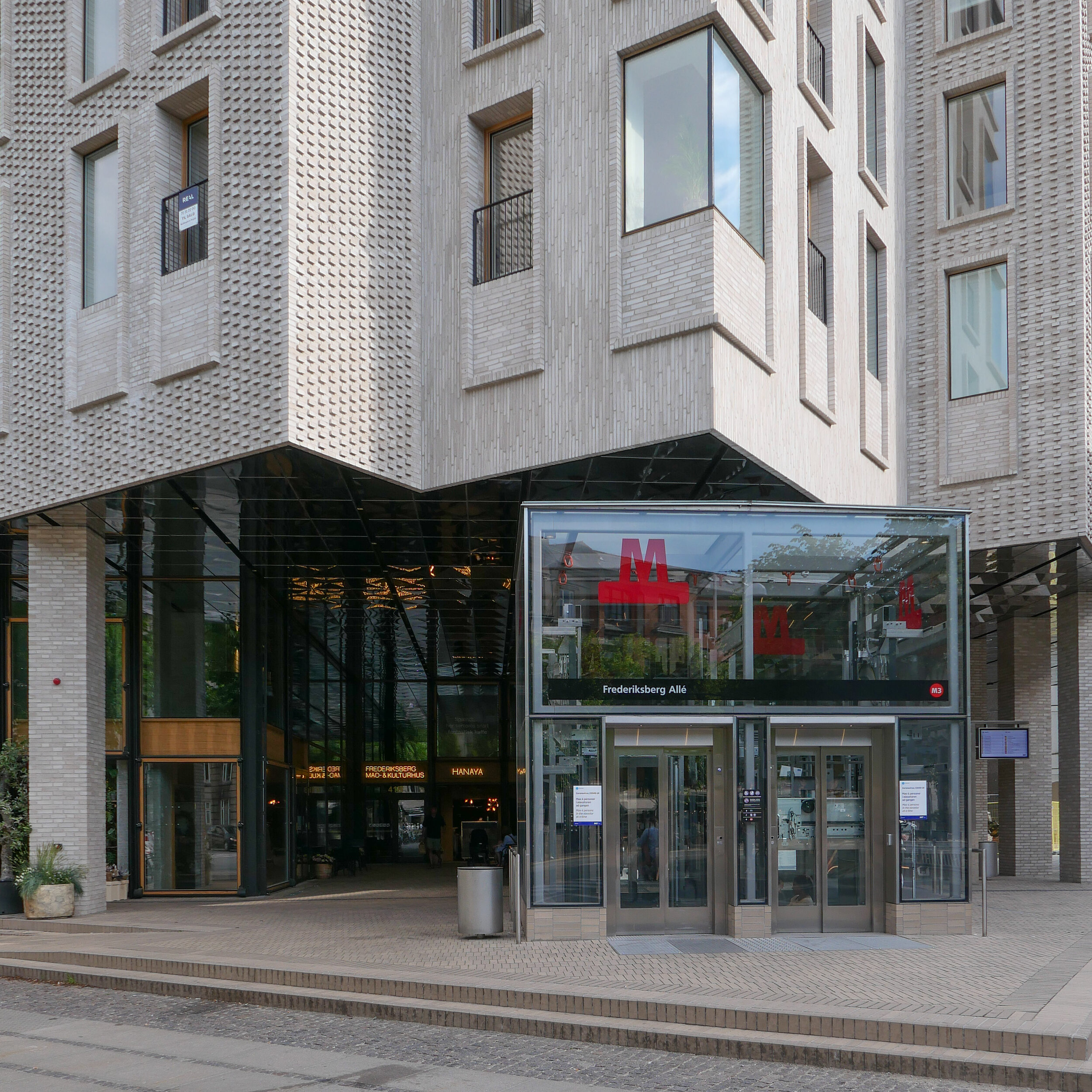
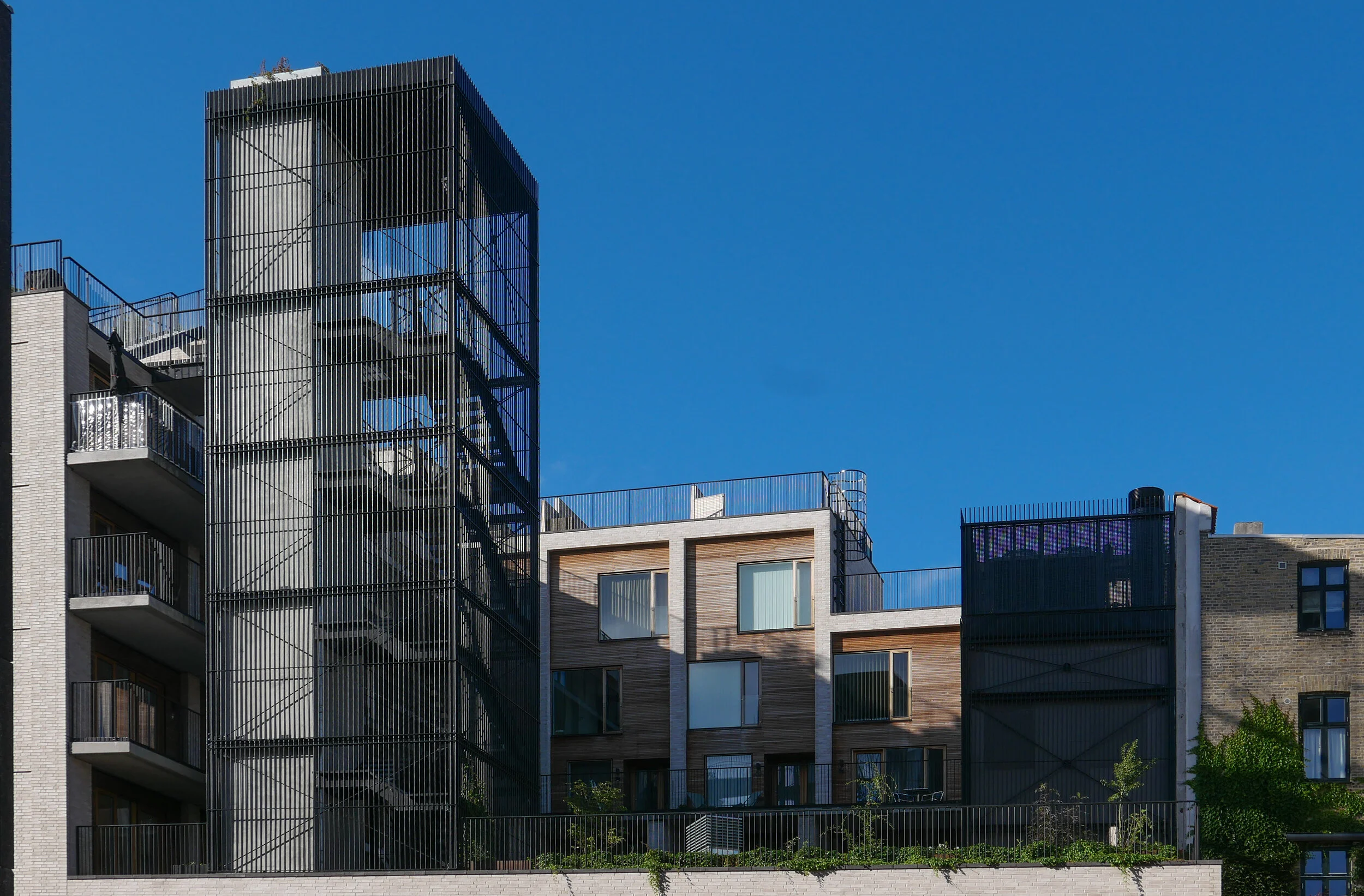
This new apartment building on Frederiksberg Allé - designed by COBE and built over a new metro station - sets a new standard for building in the city and deserves to win the Arne prize next year.

OK … it’s the slab and clad building method I rant about and rail against but that is when it is done badly with lazy or boring or cavalier design. This building shows exactly what can be done to produce an elegant and clever building by using the free tools any architect has of understanding and appreciating the use of proportion, logic, composition of masses, texture, colour tone and, with COBE, an astute knowledge of Copenhagen building traditions and an empathy with the city and its streetscapes.

The site is a square plot approximately 35 metres wide and 35 metres deep that was cleared for construction work on the new metro line and for an important new metro station here at the centre of the Allé. There was a large villa here that broke or weakened the street line so this project has been an opportunity to establish a clear and well defined street frontage but also with a sense of a new space created at the cross roads by stepping back to the corner in stages along both Frederiksberg Allé and on Platanvej - the side street.

Metro trains now run under the cross roads at an angle and, as the general principal for the metro is that both platforms and the ticket halls and entrance stairs all work in line with the train tracks, that set the angle of the lift tower to the platforms and dictated that the main entrance to the metro should be across the corner and not from either the main street or the side road. Of course the lifts and staircases could have been buried into the building, disguising or ignoring that diagonal angle, but that would not have been a challenge and much of the very best architecture is good because it works with and overcomes the problems of a specific site.

It is also important that the architects of the new building understand the main vocabulary or language of the buildings along the street …. that is, substantial apartment buildings of a high quality with angle turrets at road intersections and the use of decoration to indicate individuality or difference and status. Here the architects from COBE have resisted any temptation to produce a pastiche with domes or flourishes but use strong composition by building up elements to a corner tower and by doing that well they actually get away with producing a building that is much taller and much more solid than anything that might otherwise have been rejected by the planning authority. Given the importance of this historic street and given the potential criticism that could have landed on the desks of politicians from the wealthy and articulate people who live in the expensive homes in this neighbourhood, it had to be right.

The panels of pale brick have either areas of raised header bricks or raised courses of bricks for texture and plain sunk panels on some areas show that actually it does not need much projection or recession to throw a little shadow across the facade for definition. Many of the new buildings in the city are too flat - with no use of recession or projection - even by a slight amount - to give the facade some life.

Here, bricks are set horizontally, in the conventional way on walls where headers are pulled forward, producing a darker surface with the same colour of brick but set vertically and with much longer bricks than is normal on the sections of wall on the corner tower to produce a much softer tone that gives the wall a sheen that is almost like a textile. The windows have a projecting frame or simple architrave of headers and window frames are thin and set back but produce what looks almost like a graphic line to define the openings. There is a clever use of blind panels within the brick frames of the windows above the metro entrance to disguise a high lost area or service mezzanine inside. All this, and the good proportions of the whole and the parts, is an aspect of the design that any good 18th-century architect would understand and respect.

I’m still not convinced that the lack of any definition below the brick but above the wide openings at the corner does not look slightly weak. Steel and concrete can span any space like this without obvious support on the material of the wall face - structural features such as lintels or arches - but without them a wall hanging above a void looks insubstantial - as if it could all slide down - but here it does work because looking at the building, from the angle, it is rather like a chest of drawers with the drawers half pulled out and the corner lifted up. And then the glass tower of the metro lift slides forward under the whole lot like an actress taking the applause, slipping under the curtain of the proscenium arch. Prose too florid? Ok but it does reflect the drama of the building but drama done with an almost minimalist restraint. If this does not win an award for being the best new building in the city it certainly deserves an award for being the classiest.

To simplify what is a complicated plan, essentially, there are three parts to the building with that rectangular block cutting in from the corner and containing the metro station. On either side is a high open space rising through two floors, basically triangular and filling out the space of the plot on either side of that metro rectangle. On the initial plans there were small units on either side to create a food court with tables around the escalators that drop down to the metro platforms but in the end there are two larger restaurants and what is now a florist. On a mezzanine level are two small halls and facilities - the kulturhus - that can be rented for local events.

Above, and almost self contained, are 30 homes arranged in a squat L shape around an open courtyard that is a garden high above the street. From the courtyard itself there is access to six town houses each on two floors, with all but the corner house with dual aspects to the courtyard and to Frederiksberg Allé and then, piled on top, is another block pf six town houses above that and with roof terraces. On the west arm of the L there are relatively narrow studio flats, again with dual aspect but to the courtyard and to Platanvej - across the west side of the plot.

Upper levels of the housing are reached by open lift and stair towers with black metal framework and railings a little too much like cages. Lower apartments have entrance doors from the courtyard and the upper apartments from open external galleries … not the most common form of apartment building in the city where normally, in larger buildings, there will be a series of separate entrances along a front with separate staircases and lifts at each door and single apartments on either side at each level. Here, with the wide entrance to the metro across the corner and the commercial area on the ground floor, that was not an option.

On the courtyard side, the restrained style of the brickwork of the street frontages is abandoned for large panels of wood facing but with the grey brick used for a framing. Windows on the courtyard side are arranged with an unnecessary asymmetry and the staircases and balconies, with their black railings, begin to look a bit too much like an Escher drawing. What is good is that upper levels of the building not only step up to the corner so building up visually to the corner turret with its penthouse apartment, but they also step in or back at upper levels to disguise the height of the building when seen from street level and that also means that upper access galleries, from the lifts to the separate houses at the upper level, do not project but are on the roofs of deeper houses below and there are terraces or roof gardens on the set back so, for once, this is a major apartment block with no projecting balconies.

Frederiksberg mad-&kulturhus
COBE


a new link between the platforms of the central railway station and the new metro station

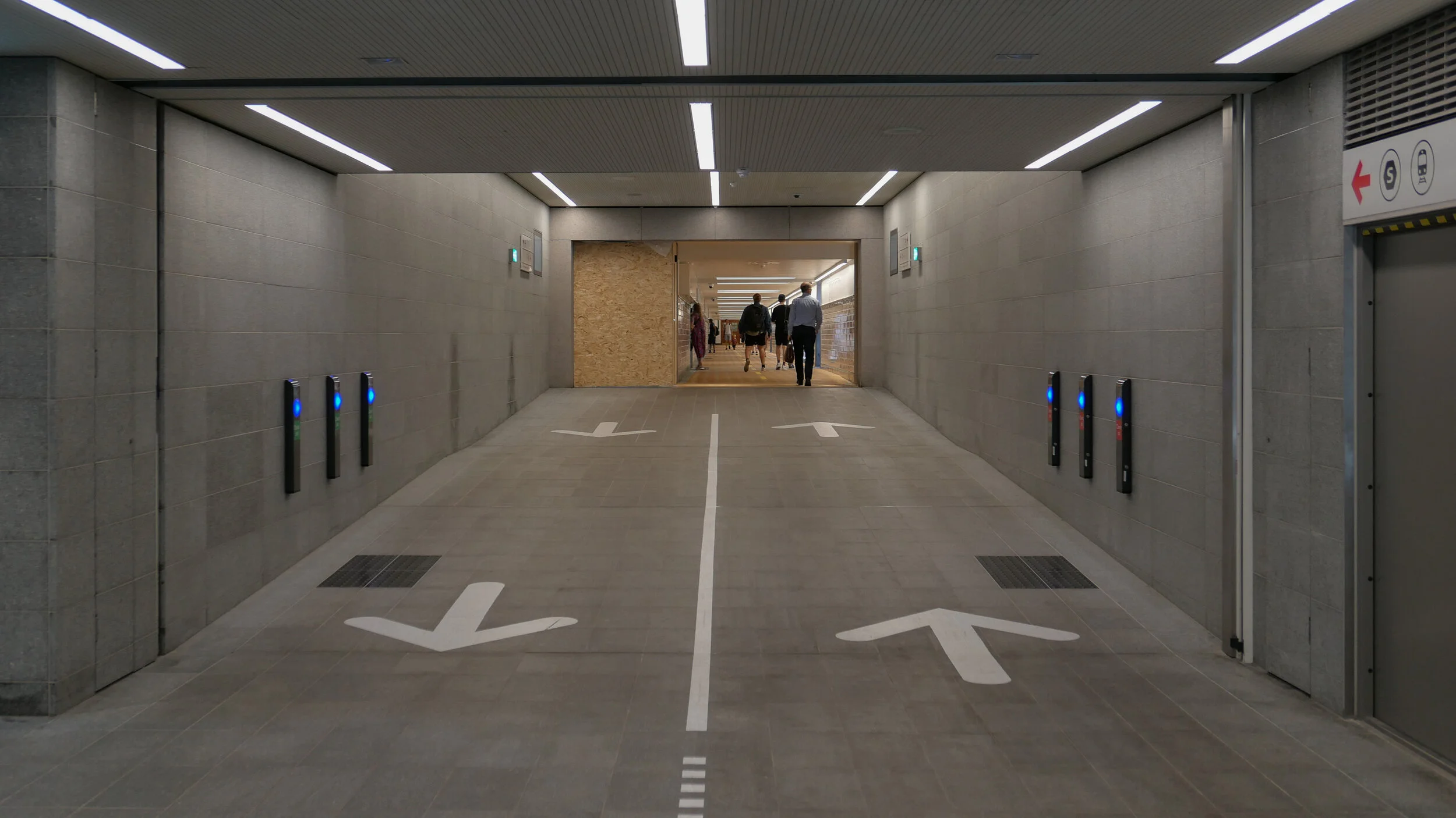
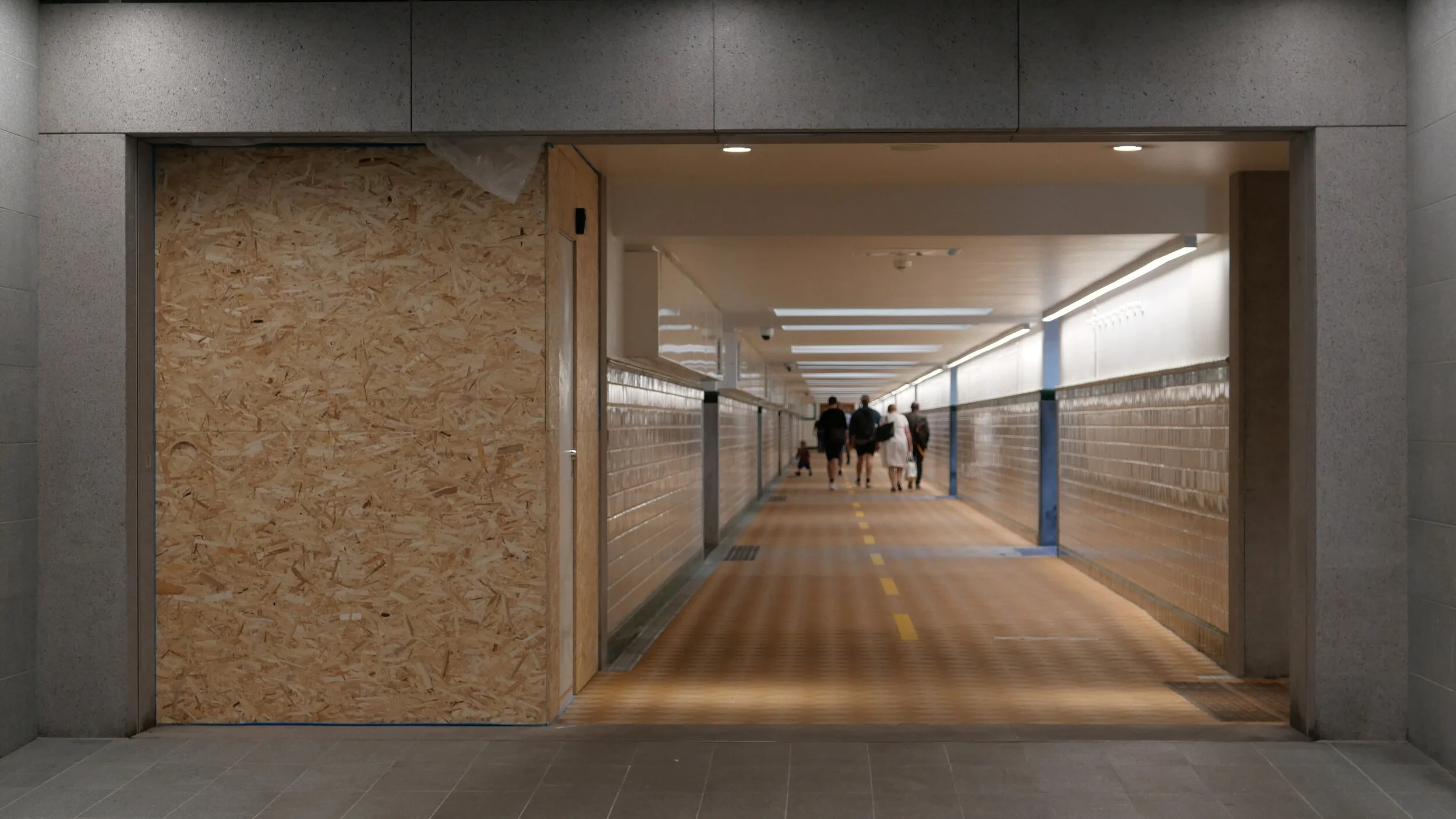
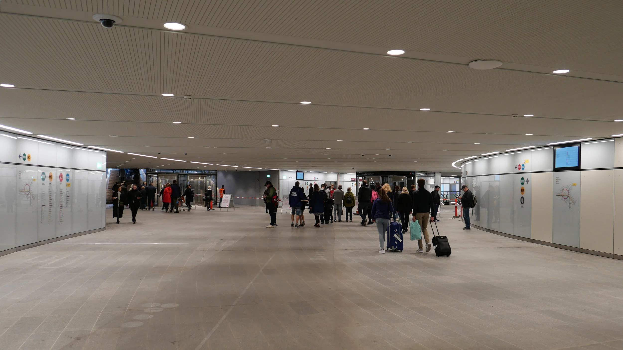
A key part of ongoing construction work to complete the new metro station at København H - the metro station at the central railway station in Copenhagen - has opened with access to a wide tunnel under the platforms of the train station so that passengers can go directly from the metro trains to the platforms for suburban and national and international trains.

Until this tunnel opened, passengers from the metro had to go up to street level and then cross over a road and go up a flight of steps to get to the main station concourse before then going back down to the train platforms that, at the central station, are below street level. 

Now, as you come up the escalators from the metro platforms, there is a large circulation area just below street level and, from that lower circulation level, you can walk straight ahead into the tunnel where there are steps and lifts up to each of the train platforms.

I’m not sure what to call this lower part of the metro station. The lower concourse?

When the first underground stations on the original metro line opened nearly twenty years ago it was the area where passengers bought tickets and where there were maps and information panels so it seemed reasonable then to call it a ticket hall. 

Now, almost twenty years later, virtually everyone has an app on their phone and even the rejsepas - the plastic travel card - seems old fashioned so fewer and fewer people are buying printed tickets. 

As long as you check information about which platform you want for which suburban train service, it’s a quick and easy way to avoid the people milling around on the busy station concourse and, the other way round, if you arrive in Copenhagen on a train then now there is a quick way down to the metro.

If people wonder about the general process of planning and designing then most would surely think about what happens out at street level - the part they can see - but this example shows just how much thought and work and money goes into threading together the new and the old parts of the infrastructure of a densely built and busy city.

the Metro to Nordhavn

At the end of March, the north part of the new M4 line of the Metro opened for trains to run from København H - the central railway station - to Orientkaj, out at the north harbour.

This new service follows the Cityring to Østerport but then, just north of the station, there is a large junction or intersection at the north end of Sortedamsø and immediately below the lake where the new line heads out to the north east. It goes under the main railway line and railway station at Nordhavn and under the main coast road - Kalkbrænderihavnsgade - to a new underground metro station just north of Nordhavn Basin.

Trains then climb steeply to the start of a new elevated section of track to terminate at a new elevated station at Ørientkaj, just over 2 kilometres from Østerport.

For now, the track stops just 70 metres beyond the new station but it will be extended on to serve new but as yet unbuilt housing and businesses at the outer or north part of Nordhavn and there are plans for it to continue to the terminals for cruise ships and, possibly, on further, back underground, to take passengers under the harbour and to Refshaleøen.

Going in the other direction, trains starting from Ørientkaj now terminate at København H - the central railway station - but the south end of the M4 line out to Sydhavn - the south harbour - is due to be completed in 2022 and then trains on the M4 line will continue on to Sluseholmen and on to what will be a major interchange with the suburban rail service at Ny Ellebjerg.

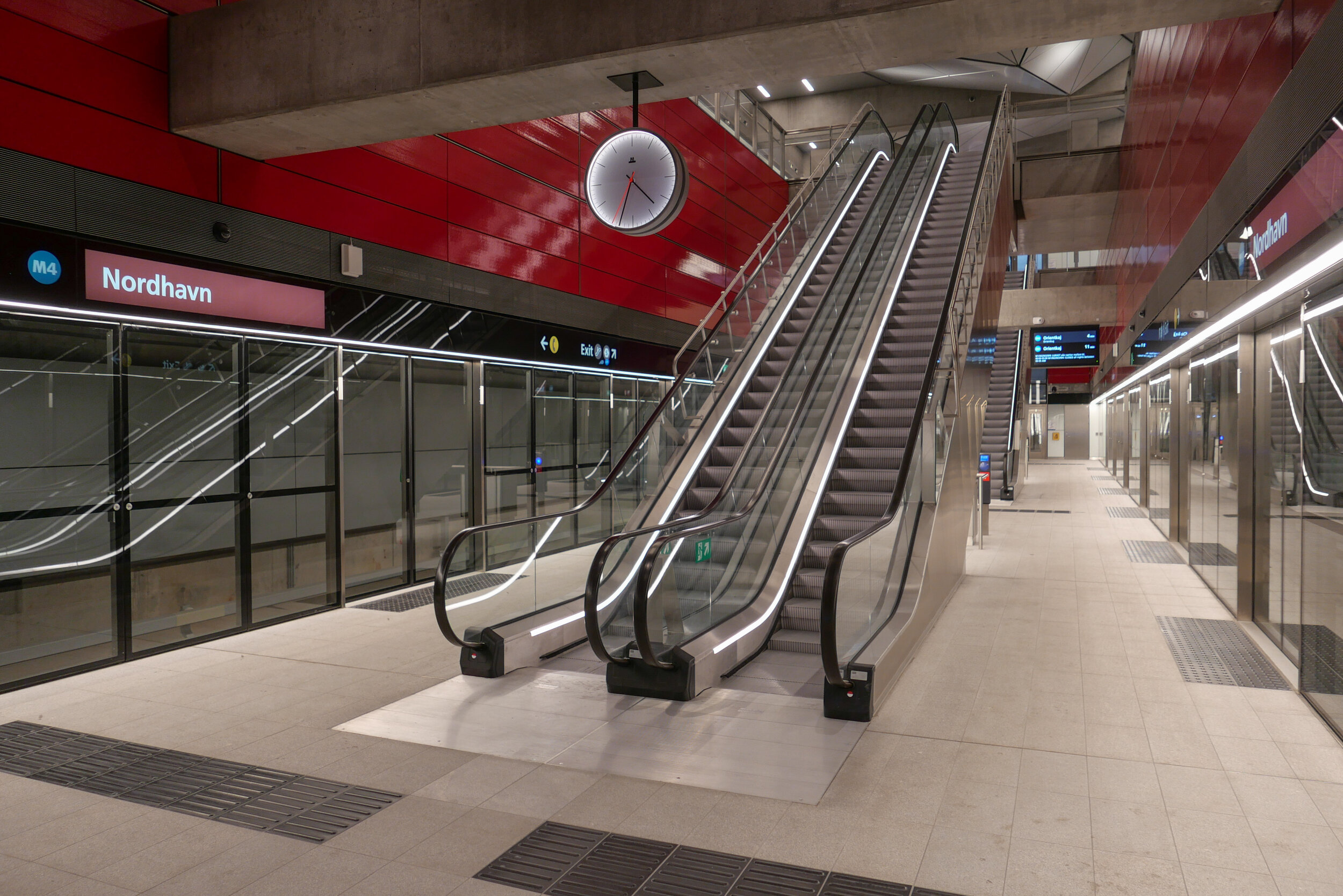
The new metro station at Nordhavn follows the same form as the other stations on the new Cityring …. so with the train tracks set apart and with a central platform between them. There is what is essentially an open concrete box above the platform that is rectangular in plan, the width of the platform and the length of the trains. This contains very open escalators, rising from the centre of the platform and free of the walls of the box and, just below street level, there is a large circulation area below street level where there are ticket machines, information panels and maps and so on with the open escalators at the centre. There are steps up to the street and, at many stations, access to underground bike storage at that level below the street. All the stations also have lifts - most with glass superstructures at street level and stops below at the ticket hall/circulation area and then at the platform.

But, here at Nordhavn, there are some distinct differences from that arrangement.

First, and perhaps most obvious, there are no skylights over the escalators. The public square above the station is only crudely laid out for now, with temporary paths for access, so it’s difficult to see how this will be organised and difficult to see why the distinct pyramid-shaped sky lights of so many of the other stations have been omitted here. These pyramid-shaped skylights over the escalators are important because they provide at least some natural light right down to the platform.

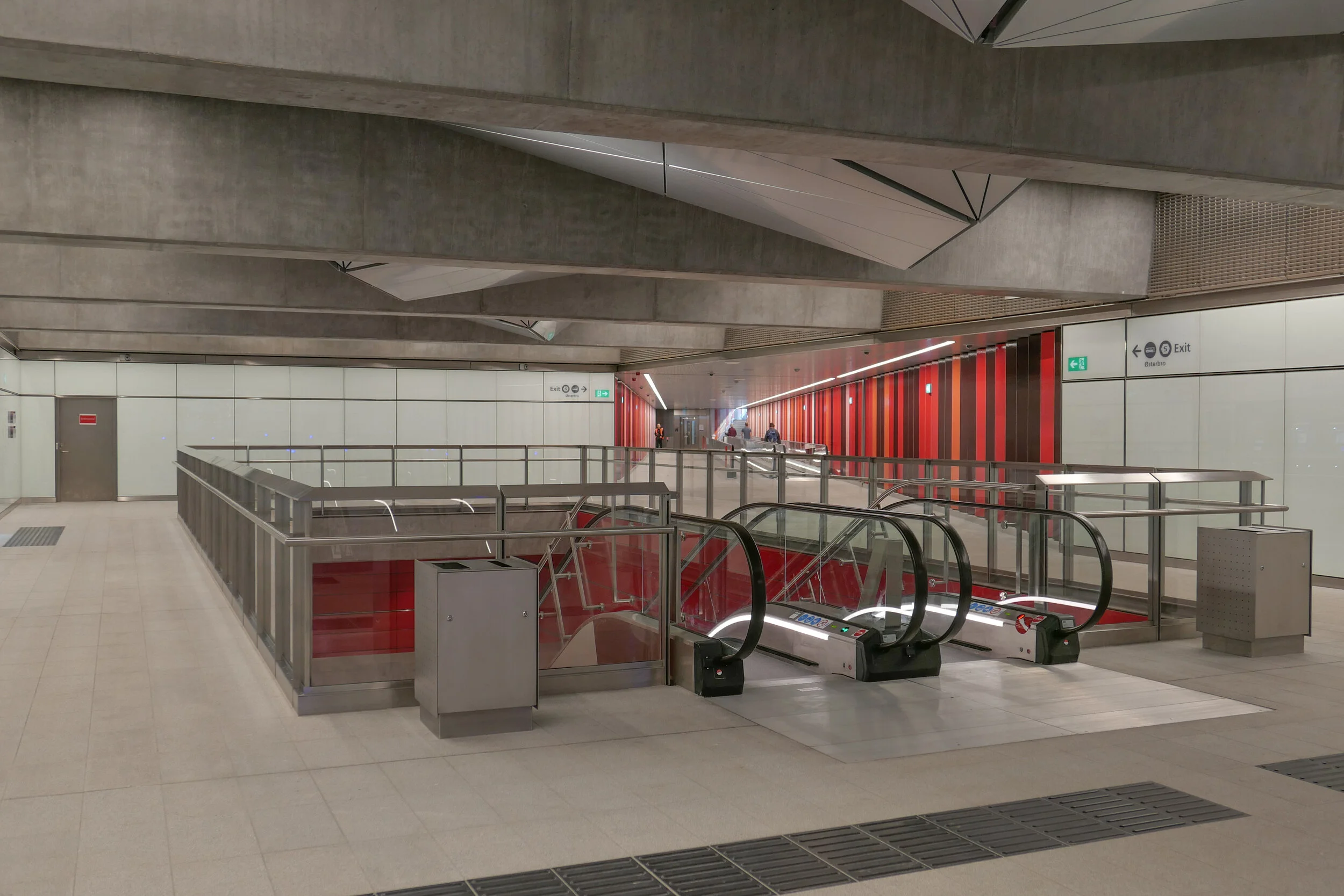
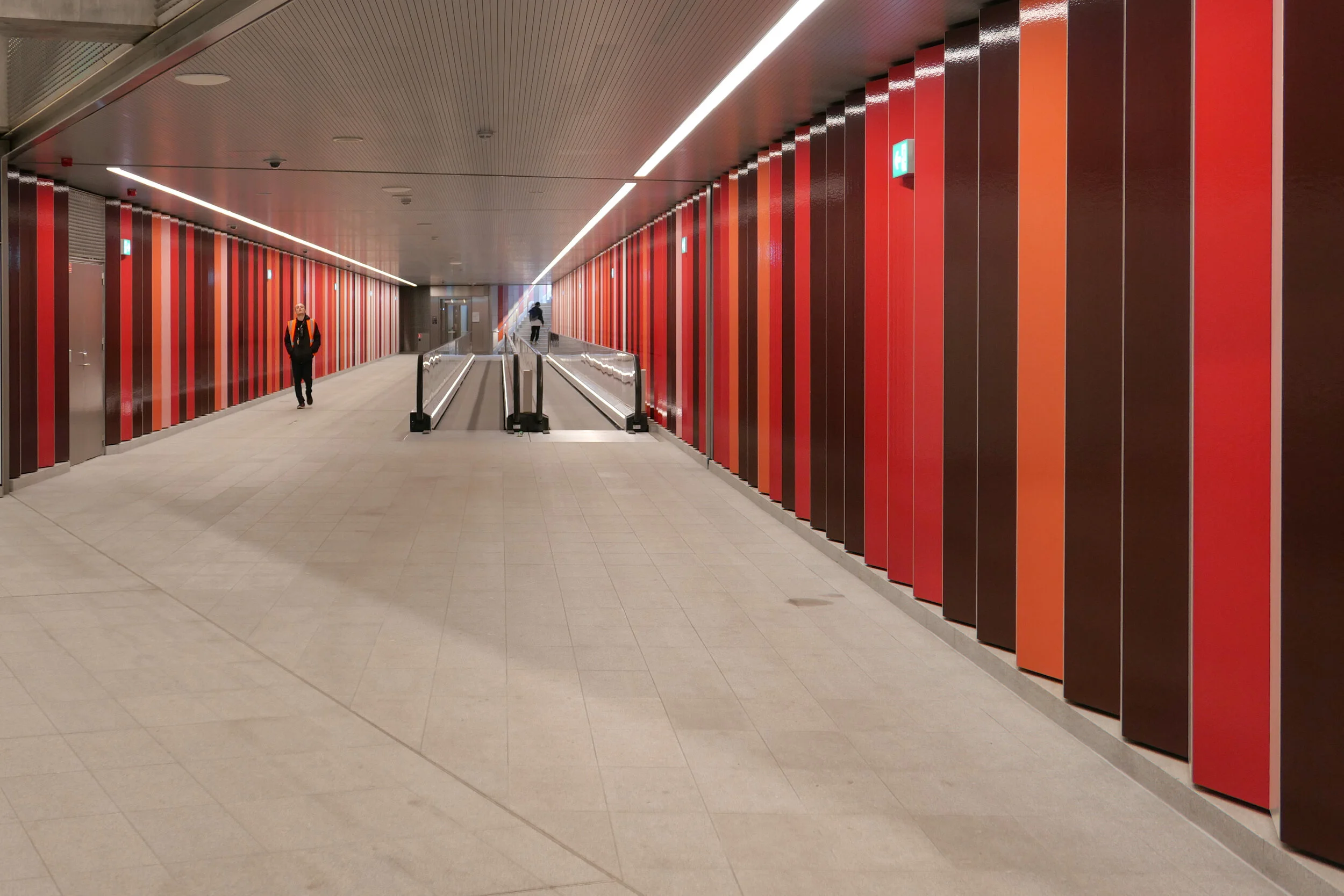
And where the other stations are set to the orientation of the streets or squares above - so with entrances and staircases and elevators that are either at each end or, in some, at the centre of each side - here at Nordhavn the tunnels and the station platform are set at an angle to the streetscape above. The east exit and entrance to Nordhavn runs out at an angle from the corner of that main hall just below street level as a short tunnel with steps to take passengers up to the street above but there is also a long pedestrian tunnel, for passengers to walk under the road and under the suburban railway, to connect the metro station to the suburban railway station and that runs out at an angle from the diagonally-opposite corner at the main ticket hall level immediately below ground. So, the main circulation area, immediately below the pavement, has a strong and distinct diagonal axis.

A unique feature in the new metro stations is a moving pavement for the main part of that long tunnel between the metro station and the suburban train station.

The walls of the box down to the platforms have the deep red cladding of other metro stations where there is an interchange between the metro and suburban trains and that deep red is also taken through the tunnel between the metro station and the suburban rail station as narrow vertical panels or stripes. In contrast, the flight of steps up to the square has striking black and white stripes.

I’m curious about this colour coding. From the train, passengers can just see the red above the platform so it might remind them to get off the train here for a railway interchange but how are visitors to the city to know that? And locals, who might have spotted the colour code, probably know where they are going anyway.


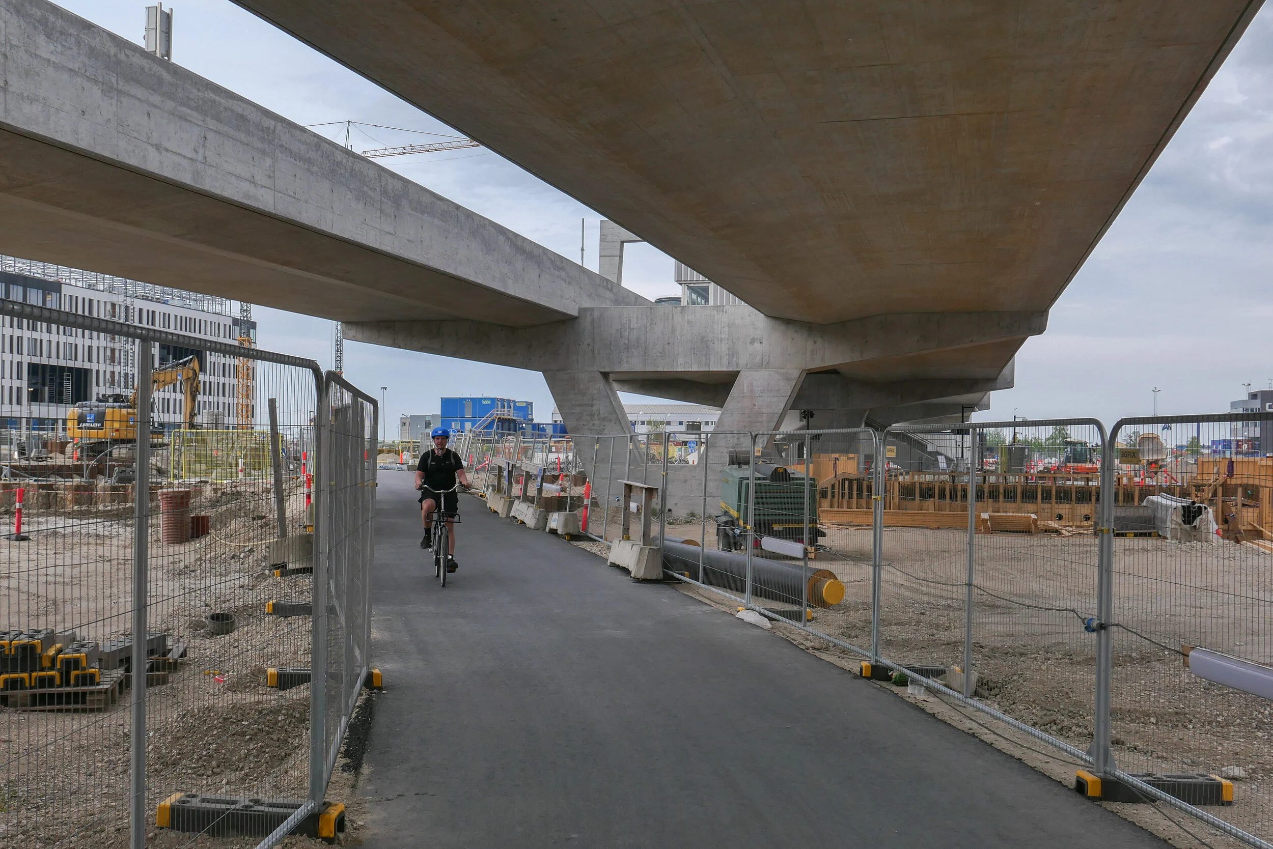
Just beyond the station at Nordhavn, trains emerge from the tunnels and run within hefty concrete channels that rise up steeply past Sundkaj to the new station at Ørientkaj that is just before Levantkaj where the track stops.

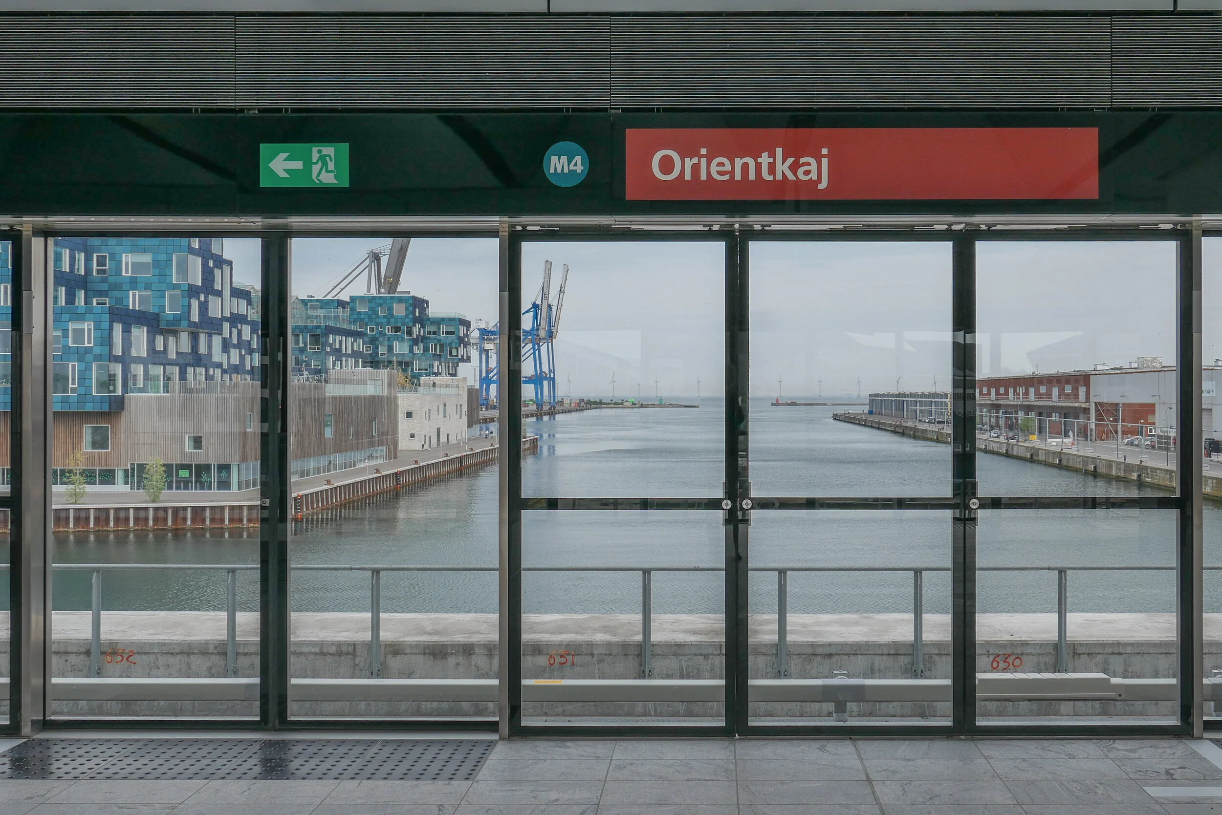
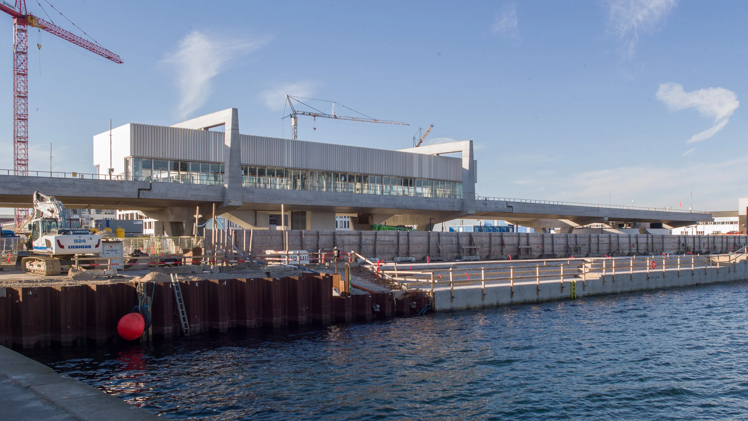
Of all the metro stations on the system, Orientkaj stands out with its strong style that owes more to engineering than to architecture.

Like the other stations, the platform at Orientkaj is set between the tracks - rather than on either side, outside the tracks - but the platform area and the tracks on either side are within a large glass box that has spectacular views straight down the dock to the Sound.

The platform area and its roof are supported on hefty concrete work with a broad V shape of supports rising from the ground and with a massive concrete cross beam that supports the platform but extends well beyond the platform with shallow notches in the top that take the troughs of the concrete track. Above, and supported on the ends of the cross beam, are large n-shaped concrete superstructures that seem to support the box of the platform. The design has echoes of the cranes on the docks that move containers along the quayside … so is this a clever visual game? Is the box hanging from the supports or simply paused before sliding on along the track?

Of course, the starting point for the design of the station may well be more mundane and more practical than anything to do with romantic evocations of the gantries of cranes for shipping containers …. it could be simply that, set at the head of the basin and close to the open sea, the glass box was needed to protect passengers and trains from the worst of the weather.

Unlike stations on the older above-ground sections of the Metro - on the lines running down to the  airport and to Vestamager - there is a central tower here with two elevators together rather than single elevators at each end of the platform.

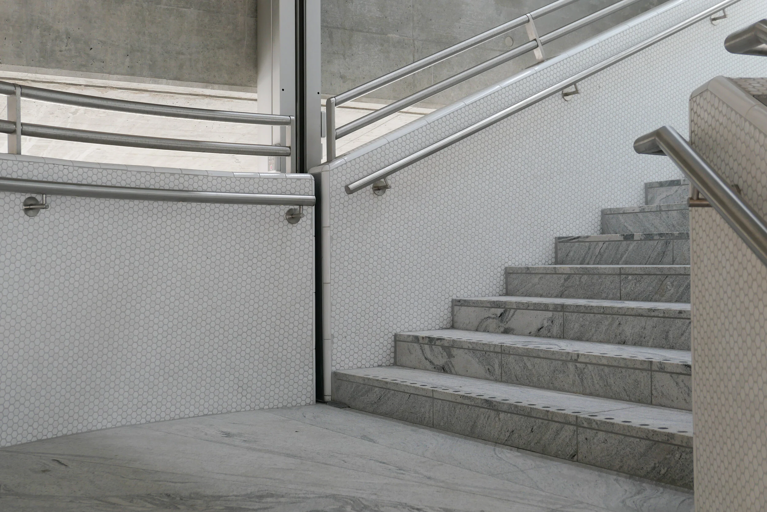
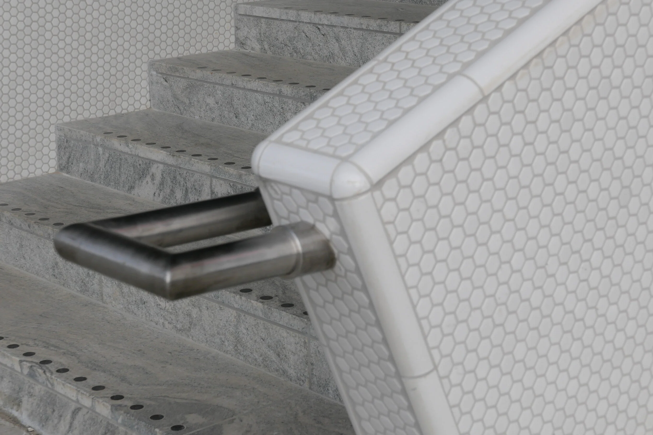
And instead of the industrial, gantry-style metal staircases down to the pavement at those first above-ground stations, here there are dog-leg staircases with solid parapets covered with small white, hexagonal tiles and the staircases are set at an angle rather than being straight and parallel to the tracks.

This has a vaguely Art-Deco feel that might or might not be a reference to the white beach-side architecture of Bellavue and Bellavista by Arne Jacobsen that is just along the coast to the north.

Copenhagen Metro
Arup on the extension to Orientkaj


can Lynetteholm be car free?

A recent article in the newspaper Politiken has suggested that the proposed development of Lynetteholm, on a new island to be constructed across the entrance to the harbour, will not be designed to be car free even though the initial plans included good links by public transport.

A new report has concluded that by making the residential areas completely car free, property and land values would be reduced so the sums do not stack up for the returns required to make the project viable.

The report by the consulting engineers Rambøll and MOE Tetraplan looked at three scenarios for the new island from almost completely car-free (10 to 15 cars per 1,000 inhabitants) through partially car-free (120 to 130 cars) and also without restrictions imposed so with average car ownership of 250 cars per 1,000 residents.
If the development goes ahead, there would be homes on Lynetteholm for around 35,000 people and jobs for 35,000.

However, this new island is not simply a development for homes and jobs but also has a complicated part in the construction a barrier that is necessary to protect the harbour from storm surges and there should also be recreational areas along the new shoreline that will attract people from all over the city.

Initial plans for the island included a link to the metro that would be a 'relatively' straightforward extension of the recently-opened line to Nordhavn but the new report has concluded that a metro line would only generate the level of service required, if there were no cars on the island and if the line was built to complete an arc across Amager so to continue round to the metro station at Christianshavn and then on under the harbour in a new tunnel to the central railway station and that, of course, that would add very considerably to the cost.

The report also suggests that the harbour ferry service, that now terminates at Refshaleøen, should not just be extended to Lynetteholm but, if the area is to be completely free of cars, would have to run every ten minutes rather than every 30 minutes with the present service.

Lynette after.jpeg

the new M4 line of the Metro to Orientkaj

Part of the new M4 Metro line is meant to open on Saturday 28th March.

The new track will run from Østerport metro station to Nordhavn, a new underground station at the inner end of the Nordhavn Bassin, and from there the track rises up steeply to Orientkaj, a new elevated station at the inner end of the quay and close to the new International School.

Just beyond the station, the elevated track stops but it will be extended out to the Ocean Quay Terminal for cruise ships and will serve the next stage of development on the outer or north part of Nordhavn.

Through the ticket area below ground and down through the escalators and on to the platform, the design for the new Nordhavn station includes red to link it visually with the design of the stations on the city ring at Nørrebro, Østerport and at Copenhagen H (the central station) as all four metro stations are major interchanges with the S or suburban rail system which is marked by it's red trains and red graphics.

In 2024 the extension of the M4 line out from the central station to the south west will be completed. This will connect the central station to the south harbour area and that line will continue on to Ny Ellebjerg and a major interchange there with the suburban rail routes for connections to the west and to the north.

Doubt about the opening date for the line to Nordhavn is due to the ongoing threat from viral infection with controls that restrict the numbers of people in all public areas although transport in Copenhagen is still running and so far there has been no announcement to suggest that the opening will be postponed.

Once it opens and once lockdown controls end that restrict how people can move around the city, the new line will carry around 11,000 passengers a day.

The extension of the M4 line from the central station to Sluseholmen and Ny Ellebjerg is to open in 2024.

the opening of the new line to Orientkaj
the line to Sydhavn / the South Harbour

above left - the track of the metro rising up to the new station at Orientkaj and, right, looking north under the first section of the elevated track
below left - drawing of the new station at Orientkaj from the Metro web site and the station from Orientkaj taken this afternoon, Sunday 15 March 2020


a new tunnel for suburban trains?

This week, in the newspaper Politiken, there was a short article on a proposal, that has been presented to the parliamentary transport committee, to consider the construction of a new tunnel, for suburban rather than for metro trains, that could form a fast link from the existing station at Hellerup, in the north part of Copenhagen, to the transport interchange at Ny Ellebjerg to the west of the city.

The new line would be over 8 kilometres long and journeys through the tunnel would be rapid because there would be few intermediate stations but these would link to the metro at strategic points.

Hellerup is a small municipality immediately north of the city and is already a busy and important interchange for suburban trains from the north but, from there, the trains run to Østerport, Nørreport, Vesterport and the central railway station through relatively narrow cuttings that date from the early part of the 20th century and from the central station curve on out through to Carlsberg and Valby or to Sydhavn and Ny Ellebjerg. All these stations are well-used interchanges and there are also smaller but also busy intermediate stations. It is a regular and relatively fast service but trains can be crowded and many of these stations are extremely busy and must be close to capacity.

Few people will travel regularly from Hellerup to Ny Ellersbjerg but a new tunnel would provide shorter and much quicker links through to alternative interchanges for joining the suburban train lines or the metro circle line at more appropriate points to get into the city or to get out to outer suburbs.

As proposed, on a new line through the tunnel, there would be just four intermediate stations ….. a station at Vibenshus Runddel - connecting to the new circle line of the metro and serving the national football stadium; a new and important station for Rigshospitalet and then new interchanges with the metro at Forum and Frederiksberg.

Trains would be short - like the metro train - and could be automatic, so driver-less, and could run every four minutes and, of course, trains would continue to run on the existing line.

This switching from train to metro or even to bus sounds complicated and frenetic but actually commuters know their routes and platforms and do most journeys on auto pilot anyway but, for other passengers, travel apps on mobile phones, updated in real time, show the best route and current arrival and departure times, platform numbers and the quickest route and electronic displays at platforms and on trains and buses now show arrival and connection times.

This is joined up planning. Planners and politicians are not resting on the laurels of what is being achieved with the construction of the new metro lines in the city but are already thinking about what has to be done next.

Østerport
Nørreport
Copenhagen Metro
the new Cityringen

Slow down you move too fast ...... just kicking down the cobblestones

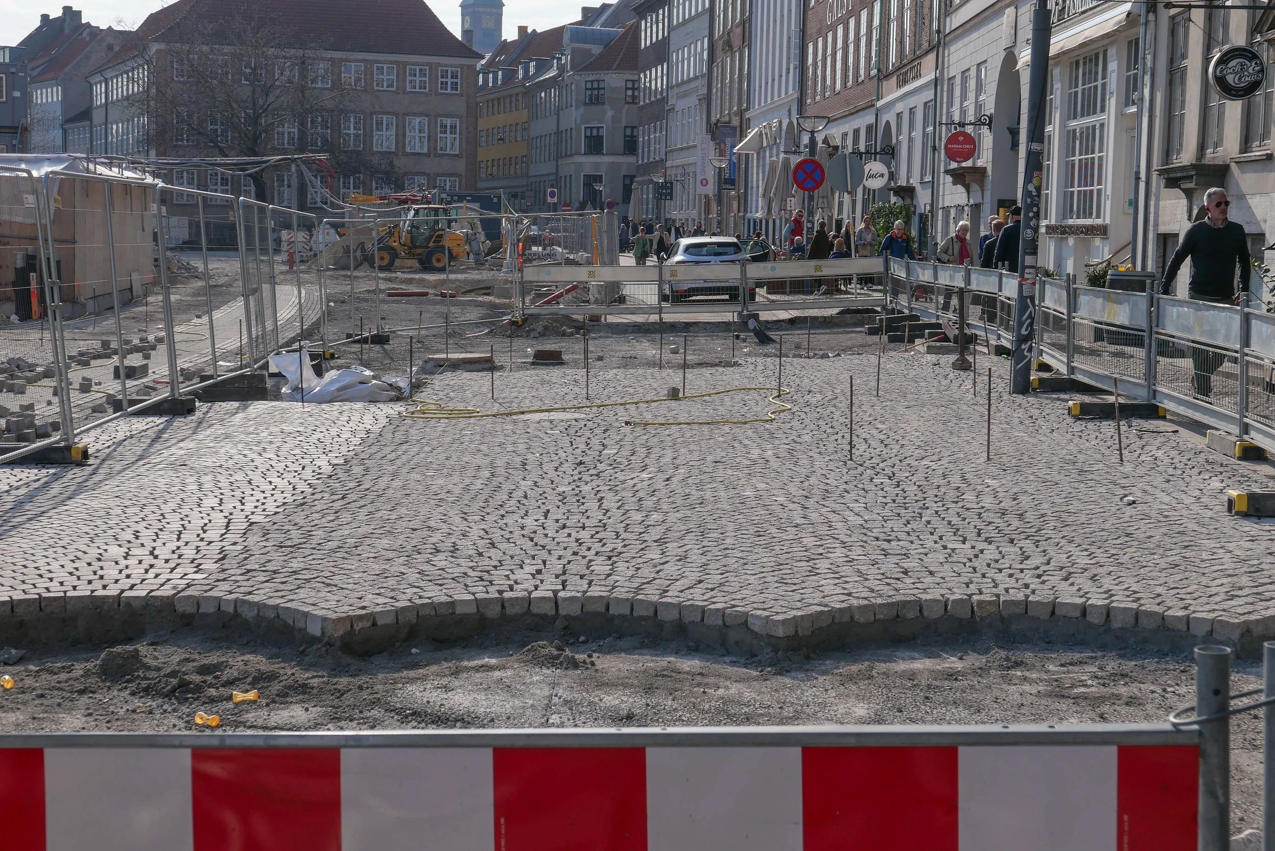
Work on Gammel Strand is now almost finished.

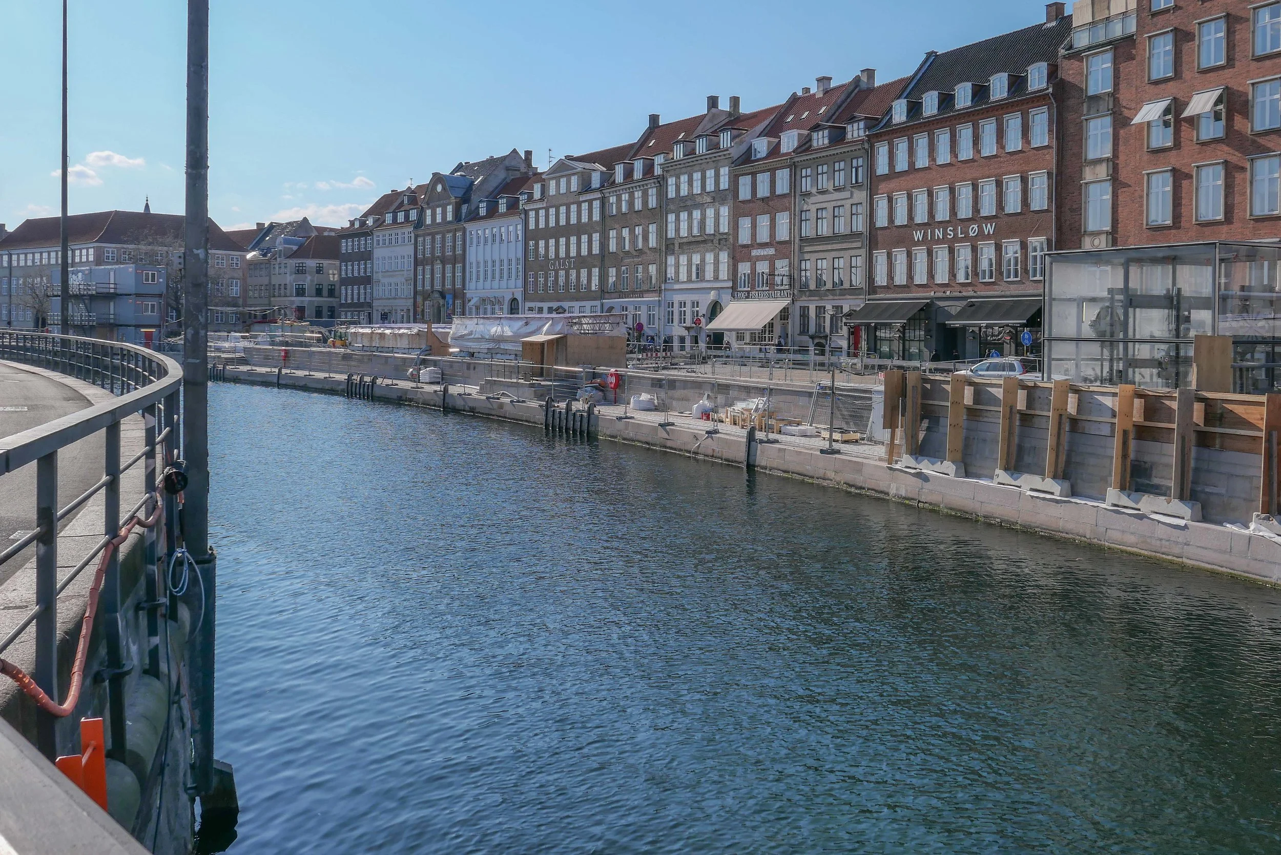
This very long and narrow triangular space - over the canal from Christiansborg - was the location of the old fish market.  There are large old houses across the long north side - facing across towards Thorvaldsens Museum and the Christiansborg Castle Church - and the long south side is defined by the quay of the canal itself,

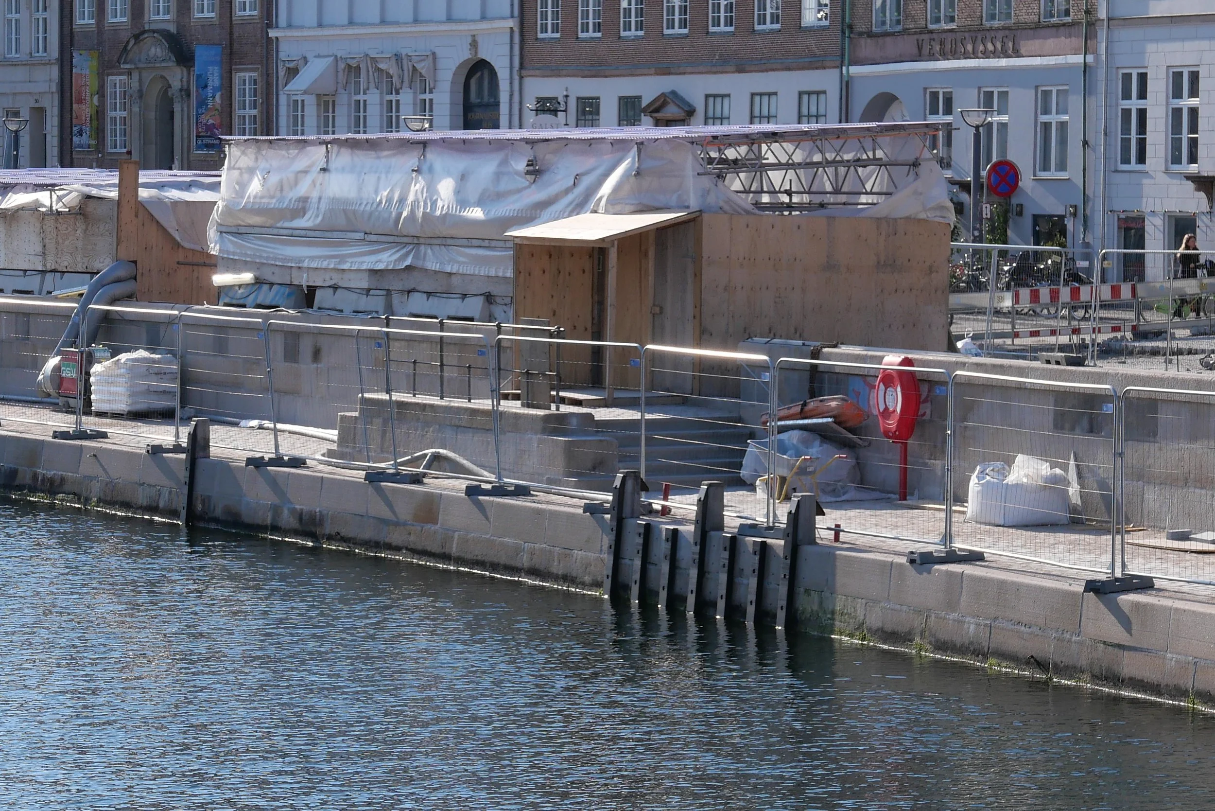
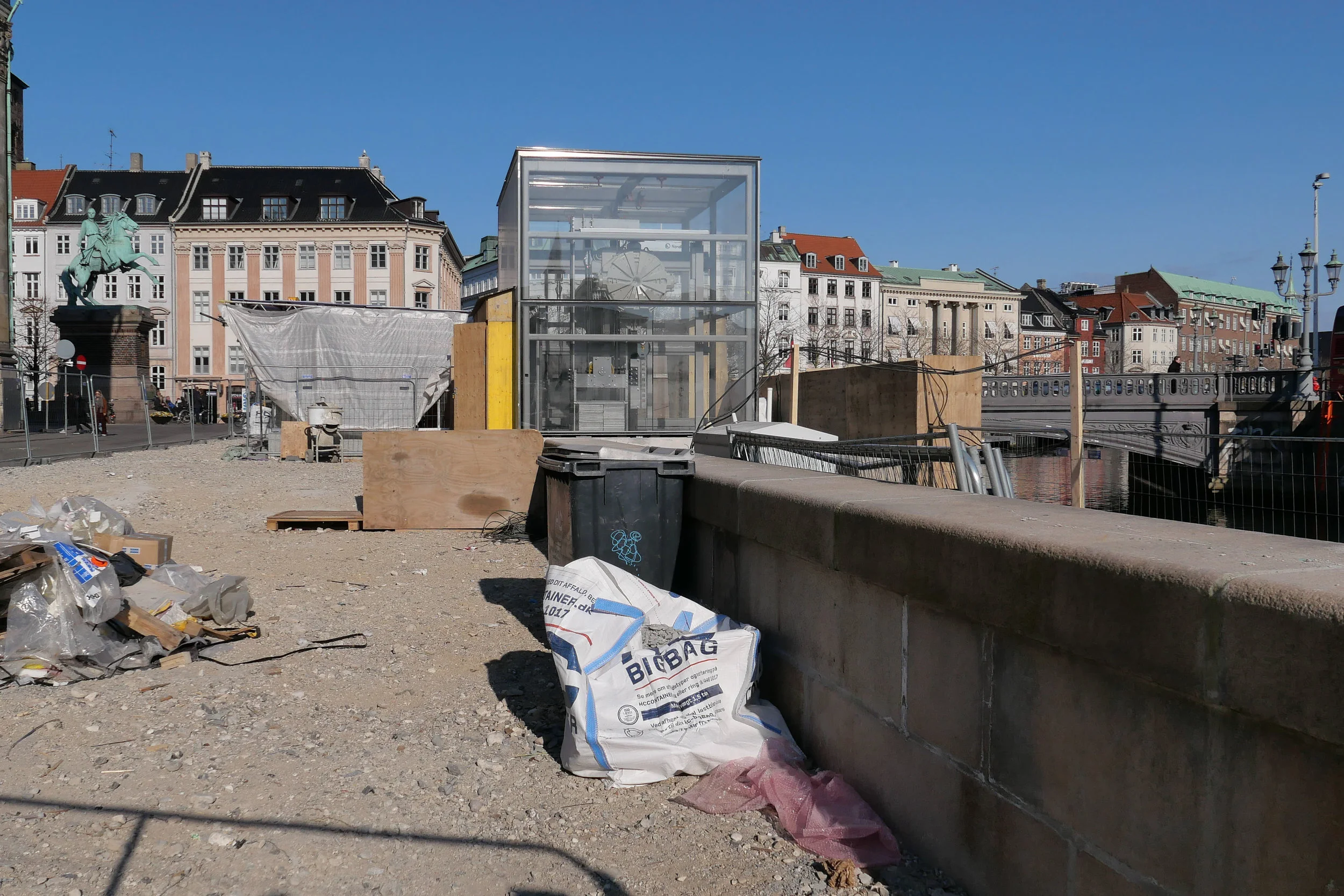
The space has been a building site for almost a decade with the construction of one of the new stations of the circle line of the metro here at the east end of the space. The entrance to the metro is close to the bridge over the canal to Christiansborg - Højbro or High Bridge with its ornate stone balustrade. The other key feature of the space is a magnificent tree at the west end in front of a large courtyard house that steps forward from the main line of facades, to enclose the space, although the quay continues on as the narrower Nybrogade.

The metro station opened in September and work then started on laying a new arrangement of cobbles.

Whereas before there was traffic cutting through the space with a relatively narrow pavement in front of the houses, this has now been restricted to access and bikes are encouraged to follow a long curve through the space marked by a relatively narrow strip of smoother cobbles or setts. There are no pavements, as such, but again changes in the arrangement of the cobbles and the line of shallow gullies for drainage mark in a subtle way a suggested line for people to follow. The new design allows much more space for restaurants here to move more tables and seating outside.

It is actually at night that you see the real gains from this new arrangement of the space. Lighting is kept relatively low and people seem to appreciate and respect the calm space. 

There are steps down to a lower level of walk along the canal itself where, because it faces south, people can sit in the sun so it is actually a complicated space, in terms of hw people move through or stop in and use the public space but it is all demarcated by subtle and careful differences in the hard landscaping and with street furniture and artificial lighting kept to a minimum. Copenhagen planning at its best.

looking along Gammel Strand from the east end with the canal to the left and the clock tower of the city hall in the distance

the fish market on Gammel Strand with the balustrade of Højbro and the houses of Ved Stranden beyond - painted by Paul Fischer a century ago

Cityringen / The City Ring

Today - Sunday 29 September 2019 - Cityringen / The City Ring - the new metro line in Copenhagen opened with a ceremony on the square in front of city hall. For the afternoon and through to midnight transport around the city was free and people were out in large numbers to see and to use the new stations and the extended train system.

Construction work started over eight years ago so citizens are now reclaiming large parts of the streetscape and squares of their city that have been fenced off behind high green hoardings as the seventeen new stations were constructed.

Bus routes too will alter drastically on 13 October with fewer buses actually crossing the city … buses will come in to a station on metro City Ring and then head back out again or will run around the edge of the city centre rather than cutting across. So, inevitably, over the coming months and years, the ways in which people move around and through the city will change.

There will be major interchanges at Kongens Nytorv and Frederiksberg where the existing lines and the new metro circle line intersect and major interchanges to other forms of transport at the new metro stations at existing stations for suburban and country-wide trains at Østerport, Nørreport and the central railway station.

All these new stations have extensive areas for leaving bicycles at street level or underground so it is clear that people will make their journeys by swapping from bike to metro to foot to bus or whatever combination makes for the best or the easiest or quickest route.

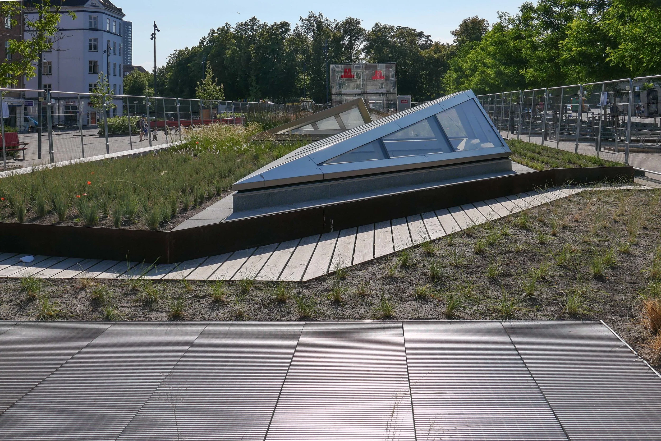
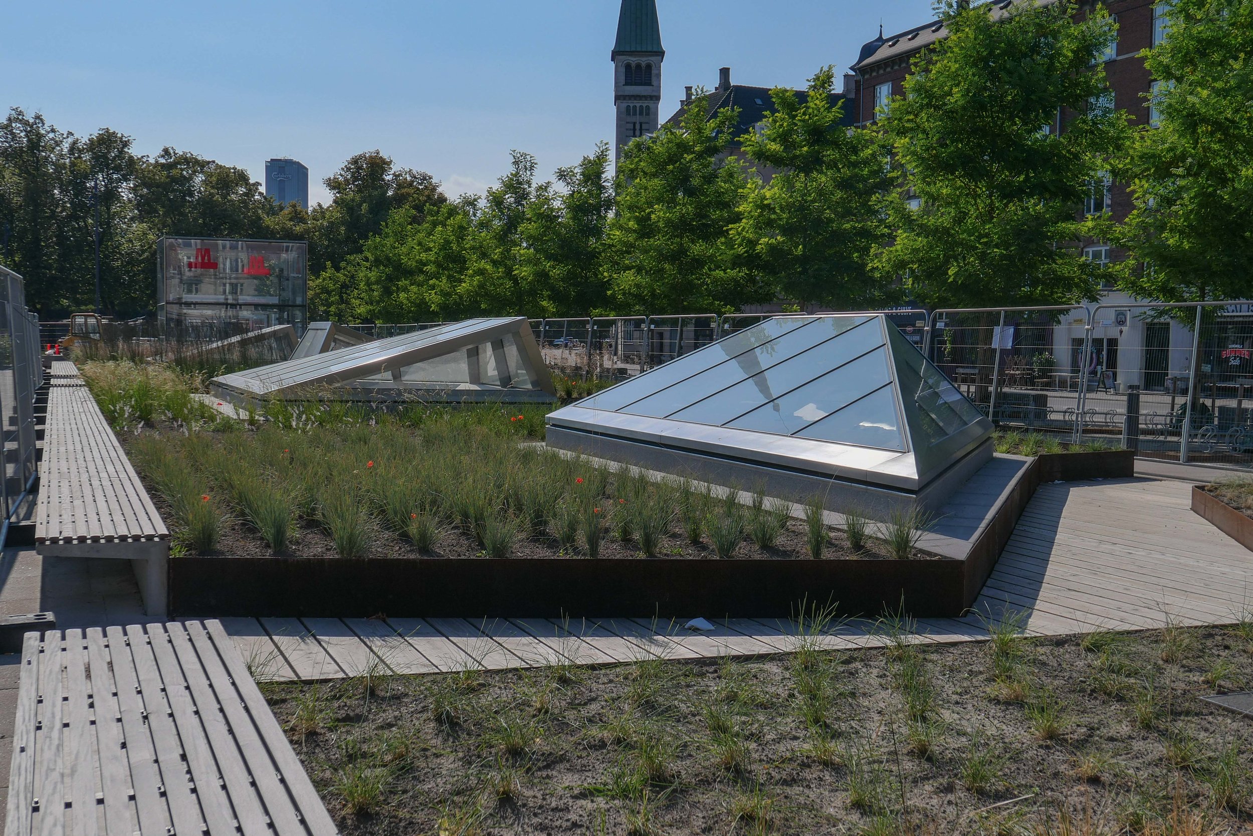
The engineering work - constructing over 15 kilometres of tunnels and huge excavations below street level for the new stations much of the work below important historic buildings, below residential area, under the canals or under existing infrastructure of water pipes, sewage pipes and so on - is clearly very very impressive but, and quite deliberately, the new stations follow the form of the existing stations so are relatively low key at street level with simple glass boxes over the lifts to the platforms and simple steps down and, for most stations, glass pyramids that throw light down into the station concourses below.

But that does not mean that the stations will not have a huge impact as most have been constructed along with dramatic improvements to the squares and streets around the station so, over the coming years, the real change will be in the ways that the metro will revitalise and transform some areas of the city - areas such as the newly renovated square and the streets around Enghave Plads or the area around Trianglen - and the metro will mean quicker and easier access to and from the densely-occupied residential areas of Vesterbro and Nørrebro and - with the next phase of work - the new residential areas of the north and south harbour …. planning that has been described by the newspaper Politiken as “binding together the suburbs.”.

the Copenhagen metro

the impressive new concourse below Kongens Nytorv and the area to leave a bicycle below street level at Marmorkirken / The Marble Church

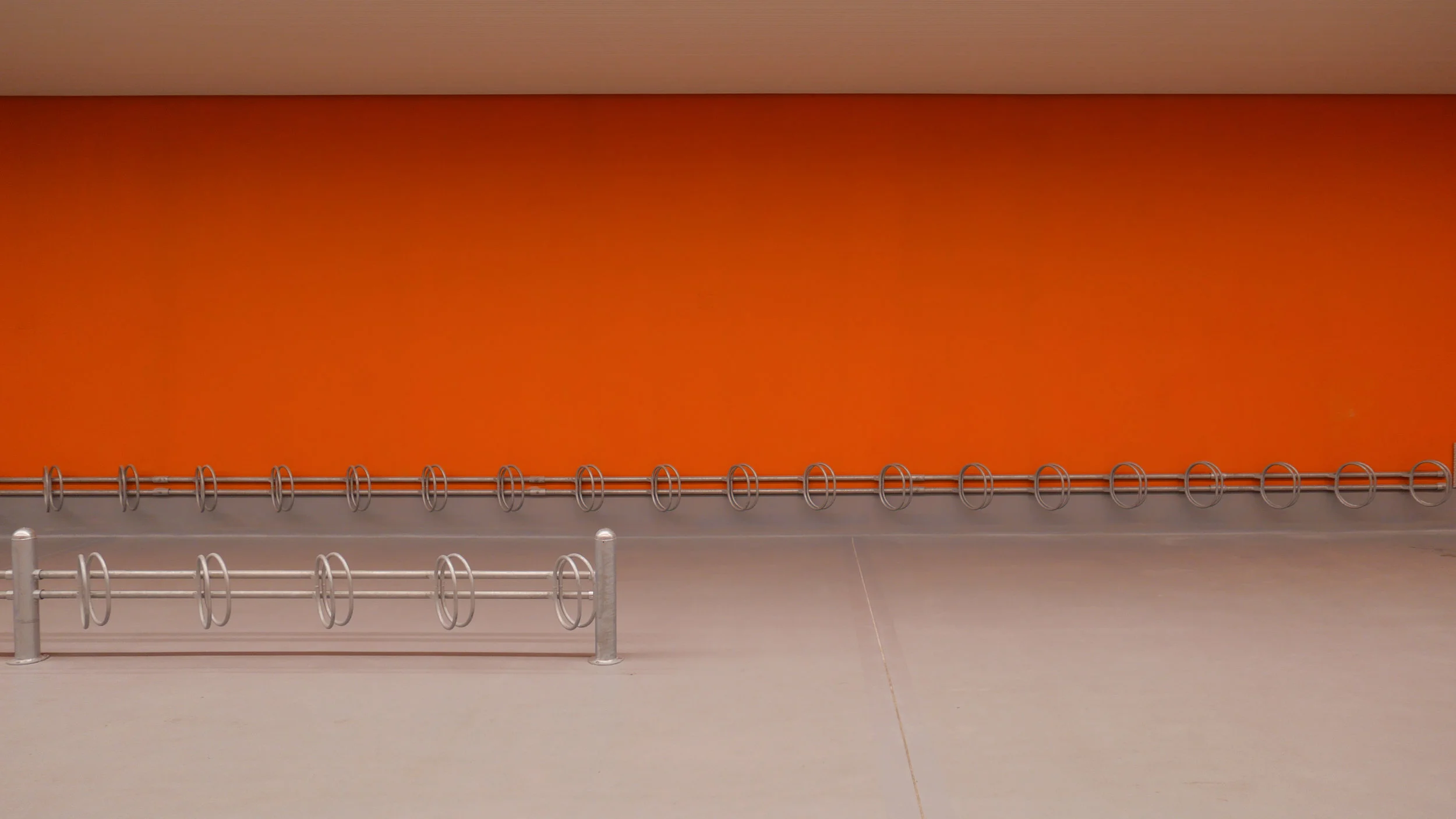
you can be certain that it will never be possible to take a photograph like this again ….. that is with the cycle store empty


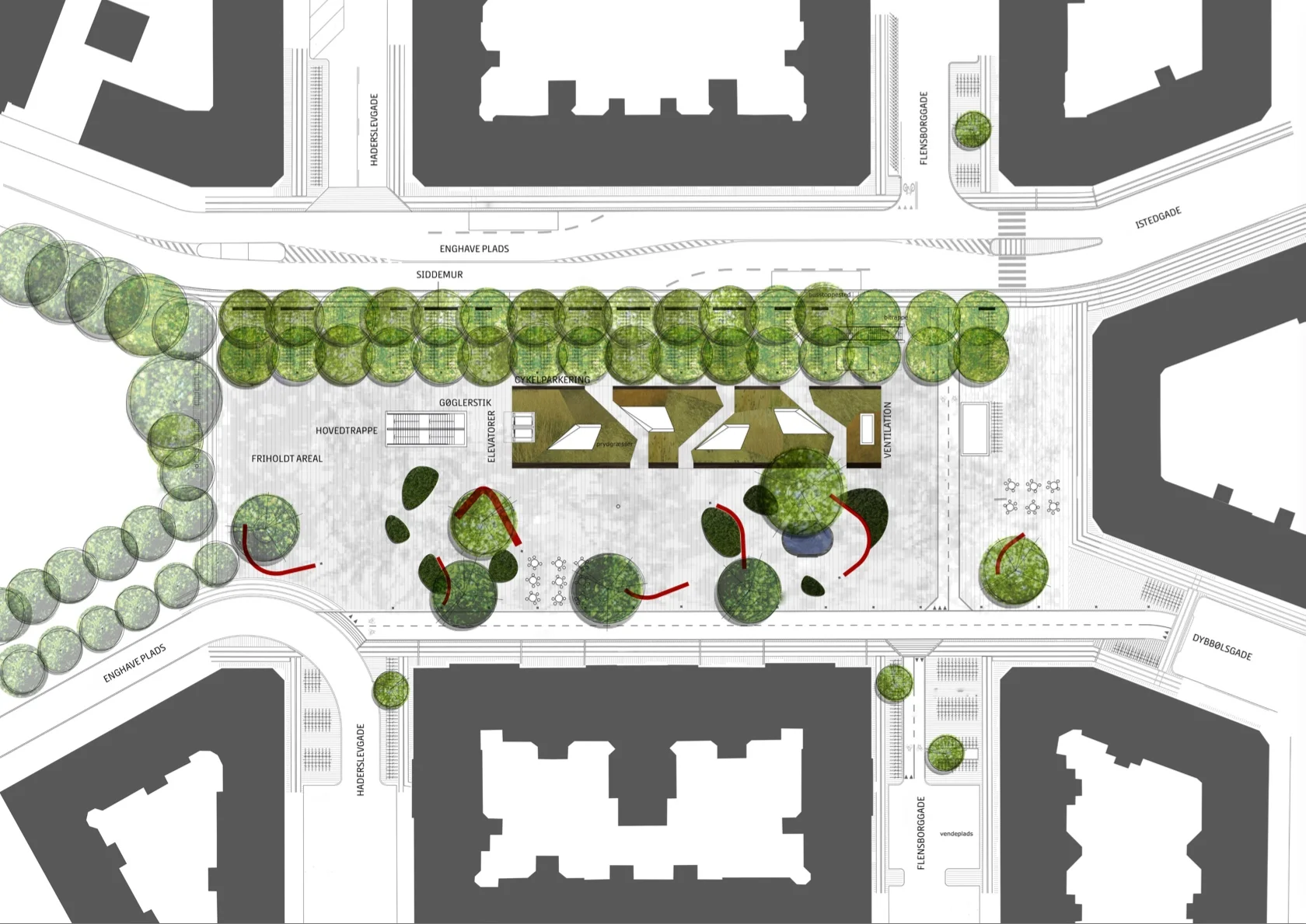
Enghave Plads

Vesterbro - the part of the city immediately west of the central railway station - is a densely-occupied area of apartment buildings with most dating from around 1900.

This was a strongly working class part of the city with the main rail line forming the southern boundary and with the meat markets, gas works and the harbour presumably supplying much of the work and the Carlsberg brewery was, until a few years ago, to the west.

The street pattern of the district is complicated with two main roads - Istedgade and Sønder Boulevard - running out at an angle from the railway station at the north-east to the south east but with secondary cross streets of traditional apartment buildings running north to south and there are also several streets running across the area from south east to north west so it a complex pattern of a grid but overlaid with a Saint Andrew cross so some streets meet or cross at odd angles.

At the south end of Istedgade is Enghave Plads - a large open square much wider east to west than the distance across from north to south and it narrows at the centre. This square is where several tram routes met so it was always an important point in the area and immediately to the west is a very large square with a major public garden - Enghave Parken - that has large apartment buildings on the north, west and south sides so the two spaces run together though divided by a busy main road - Enghavevej.

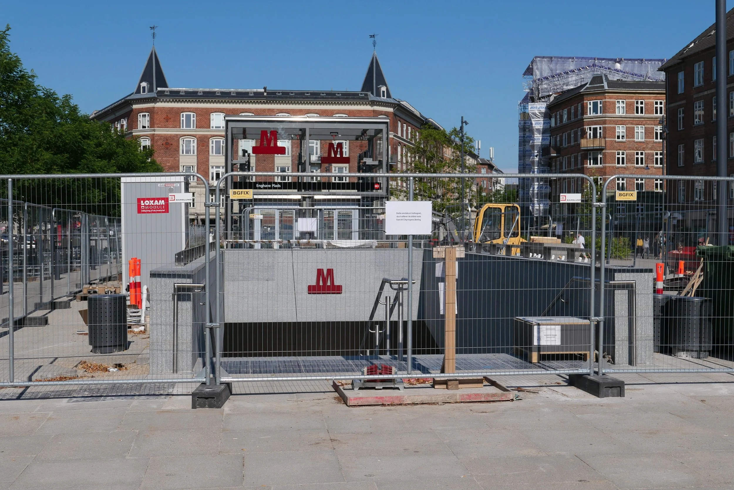
Enghave Plads is the site of one of the major new metro stations on the new circle line that will open at the end of September. The east end of the square and some of the surrounding streets have been boarded off for about a decade with major construction work for the metro but the boarding has just been taken down and the space with it's new landscaping opened officially.

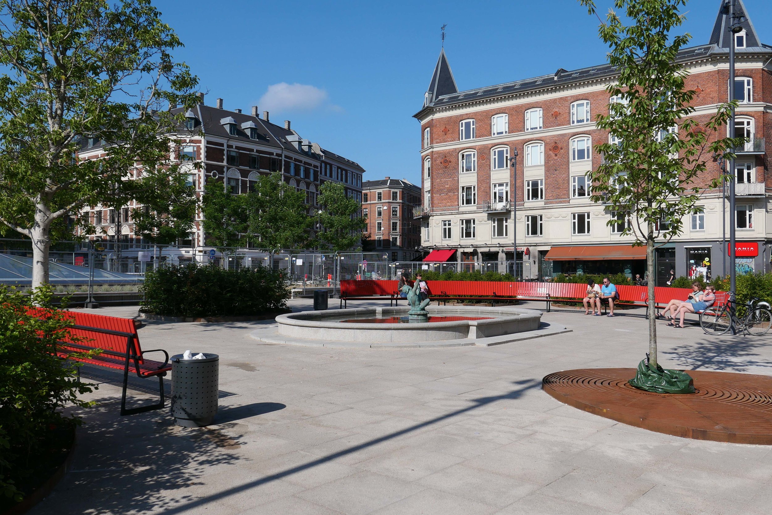
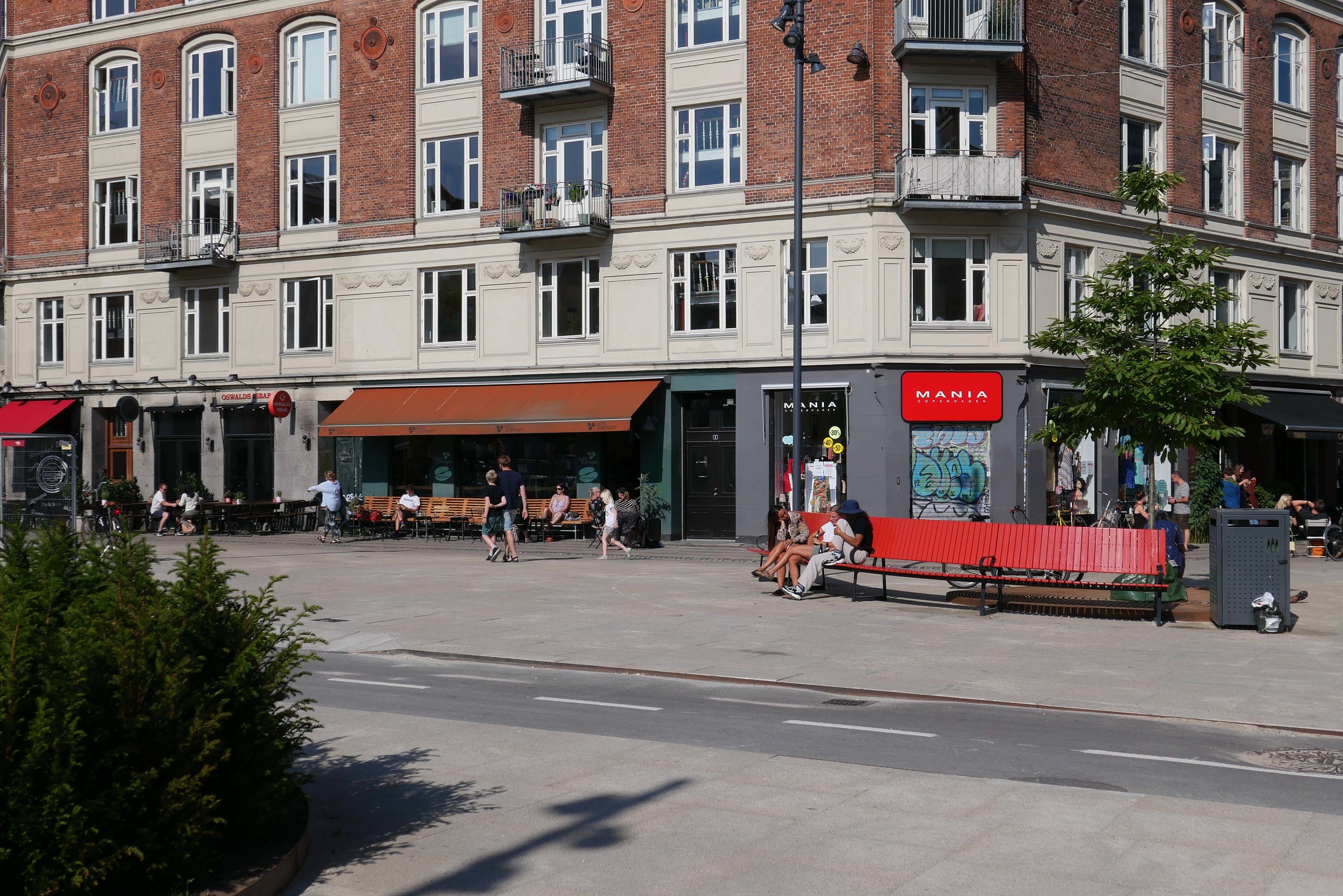
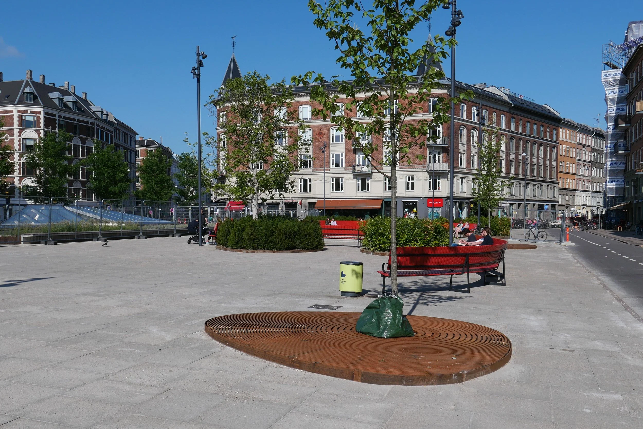
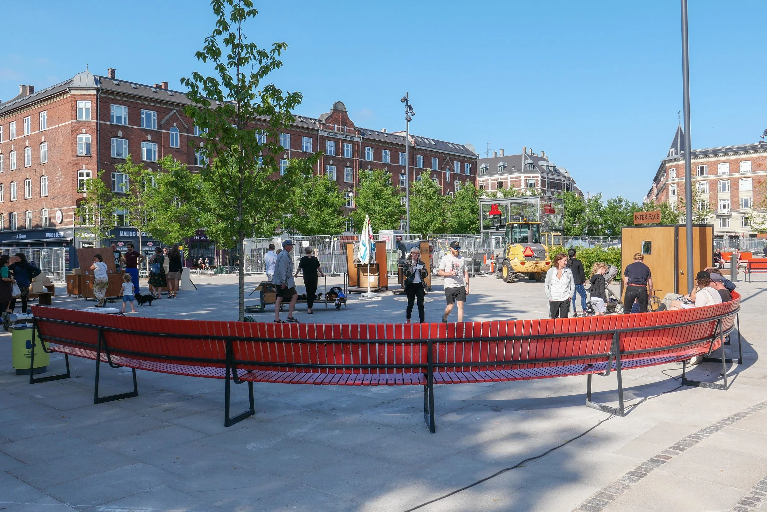
There are large areas for leaving bicycles across the north or darker side of the entrance steps to the metro station but across the south side of the metro entrance there are raised beds with Corten edging and long raised bench seats and then to the west more open space for events. This area has striking new seating that has deep red slats on a black metal frame and these form great bold curves though the initial reaction to the seating has been mixed - some asking exactly why people would want to sit next to each other in long rows even if they are curved. Mature trees to the west, along the main road, have been kept and provide a baffle against the sound of traffic and shade for more seating and an area that is fenced for ball games.

Copenhagen Metro

Vesterbro with the main railway line to the south, the MeatPacking district in the cirve of the railway and the main railway station top right
Enghave Plads just left of centre and Enghave Parken towards the left side

Enghave Plads from the east with the square of Enghave Parken beyond

tram leaving the square and heading along Istedgade towards the railway station … the area between the buildings and the central space has been paved over and the main through traffic has been restricted to the north side of the square


the new circle line of the Copenhagen Metro to open 29 September


The major new extension of the Metro in Copenhagen - the circle line round the historic centre - will now open on 29 September.

Above is the important new station at Trianglen at the south-east entrance to Fælledparken. It shows that much of the new hard landscape in place but the planned avenues of trees along each road edge are still to be planted and architectural features - such as the glass pyramids that will throw natural light down onto the platforms - are still to be installed.

Most of the new stations are at about this stage of completion above ground but the main reason for delay appears to have been caused by late delivery of the trains and the postponement of mechanical, electrical and safety testing.

Photographs of the station platforms and various designs and the different and specific colours for tiling, appropriate for the particular neighbourhood, have been published in some newspapers and show not just different and specific schemes for each station but mark a clear departure from the consistent design and the concrete finish of the existing stations on the first two metro lines that were constructed at the beginning of the century.

update - Gammel Strand


the official site for the city Metro has news, general information, drawings and a short description of the new stations along with pdf plans of the area around each station at street level

Work is moving forward fast on the hard landscaping at street level above the new metro station at Gammel Strand … a station on the new circle line that will open later in the summer.

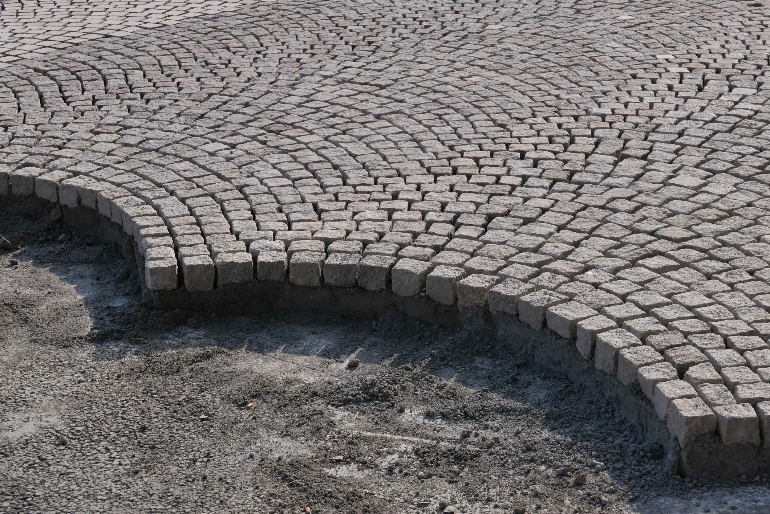
The steps down to the platforms and the glass covered lift tower are in place and setts are now being laid in the traditional scallop pattern across the main area so the new arrangement for this important historic street is becoming clear.

There was consultation with local businesses and local residents. Vehicles will be excluded, apart from deliveries, so the only through traffic will be a new narrow bike lane but with markings showing lanes to cycle in both directions.

The existing road, now being removed, runs parallel to the building frontages with just a narrow pavement so with little space for outside tables and chairs for the restaurants here. With the bike lane set forward closer to and parallel to the canal there should be much more space for people to sit outside and the gentle curve of the bike lane takes that bike traffic along the side of the canal further west rather than running as the road does now through in a straight line to Snaregade.

There will be steps down from the street level of Gammel Strand to a lower canal-side level for access to boats but as a sun trap it will certainly be used by people simply wanting to sit and watch what is happening on the water.

read more


new metro station at Orientkaj

A couple of trips out to Nordhavn recently meant an opportunity to look at progress on the new metro station at the top of Orientkaj. This is just beyond the point where the metro track emerges from underground and trains will move up onto an elevated concrete track. It is difficult to judge the design of the station but it is clearly very different from the well detailed steel and glass work of the stations on Amager on the two lines at the south end of the existing system.

Here at Nordhavn there are hefty square concrete frames set across and supporting the track and what appears to be a large box or presumably a large container suspended over the platforms that is presumably a reference to the container port here.

Just beyond the station, the elevated track stops abruptly but it should continue on to the Oceankaj Terminals where the largest cruise ships now dock.

top left - view from the south showing the track from the metro rising up from underground just before the station. Tow views of the station from the Orientkaj and - bottom right - the view across the construction site from the west.


Orientkaj

The large building to the east of the new metro station at Orientkaj - on the north side of the dock - is the new Copenhagen International School designed by CF Møller and completed in 2017. The scheme for swimming and water sport facilities is also by CF Møller.

When the first stage of new metro line M4 out to Nordhavn opens then the trains will leave the circle line at Østerport and head out towards the harbour and, after a new station at Nordhavn, will climb up onto elevated track and a new station at Orientkaj.

Here, as the trains pull into the station, to the right, looking east towards the sound, there will be a view down one of the largest docks in this part of the harbour with a line of large brick and concrete warehouses along Orientkaj itself … most dating from the second half of the last century and most bonded warehouses. These face across the dock to the new Copenhagen International School designed by CF Møller and completed in 2017.

CF Møller have designed a scheme for the dock itself with a series of islands and boarded walkways in front of the school for swimming areas, an area for water sports, - including kayak polo - and changing rooms and a sauna with facilities to be used by the school but also by the local community.

The impressive scale of the dock will be broken and the area takes another step away from its immediate past with nearly all evidence for the container port - the very reason the dock is here - lost but, and again it is a big but, it is schemes like this that will bring at least some nature back down to the quay side and will make the water a strong part of life in this area rather than simply a dramatic backdrop.


next lines for the metro in Copenhagen


construction work where the new metro line at Nordhavn emerges from underground and rises up to the new station at the start of the elevated section of track

the new station from Orientkaj

Even before the new inner-city circle line of the metro in Copenhagen has opened, there are ongoing discussions about the stage after the next stage - if you follow what I mean!

Construction work is progressing fast on the spur line of the metro that will go out to Nordhavn - the north harbour district - and, eventually, on out to the cruise ship terminals and, in the other direction, the south spur down to the south harbour - the Sydhavnslinjen - is also moving forward fast with the green boarding up around the site of the excavations for the new station at Enghave Brygge near the power station. That line will continue on to Ny Ellebjerg where it will link with the main suburban train lines and both these metro lines should open in 2025.

So, the next new section of metro, and still at the planning stage, could be an M6 line to form an arc across the top of the island of Amager. It would link the two original metro lines that head south down through Amager - so the M1 down to Ørestad and Vestamager through Islands Brygge and the M2 line down to the airport through Amagerbro - but will also continue west and through a tunnel to re-join the circle line and to the east, beyond a new station at Refshaleøen, the east end of the new line will also go under the harbour - either to form a link back to the new circle line at Østerport or to run north to Nordhavn.

Even more ambitious are proposals for a further new line out from the M6 - an M7 line - that could take the metro under the Øresund to Malmö in a new tunnel some 22 kilometres long to be excavated on a line north of the Øresund Bridge.

From Copenhagen central station to Malmö central station would then take about 23 minutes and the line could be finished and opened by 2035.

Obviously, this will be another amazing engineering project in the city but, more than that, such major infrastructure will influence how the city will work in the future - so which areas will prosper and change because of these new fast transport connections - and it will form the framework for major developments and major expansion of the city through to the middle of the century and on.


the metro, the bus and the harbour ferry in Copenhagen


With the start of a new year this is clearly a time for new plans and new schemes in the city. On the 24th January, the government launched a reorganisation of public transport in Copenhagen.

Metroselskabet - the company who now control the city Metro - will be combined with Movia who run city bus services and the Havnebuser or harbour ferry service.

The new overarching organisation is to be called Hovestadens Offentlige Transport / Metropolitan Public Transport or HOT for short and will cover the provision of transport across 34 municipalities.

Will HOT replace or at least change the responsibilities of DOT - Din Offentlige Transport / Your Public Transport that was set up in 2014? This was formed by DSB - the operators of regional trains - with Movia and Metroselskabet in order to coordinate strategy and to provide a single access point for passengers who need information about ticketing and times and so on across the system.

The reorganisation appears to be a sensible attempt to coordinate transport across the city and certainly at a sensible time … so before the completion and the opening of the new inner ring of the metro. Metroselskabet was set up by the city and by the port authority and has been organised primarily for the construction work and for the completion and opening of the metro system and not for the ongoing running of the metro system.

However, there has already been criticism - not least from Movia.

Current transport is organised across the region - so across Sjæland - and includes the suburban rail system but at this stage, as far as I can see, the S trains will not be included in the remit of the new body. Some have also been critical because this does not include any new money so seems to be simply about co-ordination and synchronisation and does not tackle capacity or improvements as such with no provision for additional equipment. This is important because the current metro line is running at almost full capacity … good in terms of the economics but not so good for passenger comfort.

To be fair, it may well be better to make further decisions after the new metro line opens this summer because the new line is bound to establish very different travel patterns for people in the city … at the very least it creates important new interchange points for swapping between one mode of transport and another and in the months after the opening will certainly reveal new congestion points in the system.

Metroselskabet
Movia
DOT

note:

Back in June, Movia announced that new harbour ferries will go into service in January 2020. These will be electric - recharging overnight but also topping up batteries at both ends of the route at Refshaleøen and Teglholmen. The new service will run every 30 minutes. As the service carries 425,000 passengers each year, this is an important and - with so many new apartments being built at the south harbour - a significant part of the city transport system.

new information panels on the Metro


Metro stations in Copenhagen are to have new flat-screen information panels on the platforms and these are part of a new information system.

The first of these new signs were installed at Vestamager and Ørestad at the end of 2018 but all the old-style signs will be replaced in all the stations over the next few months.

This is part of the preparations for July this year when Cityringen - a new inner city line - is to open.

It will be interesting to see not just how platforms and linking staircases are laid out at the new main interchanges - Kongens Nytorv will be an exceptionally busy station where the exiting lines and the new line cross - but also interesting to see where signs are placed and how signs and graphics will be used to control and direct the movement of people.

Commuters tend to move fast on auto pilot but at Kongens Nytorv, but also at Nørreport and at the new station at the City Hall, commuters will come up hard and fast against huge numbers of tourists who are new to the city and its transport systems and that's where that interface between design and human behaviour is crucial.

Can anyone explain why people stop in their tracks at the most inconvenient places - like immediately at the top of an escalator or the bottom of a flight of steps - to look at a map or gaze up to the ceiling? Are they looking for divine intervention?

There should be a new code of conduct … if you are lost step to the side.

And actually the same should apply when your mobile phone rings. Watch. It's amazing just how many people either stop walking wherever they are or at best slow down noticeably when their phone rings. I'm not sure that signs with even the cleverest graphics could deal with that problem.