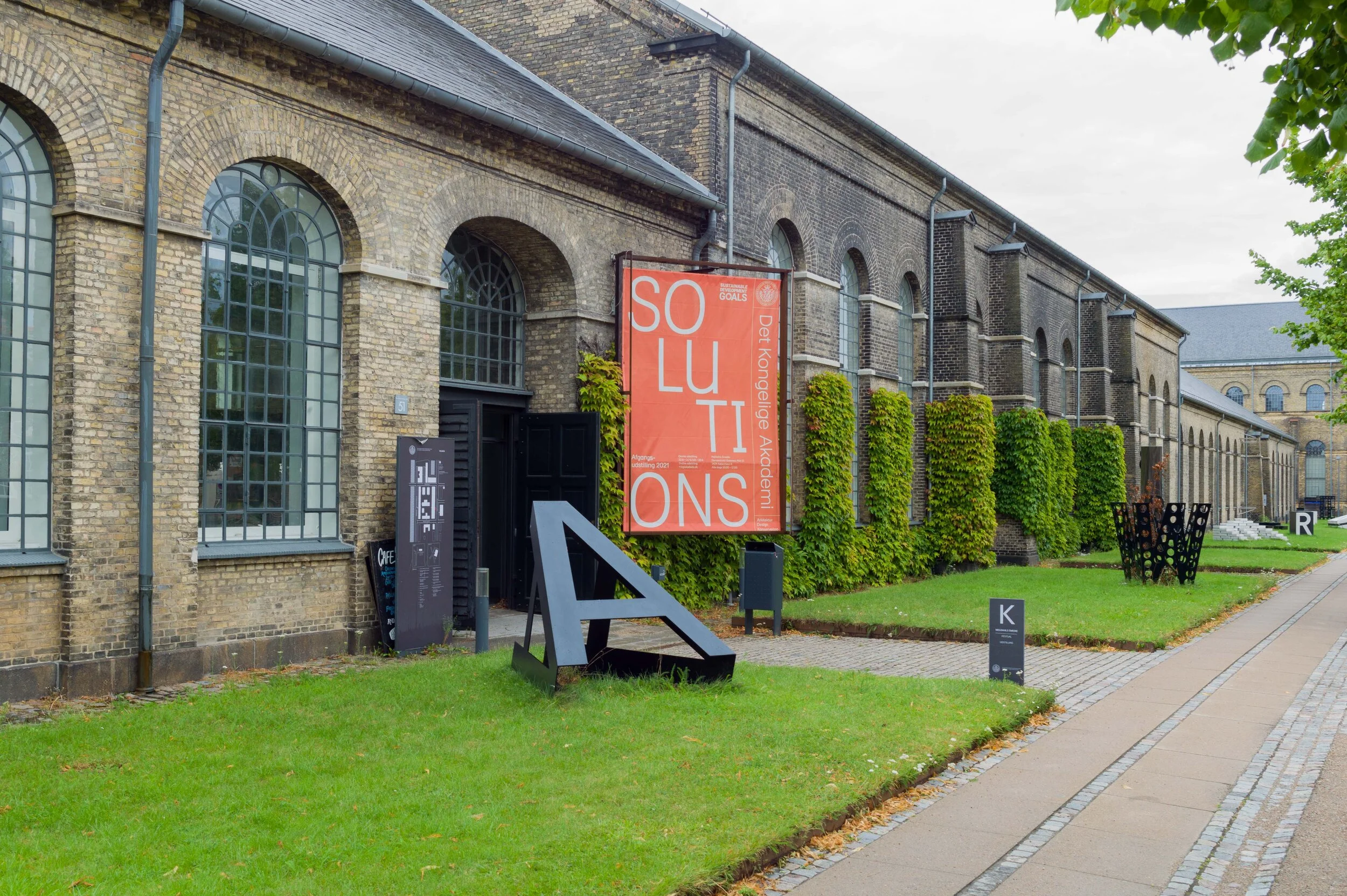
PLANETARY BOUNDARIES - rethinking Architecture and Design


This week is your last opportunity to see this important exhibition because Planetary Boundaries at the Royal Danish Academy on Holmen will close on Friday 5 April 2024.

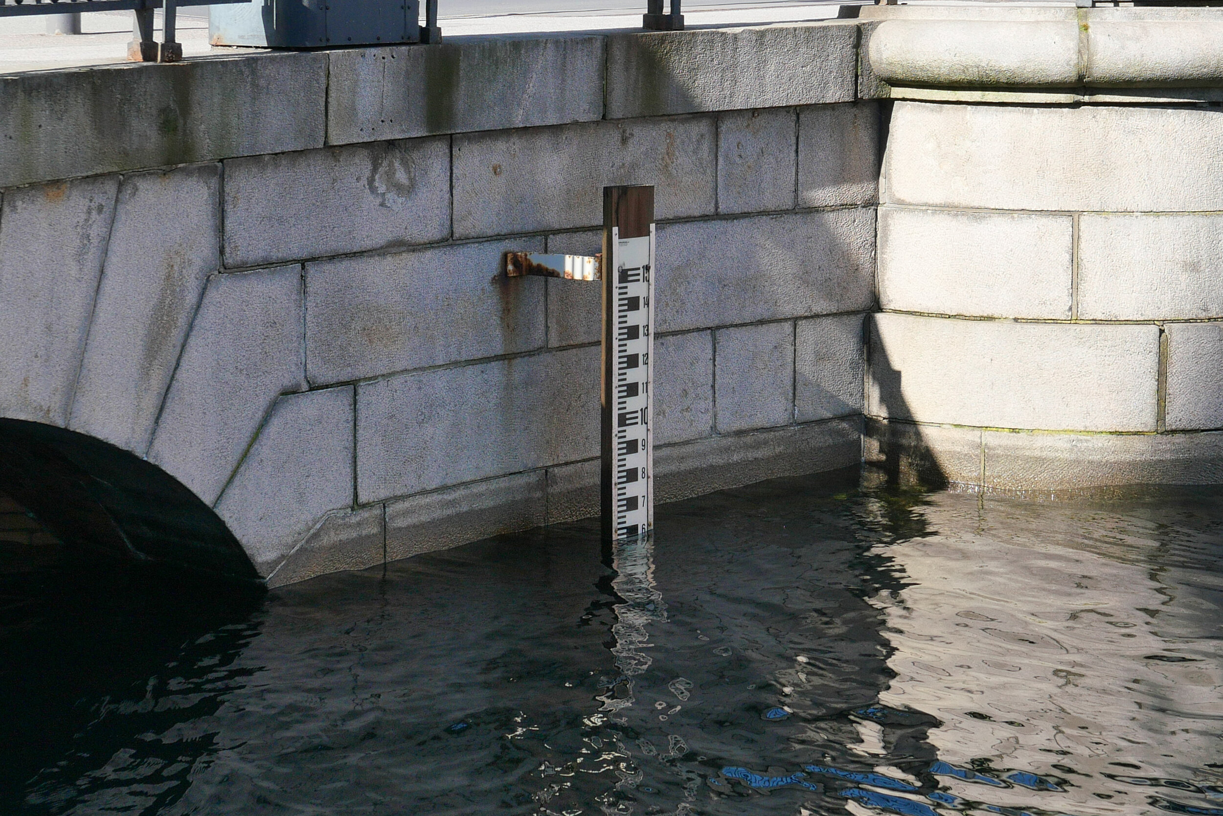
The concept of Planetary Boundaries is a method for assessing the environmental state of our planet within nine areas that regulate the Earth's stability and balance. Humans have been successful because, over thousands of years, we have adapted to survive in a remarkable range of habitats from frozen tundra to parched landscapes with barely any vegetation and we have done that through the ways we have learned to exploit a huge range of natural resources. However, there are limits to those resources and limits to how much we can pollute the land, and the water and the atmosphere of Earth with waste before that has a serious impact. Mining, the generation of power and the consequent production of waste from industrial processes are all pushing those boundaries close to and, in many environments, way beyond those limits.

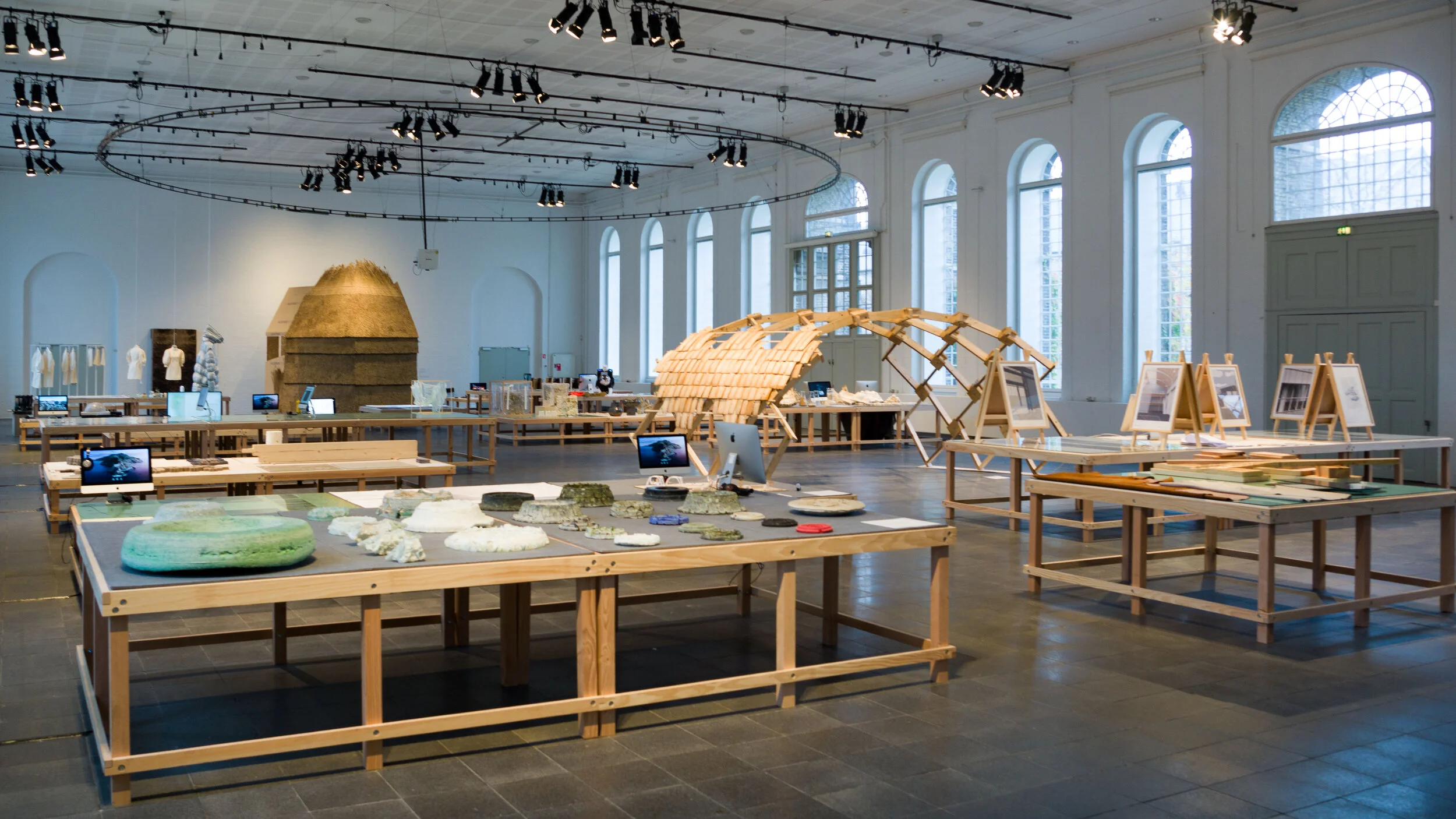
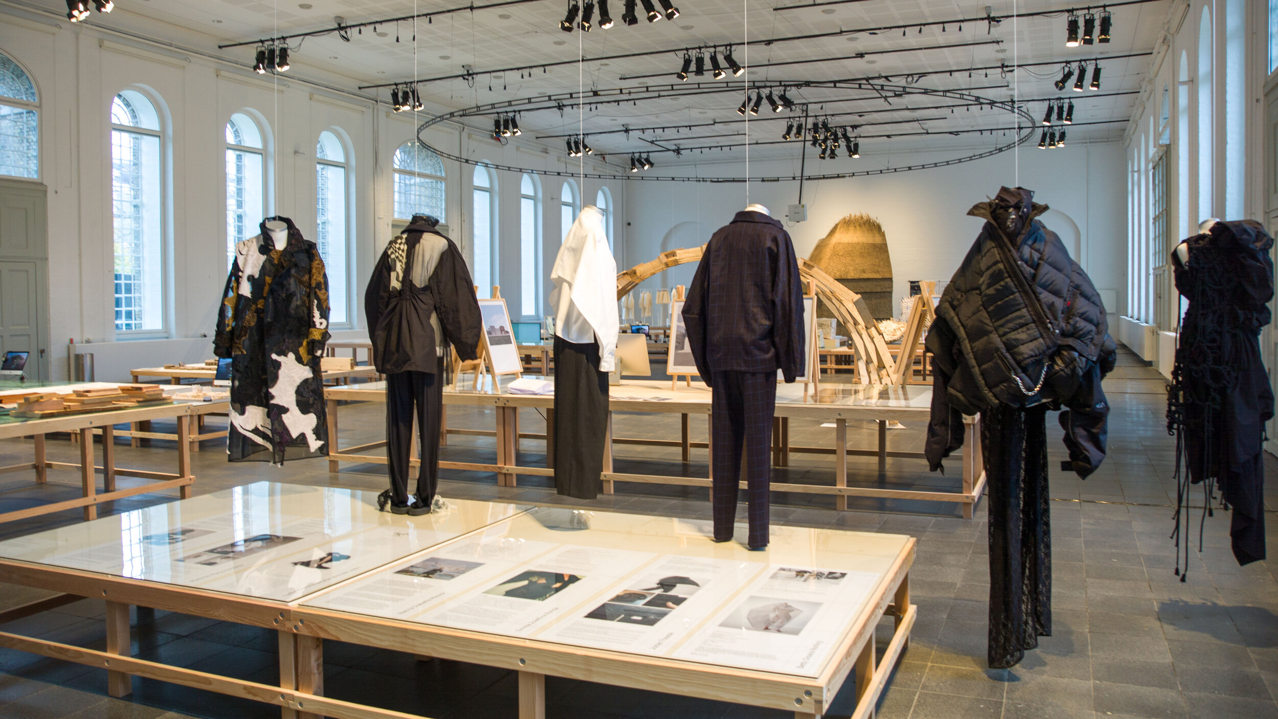
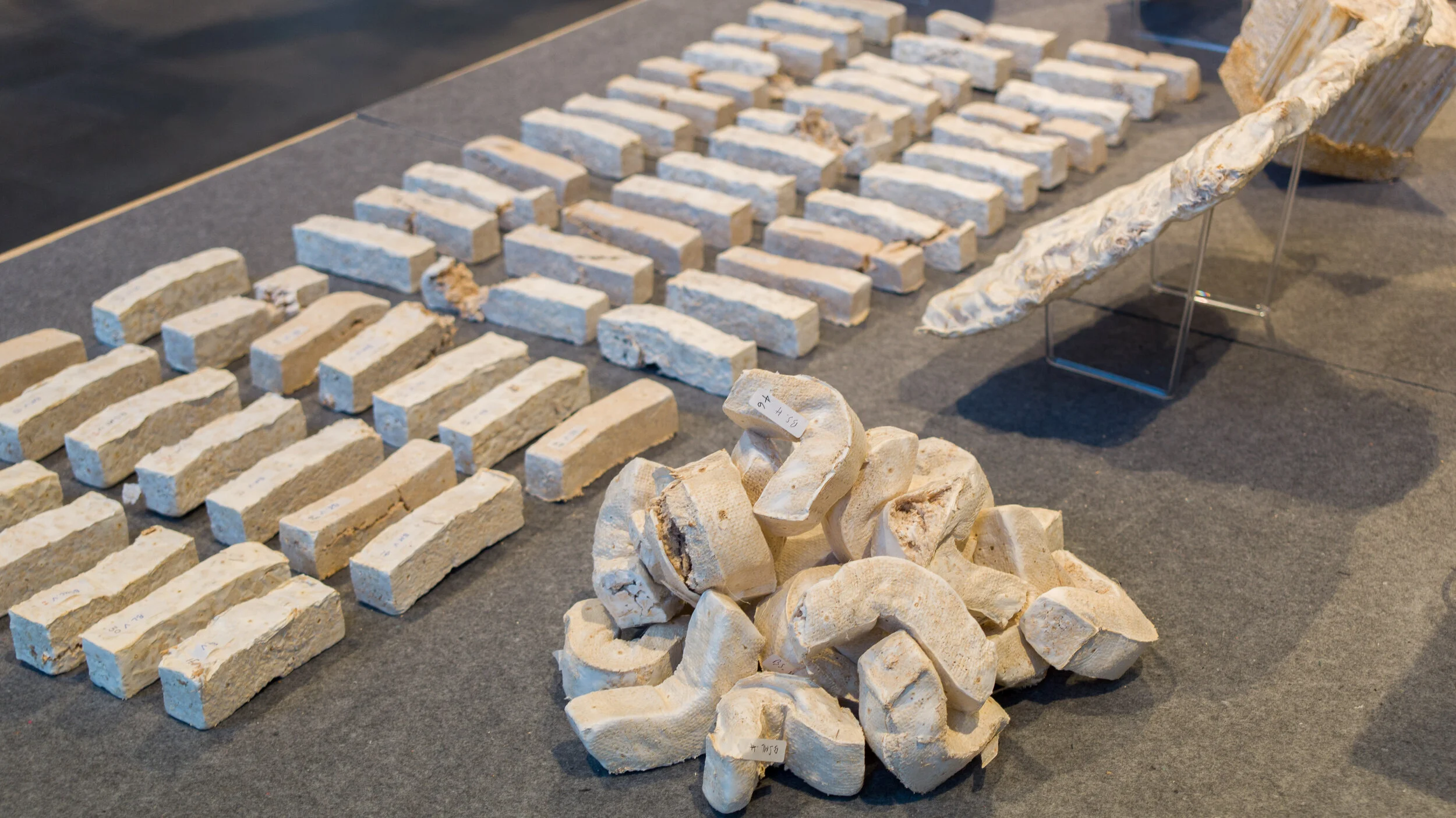
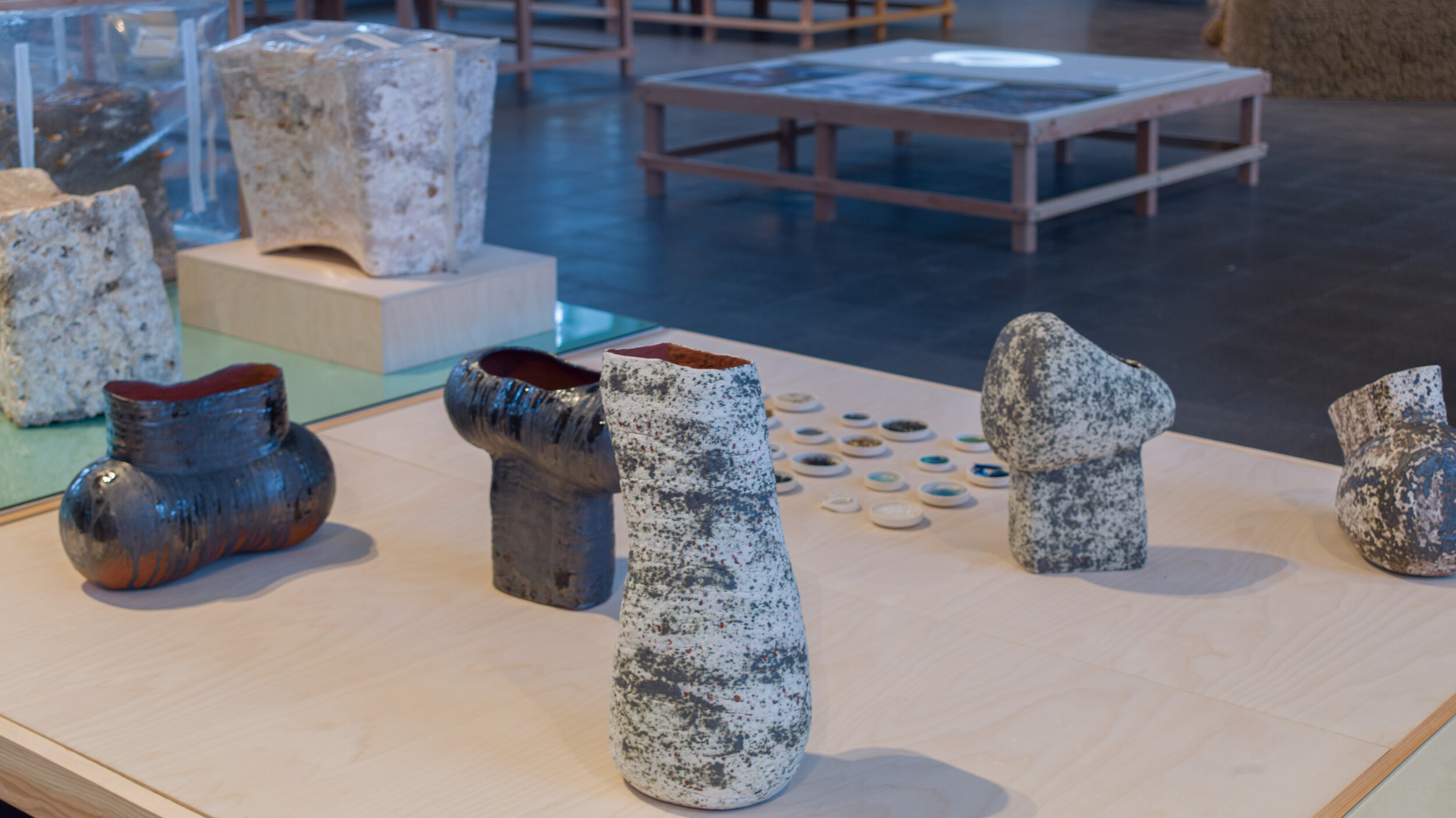
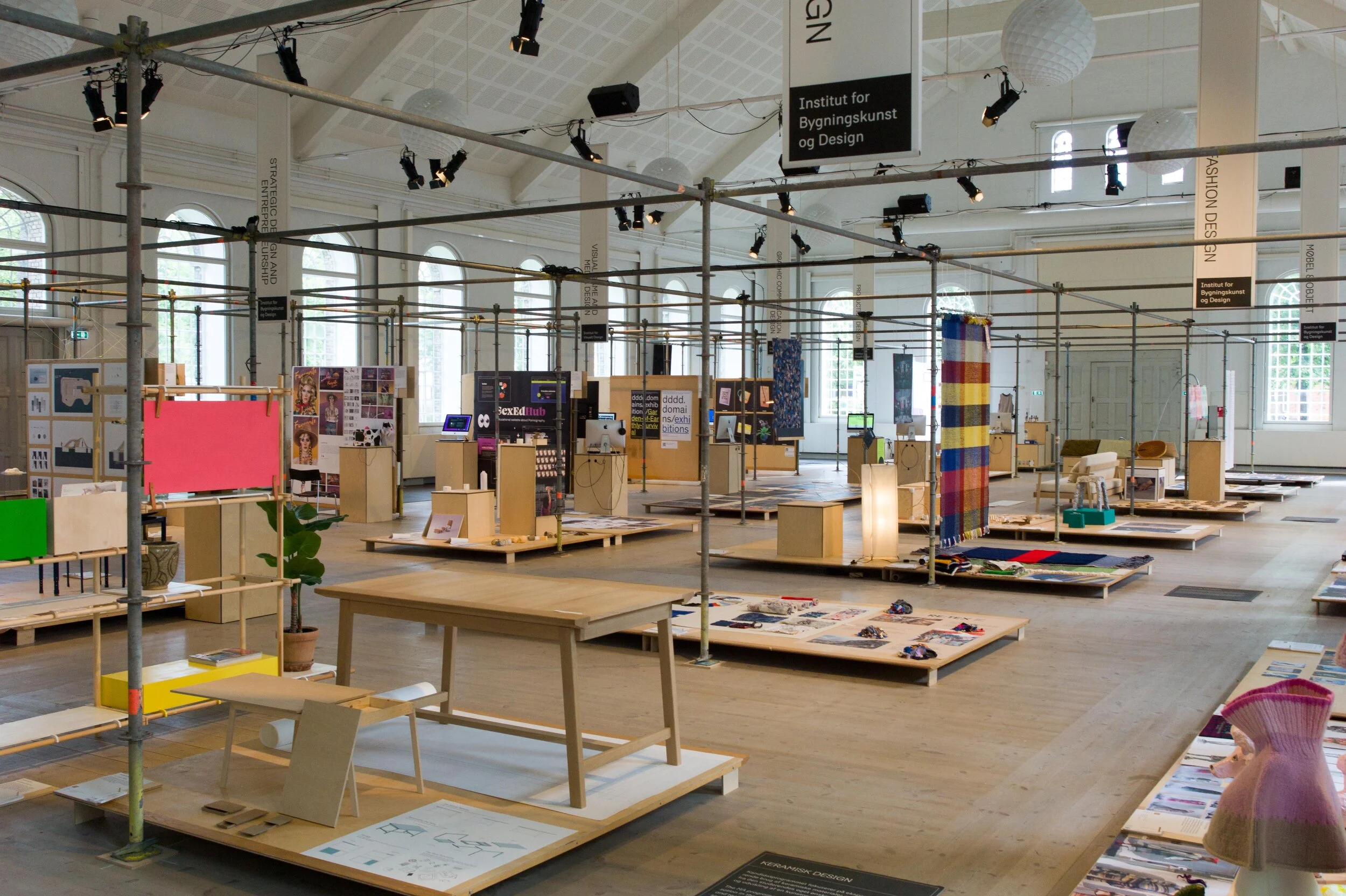
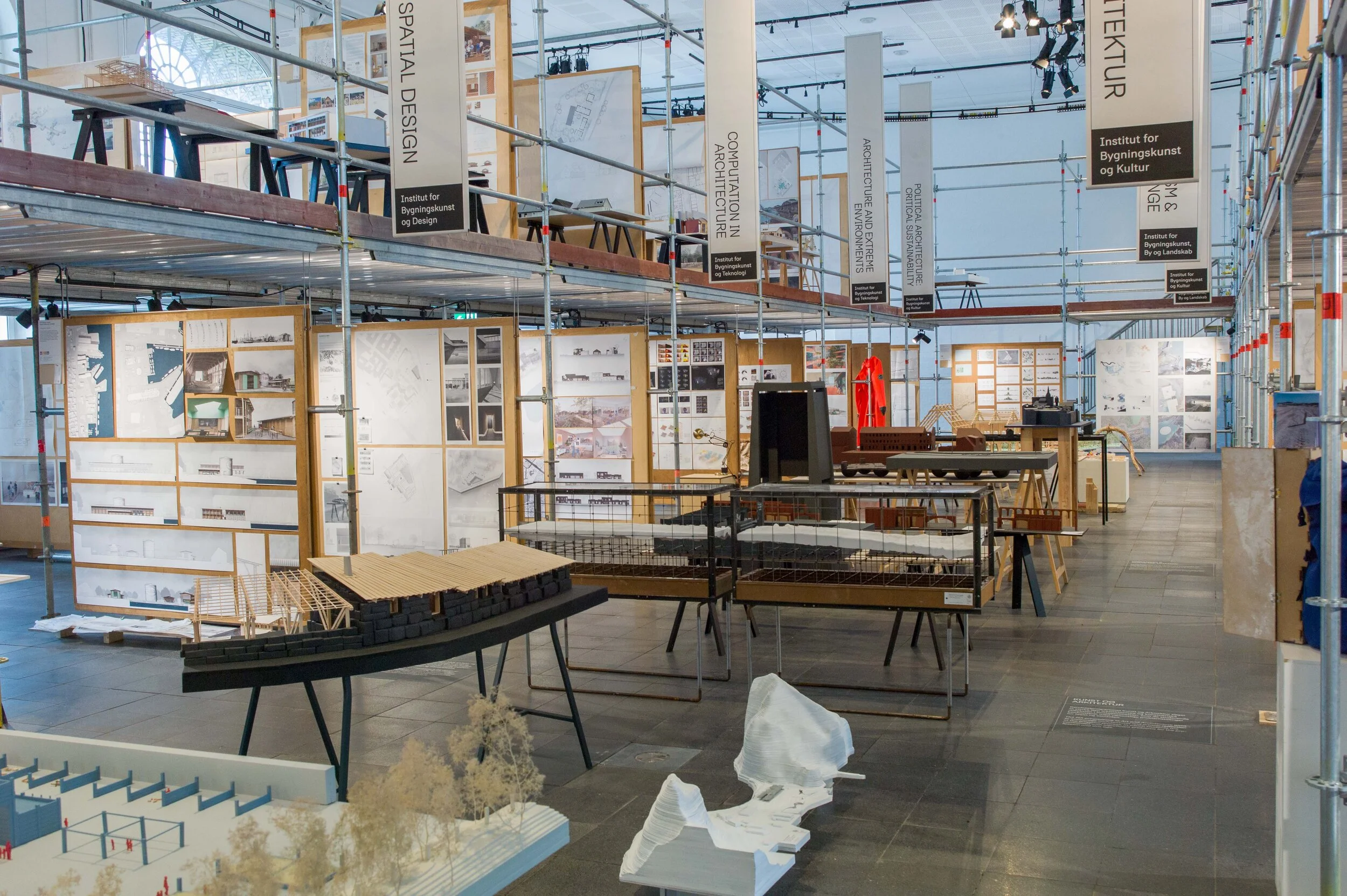
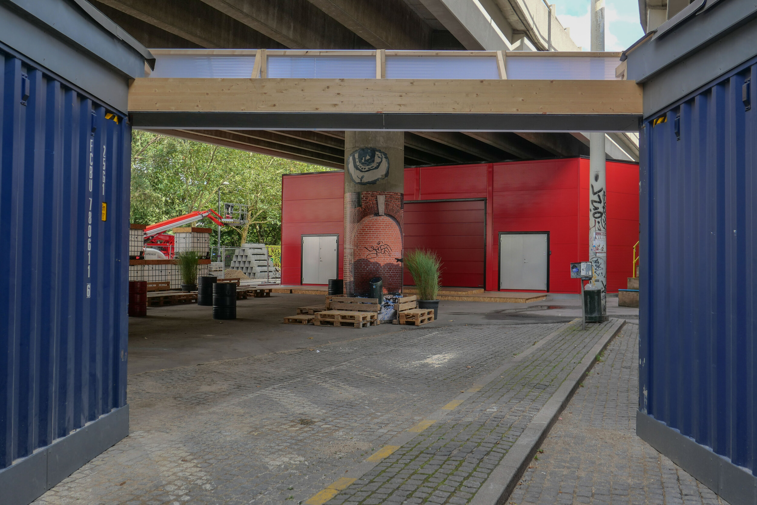
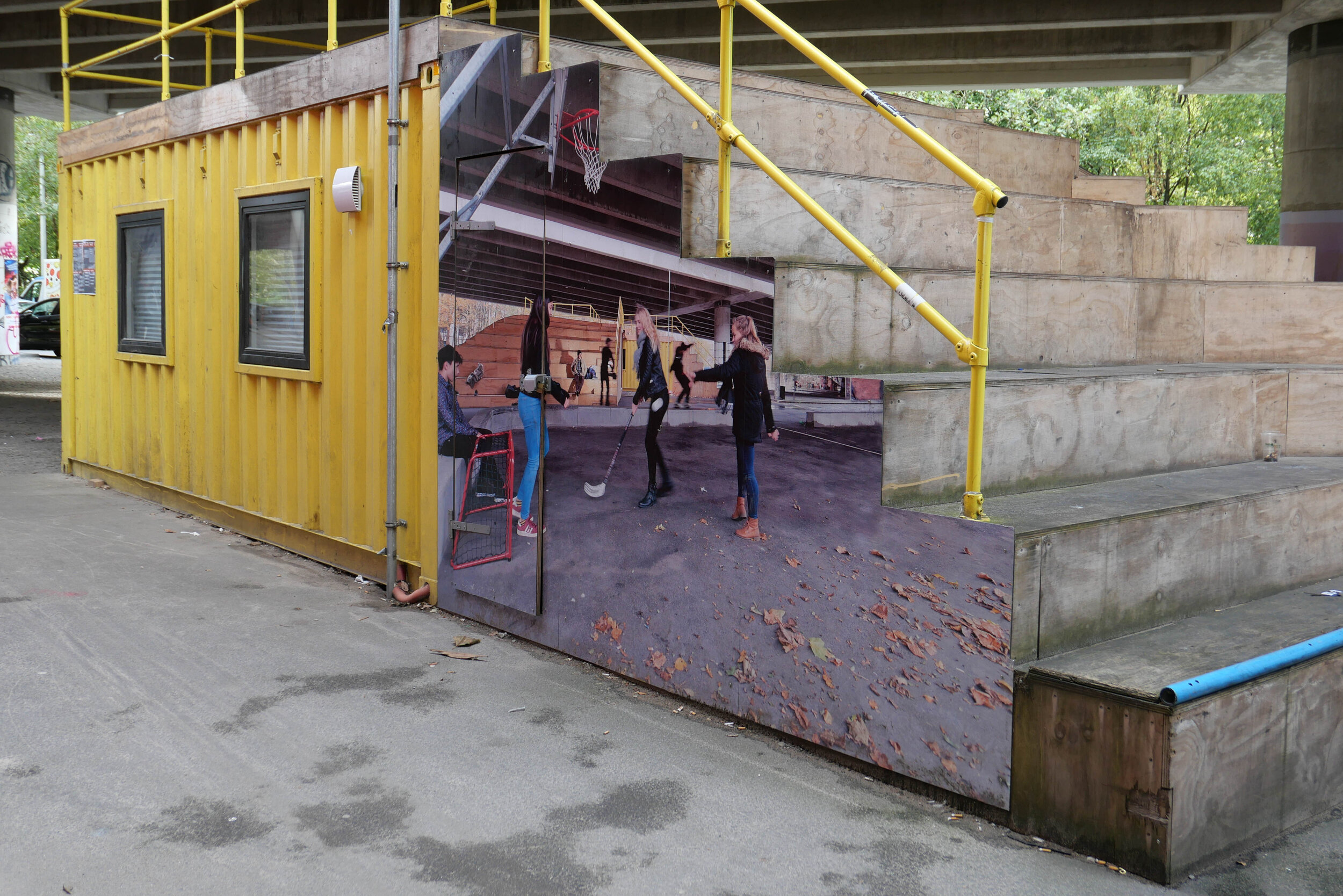
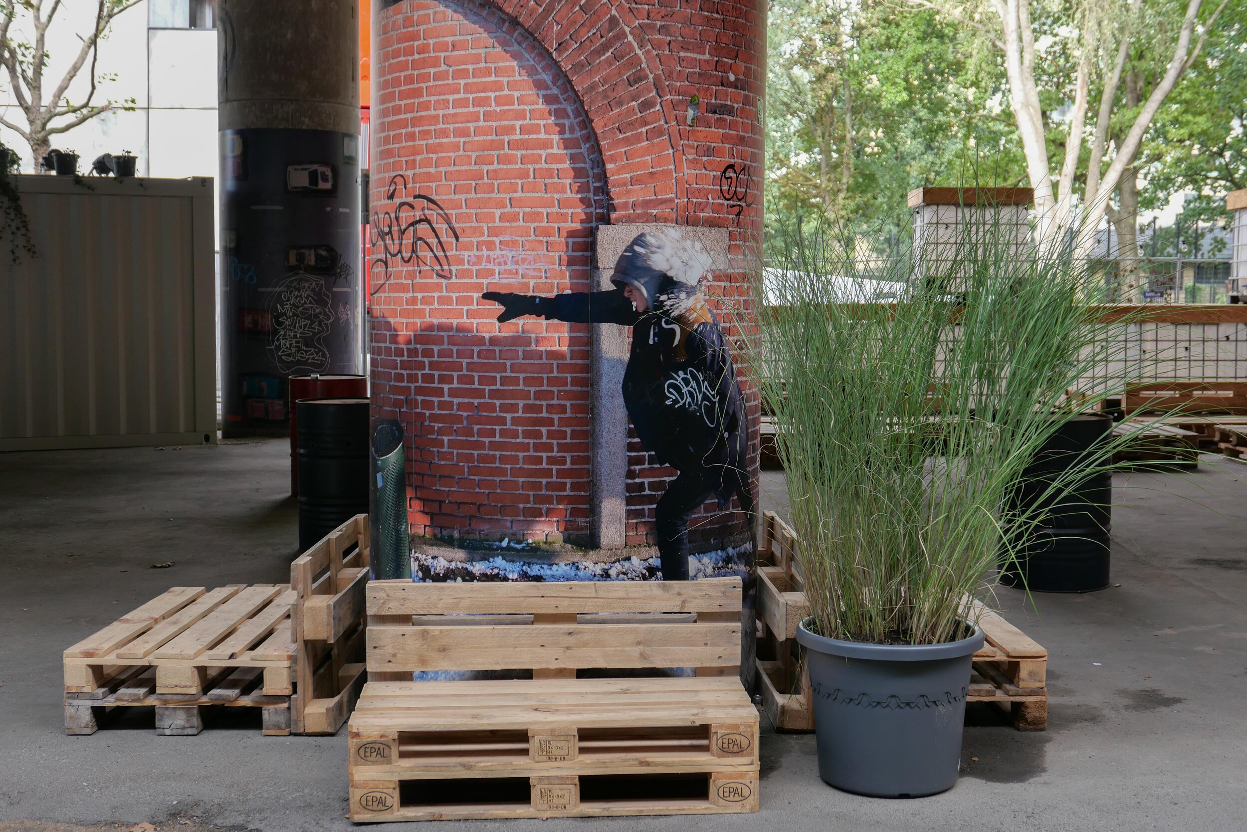
Shown here, is work from 25 research protects, that have looked at new materials or at new approaches to design and manufacturing and at changes in our building methods and planning policies that could control our demands for energy and reduce global emissions of CO2 and pollutants from mining extraction and from large-scale agricultural and industrial processes ... processes that have had such a detrimental impact on our rivers and seas and our atmosphere.

Manufacturing is responsible for over 50% of global energy usage and is responsible for 20% of global CO2 emissions.

A UN report from 2022 showed that construction work is now responsible for 34% of global energy demands and 37% of global greenhouse gas emissions.

So now, as the impact of climate change is becoming a reality, if there are not major changes to what we build and how we build, current predictions for the release of CO2 indicate that emissions from the production of building materials alone are set to double by 2060.

We have to to be rational and look at the materials we use and change how we use materials in building construction and in manufacturing.

Some of the new materials shown in the exhibition - such as fungi - or suggestions about how to use raw materials more efficiently or ideas about how to reuse salvaged materials have been proposed before but here there is a clear move on from theory to practical applications that have been or are being tested at scale.

For policy makers - now focused on making changes before we reach irreversible tipping points in global warming - these ideas may well be obvious and, for them, it is about when and how these changes are implemented but they will only be successful if a large number of people - the customers who are buying and using the products and the citizens who are living in and working in what could be very different forms of building - understand the reasons and are on board with those changes.

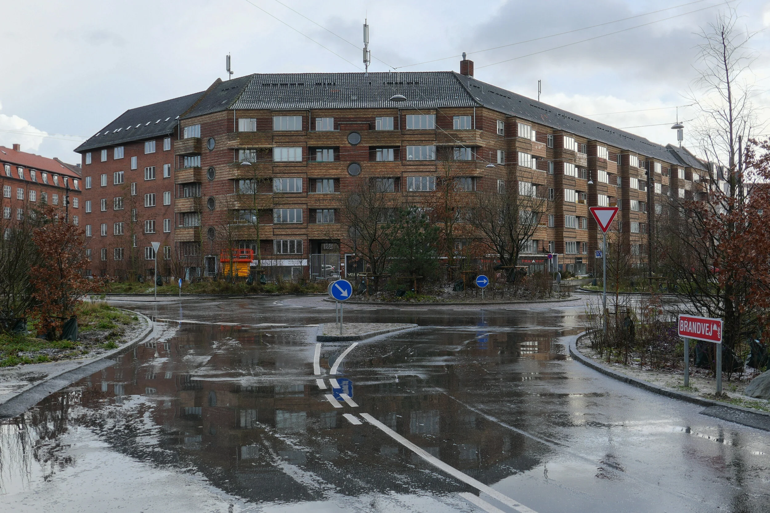
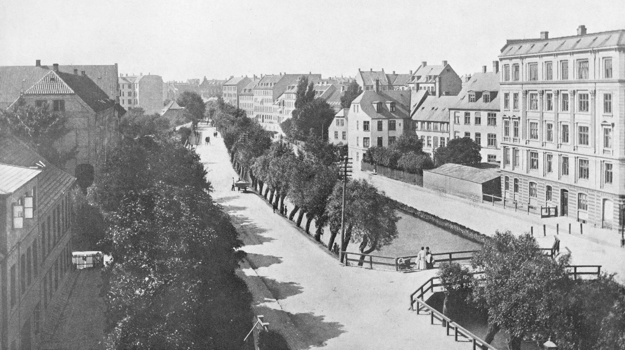
One project in the exhibition has looked at experiments in communal living with reduced personal space but increased shared space for shared facilities in housing and another project looks at increasing the density of housing in the suburbs of Copenhagen by building new houses on back plots and between existing buildings but such major change can only proceed with wide-spread consent.

The exhibition presents what are still options so the next stage should be broader and informed debate about how we use materials; about what we manufacture and how and about how we build and what we build in our cities in the future.

PLANETARY BOUNDARIES
Det Kongelige Danske Kunstakademis Skoler
for Arkitektur, Design og Konservering

Danneskiold-Samsøe Allé, 1435 København K
21 Sep 2023 - 5 Apr 2024 

Six of the projects will be shown at Form, the design center in Malmö. 

PLANETARY BOUNDARIES
Form Design Center
Lilla torg 9, Malmö, Sweden
13 April - 2 June 2024

a curious design to get across a serious message?

Benches like this have appeared in about half a dozen places around the city.

My first thought was that it seemed like a rather extreme way to stop people stretching out and sleeping on park benches. Then I wondered if it was a particularly thick apprentice in the ironworks who got the measurements wrong but that seemed more than a bit unlikely as these benches have been made here since 1888 so, really, they should know what they are doing by now.

Then I saw an article in the newspaper that sort of explained everything. They are 85 cm too high and that's the height that some scientists have suggested that sea levels will rise by the end of the century if we do not tackle CO2 pollution and sort out climate change.

The pedant in me thought that it's a bit of an obscure way to represent impending disaster and that it only really works if the benches were at the end of Ofelia Plads where the concrete runs down into the sea of the harbour but then anything helps if it makes people stop and think .... even if it is only to think how the hell would I get up there or, come to that, get down without breaking an ankle.

design classic: the Copenhagen bench
the Copenhagen bench
high water in the harbour
Ofelia Plads


high water in the harbour

Even without looking out of the window, living on Nyhavn, I know when the level of the water in the harbour is high because I can hear the engines of the tourists boats turning over as they stop at a small landing stage at Nyhavnsbroen, for people to get on and off, rather than going on under the bridge to their main landing stage at the inner end of Nyhavn at Kongens Nytorv.

Most of the boats have windscreens to shield the skipper but these are hinged to drop down to gain a few inches to get under the bridge and, through the summer, my days are punctuated by tannoy announcements from the guides trying to make passengers sit down as the boat goes under Nyhavnsbroen. I’ve never seen a tourist’s head floating in the harbour but it would give them a great if final selfie.

On Sunday the water in Nyhavn was at the highest level I have seen since I moved here …. about 1.5 metres above its normal level and just 60cm below the level of the quay.

Such a high water level was caused by storms over Denmark on Saturday. Named Storm Malik by Danmarks Meteorolgiske Institut, it forced water from the North Sea against the west coast and caused water to rise between the islands so effecting Limfjorden, Roskilde Fjord, and, to a lesser extent, Copenhagen.

It sounds dramatic but there had been good, early and accurate warnings so vulnerable areas prepared with sand bags and booms and here boat owners adjusted moorings and checked service pipes to and from their boats.

Of course, people were out on Sunday morning because they were curious but Copenhageners, like city people the World over, are pretty nonchalant about these things …. or, at least, can feign nonchalance. When I told a neighbour that this was the highest I have seen water in the harbour, he sniffed and said in his 55 years of working and living around Nyhavn, he had seen the water much, much, much higher.

Danmarks Meteorologiske Institut - Storm Malik

water lapping over the lower level of the quay at Gammel Strand

looking down at Nyhavnsbroen - the bridge across Nyhavn - at about 10am on Sunday. With the water this high, it would be difficult to get a raft let alone a tourist boat under the bridge to get to the inner end of Nyhavn at Kongens Nytorv

the water level at Nyhavnsbroen on Sunday at about 10am …. the water level had already dropped by about 20 cm - as shown by the tide mark - because when the water was at it’s highest point, the arched opening was completely submerged

update:
24 hours later - at about 10am on Monday - the water level had dropped by 1.6 metres and, if anything, is lower than normal

the warehouses at the end of Nyhavn and Skuespilhuset / The National Theatre from the inner harbour bridge around lunchtime on Sunday when the level of water in the inner harbour had already dropped

the main canal through Christianshavn where the quay is not at a constant level and, at one of the lowest points, the road was just 20 cm above the water
this sounds dramatic but, of course, if the water had risen above the edge of the quay then, as the area of flooding increases, then increasingly large amounts of water would be needed to raise the level

of course, that does happen but, more often, the problem is that, as the level of water in the harbour rises, storm drains that clear water from the street, fail and drains and sewers back up


why the city has to prepare for rising sea levels

This weekend, Danmarks Meteorologiske Institut classed Storm Malik as level two on their scale with the highest storm level being four.

The storm drove water from the Sound into the harbour and when you look at the area of the inner harbour then the amount of water here was certainly impressive - amazing even - but not dramatic for there was little flooding.

But storm surges will become more of a problem as sea levels rise because of climate change and could become a dangerous and expensive catastrophe if storm surges or high levels of water in the Sound and in the harbour coincide with heavy rain over the city. To put it simply, that is when water running of the land meets water flooding in.

Cloud bursts here are dramatic with a cloud burst defined as 15cm or more of rain falling within 30 minutes so the policy now is to control and contain surface water so that it can be released into the harbour once water levels drop. There are now also plans for raising sea defences including the construction of a tidal barrier that could be raised to block the entrance to the harbour in the event of a storm like Malik.

also see:
Sankt Kjelds Plads - climate change landscape
climate change and sustainability in Denmark?
Enghave Parken - restoration and climate change mitigation
climate change - Scandiagade

This is Christians Brygge where it goes under Knippelsbro - the bridge at the centre of the inner harbour that links the historic centre to Christianshavn and Amager. This road along the quay is a main route into the city from the south. The water was just shallow enough to drive through although unfortunate for cyclists caught by the spray and the wake from cars.

It was difficult to judge (I did not have a tape measure with me) but this flooding appears to be above the level of the water in the harbour so may well have been caused by the water in the harbour rising and blocking drains- The level of the road surface cannot be raised because the construction of the historic bridge has a shallow arch which is an integral part of the construction and already limits the height of traffic …. hence the warning lights and red and white striped warning sign.

The prediction is that, by 2070, sea levels could rise by 50cm and this map, from Danmarks Meteorologiske Institut, shows the parts of the city that would be flooded should there be a storm surge of 1.9 metres on top of that …. the rise in level this weekend was about 1.6 metres in the harbour and was, I think, rated as a once in 20 year event

The map shows the roads under the harbour bridges flooded; water over the quay in Nyhavn; Ofelia Plads and the harbour end of Sankt Annæ Plads flooded. More important, extensive areas of Christianshavn and the whole of Christiania would be under water. The outer defences of Christianshavn would overflow, including possibly covering the road between Christianshavn and Amager.

Kløvermarken - the large area of park south of the old defence and here shaped rather like a grand piano - would be under water. This is significant because plans to build housing across Kløvermarken are back on the planners’ agenda. Maybe a fact-finding trip to Chiloe in Chile might be useful to look at ways of building houses on stilts! Or maybe, just maybe, leaving Kløvermarken as an open green space for sports might be an easier if less profitable option.

work to start on dredging for the construction of Lynetteholm

At the end of 2021, the Danish Parliament passed a Construction Act for Lynetteholm and work on the new, man-made island across the entrance to the harbour will start later this month with extensive dredging that will remove sludge across the sea bed to form a stable base for the next stage when landfill will be brought in to create the island.

That sediment - estimated to be around 2.5 million tonnes across the sea bed - is described as "slightly polluted" so, presumably, that means that there is contamination from the harbour, contamination from shipping entering and leaving the harbour and pollution from the old ship yards on Refshaleøen.

‘Sludge’ will be taken south by barge to be dumped in the bay off the town of Køge. The Danish word used in the local press for this is 'klapning' or clapping but I'm not sure if that is the process or the term for the sludge. A recent article talked about the 'clapping area'.

read more

from Langelinie looking east - out to the Sound

at the centre is Trekroner Fortet - the Three Crowns Fortress - built in the 1780s to guard the entrance to the harbour
to the far left is the massive warehouse of UNICEF out at Nordhavn and the three white buildings are the cruise ship terminal
to the right the buildings are at the north end of Refshaleøen

the new island will fill the whole horizon with just a channel in front of the cruise ship terminals for boats entering and leaving the inner harbour


Copenhagen, Amager and Saltholmen in the middle of the 19th century showing shallow marshes and mud flats in the bay south of the harbour and the map has the depth of the main channels in the Sound


70% LESS CO2 - Conversion to a Viable Age

An important exhibition has just opened at the Royal Academy schools of Architecture, Design and Conservation.

Students and teaching departments were asked to submit their projects for inclusion and 31 were chosen for the exhibition to illustrate how new ideas, new materials and new methods of construction or manufacturing will help to reduce global emissions of CO2 by at least 70%.

Significant levels of CO2 are produced by the fashion industries from the production of the raw materials through manufacturing and through high levels of waste and around 10% of the global emissions of CO2 are from the ubiquitous use of concrete in all forms of construction so several projects here suggest major changes to what we make and build and how we use materials.

But there are also projects on using new materials from algae, lichen and mycelium and even one project that uses pine needles for insulation.

There are short assessments of all the projects on the academy site.

70% LESS CO2
Det Kongelige Akademi
Arketektur Design Konservering
Danneskiold-Samsøes Allé 53, København K
7 October 2021 - 14 January 2022

Solutions at Royal Danish Academy

Architecture Design Conservation: graduate projects 2021

Shown here are 220 projects from the students in the schools of architecture, design and conservation who have graduated from the Royal Danish Academy in 2021.

This is an opportunity to see the work of the Academy schools, with their focus on the UN Sustainability goals, and these projects show clearly the ways in which teaching has taken onboard the challenge of climate change and the need to reassess our approach to materials for new developments and our approach to the increasing need to conserve or adapt existing buildings.

Here are the young architects and designers of the next generation whose designs for buildings and for furniture, industrial products, fashion and graphics will have to provide solutions to the new challenges.

As last year, the graduate projects can also be seen on line.

note:
after an initial opening in late June, the exhibition closed through July but then reopened on 2 August and can be seen daily from 10.00 to 17.00 through to 20 August 2021

Royal Danish Academy Architecture Design Conservation
Philip de Langes Allé 10
1435 Copenhagen K

Graduation 2021: SOLUTIONS
the exhibition on line

 
Solutions Grid.jpeg
 

Too Good To Go - posters against food waste

A third of food produced in the World is wasted and, to compound the problem, that waste is responsible for 8% of greenhouse gas emissions.

These posters were launched on World Environment Day to make people more aware of the problem and are from a group of European illustrators and designers .

They have been printed in limited editions and can be purchased on line. The price covers printing, handling, packaging and delivery with the remainder going to the UN World Food Programme.

the exhibition continues on Bryghuspladsen until 27 June 2021


www.posters.toogoodtogo.com

Halmtorvet - a new storm drain

Sønder Boulevard - the wide street running out to the south east through Vesterbro from the west side of the main railway station - is now partly blocked with high hoardings like those that were used around main sites for engineering work when the metro was constructed. However, this site is not for the metro but for major engineering work to construct a massive storm drain.

It is part of a scheme for rain-storm mitigation for Frederiksberg and, when completed, it will be about 1.25 kilometres long to take storm water from Sankt Jørgens Sø out to the harbour with an outlet just east of the Copenhagen Island Hotel on Kalvebod Brygge … close to the swimming area in the harbour at Fisketorvet.

read more

The Nordic Report 03

This week, the Nordic Council launched the third edition of The Nordic Report on decision making for sustainable consumption and production in Iceland, Denmark, Finland, Sweden and Norway.

It follows the format of the first two reports, retaining section headings from last year, and each section has what is described as ongoing assessments …. examples of people or companies and their work or projects that are an inspiration to show the practical application of the UN Sustainable Development Goal for Sustainable Production and Consumption.

The report has been published at the end of a year when a global pandemic has forced major changes on the labour market and on the global economy and to our manner of producing, consuming and socialising.

Ignoring climate change or attempts, post pandemic, to return to business as usual - quite literally business as usual - is not and cannot be an option.


01 Nordic Values
02 Knowledge Sharing
03 Partnerships
04 Sustainable Methods and Models
05 Circular Economy
06 Reduced Waste
07 Sharing Economy
08 Robot Love
09 Responsible Procurement
10 Nudging
11 Transparency
12 Future Generations

SUSTAINORDIC

order copies of the report or read the Nordic Reports on line


the if or when and the how much and why of new islands and tunnels under the sea

This week, politicians in Copenhagen have to agree a budget for the city for the next financial period and the main item on their agenda will, presumably, be discussions about moving to the next stage their ambitious plans to construct a large new island across the entrance to the harbour …. a major engineering project that has been agreed in principle by both the national government and by the city and agreed across most political parties.

Initial plans set the new island immediately beyond and close to the Trekroner Fort - built in the late 18th century to guard the entrance to the harbour - but the most recent drawings published show that it will now be further out into the Sound and will cover a larger area of about 3 square kilometres. There will be a large park along the eastern edge - planned to be larger than the well used and popular Fælledparken on the north side of the city - with homes on the island for 35,000 people and work there for at least 12,000 people although some assessments have suggested that as many as 20,000 new jobs will be created.

But the new  island is not simply the next version of Nordhavn - just larger and further out - but it is also an integral part of an expansion of traffic infrastructure on this side of the city and there will be extensive flood defences on the east or outer side of the island that faces out across the open Sound …. defences that will be an important part of the protection against storm surges that could flood the inner harbour as the climate changes and as sea levels rise.

The name for the new island - Lynetteholm - was, In part, inspired by the shape with a broad curve to the east side - the side facing out across the Sound - and is from the Danish version of the French word lunette and that has been combined with the Norse word holm for a low island that was usually in a river or estuary and was often meadow.

However, Lynette is not a new name in this area of the outer harbour because it was the name of a curved outer fortress built in the Sound in the 1760s that, with large guns set up there, was an important part of outer defences that protected the entrance to the harbour.

read more

① road link and tunnel to Nordhavn - north of Svanemølle and south of Hellerup
② tunnel to link Nordhavn to Lynetteholm and then on to the bridge to Sweden
③ alternative route for a traffic tunnel below the coast road of Amager
④ route for tunnel from Nordhavn to Sjællandsbroen - bridge over the harbour

⑤ if the elevated motorway at Bispeengbuen is demolished then there is a plan
to construct a road tunnel from Fuglebakken to Amager - including a tunnel
under Åboulevard and under HC Andersens Boulevard and on under the
harbour and possibly as far as Artilerivej


will Lynetteholm be constructed further out into the sound?

As yet, there has been no final decision on consent for a major proposal to construct a man-made island across the main entrance to the harbour although they have got as far as calling the island Lynetteholm.

With extensive new areas of housing - comparable in some ways to the work at Nordhavn - it would be immediately beyond Trekroner / The Triangular Fort  and would be constructed across a deep and well-established navigation channel that is the entrance to the harbour from the sound.

If the island is constructed there would be just narrow passageways from the harbour to the open sea between the new island and Refshaleøen and between the island and Nordhavn and it would certainly block the view out from the harbour to the open water of the sound and certainly change the character of the harbour.

Dan Hasløv, in a recent article, published on line on the site of Magasinet KBH, has proposed an alternative site further south and further out in Middelgrunden - an area of shallower water - and there would be a wide channel between Refshaleøen and the new island.

One important role for the new island is to protect the inner harbour from storm surges but this would still be possible with barriers across to the fort from each side.

The current proposal includes road tunnels and metro tunnels to link the new island to Nordhavn and to Amager with the possibility of extending the metro under the sound to Malmö and again all that would still be feasible if the new man-made island is further round to the south but could also reduce the impact of a major new road down the east side of Amager that is part of the current proposal that would link Nordhavn to the Øresund bridge.

earlier post on Lynetteholm

the most recent scheme proposed by BY&HAVN
Flyt Lynetteholm til Middelgrunden og bevar kontakten til havet.

Dan Hasløv, Magasinet KBH 25 March 2020

view out from Nordhavn looking east to the sound from Fortkaj …. the Triangular Fort and the north edge of Reshaleøen are in the distance to the right
this view out to the open sound would be lost if the island is constructed across the entrance to the harbour


detail of chart from 1885

the most-recent version of the scheme from BY&HAVN

The Nordic Report 02

The first Sustainordic report - The Nordic Report 01 - was published by SUSTAINORDIC at the end of 2018 and now a second report - The Nordic Report 02 - has just been released and is available through bookshops and as a pdf version available on line.

This is an important publication that should be seen to mark a point where it is possible to claim that the principles of sustainability in design and production are bedding in … moving on from lobbying to mainstream implementation.

It is no longer acceptable for governments simply to produce lists of aims and targets and platitudes … a wish list that they hope will get them through to at least the next election.

This publication has the support of the Nordic Council of Ministers and is produced through a partnership of six major design bodies from each of the Nordic countries - so from Iceland, Denmark, Finland, Sweden and Norway - with Iceland Design Centre, Danish Architecture Centre, Design Forum Finland, Form Design Center and Ark Des, and DOGA. SUSTAINORDIC was established in 2015.

As with the first report, this report takes as its starting point Responsible Consumption and Production - Goal 12 of the UN Sustainable Development Goals - but with twelve points of action to form a manifesto “which resonates with Nordic values.”

It is interesting to see that the order of the action points in the updated manifesto for Report 2 have been rearranged, implying that priorities have been reassessed, and the impact of these manifesto points have also been sharpened up with stronger and more memorable headings. It is also clear that, in the year between the publications, some terms or definitions have entered a wider public usage so do not need to be explained in quite the same way.

In the 2018 manifesto, item 08 was to ….

Promote circular economy by improving the overall performance of products throughout their life cycle.
We inspire greater awareness of the urgency of products and environments being manufactured to be reused with high quality in technical or biological cycles.

…. but in this new report, at the beginning of 2020, the circular economy has risen up the order and has been given more punch. So now ….

05 CIRCULAR ECONOMY
Promote a circular economy by improving the overall performance of products throughout their life cycle.
We encourage a circular approach to minimise waste and to make optimal use of resources in production, in contrast to the "take, make & dispose" model of the traditional linear economy.

The report makes full use of a strong layout design with good graphics, distinct colours and attractive line-work illustrations - although, of course, anything other than good design would have been roundly criticised with so many design organisations involved.

That it is not a stuffy government or public information paper - with bullet points, foot notes and pages of references to sources - shows that SUSTAINORDIC and the Council of Ministers understand that climate change can only be tackled and sustainability only achieved by political action that involves and engages people to gain their support and will be achieved through radical changes in the approach and the work of architects, engineers, planners, designers, food producers and manufacturers.

Some points set out here might seem obvious … so Film, literature, music and art can be powerful weapons … but maybe even now, even in our digital and online World, that still needs to be said and other comments seem obvious when set out here but I have never heard many of these arguments made so simply and so forcefully so ….

Around 80 per cent of a product’s environmental impact is determined already in the planning phase. Using the design process as a method – to think twice in the early stages, work against norms and involve the users – is an effective way to take sustainable action.

Again, in this second report, there are, within each section, profiles and inspiring interviews about companies and products and, again, this reinforces that, for the Nordic countries, sustainability is not about concerns and  committees and initial policies but about work and projects that are already in hand and moving forward.

Nordic Council of Ministers
SUSTAINORDIC

 
Nordic Report 2.jpeg

The Nordic Report 02 can be ordered on line from Form Design Centre or read online at the same site or the report can be read or downloaded from the SUSTAINORDIC site

major reports on climate change data and policies in Denmark

Many of the official reports on climate change are published on line and most can be found in English. Text is carefully and well written to be informative and accessible and with good use of graphics and tables of data it is possible to find the latest research and the most recent proposals for mitigation.

Making these proposals for policy available and open for at least some discussion is an important way to maintain the confidence and the support of the general public.

Denmark's National Communication was published in January 2018 by the Danish Ministry of Energy, Utilities and Climate and includes data on Greenland and The Faroe Islands. It includes assessments on financial resources and sections on research, systematic climate observation as well as education, training and public awareness. There are important summaries of policies and data from 1990 onwards to see where progress has been made and this data is detailed including tables on the sale of heat pumps and support for biogas; the effect of new building regulations; explanations on data modelling; assessments of the development of wind farms in the future and assessments of a reduction in demand for energy from households through to 2030.

Denmark's National Inventory Report 2019 is the Danish greenhouse gas inventory was coordinated and edited through DCE - the Danish Centre for Environment and Energy - for submission to the United Nations Framework Convention on Climate Change. Included is data on emissions and covers not just Denmark but also Greenland and covers all sectors including energy production, industry and agriculture, forestry and other land use as well as waste disposal.

Klimaplanlægning I kommunerne,Status for danske kommuners forebyggende klimaplanlægning / Climate planning In the municipalities, Status of Danish municipalities' preventive climate planning was published in February 2020 by the Danish think tank CONCITO with support from Realdania. There is a summary in English.


Carbon footprint calculators for citizens

Recently, I received an annual summary from the company that supplies electricity to my apartment. Apparently, my usage is "average" but I realised that I had no idea what that means or if it is good or bad. People can be average smokers but that still does not mean smoking is good for them

Here the meters are read remotely and payment is paid by my bank to the company automatically so it could not be easier and then electricity is one of those things I really don't understand. And that's even though I was relatively good at physics at school. I've got a literal sort of mind that likes to see cause and effect so, even now, I can't get my head around alternating current that, by simply its name, implies something that ebbs and flows. A pump can be switched to alternate … can suck or blow but if the water I use did the same then it would surely fill and then empty the sink!

I digress. What I really mean is that I can’t see or judge, in anything like real time, how much power I'm using and, in terms of my personal carbon footprint and my impact on global warming, that can't be good. Most people act only when they see the impact of what they do in real time.

So, out of interest, I looked on line and came across an article …. Carbon footprint calculators for citizens, Recommendations and implications in the Nordic Context by Marja Salo and Maija K. Mattinen that they published in 2017.

It does not provide the solution but does look at some of the problems in making this sort of interface easy to use and meaningful but also raises questions about how, in an age drowning in information, and, even in Scandinavian countries where there is probably a higher perception of the problems of global warming, it is still difficult to find out what we should do and what impact that will have.

In the first apartment I rented in Copenhagen, I was the first occupant in the place after it had been created in the attic space of a building well over a hundred years old and the owners pointed out just how much they had had to spend to comply with current standards for insulation but then I experienced the gains first hand when the first winter came. Despite being in the roof and despite large dormer windows and one large room with floor to ceiling windows onto a balcony, I did not turn on the radiators …. and that was despite the fact that it was on the community heating system so it would have been too easy to turn it on with no physical feed back of boilers going on and off that I'm used to.

In the second apartment, it was in a very large housing complex and monitoring electricity and heating use was outsourced through a heating consultant. He came one day to do an annual check with the figures for my power usage and said he wanted to check thermostats on radiators because I seemed to be consuming more than would be expected but that was resolved when I pointed out that it was a large and very open apartment and writing and doing research meant the apartment was occupied during the day and I was sitting at a desk in a large space with floor to ceiling windows in an apartment that was nearly twenty years old so not built to current standards and heating had to be kept relatively high or I'd have to sit at the computer wearing a scarf and gloves.

I'm suspicious of monitors and assessments offered by the utility supplier or the manufacturer of white goods because surely they just need to sell me more and, on the other hand, a generic and vague tick-box survey cannot, surely, take into account things like working from home and yet we really do need more guidance and more tangible proof that relates to us specifically if we are to change habits and make a difference.

Carbon footprint calculators


climate change and rising sea levels


If there is a sudden rain storm In Copenhagen and, within an hour, streets are flooded and businesses are closed and transport is disrupted, then the consequences from climate change seem obvious and imminent. Problems are here and are now so, for politicians, planners, voters and tax payers, the need to act and act now is easy to understand.

But rising sea levels are more difficult.

For a start, the time scale is longer. People still talk about dealing with once-in-a-hundred-year storms … perversely trying to persuade themselves that means it will not happen for a hundred years when a catastrophic storm tomorrow could still, strictly, be once in a hundred years if it's then 99 years until the next one.

Statistics and the data seem much less certain for the rise in sea levels but how can we expect scientists to be any more precise with predictions when these changes are on such an enormous scale and there are so many variables - not least when it comes to calculating a tipping point as sea ice or glaciers melt?

But for Denmark, these calculations and planning now for works for mitigation are crucial.

On one side of the weighing scales, for policy makers and planners, are some positives: Denmark is a relatively small and relatively prosperous country with a strong history of major and successful engineering projects and with a population that still appreciates and understands the role of the state in major interventions for general gains. But, on the other side of those scales, Denmark is a low-lying country with an astonishing number of islands and a coast line that, as a consequence, is said to be about 7,300 kilometres in length. Is it a case of too much to do and too little time?


Living now on Nyhavn I'm very aware of the levels of the water in the harbour as the tide rises and falls each day. It might not be as dramatic or by as much as on the west coast - where settlements face out to the North Sea and its weather - but still the level of the water in the harbour rises by as much as a metre from the lowest to the highest level through each day. There is a fixed measure on the bridge across the middle of the harbour that I can see from my desk … or, to be completely honest, there is a height marker I can see from my desk if I stand up …. and I can also hear when the tour boats stop just before the bridge to drop off and pick up passengers if the tide is too high for the boats to get under the bridge to reach the ticket office and landing stage at the top of the harbour.

The quayside here is just 1.5 metres above the level of the sea water at high tide …. so, to put it the other way round, the sea is just 1.5 metres below my front door.

The highest tidal surge out in the sound - sea water driven by winds or storms - was apparently three metres in 1872 although there seems to be no record of floods and damage in the city that year as a consequence. Complete official records date back only to 1890.

There was a surge of 1.57 metres in 1921 and the highest surge of sea water from a storm recently was on 19 January 2007 when the water level rose by 1.31 metres. I've looked at back copies of Politken for that weekend but, curiously, there seem to be no reports of flooding or damage in the city with just one report about the harbour that weekend that has a photograph of a huge number of bikes that had been hoiked out of the canal around Christiansborg as part of a clean-up campaign.

But then add the height of a possible storm surge to the higher level of the sea because of global warming and melting of polar and Greenland ice and you can see why the city has to make major decisions now about what has to be done.

Calculations have suggested that, between now and 2050, sea level in the sound will rise between 10 centimetres and 30 centimetres and by the end of the century - so only 80 years away - the rise in sea level here will be between 20 centimetres and 1.6 metres with a 5% chance the rise will be over 2 metres. The median figure for the rise in sea level for Copenhagen is 70 centimetres and that could mean water lapping over the quay at high tide.

The only thing that is certain, is that I won't be here eighty years from now but, in a worst-case scenario, the sea will be at the front door of this building and that is without worrying about storms.

The whole of Christianshavn was built up out of the sea in the 17th century and looking at historic maps it is clear that the outer part of Nyhavn was built out way beyond the line of the beach.

I have read somewhere that the crown sold off areas of the sea bed and it was up to new owners to drive in wooden piles and fill in and create a plot for their buildings. Whether or not that is true, I wonder how much rising water levels will effect foundations. There is remarkably little visual evidence for subsidence but what will happen as the water table rises? And, more important, whatever work is considered to protect the city from flooding, major engineering interventions will change, and change permanently, the character of the inner harbour and the beaches and low-lying land of Amager - the island immediately to the south of the city.


Special Report on the Ocean and Cryosphere in a Changing Climate.

Last year - in September 2019 - the Intergovernmental Panel on Climate Change published their Special Report on the Ocean and Cryosphere in a Changing Climate.

Produced by more than 100 climate and marine scientists from 36 countries, this report assesses how global warming is having an impact on sea levels as sea ice melts and uses clear research data to calculate the potential extent of change and the rate of change.

Through the 20th century, sea levels rose by 15 centimetres (6 inches) but as global warming is causing ice in glaciers and in the Arctic and Antarctic sea to melt at twice that rate then calculations indicate that by the end of the century, so by 2100, sea levels will rise by an additional 10 centimetres so between 61 centimetres and 1.1 metres and if the Arctic ice sheets melt faster than current predictions suggest, then, by 2100, sea levels could rise by 2 metres.

Small glaciers are expected to lose more than 80% of current ice mass and that would have a severe impact on supplies of drinking water and consistent supplies of water to rivers for irrigation. With flooding of coastal areas and the impact on coastal cities and on densely populated delta areas then changes to sea level will dramatically reshape "all aspects of society."

The report can be read on line and the separate sections downloaded.

these are:

Summary for Policymakers
Technical Summary
Framing and Context of the report
High Mountain Areas
Polar Regions
Sea Level Rise and Implications for Low-Lying Islands, Coasts and Communities
Changing Ocean, Marine Ecosystems and Dependent Communities
Extreme, Abrupt Changes and Managing Risks
Integrative Cross-Chapter Box on Low-lying Islands and Coasts


So just what does a tonne of CO2 look like?

Over the Autumn and Winter there have been a fair few posts here about sustainability in design and architecture and about planning to mitigate climate change. 

Articles about both sustainability and about the impact of severe weather from the changing climate have become much more prominent in the press, reflecting public concern, and in January a major Danish architecture award - the Arne Prize - went to the climate mitigation works around Sankt Kjelds Plads in the city.

It's not all grim news. The average carbon footprint for someone living in Denmark has dropped from over 14 tonnes a year in 1995 to about 6 tonnes a year now, twenty five years later, but there is still a long way to go. Statistics indicate that Denmark has the fifth highest household carbon footprint in Europe and those statistics may well get worse before they get better. A recent article in the magazine Wired looked at a new problem because, with cheap and sustainable energy from wind farms, international data centres are considering a move to Denmark and, as they are notoriously greedy on energy, that could increase the carbon footprint for the country by as much as 10% by 2030 and there have been articles in national newspapers about a scandal over carbon offset schemes that now appear to have been fraudulent.

But I realised that I had absolutely no idea just what a tonne of carbon dioxide looks like or, come to that, how much carbon could be offset by planting a tree.

Then I came across the photograph of a balloon outside the parliament buildings in 2007 that represents a tonne of carbon. And suddenly I had the image of walking around Copenhagen this time next year followed by six of these and my trips to the recycle bins with bags of plastic food containers and glass jars seemed a bit feeble

Photosynthesis removes carbon dioxide naturally and trees are good at storing carbon removed from the atmosphere by photosynthesis but a young tree absorbs about 1.4 kilos (3lbs) of carbon dioxide in a year and when more established and larger, so after about 10 years of growth, a tree can absorb  22 kilos (48lbs) of carbon dioxide a year.

An acre of mature trees absorbs about 3 tonnes of carbon a year so Danes would need just over 2 acres of woodland each to absorb their personal carbon footprint.

If you can't visualise an acre, then if you planted the garden area of Sankt Annæ Plads with trees all the way from just behind the equestrian statue of Christian X at the end towards Bredgade and down as far as the water at the edge of the harbour, that would be about 2 acres so would just about do it …. for you. So where do the trees for the rest of your family go …. or, come to that, the trees for the other million or so people living in Copenhagen?


Sankt Annæ Plads

Sankt Kjelds Plads and Bryggervangen climate-change scheme - winner of the Arne Prize 2020

On Friday, it was announced that the climate-change scheme for Sankt Kjelds Plads and Bryggervangen by SLA architects and the engineering company NIRAS has been awarded the Arne Prize for 2020 …. the major annual award from the Danish Association of Architects.

The selection of a climate-change project for the Arne Prize has, if anything, more significance because this year there was a short list of six projects that included very strong contenders for the prize with the extensive work on Karen Blixens Plads - a huge project by the architects COBE that is at the centre of the south campus of the university - and the stunning stations of the new line of the Metro that opened in September.

Sankt Kjelds Plads is at the centre of a densely-built residential area immediately north of Fælledparken so it is about 4 kilometres north of the centre of the city. Most of the apartment buildings here date from the first half of the last century with most buildings of five storeys around attractive but enclosed courtyards and with wide but slightly bare and bleak streets.

Storms with sudden and increasingly severe rain have meant severe threats from flooding both as drains block and streets flood but also as rain-water floods down from the roofs.

This extensive and essential scheme to control storm water in the area was designed in 2015 with construction work and then planting undertaken between 2016 and 2019 and had to include extensive and disruptive engineering works for new drains and for sunken holding areas for water so sewers are not overwhelmed with cloud bursts.

A crucial part of the scheme was to rationalise on-street parking for cars and to reduce and slow down through traffic so large areas of what had been tarmac could be replaced with pedestrian areas with seating and with dense planting more like urban woodland than simply shrubbery around newly excavated hollows that act as temporary water-holding tanks but are otherwise planted with vegetation that can withstand occasional flooding.

Shale has been used around water pipes to slow the water that cascades from down pipes in a storm and there are large domed sumps with wide vertical drops to deal quickly with water from street gulleys.

What is already clear is that there has been major social gain from the work with new cafes and new businesses attracted to the square and to the nearby and related climate-change scheme for Tåsinge Plads just 80 metres to the east of Sankt Kjelds Plads.

initial assessment posted to Danish Design Review in April 2019
Tåsinge Plads


note:

Each year, alongside the main Arne Prize, there is a second award - the Lille Arne or Little Arne Prize - that recognises excellence across a broader range of work associated with architecture. This year the Lille Arne was awarded to Sydhavnens Folkmøde that provides a platform for local residents to have a democratic involvement in the on-going development of the south harbour.

Sydhavnens Folkemøde


update - Bispeengbuen

Bispeengbuen is a raised section of motorway in the north part of the city that opened in August 1972.

It has three lanes of traffic in each direction but with slip roads and with high sound baffles, added in the 1990s, it is intrusive as it cuts through and divides a densely-built residential neighbourhood. The heavy traffic using the road as a fast route into or out of the city is close to apartment buildings at the level of second-floor windows and, from the start, there were strong local protests with the opening marked by demonstrations and even a bomb threat.

The road is owned by the state but one suggestion now is that it should be transferred to the city and to the municipality of Frederiksberg - the road runs between the two - and, in 2017, politicians from both Copenhagen and Frederiksberg suggested that the road and its traffic could be taken down into a tunnel and the elevated section demolished.

This would provide an opportunity to reinstate a river that had flowed through a meadow here since the late 16th century although the river itself did not run along a natural course. In the 1580s, it was diverted to bring water to low marshy ground around the west side of the city, outside and below the defensive embankments, to form a stronger outer defence and to provide a supply of fresh water for the city.

Around 1900, at the city, end the river, Ladegårdsåen, was taken down into a covered culvert and the road to the lakes became a major route into the city from the north.

From the north end, from Borups Allé, traffic coming into the city goes under the suburban railway line - just to the east of the station at Fuglebakken - and then, immediately south of the railway line, the traffic is taken up onto the raised section that continues on for about 700 metres to Borups Plads where the road returns to ground level but the tunnel would continue on further, closer to the intersection with Jagtvej to make this north part of the proposed tunnel about a kilometre in length.

If the river is reinstated with extensive planting to create a park here, the work could be part of major climate-change mitigation on this side of the city and would create a significant amenity for this residential area.

With a decision on the tunnel delayed, the area under the raised section of the road has been improved with the opening in April 2019 of Urban 13 - “a creative urban space.”

Designed by Platant, shipping containers have been adapted to create a cafe and a function room for local events and an area with steep blocks or steps for seating forms an outdoor concert venue and there is new planting in containers.

proposal from PLATANT to build a deck over the elevated motorway for housing and gardens with access by new towers against the edge of the road

Container City will be here for five years and, even then, work on the elevated roadway may be delayed so Platant have put forward an imaginative and ambitious scheme to adapt the motorway itself with an upper deck that could be constructed above the road deck to support new housing and gardens and with access by way of a number of new towers built along the road edge. It would be designed so that this could be dismantled and the materials reused if work on demolishing the road and building the tunnel does go ahead.

URBAN 13
PLATANT
Cloudburst Masterplan by Rambøll


view from Google Earth with the curve of the elevated section of motorway top left

a tunnel, to take the main through traffic underground, could replace the motorway and it could be continued down Åboulevard, following the line of an old river to the lakes, and the river, now in a covered culvert below the road, would then be returned to the surface


the line of the proposed tunnel from the suburban railway line at Fuglebakken to the lakes and from there along the line of HC Andersens Boulevard and on under the harbour to Islands Brygge to connect with a north harbour tunnel that is also being considered.

there would be a limited number of entry and exit points from the tunnel because it is not for local journeys but for through traffic

the tunnel from Fugglebakken to Islands Brygge is just over 4.5 kilometres


proposal for the park and the reinstated river if Bispeengbuen - the elevated motorway - is demolished and the traffic taken down into a new tunnel


update - a road tunnel below Åboulevard and then on below HC Andersens Boulevard

Åboulevard in the late 19th century looking north with the river still at the centre

Bethlehem church designed by Kaare Klint was completed in 1938 but the apartment building dating from around 1900 is on the right on both the historic view and the photograph of Åboulevard now


A proposal for a major engineering project, to construct a traffic tunnel down the west side of the historic city centre, is now in doubt.

It would take underground much of the traffic that now drives along HC Andersens Boulevard, on the west side of the city hall, and is part of a plan to remove the elevated motorway at Bispeengbuen - bringing traffic into the city from the north - and this would make it possible to reinstate a river that flowed into the lakes that now flows through a covered culvert below Åboulevard.

From Jagtvej, at the south end of the elevated highway at Bispeengbuen, and following the line of Åboulevard to the outer side of the lake, is about 1.6 kilometres and, from the lakes, a tunnel running between Jørgens Sø and Peblinge Sø and on along the line of Gyldenløvesgade to Jarmers Plads and then down the full length of HC Andersens Boulevard and then under the harbour to Islands Brygge is another 2 kilometres so, including the proposed tunnel at Bispeengbuen, that would be between 4.5 and 5 kilometres of tunnel in total.

For comparison, in Oslo, the Festning tunnel - opened in 1990 to take traffic away from the square in front of Oslo city hall - and then an extension to the east - the Operatunnelen completed in 2010 - form, together, about 5.7 kilometres of underground motorway.

The landscape and architecture studio Tredje Natur and the engineering specialists COWI have drawn up a feasibility study for the proposed scheme for the finance directors of the city and of the municipality of Frederiksberg - the road runs between the two areas.

Reinstating the river and extensive landscaping would be an important part of storm water protection for the low-lying areas of Frederiksberg with planting, surface drains, and culverts controlling storm floods before taking it away from the area in substantial storm drains in the bottom half of the tunnels below the road decks in the upper half of the tunnel.

Tredje Natur have produced drawings for the planting that would be possible along HC Andersens Boulevard if the heavy traffic that uses the road is taken down into a new tunnel. There could be a narrow road for local traffic, an open water course and extensive planting.

Tredje Natur


a suggestion for new landscaping along HC Andersens Boulevard proposed by Tredje Natur

1 south end of the boulevard looking south towards Langebro with the Glyptotek to the right
2 looking north from the Glyptotek with Tivoli to the left and the city hall to the right
3 from the south-west corner of the city hall square
4 crossing the city hall square heading north
5 the north end of HC Andersens Boulevard looking to to the tower of Realdania on Jarmers Plads

the map was published in 1860 and shows the river flowing into the lakes at the south end of Peblinge Sø with the road on the south bank and just a narrow lane, Aagade, at the back of gardens on the north bank

the river was moved down into a culvert and Åboulevard - the road above the culvert - is now wide and busy with traffic to and from the centre of the city

the lakes to the top with Sankt Jørgens Sø to the left and the end of Peblinge Sø to the right

the road over the causeway comes down to Jarmers Plads and then past the west side of the city hall at about the centre of the photograph with Tivoli to the left and then HC Andersens Boulevard continues on down to Langebro as a main route to cross from the city to Amager

historic aerial view showing the bridge over the harbour at Langebro that was built in 1903 and the first part of HC Andersens Boulevard with densely-planted trees down the centre rather than bumper to bumper cars now


not just in cities and towns …..

model of the new Wadden Sea interpretation by Dorte Mandrup

This blog is about Danish architecture - about buildings and the built environment - and about design and making or design and manufacturing so, in the recent posts about climate-change mitigation, the schemes discussed have been about dealing with flooding from rain storms in the city.

Work to mitigate the consequences of climate change is crucial because it has been predicted that, with global warming, annual rain fall in Denmark could increase by as much as 30%. This will not be spread evenly through the year but there will be sudden and dramatic storms with torrential rain falling over a relatively sort period of thirty minutes or an hour.

I was not in the city for the devastating storm of 2011 so I did not see first-hand the damage done then as drains were overwhelmed and - as streets flooded - buildings were inundated but I had seen some of the videos that people took showing the intensity of the rain.

Then, about a month after I moved to Copenhagen, there was a sudden storm that flooded local streets. Where I was living, each apartment had storage space in the basement and I lost packing boxes, tools in plastic boxes later rusted and books that had been left down there were ruined. For nearby businesses, damage took months and in some cases years to sort out where floors lifted and electric systems were damaged beyond simple repair. In that storm, the water was about 30 cm deep across the basement with water running down from the street and pumps had to be brought in but in 2011, I was told, water had come up to the level of the basement ceiling so I can see why city politicians have spent so much money and time and effort on trying to make Copenhagen more resilient. Some 300 schemes have been completed or are, to use a bad pun, in the pipe line.

Denmark is renowned for its modern architecture and for furniture design but the country also has a strong and world-wide reputation for its engineering and this is crucial for the successful completion of appropriate mitigation projects.

But this is not to suggest that all the problems and all the major protection plans are urban.

Denmark is a relative small country but it is a country made up of islands - there are some 443 named islands - and it has a disproportionately long coast line of around 8,750 kilometres. To put this in perspective, there is one land border - the border with Germany - and that is just 68 kilometres across.

And the country is low - not as low as parts of the Netherlands of course - but the highest point is just 171 metres above sea level. It is also something of a moving problem as the sea takes away and then redistributes sediment and builds up new land elsewhere and to such an extent that the calculated area of the country is changing regularly.

It has been calculated that 17% so nearly a sixth of Danish homes are vulnerable to flooding with 10,644 along streams, 393,574 in hollows liable to flood and 64,000 homes along the coast.

I now live on Nyhavn in Copenhagen where the quay is just 15 metres wide and the level of the water is less than 2 metres below the edge of the wharf. There is hardly anywhere better to live but, to put climate change in some sort of perspective, current predictions suggest that if global warming continues and glaciers and the Greenland ice mass melt then sea levels could rise by 1.5 metres …. and right now, right here, the front door of the building where I live is 20 steps and 1.8 metres above the Baltic.

So, extensive engineering schemes are needed to protect coast lines around the country and there has to be ongoing discussion about the other policies needed to protect some areas. Particularly important, rare or unique natural landscapes habitats like the Wadden Sea area on the west coast of Denmark are being protected and last week there was a debate in the newspaper about the possibility returning areas of peat bog at Vejen Mose in Jutland to their original state because draining the land for agricultural use has released carbon deposited there …. as much as 1.4 million tonnes of carbon emissions each year.

These decisions are not easy and not cheap but are now urgent and, as with all policies about climate change and sustainability, complicated and difficult compromises will have to be made.

Wadden Sea dikes
Dorte Mandrup Wadden Sea Centre


Sankt Annæ Plads is at the centre of one of the most densely occupied districts of the historic centre of Copenhagen. The wide street overall is 460 metres long and 30 metres wide and three years ago the area was excavated and the centre lowered to absorb and, in a storm, hold back rain water and there are now large fast-flowing drains below continuous grills to take rain water from roofs to vast tanks where water can be held so it does not overwhelm drains and sewers and can be released into the harbour as when it is appropriate.

Sankt Annæ Plads