Bispeengbuen - a new plan

Yesterday, an article in the Danish newspaper Politken reported that planners and politicians in Copenhagen might have come to a decision on the fate of Bispeengbuen - the section of elevated motorway that runs down the border between Frederiksberg and the Nørrebro district of Copenhagen.

One of several major schemes to improve the road system in the city in the late 1960s and 1970s, Bispeengbuen was planned to reduce delays for traffic coming into the city from suburbs to the north west.

At the south end of the elevated section, at Borups Plads, traffic, heading into the city, drops back down to street level and continues first down Ågade and then on down Åboulevard to the lakes and, if it is through traffic, then on, past the city hall, and down HC Andersens Boulevard to Langebro and across the harbour to Amager.

Between the elevated section and the lakes, the road follows the line of a river that, from the late 16th century, had flowed through low-lying meadows - the Bispeeng or Bishop's Meadow - and brought fresh water in to the lakes. In 1897, the river was dropped down into a covered culvert and it still flows underground below the present traffic.

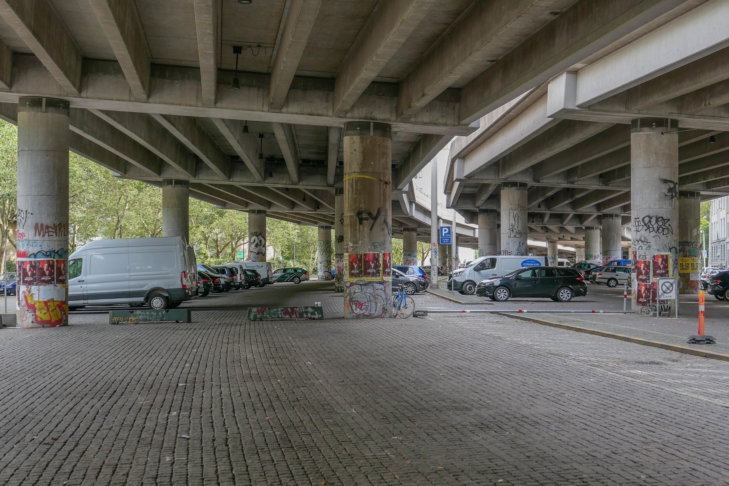
From the start, the elevated section was controversial as it cuts past and close to apartment buildings on either side - close to windows at second-floor level - and the area underneath is gloomy and generally oppressive. Traffic is fast moving and generates a fair bit of noise and it forms a distinct barrier between the districts on either side.

There has been an ambitious plan to drop the road and its traffic down into a tunnel with the river brought back up to the surface as the main feature of a new linear park. The full and very ambitious plan - for ambitious read expensive - was to extend the tunnel on to take all through traffic underground, to Amager on the south side of the harbour.

There has been talk of a less expensive plan to demolish the elevated section, to bring all traffic back down to street level, which would be cheaper but would not reduce the traffic and would leave the heavy traffic on HC Andersens Boulevard as a barrier between the city centre and the densely-populated inner suburb of Vesterbro.

This latest scheme, a slightly curious compromise, is to demolish half the elevated section. That's not half the length but one side of the elevated section. There are three lanes and a hard shoulder in each direction and the north-bound and city bound sides are on independent structures. With one side removed, traffic in both directions would be on the remaining side but presumably speed limits would be reduced - so, possibly, reducing traffic noise - and the demolished side would be replaced by green areas although it would still be under the shadow of the surviving lanes.

It was suggested in the article that this is considered to have the least impact on the environment for the greatest gain ... the impact of both demolition and new construction are now assessed for any construction project.

There is already a relatively short and narrow section of park on the west side of the highway, just south of Borups Plads, and that is surprisingly quiet - despite alongside the road.

On both sides of the road, housing is densely laid out with very little public green space so it would seem that both the city of Copenhagen and the city of Frederiksberg are keen to proceed. Presumably they feel half the park is better than none although I'm not sure you could argue that half an elevated highway is anywhere near as good as no elevated motorway.

The situation is further complicated because the highway is owned and controlled by the state - as it is part of the national road system - so they would have to approve any work and police in the city may also be in a position to veto plans if they feel that it will have too much of an impact on the movement of traffic through the area.

update - Bispeengbuen - 14 January 2020
update - a road tunnel below Åboulevard - 15 January 2020

note:
Given the brouhaha over each new proposal to demolish the elevated section of the motorway, it is only 700 metres overall from the railway bridge to Borups Plads and it takes the traffic over just two major intersections - at Nordre Fasanvej and Borups Allé -  where otherwise there would be cross roads with traffic lights. I'm not implying that the impact of the road is negligible - it has a huge impact on the area - but, back in the 1960s, planners clearly had no idea how many problems and how much expense they were pushing forward half a century with a scheme that, to them, must have seemed rational.

My assumption has been that the motorway was constructed, under pressure from the car and road lobby, as part of a tarmac version of the Finger Plan of the 1940s.

The famous Finger Plan was an attempt to provide control over the expansion of the city, and was based on what were then the relatively-new suburban railway lines that run out from the centre. New housing was to be built close to railway stations and with areas of green between the developments along each railway line .... hence the resemblance to a hand with the city centre as the palm and the railway lines as outstretched fingers.

Then, through the 1950s and 1960s, the number of private cars in Copenhagen increased dramatically and deliveries of goods by road also increased as commercial traffic by rail declined.

I don't know who the traffic planners were in Copenhagen in the 1950s and 1960s but, looking back, they barely appreciated old building or existing communities, and, presumably, looked to LA and, possibly, to the Romania of Nicolae Ceaușescu for inspiration. Their ultimate aim, in their professional lives, seems have been to design a perfect motorway intersection where traffic flowed without any delays.

They wanted to build a motorway down the lakes and when that was thwarted they proposed a massive motorway system that was to be one block back from the outer shore of the lakes - sweeping away the inner districts of Østerbro and Nørrebro - and with new apartment buildings along the edge of the lake - between their new motorway and the lake - that would have formed a series of semi-circular amphitheatres looking across the lakes to the old city. The whole of the inner half of Vesterbro, including the meat market area, and the area of the railway station would have become an enormous interchange of motorways where the only purpose was to keep traffic moving.

We have to be grateful that few of those road schemes were realised but there is also a clear lesson that, however amazing and visionary a major plan for new infrastructure may appear, it can, in solving an immediate problem, create huge problems for future generations to sort out.

approaching the elevated motorway from the south
the motorway from Ågade on the east side
the motorway crossing Borups Allé

the river close to the lakes at Åboulevard but now in a culvert below the road

Bispeengbuen under construction showing how it cut a swathe through the existing neighbourhood - city archive 50675

the earlier proposal to bury the road in a tunnel and bring the river back up to the surface as the main feature of a new linear park

small area of park on the west side of the road

the if or when and the how much and why of new islands and tunnels under the sea

This week, politicians in Copenhagen have to agree a budget for the city for the next financial period and the main item on their agenda will, presumably, be discussions about moving to the next stage their ambitious plans to construct a large new island across the entrance to the harbour …. a major engineering project that has been agreed in principle by both the national government and by the city and agreed across most political parties.

Initial plans set the new island immediately beyond and close to the Trekroner Fort - built in the late 18th century to guard the entrance to the harbour - but the most recent drawings published show that it will now be further out into the Sound and will cover a larger area of about 3 square kilometres. There will be a large park along the eastern edge - planned to be larger than the well used and popular Fælledparken on the north side of the city - with homes on the island for 35,000 people and work there for at least 12,000 people although some assessments have suggested that as many as 20,000 new jobs will be created.

But the new  island is not simply the next version of Nordhavn - just larger and further out - but it is also an integral part of an expansion of traffic infrastructure on this side of the city and there will be extensive flood defences on the east or outer side of the island that faces out across the open Sound …. defences that will be an important part of the protection against storm surges that could flood the inner harbour as the climate changes and as sea levels rise.

The name for the new island - Lynetteholm - was, In part, inspired by the shape with a broad curve to the east side - the side facing out across the Sound - and is from the Danish version of the French word lunette and that has been combined with the Norse word holm for a low island that was usually in a river or estuary and was often meadow.

However, Lynette is not a new name in this area of the outer harbour because it was the name of a curved outer fortress built in the Sound in the 1760s that, with large guns set up there, was an important part of outer defences that protected the entrance to the harbour.

read more

① road link and tunnel to Nordhavn - north of Svanemølle and south of Hellerup
② tunnel to link Nordhavn to Lynetteholm and then on to the bridge to Sweden
③ alternative route for a traffic tunnel below the coast road of Amager
④ route for tunnel from Nordhavn to Sjællandsbroen - bridge over the harbour

⑤ if the elevated motorway at Bispeengbuen is demolished then there is a plan
to construct a road tunnel from Fuglebakken to Amager - including a tunnel
under Åboulevard and under HC Andersens Boulevard and on under the
harbour and possibly as far as Artilerivej


update - Bispeengbuen

Bispeengbuen is a raised section of motorway in the north part of the city that opened in August 1972.

It has three lanes of traffic in each direction but with slip roads and with high sound baffles, added in the 1990s, it is intrusive as it cuts through and divides a densely-built residential neighbourhood. The heavy traffic using the road as a fast route into or out of the city is close to apartment buildings at the level of second-floor windows and, from the start, there were strong local protests with the opening marked by demonstrations and even a bomb threat.

The road is owned by the state but one suggestion now is that it should be transferred to the city and to the municipality of Frederiksberg - the road runs between the two - and, in 2017, politicians from both Copenhagen and Frederiksberg suggested that the road and its traffic could be taken down into a tunnel and the elevated section demolished.

This would provide an opportunity to reinstate a river that had flowed through a meadow here since the late 16th century although the river itself did not run along a natural course. In the 1580s, it was diverted to bring water to low marshy ground around the west side of the city, outside and below the defensive embankments, to form a stronger outer defence and to provide a supply of fresh water for the city.

Around 1900, at the city, end the river, Ladegårdsåen, was taken down into a covered culvert and the road to the lakes became a major route into the city from the north.

From the north end, from Borups Allé, traffic coming into the city goes under the suburban railway line - just to the east of the station at Fuglebakken - and then, immediately south of the railway line, the traffic is taken up onto the raised section that continues on for about 700 metres to Borups Plads where the road returns to ground level but the tunnel would continue on further, closer to the intersection with Jagtvej to make this north part of the proposed tunnel about a kilometre in length.

If the river is reinstated with extensive planting to create a park here, the work could be part of major climate-change mitigation on this side of the city and would create a significant amenity for this residential area.

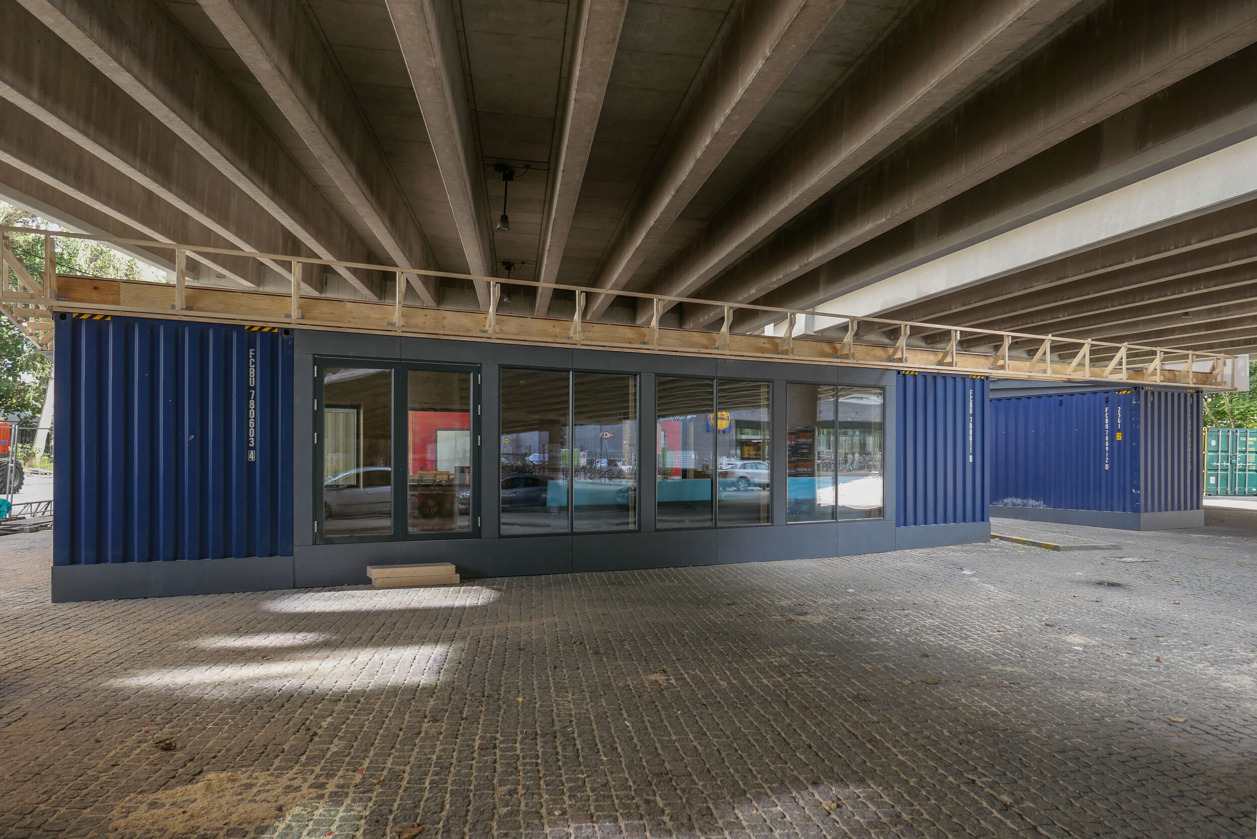
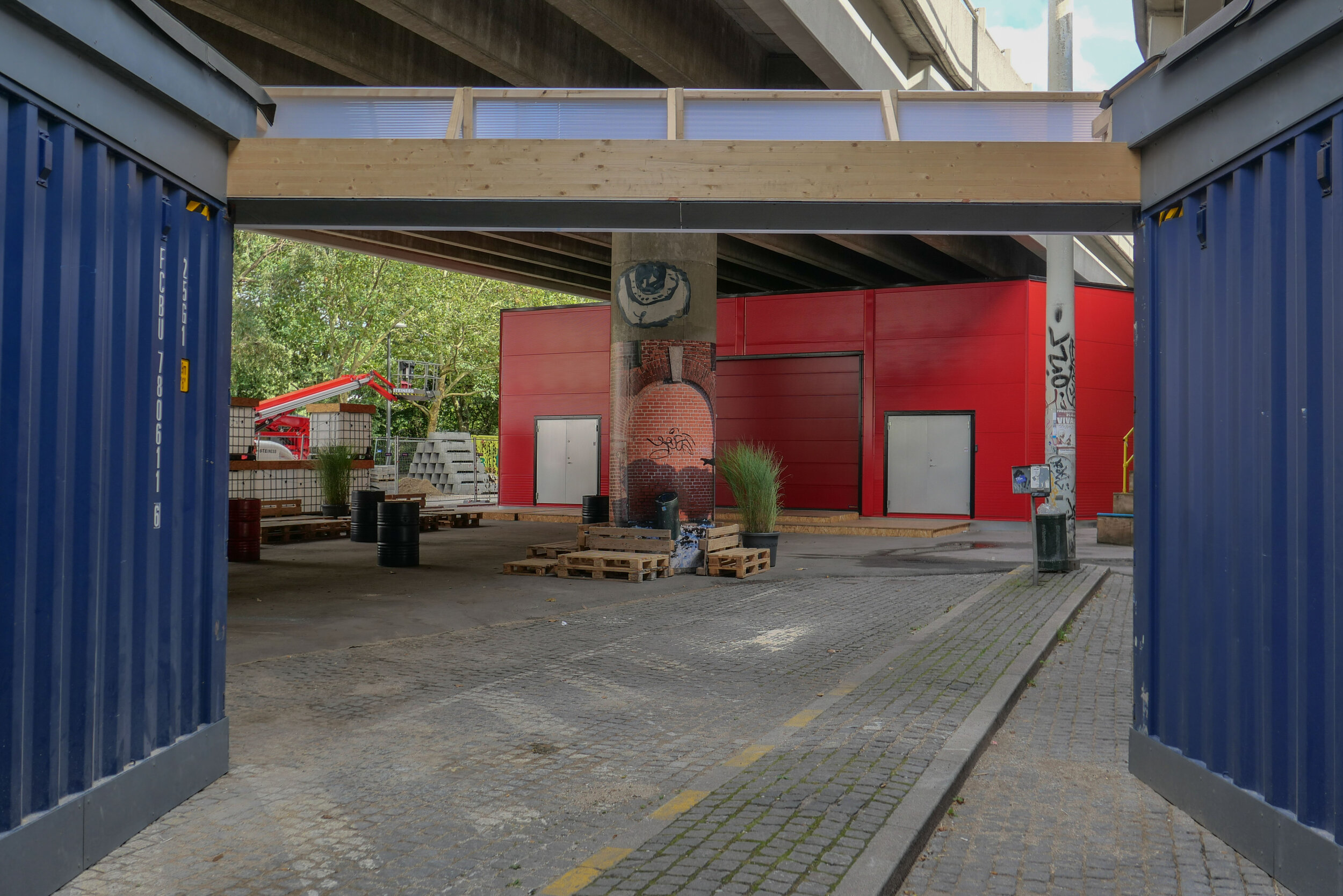
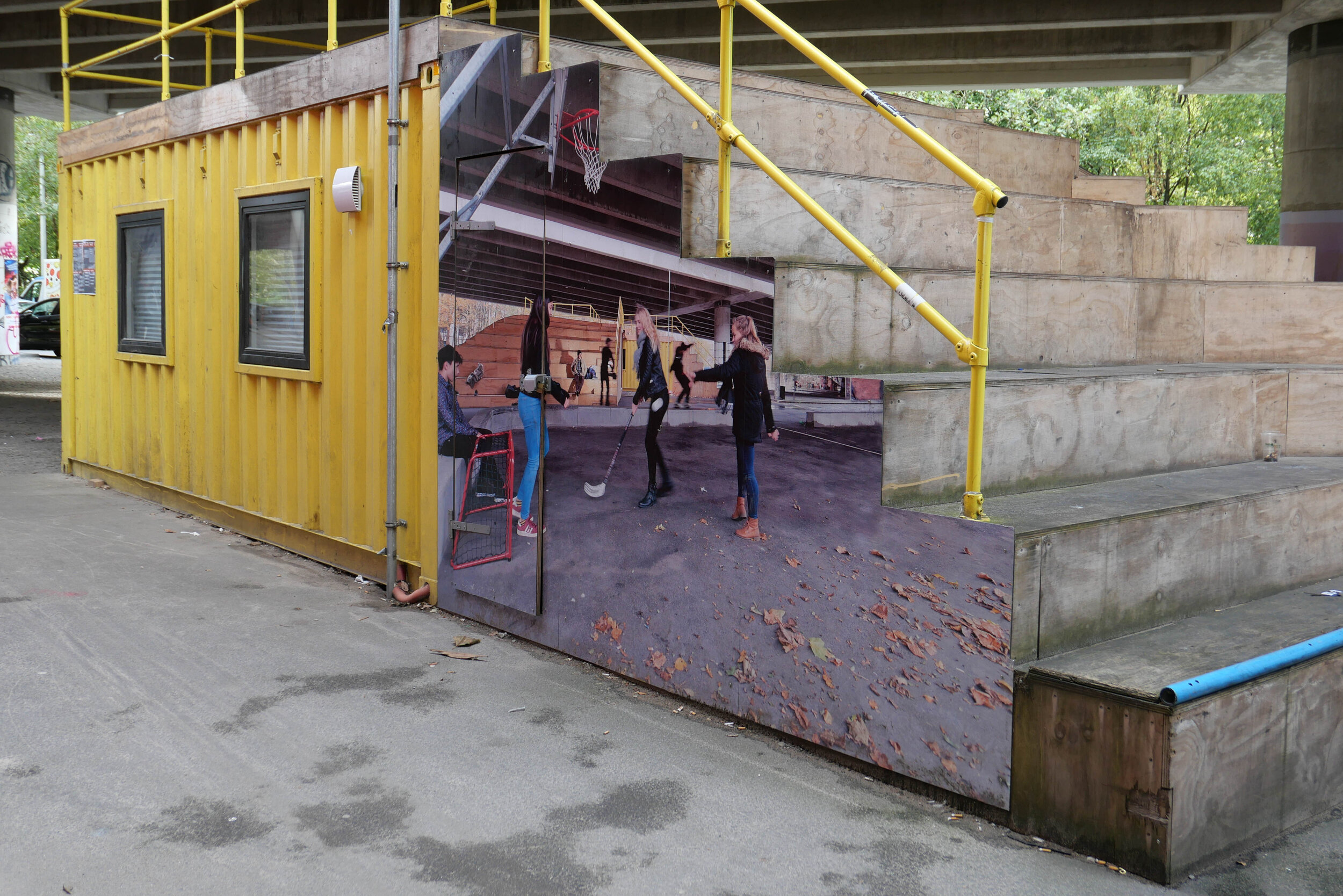
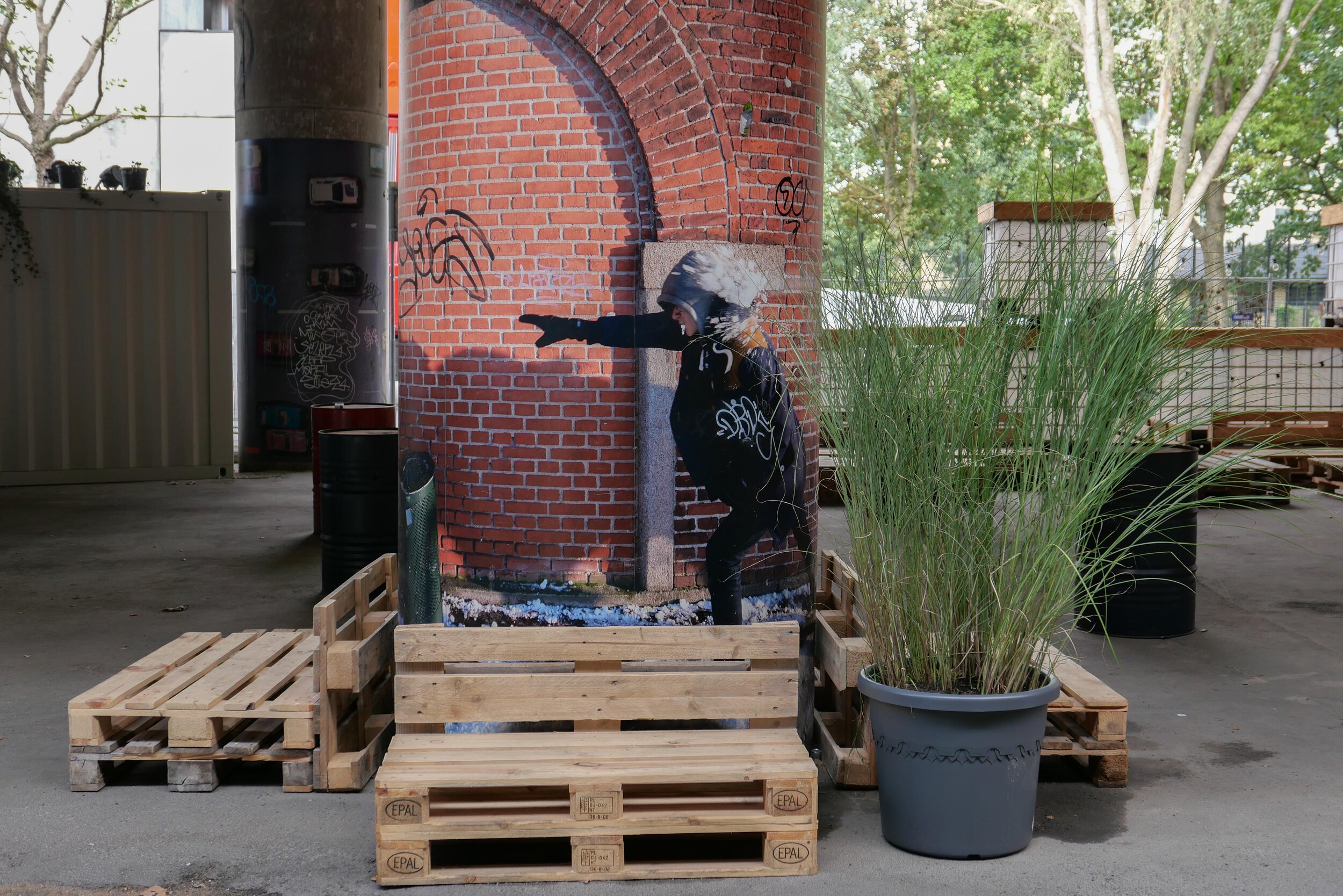
With a decision on the tunnel delayed, the area under the raised section of the road has been improved with the opening in April 2019 of Urban 13 - “a creative urban space.”

Designed by Platant, shipping containers have been adapted to create a cafe and a function room for local events and an area with steep blocks or steps for seating forms an outdoor concert venue and there is new planting in containers.

proposal from PLATANT to build a deck over the elevated motorway for housing and gardens with access by new towers against the edge of the road

Container City will be here for five years and, even then, work on the elevated roadway may be delayed so Platant have put forward an imaginative and ambitious scheme to adapt the motorway itself with an upper deck that could be constructed above the road deck to support new housing and gardens and with access by way of a number of new towers built along the road edge. It would be designed so that this could be dismantled and the materials reused if work on demolishing the road and building the tunnel does go ahead.

URBAN 13
PLATANT
Cloudburst Masterplan by Rambøll


view from Google Earth with the curve of the elevated section of motorway top left

a tunnel, to take the main through traffic underground, could replace the motorway and it could be continued down Åboulevard, following the line of an old river to the lakes, and the river, now in a covered culvert below the road, would then be returned to the surface


the line of the proposed tunnel from the suburban railway line at Fuglebakken to the lakes and from there along the line of HC Andersens Boulevard and on under the harbour to Islands Brygge to connect with a north harbour tunnel that is also being considered.

there would be a limited number of entry and exit points from the tunnel because it is not for local journeys but for through traffic

the tunnel from Fugglebakken to Islands Brygge is just over 4.5 kilometres


proposal for the park and the reinstated river if Bispeengbuen - the elevated motorway - is demolished and the traffic taken down into a new tunnel