Alfred Nobels Bro

 
Alfreds Bro Map.jpg
 

A new harbour bridge, Alfred Nobels Bro, was opened in the middle of December.

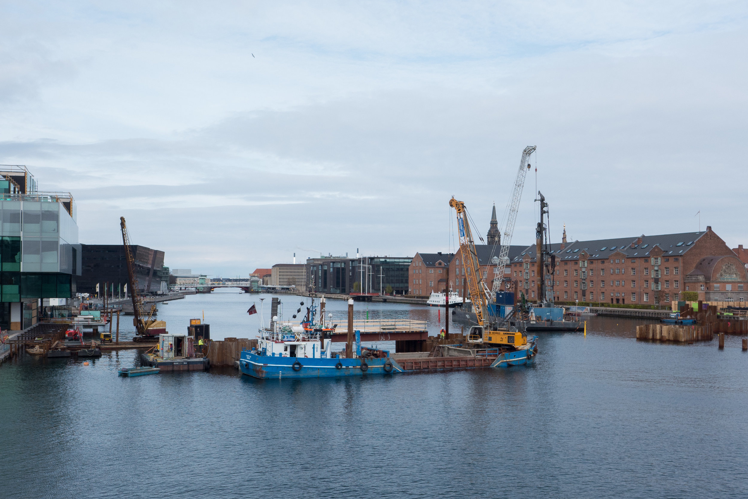
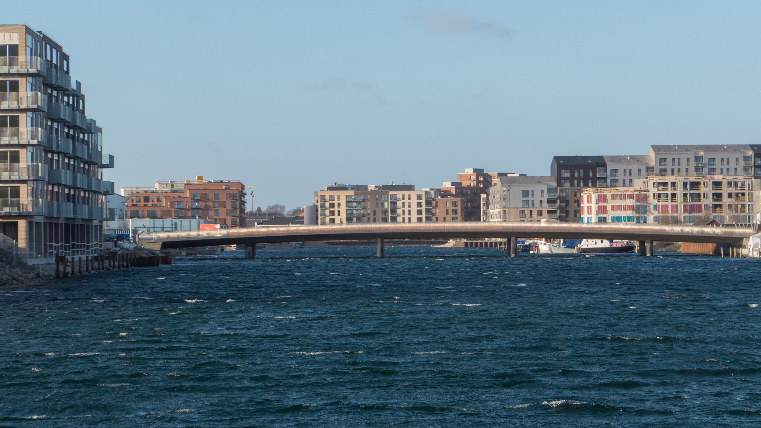
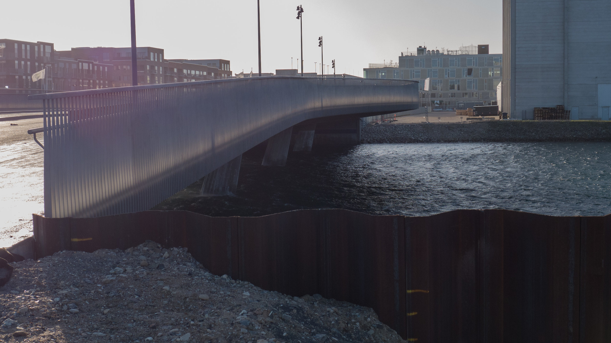
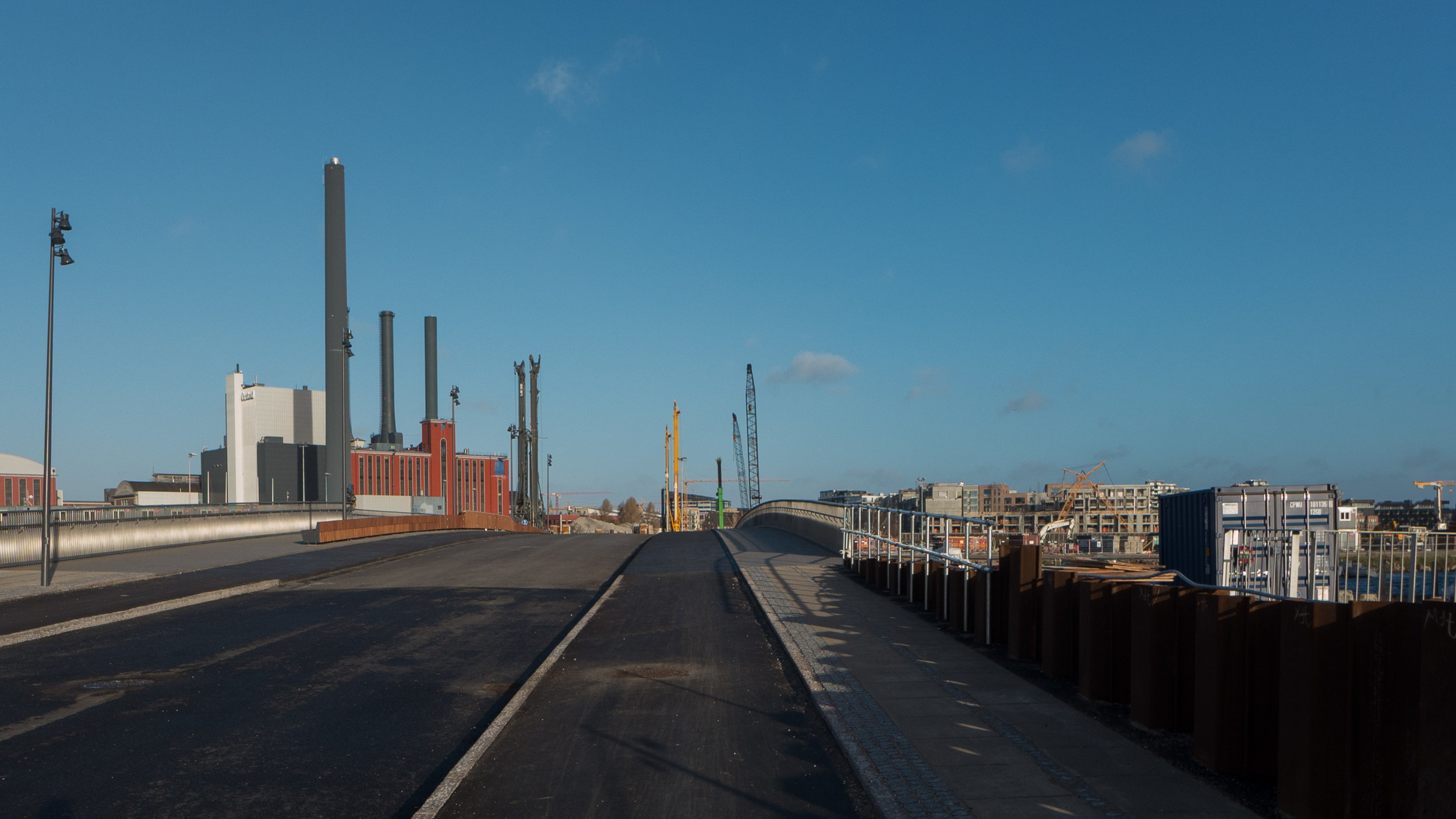
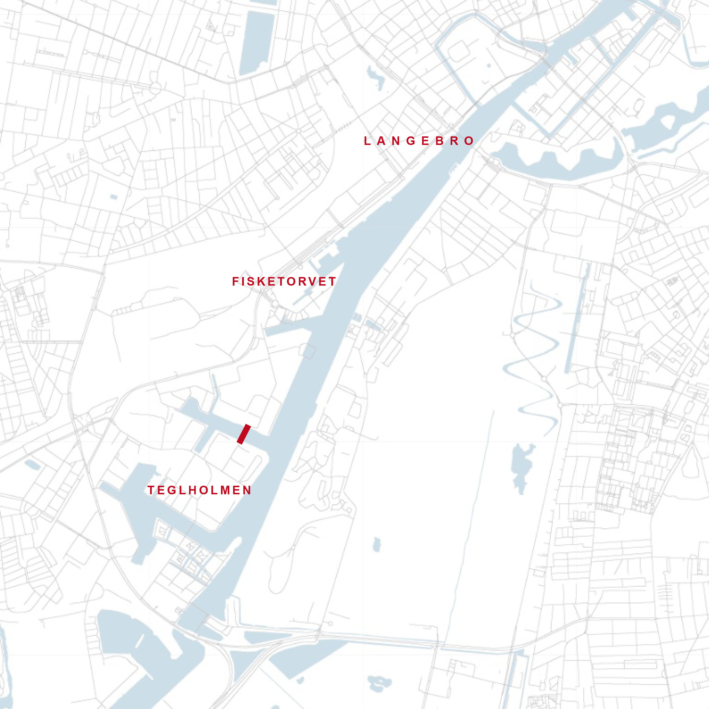
In the south harbour, south-west of the centre, the bridge crosses Frederiksholmsløbet - a wide canal off the main harbour - and links Enghave Brygge and the area around the shopping centre of Fisketorvet - to the large area of new apartment buildings of Teglholmen.

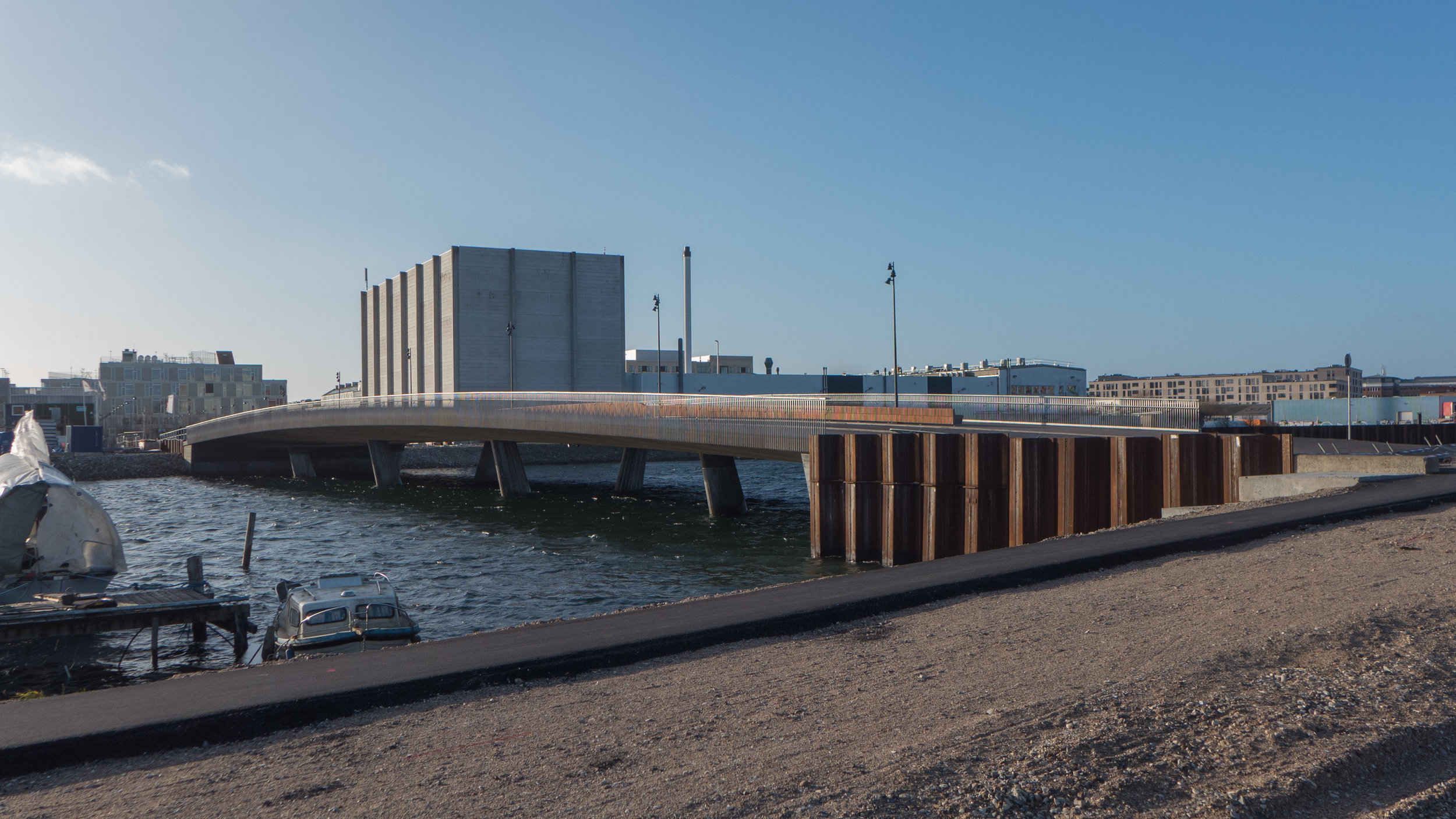
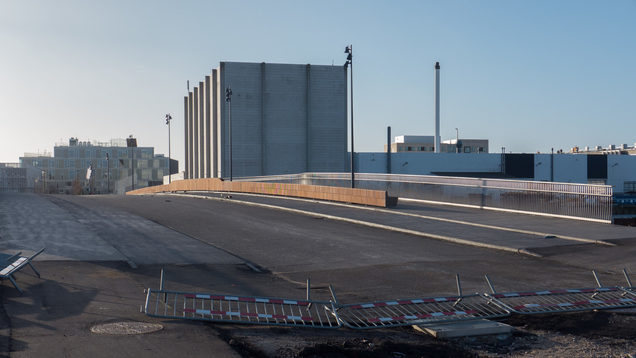
The north side of the bridge is close to the power station H C Ørsted Værket and close to the site for a new metro station. Until the excavations and work for the metro are completed in 2023, the new bridge can only be used by cyclists and pedestrians but it will then take all vehicles.

This is the final link that completes the 13 kilometre circuit around the inner harbour for bikes and walkers and runners.

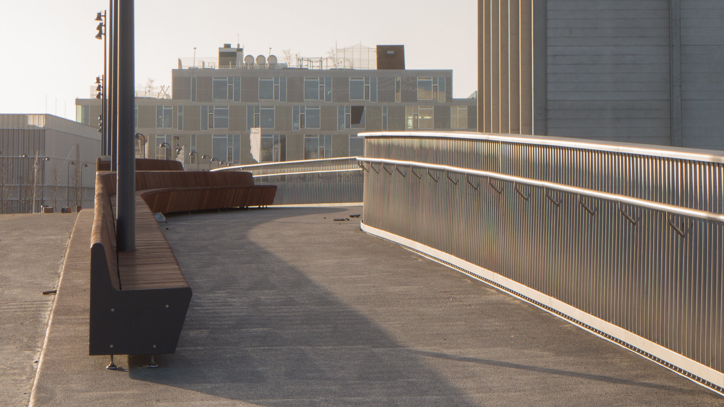
The canal here is 90 metres wide and the bridge deck is wide with two lanes for traffic at the centre; wide lanes for bikes on both sides and wide pavements. The pavement on the side looking inwards, down the canal, is bowed outwards and has a broad single bench, with its back hard against the road, 70 metres long and with a bowed shape that follows the plan of the bridge itself.

It's not clear why the bench faces down the canal rather than towards the open harbour unless the idea is that people will sit here to catch the last of the evening sun - an attempt to repeat the way that Dronning Louises Bro over the lakes to the west of the city is used as a popular place for people to sit in the evening before they head home from work.

The deck is supported on pairs of concrete columns that lean outwards but the structure is so large that it can hardly be called elegant and until the new apartment buildings are completed it really would be difficult to describe the views from the bridge as attractive.

The team behind the design of the bridge were COBE Architects, the engineers MOE, Arkil Holding A/S and G9 Landscape who made the mahogany bench.

Lille Langebro

Over the Summer, work has progressed on the new cycle and pedestrian bridge over the harbour. Substantial piles have been driven in on the Christianshavn side for the south approach to the bridge and shuttering is in place and the intermediate piers across the river are being constructed.

The bridge for bicycles and for pedestrians will link Langebrogade on the Christianshavn side to Christians Brygge on the city side and in plan will follow a gentle curve starting on the line of Langebrogade which is set at an angle as it approaches the harbour from the south but will align with Vester Voldgade on the city side. The harbour at this point is just under 150 metres wide and the bridge will rise to provide a clearance of 5.4 metres towards the middle so smaller boats can pass under but two sections will pivot apart to provide a clear passage 35 metres wide when open for higher vessels to move up and down the harbour.

The design is by the London architectural practice of WilkinsonEyre with the engineers Buro Happold and Urban Agency who have offices in Copenhagen and whose projects in the city include their work on the Kalvebod Wave close to the site of the new bridge but on the other side of Langebro.

In profile, as well as in it’s plan, drawing indicate that the new bridge will be rather more elegant than the new central harbour bridge … so closer in style to Bryggebroen - the bridge by Dissing + Weitling that was completed in 2006 to cross the harbour from Amager to the shopping centre of Fisketorvet on the city side.

WilkinsonEyre, on their internet site, state that they "love to make dynamic use of space, light and materials, focusing on proportions to create something memorable that lifts the spirits and has a logic and sense of place." 

The bridge deck will have edge beams with a triangular section and rather as with Belverderebroen these will change or ‘flex’ from horizontal at the quay to more upright at the centre - to provide a stronger sense of a parapet at the highest point - before dropping back as the bridge reaches the opposite shore. A section of the bridge was shown on site last summer but the Urban Agency site has a good sequence of drawings that shows how the cross section of the bridge alters towards the centre.

WilkinsonEyre

Urban Agency

illustrations from WilkinsonEyre and Urban Agency


map from the 19th century showing clearly the bastions and the water between the city and the gardens at Tivoli. H C Andersens Boulevard was built here in the late 19th century

the alignment of the new bridge on an aerial view from Google


view c.1860 before the wharves on the city side were constructed. The new bridge will be approximately on the line of the timber bridge shown here and Langebro bridge - completed in 1954 - is closer to the line of groins further out at what was then the entrance to the harbour

Langebro crossing the harbour from the city side to Amager Boulevard. The bridge designed by Kaj Gottlob was completed in 1954. The separate swing bridge for the railway has been demolished. Langebrogade, on the Christianshavn side of the city defences, is the road running away from the viewpoint top left in the photograph.

In terms of planning - both modern planning and the historic street plan - the new bridge is fascinating. The main bridge across the harbour until the 1950s - certainly in terms of traffic was Knippelsbro. There had been a bridge linking the historic centre of the city with Christianshavn in that location - give or take 20 metres - from the early 17th century.

Below, to the south of Knippelsbro, the harbour was actually much much wider than it is now, like a broad estuary although there had been long narrow timber bridges across linking the defences around the west side of the city with the fortifications around Christianshavn, so connecting Kalvebod Bastion on the city side to Rysensteen Bastion on the Amager side. 

Through the late 19th and early 20th century, the banks on either side at this south end of the harbour were altered, with quays and wharves constructed on both sides, that narrowed the channel, and there were a series of more important bridges, including rail bridges, at this point. 

As the defensive embankment around the city was removed - from the 1870s onwards - the water outside the embankment was filled in - apart from short sections that survive in the Tivoli gardens - and the new broad strip of newly drained and infilled land was built across with major new civic buildings including the city hall and the city hall square and on round towards the harbour - along what was then the new boulevard - were the Glyptotek and a number of city institutions so in the mid 1870s the bridge over the harbour was widened.

That was replaced by a swing bridge in 1903 but after the war, in the early 1950s, that bridge and an adjoining rail bridge were demolished. A temporary bridge had been constructed and then, in 1954, the present wide road bridge - Langebro - designed by Kaj Gottlob was completed. This took traffic from H C Andersens Boulevard not to Christianshavn but to Amager Boulevard, a major new road outside the defences.

The bridge has heavy use by road traffic- including up to 35,000 bikes crossing Langebro EACH DAY - so the new bridge is designed to encourage cyclists to take a separate route.

There has been extensive development lower down the harbour, with new apartment buildings on the Amager side below Islands Brygge, so the main approach ramp to the bridge on that side of the harbour will be turned in that direction although many from Christianshavn and from the east side of Amager also cycle into the city so the diagonal run of Langebrogade, inside the old defence works, should become a much more important cycle route.

On the city side of the new bridge, Vester Voldgade has been re landscaped to provide a safer and more attractive route into the centre with a wide bike lane for a way into the city centre that is parallel to H C Andersens Boulevard and will take cyclists directly to the City Hall Square and the new major metro interchange that will open there next year or it will give them a route on round to the central station where there are plans to rebuild and extend the cycle storage facilities there. 

You can see now how the integrated bicycle and metro and train systems are being linked together.


from Christianshavn with the new building, BLOX, to the right and in the distance, at the end of Vester Voldgade, the tower of City Hall. Shuttering is where the intermediate piers of the new bridge are being constructed.


from Langebro in May with BLOX to the left, the old sugar company building and Christianshavn to the right and Knippelsbro in the distance


engineering works for one of the piers of the new bridge photographed from the harbour ferry in August with the old sugar company building on the Christianshavn side 


Knippelsbro - KULTURTÅRNET


At the centre of the harbour is Knippelsbro - the bridge between the historic centre of the city and Christianshavn. There has been a bridge here since the early 17th century when houses and warehouses were first built on land claimed from the sea in what was then a wide stretch of open water between the walled settlement of Copenhagen and the island of Amager.

The present bridge was completed in 1937 - designed by Kaj Gottlob and built by Wright, Thomsen & Kier with Burmeister & Wain - an engineering company whose works were just to the west of the bridge and whose ship yards were then to the east at Refshaleøen.

Earlier bridges had been at the level of the quay so had to be raised for most shipping to pass and were relatively narrow. As the port expanded, traffic crossing over and passing under the bridge increased so the new bridge, with a deck well over 27 metres wide, meant there could be tram tracks in each direction down the centre, wide lanes for traffic and wide pavements and, set much higher, with long approach ramps on both sides, the bridge only had to be raised for the larger ships passing through to the quays where the National Library now stands and to a long line of quays along the Islands Brygge side.

With its two copper-clad towers on distinctive stone piers, set just out from the quays, the bridge is an iconic and perhaps the iconic feature of the inner harbour.

Those towers held control rooms and sleeping accommodation for the men who supervised and opened the bridge but with the decline in harbour traffic the bridge is now controlled from the tower on the city side and the tower on the south or Christianshavn side of the bridge has been redundant for many years. A long campaign of lobbying and a serious programme of restoration work has lead to the south tower reopening as a new cultural attraction in the city. Visitors can climb up to the upper viewing gallery for amazing views up and down the harbour and in the process appreciate the quality of the well-thought through and careful design of the tower itself … now restored as one of the major monuments in the city from the 1930s that can be seen in its original form.

Some facilities were upgraded, including the fitting out of a new kitchen, so the tower can be used for social and cultural events including as a venue for meetings and meals and there have even been a couple of jazz concerts.

For information - Kulturtårnet or email l.lyndgaard@gmail.com


Belvederebroen


A new bridge for cyclists and pedestrians was opened in the south harbour area of Copenhagen in October last year. 

Constructed over the Belvedere inlet - a narrow cut at the end of Frederiksholmsløbet - it connects Frederiks Brygge with Enghave Bryyge and completes a 13 kilometre circuit around the inner harbour for walkers, runners and cyclists and allows local cyclists to avoid heavy traffic on Vasbygade.

Designed by the architect SLA, this bridge is 25 metres long and is a generous width at 6 metres across. 

The sides or parapets are formed with large but thin tabs of steel that appear to have been folded upwards at different angles so they are close to vertical at the centre of the span but drop outwards and downwards in stages until they are almost horizontal towards the banks. It feels as if the bridge is open and welcoming as you approach and then gradually encloses you and protects you as you cross before opening out again as you reach the far side.

This folding is reminiscent of origami, of course, but it also looks a bit like the effect you get as pages of a book drop open.

There are three folds … the first just up from the bottom to form vertical at the bottom where the panel is attached to the side of the deck of the bridge so the next part is angled out. Then there is a fold up to form a vertical section that is more pronounced towards the centre and then, except on the outer tabs, a fold for a narrow almost horizontal section outwards to make what is, at the centre, the handrail of the bridge.

There is a striking contrast between the colour of the outside of the parapet in deep shiny iron-oxide red - rather like a Chinese lacquer red - and a matt grey inner surface and deck that is rubberised to reduce noise and provide better grip for bike tyres.

Sydhavnen - South Harbour - is an extensive area of new and ongoing redevelopment below HC Ørstedsværket - the power station at the south end of the harbour. The bridge is actually temporary and will only be here for about eighteen months before a permanent bridge - designed by the architectural practice COBE - is built to cross Frederiksholmsløbet to connect Enghave Brygge and Teglholmen.

SLA