the Dragon Fountain returns to Rådhuspladsen

This morning coffee and cakes were served to celebrate the return of the Dragon Fountain to Rådhuspladsen - the square in front of the city hall in Copenhagen.

The fountain, designed by PC Skovgaard and Thorvald Bindesbøll, was installed in the square in 1923, but it was then closer to the city hall and off to the west side. At the beginning of November in 2020, it was dismantled and taken to workshops to be restored.

It has now been returned to the square but to a new position, on the central axis of the city hall, and a large, granite basin - that had originally surrounded the fountain but had been removed 69 years ago - has been reinstated.

The bronze bull fighting with a dragon and the lower bronze basin with three dragons or mythical creatures are 6 metres high overall and together they weigh about 4.5 tons and the granite basin is 14 metres across so this is a substantial work.

Below the paving of the square, there is a large pump house where the water - approximately 42,000 litres for the 19 jets of the fountain - is filtered and treated to prevent the growth of algae.

the Dragon Fountain is on the move again


Dragesprinvandet / The Dragon Fountain is back on the square in front of the city hall


Today, the Dragon Fountain was moved back to Rådhuspladsen and lifted into place at the centre of a shallow granite basin that reinstates an earlier form of the work.

By the time I got to the square, the bronze basin with the lower dragons clinging to its rim and then the upper sculpture of a dragon and a bull fighting were all in place and the compound was empty of people although an article in Politiken, in their evening edition, described just how many problems there had been through the day in getting the bronze work to drop into place over the centre of the granite basin.

In 1901 - when the fountain was first set up in Rådhuspladsen - it was in the south-west corner of the square, close to the city hall, but out to the west side.

In 1954, when Hans Christian Andersens Boulevard was established as a main and therefore wide road across the west side of the square, the fountain had to be moved in towards the city hall.

The square has seen major changes over the last couple of years with the construction of a station for the metro and after being dismantled and after it was restored, the fountain has now been given a new and more prominent position on the axis of the main entrance into the city hall and on the short cross axis of the square it is now in line with Strøget …. The Walking Street.

A post here - from November 2020 - when the fountain was dismantled and taken from the square for restoration - has more photographs of the fountain and more information about the design.

Once the fountain is connected to water and after all the paving has been reinstated then I should be able to take a picture-postcard view.

the Dragon Fountain is on the move again
2 November 2020


the stone base for the fountain photographed at end of April
note: the temporary wooden rail around the rim and a metal beam pivoting at the centre of the fountain to carry a curved former that was swept around, once concrete had been poured in, to form a shallow basin with a consistent profile


Papirøen / Paper Island

from the north west looking across to the opera house
and to the new apartment buildings beyond

It's a year since I last posted about the new apartments under construction on Papirøen or Paper Island at the centre of the harbour in Copenhagen.

The main blocks are all up to their full height and, in the last couple of months, high cranes cross the site have been taken down so you can now see clearly the scale and the full impact of this large development. 

There are high, wedge-shaped blocks of different heights grouped around a courtyard and they are all faced in pale yellow brick with long sloping roofs but with slightly different arrangements of closely-spaced windows and balconies. There are also large slabs of concrete in place now for the cross walls of what appear to be a short row of houses on the north side of the island, facing towards the opera house, and a second row of seven houses across the south side of the island facing towards the canal and the inner harbour bridge. However, without their roofs or windows, it is still difficult to assess how these lower buildings will have an impact on the whole group although they should disguise and reduce the apparent height of the apartment blocks as they will appear from the level of the quay.

The elongated and tapered shapes of the individual buildings mask their overall height - the tallest block has twelve floors - and, to some extent, the sloping shape reduces the deep shadow that will be cast by the buildings.

There will be a swimming complex at the north-west corner of the island but little of the upper structure or the pyramid-shaped roof of that building is yet in place so, again, it is difficult to assess the visual impact on the harbour when the scheme is seen from the north, where the harbour, until now, has been dominated by the striking roof line and strong silhouette of the opera house.

Temporary, opaque-plastic sheeting over the phenomenal number of balconies has protected the interior from dirt and debris while the major construction has been completed but now, as the interiors are fitted out, much of this protection has been removed and it certainly gives a better impression of the final appearance of the blocks. The plain long slopes of pale brick had made the blocks look like narrow wedges of cheese stacked on end but the balconies are deep with what appear to be dark framing to the windows that are set back - the balconies are 'internal' rather than being cantilevered out - and these form a strong pattern of shadow and light across the slopes that relieves the otherwise massive but bland slopes.

Obviously, it is still difficult (and unfair) to judge the design at this stage - when it is still without the broad walks around the perimeter and still has a clutter of builders cabins and scaffolding and small cranes - but what is clear is that the massive scale of the development will have an impact on the harbour. The development looms over the important 18th-century buildings of the Arsenal to the east and the buildings are so tall that they can be seen from Knippelsbro to the south and from the quays as you approach the inner harbour bridge from that side and has a marked and not obviously good impact on the harbour when seen from the north. The buildings now close the view down the important open space of Sankt Annæ Plads, on the opposite side of the harbour, immediately north of the theatre, and can now be seen as the most distinct feature on the skyline rising above the trees when looking towards the city from the south from as far away as Kløvermarken.

COBE, the architects for the Papirøen development, in their own distinct but quiet way, are one of the most adventurous and most interesting architectural studios in the city and I find it difficult, normally, to be critical of their work. In a clever and well thought-through way, they challenge or push against conventions but generally stop short of being overtly controversial.

At Krøyers Plads, a development of apartment buildings just south of Papirøen, they helped Vilhelm Lauritzen, the main architects, negotiate a controversial scheme through difficult planning objections that had been mired in controversy for decades. Ironically, the apparent impasse was resolved by going for much lower buildings where high-rise towers had been proposed in earlier schemes. COBE completed a careful assessment of the streets and quays that form the wider setting of that development and went back to the silhouette and arrangement of historic warehouses along the harbour as their starting point for the design but then played with the forms and angles of roofs and the arrangement of balconies to produce an interesting and generally well-received development.

On Frederiksberg Allé, COBE designed a new apartment block over the new metro station that played with historical conventions to produce a very sophisticated design on a very sensitive site and, in complete contrast, at Orientkaj, their new metro station in brutal concrete is uncompromising but is appropriate as a homage to the earlier industrial forms of the buildings there when the area was once the dock of a busy container port.

However, here at Papirøen, on such a crucial site at the centre of the old harbour, just down from the opera house and immediately opposite the national theatre, when you get up onto such an important stage, you have to be completely sure of the value and quality of the scheme that will be there for fifty or a hundred or, probably, more years.

The popular food halls that were in the concrete warehouses here in the years immediately before building work started, are set to return, so the site could become well used again and the buildings, even unfinished as they are, looked good at night when they were illuminated for the Copenhagen Festival of Light but will that be enough to compensate for the obvious and justified criticism that this is a massive development that really should mark a nadir for the rampant exploitation and gentrification of the historic harbour.

new apartment buildings on Papirøen 2 March 2022

COBE on Papirøen

from the quay on the south side of the national theatre looking across the harbour to the west side of Papirøen

the south side of the new buildings from the quay at the east end of the inner harbour bridge

view from the north from the side of the canal opposite the opera house … the temporary cabins on the right are for the construction of an underground car park and a new park on the island between the opera house and Papirøen

from the south west with the buildings of the Arsenal in the foreground

from the quay on the city side of the harbour looking north towards the inner harbour bridge with the dark brick ranges of Krøyers Plads on the right (also by COBE) and the new apartment buildings of Papirøen beyond the bridge

from Lille Langebro looking north … from this distance the the new apartment buildings are tucked back on the right beyond Knippelsbro

Dansende Par / Dancing Couple on Lizzies Plads

After a fair few years I'm still exploring the city and still finding streets and squares I have not seen before. If I'm heading back from anywhere - and I'm not in a hurry - I usually aim in the general direction and just see what I come across or where a road takes me and I always have a camera with me.

This afternoon I was in Sunby - heading roughly in the direction of the metro station at Amager - and ended up at the junction of Lyongade, Wittenberggade and Frankrigsgade. About 300 metres east of the shopping centre, the roads meet at anything but right angles. at a triangular area - a public space. It’s known locally as Lizzies Plads in recognition of the work of Lizzie Liptak - a local chair of a residents association for Røde Møllegård - a large housing complex immediately south of the square.

There, in the middle, is a couple dancing and they are accompanied by a woman playing a fiddle and a man on an accordion.

It's a work by the Danish artist, sculptor, musician and farmer Knud Ross Sørensen (1945-2018).

The dancing figures were installed here in 2008 and in 2014, following a deal brokered by Lizzie Liptak, a figure of a seated accordion player by Sørensen was traded in as part exchange and funds for another figure were razed through various bodies so there are now two musicians to accompany the dancers.

Apparently the area was overgrown and had been used before as a bit of a rubbish tip but this is the city where problem areas are given new libraries to help turn them around and sculpture and lighting to show locals that actually people do and should care about their streets and public spaces. Landscape design was by Birgitte Fink.

The figures in concrete are bold and naive and jolly and dance their dance at pavement level and they made me smile and I guess that's the point.

Bispeengbuen - a new plan

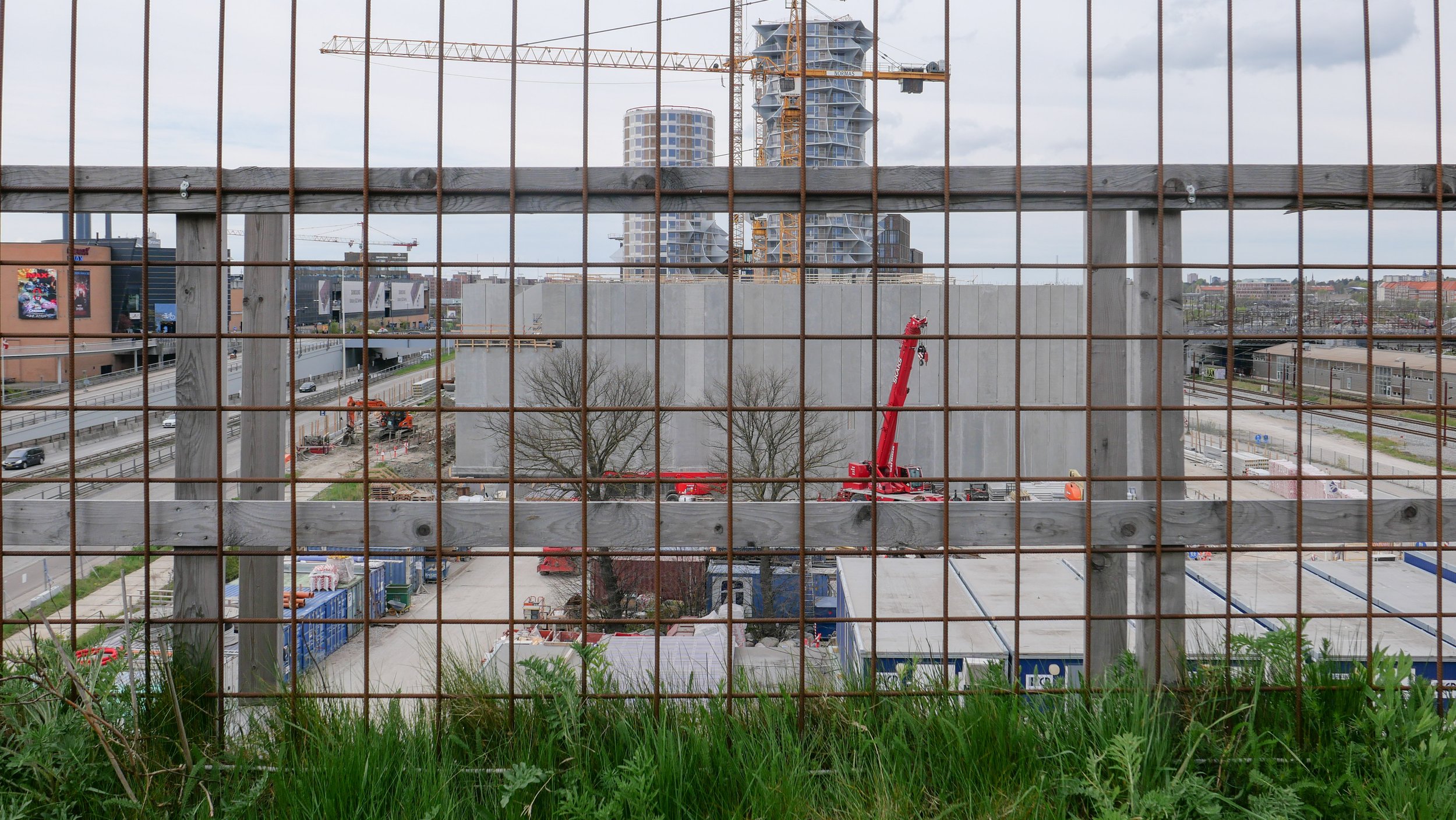
Yesterday, an article in the Danish newspaper Politken reported that planners and politicians in Copenhagen might have come to a decision on the fate of Bispeengbuen - the section of elevated motorway that runs down the border between Frederiksberg and the Nørrebro district of Copenhagen.

One of several major schemes to improve the road system in the city in the late 1960s and 1970s, Bispeengbuen was planned to reduce delays for traffic coming into the city from suburbs to the north west.

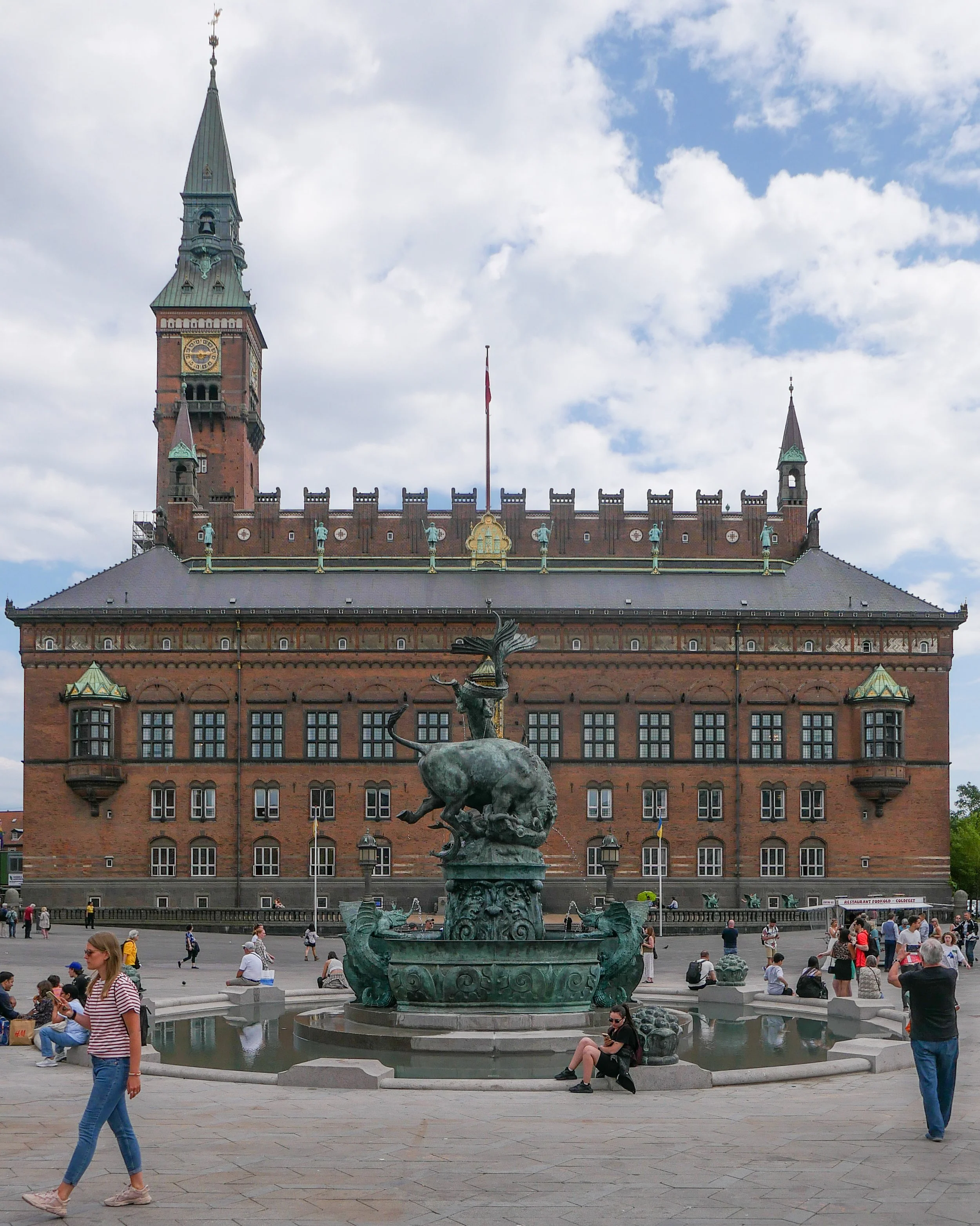
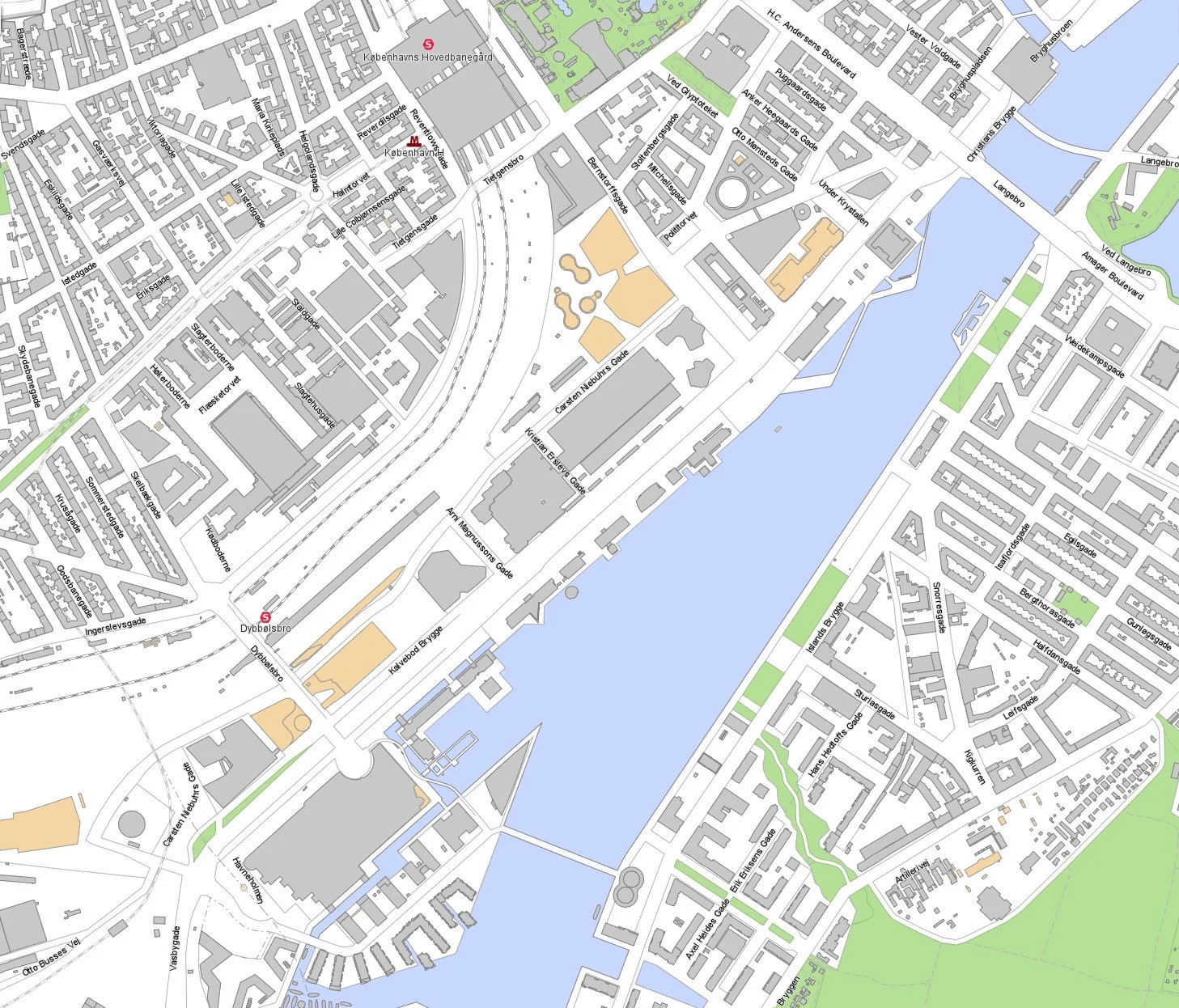
At the south end of the elevated section, at Borups Plads, traffic, heading into the city, drops back down to street level and continues first down Ågade and then on down Åboulevard to the lakes and, if it is through traffic, then on, past the city hall, and down HC Andersens Boulevard to Langebro and across the harbour to Amager.

Between the elevated section and the lakes, the road follows the line of a river that, from the late 16th century, had flowed through low-lying meadows - the Bispeeng or Bishop's Meadow - and brought fresh water in to the lakes. In 1897, the river was dropped down into a covered culvert and it still flows underground below the present traffic.

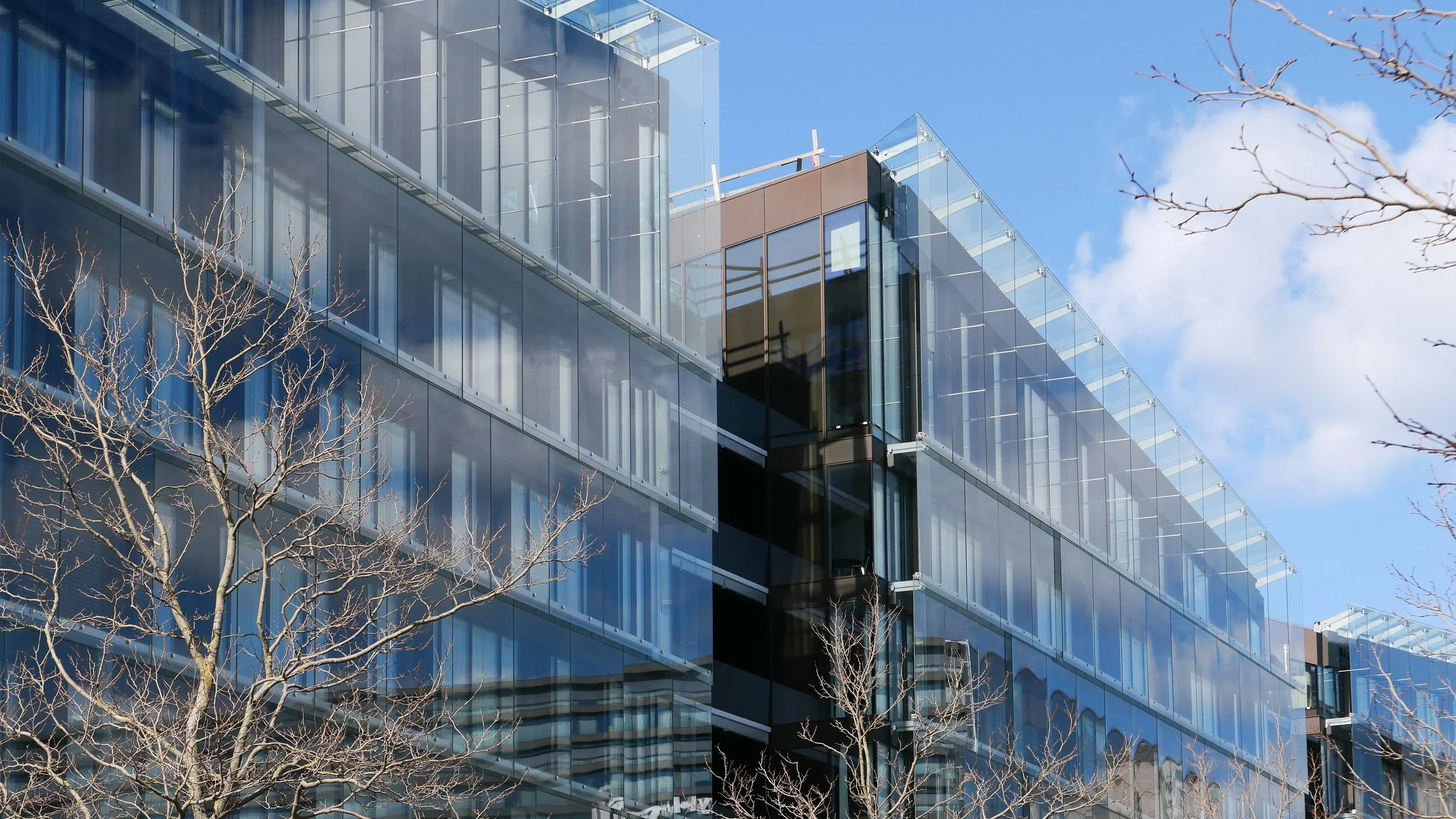
From the start, the elevated section was controversial as it cuts past and close to apartment buildings on either side - close to windows at second-floor level - and the area underneath is gloomy and generally oppressive. Traffic is fast moving and generates a fair bit of noise and it forms a distinct barrier between the districts on either side.

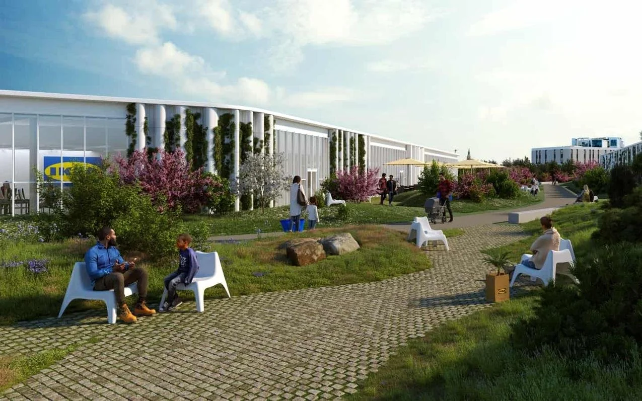
There has been an ambitious plan to drop the road and its traffic down into a tunnel with the river brought back up to the surface as the main feature of a new linear park. The full and very ambitious plan - for ambitious read expensive - was to extend the tunnel on to take all through traffic underground, to Amager on the south side of the harbour.

There has been talk of a less expensive plan to demolish the elevated section, to bring all traffic back down to street level, which would be cheaper but would not reduce the traffic and would leave the heavy traffic on HC Andersens Boulevard as a barrier between the city centre and the densely-populated inner suburb of Vesterbro.

This latest scheme, a slightly curious compromise, is to demolish half the elevated section. That's not half the length but one side of the elevated section. There are three lanes and a hard shoulder in each direction and the north-bound and city bound sides are on independent structures. With one side removed, traffic in both directions would be on the remaining side but presumably speed limits would be reduced - so, possibly, reducing traffic noise - and the demolished side would be replaced by green areas although it would still be under the shadow of the surviving lanes.

It was suggested in the article that this is considered to have the least impact on the environment for the greatest gain ... the impact of both demolition and new construction are now assessed for any construction project.

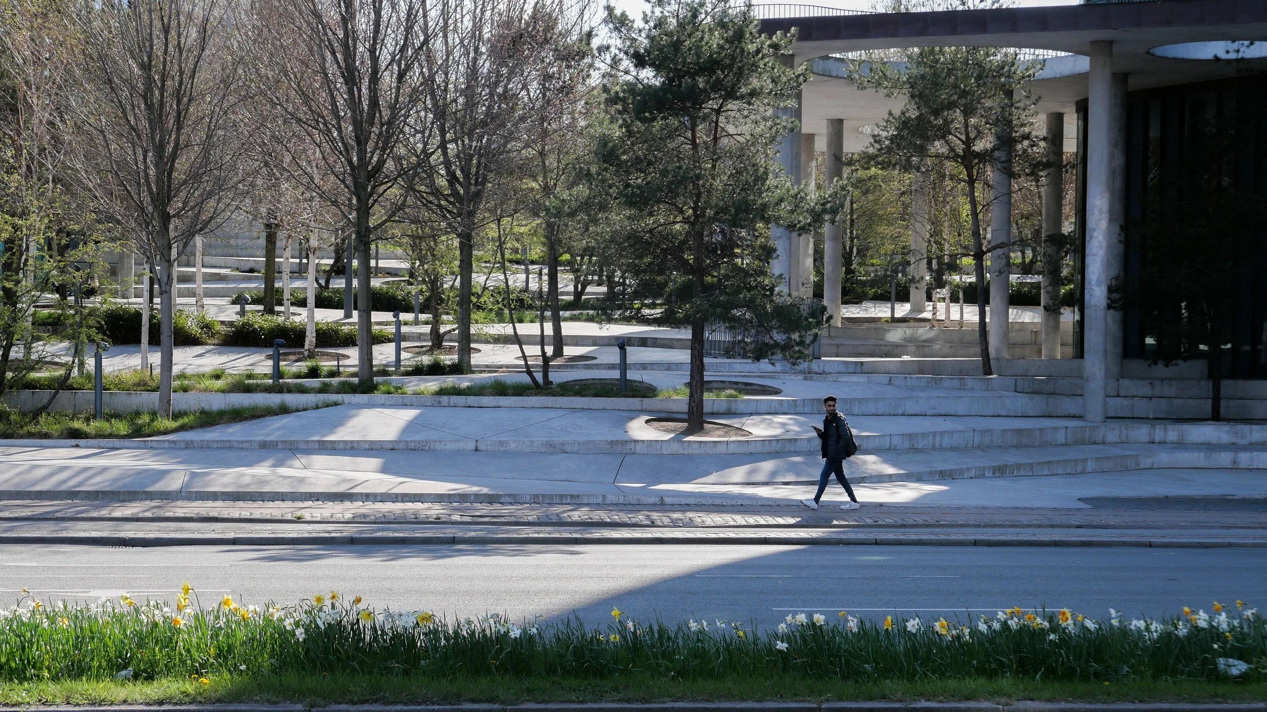
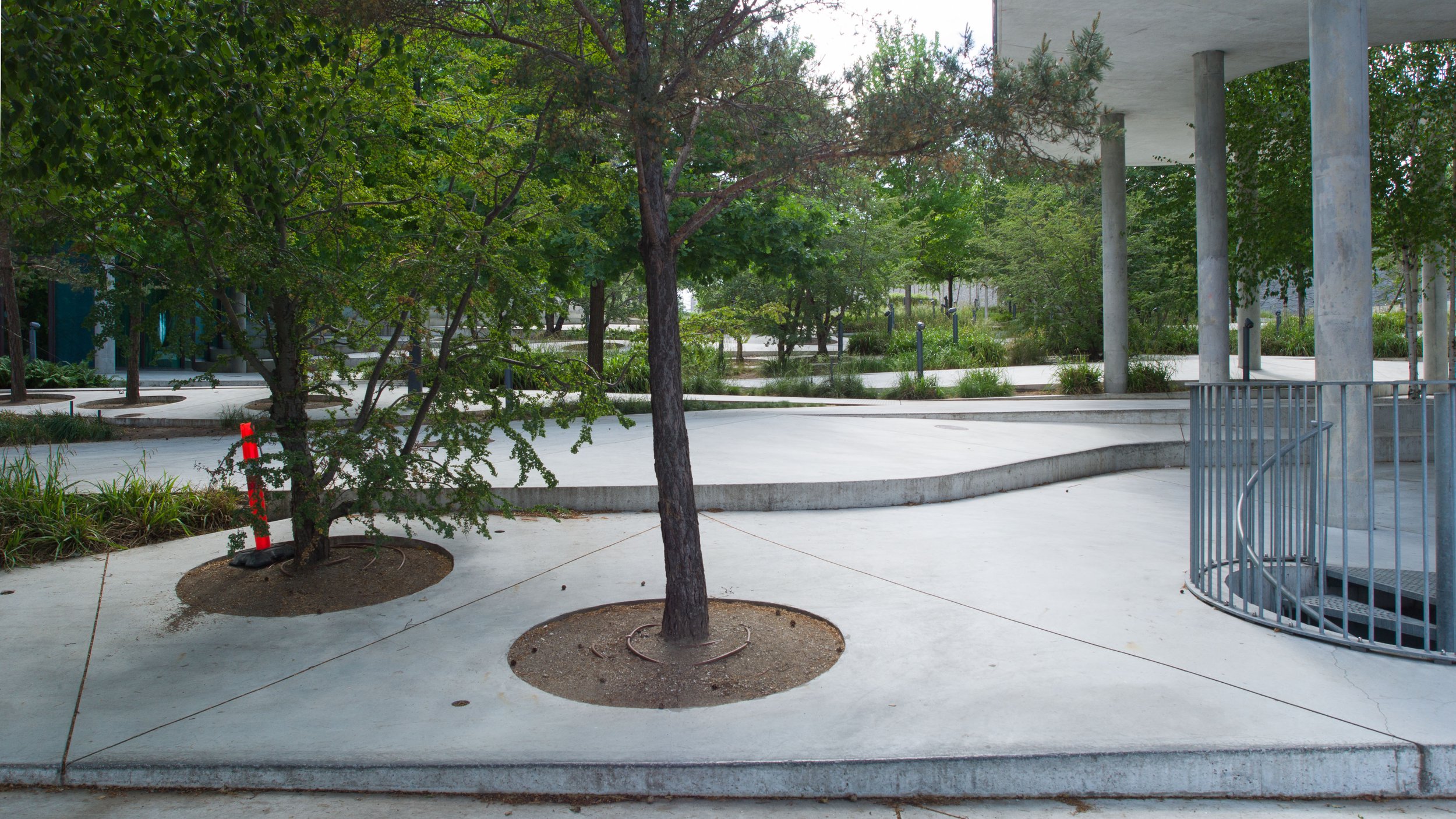
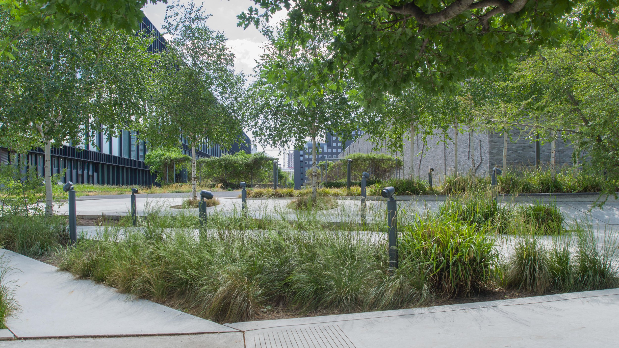
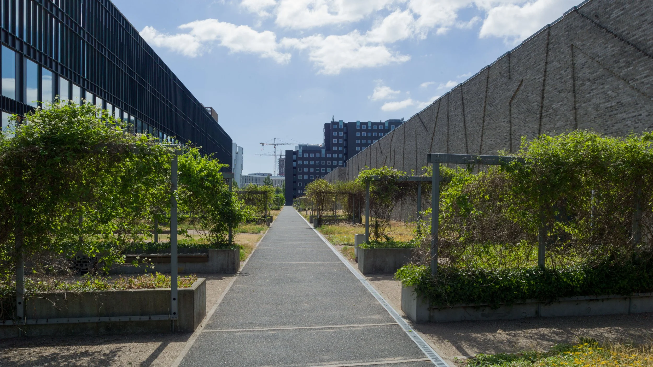
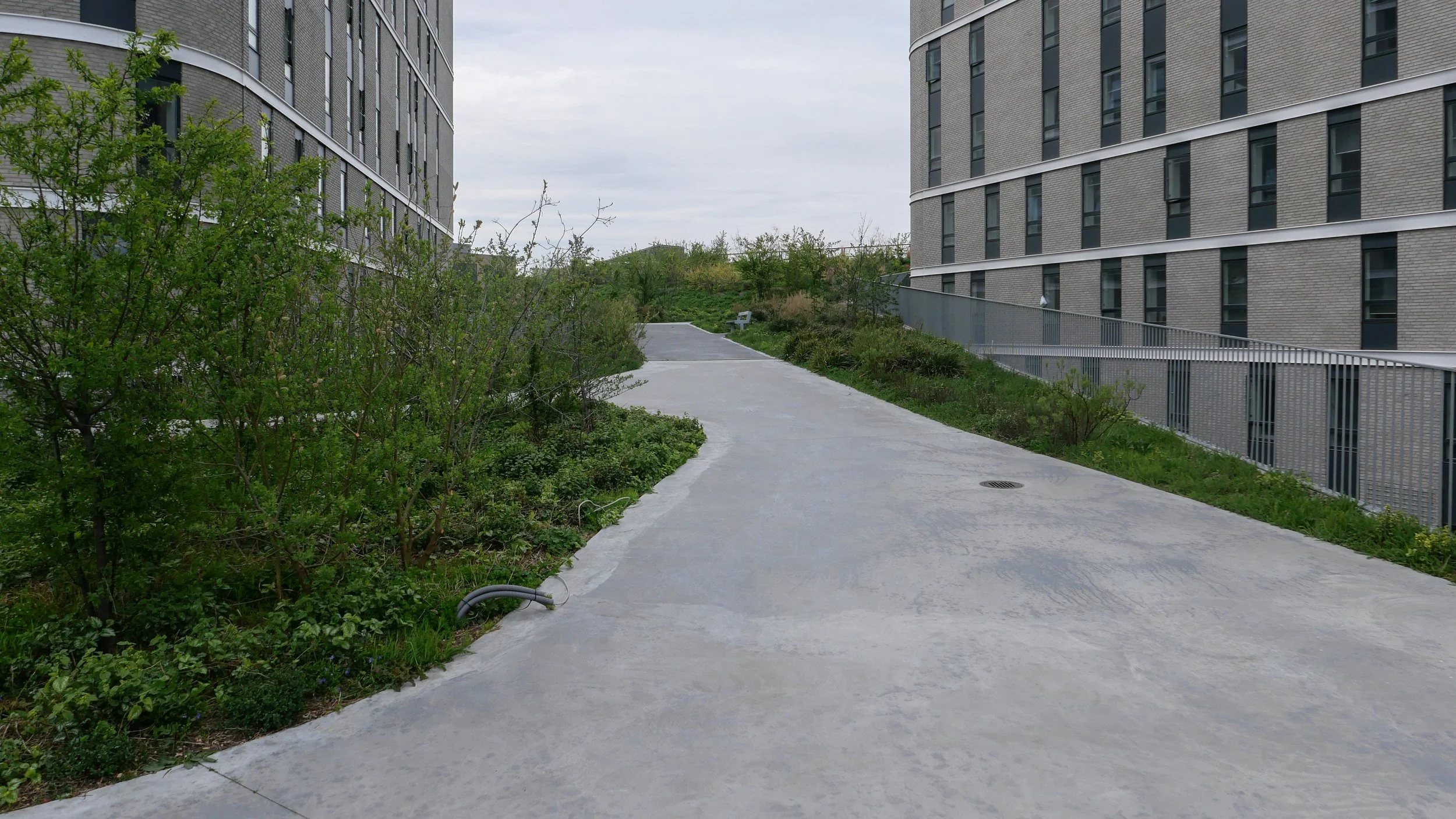
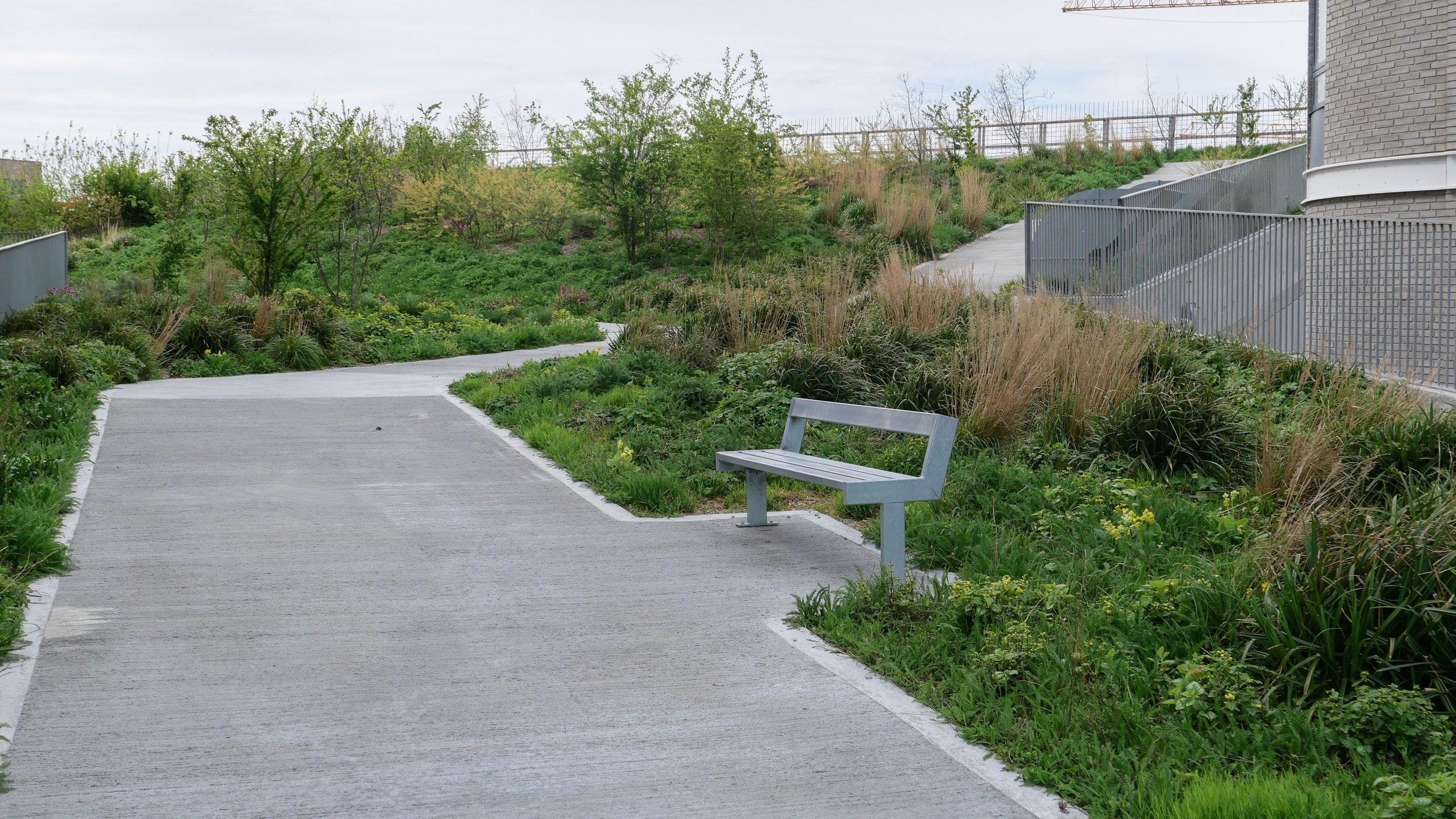
There is already a relatively short and narrow section of park on the west side of the highway, just south of Borups Plads, and that is surprisingly quiet - despite alongside the road.

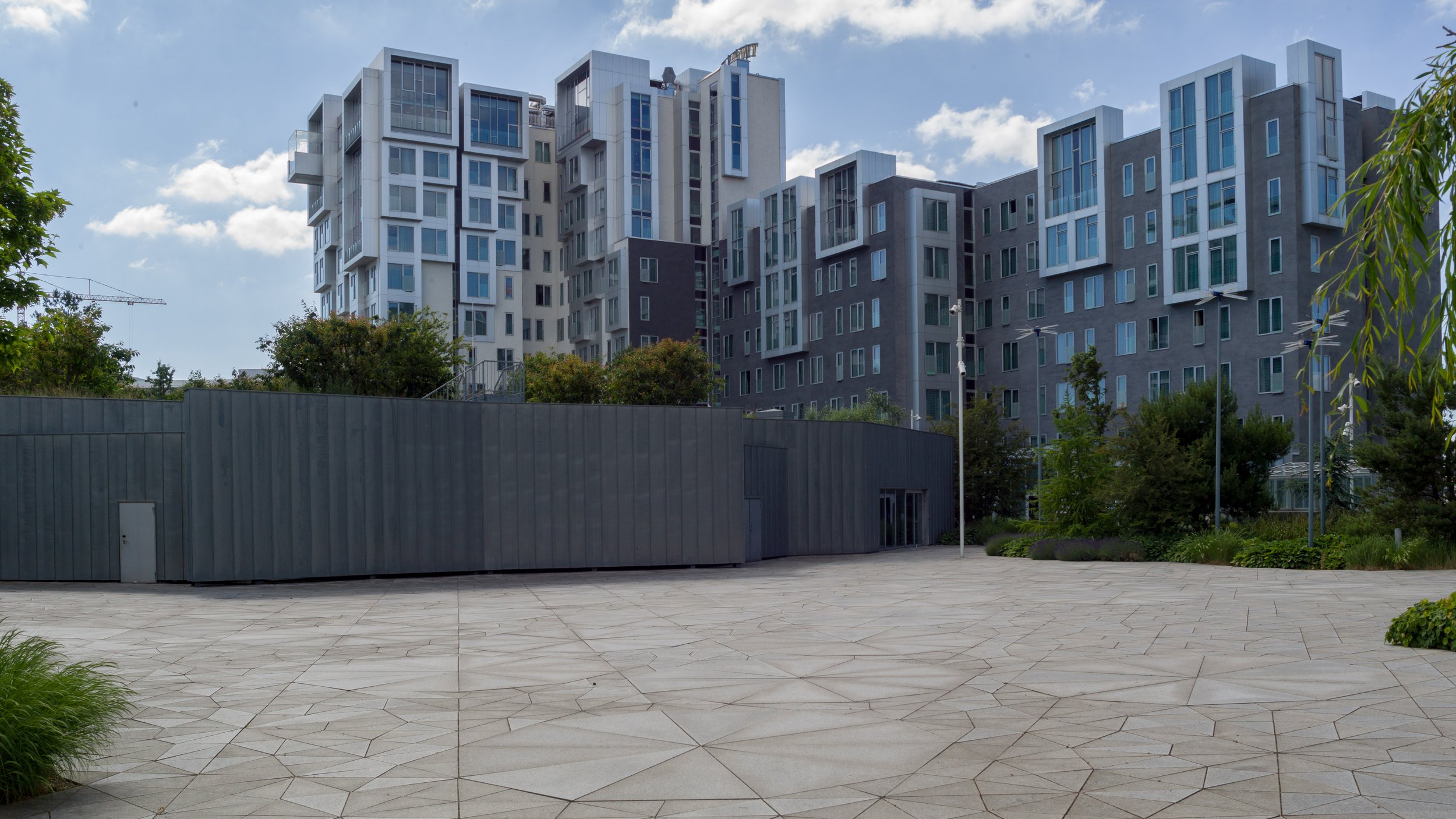
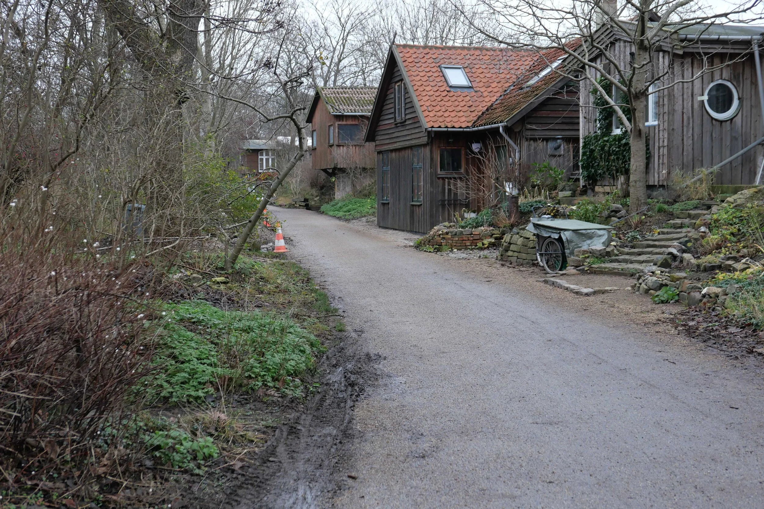
On both sides of the road, housing is densely laid out with very little public green space so it would seem that both the city of Copenhagen and the city of Frederiksberg are keen to proceed. Presumably they feel half the park is better than none although I'm not sure you could argue that half an elevated highway is anywhere near as good as no elevated motorway.

The situation is further complicated because the highway is owned and controlled by the state - as it is part of the national road system - so they would have to approve any work and police in the city may also be in a position to veto plans if they feel that it will have too much of an impact on the movement of traffic through the area.

update - Bispeengbuen - 14 January 2020
update - a road tunnel below Åboulevard - 15 January 2020

note:
Given the brouhaha over each new proposal to demolish the elevated section of the motorway, it is only 700 metres overall from the railway bridge to Borups Plads and it takes the traffic over just two major intersections - at Nordre Fasanvej and Borups Allé -  where otherwise there would be cross roads with traffic lights. I'm not implying that the impact of the road is negligible - it has a huge impact on the area - but, back in the 1960s, planners clearly had no idea how many problems and how much expense they were pushing forward half a century with a scheme that, to them, must have seemed rational.

My assumption has been that the motorway was constructed, under pressure from the car and road lobby, as part of a tarmac version of the Finger Plan of the 1940s.

The famous Finger Plan was an attempt to provide control over the expansion of the city, and was based on what were then the relatively-new suburban railway lines that run out from the centre. New housing was to be built close to railway stations and with areas of green between the developments along each railway line .... hence the resemblance to a hand with the city centre as the palm and the railway lines as outstretched fingers.

Then, through the 1950s and 1960s, the number of private cars in Copenhagen increased dramatically and deliveries of goods by road also increased as commercial traffic by rail declined.

I don't know who the traffic planners were in Copenhagen in the 1950s and 1960s but, looking back, they barely appreciated old building or existing communities, and, presumably, looked to LA and, possibly, to the Romania of Nicolae Ceaușescu for inspiration. Their ultimate aim, in their professional lives, seems have been to design a perfect motorway intersection where traffic flowed without any delays.

They wanted to build a motorway down the lakes and when that was thwarted they proposed a massive motorway system that was to be one block back from the outer shore of the lakes - sweeping away the inner districts of Østerbro and Nørrebro - and with new apartment buildings along the edge of the lake - between their new motorway and the lake - that would have formed a series of semi-circular amphitheatres looking across the lakes to the old city. The whole of the inner half of Vesterbro, including the meat market area, and the area of the railway station would have become an enormous interchange of motorways where the only purpose was to keep traffic moving.

We have to be grateful that few of those road schemes were realised but there is also a clear lesson that, however amazing and visionary a major plan for new infrastructure may appear, it can, in solving an immediate problem, create huge problems for future generations to sort out.

approaching the elevated motorway from the south
the motorway from Ågade on the east side
the motorway crossing Borups Allé

the river close to the lakes at Åboulevard but now in a culvert below the road

Bispeengbuen under construction showing how it cut a swathe through the existing neighbourhood - city archive 50675

the earlier proposal to bury the road in a tunnel and bring the river back up to the surface as the main feature of a new linear park

small area of park on the west side of the road

clapping for Lynetteholm stops

Work on dredging in the entrance to the harbour, for the construction of the man-made island of Lynetteholm, has been stopped because further reports are now required on the environmental impact of dredging polluted sludge from the site and taking it down the coast to the bay at Køge to dump.

There is growing criticism of the new island and it has become a contentious issue in both parliament and in the press because criticisms or, at the very least least concern, from the Swedish government about the construction work and the island itself was not revealed when a construction act for the work was debated and passed in the Danish parliament.

work to start on dredging for the construction of Lynetteholm January 2022

note:
When I wrote about Lynetteholm in the New Year, I had to confess then that I was not sure what the Danish term klapning meant or rather what it means specifically in this context when clearing the sea bed of sludge by dredging.

The word used in all newspaper articles was klapning but dictionaries and Google always gave me clapping as the English translation but neither word was used in general articles on dredging.

Finally I tracked down the answer.

When sludge is dredged up to clear a channel or, as here, to form a stable base for constructing a man-made island, the sand and mud can be loaded onto large open barges or ships and they sail down the coast where, over a designated site, they open large flaps on the underside of the hull to release the sludge. Those flaps can be opened and closed several times to dislodge everything .... hence clapping. Obvious now I know.

looking out from Nordhavn to the Sound
at the centre of the view is Trekroner Fortet - the Three Crowns Fortress - built in the 1780s to guard the entrance to the harbour

the new island will fill the whole horizon beyond the fort with just a narrow channel for boats to enter and leave the inner harbour

by 2070, when building work on the island is set to be completed, this view will be filled by the skyline of new housing for 35,000 people


is the area around Kalvebod Brygge the new hotel quarter of Copenhagen?

the water front of the south harbour from Amager with the new Hotel Cabinn to the left, the white towers of the Tivoli Congress Center behind the office buildings and the Copenhagen Marriott to the right

At the city end, Kalvebod Brygge starts just south of HC Andersons Boulevard and Langebro and runs in a straight line to Otto Busses Vej - just beyond the Fisketorvet shopping centre - a distance of 1.6 kilometres. This is a wide and busy dual carriageway that from the 1960s has been the main road into the city from the south.

As part of the first redevelopment of the south harbour, in the 1990s, the quay was extended out into the harbour and a line of fairly characterless office buildings were constructed. The city was almost bankrupt and development of the port was crucial so the development allowed does not not make the most inspired use of the harbour - and certainly not as it is now - although buildings at the city end of Kalvebod Brygge, around a square south of Hambrosgade, are more distinguished.

As an area, the streets and squares north of Kalvebod Brygge form a rather odd shape that is 550 metres deep at the city end - from the harbour along HC Andersens Boulevard to the south-east corner of Tivoli - but the main railway tracks take out a great arc from the north-west side so that at the south end - at Otto Busses Vej - the area is only 200 metres deep from Kalvebod Brygge back to the railway.

The first large hotel in this part of the city was the tower of what is now the Danhostel - on HC Andersens Boulevard, against the south side of Langebro. When it opened in 1955, it was the tallest building in Copenhagen and was called the Europa Hotel.

The Copenhagen Marriott, 270 metres from Langebro, was designed by PLH Architects, and opened in 2001 and Copenhagen Island - a large hotel, close to a shopping centre at Fisketorvet designed by Kim Utzon - opened in June 2006.

By far the largest hotel complex is the Tivoli Congress Center, on the railway side of Kalvebod Brygge, with all three large blocks designed by Kim Utzon The Hotel Wakeup and the Hotel Harbour Tower were built in 2009 and the City Tower in 2016.

Recently, two new luxury hotels have opened at the north edge of the area, close to Tivoli, with the Nobis Hotel in the old building of the Danish Academy of Music on HC Andersens Boulevard and Villa Copenhagen in a prominent circa 1900 building that was the offices of Danish Post Office.

To these have now been added The Cabinn Hotel on Kalvebod Brygge - probably the ugliest building in the city from the last few years - and the recently-opened Next House Hotel, again by Kim Utzon. The next hotel in the area will be the Scandic Spectrum on Kalvebod Brygge by Dissing+Weitling that will open in June.

In a number of posts, I have written that I feel strongly that the dramatic and rapid rise in the number of tourists coming to the city and the construction of a large number of new hotels in the city over the last decade is one of the biggest threats to the character of the Copenhagen but one that is barely discussed by politicians.

The arguments for would probably be the creation of jobs, inward investment and money spent by tourists in the city in shops and at tourist destinations.

My argument against is that the huge number of tourists and, of course, all the passengers from cruise ships - just under a million in 2019 in the year before the pandemic - are swamping the city and changing the character of Copenhagen.

If you think that the number of new hotels around Kalvebod Brygge is hardly a tidal wave then maybe consider the figures. In just this one part of the city, many of the hotels are not just large but several of them are run as hostels with family or group rooms with four or more beds. Obviously that, in itself, is not a bad thing, but In just this part of the city, at a conservative estimate, there are rooms and beds for 13,500 visitors a night if you assume that there could be two people in most rooms. Not all of the rooms will be occupied on any one night but, before the pandemic, Copenhagen had occupancy rates of 80% and I am sure that all the hotels will be aiming to get back to that level as soon as possible now that pandemic restrictions have been eased.

If 13,500 does not sound like a particularly large number of tourists then consider that only 10,000 people are permanent residents in Christianshavn so, just in theory, every single person living in Christianshavn could march over Langebro and, together, they could have a weekend away. I can actually think of better ways to bond and the irony is that, of all the areas in the city, Kalvebod Brygge is probably the least likely part of the city that residents of Christianshavn would visit … unless they were cutting through to Vesterbro.

the first number is rooms and, for the hostel hotels, the second number is beds

Although this area along Kalvebod Brygge is close to Ny Carlsberg Glyptotek and close to Tivoli, there are few other attractions for tourists in the immediate area. The buildings along the quay are some of the most boring modern buildings in the city but the harbour here is relatively wide and sheltered. If city planners want to make a success of this area and if, as they have said, they want to divert tourists away from the key sites, like Nyhavn, that now get very crowded, then they should consider extending pontoons out into the harbour with historic ships moored here and with restaurant ships here rather than in Nyhavn as proposed by some.

There might be an appropriate sailing ship to convert to a youth hostel - so a Copenhagen version of the Af Chapmann in Stockholm - or a group of the Urban Rigger floating shipping containers, designed by Bjarke Ingels as accommodation for students, could be moored here.

In theory, if the pandemic really is beaten and if tourists return, and if hotels get back to 80% occupancy rates, then around 4 million tourists a year could be staying in just this relatively small area of the city so it might be an idea to give them something to see and something to do.

is the growth of tourism in the city a threat? January 2022

Kalvebod Brygge - the main road between the harbour and the railway - before the south harbour was redeveloped

looking north towards Langebro from the cycle and foot bridge that crosses from the shopping centre at Fisketorvet to Amager
the white tower of the Tivoli Congress Center rises above the office buildings along the quay and the Copenhagen Marriott is in the distance

Copenhagen Marriott to the left, on the quay, by PLH Architects 2001
and in the gap - Scandic Spectrum by Dissing+Weitling that will open in June

Tivoli Congress Center - Tivoli Wakeup by Kim Utzon 2009

Tivoli Congress Center - City Tower by Kim Utzon 2016

Hotel Cabinn Copenhagen, 2019 with 1202 rooms and 2,645 beds

Next House, by Kim Utzon 2022

Scandic Spectrum by Dissing+Weitling to open in June 2022


det grønne strøg / the green line - the high-level landscape of Kalvebod Brygge

An ambitious plan to create a raised landscape at a high level between new buildings on the railway side of Kalvebod Brygge was set out in the local plan of 2006 where it was described as if it was to be a series of hills.

The first part of the gardens, at the north end - with a steep slope up from Bernstorffsgade, between the towers of the SEB offices, was completed in 2009 and the gardens were soon extended on across the roof of a new archive building and through to the Tivoli Hotel and Congress Center. Then the new developments stalled.

The west end of the landscape gardens, through the Nexus building, has just been planted but construction work on the middle section, across the roof of a new IKEA store, has only just restarted.

All these new buildings, that frame the gardens, are between Kalvebod Brygge and Carsten Niebuhrs Gade and, when finished, the high-level landscape will extend for over a kilometre from Bernstorffsgade to a new railway traffic control tower on Otto Busses Vej.

Lokalplan nr. 403 "Rigsarkivet" 2006

the landscape scheme starts at Bernstorffsgade at the SEB buildings
a winding concrete path climbs up a steep slope from the road with well established trees

this sequence of photographs shows the gardens from Bernstorffsgade to Arni Magnussons Gade and the bridges across to Hotel Cabinn

At the city-centre end, at Bernstorffsgade, the landscape starts at street level with pathways twisting from side to side to climb up between the SEB buildings to a point 7 metres above the level of the pavement.

There is then a wide bridge that crosses a service road for the State Archive and the gardens continues between the archive stores on the side towards the railway and a newly-revamped office building, now known as KB32, on the Kalvebod Brygge side. That straight section of garden, 190 metres long and 29.6 metres wide, is 8 metres above the pavement of Kalvebod Brygge.

Maintaining that level, there is a single narrow bridge over another service road before the gardens open out between the towers of the Tivoli Hotel and Conference Centre.

Beyond the Tivoli hotels, there is a slightly odd and over-complicated series of narrow bridges - with handrails that would grace a multi-storey car park - that cross a wider street called Arni Magnussons Gade. It is a dual carriageway that will be the access to a new bus station between Carsten Niebuhrs Gade and the railway.

Here, the landscaped area first forms the canopy over the entrance to the Hotel Cabinn before the garden then climbs up steeply between the two towers of the hotel where it now ends abruptly at a fence before the next section where work has just started on building a new IKEA store.

There, about 17 metres above the pavement of Kalvebod Brygge, the garden or "green lounge" on the roof of IKEA will be level and will cross over Dybbølsbro.

Then, between the two towers of Kaktustårnene or The Cactus Towers designed by Bjarke Ingels, the gardens will drop down at a very steep angle to the entrance level to the two blocks of the new Nexus building and then, between the those two office blocks, drop down again to end at the level of Carsten Niebuhrs Gade.


map from 2006 in Kalvebod Lokalplan 403 with the different stages of the development of this area from the SEB site at I through to the IKEA site at IV ….
then, the green line was only to extend as far as the area where Kaktustårnene are, beyond Dybbølsbro, but not the site of the railway control tower

①  Danske Banks Hovedsæde / headquarters for Danske Bank by Lundgaard & Tranberg - under construction
②  SEB Bank & Pensions by Lundgaard & Tranberg 2008-2011 and The City Dune by SLA design studio
③  Rigsarkivet / State Archive by PLH Arkitekter
④  KB32 by Vilhelm Lauritzen Architects and JJW ARKITEKTER completed in 2021
⑤  Tivoli Congress Centre by Kim Utzon 2009-2016
⑥  Hotel Cabinn 2019
⑦  IKEA store by Dorte Mandrup - under construction
⑧  Kaktustårnene / The Cactus Towers by Bjarke Ingels - under construction
⑨  Nexus for Energistryrelsen Trafikstyrelsen and Banedanmark by Arkitema 2014-2019
⑩  Trafiktårnet Øst / Railway control tower by Tranberg Arkitekter 2013-2015

A Bernstorffsgade B Carsten Niebuhrs Gade C Kalvebod Brygge D proposed bus station E Dybbølsbro F Fisketorvet G Metro station opens 2024


the gardens on the steep slope where they climb up between the towers of Hotel Cabinn

from the bridge over Arni Magnussons Gade, the gardens climb steeply up to a temporary fence where the gardens will continue on over the roof of a new IKEA store


details of the planting and concrete paths on the slope up from Bernstorffsgade between the two SEB buildings by the landscape designers SLA

Planting is well-established between the SEB buildings with a good selection of trees, many with decorative bark, and with some that have grown up through large holes in the prominent concrete canopies of the buildings. Narrow slots in the concrete path channel away rain water that is recycled for watering the trees and shrubs.

Across the roof of the archive, the design is more architectural with low planting and trellis that form a sequence of simple spaces with seating. The gardens help control the temperature and internal climate of the archive.

The section through the Tivoli Hotel has well-established shrubs and trees but the spaces could be better used. This is one area that might be treated like public squares and might even be used to host events. It would also be the one place, along the length of the gardens, that might benefit from a small coffee bar or cafe although, generally, the main character of the gardens is that it is quiet or peaceful ... when taking some of these photographs on a Sunday morning, only two people walked through and there were birds singing loudly in the trees.

The steep path up between the towers of Hotel Cabinn has no trees and although the low planting is good - with a variety of leaf types and shrubs - the plants could be in bolder groups, to create a stronger architectural character against the stark buildings, rather than being scattered. There are benches at intervals up the slope where you can take in the views.

At various points through the gardens there are views out between the buildings to the railway and Vesterbro on one side and through to the south harbour on the other.

There are drawings of the proposed garden on the roof of the IKEA store but it is difficult to imagine how the areas of planting will then drop down the steep slope between the Cactus Towers although Bjarke Ingels has produced planted areas at a similar steep angle on the 8 Building in Ørestad and at Copenhill on the roof of the Amager Bakke incinerator.

Where the garden drops down again between the two blocks of the Nexus building, new planting has established itself quickly and there is an interesting concrete rill or channel to take rain water down through the garden.

Back at the city end, when finished, new headquarters for Danske Bank on Bernstorffsgade immediately north of the SEB towers, will have broad flights of steps up between the buildings to a new terrace overlooking the railway and this will be connected to the main landscaping by a bridge over Carsten Niebuhrs Gade between the SEB building and the Archive.

When finished there will be public access for the full length of the high landscape and with steps up to the gardens at several intermediate points.

new steps up to the gardens with Tivoli Hotel to the left and Hotel Cabinn to the right and with the cross road Arni Magnussons Gade between the two hotels


the gardens on the roof over the IKEA store with the two Catus Towers beyond

the far end of the gardens where it drops down between the two blocks of the Nexus building with a view of the new railway control tower beyond


Rigsarkivet / State Archive by PLH Architects 2009

A new store for the holdings of Rigsarkiv - the State Archive - was designed by PLH Architects and opened in 2009.

It was built across the back of the long concrete building of the Danish Railways freight building from the 1960s and was on the site of the train shed of the freight terminal building.

Externally the archive building reads as two parts - a flat-roofed section below and, in fact forming, the high-level landscaped garden and two large warehouse blocks in line with a gap between them on the back of the plot so along Carsten Niebuhrs Gade.

The street facade and the parts of the block visible above the garden are faced in yellow/grey bricks that is enlivened by a shallow but strong relief pattern that is inspired by runic lettering and is created by breaking forward courses of the brickwork by just 6 cm and the graphic effect is created by the shadow.

Inside the two tall blocks, there are enormous storage halls that are 15 metres high with racking that is 12 metres high. In total there are said to be 370 kilometres of shelving in the archive.

Windowless facades and the garden across the roof maintain the temperature and the microclimate of the storage facilities - crucial for the historic documents, books and maps stored here.

The courtyard between the two ranges is 190 metres long and just under 30 metres wide and the garden area is described by the architects as a green street although it is at the level of the second floor so 8 metres above the level of the pavement along Kalvebod Brygge.

The garden is open to the public with access from either the slope up between the buildings of the SEB offices to the north or from the upper garden of the Tivoli Conference Center and Hotels to the south and there is now also a new external staircase at the city end of the main office block that was added as part of the recent and extensive remodelling of the main freight terminal building along Kalvebod Brygge - now known as KB32.

PLH Architects
The National Archive

the two blocks of the archive store from Carsten Niebuhrs Gade


construction work has started for the new IKEA store in Copenhagen

Work has started on the construction of a new IKEA store on Kalvebod Brygge in Copenhagen - the main road running out of the centre and heading to the south west along the north side of the harbour.

The project, designed by Dorte Mandrup, was put on hold by IKEA for well over a year but parts of the concrete frame and the upper floors are now in place so you can see that it will be a substantial building.

The store will have a large garden across the roof that will continue a raised and landscaped walkway, started over ten years ago. When finished, there will be areas of garden above street level for over a kilometre from the SEB bank building by Lundgaard & Tranberg Arkitektfirma at Bernstorffsgade through to the new Cactus building by Bjarke Ingels - beyond the IKEA building on the west side of the bridge from Dybbølsbro Station to Fisketorvet - and then on to the new railway control tower at Otto Busses Vej.

The roof over the IKEA store has been described as a green lounge and there will be good views from here over the railway lines to Vesterbro to the north and to the city to the east.

Tall and thin concrete columns will support the canopy or bridge taking the garden over the top of Dybbølsbro and this strong vertical emphasis is taken across the main front of the store - on the front towards the railway - and around the pavilions that rise above the garden level.

This is a challenging site between the new Hotel Cabinn to the east and Dybbølsbro to the west - the high-level bridge that crosses from Vesterbro and the suburban railway station to the north to the shopping centre of Fisketorvet and the harbour to the south.

The site is about 65 metres deep and 240 metres from east to west - from the hotel to the bridge with a high raised bank across the south side that is the retaining wall for an exit slipway from Kalvebod Brygge and, to the north, on the other side of Carsten Niebuhrs Gade, are the tracks of the railway running in and out of the main station.

Dorte Mandrup

note: south to the top

left - the west end of the new store
centre - the slip road down to Kalvebod Brygge across the south side of the site
right - down the slip road and the buildings between Kalvebod Brygge and the harbour

friends and former colleagues accuse me of being uncritical of everything and anything if it’s Danish so, to redress the balance, I bring them here to Kalvebod Brygge to show them that Danish architects and planners can get it wrong …. very very wrong


below - the proposed IKEA store from the north with the bridge from Dybbøsbro station on the right and the Cactus building by Bjarke Ingels on the right edge and Hotel Cabinn on the left.
in the foreground is Carsten Niebuhrs Gade - between the main railway line and the IKEA site - and with the new bus station that is proposed for the strip of land against the railway.
Fisketorvet, with its distinct concave entrance, is beyond and the new metro station will be at the south-west end of Fisketorvet so to the far right
beyond the harbour is Amager


a new bus station to be built on Carsten Niebuhrs Gade


In March, Vejdirektoratet / the Danish Road Directorate, confirmed that a new terminal for long-distance buses will be built on the narrow strip of land between Carsten Niebuhrs Gade and the railway lines.

The land is about 500 metres long but only 20 or 25 metres deep from the edge of the road to the boundary fence of the railway so the buses will pull in and park at an angle.

The terminal will open in the Spring of 2023 and will replace bus stops closer to the main railway station that are along the pavement on Ingerslevsgade - the road on the inside curve of the railway tracks.

At Carsten Niebuhrs Gade, there will be 15 stands for buses with waiting facilities for passengers, including toilets and a kiosk, and there will be space for 200 bicycles to be left at the lower level and a lift up to the bridge to transfer to the suburban railway station at Dybbølsbro to the north or to a new metro station at the west end of Fisketorvet - the shopping centre to the south.

A report by the engineering consultants MOE from August 2019, showed details for traffic flow in and out of the bus terminal from Kalvebod Brygge with necessary road markings and lane markings at all the junctions. The bus terminal will deal with 195 buses a day and approximately 1.4 million passengers a year.

When completed, the terminal will be handed over to the city but will be run by the transport company Movia.

Vejdirektoratet
MOVIA

view along Carsten Niebuhrs Gade - looking east from under Dybbølsbro towards the new Hotel Cabinn.
the site for the new bus station and buildings along the railway are to the left and the site of the new IKEA store is to the right. The blank grey rectangle in front of the hotel is the end of the raised walkway waiting to be linked on to the garden across the roof of the IKEA store

Kalvebod Brygge to the top and the railway terrain to the bottom with Tivoli Congress Center, the bridges over Arni Magnussons Gade and Hotel Cabinn to the left and then the site where work on the new IKEA store has restarted and with the bridge from Dybbølsbro station to the Fisketorvet shopping centre on the right
the new bus station will be between the railway and Carsten Niebuhrs Gade


Det Grønne Strøg - the green line - will continue through Kaktustårnene / Cactus Towers

Kaktustårnene or the Cactus Towers at Dybbølsbro will not be finished until the summer and it is still difficult to see how the high landscape of Det Grønne Strøg / the Green Line will transition across from the roof of the new IKEA store - still under construction - and then drop down steeply to the level of the entrance to the NEXUS building.

From the street and from the shopping centre of Fisketorvet, you can see what appears to be a large, square slab of concrete set at a sharp angle at the base of the towers and that forms, in part, the roof of a large, open, lobby or entrance into the towers and supported on high and slender columns. Drawings show that there will be a sharply-winding path dropping down between the towers through planting.

The towers were designed by BIG - Bjarke Ingels Group - and they have experience of forming steep landscapes at 8Tallet in Ørestad and on the roof of the Bakke or incinerator which is steep enough for a ski slope.

When finished this summer, there will be 495 apartments in the towers that are wedge shaped and each has a striking and sharply-angled balcony.

There will be a few apartments with two rooms but most are single studio rooms of just 33 square metres and have been described as providing "Micro Living" so it is slightly ironic that publicity material promotes the location as next to a new IKEA store when the furniture in the apartments is fitted and with little space for anything else. They even seem to have a bed that is, it appears from drawings, to be a mattress on the large windowsill.

Marketing of the apartments is aimed at young, single, people and there will be communal spaces in the towers for meeting and eating but they might also appeal to professionals who want a base for working in the city during the week but return home at weekends.

Copenhagen has a chronic shortage of housing for students and for single young professionals so it will be interesting to see how quickly tenants are found but my guess is that living in Kaktustårnene will be popular and fashionable.

from the entrance to the shopping centre at Fisketorvet with the two round towers of Kaktustårnene still being fitted with balconies but with the lobby area on slender columns in place
straight ahead is Dybbølsbro - the bridge crossing the railway to the suburban railway station and to Vesterbro beyond
Det Grønne Strøg - the Green line - will be carried over the road with a bridge or bridges from the roof of the IKEA store

looking towards Kaktustårnene at the lower level of Carsten Niebuhrs Gade with the first stages of the IKEA building to the left showing just how high above street level the garden across the roof will be
Dybbølsbro runs across the view left to right with the lobby of the entrance and the towers beyond …. the public gardens of the Green Line will continue from the roof of IKEA to the roof of the lobby and then drop down at a sharp angle to the level of the entrance to the NEXUS building beyond

the green line continues through Nexus by Arkitema

Nexus is a large, new building where there are offices for five public agencies … Rail Net Denmark, the Danish Transport Authority, the Danish Road Directorate, the Danish Building Authority and the Danish Energy Agency.

From the air view, you can see that there is a complicated, clover-leaf arrangement of four blocks and each with an atrium. From the streets around and from the central 'courtyard' this underlying arrangement is not so obvious.

There are tight, outward-facing open courtyard on both sides of the building …. so on the north side, towards the railway, there is a relatively narrow courtyard with a main entrance from the street level of Carl Niebuhrs Gade and, on the opposite side, towards Kalvebod Brygge, there is a comparable open courtyard that appears to be primarily a light well for what would otherwise be a large and deep block.

Judging by eye, the south block of the four, has two corners set at right angles - so just one side - the inner side - is set at an angle. Two blocks have a single corner each that is at a right angle - the north block with a 90 degree angle towards the small courtyard on its east side and the east block with one external right angle, towards Fisketorvet. The west block has no right angles so there appears to be a game going on here.

It's partly about how someone understands the relationships of the blocks from the outside as they approach the building and in part its about how the view out from the offices is guided by the angle of the external wall.

Some upper levels step back at each floor and change angle slightly so. again, it is about how the blocks are perceived and it hints, unlike a sheer wall, that the building is turning or twisting. The set backs are too small to make much difference to the shadow thrown by the building.

With the garden through the centre of the building, as part of the green line, the visitor is drawn in by the angles narrowing towards a main entrance to the offices at the upper level but also, from the entrance, the angles opening out beyond shows you the way out and on down.

This is a very sophisticated combination of angles, levels and landscape that control and direct how people see the building but also how they move around and into the building.

Inside, the atriums, staircases, wide public areas and views out to courtyards and so on all suggest a flexible work environment and is very much about people move around even during the working day. This is a stark contrast to 'modern' Danish office buildings of the 1950s and 1960s like Søllerød Town Hall by Arne Jacobsen where the over-riding arrangement in the office building is a spine corridor with single-cell work spaces on either side and that is repeated on each floor.

The landscape of Det Grønne Strøg - the green line - runs through the centre of the building and reads as a steeply sloping green canyon that is quite enclosed with bridges across at upper levels

Workers and visitors coming from either Dybbølsbro and the suburban train station or by bike over the cycle bridge, coming from Islands Brygge, arrive at the top of the green street on the north side and there is a main entrance there but with views down the green landscape that drops down a series of zig-zag concrete paths with a concrete rill that will take rain water down alongside the path.

Through the length of the green line, a key part of the design is that all rain water is captured and reused for the plants and trees.

New planting is attractive but, until it becomes more established, it is difficult to judge but there is a good view down from the top to the new railway control tower beyond.

Arkitema - Nexus


from the air, the grouping of four blocks forms a clover-leaf arrangement with few right angles
the railway is to the North and Kalvebod Brygge and its slip roads to the south
the Cactus Towers are to the north-east and, when completed, Det Grønne Strøg or the Green Line will cross from the roof of the IKEA store - now under construction - and drop down a steep slope before continuing on through the Nexus building to the landscape around the new railway control tower

the SEB towers at the corner of Bernstorffsgade and Kalvebod Brygge were finished in 2011 and this was the first part of the green line completed … it’s where the landscape rises up a steep slope from pavement level to continue across the roof of the archive building
it is obvious that over a decade later, economic imperatives now determine the amount of land that is built on and the area of public space at Nexus is as tight as possible
in the initial Lokalplan of 2006, the Nexus site was set aside to be a park free of buildings but now open land in the city is seen as too valuable to be left fallow


the original scheme for the south or outer end of Det Grønne Strøg - the Green Line - was set out in a Lokalplan
then, what is now the Nexus site, immediately before the circular railway control tower, was to be left open as a park without any buildings
note that all the buildings were to have a dynamic and twisting outline with all upper floors setting back and the angle changing to reduce the oppressive outline of a tall block with sheer sides and to reduce shadow and reduce the impression of height from below
the two blocks set on either side of the green line on the left or south side of Dybbølsbro - labelled F and G - is the site of the two Cactus Towers by BIG that are now close to completion


Trafiktårnet Øst / Traffic Tower East by Tranberg Arkitekter

This is where the raised landscaped gardens of Det Grønne Strøg / The Green Line - drops back down to pavement level.

Det Grønne Strøg starts at the SEB towers over a kilometre away at Bernstorffsgade where a path winds up between two office buildings by Lundgaard & Tranberg and with the steep slope planted with trees.

That section of the landscape climbs up to 7 metres above the pavement and was completed in 2009 so the whole scheme has taken well over a decade to complete. In fact, the idea was conceived in 2006 in the local plan for the development of this area of office buildings and hotels along Kalvebod Brygge and there is still a large break in the middle where work has only just started on building a new IKEA store. That is where the garden will be across the roof of the store at the highest point of the green line.

The Traffic Tower is set on a grass mound and, at the outer edge, the landscape is raised just above pavement level with the garden area retained by Corten steel.

The tower is a regional control centre for Danish Railways and is built in dark brick … a reference to the extensive number of railways buildings and stations from the late 19th and the early 20th century that were generally in brick.

Using a brick that is almost mauve but with some bricks that are deep rust in colour gives the brickwork a texture and colour range without which a building of this size would look oppressive.

The brickwork is relieved by small, blind, recessed panels but the brick also continues across the windows as open grids that give the tower a more uniform look that emphasises the cylindrical shape and a gives a strong sense of security. These open grids of brick throw an attractive, broken or dappled light across the rooms behind.

The tower rises through nine floors with a double-height control room with balconies and with a high parapet that shields an open area of roof terrace used by staff and visitors.

Inside, the interior is light, mostly white, in contrast to the fortress-like exterior, but with areas of wood slats for acoustic control. There is an atrium that rises up through all nine floors and a dramatic spiral staircase through the full height.

The sculptor Henrik Plenge Jakobsen has created a bronze and steel African mask to the left of the entrance and designed a striking, geometric, tiled floor in the atrium, at the level of the entrance, that continues through into the canteen.

There is a second but smaller version of the tower - with five stories - in Fredericia.

Tranberg Arkitekter
Trafiktårnet Øst, København
Trafiktårnet Vest, Fredericia
Henrik Plenge Jakobsen

Traffic Tower East from the corner of Carsten Niebuhrs Gade and Otto Busses Vej

the garden is higher than the pavement on the north-west and south-west sides of the plot and the ground is retained by Corten creating a barrier between the street and the area of shrubs and trees.
the colour of the steel is a subtle contrast with the brickwork - that has rust-coloured bricks along with mauve - and the raw material is appropriate on what is, after all, an industrial site


plan of the Kalvebod Brygge high landscape with the Traffic Control Tower to the left and the SEB buildings at the right end
from the Local Plan 485 2016

Det Grønne Strøg


the landscape of Det Grønne Strøg starts over a kilometre away from the control tower and, when completed, will run from Bernstorffsgade to Otto Busses Vej.

Lokalplan 485 2016

the small, recessed panels act as a subtle version of string courses in 18th-century architecture by forming a horizontal band that indicates the floor levels and breaks what would otherwise be unbroken vertical emphasis

the large windows of the canteen are treated in a slightly different way with a broken and irregular grid of bricks

bronze mask to the left of the entrance by Henrik Plenge Jakobsen


The railway control tower is 42 metres high and it raises some interesting points about just how high buildings in the city should be and when and why high buildings should or should not be given planning consent.

Curiously, to me the control tower looks taller than its width but, in fact, the diameter is the same as the height so that would suggest that possibly we see and we are aware of height more acutely than width.

There is a fantastic free-hand sketch of an early concept on the architects online site but the idea of a simple cylinder set within a cube suggests that there is a strong geometric framework for the realisation of that idea.

When the green line of a raised landscape through the new buildings along Kalvebode Brygge was first proposed in the Lokalplan of 2006, there was a height restraint or glass ceiling of 36 metres for all the buildings although that was soon increased to a height limit for new buildings of 40 metres .... so very close to the height of the control tower.

Presumably, because this land was on former railway sidings, so potentially polluted, and partly because of the position, close to the city centre but between a busy road and the main railway into the city, this was designated to be a business district rather than being zoned for housing or recreation but the aim was to ….

create an urban business area that appears green and natural’ ...
The green line must clearly appear as the areas "lifeblood" and must clearly make visible the whole underlying idea.

Basically, the green landscape was to be the key element of the area that should be visible and obvious.

However, by 2011, a new Lokalplan had increased the limit on the height of the buildings to 47 metres but the suggestion was still that upper floors should be set back in a series of steps to reduce the visual impact, when seen from below, and to control the amount of shadow thrown across the area and across nearby buildings. It is also obvious that the buildings as realised are larger in terms of footprint than those suggested in the Lokalplan. In realisation, the planted area of the landscape was reduced in area.

The Hotel Cabinn is 32 metres high and the IKEA store will be 26 metres high but several of the buildings along the Kalvebod development have broken through those original height restrictions.

The Tivoli Congress Center is 48 metres high and the two round towers of Kaktustårnene by Bjarke Ingels - now being fitted out and due to open soon - are 60 metres and 80 metres high and the Post Towers, on the site of the old post office buildings at Bernstorffsgade - immediately north of the start of the green line and to be completed by 2027 - will be 67 metres, 93 metres and 115 metres high.

a high-rise tower building not just throws shadows across nearby streets but often disrupts the street pattern of historic areas but it can also have a huge and detrimental impact on views from and along historic streets

Vesterbro is a densely built residential area with apartment buildings that date generally from around 1900
the towers of the new Carlsberg development can be seen as the focal point of many streets and not in a good way
the railway control tower is on the far side of the railway tracks and , because of its relatively modest height - if you call 42 metres modest - it does not loom over the streets that look towards it and the restrained colour of the brickwork reduces the impact
this is the view of the tower from Vesterbro down Arkonagade


an introduction to the historic buildings of the Carlsberg Brewery ....

The site of the Carlsberg brewery in Copenhagen is not just large - by 2008, when brewing here ended, the brewery covered some 33 hectares - but it is also a complicated industrial site that evolved over a period of 150 years as both the technology of brewing on a large scale - so brewing on a truly industrial scale - developed and as the company expanded.

The basic story might appear to be fairly straightforward: a new brewery was established here in 1847 and brewing continued on the site until 2008 but this is not simply the story of a brewery. For a start, there were three separate breweries here.

read more

JC Jacobsen established a brewery here with the first beer brewed in November 1847
photograph from Copenhagen city archive 65539

new apartment buildings on Papirøen at the centre of the inner harbour

On Papirøen - Paper Island - the new apartment buildings designed by COBE are now rising rapidly and beginning to dominate the inner harbour.

The square island is in a prominent position opposite the entrance into Nyhavn from the inner harbour and opposite Skuespilhuset - the national theatre - and  just north of the inner harbour bridge and just south of the opera house and the new opera park that was also designed by COBE.

The recent growth spurt of the construction work on the apartments is easy to understand. Massive excavations, for foundations and piling to support the new buildings, seemed to take a very long time but now, having reached the level of the quay, it has simply been a matter of bringing in all the slabs of concrete and the ready-formed balconies and the facing panels of fawn brick and lifting them into place.

It's the ubiquitous method for building now ....
drop off and slot in building.

But now most of the blocks are close to their final height, you get a sense of just how much this massive development will dominate this part of the harbour.

The distinct tapered silhouette with, what are in effect, abnormally extended roof slopes, cannot disguise the fact that the main block, set above a very high main floor, rises to the equivalent of 12 floors and on the east side, the side away from the harbour, the new buildings now swamp the 18th-century naval buildings of the Arsenal and the mast sheds beyond.

It is now even more difficult to appreciate the overall scale and the importance of the naval buildings that, over a distance of more than 700 metres, would have formed such an impressive backdrop to the vast area of open water where, through the 18th century, the great Danish naval fleet was anchored.

What is now called Papirøen actually had a second mast crane on the west side, towards the city, but otherwise seems to have been relatively open and was where naval officers arrived as they came by boat to join their ships ... coming over from the administrative buildings of the navy and the main ship yards that were then north of the royal castle in the area of the city between Holmens Kirke and Nyhavn.

the 18th-century warehouse of Nordatlens Brygge from the south west with the development of Kroyers Plads, also by COBE, to the right and the site of the Papirøen development to the north of the warehouse to the left of this view

COBE, on their web site, imply that the main inspiration for the new buildings came from looking at the old warehouses along the harbour although the new blocks have none of the dignified and restrained grandeur of, for instance, Nordatlantens Brygge just to the south of the Papirøen site and the very deep balconies framed by concrete uprights and the slightly odd shifting across of the position of windows and balconies on alternate floors across the south side - to create a slightly restless chequerboard effect - are closer in visual effect to the large development on Dronningens Tværgade from around 1950 that were designed  by Kay Fisker. Certainly not a bad model but possibly not a good one as Fisker was clearly and openly proud of his tall blocks whereas the Papirøen blocks are trying to disguise their height and, to some extent, must be trying to mitigate the shadows these very large buildings will throw across surrounding properties and across the courtyard at the centre of the development. 

the new apartments looking across the harbour from Skuespilhuset - from the board walk of the national theatre - two views from the Holmen side of the harbour - from the north east and from the south east - and the development from the south west - from the inner harbour bridge with the opera house beyond

the west side of the devlopment with the opera house beyond and (below) the apartments at Dronningens Tværgade by Kaj Fisker

the south side of the new apartments (above) and the north side of the square at Dronningens Tværgade by Kaj Fisker (below)

Newspaper printing works in the city stored their paper in the post-war concrete warehouses here - hence the popular name of the island- but after the warehouses closed, the buildings were used for car parks, for temporary gallery spaces - Copenhagen Contemporary, now out at Refshaleøen, started life here - and &Tradition had their first store out here and the COBE studio themselves had studio space in the warehouses.

But the main use for the concrete buildings on the side towards the harbour was for an incredibly popular food hall that thrived despite being in a slightly awkward place ... it was quite a long walk to get here before Inderhavnsbroen - the inner harbour bridge - was finished.

The food halls are set to return to the island - to the spaces on the ground floor - but these apartments will be some of the most expensive in the city so it will be interesting to see if they can coexist happily as neighbours.

It's probably unfair to criticise the building while so much is unfinished and a wide board walk around the buildings and a new swimming pool complex at the north-west corner will contribute much to this part of the city ... but visually I'm not sure the reality will match the romanticised and possibly over optimistic CAD drawings for the scheme. I’m always suspicious about proposals for buildings that are shown to look amazing in the dusk or in the dark.

Cobe on Paper Island

Papirøen - Paper Island from the inner harbour bridge in August 2017 (left)

the paper warehouses on the island were not attractive and certainly not in such a prominent position but, with the opening of the gallery space occupied by Copenhagen Contemporary and with the incredibly popular food hall that opened here, there was a vitality that will be hard to replicate once the expensive apartments are occupied


Christiania at fifty

the main entrance into Christiania

If visitors to the city know about Christiania, then it is usually because they have heard of Pusher Street but the history of the old barracks here - the buildings that were occupied fifty years ago - and the topography of this area - between the old city and the island of Amager - and, of course, the subsequent history of the community here is so much more interesting than the drug trade.

From the 1830s through to the 1970s this part of the city, close to Christianshavn and immediately south of the naval dock yards, was a major military establishment for the artillery.

Called Bådsmandsstrædes Kaserne, there were barracks; training grounds; stables for the horses that pulled gun carriages; a large riding hall and workshops for producing weapons for the artillery as well as  stores for supplies; weapons and gunpowder.

When the army moved out in the Spring of 1971, local people broke down the boundary wall, at first to make use of open space here as a play area for children who lived in the densely-packed housing of Christianshavn but then people realised they could occupy and make use of the buildings and on 26 September 1971 the settlement of Christiania was declared to be a free and independent town ... free of the laws and regulations of not just the city but also free of the laws of the state.

Back then, politicians and the police must have believed that this new community would survive for weeks or, at most but, fifty years later, Christiania is still here.

Sitting just inside the south entrance to Christiania, is the giant figure of Green George that was created from scrap wood in 2019 by the Copenhagen artist Thomas Dambo
the mural behind was painted by Rasmus Balstrøm.


graffiti and posters are important in the art work produced in the settlement …. here (above) on the outer wall of one of the main buildings that faces directly onto Prinsessegade and (below) on the boundary wall further north along Prinsessegade on the side of the boundary fence that faces out to the road

Christiania is not just the area within the former barracks but it extends north along the outer defences so encloses a large and important green area of the city.

The old buildings along the defences include stable blocks and gunpowder stores but also a number of self-built houses. There is public access to the lanes down the inner line of bastions and down the outer defence and it is a popular route for people walking between the city and Refshaleøen.

The main area of Christiania is remarkably close to the centre of the city and would be extremely valuable if redeveloped so there are occasionally rumours that the area is to be be cleared for social housing to be built here.


Solutions at Royal Danish Academy

Architecture Design Conservation: graduate projects 2021

Shown here are 220 projects from the students in the schools of architecture, design and conservation who have graduated from the Royal Danish Academy in 2021.

This is an opportunity to see the work of the Academy schools, with their focus on the UN Sustainability goals, and these projects show clearly the ways in which teaching has taken onboard the challenge of climate change and the need to reassess our approach to materials for new developments and our approach to the increasing need to conserve or adapt existing buildings.

Here are the young architects and designers of the next generation whose designs for buildings and for furniture, industrial products, fashion and graphics will have to provide solutions to the new challenges.

As last year, the graduate projects can also be seen on line.

note:
after an initial opening in late June, the exhibition closed through July but then reopened on 2 August and can be seen daily from 10.00 to 17.00 through to 20 August 2021

Royal Danish Academy Architecture Design Conservation
Philip de Langes Allé 10
1435 Copenhagen K

Graduation 2021: SOLUTIONS
the exhibition on line

 
Solutions Grid.jpeg
 

Monocle magazine top cities for quality of life 2021

Since 2007, the magazine Monocle has published an annual Quality of Life Survey that ranks cities around the world as "liveable locations".

They thought that it was inappropriate to produce a list last year, at a high point in the pandemic, but their journalists and research team now see cities "building back bigger and better" so their criteria for the list in 2021 - recently published - have changed to reflect this with emphasis on "confidence and the push for a quality of life that works for all."

In the introduction to the list, Monocle sets out key requirements for a liveable city including "robust, dependable services, plenty of green spaces and strong leadership" and their important message is to "get the basics right and it's easier to weather the catastrophe."

I assume that the typical reader of Monocle is relatively young but well established - so 25 to 45 and professional; well off or affluent rather than wealthy; used to travelling frequently for work or for leisure and with high expectations when it comes to food, eating out and spending on clothes and furniture. This is reflected in their assessment of each city but the magazine has always been astute about and critical of public services - particularly international, regional and local transport - and this makes their survey as much about governance and good business as about simple consumption.

On first seeing the list, the obvious observation is that Nordic capital cities take three of the top four places and these are cities with strong, left-of-centre or socialist governments at local and national level.

The entry for Copenhagen points out the importance for the city of its sense of pride in social cohesion and that has certainly been important as the city went into lockdown.

Most parts of the city have easy access to green space and to the clean waters of the harbour for exercise, swimming, a huge range of outdoor sports and for leisure and through the pandemic these public outdoor areas have been crucial as safe outdoor areas where anyone and everyone can exercise and socialise.

In their short assessment Monocle spotlights the new Metro ring that has “made it easier to access all parts of the city, and the Refshaleøen district is particularly appealing these days due to the presence of of the Copenhagen Contemporary art museum and an eclectic range of dining options."

Quality of Life Special Edition
July/August 2021 issue 145
Monocle


Monocle top 20
Liveable Cities

① Copenhagen
② Zurich
③ Helsinki
④ Stockholm
⑤ Tokyo
⑥ Vienna
⑦ Lisbon
⑧ Auckland
⑨ Taipei
⑩ Sydney
⑪ Seoul
⑫ Vancouver
⑬ Munich
⑭ Berlin
⑮ Amsterdam
⑯ Madrid
⑰ Melbourne
⑱ Kyoto
⑲ Brisbane
⑳ Los Angeles


Halmtorvet - a new storm drain

Sønder Boulevard - the wide street running out to the south east through Vesterbro from the west side of the main railway station - is now partly blocked with high hoardings like those that were used around main sites for engineering work when the metro was constructed. However, this site is not for the metro but for major engineering work to construct a massive storm drain.

It is part of a scheme for rain-storm mitigation for Frederiksberg and, when completed, it will be about 1.25 kilometres long to take storm water from Sankt Jørgens Sø out to the harbour with an outlet just east of the Copenhagen Island Hotel on Kalvebod Brygge … close to the swimming area in the harbour at Fisketorvet.

read more