the Dragon Fountain returns to Rådhuspladsen

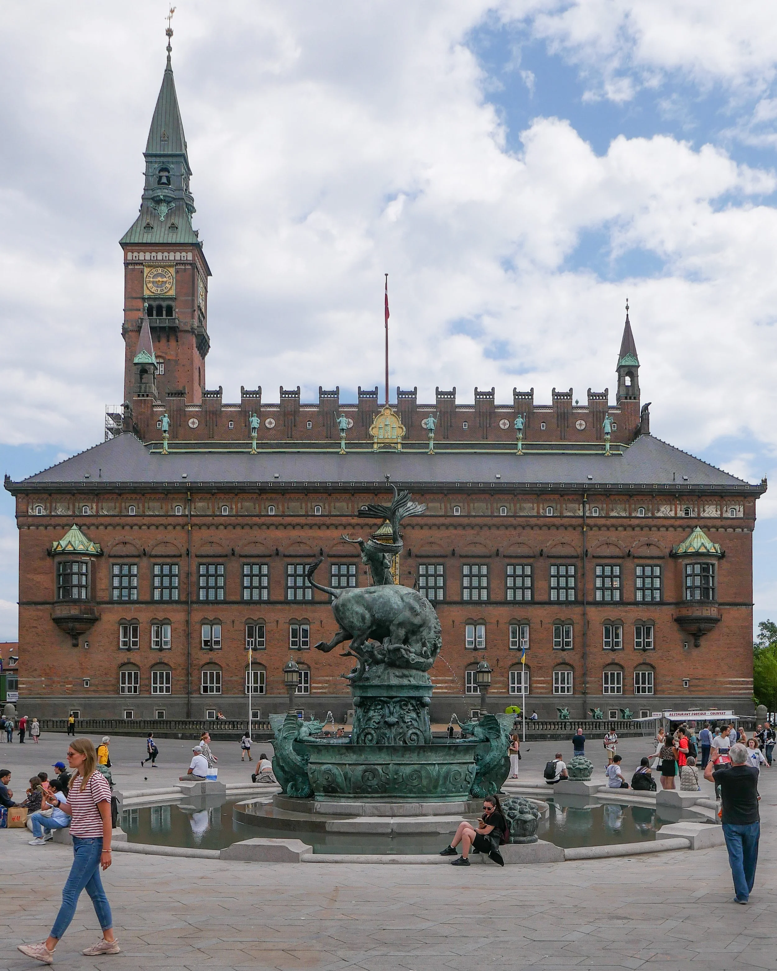
This morning coffee and cakes were served to celebrate the return of the Dragon Fountain to Rådhuspladsen - the square in front of the city hall in Copenhagen.

The fountain, designed by PC Skovgaard and Thorvald Bindesbøll, was installed in the square in 1923, but it was then closer to the city hall and off to the west side. At the beginning of November in 2020, it was dismantled and taken to workshops to be restored.

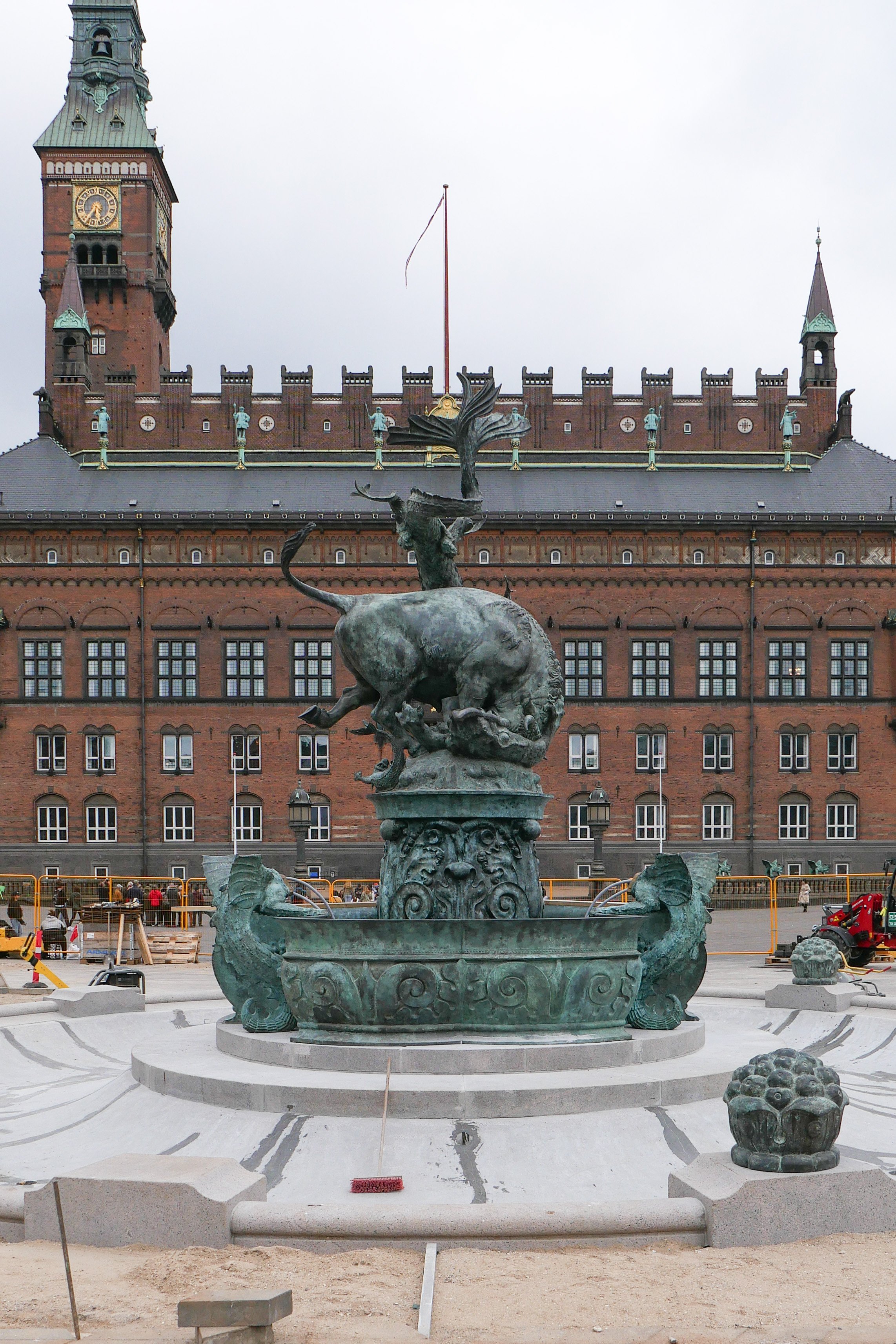
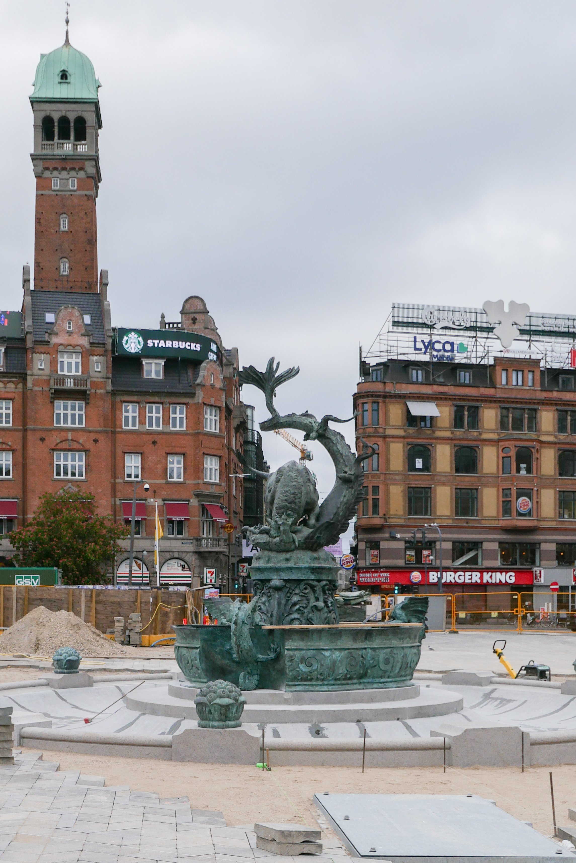
It has now been returned to the square but to a new position, on the central axis of the city hall, and a large, granite basin - that had originally surrounded the fountain but had been removed 69 years ago - has been reinstated.

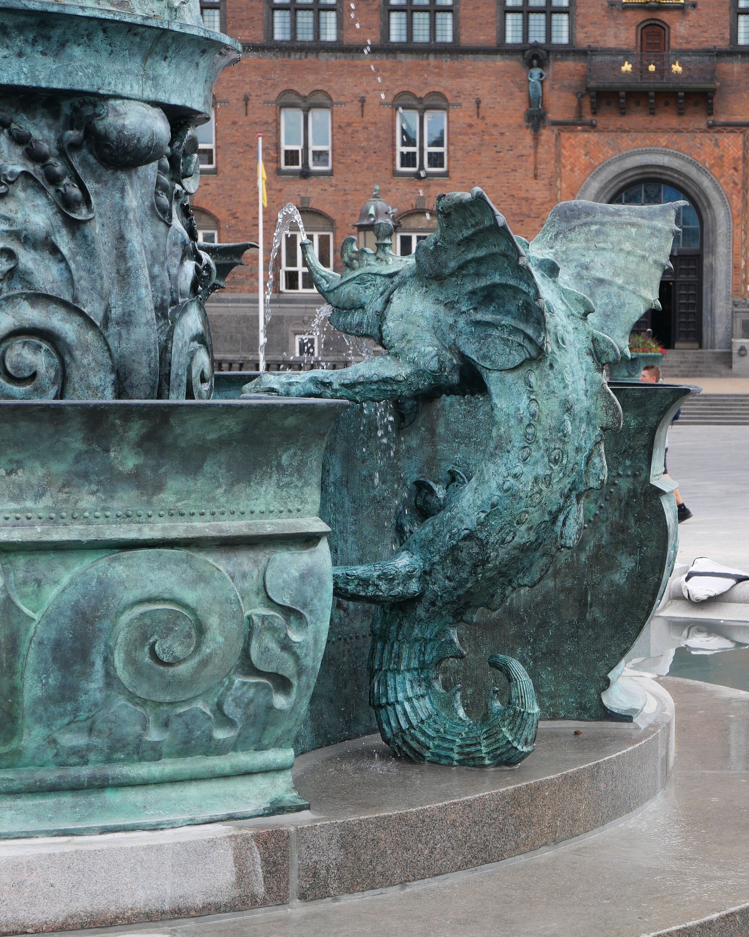
The bronze bull fighting with a dragon and the lower bronze basin with three dragons or mythical creatures are 6 metres high overall and together they weigh about 4.5 tons and the granite basin is 14 metres across so this is a substantial work.

Below the paving of the square, there is a large pump house where the water - approximately 42,000 litres for the 19 jets of the fountain - is filtered and treated to prevent the growth of algae.

the Dragon Fountain is on the move again


Dragesprinvandet / The Dragon Fountain is back on the square in front of the city hall


Today, the Dragon Fountain was moved back to Rådhuspladsen and lifted into place at the centre of a shallow granite basin that reinstates an earlier form of the work.

By the time I got to the square, the bronze basin with the lower dragons clinging to its rim and then the upper sculpture of a dragon and a bull fighting were all in place and the compound was empty of people although an article in Politiken, in their evening edition, described just how many problems there had been through the day in getting the bronze work to drop into place over the centre of the granite basin.

In 1901 - when the fountain was first set up in Rådhuspladsen - it was in the south-west corner of the square, close to the city hall, but out to the west side.

In 1954, when Hans Christian Andersens Boulevard was established as a main and therefore wide road across the west side of the square, the fountain had to be moved in towards the city hall.

The square has seen major changes over the last couple of years with the construction of a station for the metro and after being dismantled and after it was restored, the fountain has now been given a new and more prominent position on the axis of the main entrance into the city hall and on the short cross axis of the square it is now in line with Strøget …. The Walking Street.

A post here - from November 2020 - when the fountain was dismantled and taken from the square for restoration - has more photographs of the fountain and more information about the design.

Once the fountain is connected to water and after all the paving has been reinstated then I should be able to take a picture-postcard view.

the Dragon Fountain is on the move again
2 November 2020


the stone base for the fountain photographed at end of April
note: the temporary wooden rail around the rim and a metal beam pivoting at the centre of the fountain to carry a curved former that was swept around, once concrete had been poured in, to form a shallow basin with a consistent profile


Platform C - Syddyssen


This oak bench and viewing point by the design studio Fokstrot was completed in January 2020 and is. in part, a rethinking of the Copenhagen circular bench but here people face inwards rather than looking out as a place for conversation although there are also good views down the water to Kaninøen - a triangular island that was part of the outer defences of the city - or across the water, and back towards the city and to Christianshavns Vold, with the distinct twisted spire of Vor Frelsers Kirke or Church of Our Saviour.

The platform is less than 100 metres from the heavy traffic of Torvegade - the road down through Christianshavn from Knippelsbro to get over to Amager - but this could be a different world.
Walking from Christianshavn, at the end of the causeway over the water, Syddyssen is to the left, just before Christmas Møllers Plads, and is the footpath along the inner edge of the low outer embankment of the defences.

FOKSTROT

an introduction to Kalvebod Brygge

Planning is about the future. That's in the very word itself. We plan to do something ... planning is not retrospective. But it really is important to understand how we got here - why a street or group of buildings is as it is - to understand how and why what we have is good or bad and to use that to inform what happens next.

The history of Kalvebod Brygge is fascinating and complicated but, in terms of history, all relatively recent and all recorded on the maps produced over the last 100 years or so.

Primarily, the development of the south harbour is a lesson in how economic and political events often move faster than the best-laid plans for our streets and squares and, too often, a complicated scheme of renewal or development can take so long to realise that it is redundant or inappropriate by the time it is completed.


1912

1945

1967

Until the late 19th century, the harbour south of what is now Langebro was a wide bay.

In the middle of the 19th century a new railway from Copenhagen to Roskilde was laid out along the north beach of the bay, along what is now Sønder Boulevard. In commercial terms, the close proximity of water and railways is catnip for development … as much back then in the 19th century as it is now.

First a meat market and gas works were built out into the bay with wharves for the delivery of coal for both the gas works and then for a new electricity works built immediately south of Tivoli. That was superseded in 1932, when the coal-fired power station of HC Ørstedværket opened.

There were wood yards between the harbour and Ny Glyptotek when it was built in the 1890s but these were rapidly replaced with new streets and apartment buildings.

A new central railway station was built in 1911 and the railway was taken out on a wider curve on yet more land claimed from the bay and, for the first time, Bernstorffsgade, between the new station and Tivoli, became a main road though, initially, it did not continue much further than the south-west corner of Tivoli and certainly not as far as the harbour.

At about the same time, so from about 1890, the line of the shore of Amager, opposite, was also being pushed further and further out into the bay and both sides of the approach to Langebro became docks.

If you use the word port it usually conjurers up the image of ocean-going liners but this was docks .... vital, hard working but fairly grubby commercial quays for coal, grain, sand and building materials and soy beans and sugar. The sort of goods carried in freighters.

On the city side, these  commercial docks continued all the way up to Knipplesbro so across where the National Library and BLOX are now.

Rail tracks came off the outside curve of the main railway and ran all the way up the city side as far as Nyhavn and at Langebro the railway crossed over to Amager and ran down quays on the Islands Brygge side … all for goods and not for passengers.

The area where Kalvebod Brygge is now was mainly rail sidings and marshalling yards and, although it might seem incredible now, this was where, around 1969,  the city built the first container port. The main area for transferring containers from ships to railway trucks - then a very new system for shipping goods - was on new yards where the service depot of the metro is now.

There were soon huge new cranes along the quay for transferring containers but it was early days for this new form of shipping and there are accounts of early attempts to pick up and move containers with a fork-lift truck on each side in, what sounds like, a dangerous balancing act or containers were lifted up from the end which blocked the driver’s view of where he was going and it can’t have been that good for the cargo to have the container tipped up at an angle.

There was still a large building of circa 1910 that had been a pig market on the quayside although it had been used as a garage for some time. It was demolished in 1966 and work started on extending Bernstorffsgade down across the site of the market as far as the quay and then a main road, a dual carriageway, was constructed along the quay - and that is what is now Kalvebod Brygge - to be the main fast route into and out of the city.

This was part of wider plans to modernise radically the road system of the old city with wide and fast new roads. It was the period when there were even plans to build a motorway down the lakes as an inner ring road and the period when large blocks of old buildings in the north corner of the old city were demolished and the first glass and steel office buildings were constructed within the old defences.

But events and world economics and technology were moving faster than the plans and the dock was in decline. Not least, the problem was that the docks had to deal with larger and larger ships and these would all have meant the raising of Knipplesbro and Langebro and the opening of the rail bridge at Langebro to let them through. The docks in the south harbour went into decline and the focus turned to large new facilities at Nordhavn and on the expansion of other ports in Denmark

If the office buildings along Kalvebod Brygge can be criticised, it is because they are uninspiring and waste an amazing location but, by the late 1980s and into the 1990s, the city was facing bankruptcy and a new business area and any way to revitalise the harbour was better than any alternative. Award-winning architecture was not a priority.

on the city side, the commercial quays continued as far as Knippelsbro

the pig market that was demolished in 1966 for the extension of Bernstorffsgade as far as Kalvebode Brygge - Copenhagen Archive 42126

construction work for Kalvebod Brygge - Copenhagen Archive 91920
the building immediately below the end of the crane is what is now KB32

Bernstorffsage and Kalvebod Brygge in 1989 - the tower block is now a hotel and the car park to its right is the site of the new Scandic Spectrum hotel
the area of grass to the left is where the SEB offices are now
note the commercial/industrial building north of the police station - the building with a circular courtyard
that site too is now a hotel