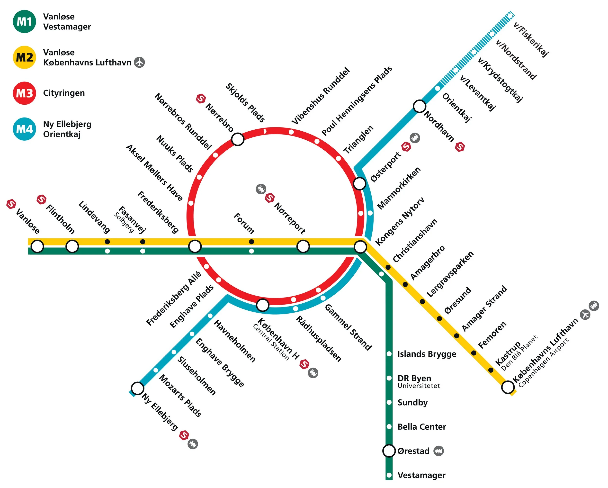
a new metro line across Amager
/Reports in newspapers this week suggest that politicians at city hall have agreed on a new route for the next new line to be added to the metro system in Copenhagen.
Identified as the M5 line in previous plans, it is to run from the central railway station to serve Amager and Refshaleøen and the controversial new island of Lynetteholm.
Back in the Autumn of 2020, several options were published by Metroselskabet - the company that runs the metro - as they explored possible ways to extend the metro on from Orientkaj on Nordhavn to the new island of Lynetteholm and then, from there, down to Refshaeløen.
In a tight arc, the new line would have continued across Amager with major interchanges with the existing metro lines at Amagerbro and Islands Brygge before going under the harbour to the central railway station. It was also suggested, in the report, that there was also the possibility to extend the line on from the central station to serve the inner area of Nørrebro and the main hospital.
Two years ago, the priorities were to provide a metro service for the cruise ship terminal on Nordhavn and to serve the proposed housing on Lynneteholm along with an alternative route to reach the centre of the city from Amager that would relieve pressure on the original metro line from the airport and from Ørestad through Christianshavn to Kongens Nytorv that is now close to maximum capacity.
An obvious problem with those schemes was that there was a great gap in the middle where the new island might or might not be constructed ... the loop would only be fully operational when the two stations on Lynetteholm were open and it's housing completed and, current estimates suggest that will be sometime after 2070.
In addition, in order to work at optimal efficiency, any new line should have it's own service centre for it's own trains .... comparable to the service area at Metrovej in Ørestad for the original metro lines and Metro Service between Otto Busses Vej and Vasbygade for trains from the Cityringen.
In this, the most recent proposal for a new metro line from the central railway station, the line would take a wider curve across Amager to serve extensive areas of housing - both new developments and the revitalisation of older housing - where the only public transport is the bus services.
A new metro line from the central station would go under the harbour to a new station at Bryggebroen, at the south end of Islands Brygge, and then on to the existing metro station at DR Byen - rather than the original plan for an interchange at Islands Brygge metro station - and then to a new station on Amagerbrogade - further south than the interchange at the Amagerbro shopping centre proposed in earlier plans - and then on to an interchange at Lergravsparken - where passengers could change trains to get out to the airport. This new route would then continue north, close to the line of earlier route, to Prags Boulevard and Refshaleøen.
An area where the trains from this metro line could be serviced would be constructed out on the island of Prøvestenen.
This new metro line could be completed by 2035 but could then be extended on to Lynetteholm - if and when the island is finished - and, at the city end, the line could be extended on from the central station to inner Nørrebro and Rigshospitalet.
This is an important example of just how plans for major infrastructure projects have to evolve as other problems or other demands come to the fore or as the economic situation dictates.
the end of the line for now 10 Sept 2020
Cityringen / The City Ring 29 September 2019
Lynetteholmen - a new island across the harbour 5 September 2019


