an unbuilt tram station for Rådhuspladsen
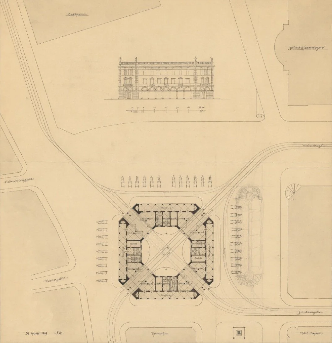
Looking for old photographs and drawings of the buildings around Rådhuspladsen - the square in front of the city hall - I came across this amazing proposal by the architect Ludvig Clausen for large and elaborate tram station - a Sporvejsstation - that was designed in 1899 but was not built.

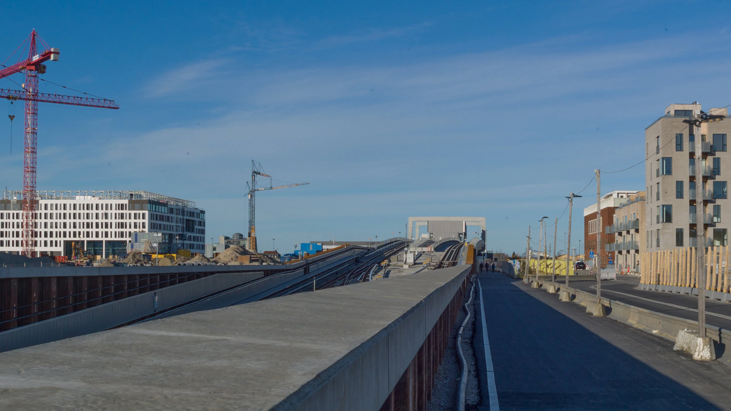
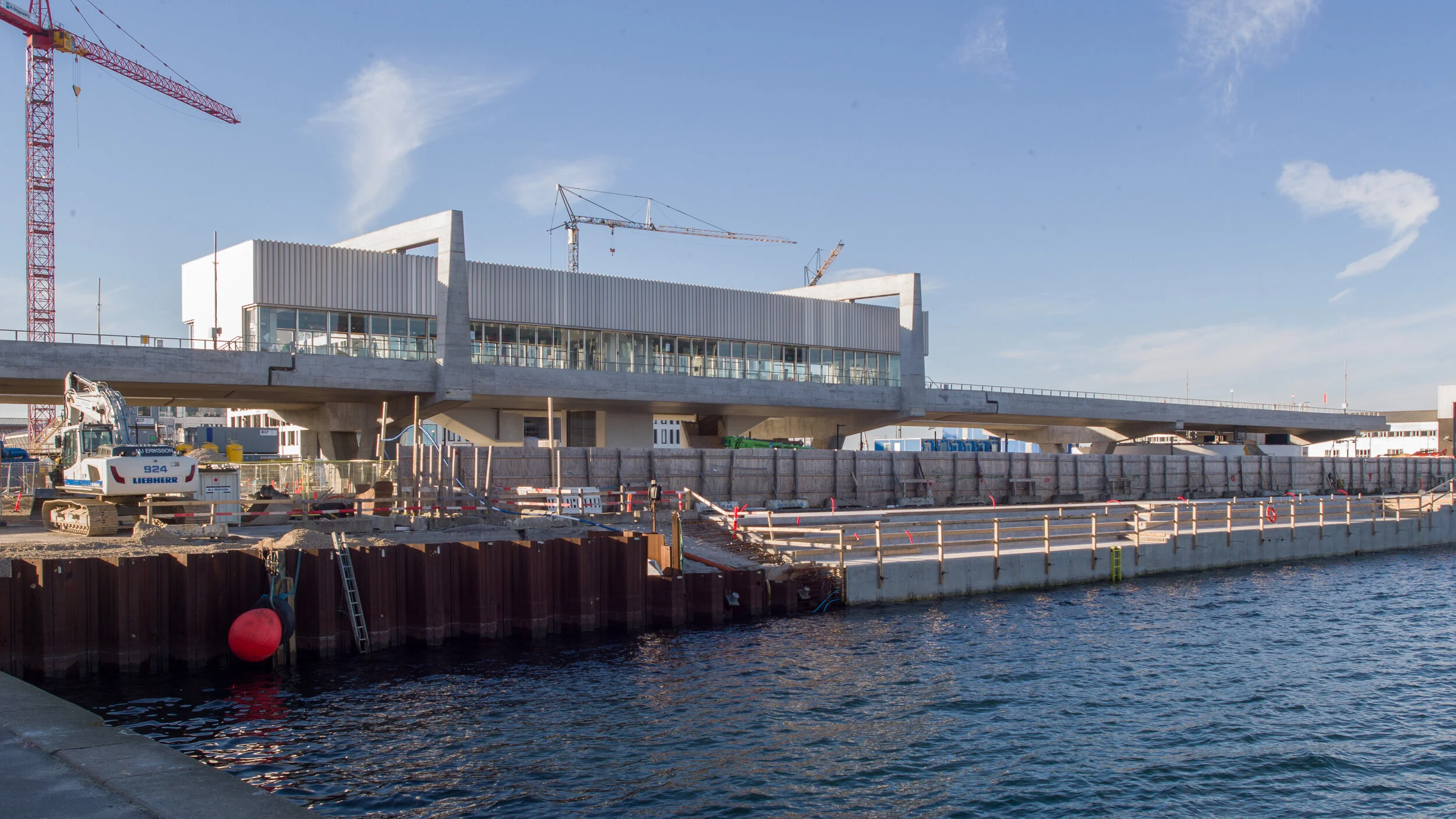
It would have been across the north side of the square so opposite the city hall and over the new metro station that opened recently.

In plan it would have been a large square building but with strongly chamfered external corners but with a courtyard that was a regular octagon. Tram lines would have entered through double arches on each of these corners and the trams would have crossed over in the centre, with pairs of lines crossing over like a cross of Saint Andrew, but also with curved lines on each side so that trams could come in and then exit through adjacent corners.

The four main elevations would have had arcaded loggias facing outwards and the building would have had three floors with a balustraded parapet. Windows on the main first floor are shown with architraves and pediments so it was a modern transport hub in the style of a renaissance palace in Italy.

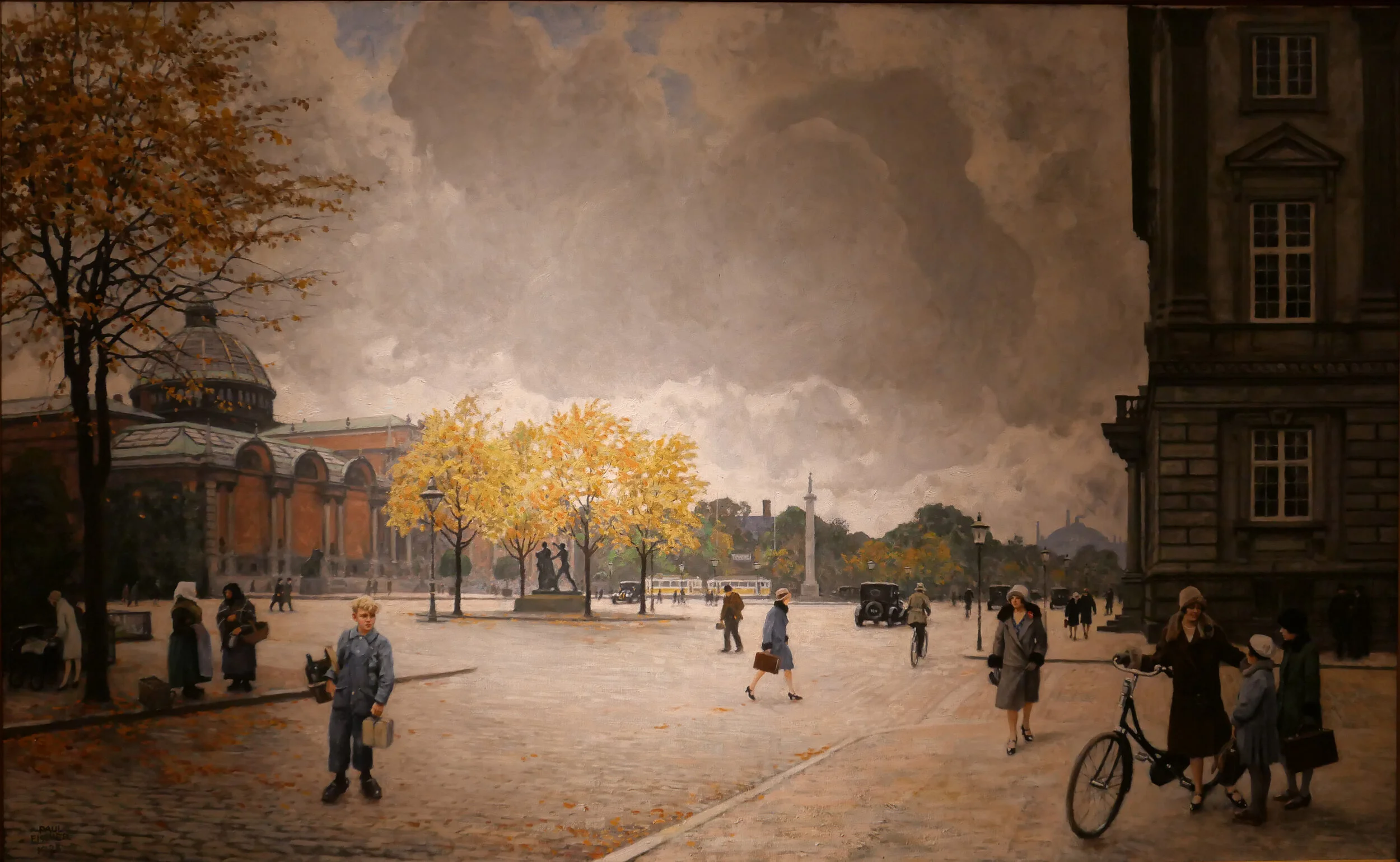
And it would have been an enormous building … the plan shows it as wider than Helmerhus - the large apartment building with commercial space, designed by Arne Petersen and Henrik Hagemann, that was finished in 1893 and survives across the north side of the square.

The tram station would have been laid out to respect the alignment of what were then the most recent buildings on the square rather than being set square on to the city hall or being lined up with the older buildings along the east side of the square.

Note the 31 horse-drawn cabs that are shown standing in ranks on three sides and facing out and ready to take passengers into the city. This was clearly intended to be a busy and important transport hub.

The main tram lines were in and out of the square along Vesterbrogade, as you would expect, but also up and down Vester Voldgade, on the east side of the city hall, rather than along what is now HC Andersens Boulevard on the west side of the square. That only became the main street for traffic in the 20th century. A fourth tram line went out of the square and down Jernbanegade that was then not the street to Vesterport station, as it is now, but led to what was then the main railway station then on the north side of Vesterbrogade.

In the archive, there is a second drawing by Clausen for an alternative version of a tram interchange that is in the style of grand Danish architecture in the 17th-century, with polygonal turrets and cupolas, as if the architect had imagined trams driving in and out of Frederiksborg.

drawing in the archive of Danmarks Kunstbibliotek

the north end of Rådhuspladsen with Helmerhus to the right and, beyond, the shallow dome of Dagmarteatret opened in 1883 but closed in 1937 and was then demolished - the trams are there but, sadly, not the renaissance tram station


traffic on HC Andersens Boulevard

One of the paintings in the current exhibition at the Museum of Copenhagen about the work of Paul Fischer is his view of HC Andersens Boulevard looking north towards the city hall from just before Dantes Plads on the right with the distinct building of what was then the new Ny Carlsberg Glyptotek on the left.

The first impression is that this must be a romanticised or highly edited view with people just sauntering across the boulevard but Fischer used his own photographs of the streets and squares in the city to compose what he painted and seems, generally, to have painted what he photographed.

So comparing the painting with a photograph taken last week you can see just how much space we have sacrificed to the car and just how much clutter there is with street signs and road markings.

When Fischer painted HC Andersens Boulevard there were trams running into the city hall square and out along Vesterbrogade and by then the railway line from the central station to Østerport had been constructed and suburban lines were being opened so public transport was well established.

Part of the problem with the Boulevard now is not just that there are three lanes of traffic between the lakes and the bridge over the harbour that run across the west side of the main city hall square but the traffic is unrelenting and although there are traffic signals - where pedestrians cross over - the traffic then sprints on to the next crossing so there can be noise and heavy fumes. The road has also taken over more and more of the width to allow for feeder lanes and particularly where vehicles back up before the lights waiting for them to change to let them cross over the traffic coming in the opposite direction.

One simple solution would be to drop the overall speed limit. This would not make it slower for the overall journey but simply control the cars racing to try and beat the next lights. It should also be possible at some junctions to stop traffic turning left, to cross over oncoming vehicles, by making cars turn right and then go round three sides of a block before crossing straight over at the junction where otherwise they would have turned left. Then, perhaps, some of the feeder lanes and the parking lanes could be taken over for wider pavements and more trees.

Paul Fischer exhibition at the Museum of Copenhagen

painting of HC Andersens Boulevard that is currently in the exhibition at the Museum of Copenhagen about the work of Paul Fischer and the same view photographed last week


HC Andersens Boulevard runs across the west (in this view the right) side of the city hall square with the Tivoli Gardens and then Ny Carlsberg Glyptotek before the harbour and Langebro. This aerial view shows just how much of the overall width - 50 metres from building front to building front - is tarmac and shows the chicanes at each junction.

When the square in front of the city hall was laid out and when these major buildings were constructed around 1900, Vester Voldgade on the east (left) side of the city hall was initially the main route down to the harbour and it follows the line of the road that was inside the city defences before the banks and outer ditches were removed in the late 19th century.

The original Langebro was at the end of Vester Voldgade and crossed to Christianshavn inside the defences on the line and angle that is now taken by Lille Langebro - the recently-opened bicycle bridge.


the new M4 line of the Metro to Orientkaj

Part of the new M4 Metro line is meant to open on Saturday 28th March.

The new track will run from Østerport metro station to Nordhavn, a new underground station at the inner end of the Nordhavn Bassin, and from there the track rises up steeply to Orientkaj, a new elevated station at the inner end of the quay and close to the new International School.

Just beyond the station, the elevated track stops but it will be extended out to the Ocean Quay Terminal for cruise ships and will serve the next stage of development on the outer or north part of Nordhavn.

Through the ticket area below ground and down through the escalators and on to the platform, the design for the new Nordhavn station includes red to link it visually with the design of the stations on the city ring at Nørrebro, Østerport and at Copenhagen H (the central station) as all four metro stations are major interchanges with the S or suburban rail system which is marked by it's red trains and red graphics.

In 2024 the extension of the M4 line out from the central station to the south west will be completed. This will connect the central station to the south harbour area and that line will continue on to Ny Ellebjerg and a major interchange there with the suburban rail routes for connections to the west and to the north.

Doubt about the opening date for the line to Nordhavn is due to the ongoing threat from viral infection with controls that restrict the numbers of people in all public areas although transport in Copenhagen is still running and so far there has been no announcement to suggest that the opening will be postponed.

Once it opens and once lockdown controls end that restrict how people can move around the city, the new line will carry around 11,000 passengers a day.

The extension of the M4 line from the central station to Sluseholmen and Ny Ellebjerg is to open in 2024.

the opening of the new line to Orientkaj
the line to Sydhavn / the South Harbour

above left - the track of the metro rising up to the new station at Orientkaj and, right, looking north under the first section of the elevated track
below left - drawing of the new station at Orientkaj from the Metro web site and the station from Orientkaj taken this afternoon, Sunday 15 March 2020


a new tunnel for suburban trains?

This week, in the newspaper Politiken, there was a short article on a proposal, that has been presented to the parliamentary transport committee, to consider the construction of a new tunnel, for suburban rather than for metro trains, that could form a fast link from the existing station at Hellerup, in the north part of Copenhagen, to the transport interchange at Ny Ellebjerg to the west of the city.

The new line would be over 8 kilometres long and journeys through the tunnel would be rapid because there would be few intermediate stations but these would link to the metro at strategic points.

Hellerup is a small municipality immediately north of the city and is already a busy and important interchange for suburban trains from the north but, from there, the trains run to Østerport, Nørreport, Vesterport and the central railway station through relatively narrow cuttings that date from the early part of the 20th century and from the central station curve on out through to Carlsberg and Valby or to Sydhavn and Ny Ellebjerg. All these stations are well-used interchanges and there are also smaller but also busy intermediate stations. It is a regular and relatively fast service but trains can be crowded and many of these stations are extremely busy and must be close to capacity.

Few people will travel regularly from Hellerup to Ny Ellersbjerg but a new tunnel would provide shorter and much quicker links through to alternative interchanges for joining the suburban train lines or the metro circle line at more appropriate points to get into the city or to get out to outer suburbs.

As proposed, on a new line through the tunnel, there would be just four intermediate stations ….. a station at Vibenshus Runddel - connecting to the new circle line of the metro and serving the national football stadium; a new and important station for Rigshospitalet and then new interchanges with the metro at Forum and Frederiksberg.

Trains would be short - like the metro train - and could be automatic, so driver-less, and could run every four minutes and, of course, trains would continue to run on the existing line.

This switching from train to metro or even to bus sounds complicated and frenetic but actually commuters know their routes and platforms and do most journeys on auto pilot anyway but, for other passengers, travel apps on mobile phones, updated in real time, show the best route and current arrival and departure times, platform numbers and the quickest route and electronic displays at platforms and on trains and buses now show arrival and connection times.

This is joined up planning. Planners and politicians are not resting on the laurels of what is being achieved with the construction of the new metro lines in the city but are already thinking about what has to be done next.

Østerport
Nørreport
Copenhagen Metro
the new Cityringen

update - Bispeengbuen

Bispeengbuen is a raised section of motorway in the north part of the city that opened in August 1972.

It has three lanes of traffic in each direction but with slip roads and with high sound baffles, added in the 1990s, it is intrusive as it cuts through and divides a densely-built residential neighbourhood. The heavy traffic using the road as a fast route into or out of the city is close to apartment buildings at the level of second-floor windows and, from the start, there were strong local protests with the opening marked by demonstrations and even a bomb threat.

The road is owned by the state but one suggestion now is that it should be transferred to the city and to the municipality of Frederiksberg - the road runs between the two - and, in 2017, politicians from both Copenhagen and Frederiksberg suggested that the road and its traffic could be taken down into a tunnel and the elevated section demolished.

This would provide an opportunity to reinstate a river that had flowed through a meadow here since the late 16th century although the river itself did not run along a natural course. In the 1580s, it was diverted to bring water to low marshy ground around the west side of the city, outside and below the defensive embankments, to form a stronger outer defence and to provide a supply of fresh water for the city.

Around 1900, at the city, end the river, Ladegårdsåen, was taken down into a covered culvert and the road to the lakes became a major route into the city from the north.

From the north end, from Borups Allé, traffic coming into the city goes under the suburban railway line - just to the east of the station at Fuglebakken - and then, immediately south of the railway line, the traffic is taken up onto the raised section that continues on for about 700 metres to Borups Plads where the road returns to ground level but the tunnel would continue on further, closer to the intersection with Jagtvej to make this north part of the proposed tunnel about a kilometre in length.

If the river is reinstated with extensive planting to create a park here, the work could be part of major climate-change mitigation on this side of the city and would create a significant amenity for this residential area.

With a decision on the tunnel delayed, the area under the raised section of the road has been improved with the opening in April 2019 of Urban 13 - “a creative urban space.”

Designed by Platant, shipping containers have been adapted to create a cafe and a function room for local events and an area with steep blocks or steps for seating forms an outdoor concert venue and there is new planting in containers.

proposal from PLATANT to build a deck over the elevated motorway for housing and gardens with access by new towers against the edge of the road

Container City will be here for five years and, even then, work on the elevated roadway may be delayed so Platant have put forward an imaginative and ambitious scheme to adapt the motorway itself with an upper deck that could be constructed above the road deck to support new housing and gardens and with access by way of a number of new towers built along the road edge. It would be designed so that this could be dismantled and the materials reused if work on demolishing the road and building the tunnel does go ahead.

URBAN 13
PLATANT
Cloudburst Masterplan by Rambøll


view from Google Earth with the curve of the elevated section of motorway top left

a tunnel, to take the main through traffic underground, could replace the motorway and it could be continued down Åboulevard, following the line of an old river to the lakes, and the river, now in a covered culvert below the road, would then be returned to the surface


the line of the proposed tunnel from the suburban railway line at Fuglebakken to the lakes and from there along the line of HC Andersens Boulevard and on under the harbour to Islands Brygge to connect with a north harbour tunnel that is also being considered.

there would be a limited number of entry and exit points from the tunnel because it is not for local journeys but for through traffic

the tunnel from Fugglebakken to Islands Brygge is just over 4.5 kilometres


proposal for the park and the reinstated river if Bispeengbuen - the elevated motorway - is demolished and the traffic taken down into a new tunnel


restoration of the railway station at Østerport


Østerport station is at the centre with its distinct hipped roof. The track to Klampenborg and Helsingør is to the north and the later tracks, along the line of the fortifications, to the south - the bottom left corner of the view. The road across the front of the station is here called Oslo Plads with the Nyboder houses to the south - the bottom of the view - and the edge of Kastellet - the earthworks of Kastelvolden to the right and the trees and lake of the public park of Østre Anlæg to the left. This was taken before work on the metro station was finished but the glass pyramids over the metro platform and the steps down into the station can be seen in front of the apartment building north-west of the station

photograph of the station from the marshalling yard to the south taken in 1896 - before building work was completed

the construction of the Boulevard line in 1917 to link Østerport to the central railway station. The corner of a building on the left is Statens Museum for Kunst with the trees of Østre Anlæg beyond and Østerport station in the distance


outline history of the station …..

1897 Østerbro Station  designed by Heinrich Wenck (1851-1936) completed

Station known to local people as Østbanegården

1917 Boulevardbanens / Boulevard Railway constructed along the line of the old city defences across the north side of the old city to connect Østerport through to the Central Station via new stations at Nørreport and Vesterport

1923 Østerport Station rebuilt under Knud Tanggaard Seest (1879-1972) chief architect for Danish Railways from 1922 to 1949

1934 suburban line to Klampenborg opened

1 July 2000 new service started with trains from Helsingør to the central station and then on to the airport and across the newly-opened bridge to Malmö. 

September 2019 Metro Station on Cityring opened

Danske Statsbaner - DSB or Danish Railways - have restored the railway station at Østerport with an extensive and major project that has taken two years.

The station was designed by Heinrich Wenck (1851-1936) and it was completed in 1897 as the terminus of the coast line from Helsingør to Copenhagen although, twenty years later in 1917, the Boulevardbanens or Boulevard Railway was constructed along the line of the old city defences across the north side of the old city to connect Østerport through to new stations at Nørreport, Vesterport and then on in a wide curve to the Central Station.

The railway lines here are below street level and the distinct station building runs across the top at street level and faces on to a broad street called here Oslo Plads but in fact a part of the busy main road out from the centre to Hellerup and on along the coast to Klampenborg.

The building takes the form of a large elongated hall parallel to the street with timber posts that support a large hipped roof. Inside there are two cross corridors, running back from the street with high barrel ceilings lit by semi circular windows set in large dormer windows in the front and back slopes of the roof.

Over the years the interior had been altered with secondary walls subdividing the space but, with the restoration, waiting rooms and a large information office have been removed and suspended ceilings taken down to open out the space.

In the new arrangement, there is still a large station store, a coffee shop and office space but by using glass walls there are now open views diagonally through the building that creates a new feeling of this as an open and unified space.

Archaeological investigation uncovered the original colour scheme and this has been reinstated using linseed oil paint with deep iron red and dark blue green colours that give the interior a richness but without being overbearing … an effect that is in part achieved because the paint finish is matt rather than having the gloss of a modern paint.

The terrazzo floor has also been restored.

The original building had a deep veranda across the front and the ends but in the alterations in the early 20th century, the outer walls were moved forward to the front edge of the roof but it was not possible to reinstate those features.

It is where the building looks weakest because this later brickwork, along with poorly detailed windows, look too simple and too rustic or 'vernacular' for what is a major public building.

However, we should just be grateful that the building survived because in the 1960s there were plans to demolish the fine 19th-century station and replace it with a high-rise tower although, fortunately, that scheme was abandoned.

A strong feature of the new arrangement of the interior is the broad and open corridor that runs across the full width of the building to provide a clear access to the doorways to the staircases down to the platforms so circulation seems obvious and rational with good natural and good electric lighting and careful placing of signs and departure boards. At one end the corridor takes you out to the Irma food store - while keeping under cover - and at the other end there will access to take passengers out and down to the new metro station that opened at the end of September.

With the completion of the large new metro station, this restoration of the railway station is part of the complete re-planning of public transport for passengers coming into or travelling round or through the city.

Østerport will now be a major hub with an interchange between suburban trains, a regular service with trains to the airport and from there over the sound and on to Malmö and the new metro circle line and with local buses and links to the ferry terminal for the boats to Oslo and with the terminal for cruise ship further out at Nordhavn. For now these links are by bus or taxi but the metro station at Østerport will be the start of the next stage of the metro line with the completion of the M4 line to Orientkaj and then an extension to the terminal for cruise ships.

Passenger numbers for Østerport are expected to increase from 30,000 to 45,000 people a day.

The work on the restoration has been by KHR Architecture who designed the concrete shopping centre and the sunken office with a pyramid roof and a third staircase down to the platforms for the trains to Sweden that are all also being restored and extended.

Cityringen / The City Ring

Today - Sunday 29 September 2019 - Cityringen / The City Ring - the new metro line in Copenhagen opened with a ceremony on the square in front of city hall. For the afternoon and through to midnight transport around the city was free and people were out in large numbers to see and to use the new stations and the extended train system.

Construction work started over eight years ago so citizens are now reclaiming large parts of the streetscape and squares of their city that have been fenced off behind high green hoardings as the seventeen new stations were constructed.

Bus routes too will alter drastically on 13 October with fewer buses actually crossing the city … buses will come in to a station on metro City Ring and then head back out again or will run around the edge of the city centre rather than cutting across. So, inevitably, over the coming months and years, the ways in which people move around and through the city will change.

There will be major interchanges at Kongens Nytorv and Frederiksberg where the existing lines and the new metro circle line intersect and major interchanges to other forms of transport at the new metro stations at existing stations for suburban and country-wide trains at Østerport, Nørreport and the central railway station.

All these new stations have extensive areas for leaving bicycles at street level or underground so it is clear that people will make their journeys by swapping from bike to metro to foot to bus or whatever combination makes for the best or the easiest or quickest route.

The engineering work - constructing over 15 kilometres of tunnels and huge excavations below street level for the new stations much of the work below important historic buildings, below residential area, under the canals or under existing infrastructure of water pipes, sewage pipes and so on - is clearly very very impressive but, and quite deliberately, the new stations follow the form of the existing stations so are relatively low key at street level with simple glass boxes over the lifts to the platforms and simple steps down and, for most stations, glass pyramids that throw light down into the station concourses below.

But that does not mean that the stations will not have a huge impact as most have been constructed along with dramatic improvements to the squares and streets around the station so, over the coming years, the real change will be in the ways that the metro will revitalise and transform some areas of the city - areas such as the newly renovated square and the streets around Enghave Plads or the area around Trianglen - and the metro will mean quicker and easier access to and from the densely-occupied residential areas of Vesterbro and Nørrebro and - with the next phase of work - the new residential areas of the north and south harbour …. planning that has been described by the newspaper Politiken as “binding together the suburbs.”.

the Copenhagen metro

the impressive new concourse below Kongens Nytorv and the area to leave a bicycle below street level at Marmorkirken / The Marble Church

you can be certain that it will never be possible to take a photograph like this again ….. that is with the cycle store empty


De Forenede Sejlskibe / The United Sailing Ships

Three ships of De Forenede Sejlskibe - United Sailing Ships - are berthed at the quay across the front of the large brick warehouses that wa built as grain stores in the 1780s but is now the Admiral Hotel.

The schooners are the freighters Mira built in 1898 and Halmø from 1900 - both from the shipyards of Rasmus Møller in Faaborg - and the training ship Lilla Dan built in Svendborg in 1951.

In talking about modern design in posts here, much is made of functionality, materials, technology and quality of production but of course these are hardly new concepts. Generally Functionalism describes a style of architecture and design from the early decades of the last century but describing something as functional can now be almost pejorative - implying it’s something slightly basic that works - anything from an orange squeezer to a stripped down and basic kitchen - almost as if buying something that actually works properly is surprising and might even be worth using as a sale pitch.

But in the design and construction of these ships, functionalism and well-crafted and hard-wearing fittings were not primarily about aesthetics but rather a matter of life and death and profit … the parts, and therefore the ship as a whole, had to be robust and, to be efficient and, generally, had to be managed by the smallest number of crew possible. That they are also strikingly beautiful is a bonus that reflects the skill of the craftsmen and the quality of the materials they used.

If you want to trace through how the specific qualities of materials along with craft or manufacturing skills focused on function for the starting point that determines form of a design and how function and form and materials and techniques for working those materials are a framework or control for the design and all working together then a good place to start is to look carefully at an old water mill or a windmill or an early steam engine or, as here, at hand-built sailing ships. Not just at the separate parts but at how the whole functioned.

The harbour has become more and more sanitised and being given the opportunity to see working ships should remind people that the bustle and noise of goods being loaded and unloaded on these wharfs and dock basins was the reason that the city is here and that was the source of its wealth and significance.

De Forenede Sejlskibe

select an image to open photographs in a slide show

the quay in the late 19th century where Skuespilhuset - the Playhouse of the National Theatre - stands now, looking towards north east towards the sound with the buildings of Kvæsthus to the left that in this view hide the warehouse and the quay that is now the Admiral Hotel

masted trading ships at the quay in front of Børsen - The Copenhagen Exchange - in the 1890s


a new library for Nørrebro


At the beginning of August a new public library opened in the old tram sheds in Nørrebro.

The building is set back from Nørrebrogade with a large square at the front where trams originally turned into the sheds and the original high and narrow openings towards the road have been retained but with new doors that have stylised versions of giant book cases.

Inside, the single huge space of the shed has been retained with arched openings in the brickwork along the east side towards Bragesgade kept as a strong architectural feature and to flood the space with light. The industrial roof has been kept and is now painted black.

Fittings are in pale plywood and divide up the space and there are integral breaks in the shelving with desk spaces and benches that create quiet places to work but also form views through the space.

Across the west side of the library are smaller spaces on two levels with meeting rooms above for meetings and teaching that the community can use and, like all libraries in the city, there is a play area for children to encourage even the youngest to see the library as a fun place to visit.

Further back from the road is a second huge tram shed and that was converted some years ago to a sports hall - Nørrebrohallen - and there is now a large entrance area and large cafe between the two - between the library and the sports halls - as a place where people can meet.

Running back from the road and along the west side of the buildings is the famous city park - Superkilen - with its outdoor play and sports so this area is now a major hub for the community around. It is anticipated that visitor numbers to the library could soon exceed 1,000 a day.


select any image to open the photographs as a slide show

sport and space consultancy KEINGART
have published a pdf file on line with
plans of the library and cafe area


Enghave Plads

Vesterbro - the part of the city immediately west of the central railway station - is a densely-occupied area of apartment buildings with most dating from around 1900.

This was a strongly working class part of the city with the main rail line forming the southern boundary and with the meat markets, gas works and the harbour presumably supplying much of the work and the Carlsberg brewery was, until a few years ago, to the west.

The street pattern of the district is complicated with two main roads - Istedgade and Sønder Boulevard - running out at an angle from the railway station at the north-east to the south east but with secondary cross streets of traditional apartment buildings running north to south and there are also several streets running across the area from south east to north west so it a complex pattern of a grid but overlaid with a Saint Andrew cross so some streets meet or cross at odd angles.

At the south end of Istedgade is Enghave Plads - a large open square much wider east to west than the distance across from north to south and it narrows at the centre. This square is where several tram routes met so it was always an important point in the area and immediately to the west is a very large square with a major public garden - Enghave Parken - that has large apartment buildings on the north, west and south sides so the two spaces run together though divided by a busy main road - Enghavevej.

Enghave Plads is the site of one of the major new metro stations on the new circle line that will open at the end of September. The east end of the square and some of the surrounding streets have been boarded off for about a decade with major construction work for the metro but the boarding has just been taken down and the space with it's new landscaping opened officially.

There are large areas for leaving bicycles across the north or darker side of the entrance steps to the metro station but across the south side of the metro entrance there are raised beds with Corten edging and long raised bench seats and then to the west more open space for events. This area has striking new seating that has deep red slats on a black metal frame and these form great bold curves though the initial reaction to the seating has been mixed - some asking exactly why people would want to sit next to each other in long rows even if they are curved. Mature trees to the west, along the main road, have been kept and provide a baffle against the sound of traffic and shade for more seating and an area that is fenced for ball games.

Copenhagen Metro

Vesterbro with the main railway line to the south, the MeatPacking district in the cirve of the railway and the main railway station top right
Enghave Plads just left of centre and Enghave Parken towards the left side

Enghave Plads from the east with the square of Enghave Parken beyond

tram leaving the square and heading along Istedgade towards the railway station … the area between the buildings and the central space has been paved over and the main through traffic has been restricted to the north side of the square


Lille Langebro

Yesterday a new bridge in Copenhagen opened for cyclists and pedestrians to cross over the harbour from the city side just south of BLOX to Christianshavn.

There appeared to have been no opening ceremony and no notices in the newspaper.

It’s very elegant and forms a gentle curve as it crosses the harbour and my first reaction, on crossing over the bridge, is that it makes the bicycle and pedestrian bridge from Nyhavn to Christianshavn look clunky and over engineered.


the new circle line of the Copenhagen Metro to open 29 September


The major new extension of the Metro in Copenhagen - the circle line round the historic centre - will now open on 29 September.

Above is the important new station at Trianglen at the south-east entrance to Fælledparken. It shows that much of the new hard landscape in place but the planned avenues of trees along each road edge are still to be planted and architectural features - such as the glass pyramids that will throw natural light down onto the platforms - are still to be installed.

Most of the new stations are at about this stage of completion above ground but the main reason for delay appears to have been caused by late delivery of the trains and the postponement of mechanical, electrical and safety testing.

Photographs of the station platforms and various designs and the different and specific colours for tiling, appropriate for the particular neighbourhood, have been published in some newspapers and show not just different and specific schemes for each station but mark a clear departure from the consistent design and the concrete finish of the existing stations on the first two metro lines that were constructed at the beginning of the century.

celebration to mark Faroese Flag Day

The present flag of the Faroe Islands - the Merkið or banner - was hoisted for the first time on 22 June, 1919 and replaced earlier flags - one with the symbol of the ram and a flag with the Oyster Catcher.

To mark the occasion there will be a stalls and a programme of events including music and art at  Nordatlantens Brygge - the large warehouse built in 1766 on the south side of the harbour - almost opposite Nyhavn so now alongside the new bridge over the harbour.

This area, with the main warehouse, smaller warehouses to the south and low sheds to the west, on the Christianshavn side of the dock, was the centre of Danish trade with the Faroe Islands, Finnmark (the very northern part of Norway) and with Iceland and Greenland so dried fish, salted herring, skins, furs and the products from whaling were all unloaded and stored here before being sold and sent out across Europe.

With a dock on the east side, as well as the surviving dock and quay on the west side of the warehouse, goods could be loaded and unloaded on both sides of the warehouse and the hoists and loading doors and the heavy timber structure of the floors, still visible inside the warehouse, are evidence of the quantity and weight of goods held here in transit.

Around 1970, trade with the countries of the North Atlantic was moved to Aalborg and since 2003, the warehouse has been a cultural centre that focuses, generally, on events associated with the countries of the North Atlantic and the nearby Kroyer's Warehouse has been restored and houses the Arctic Institute and the Department of Eskimology.

Through the flag celebrations and arranged by Felagið Føroysk Træseglskip (The Association of Faroese Wood Sailing Ships) sailing ships will be birthed at the quay alongside the warehouse and it gives a very strong idea of what this area must have been like through the 18th and the 19th centuries as ships loaded and unloaded here.


events continue at Nordatlantens Brygge until 5 June 2019

L1022923.JPG

Kongens Nytorv

Although the opening of the new Metro has been delayed, that delay seems to be underground because work is moving forward fast on the townscape around the stations. Trees are now in and established around the new Metro station on the square in front of the city hall and this was Kongens Nytorv this morning. There was a station here for the existing metro line but this will now be a major interchange between the old line and the new city ring.

On the square, the hoardings are down and the trees and the paving are finished. It looks close to being opened completely with just temporary wire fencing around the gardens and the statue at the centre.

update - udlejningsløbehjul

With the recent fine weather these things are everywhere around the city and not just ridden everywhere but abandoned everywhere.

They appeared first in the late Autumn but there are now three companies renting out these scooters.

Initially there was some debate about scooters being legal on the public road - they appeared in October - were banned three days later and then given permission. Then there were questions about the possible dangers of relatively fast scooters mixing with bikes on the cycle lanes and pedestrians on footpaths and, more recently, complaints about scooters blocking footpaths when they are left at the end of the hire.

Now, in one national paper, comes a more interesting controversy. The scooters are promoted as not just enabling people to get around easily and quickly and independently but that, powered by batteries, they are ecological - good for the environment - if you assume that someone abandons a car journey and goes by scooter ….… before abandoning the scooter.

The problem seems to be that the scooters, or at least the first ones, were designed for use indoors and were for personal use so presumably that means not built for continuous or frequent use and not designed for, shall we say, robust use, rented out.

The average life for one of these scooters is said to be between 60 and 90 days so, when taking into account manufacturing costs, materials and energy and so on, then that is hardly a sustainable 'wheel' print.

But, to be fair, much of the problem is with the user rather than the scooter.

Properly regulated and used sensibly these could provide one solution for getting from metro and suburban train hubs into or around the city and they do actually take up less space than a bike when parked properly. It will be interesting to see how this works out but at the moment it is looking more and more likely that the politicians will act first and bring in a ban.

earlier post nice parking

Udlejningsløbehjul? That's the Danish word for rental scooters


nice parking


This Spring, in Copenhagen, the new trend for fast transport to get around the city are battery-powered scooters. A couple of companies are providing the scooters that are hired through phone apps of course.

There are two obvious problems that have to be sorted out. First, although many scooter riders stick to the bike lanes, many do not, and if the rider tries boarding tricks of popping up onto the pavement and off or weaving in and out of pedestrians then these things get up quite a speed and accidents are inevitable.

The second problem - and already the cause of heated debate in the newspapers - is that the scooters, even when neatly parked, can be left and are left anywhere so can and do block footpaths. They are also just abandoned - as I spotted here last weekend - and this was not some disgruntled pedestrian moving a scooter out of the way - but a pond well away from the footpath.

OK. Call me old and grumpy.

update - Lille Langebro


The four sections of the new cycle and pedestrian bridge have arrived from the Netherlands on a gigantic barge and are being lifted into place … the work started yesterday and it looks as if all the sections will be in place today.

These photographs show what will be the first fixed section from the city side as it was taken off the barge by a huge floating crane and swung across the harbour and lowered into place to be guided down by engineers on the quayside by BLOX and engineers in two small boats by the pier in the harbour. The sections in place, in the photographs, are the first section from the Amager side and the part that swings open on the the city side - general views are photographed here from Langebro.

The bridge will be completed by late summer and then the opening and closing of the swing sections will be controlled from the bridge house on the existing road bridge.

earlier post
earlier thought


update - Karen Blixens Plads


A bright if slightly cold Sunday afternoon so it seemed like a good time to walk over to the south campus of the University of Copenhagen to look at progress on the new landscaping for Karen Blixens Plads by COBE.

The main construction work is finished and the paving done but the area is still fenced off although it might be the best time to take photographs before it gets swamped with bikes and students.

earlier post

COBE

smart city - data in action


The 5C bus route through the city provides one good example of the use of smart data in Copenhagen.

New buses were introduced on this major cross-city route last year. These buses cross the city - passing through the major transport hub at Nørreport, stoping at the central railway station and run out to the airport so it is crucial that passengers have reliable and up-to-date information.

Displays at the bus stop show arrival times for buses approaching the stop - an information service already well established on other bus routes - but once on the bus there are side panels that show the next stop and route maps with information about changing to another bus service whose route intersects. Large overhead displays updates to show clearly, for the next stop, times for buses on other routes and, as the bus approaches the central station, there is not just information about the next available train and the time of departure (updated in real time) but also the number of the platform where the train will depart.

Passengers have access to the same data on their phones if they are planning their route ahead and phones, and for passengers travelling with a rejsekort or travel card, an app on a home computer records trip details for reference but also, of course, this data is available for the efficient management of the system.

With the opening of a new circle line of the metro this year and with plans for a light railway, the system will, more than now, allow passengers to swap between different systems and data systems will make this as easy and as reliable as possible.