

traffic on HC Andersens Boulevard
/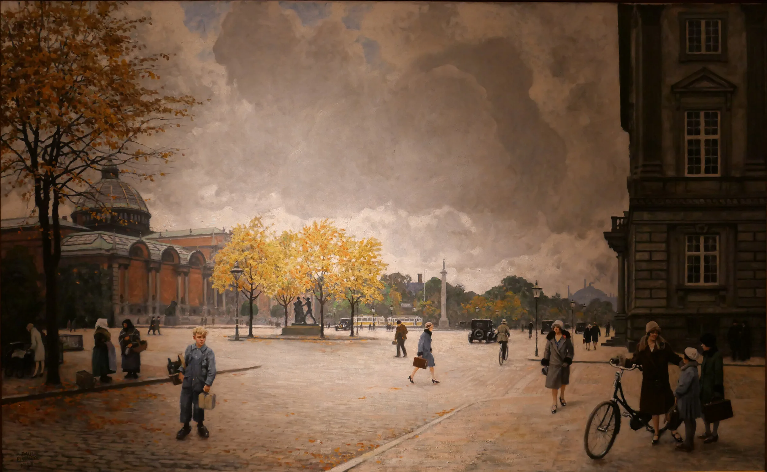

One of the paintings in the current exhibition at the Museum of Copenhagen about the work of Paul Fischer is his view of HC Andersens Boulevard looking north towards the city hall from just before Dantes Plads on the right with the distinct building of what was then the new Ny Carlsberg Glyptotek on the left.
The first impression is that this must be a romanticised or highly edited view with people just sauntering across the boulevard but Fischer used his own photographs of the streets and squares in the city to compose what he painted and seems, generally, to have painted what he photographed.
So comparing the painting with a photograph taken last week you can see just how much space we have sacrificed to the car and just how much clutter there is with street signs and road markings.
When Fischer painted HC Andersens Boulevard there were trams running into the city hall square and out along Vesterbrogade and by then the railway line from the central station to Østerport had been constructed and suburban lines were being opened so public transport was well established.
Part of the problem with the Boulevard now is not just that there are three lanes of traffic between the lakes and the bridge over the harbour that run across the west side of the main city hall square but the traffic is unrelenting and although there are traffic signals - where pedestrians cross over - the traffic then sprints on to the next crossing so there can be noise and heavy fumes. The road has also taken over more and more of the width to allow for feeder lanes and particularly where vehicles back up before the lights waiting for them to change to let them cross over the traffic coming in the opposite direction.
One simple solution would be to drop the overall speed limit. This would not make it slower for the overall journey but simply control the cars racing to try and beat the next lights. It should also be possible at some junctions to stop traffic turning left, to cross over oncoming vehicles, by making cars turn right and then go round three sides of a block before crossing straight over at the junction where otherwise they would have turned left. Then, perhaps, some of the feeder lanes and the parking lanes could be taken over for wider pavements and more trees.


