controversial redevelopment of the French School on Værnedamsvej in Frederiksberg

It looks as if a controversial development of the French School in Frederiksberg is now on hold.

Simon Aggesen, Conservative mayor of Frederiksberg, had absented himself from voting because he lived close to the proposed development but he-has moved and he has now announced his opposition to the project which changes the balance for any vote by the city council.

The Lycée Francais - now known as Lycée Francais Prins Henrik - opened in 1954 on Dag Hamerskjolds Allé and, when the number of pupils increased, the school moved first to Blegdamsvej and then to Frederiksberg Allé 16 and in 1992, into large 19th-century school buildings at Frederiksberg Allé 22 that had been the Schneekloth's School. In 2005 the Lycée expanded into buildings reached from Værnedamsvej.

An American private equity fund - Angelo Gordon - has submitted plans for a major redevelopment of the school site that would add 4,000 square metres to 7,325 square meters of the buildings to be retained and there would have been new housing and a large, new underground carpark with space for 70 cars.

This area around Værnedamsvej is already one of the most densely occupied parts of Frederiksberg and local people want a much more modest scheme here with some new housing but with a series of quiet courtyard spaces off Værnedamsvej to balance the bustle and lively atmosphere of the well-used and popular street and to form a new link through to Frederiksberg Allé.

This is a densely-packed block surrounded by older apartment buildings and there will certainly be conflicts over rights to light and air to adjoining properties if the scheme proceeds as proposed.


Værnedamsvej is across the top of this view with Gammel Kongevej to the left and Frederiksberg Allé and the circus of Sankt Thomas Plads to the right with the large 19th-century buildings of the school at the centre of the block.


recent criticism of Nørreport


Recently, there was an article in Politiken, the Danish daily newspaper, that criticised the square above Nørreport station because it’s looking tired and slightly scruffy.

In part, of course, the remodelling of the area completed five years ago has been a victim of it’s own success.

When COBE, the architects responsible for the remodelling, took on the commission, their first task was to look at how people moved across the space when the station entrances were on an island with traffic moving along both long sides of the space so, wherever you were coming from or going to, you had to cross a road to get to steps down to the trains that at this station are below pavement level. By closing and paving over the road on the city side and by pushing all through traffic, including buses, to the long west side, then, in effect, the problem was halved.

This is still the busiest transport interchange in the city and, for that reason alone, it can not be a place where people can or should be encouraged to stay so it can’t really be too inviting. There are seats and people seem happy to stand around waiting if they have arranged to meet someone but that it is about it. It is and has to be a transit space.

The article criticised the sunken areas where bikes are left but actually they work remarkably well given the phenomenal number of bikes left here. Generally, few bike spill out over the paving where pedestrians walk and very few pedestrians find it clever or necessary to cut between the parked bikes and when I checked, over a couple of different days, they were not full of litter as suggested.

Paving and metal drainage and service covers that divide the huge area into an overall chequer or square pattern are certainly looking worn and dirty and cracked. In part this is because heavy vehicles sometimes need access and can cause damage but possibly the main problem with the paving is the colour and the lack of texture. As with the paving on Købmagergade - the long pedestrian street that starts at Nørreport and runs down to Strøget - the Walking Street - the paving is too pale and too smooth. Areas of older stone setts in the historic centre tend to have much darker greys and even some purple tones and that seems to provide a better visual base for the buildings and, in a practical way, show dirt and stains less although nothing can disguise the blobs of chewing gum. A bin it and don’t spit it or flick it campaign is desperately needed.


Nørreport does work well at night with soft light from the ventilation towers that makes it feel safe but the light is not so bright that you feel as if you are moving around under the glare of security spot lights.

Maybe some areas of paving can be improved and possibly some new trees at the north end might help to screen off Gothersgade and give a sense of enclosure but more general planting is not necessary …. it has to be understood that this area should not be treated as if it was an enclosed space like a square because it is simply the centre section of a long but wide road.

It’s good to have at least some urban areas in the city that are designed to be busy and bustling spaces.


Israels Plads

There has been no similar criticism of Israels Plads that, like the remodelling of the pedestrian area of Nørreport, was also designed by COBE. This is still one of the most used and most popular urban spaces in the city …. an obvious planning and design success.

Here, unlike with the paving across the square at Norreport, the hard landscaping seems to to have survived well and in part that may be because a relatively high kerb around the square, with an edge in Corten steel, discourages vehicles from driving onto the central space.

The area at the north end of the square - close to the food halls - is still incredibly popular - people buy food and drink in Torvehallerne and come across here to sit on the steps to watch what is happening on the square. The large fenced area for ball games is very well used.

The trees are growing well and, as they mature, they make an ever stronger link through to the established and dense tree planting of Ørestedsparken to the south. These trees on the square provide shade for people sitting on benches around each tree but the trunks are high enough that the branches and leaves above do not interrupt lines of sight.

This is a huge space - well over 100 metres from side to side - from building to building - and 140 metres from the park to Vendersgade - the road that separates the square from the equally large area around the two food halls.

With such a large area there is certainly space for several different events or areas of activity going on at the same time without people falling over each other or being distracted by any noise. Perhaps in this post-Coronavirus age Israels Plads should and could be used as a venue for many more events but that is up to the city council.

About the only thing I would complain about is that the fountains and water channel at the park end are rarely running but I guess parents who have had to fish out their wet toddlers would not necessarily agree.

select any image to open in slide show


Carlsberg Byen

L1132341.JPG

I keep going back up the hill to walk around the building site that is the Carlsberg redevelopment area in the misplaced hope it will look better but each time it looks worse …. more densely built up with the industrial heritage more and more overwhelmed and over shadowed as the new tower blocks crammed onto the site rise and rise and rise.

Eventually, and maybe soon, architects and planners will begin to understand that this is one of the greatest missed opportunities in the building history of the city. Not a missed opportunity to make money of course but that is the problem.

As you walk around, then what is obvious is that accountants or the money men must have overseen or overruled every decision ……. move that block ten metres that way and make that a tower rather than a courtyard and you can squeeze another block in there.

OK, it's still a massive construction site but enough is finished that you can judge pretty well what the end result will look like.

For a start, old brewery buildings have, at best, become bit players or, at worst, they have been gutted to become frontages … a sort of inconvenient façade that has been grudgingly retained.

Or what were grand buildings that impressed because they were so big and so weird but somehow so right …. a chimney ringed by dragons, a gate tower supported on elephants … now look little and insignificant …. the amazing chimney no more than a street sculpture in a back courtyard.

The remarkable asset of the site was that rare commodity in Copenhagen ….. slopes …. because this is at least a hill even if it was never a berg.

There are odd flights of steps up but generally to courtyards raised over car parks but it could and should have been all so much more dramatic. The starting point should have been the topography and the amazing historic buildings. Instead, the starting point was the bottom line.

When Bohrs Tårn / Bohr Tower was criticised, one of the architects explained that Carlsberg Byen was to be seen as a Tuscan hill town and to judge the development on just the first of the tower blocks to be completed would be like judging San Gimignano from a single tower but I've been to San Gimignano and Carlsberg, rising up beyond Vesterbro, sure isn't a Tuscan hill town.

There are a couple of nice little squares so Jan Gehl and his team seem to have had some influence but again, it could and should have been so much better. The drama has been stripped out where there could have been a progression through a sequence of good spaces and good views through and across the site should have made use of being able to look down or look across or look up to another building and there could have been more play with scale but this is a development that has managed to make four life-sized stone elephants look small.


From a visit years ago, I remember a playground that was in a tree-lined hollow with an incredible suspended walkway and a car hanging in the trees and was amazed, back then, to see how imaginative planners could be and how committed they were to children not just playing but pushing boundaries. Trying to find the site now, it is a construction yard but it looks as if the coombe will be crammed into the back yard of a tower where it can only be a damp and overshadowed hollow for apartment balconies to look down on.

If you prefer a stripped-down modern Scandinavian aesthetic, then the old buildings of the brewery were difficult to like but at least you can appreciate the money that was spent on some incredible craft and building skills. And there are some more recent but imaginative buildings that play with ideas and with materials so the brick terraces of De hængende Haver / the Hanging Gardens or the golden discs of Lagerkælderen - the cellar that was not a cellar.

The new buildings are basically all concrete slab blocks of various heights and most are fairly standard with relatively standard but relatively large apartments so all that really differentiates them is the unfettered use of cladding …. anything goes as long as it's different. And the other factor you have to consider here, even if you can afford an apartment, is if you have enough money to get an apartment and a balcony that is not in shadow or overlooked. A large number of drawings in the Lokalplan with shadows from towers in different seasons and different times of day show they were concerned back then about shadows but that doesn't seem to have meant many changes.

There are some good buildings …. the apartment building by Praksis that looks over the J C Jacobsens Garden plays clever and interesting games with the brickwork and with the traditional form of a Copenhagen apartment building but this is for the Carlsberg Foundation and clearly an appropriate amount of money was invested so the consequence is a building with an appropriate quality in both its design and in its construction.

The Carlsberg redevelopment is an interesting social experiment …. with a new or, at least, a modified Copenhagen life style. How will Copenhageners cope with living so far above the streets and squares …. or are all these apartments for foreign investors and incomers?

The only saving grace is that people in this city are still incredibly respectful of their streets and public spaces … or at least if Copenhagen streets are compared with the rubbish and vandalism found in so many other densely-built and crowded cities. If the spaces around these apartment buildings become unloved and scruffy then, here on the hill, they really will have built today the ghettoes of tomorrow.

Lokalplan 432, Carlsberg II, December 2016
Carlsberg Byen

Surely, Bohr Tower, and the buildings around it, are contenders for an award as the ugliest new buildings in the city

then ……. and now


buildings that depend on insulation and cladding


a new link between the platforms of the central railway station and the new metro station

A key part of ongoing construction work to complete the new metro station at København H - the metro station at the central railway station in Copenhagen - has opened with access to a wide tunnel under the platforms of the train station so that passengers can go directly from the metro trains to the platforms for suburban and national and international trains.

Until this tunnel opened, passengers from the metro had to go up to street level and then cross over a road and go up a flight of steps to get to the main station concourse before then going back down to the train platforms that, at the central station, are below street level. 

Now, as you come up the escalators from the metro platforms, there is a large circulation area just below street level and, from that lower circulation level, you can walk straight ahead into the tunnel where there are steps and lifts up to each of the train platforms.

I’m not sure what to call this lower part of the metro station. The lower concourse?

When the first underground stations on the original metro line opened nearly twenty years ago it was the area where passengers bought tickets and where there were maps and information panels so it seemed reasonable then to call it a ticket hall. 

Now, almost twenty years later, virtually everyone has an app on their phone and even the rejsepas - the plastic travel card - seems old fashioned so fewer and fewer people are buying printed tickets. 

As long as you check information about which platform you want for which suburban train service, it’s a quick and easy way to avoid the people milling around on the busy station concourse and, the other way round, if you arrive in Copenhagen on a train then now there is a quick way down to the metro.

If people wonder about the general process of planning and designing then most would surely think about what happens out at street level - the part they can see - but this example shows just how much thought and work and money goes into threading together the new and the old parts of the infrastructure of a densely built and busy city.

Public Space & Public Life during Covid 19

Jan Gehl and his staff, with the support of Realdania and the City of Copenhagen, have looked at how the coronavirus pandemic and restrictions imposed for necessary social distancing have changed the ways in which people are using streets, public spaces, parks and playgrounds during the "lock-down."

A team of 60 surveyors completed observations over 12 hours on two days, a Friday and a Saturday, in Copenhagen, Helsingør, Svendborg and Horsen.

Information was logged using their digital platform called Public Space Public Life to record who was using public space for activities and when; to record if people were stationary or moving through the space and to record if those people who were outside were alone or in small groups.

Conclusions from that data have now been presented in their report as what are called 'snap shots' with charts, dynamic maps and simple graphs to record the time and the location of activity.

Downtown or commercial areas, particularly shopping streets, had less use than would be normal but local places with activities such as playgrounds were used more and used by more children and older people than before and observers recorded changes in gender distribution, so women were often seen in pairs while men tended to be either alone or in groups of four or more.

The research was undertaken because "Major global crisis, such as pandemics, economic depressions, and wars shape our societies and the way people experience everyday life."

No one can be sure how the pandemic will progress or what, if any, the immediate and the long-term consequences will be but this report forms an important and appropriate starting point for any changes and any new planning policies for public space that might be necessary.

the full report is available online in Danish or in English
Jan Gehl - People


Coronavirus and lockdown … is this the time to rethink tourism in Copenhagen?

In 2004 Copenhagen had 136 hotels that provided 4.9 million nights for hotel guests and in that year 250 cruise liners called at the port bringing an annual total of more than 350,000 passengers to the city. Back then, there was no such thing as Airbnb … that only got going in 2009.

And by 2009 that figure for overnight stays in hotels in Copenhagen had risen to 20 million overnight stays and by 2019 risen again to 29 million and that is predicted to DOUBLE by 2030.

In 2019 there were 940,000 passengers "welcomed" to the Port of Copenhagen but the increase in the number of passengers on ships docking here is rising fast. A new fourth terminal at Oceankaj out at Nordhavn will provide facilities for even larger ships - ships with more than 5,000 passengers - so, despite the drastic impact of the Coronavirus pandemic and despite the incredibly negative press with pictures and news programmes about passengers trapped in infected ships all over the World, it is still hoped that the number of cruise-ship passengers doing a stopover in Copenhagen will increase and at a significant rate.

Exact figures for the number of tourists staying in Airbnb accommodation in the city is difficult to find on line although one site has a map showing 26,016 properties in the city that were listed at the end of last month.

That number surprised even me.

Just 4,712 of those listings are for a room in someone's home - the original idea behind Airbnb - but 21,766 are for renting the whole home - houses or apartments.

It seems to be impossible to work out exactly how many tourists are staying in Airbnb properties at any one time and Airbnb is no longer the only player in that business. It is also clear that owners and certainly Airbnb themselves have absolutely no idea how many people will actually occupy a place … they know only the number of beds advertised but can’t know how many are in them or sleeping on the sofa or the floor.

Some of these properties are owned by someone travelling or working away for a fixed time and let their property to someone to take care of it and bring in a modest income and that is fine but exactly how many of those properties registered with Airbnb are owned commercially to exploit what, for now, looks like good returns from short-term rental income? How many long weekends equals 12 months?

The reality is that all, apart from rooms let by an owner in their own home, are homes that should be for permanent residents of the city but are no longer available for long-term rent or to own. By a rough calculation those 21,000 properties could be homes for 30,000 people or maybe more …. about the same number of people that should be housed in Lynetteholm …. the island that will be reclaimed from the sea at considerable expense for new housing and new jobs. Seems sort of crazy.

For three years I lived in an apartment block where there were 16 Airbnb lets around the courtyard. Many people came, stayed, went without a problem. Often the only obvious nuisance was the sound of travel-case wheels being dragged over the cobbles in the early morning or in the evening as people headed out to the metro for the airport … you can always tell which wheelie bags are incoming Airbnb just from the noise because they stop at regular intervals to consult a phone map or the app with details of how and where to get the key. Is there no such thing as quiet wheels for rough surfaces and what happened to the days when people packed just what they could carry on their back?

But there were also bad weekends such as the one when two separate groups, with balconies on either side of the street and just a few metres along from my bedroom window, decided it would be fun to share and exchange music by blaring it out turn by turn across the street from their separate all-night parties.

And I now live in a building with just four apartments but one Airbnb listing, though thankfully that is the smallest in the block and let infrequently, but next door the building has three large apartments and all three seem to be let short term and I can tell you that, although with lockdown tourists may be rare, owners are now finding new ways to bring in income and out of the last six weekends, four have had all-night parties and by all night I mean all night with one cove, drunk or stoned or both, still shouting obscenities and witticisms to anyone and everyone walking past until 6am from a balcony just 2 metres from my bedroom window and this last weekend was the worst with very loud parties on Friday, Saturday and Sunday and with none of them starting until midnight. And by loud I mean very with women screaming for what sounded like a competition and I'm someone who can and does sleep on any train or bus or deck of a ship … the person who, notoriously, muttered and turned over and snuggled up to the warm funnel of the ship (not a euphemism) and slept through a volcano erupting with everyone up on deck to watch and ooh and ahh at an amazing spectacle where I was there but wasn’t.

Hotels, cruise ships and Airbnb bring huge numbers of people to a relatively small and densely-packed city and that is becoming more and more of a problem.

One of the major and most positive things about Copenhagen, among many positive things, is that, unlike so many cities, people do live right in the centre. The more Airbnb in the city, the less people living here. The more tourists the fewer butchers and bakers and candlestick makers and the more burger bars and tourist tat.

Most visitors want to see and tick off the same few things and, although the city council have talked about trying to encourage visitors to go out to a wider area of the city, I'm not sure how you get that across and particularly to the cruise-ship brigade who do a quick dash in on coaches to look at the shops and buy an ice cream and to tick off that list but also to complain about just how small and disappointing the Little Mermaid looks “in real life” as if either a small statue or a cruise could ever be described as real life.

In the first stage of opening the borders from lockdown, visitors from Germany, Norway and Iceland will be able to enter Denmark but what is interesting is that they can visit the city but not stay overnight and to enter Denmark they will have to have confirmed bookings for at least 6 nights outside the capital. Apparently that will remain in force until the end of August. It’s a short-term measure but could provide important information about how much it is possible to manage tourism without killing it.

Obviously, tourists bring money in and jobs are created but is there a full and independent audit of how much visitors spend? And a tally of how much profit is exported to international investors; how many jobs are real so good, permanent jobs for local people and how many jobs are temporary and taken by workers from other countries who themselves have to be housed within the city.

I'm a newcomer and I can certainly confirm that people here are welcoming and are very proud of their city and the life-style is very good - as proved by all those life-style surveys - but, curiously, few tourists seem to appreciate that that life style is actually about family life and facilities for schools and libraries and quiet parks and street corners with communally owned picnic tables in communal courtyard gardens that tourists never see but, if the numbers increase, tourists could so easily overwhelm all that.

from the ridiculous to the sublime?
Oh OK maybe the city can be too quiet.

Like most people who live here, I avoid Strøget - the Walking Street that is now more like Crowded and Frustrating Amble Street than strolling street - and at the west end, with few exceptions, it is filled with shops which seem to be aimed at visitors rather than locals.

The lockdown has meant that people in the city realise just what it is like to have quiet streets and the city to themselves. The novelty will probably wear off if it turns out that restaurants and shops cannot survive from local customers alone but it is certainly the time to reconsider just how much tourism is good for Copenhagen. It's not as bad as Barcelona or Venice or Prague but, once it becomes as bad as Barcelona or Venice or Prague, then it will be much, much more difficult to back track.

note:
In 2018 OECD published figures for tourism in Denmark in their report
OECD Tourism Trends and Policies 2018


Nyhavn

Recently, while doing research for a number of posts on buildings around Råshuspladsen, I’ve been using the vast collection of historic photographs from the city archive that are now available on line and, although not actually looking for it, I came across this photograph of Nyhavn … a photograph of the view from the ‘new’ harbour looking towards the more open water of the main harbour.

It was taken sometime after 1900 and probably before 1910 and for me it sums up what is so fantastic about Nyhavn and about the survival of so many major historic buildings along the quays on either side.

For over 200 years, this part of the city was at the heart of commercial trade with merchants living here and with warehouses and workshops that continued to thrive even when, from the end of the 18th century and through the 19th century, they were superseded by the larger warehouses of Christianshavn and Larsens Plads and the line of large brick warehouses between Amalienborg and the harbour.

In the book Historiske Huse in det gamle København, published by the National Museum in 1972, forty four buildings in Nyhavn are included with short summaries of their date; their builder (if recorded) and with details about important later owners. Despite alterations, most of the buildings on the north side, date back, at least in part, to the construction of the harbour in the 1680s. On the south side was the palace of Charlottenborg, that survives, and then further down the harbour buildings from the naval dockyard and the first botanical gardens. It was only in the middle of 19th century that the larger apartment buildings along the quay below the bridge on the south side were constructed.

The photograph shows that the ships moored here - designed and constructed for specific cargoes or different trading routes - were as beautiful and as amazing as the buildings. And, of course, it was the ships that generated the income that provided the money to build and then later to improve the houses as the wealth of the city merchants increased and as tastes and styles and fashions changed.

Some will argue that the harbour has been swamped by it’s own success and has been or will be destroyed by the ever-larger numbers of tourists and the restaurants that are here to serve them but, of course, some will argue that it is only the income from tourism that now means the buildings can be maintained and that they now have a valid role.

The important thing is that they do survive and that they are well maintained not just as exteriors, so simply as a backdrop, but rather as incredibly important historic buildings and interiors that contain the physical and tangible evidence for how people in the city lived and worked and traded and the evidence to show how and why they were successful.


Nyhavn ….. dining ships or have the tourist restaurants had their chips?

Recently, it has been suggested that consent should be given so restaurant ships can be moored in Nyhavn but it was not clear if that meant, in effect, extensions out onto the water from the existing restaurants and their kitchens or new and separate businesses.

How could the services such as power and waste disposal work and would the ships have toilets or would diners use toilets in the buildings and would this all be along the north quay or along both sides?

It strikes me as trying to wring every last kroner of profit out of the harbour that is already under pressure.

I’ve eaten several times at the Færge Cafe in Christianshavn. They have a boat, moored just on the quay there by the bridge, as an additional space for their dining room, and that is very good and very pleasant but in part that has ben allowed because there is no space for tables on the quay itself and, anyway, just because someone else has done it and been successful, that should not be grounds for planning consent for the same anywhere and everywhere.

If any quay has the space for more restaurants on the water then it might be Kalvebod Brygge - down from Langebro - and could be part of the proposed policy to persuade tourists to try areas other than the obvious ones but even there it would have to be through a specific and well argued application.

telling you where to put it

Graphics for waste.jpeg

The amount of rubbish and the types of rubbish we recycle has changed over the years.

And not just what and how much is recycled has changed: the colour of bin you put the waste in and the sort of label or symbol on the bin has changed at different times in different places so now varies from city to city. Even within Copenhagen, the what and the where is different from one part of the city to the next. Some people would claim that you get a better sort of rubbish in Frederiksberg or Hellerup to the rubbish people throw away in Christianshavn but I'm not convinced.

But now, throughout Denmark, all this is to be rationalised and with standard graphics so, hopefully, you will no longer have to stand in front of a line of bins trying to work out what the symbol really means.

Now there will be ten different bins for ten types of waste.

…. but even here they seem to have forgotten batteries and is anyone completely sure when paper is too thick to be paper and becomes cardboard or at what point a pamphlet becomes a book?

All we do know for certain is that gone are the days when everything simply went into one bin and ended up at the district heating incinerator.


I just don't understand

Occasionally articles or letters in newspapers here complain that things have changed for the worse or that the city are failing to clear certain bins or sweep certain streets but Copenhagen is remarkably clean and free from litter … and particularly for a busy city where many people actually live in the centre.

OK … sometimes bins in certain popular areas fail to cope with rubbish but on the whole, when you see rubbish on the ground around a bin in the street, then it's actually that the bin was fairly full and then birds, particularly gulls, have been after food waste, or foxes have scavenged and pulled things out in the early hours of the morning and, even in Copenhagen, they have not managed to train them to put the paper back when they have found and eaten the scraps of food.

You do see the odd person dropping the odd wrapper but it is remarkably rare.

But what I really, really don't understand is the number of fag ends everywhere and the round blobs of flattened chewing gum on the pavement but particularly near pedestrian crossings. Odd … do people really take the few seconds of waiting for the green man to appear as the best time to gob out their gum?

But I didn't realise this was all such a really huge problem until the Museum of Copenhagen reopened in their new building. Not, he adds quickly, that they are in any way responsible or guilty. Just that I stood and watched the full half-hour sequence of information about the city that flows past as an electronic version of ticker tape on their new data wall on the top floor.

According to the data wall, 80% of the rubbish cleared from the streets by city street cleaners  is cigarette ends. That's 80% by weight. And remember they are plastic, or a certain sort of plastic, and now there must be health issues.

And the same with the gum … the problem with people spitting in the street is now rather more of a worry. Or don't people spit? I’ve never actually seen anyone at a pedestrian crossing spit but perhaps people are skilled and discreet and I've just not noticed. Do they rake out and drop? How does that fit with not putting your hands near your mouth now?

I'm not being holier than thou but I have never smoked and although I like the initial few seconds of the shot of peppermint from gum I hate that long chewing on a rubber band experience so go for mints … though I guess then that rots the tooth enamel but then the mints go down and not out onto the ground.

Unlike the fag butts, it's not the weight of the gum that is a problem but it gets on shoes and gets carried into buildings well at least when it's in the initial tacky stage - but then after it sets like concrete - or do I mean sets on concrete - then it costs the city, according to the data wall, 10 Danish kroner per blob to clean off the pavement.

Next time you walk along a Copenhagen pavement look at just how much it looks more like a dull mottled but blobby marble than like the granite or sandstone or limestone it is and think how much that will cost to remove.

not actually the worst splattering of gum blobs but an odd place …. this the pavement at the main doorway into the cathedral … so is it better to spit it out on the doorstep or or to chew while you walk around a cathedral?


the Metro to Nordhavn

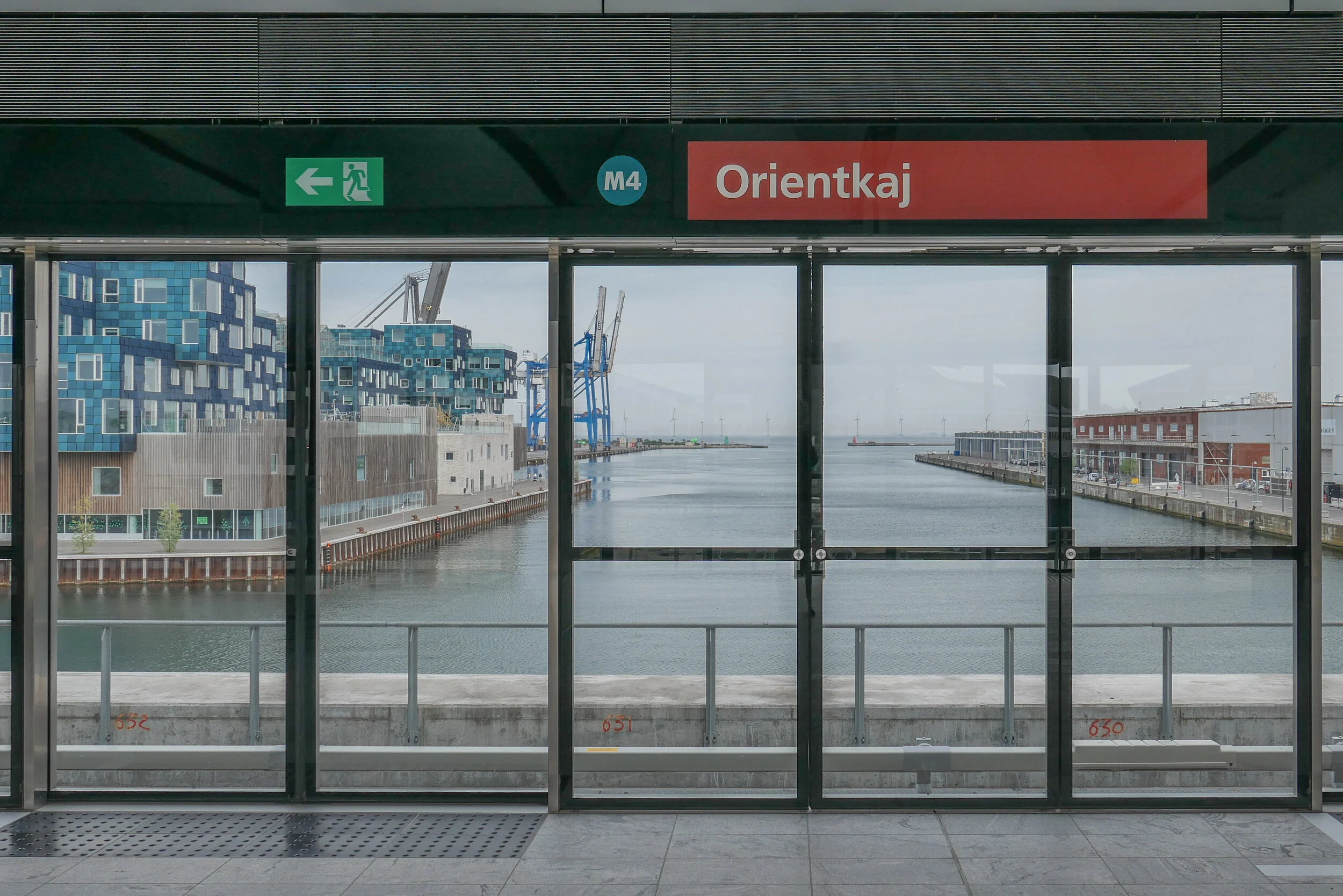
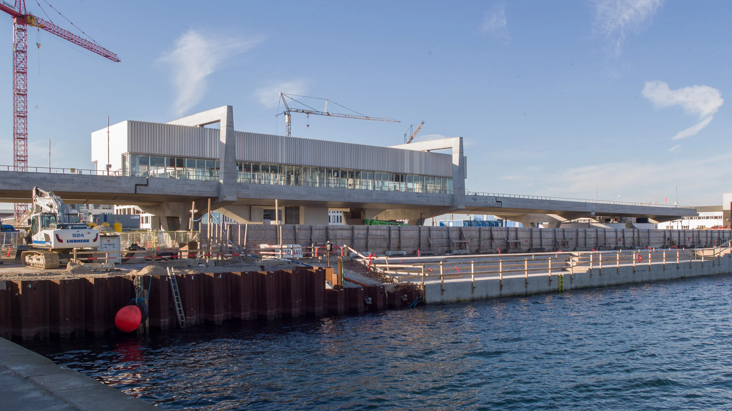
At the end of March, the north part of the new M4 line of the Metro opened for trains to run from København H - the central railway station - to Orientkaj, out at the north harbour.

This new service follows the Cityring to Østerport but then, just north of the station, there is a large junction or intersection at the north end of Sortedamsø and immediately below the lake where the new line heads out to the north east. It goes under the main railway line and railway station at Nordhavn and under the main coast road - Kalkbrænderihavnsgade - to a new underground metro station just north of Nordhavn Basin.

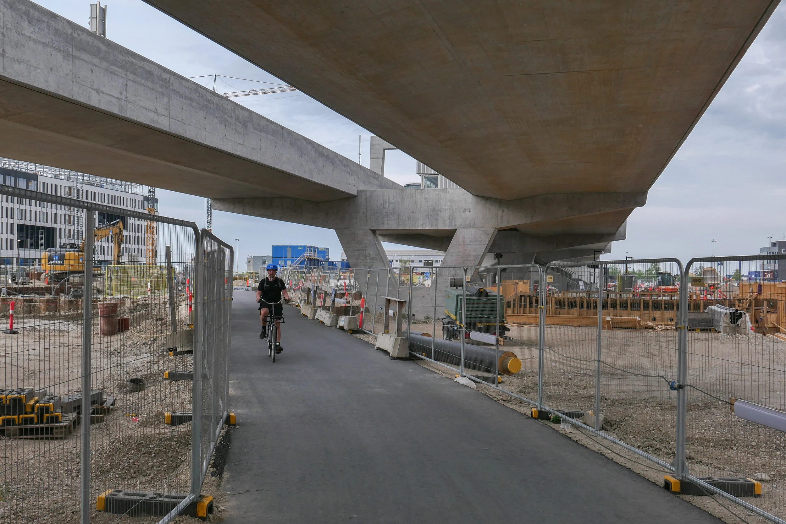
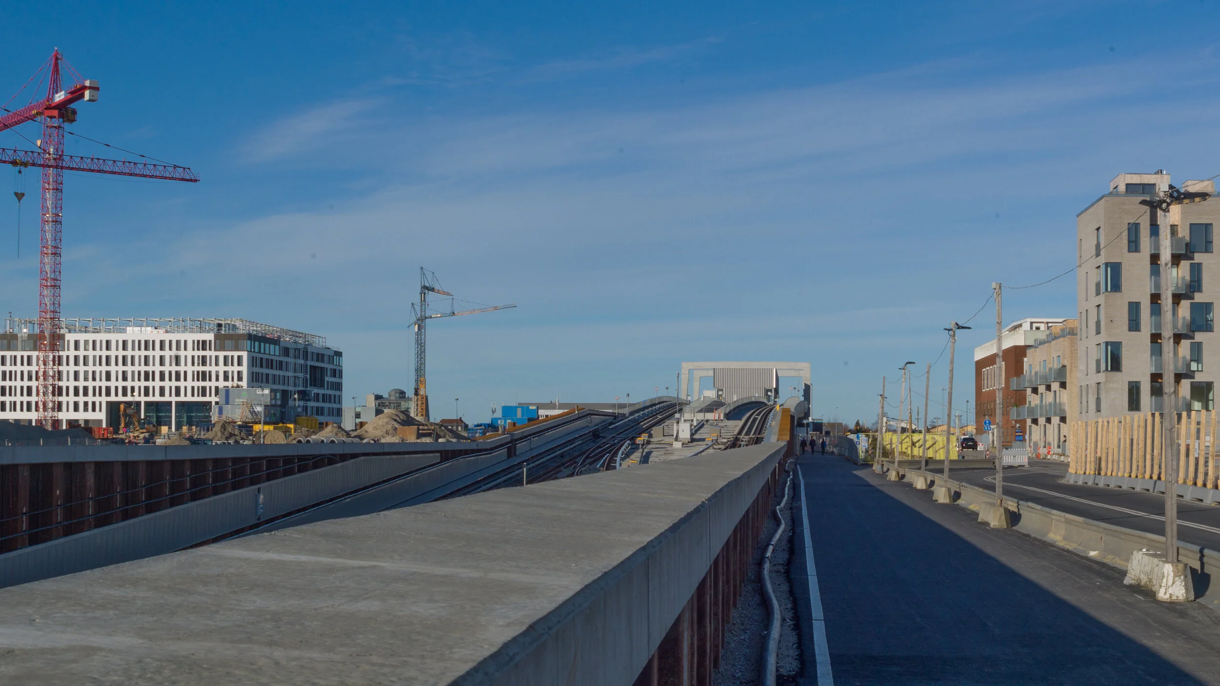
Trains then climb steeply to the start of a new elevated section of track to terminate at a new elevated station at Ørientkaj, just over 2 kilometres from Østerport.

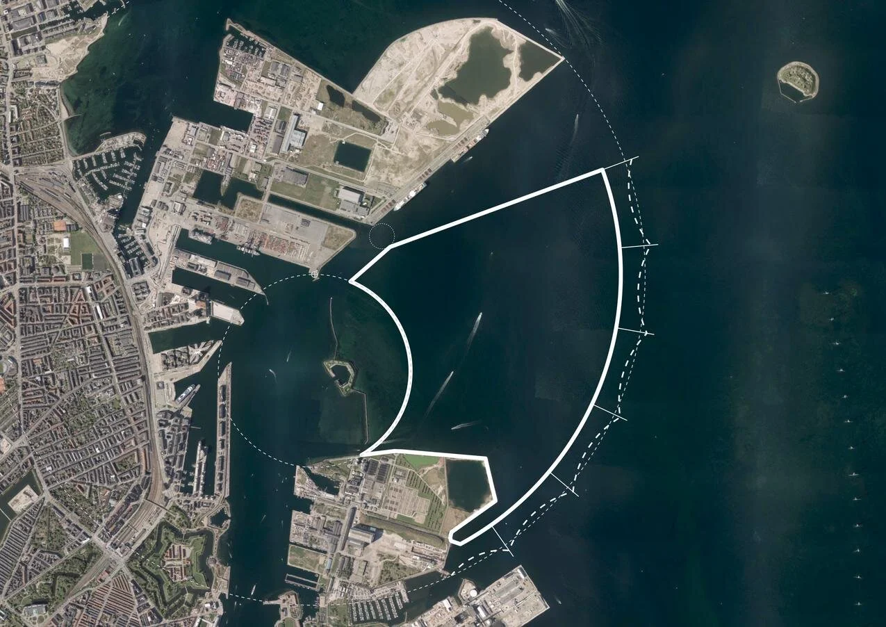
For now, the track stops just 70 metres beyond the new station but it will be extended on to serve new but as yet unbuilt housing and businesses at the outer or north part of Nordhavn and there are plans for it to continue to the terminals for cruise ships and, possibly, on further, back underground, to take passengers under the harbour and to Refshaleøen.

Going in the other direction, trains starting from Ørientkaj now terminate at København H - the central railway station - but the south end of the M4 line out to Sydhavn - the south harbour - is due to be completed in 2022 and then trains on the M4 line will continue on to Sluseholmen and on to what will be a major interchange with the suburban rail service at Ny Ellebjerg.

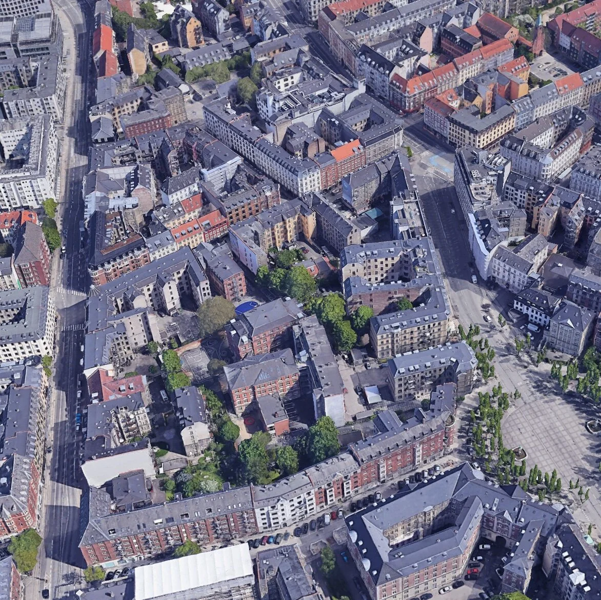
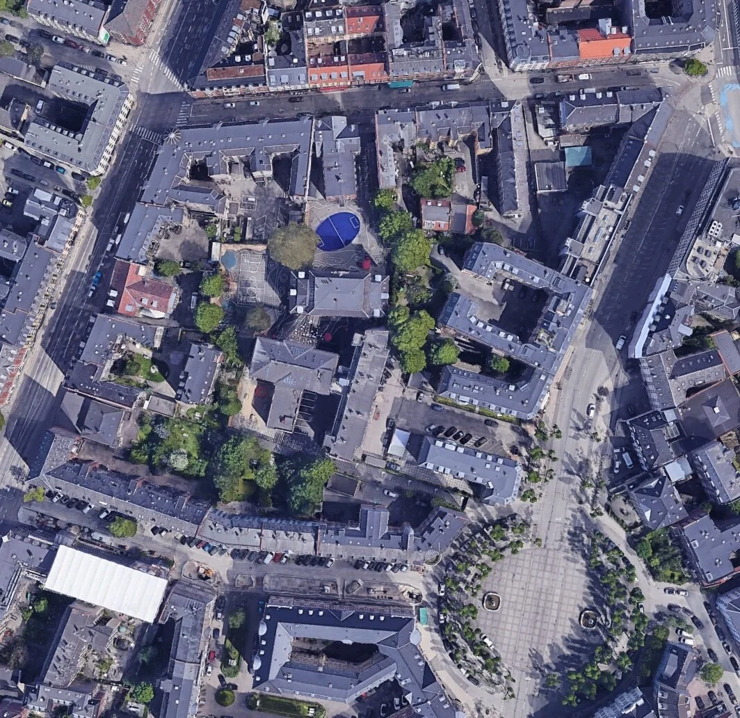
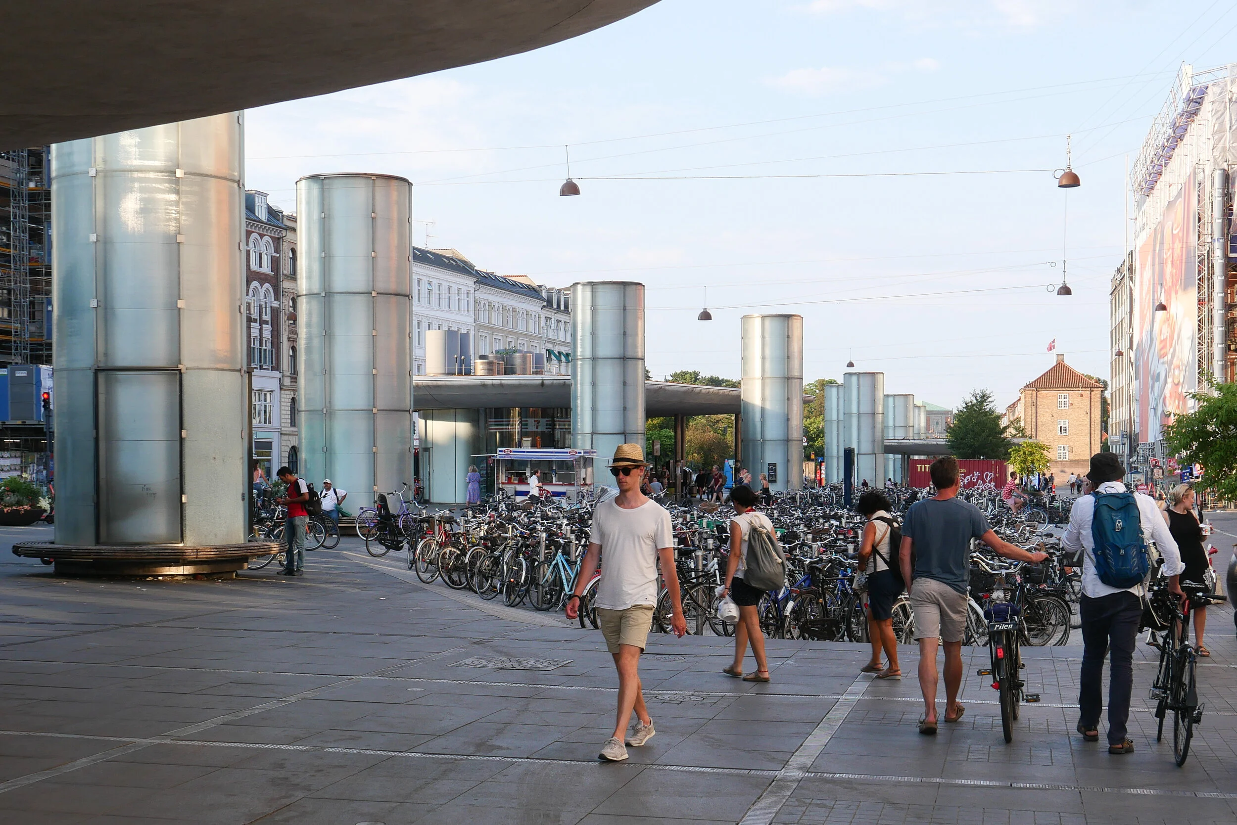
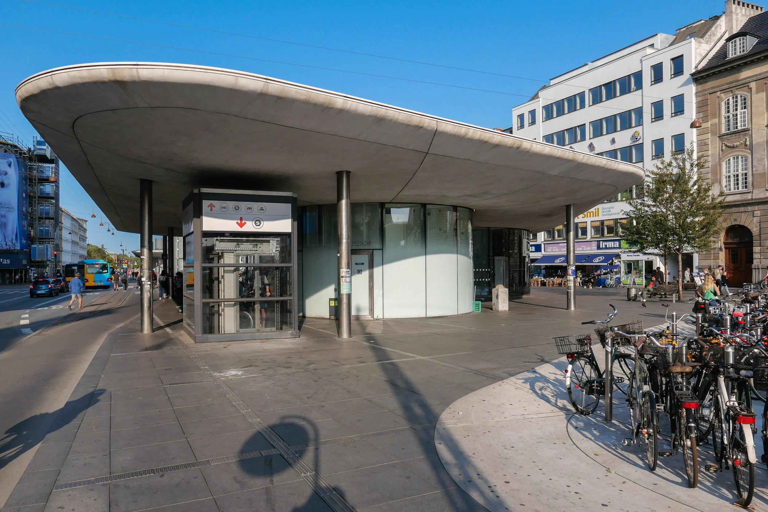
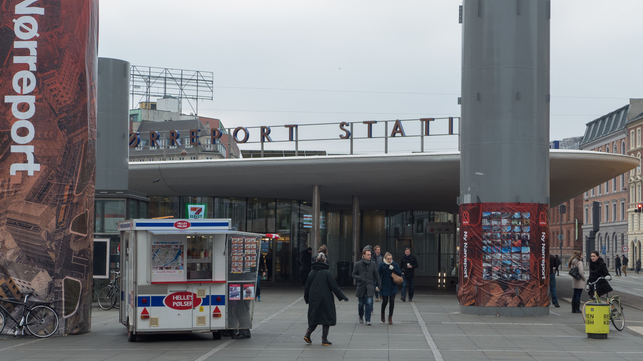
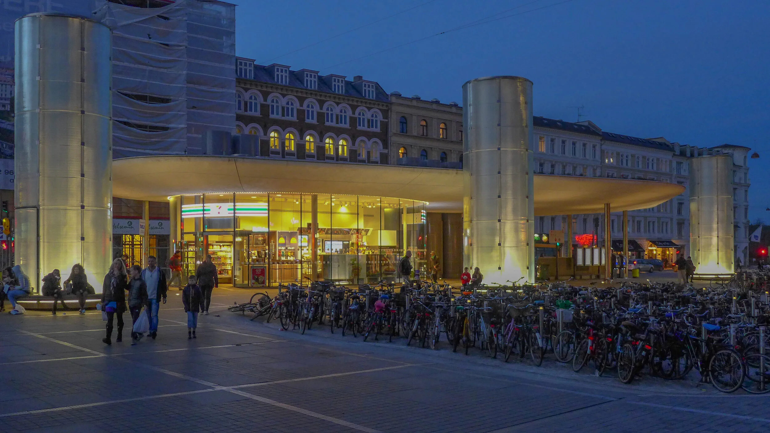
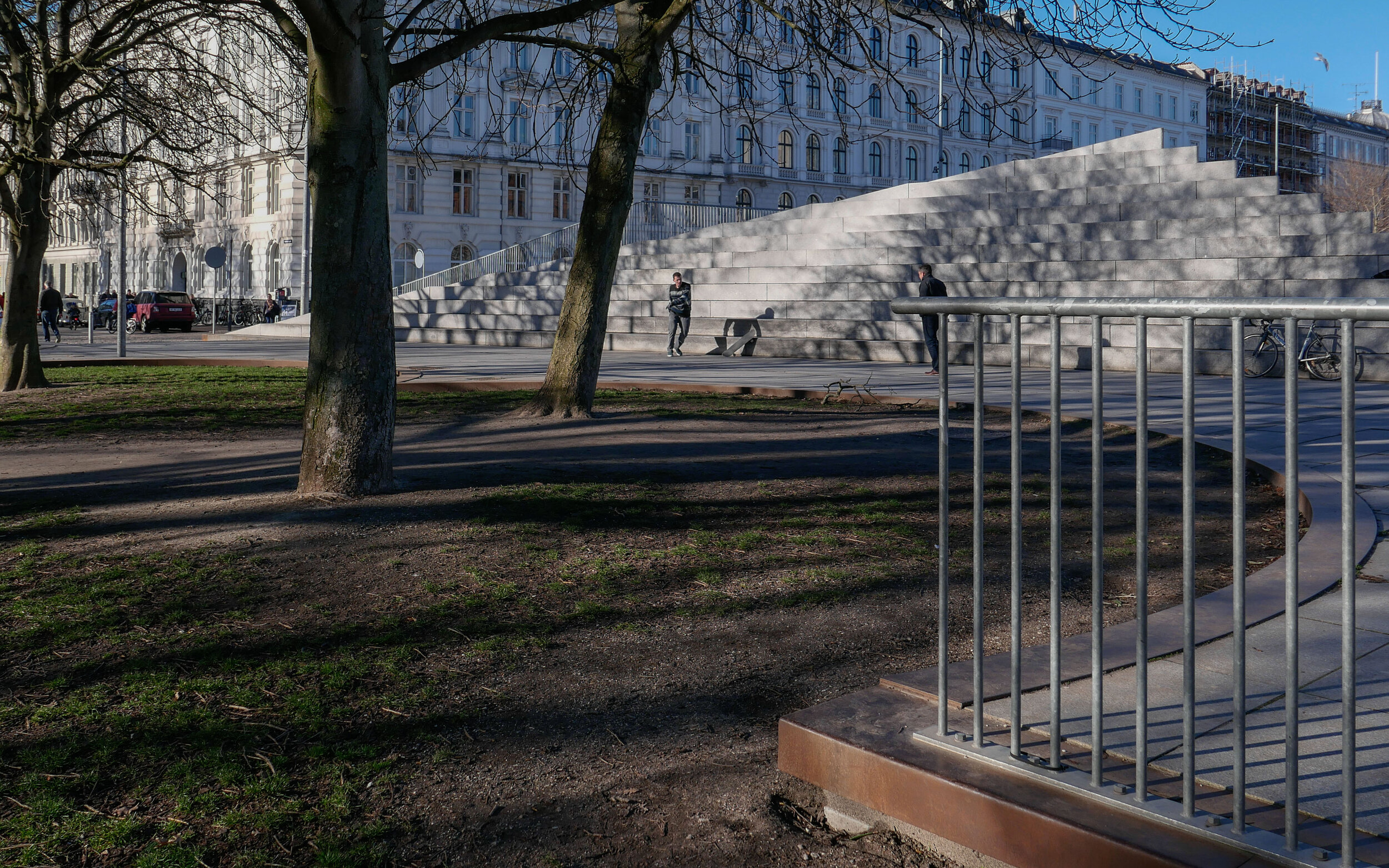
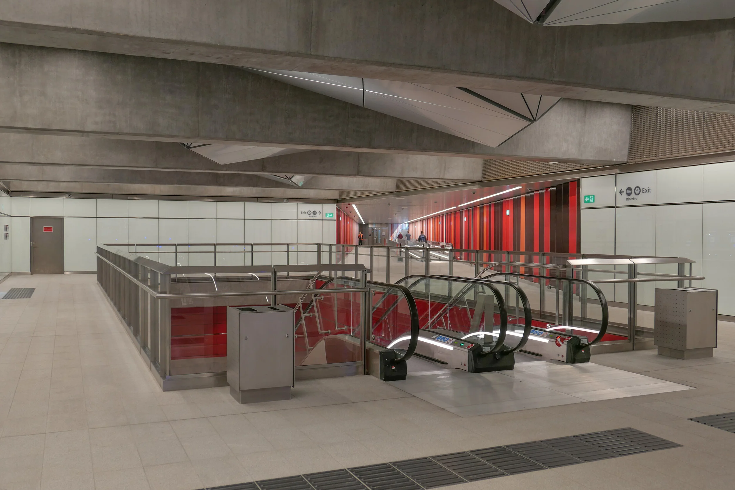
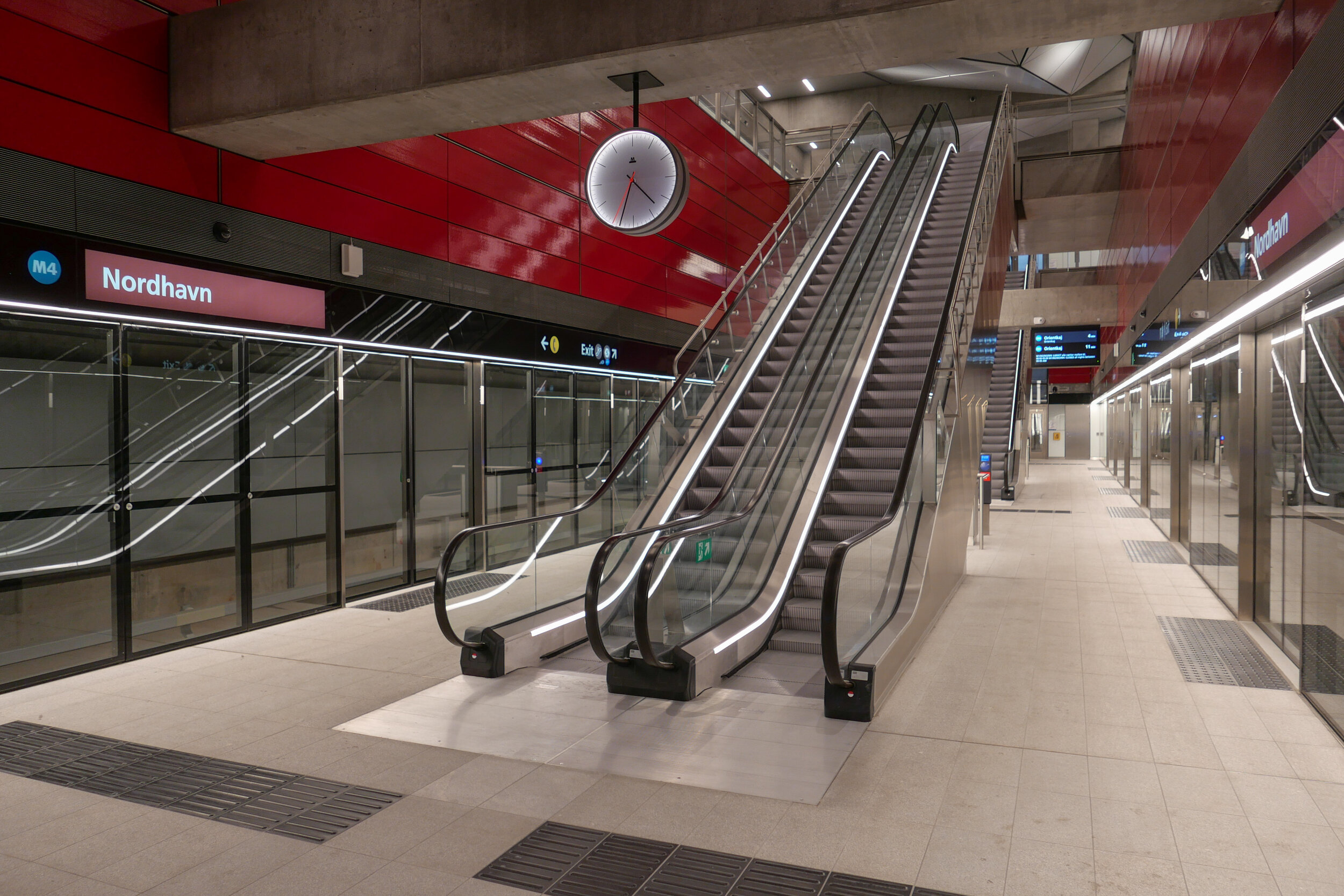
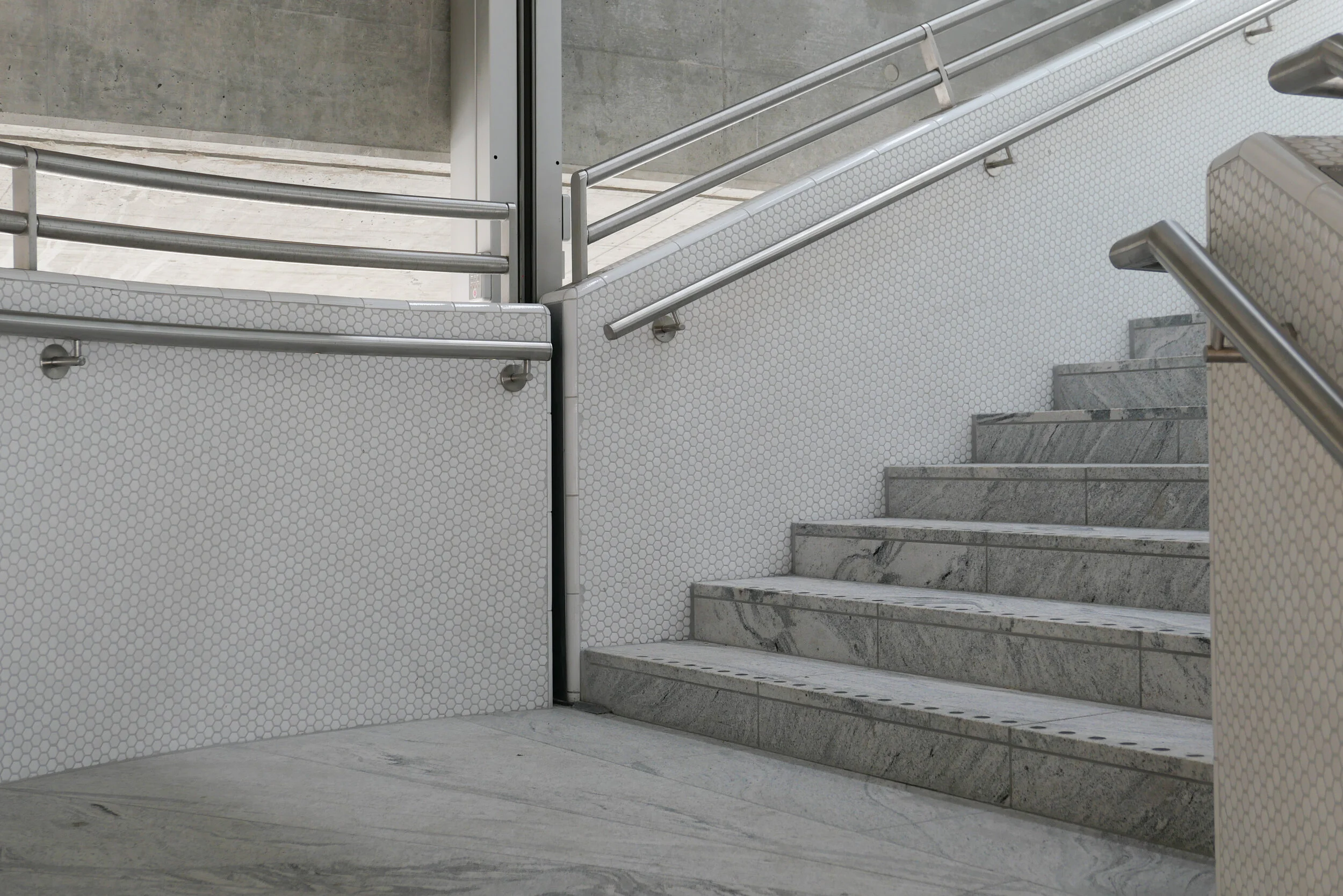
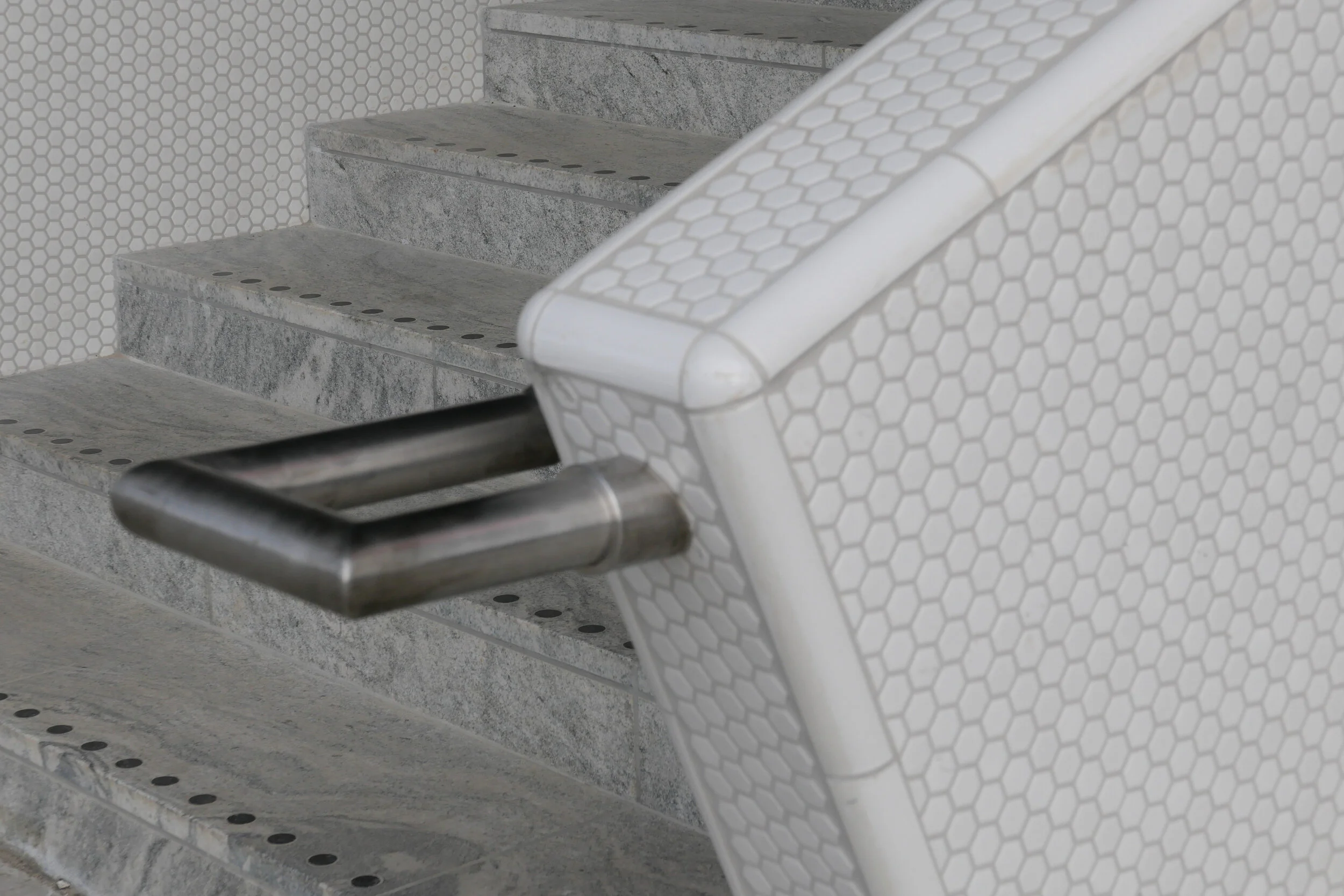
The new metro station at Nordhavn follows the same form as the other stations on the new Cityring …. so with the train tracks set apart and with a central platform between them. There is what is essentially an open concrete box above the platform that is rectangular in plan, the width of the platform and the length of the trains. This contains very open escalators, rising from the centre of the platform and free of the walls of the box and, just below street level, there is a large circulation area below street level where there are ticket machines, information panels and maps and so on with the open escalators at the centre. There are steps up to the street and, at many stations, access to underground bike storage at that level below the street. All the stations also have lifts - most with glass superstructures at street level and stops below at the ticket hall/circulation area and then at the platform.

But, here at Nordhavn, there are some distinct differences from that arrangement.

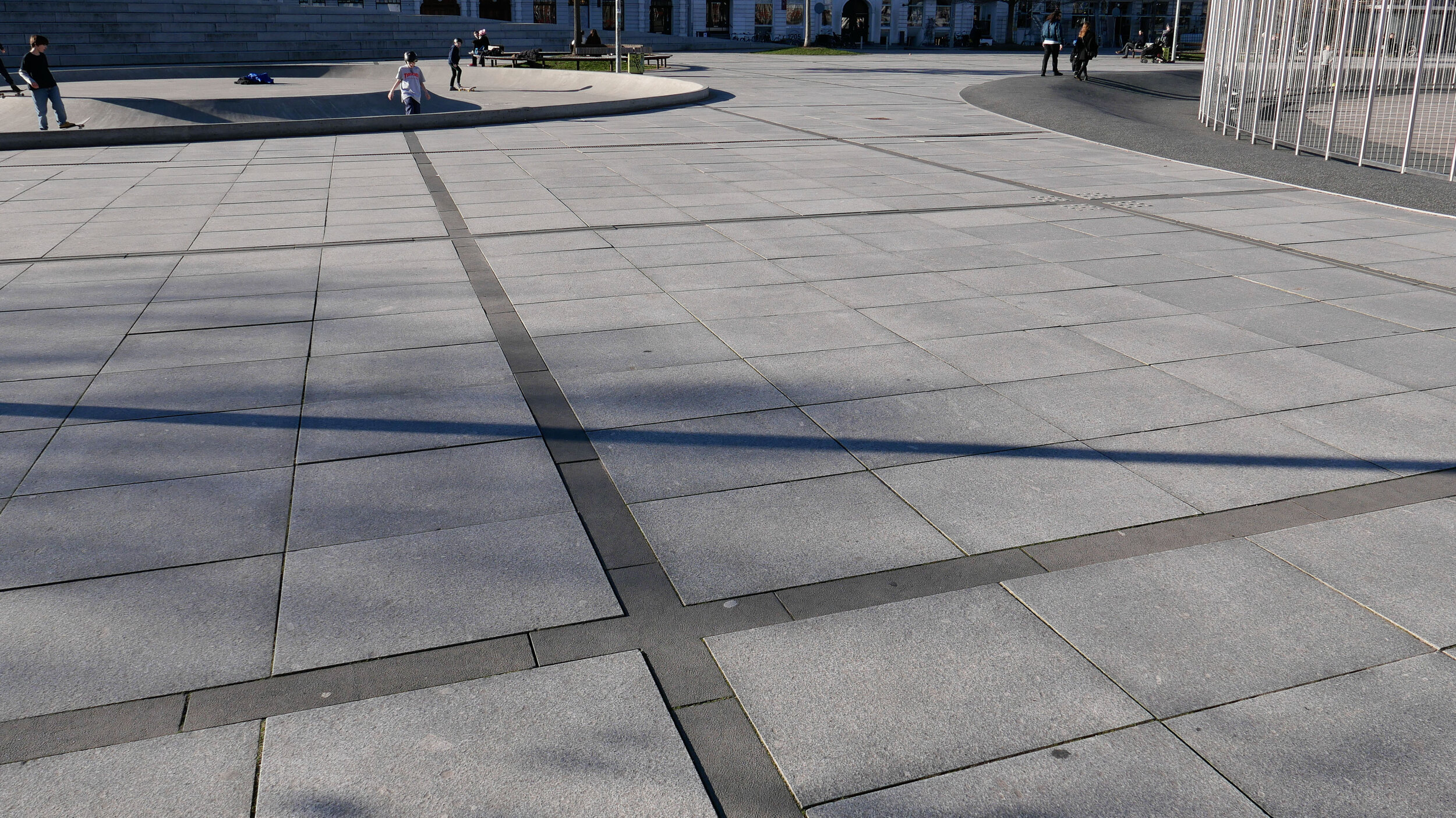
First, and perhaps most obvious, there are no skylights over the escalators. The public square above the station is only crudely laid out for now, with temporary paths for access, so it’s difficult to see how this will be organised and difficult to see why the distinct pyramid-shaped sky lights of so many of the other stations have been omitted here. These pyramid-shaped skylights over the escalators are important because they provide at least some natural light right down to the platform.

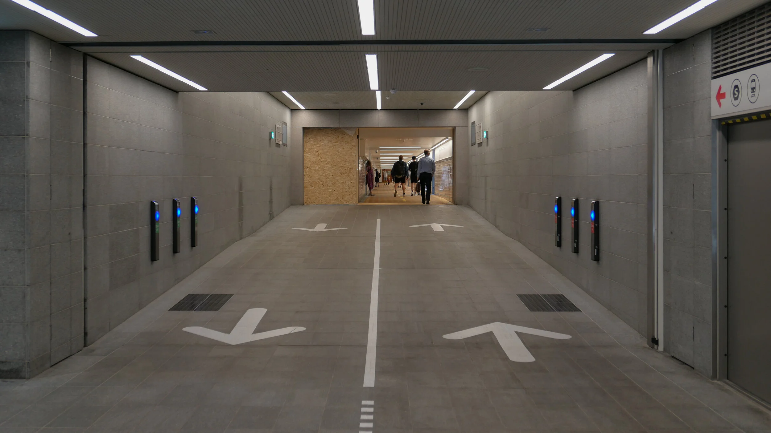
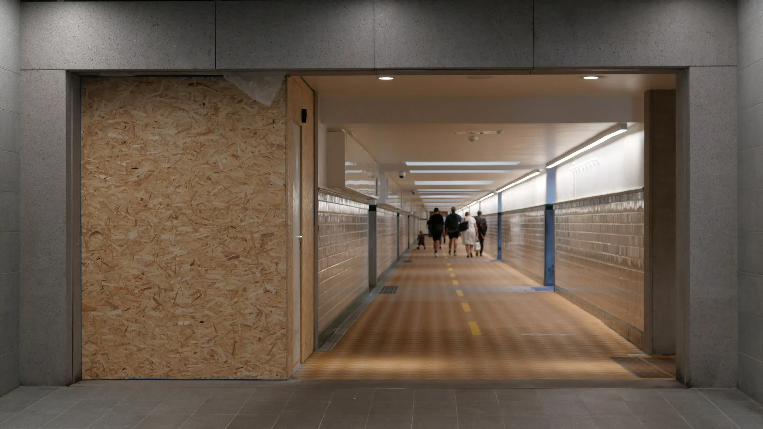
And where the other stations are set to the orientation of the streets or squares above - so with entrances and staircases and elevators that are either at each end or, in some, at the centre of each side - here at Nordhavn the tunnels and the station platform are set at an angle to the streetscape above. The east exit and entrance to Nordhavn runs out at an angle from the corner of that main hall just below street level as a short tunnel with steps to take passengers up to the street above but there is also a long pedestrian tunnel, for passengers to walk under the road and under the suburban railway, to connect the metro station to the suburban railway station and that runs out at an angle from the diagonally-opposite corner at the main ticket hall level immediately below ground. So, the main circulation area, immediately below the pavement, has a strong and distinct diagonal axis.

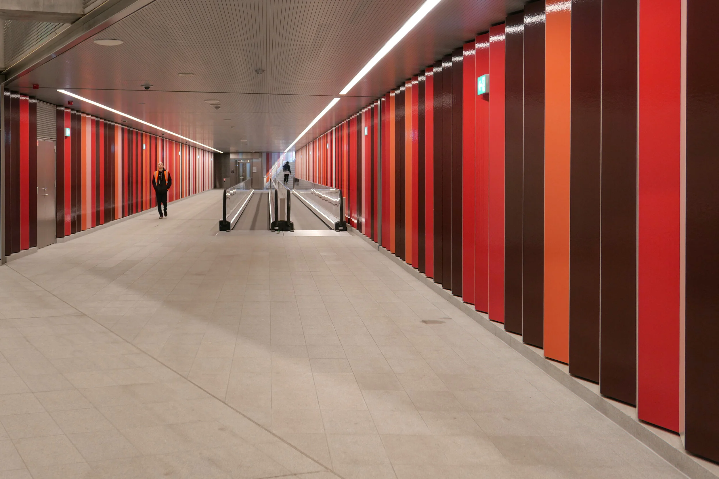
A unique feature in the new metro stations is a moving pavement for the main part of that long tunnel between the metro station and the suburban train station.

The walls of the box down to the platforms have the deep red cladding of other metro stations where there is an interchange between the metro and suburban trains and that deep red is also taken through the tunnel between the metro station and the suburban rail station as narrow vertical panels or stripes. In contrast, the flight of steps up to the square has striking black and white stripes.

I’m curious about this colour coding. From the train, passengers can just see the red above the platform so it might remind them to get off the train here for a railway interchange but how are visitors to the city to know that? And locals, who might have spotted the colour code, probably know where they are going anyway.


Just beyond the station at Nordhavn, trains emerge from the tunnels and run within hefty concrete channels that rise up steeply past Sundkaj to the new station at Ørientkaj that is just before Levantkaj where the track stops.

Of all the metro stations on the system, Orientkaj stands out with its strong style that owes more to engineering than to architecture.

Like the other stations, the platform at Orientkaj is set between the tracks - rather than on either side, outside the tracks - but the platform area and the tracks on either side are within a large glass box that has spectacular views straight down the dock to the Sound.

The platform area and its roof are supported on hefty concrete work with a broad V shape of supports rising from the ground and with a massive concrete cross beam that supports the platform but extends well beyond the platform with shallow notches in the top that take the troughs of the concrete track. Above, and supported on the ends of the cross beam, are large n-shaped concrete superstructures that seem to support the box of the platform. The design has echoes of the cranes on the docks that move containers along the quayside … so is this a clever visual game? Is the box hanging from the supports or simply paused before sliding on along the track?

Of course, the starting point for the design of the station may well be more mundane and more practical than anything to do with romantic evocations of the gantries of cranes for shipping containers …. it could be simply that, set at the head of the basin and close to the open sea, the glass box was needed to protect passengers and trains from the worst of the weather.

Unlike stations on the older above-ground sections of the Metro - on the lines running down to the  airport and to Vestamager - there is a central tower here with two elevators together rather than single elevators at each end of the platform.

And instead of the industrial, gantry-style metal staircases down to the pavement at those first above-ground stations, here there are dog-leg staircases with solid parapets covered with small white, hexagonal tiles and the staircases are set at an angle rather than being straight and parallel to the tracks.

This has a vaguely Art-Deco feel that might or might not be a reference to the white beach-side architecture of Bellavue and Bellavista by Arne Jacobsen that is just along the coast to the north.

Copenhagen Metro
Arup on the extension to Orientkaj


can Lynetteholm be car free?

A recent article in the newspaper Politiken has suggested that the proposed development of Lynetteholm, on a new island to be constructed across the entrance to the harbour, will not be designed to be car free even though the initial plans included good links by public transport.

A new report has concluded that by making the residential areas completely car free, property and land values would be reduced so the sums do not stack up for the returns required to make the project viable.

The report by the consulting engineers Rambøll and MOE Tetraplan looked at three scenarios for the new island from almost completely car-free (10 to 15 cars per 1,000 inhabitants) through partially car-free (120 to 130 cars) and also without restrictions imposed so with average car ownership of 250 cars per 1,000 residents.

If the development goes ahead, there would be homes on Lynetteholm for around 35,000 people and jobs for 35,000.

However, this new island is not simply a development for homes and jobs but also has a complicated part in the construction a barrier that is necessary to protect the harbour from storm surges and there should also be recreational areas along the new shoreline that will attract people from all over the city.

Initial plans for the island included a link to the metro that would be a 'relatively' straightforward extension of the recently-opened line to Nordhavn but the new report has concluded that a metro line would only generate the level of service required, if there were no cars on the island and if the line was built to complete an arc across Amager so to continue round to the metro station at Christianshavn and then on under the harbour in a new tunnel to the central railway station and that, of course, that would add very considerably to the cost.

The report also suggests that the harbour ferry service, that now terminates at Refshaleøen, should not just be extended to Lynetteholm but, if the area is to be completely free of cars, would have to run every ten minutes rather than every 30 minutes with the present service.

Lynette after.jpeg

will Lynetteholm be constructed further out into the sound?

As yet, there has been no final decision on consent for a major proposal to construct a man-made island across the main entrance to the harbour although they have got as far as calling the island Lynetteholm.

With extensive new areas of housing - comparable in some ways to the work at Nordhavn - it would be immediately beyond Trekroner / The Triangular Fort  and would be constructed across a deep and well-established navigation channel that is the entrance to the harbour from the sound.

If the island is constructed there would be just narrow passageways from the harbour to the open sea between the new island and Refshaleøen and between the island and Nordhavn and it would certainly block the view out from the harbour to the open water of the sound and certainly change the character of the harbour.

Dan Hasløv, in a recent article, published on line on the site of Magasinet KBH, has proposed an alternative site further south and further out in Middelgrunden - an area of shallower water - and there would be a wide channel between Refshaleøen and the new island.

One important role for the new island is to protect the inner harbour from storm surges but this would still be possible with barriers across to the fort from each side.

The current proposal includes road tunnels and metro tunnels to link the new island to Nordhavn and to Amager with the possibility of extending the metro under the sound to Malmö and again all that would still be feasible if the new man-made island is further round to the south but could also reduce the impact of a major new road down the east side of Amager that is part of the current proposal that would link Nordhavn to the Øresund bridge.

earlier post on Lynetteholm

the most recent scheme proposed by BY&HAVN
Flyt Lynetteholm til Middelgrunden og bevar kontakten til havet.

Dan Hasløv, Magasinet KBH 25 March 2020

view out from Nordhavn looking east to the sound from Fortkaj …. the Triangular Fort and the north edge of Reshaleøen are in the distance to the right
this view out to the open sound would be lost if the island is constructed across the entrance to the harbour


detail of chart from 1885

the most-recent version of the scheme from BY&HAVN

World Happiness Report 2020

The World Happiness Report was published on 20 March 2020 and can be downloaded or read on line.

“From 2013 until today, every time the World Happiness Report (WHR) has published its annual ranking of countries, the five Nordic countries – Finland, Denmark, Norway, Sweden, and Iceland – have all been in the top ten, with Nordic countries occupying the top three spots in 2017, 2018, and 2019. Clearly, when it comes to the level of average life evaluations, the Nordic states are doing something right, but Nordic exceptionalism isn’t confined to citizen’s happiness. No matter whether we look at the state of democracy and political rights, lack of corruption, trust between citizens, felt safety, social cohesion, gender equality, equal distribution of incomes, Human Development Index, or many other global comparisons, one tends to find the Nordic countries in the global top spots.”

For the first time The World Happiness Report ranks cities around the world by their subjective well-being and Nordic cities take six of the ten top places.

1   Helsinki, Finland
2   Aarhus, Denmark
3   Wellington, New Zealand
4   Zurich, Switzerland
5   Copenhagen, Denmark
6   Bergen, Norway
7   Oslo, Norway
8   Tel Aviv, Israel
9   Stockholm, Sweden
10 Brisbane, Australia

“What exactly makes Nordic citizens so exceptionally satisfied with their lives? ….. Through reviewing the existing studies, theories, and data behind the World Happiness Report, we find that the most prominent explanations include factors related to the quality of institutions, such as reliable and extensive welfare benefits, low corruption, and well-functioning democracy and state institutions. Furthermore, Nordic citizens experience a high sense of autonomy and freedom, as well as high levels of social trust towards each other, which play an important role in determining life satisfaction. On the other hand, we show that a few popular explanations for Nordic happiness such as the small population and homogeneity of the Nordic countries, and a few counterarguments against Nordic happiness such as the cold weather and the suicide rates, actually don't seem to have much to do with Nordic happiness.”

Holckenhus

Holckenhus is a large and prominent apartment building on HC Andersens Boulevard that is two blocks south of the city hall and opposite Ny Carlsberg Glyptotek.

It occupies a complete city block that is not square but is actually a distinct trapezium with it's narrowest front to HC Andersens Boulevard; a long north front to the relatively narrow but busy Stormgade; a main frontage to Vester Voldgade and the most important and best-known frontage to the public space of Dantes Plads.

The building was designed by the architect Philip Smidth who also designed several of the major buildings around the city hall and it stands over the site of one of the major bastions of the old city defences called Holck's Bastion and that gave the building its name.

This part of the defences was the last major section around the city to be dismantled - late in the 1880s. Work on the the apartment building started in 1891 and was completed in 1893. Work on the Glyptotek began in 1892 and was completed in 1896 and there are early photographs that shows open ground beyond the gallery and the apartment buildings where the land there was being claimed from the sea.

The apartment building has upper floors in red brick with architectural features - including window architraves and quoins that form pilasters at the corners - in pale stone or cement and over a rusticated stone base but the most distinct feature is the steeply-pitched mansard roofs with dormer windows over what are marked out with quoins to be corner towers along with raised roofs over the sections or pavilions at the centre of each long frontage.

One source of inspiration for the design is clearly the architecture of chateaux and urban palaces in France from the 16th and 17th centuries so the style is generally described as French Renaissance although there is also a strong link to Danish architecture of the 17th century.

There were shops or commercial properties at street level with a lower-height mezzanine above and the most important apartments were on the second floor with balconies to the windows at that level with stone balustrades.

Inventories show that NA Scioldann, the builder of the apartments, lived in a large apartment in the building and he is credited with encouraging artists to move here to studios at the upper level.

A census of 1895, records that the prominent artist PS Kroyer had an apartment in Holckenhus, where he lived with is wife Marie Kroyer and three maids and a nurse for their new-born daughter, and the painters Agnes Slott-Møller and Emil Nolder are also known to have lived in the building.

Controversies over the future of Holckenshus aired in newspapers through last summer after the property was acquire by Blackstone - an American private equity fund - and there were reports that in their work to ‘upgrade’ the building, stained glass on staircases has been removed and high-quality and original woodwork on doors and staircases have been painted over but with details now picked out in gold.

However, the controversial and contentious proposal from Blackstone is to raise the roof between the towers to create eight luxury penthouse apartments. Clearly, the corner turrets and the central pavilions on each of the long facades is the key feature of the design of the exterior and a common roof line would undermine and change fundamentally the original concept.

The building is a major Danish cultural assets and not just the external appearance, in such a prominent position, should be preserved but features of the original interior have to be protected.

An article in Jyllands-Posten on 28 August 2019 Historisk bygning har huset Krøyer og andre store kunstnere: Renovering møder kritik by Ronja Melander has photographs of the interior and the web site of the Museum of Copenhagen has an article on the building and its occupants - Holckenhus - en beboelsesejendom med kunstneratelierer

Holckenhus has been added to the time line for apartment buildings on the site Copenhagen by design


the Boulevard in 1897 with the corner turrets of Holckenhus just visible (centre left) with the newly-completed Ny Carlsberg Glyptotek


an axis on the line of an avenue that was never planted

the view from Dantes Plads to Christiansborg above and the plan fot an extension of the city drawn by Conrad Seidelin in 1857 below with a long double avenue or ride to the corner of a large new garden that appears to have been designed for irregular paths through densely planted trees with a terrace out to the bay and an avenue of trees returning along the shore to Langebro that then crossed to Christianshavn from the end of what is now Vester Voldgade.

Note: the plan shows the original railway station, built in 1847, with the railway line along what is now Sønder Boulevard, and what might have been a proposal for a new U-shaped station on Vester Voldgade.

Standing on Dantes Plads - just out from Holckenhus - the buildings across the north side of the square - it becomes obvious that there is a straight view down the street called Ny Vestergade to Christiansborg on its central east/west axis, across the Marble Bridge, and through the outer stable court to the great tower over the east entrance.

In the other direction, west from Dantes Plads, this line cuts close to the corner of Ny Carlsberg Glyptotek but continues as far as the side entrance to Øksnehallen - the meat market - even following across the bridge taking Tietgensgade over the main railway lines at the south end of the platforms of the central station.

Copenhagen is not a city of long straight roads let alone grand avenues and bombastic planning so the line and the length of this axis - 1,300 metres in all - is curious.

Although the central axis through the courtyards of Christiansborg and out over Marmorbroen / the Marble Bridge was created in the early 18th century - when the castle was rebuilt - the axis on further to the west was not a viable proposition then as it was blocked by the high bank of the defences on the outer side of what is now Vester Voldgade, and, beyond the defences, the sea of the bay to the south west cut in much closer than it does now so the sight line from the Marble Bridge - the west exit from the palace - would have looked along the beach. It might have been possible that this had been planned as a grand route from Christiansborg to the palace at Frederiksberg but that would have needed a new gateway through the defensive bank and, in any case, the alignment is wrong.

What seems more plausible is that this axis as far as the meat market has its origin in a scheme for extending the city that was proposed by the Danish architect Conrad Seidelin in the 1850s in anticipation that the old defences of the city would be dismantled.

In the end, by the time the high banks of the defences were taken down and the ditches filled in, the ownership of much of the land around the city had changed hands and some new streets had already been laid out so little of the plan by Seidelin was realised.

Here, west of the old city, he had proposed a long tree-lined avenue or boulevard on the central axis of Christiansborg that created a ride or esplanade out from the Marble Bridge to a large informal garden or park on the line of the lakes. This seems to have been envisaged as a royal garden comparable to the Queen's gardens that had been laid out to the north of the city at Sophie Amalienborg in the second half of the 17th century. Seidelin also proposed an avenue or ride returning along the harbour.

The axis, from Christiansborg to the meat market, seems to have survived by default despite the fact that the avenue and new gardens became less and less likely as the decades passed.

the Seidelin plan

traffic on HC Andersens Boulevard

One of the paintings in the current exhibition at the Museum of Copenhagen about the work of Paul Fischer is his view of HC Andersens Boulevard looking north towards the city hall from just before Dantes Plads on the right with the distinct building of what was then the new Ny Carlsberg Glyptotek on the left.

The first impression is that this must be a romanticised or highly edited view with people just sauntering across the boulevard but Fischer used his own photographs of the streets and squares in the city to compose what he painted and seems, generally, to have painted what he photographed.

So comparing the painting with a photograph taken last week you can see just how much space we have sacrificed to the car and just how much clutter there is with street signs and road markings.

When Fischer painted HC Andersens Boulevard there were trams running into the city hall square and out along Vesterbrogade and by then the railway line from the central station to Østerport had been constructed and suburban lines were being opened so public transport was well established.

Part of the problem with the Boulevard now is not just that there are three lanes of traffic between the lakes and the bridge over the harbour that run across the west side of the main city hall square but the traffic is unrelenting and although there are traffic signals - where pedestrians cross over - the traffic then sprints on to the next crossing so there can be noise and heavy fumes. The road has also taken over more and more of the width to allow for feeder lanes and particularly where vehicles back up before the lights waiting for them to change to let them cross over the traffic coming in the opposite direction.

One simple solution would be to drop the overall speed limit. This would not make it slower for the overall journey but simply control the cars racing to try and beat the next lights. It should also be possible at some junctions to stop traffic turning left, to cross over oncoming vehicles, by making cars turn right and then go round three sides of a block before crossing straight over at the junction where otherwise they would have turned left. Then, perhaps, some of the feeder lanes and the parking lanes could be taken over for wider pavements and more trees.

Paul Fischer exhibition at the Museum of Copenhagen

painting of HC Andersens Boulevard that is currently in the exhibition at the Museum of Copenhagen about the work of Paul Fischer and the same view photographed last week


HC Andersens Boulevard runs across the west (in this view the right) side of the city hall square with the Tivoli Gardens and then Ny Carlsberg Glyptotek before the harbour and Langebro. This aerial view shows just how much of the overall width - 50 metres from building front to building front - is tarmac and shows the chicanes at each junction.

When the square in front of the city hall was laid out and when these major buildings were constructed around 1900, Vester Voldgade on the east (left) side of the city hall was initially the main route down to the harbour and it follows the line of the road that was inside the city defences before the banks and outer ditches were removed in the late 19th century.

The original Langebro was at the end of Vester Voldgade and crossed to Christianshavn inside the defences on the line and angle that is now taken by Lille Langebro - the recently-opened bicycle bridge.


the new M4 line of the Metro to Orientkaj

Part of the new M4 Metro line is meant to open on Saturday 28th March.

The new track will run from Østerport metro station to Nordhavn, a new underground station at the inner end of the Nordhavn Bassin, and from there the track rises up steeply to Orientkaj, a new elevated station at the inner end of the quay and close to the new International School.

Just beyond the station, the elevated track stops but it will be extended out to the Ocean Quay Terminal for cruise ships and will serve the next stage of development on the outer or north part of Nordhavn.

Through the ticket area below ground and down through the escalators and on to the platform, the design for the new Nordhavn station includes red to link it visually with the design of the stations on the city ring at Nørrebro, Østerport and at Copenhagen H (the central station) as all four metro stations are major interchanges with the S or suburban rail system which is marked by it's red trains and red graphics.

In 2024 the extension of the M4 line out from the central station to the south west will be completed. This will connect the central station to the south harbour area and that line will continue on to Ny Ellebjerg and a major interchange there with the suburban rail routes for connections to the west and to the north.

Doubt about the opening date for the line to Nordhavn is due to the ongoing threat from viral infection with controls that restrict the numbers of people in all public areas although transport in Copenhagen is still running and so far there has been no announcement to suggest that the opening will be postponed.

Once it opens and once lockdown controls end that restrict how people can move around the city, the new line will carry around 11,000 passengers a day.

The extension of the M4 line from the central station to Sluseholmen and Ny Ellebjerg is to open in 2024.

the opening of the new line to Orientkaj
the line to Sydhavn / the South Harbour

above left - the track of the metro rising up to the new station at Orientkaj and, right, looking north under the first section of the elevated track
below left - drawing of the new station at Orientkaj from the Metro web site and the station from Orientkaj taken this afternoon, Sunday 15 March 2020


a new tunnel for suburban trains?

This week, in the newspaper Politiken, there was a short article on a proposal, that has been presented to the parliamentary transport committee, to consider the construction of a new tunnel, for suburban rather than for metro trains, that could form a fast link from the existing station at Hellerup, in the north part of Copenhagen, to the transport interchange at Ny Ellebjerg to the west of the city.

The new line would be over 8 kilometres long and journeys through the tunnel would be rapid because there would be few intermediate stations but these would link to the metro at strategic points.

Hellerup is a small municipality immediately north of the city and is already a busy and important interchange for suburban trains from the north but, from there, the trains run to Østerport, Nørreport, Vesterport and the central railway station through relatively narrow cuttings that date from the early part of the 20th century and from the central station curve on out through to Carlsberg and Valby or to Sydhavn and Ny Ellebjerg. All these stations are well-used interchanges and there are also smaller but also busy intermediate stations. It is a regular and relatively fast service but trains can be crowded and many of these stations are extremely busy and must be close to capacity.

Few people will travel regularly from Hellerup to Ny Ellersbjerg but a new tunnel would provide shorter and much quicker links through to alternative interchanges for joining the suburban train lines or the metro circle line at more appropriate points to get into the city or to get out to outer suburbs.

As proposed, on a new line through the tunnel, there would be just four intermediate stations ….. a station at Vibenshus Runddel - connecting to the new circle line of the metro and serving the national football stadium; a new and important station for Rigshospitalet and then new interchanges with the metro at Forum and Frederiksberg.

Trains would be short - like the metro train - and could be automatic, so driver-less, and could run every four minutes and, of course, trains would continue to run on the existing line.

This switching from train to metro or even to bus sounds complicated and frenetic but actually commuters know their routes and platforms and do most journeys on auto pilot anyway but, for other passengers, travel apps on mobile phones, updated in real time, show the best route and current arrival and departure times, platform numbers and the quickest route and electronic displays at platforms and on trains and buses now show arrival and connection times.

This is joined up planning. Planners and politicians are not resting on the laurels of what is being achieved with the construction of the new metro lines in the city but are already thinking about what has to be done next.

Østerport
Nørreport
Copenhagen Metro
the new Cityringen