Europe's most densely populated square kilometres - mapped

Back in the Spring, at the end of March, The Guardian published an article about "overstretched cities."

With the results from data compiled by Professor Alasdair Rae of the University of Sheffield, they produced a list of the 15 cities in Europe with the most densely populated areas within a single square kilometre. Curiously, London only managed to get into the list at 15 with a part of west London that has 20,477 people living within a single square kilometre. Top of the list was Barcelona with one block of a square kilometre that houses 53,119 people.

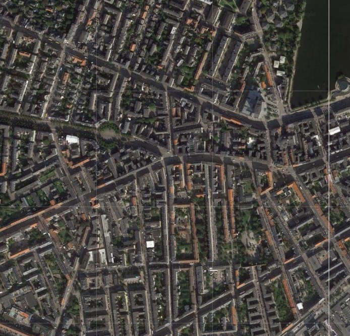
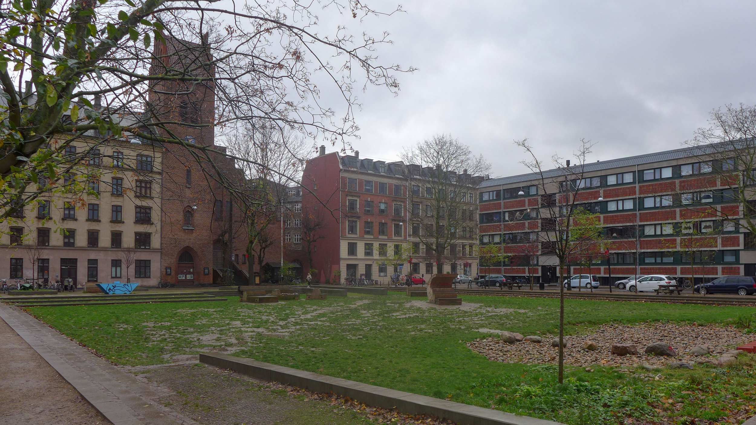
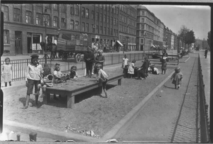
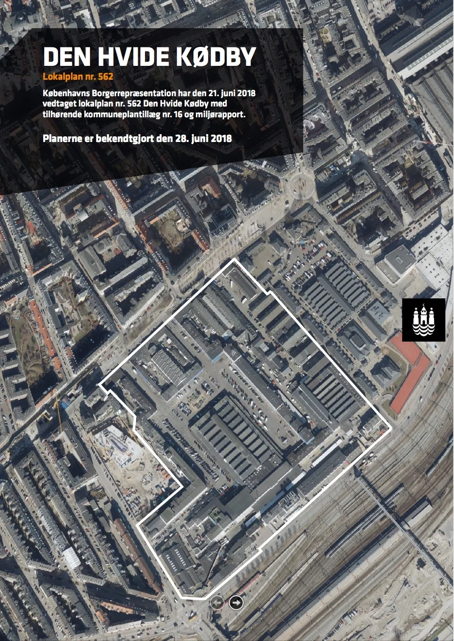
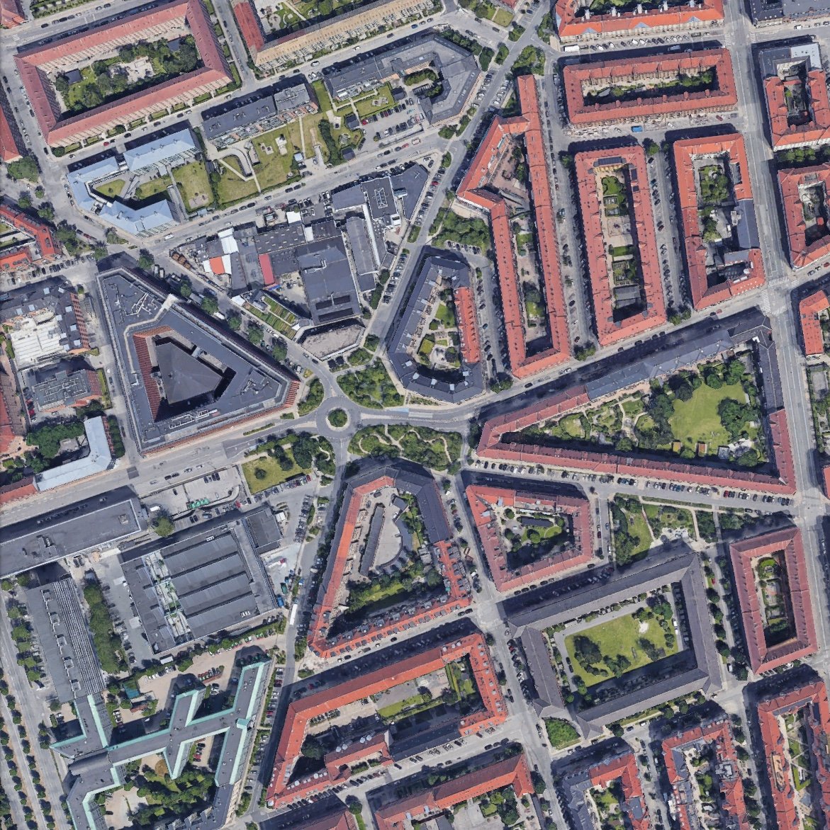
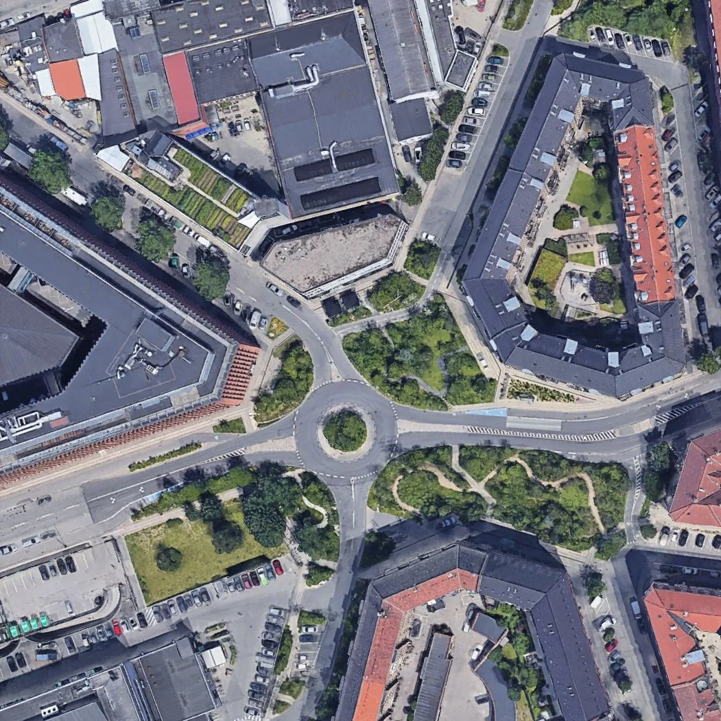
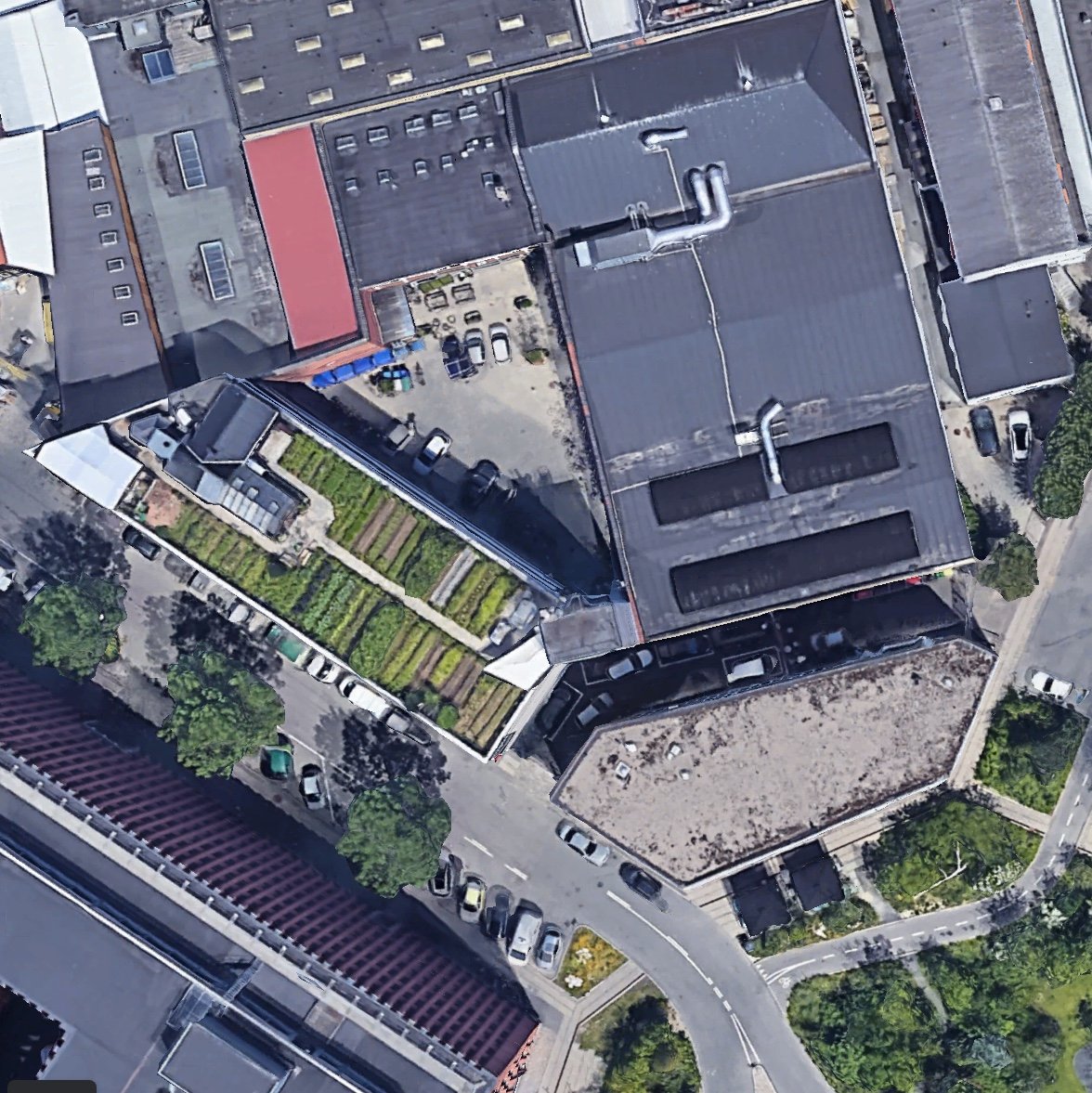
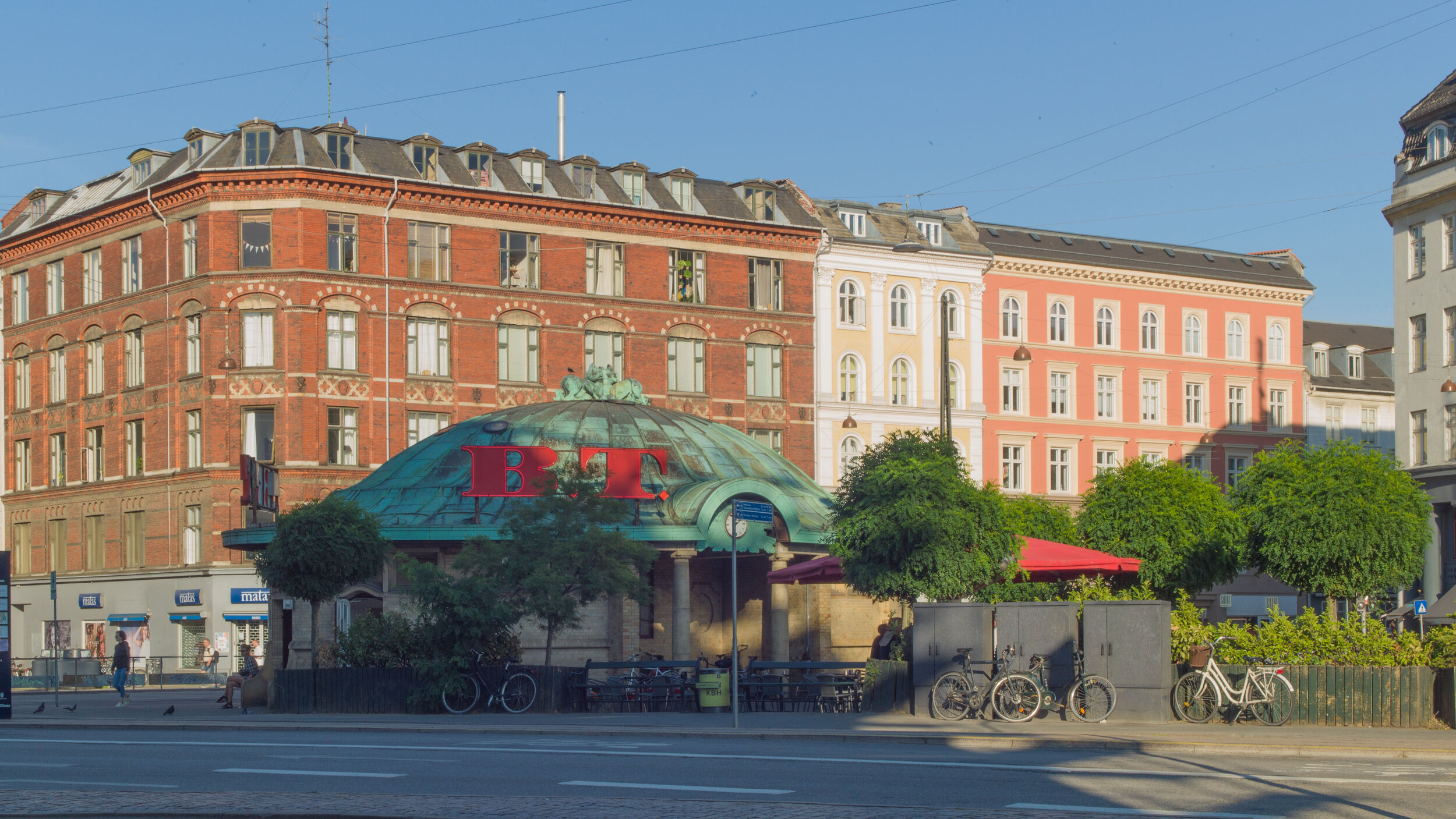
What was surprising was that Denmark had a place in the list at all but it was the area that is so densely packed with people that it made the list that is even more surprising. In at number eleven, with 22,381 people living within a block a kilometre across, was part of Frederiksberg immediately west of the centre of the city in Copenhagen.

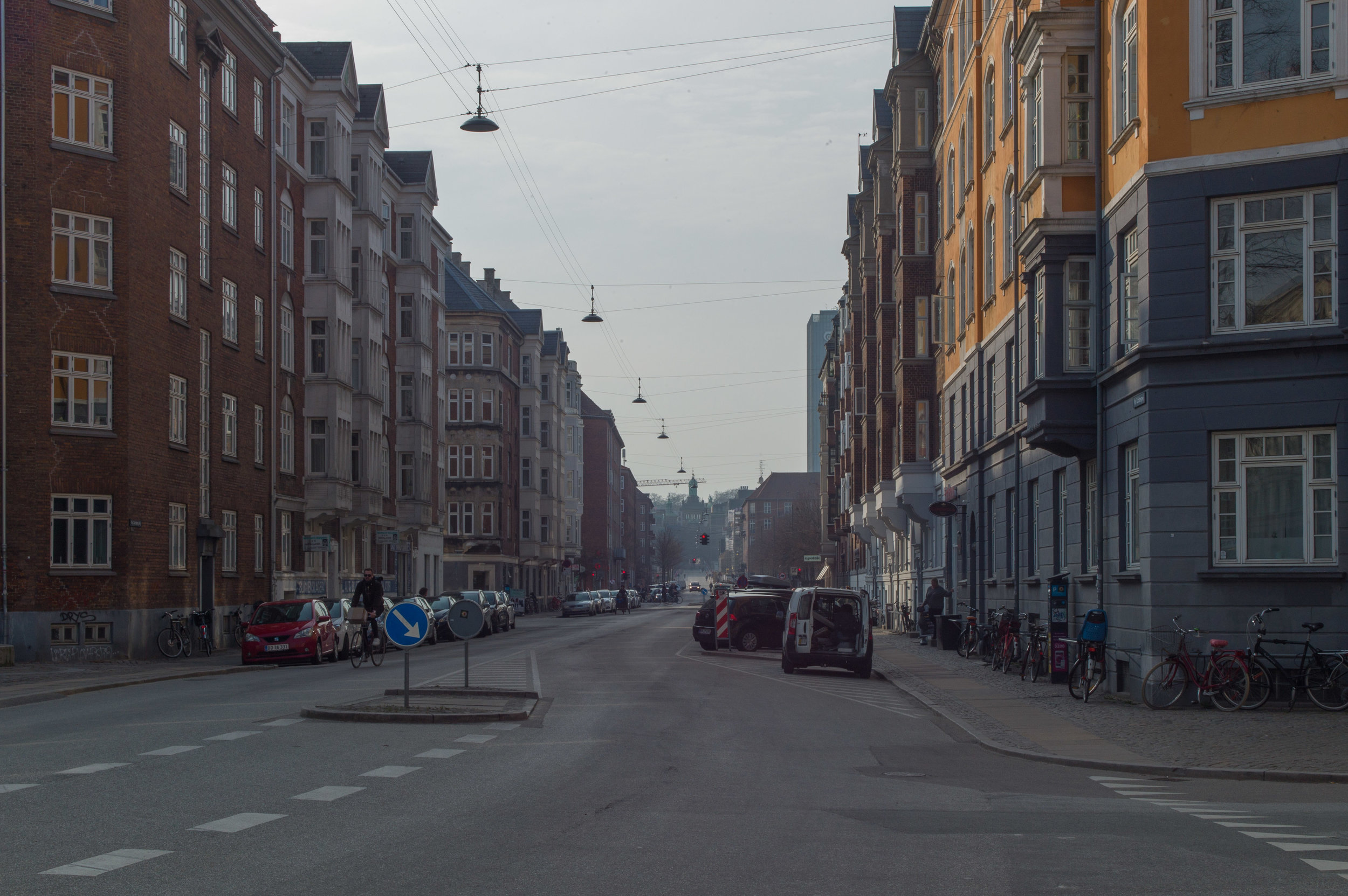
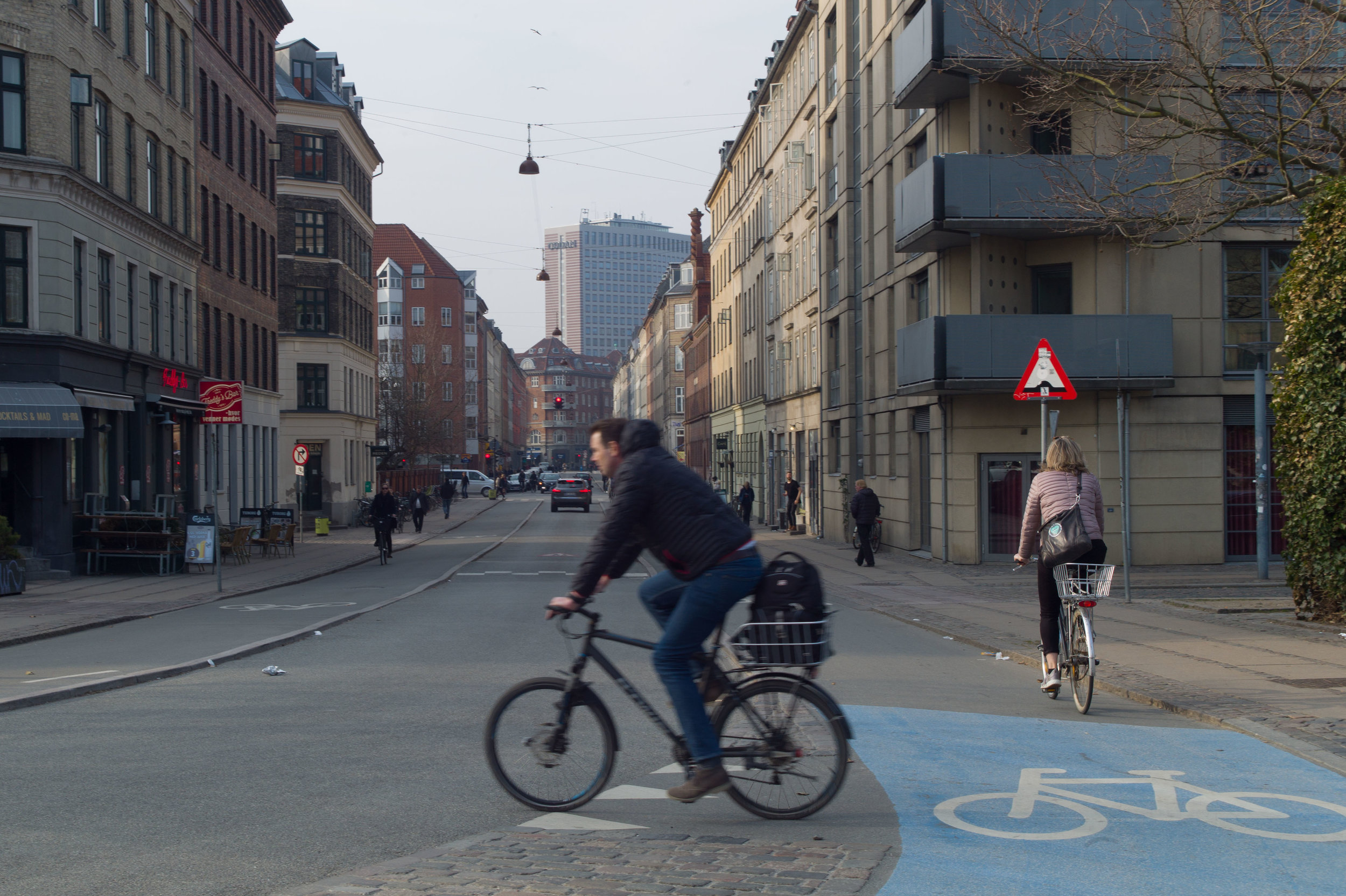
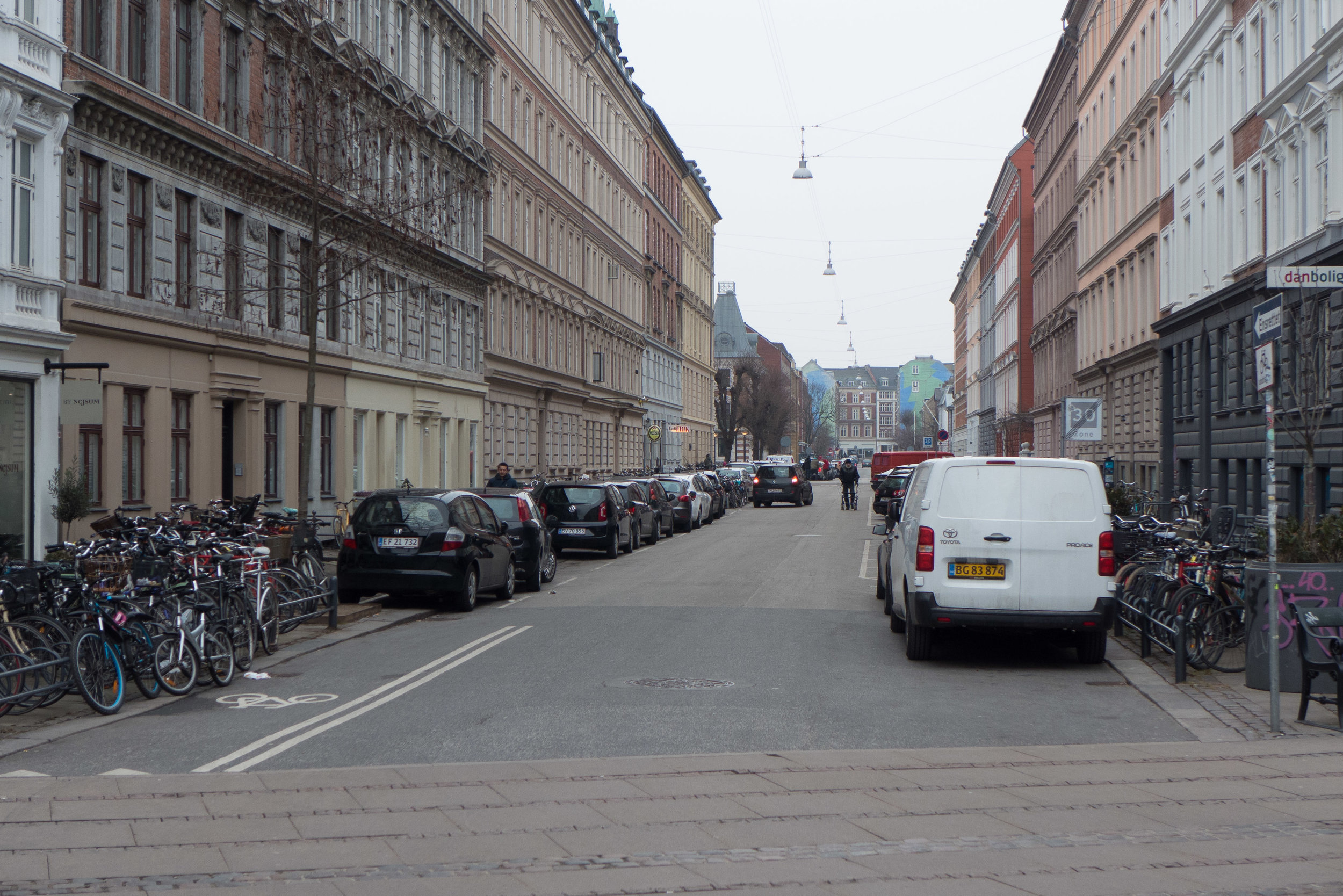
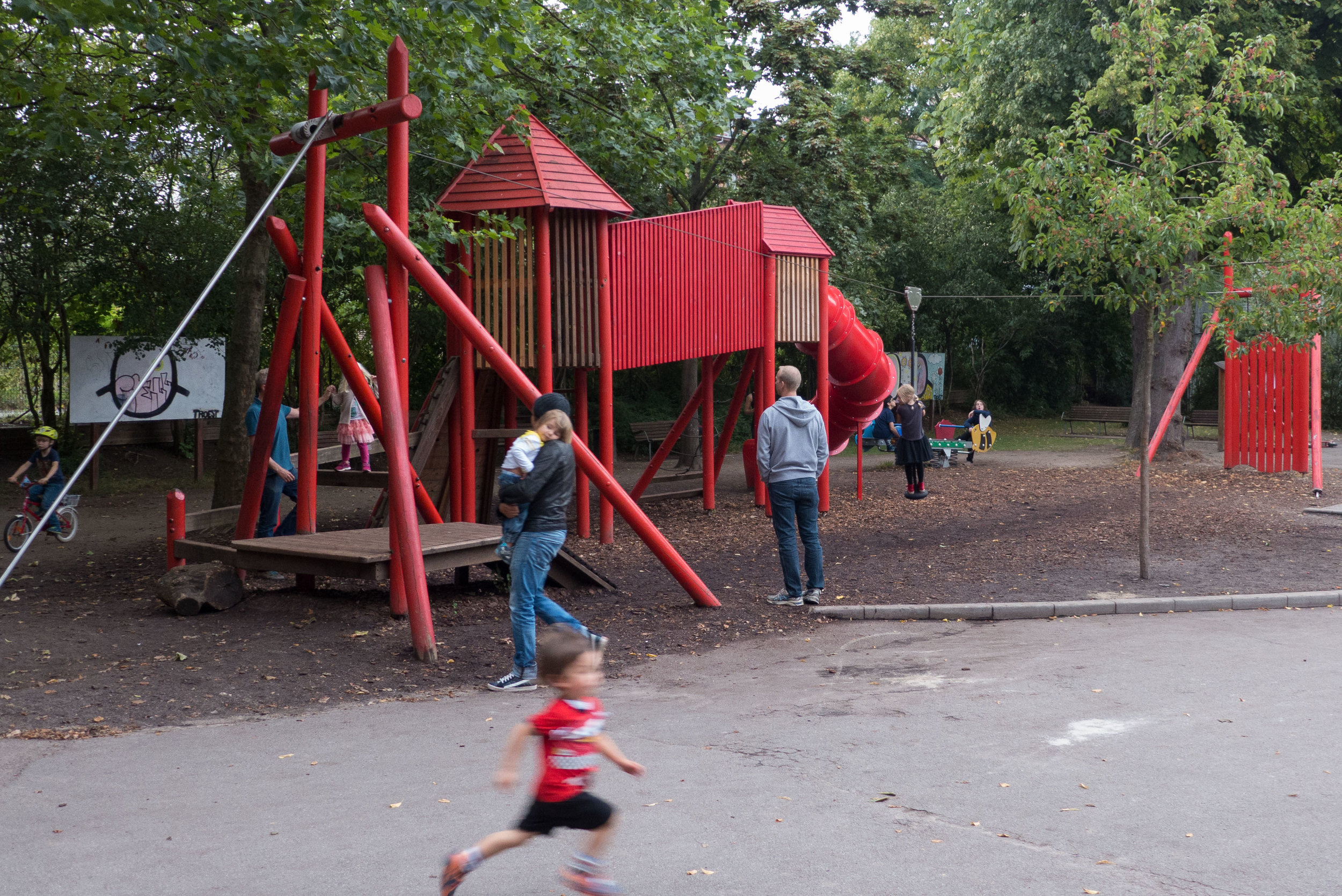
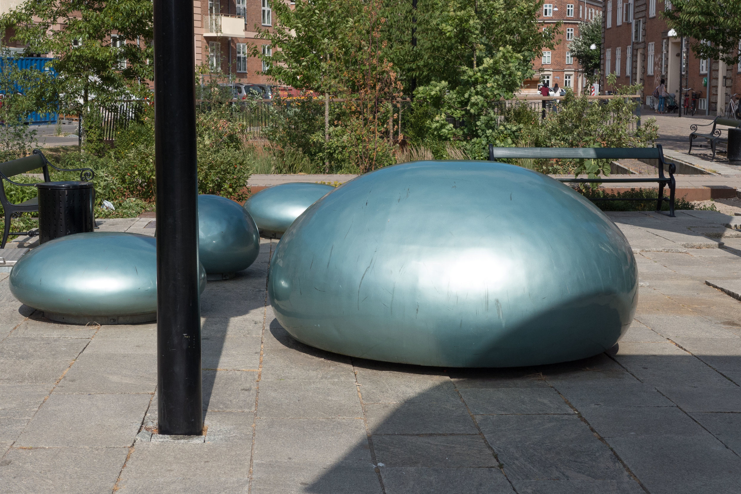
The word being much used in the Danish press at the moment, in discussions about poor-quality housing in areas with problems, is ghetto but then this part of Frederiksberg is far far from being a ghetto. In fact, just the opposite. For young middle-class families in the city, the place to aspire to is this densely-packed area of apartment buildings.

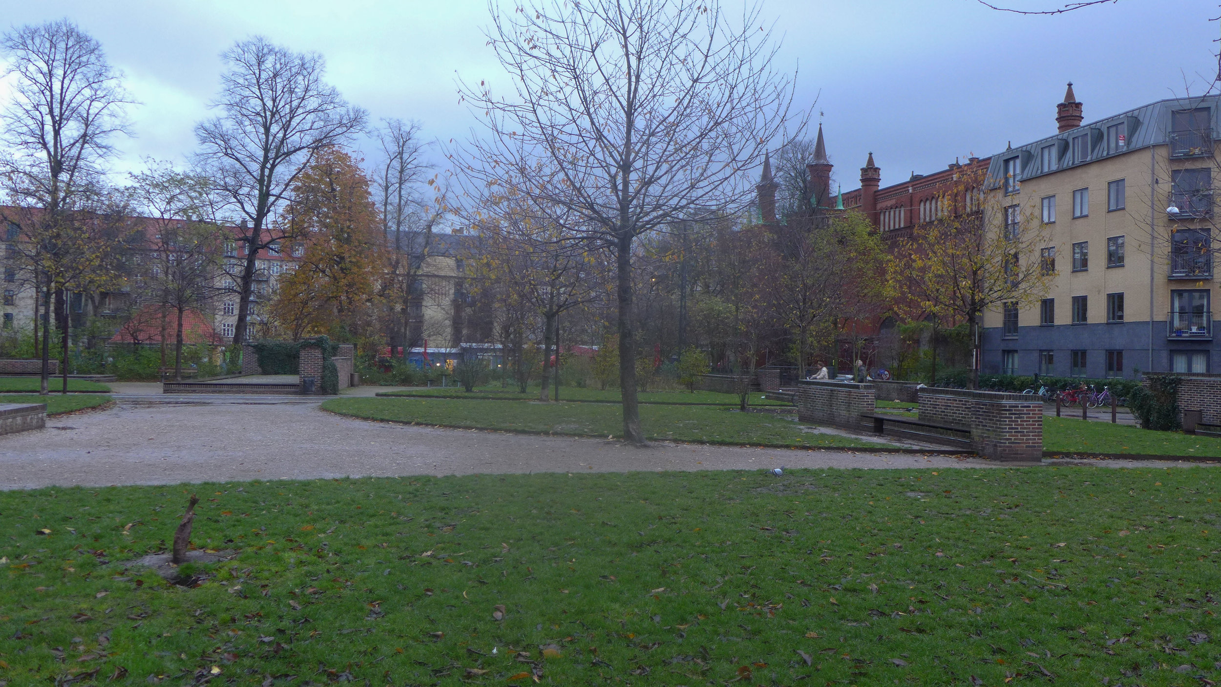
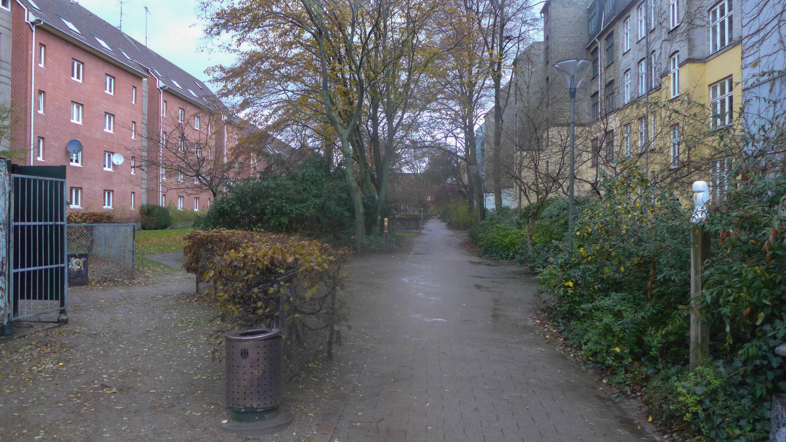
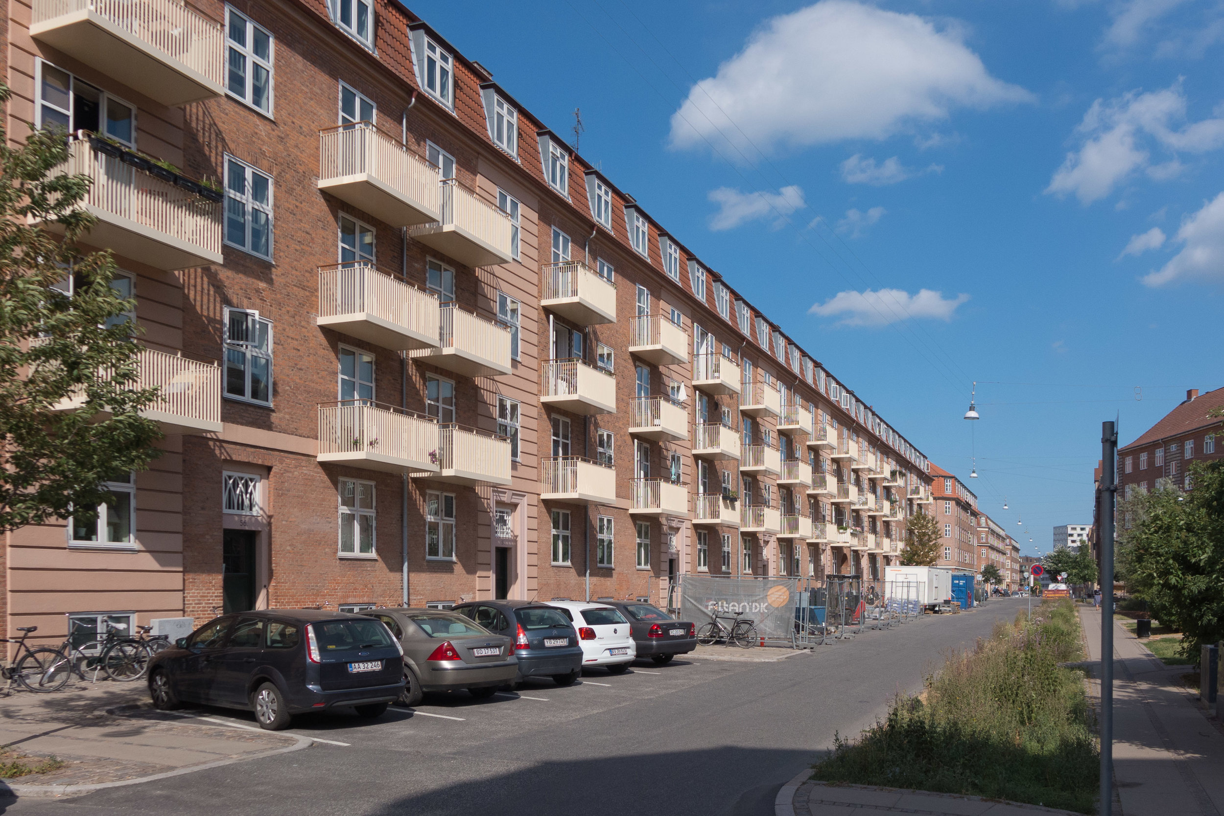
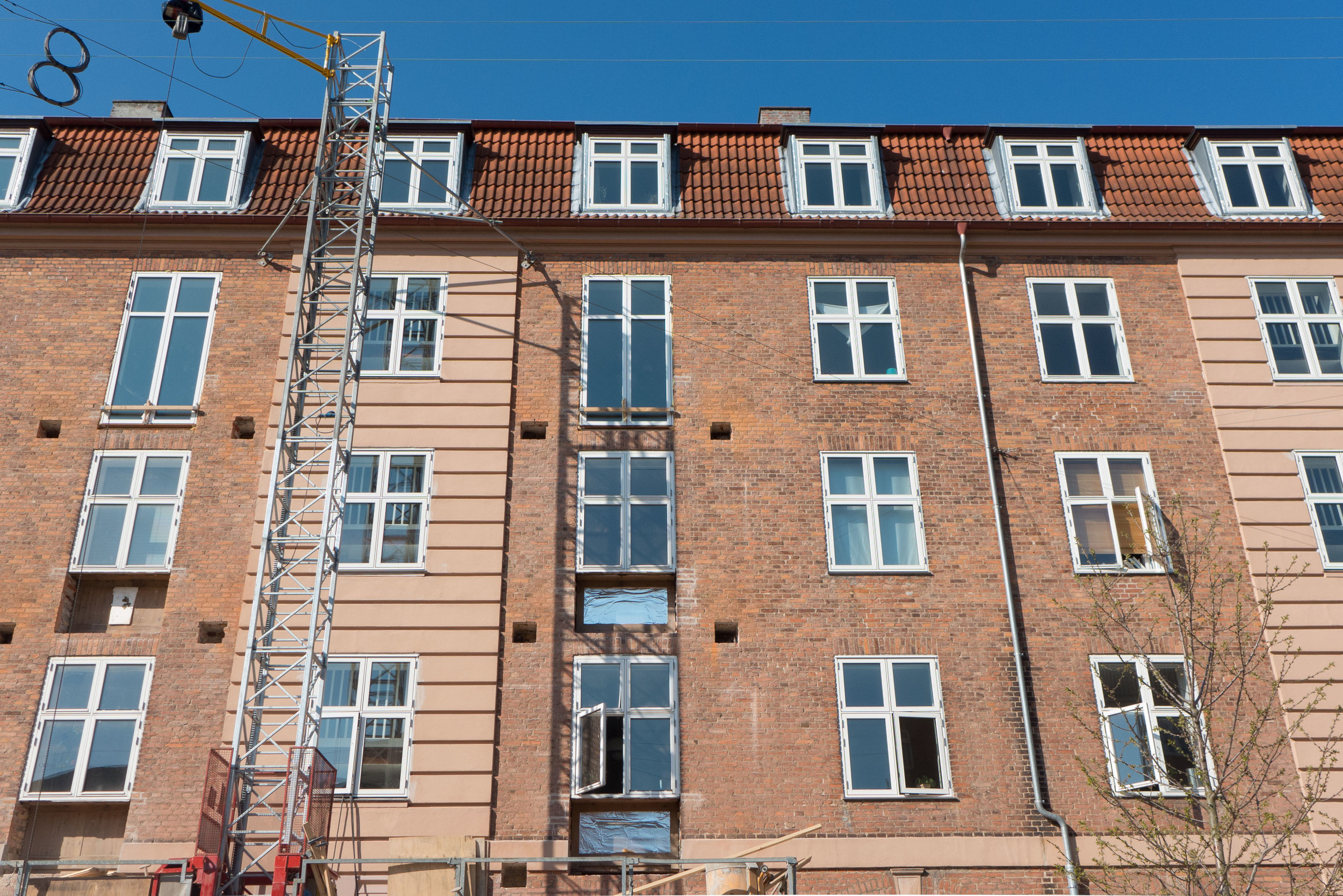
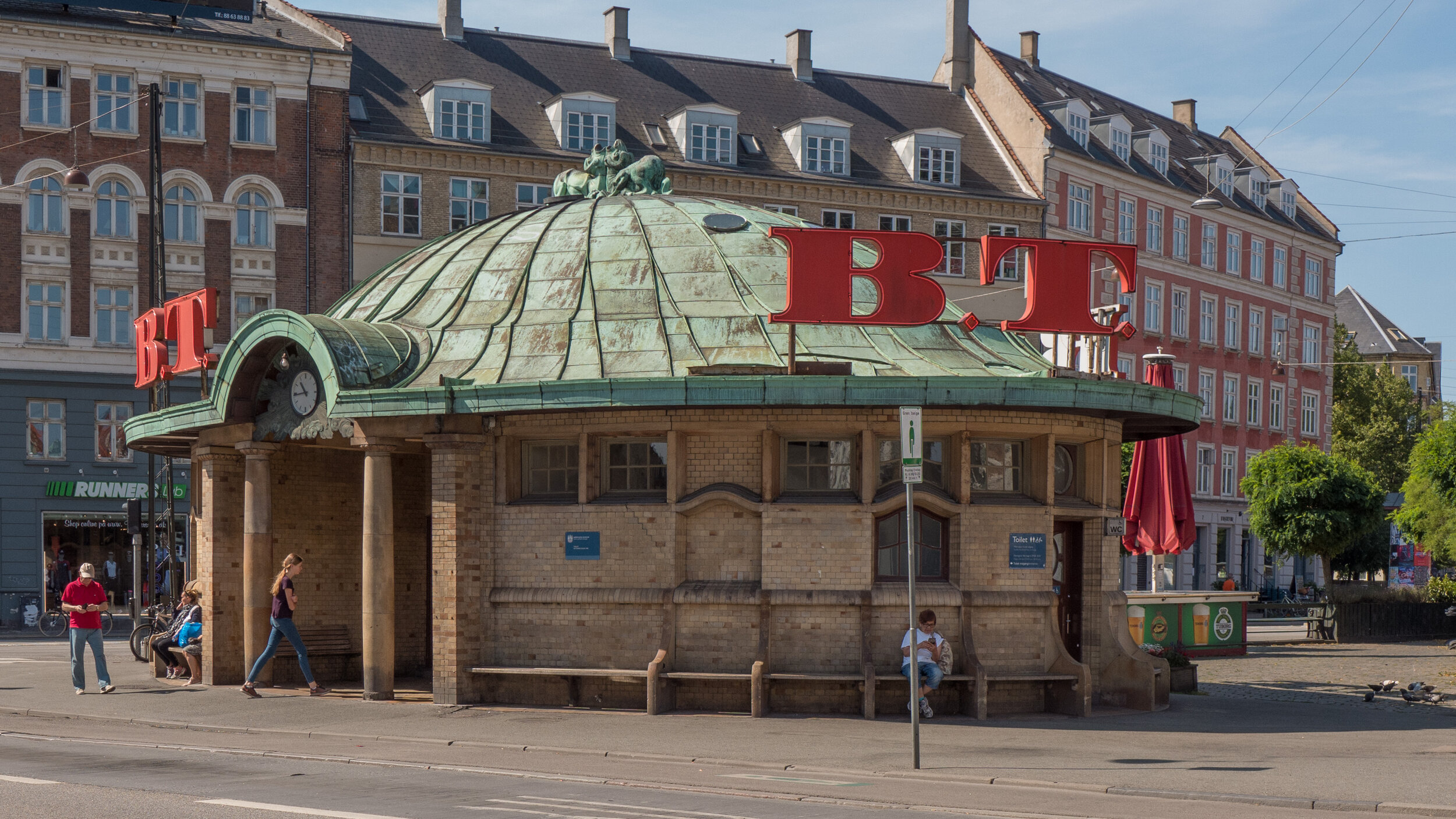
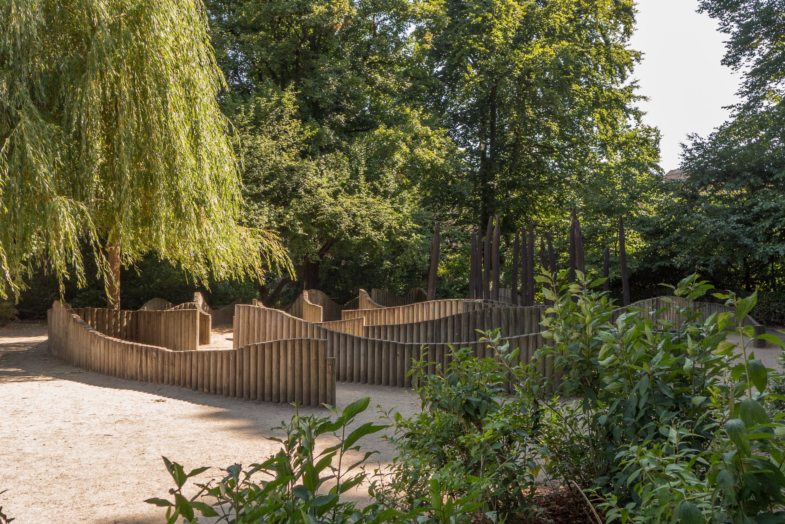
What is even more important to understand, in terms of planning, is that this is an area of older apartment blocks dating from the late 19th and early 20th century, most of five or six floors, set around squares and streets with only one high-rise building and that is an office building and not apartments.

If there is a lesson for planners it has to be that density of occupation is not necessarily bad and certainly the solution is not that the only way is up.

Frederiksberg from air.jpeg


owning the streets


As soon as the sun comes out, people in Copenhagen move outside and stake a claim to the streets. It doesn't have to be warm … just light. It's not that Danish homes are so awful that people can't stay in … just the opposite … but in Copenhagen there is plenty of evidence that this is not a modern idea. Historic paintings and drawings show citizens strolling along the pathways on top of the city defences or promenading on the squares … so walking and talking rather than actually going somewhere … and there is still a tradition to walk around the top of the embankments of the 17th-century fortress in the Spring or stroll along Langeliniekaj. It's said that the citizens only agreed to the  construction of the Free Port - which blocked the walk along the foreshore - if the quay was constructed with open access for a Sunday afternoon stroll.

The use of the public space of the street can be much more active so there is play equipment for children on many squares and streets and permanent fitted exercise equipment for people out for a jog who want to do more than just run.

Of course tables are moved out onto the pavements outside cafes and there are benches everywhere … most painted the special colour used in the city called Copenhagen Green.

This is hardly unique but in Copenhagen you can see a clear reason why this use of public space became so important: Copenhagen was surrounded by substantial defensive ramparts that enclosed a relatively small area and until about 1870 there was little construction allowed outside the gates to keep sight lines open in case of attack or a siege. As the population grew so space was limited and even many of the  courtyards had houses built in them so the only space available, for any sort of leisure, were the squares, streets or even the churchyards … even now the large graveyards around the city are a very popular and very pleasant place to stroll with family or friends.

Copenhagen is an amazing place to live for so many reasons but, if I had to cut the list right down to one, then it would be that for a densely built up city there is remarkably little vandalism ... people use and live in and own and share the public space so much more than in any city I have lived in before but, taking ownership of the street, people treat public space, their public space, with respect. 


street life - some needing stamina - some needing less energy


Sønder Boulevard then and now ... around 1900 and on a bright but cool day in early Spring 2018 above and immediately below

 
L1270517.jpg
 

the hoardings have come down along Sønder Boulevard

The new line of the metro in Copenhagen will open in 2019. Much of the main engineering work on the surface has been completed and the high green hoardings that surrounded all the main sites are now coming down.

From the city hall square and the central railway station, the new line heading out to the west follows the line of Sønder Boulevard across the north side of the meat markets and on down to Enghave. The hoardings came down in the Spring and work started on new hard landscaping and planting new trees.

Immediately, people from the neighbourhood, from the densely built apartment blocks here, reclaimed the public space.

Sønder Boulevard was actually the line of the railway in the late 19th century as it curved in from the west from Roskilde to a railway station just south of the present main building and the line followed closely what was then the shore of the bay.

The railway line was moved first to come into the city further north cutting across the lakes and then it was moved again to its present alignment across the south side of the meat markets. As the shore line was pushed out further and further into the bay, with new land claimed from the sea for first a gas works and then for the meat market, the old line became a street, Sønder Boulevard, with apartment buildings on both sides. It is a wide street with grass down the centre but through the last century it was a main route for traffic coming into the city.

The traffic lanes on each side have been reduced in width and this is no longer a main route so the centre area has basketball courts, play equipment, seating areas and imaginative planting to create a linear park that from Halmtorvet at the city end to Enghavevej and then across that road on towards Carlsberg is not far short of 2 kilometres.

the Boulevard while the engineering works for the new metro line were in progress - the edge of the meat market is at the top right and the distinctive tower of the church on Dannesbrogsgade towards the bottom right

1 - At the city end of Sønder Boulevard the landscaping of the street starts with paving and an area of water at Halmtorvet with an open area of gravel used for markets and then curved areas of stone steps and seating ... the meat market is on the right
2 - the Boulevard has shops and cafes and where cross streets meet the Boulevard at an angle there are paved areas - triangular rather than square - with cafes with pavement seating
3 - cross streets are a meeting place
4 - even in April, because the hoardings had come down,  people came out to sit in the sun - the sun was low but bright but not yet that warm ... the reason for the combination of coats and sun glasses ... looking towards the centre of the city with the tower of city hall in the distance


in the 1870s the railway line followed the shore with only gas works on land built out into the bay and that is where the meat market is now .....
the lakes, Tivoli and the line of Vesterbrogade are easily recognised reference points

Den Hvide Kødby / The White Meat City …. Local Plan Report 562


At the end of June a local plan - number 562 - was published by the city for Den Hvide Kødby /  the White Meat City district of Copenhagen. 

This is the west part of a large area of market buildings and slaughter houses that developed here from 1879 onwards when the meat market was moved from a site further north, closer to the lakes.

The market, sometimes referred to now as the Meat District, is west of the present central railway station and immediately south of a long open public space called Halmtorvet that continues on west into Sønder Boulevard and forms the north boundary of the site. 

Den Brune Kødby, the Brown Meat market, was the first part of the market to be built and is in brick. The buildings to its west - sometimes referred to as Den Grå Kødby or the Grey Market and included in this plan - were extensive additions to the market from around 1900 in grey or white brick and Den Hvide Kødby or White Meat City - primarily low and mainly flat-roofed buildings in concrete with white facades was a large addition to the meat market dating from the 1930s. 

In part because these are essentially industrial buildings but also because of the clean simple outlines with no decoration, then, in terms of style, this part of the market built in the 1930s is generally described as an important example of Functionalist architecture.

Note that the popular reference to the east part as the Brown Meat market only emerged after the construction of the additions of the 1930s - to distinguish the different parts the names refer to the colour of the buildings and not to the colour of the meat.

The area is owned by the city and this is certainly important for the long-term conservation of this area and for appropriate controls on detrimental development .

read more

Østergro in Østerbro


Ydre Østerbro or outer Østerbro north of Jagtvej - so between Fælledparken and Kildevældsparken and the railway across the north side of the city - is a densely-built area with large apartment buildings but also with workshops and small factories and office buildings. Jagtvej runs east west across the north side of the Fælledparken and is around 3 kilometres north of the historic centre of the city.

Current work on Tåsinge Plads and Sankt Kjelds Plads are not the first projects to bring large areas of plants and greenery right into the centre of Østerbro.

If you look on Google Earth, you can see that most of the apartment buildings have large enclosed courtyards that are now gardens and many have play equipment for children but also if you look just north of Sankt Kjelds Plads - the large round-a-bout almost at the centre of the Ydre Østerbro - then immediately to the west of Fitness World, the long rectangle of green along the east side of Abeløgade looks like a large allotment though it is not alongside the pavement but is four floors up on the roof of a former garage. This is Østergro … a large garden run by a local association where members can grow vegetables and flowers.

There is a restaurant up here and an important part of the work of the association is to teach children and visitors about food production … too many city dwellers have little or no idea where their food comes from and what is involved in growing vegetables and herbs. There was never a suggestion that this could make the area self sufficient for food but it's a good start.

the rain is coming - Sankt Kjelds Plads
update - Sankt Kjelds Plads - climate change landscape
the rain is coming - Tåsinge Plads three years on

Østergro


the rain is coming - Sankt Kjelds Plads

Sankt Kjelds Plads looking south from Æbeløgade and the view up Bryggervangen towards the Plads with the new areas for planting under construction in July 2018

new storm drains going in along the road edge (above)
drawing from SLA showing the extent of the scheme from Sankt Kjelds Plads and north and south along Bryggervangen  (below)


Less than 100 metres from Tåsinge Plads is Sankt Kjelds Plads - a second phase of work for new drain systems with hard landscaping and appropriate planting to cope with the inundation of water from rain storms. 

Here there is a large traffic intersection with Bryggervangen running through from north east to south west and three other roads - Nygårdsvej from the east, Æbeløgade from the north west and Sejrøgade from the south west - meeting at a large space that was until recently laid out as a large traffic round-a-bout.

A new scheme with holding tanks for rainwater, new storm drains and a series of water features and extensive planting have been designed by SLA.

New areas of paving and traffic calming with new marked bays to control car parking is well in hand.

It is not just the road intersection that will have new planting but the long diagonal run of Bryggervangen is part of the work and this will form a new green corridor from a small lake and open ground several blocks to the north at Kildevældssøen and continuing south towards the open space of Fælledparken.

the new climate district - by Tredje Natur


A local store has a window covered with a huge illustration of the finished scheme.


the rain is coming - Tåsinge Plads three years on


There was a post here about Tåsinge Plads back in 2015 along with a review of an exhibition called The Rains are Coming that was at the Danish Architecture Centre and was about how the city is dealing with climate change and the problems from sudden and torrential rain storms flooding streets and squares as drainage systems fail to cope.

Then, the main engineering work had been completed with new drains around the square to take surface water and water running off the roofs of the buildings and low holding tanks had been constructed. It seemed like time to go back to photograph the area now that the trees and shrubs are well established.


THE FIRST CLIMATE RESILIENT DISTRICT IN THE CITY
the pierced domes are drain covers for the deep and wide new drainage channels below
there are two sunken areas planted with appropriate water plants that are holding tanks for storm water to stop it overwhelming the drains and at the west end is a raised mound
bridges and passageways across the square are in Corten
paving drops down in shallow steps to channel surface water and excess water is taken down into holding tanks
rain from the side streets is contaminated by surface dirt and traffic pollution so is dealt with separately in 'swales' that replaced the street gutters with ditches and plants and with filters below


It is interesting to see how the square is now used by people living in nearby apartments.  On-street parking for cars has been either removed or rationalised - so in neighbouring streets cars park now on just one side, usually the side in the shade, and they park front on to the kerb rather than parallel with the pavement.

On the square itself, the road along one side has been paved over and the local café has moved tables and chairs out onto the square. People were sunbathing on the new raised slopes of the hillock at the west end and one local lady was using a wood sculpture as a place to sit and read her newspaper in the shade on a hot day.

balconies being fitted earlier in the summer and the finished work with large new balconies to the apartments looking south and looking down onto the new landscaping of the square


The apartment building across the north side has new balconies fitted across the frontage so people can sit in the sun and look down on the square.

This has been a very dry and untypical summer so it was not possible to watch the rain umbrellas and the channels through the water gardens actually doing what they are supposed to do … that just means another visit sometime soon when it is raining hard.

The landscape and drainage solutions were designed by GHB Landskabsarkitekter.

a new metro station at Trianglen

gravel area at the entrance to Fælled Park ... hoardings have been taken down but there is now a wire fence around the excavations and remaining equipment of the engineers for work to complete the new metro station here ... the park is to the left and Trianglen immediately to the right ... the post office building to the left was designed by Thorvald Jørgensen and completed in 1922 and Østre Power Station, on the far side of Øster Allé, was designed by Ludvig Fenger and Ludvig Clausen and built in 1902


The main engineering works for the new metro station at Trianglen are finished and the high hoardings around the site have been taken down so once more it’s possible to appreciate the size of the open space here at the south-east corner of Fælledparken / Fælled Park.

A local plan for this major work was adopted in 2011 and published in 2012 … one of 14 local plans drafted for the 14 new metro stations that are to be built in the city with the construction of the new metro line.

In the introduction to the report it was stressed that the "layout of the station space must be in interaction with neighbouring areas around Øster Allé and Fælledparken."

This was an important policy because the space, in front of the main entrance into the park, acts as an area of transition from the busy area of Trianglen itself to the open green space and the trees of the park but this area of gravel has also been used in the past as an open space for various events such as markets so no new buildings were proposed apart from the concrete steps down into the station and necessary vents and roof lights and these, along with spaces for parking for bikes, have been kept to the two outer sides along Blegdamsvej and Øster Allé and will be screened by being set within double lines of trees. 

The steps down into the metro station fit rationally with the main directions from which people will approach the station or their main destinations as they leave … so steps at the corner, on the axis of the entrance to the park, are angled towards Trianglen; steps just inset from Blegdamsvej will be used by passengers heading to or coming from the Red Cross building, the Masonic Hall or, further on, the hospital and the east steps will serve people going to the post office or heading up Øster Allé towards the football stadium. 


These outer edges of the space will have hard paving - traditional Copenhagen setts or cobbles - but the central area will be returned to a level gravel surface. The planting of trees reinforces the simple symmetry of the layout of the space but also acts as a visual barrier between the open gravel-covered space and the road traffic beyond.

Improvements are not restricted to the area immediately around the metro station for there will also be new planting of trees and changes to the hard landscaping at this south end of Øster Allé and along Blegdamsvej that, with planting and improved paving, is rapidly becoming one of the most attractive of the boulevards in the city.

photograph and drawing from Metroselskabet

Trianglen in Østerbro


Trianglen is a busy triangle-shaped public space in the district of Østerbro - so north of the lakes and immediately to the east of the new metro station that will take the same name. 

This is where two main roads in the city cross at an angle rather than at 90 degrees and it illustrates well how a dynamic townscape evolves over what is often centuries through a combination of factors including, of course, topography but also military and strategic history, wider patterns of roads and transport - so where people are travelling to or from either away from the city or within the city - and inevitably ownership and property boundaries and, in many cases, the direct involvement of a monarch, a city council and - from the 20th century onwards - planning authorities and transport companies. 

Oh … and as much as anything it’s often about the way people use a space or even how they cut across corners that ends up fixed in the position and line of roads, pavements and buildings.

read more

Bien at Trianglen

Trianglen Bien.jpg


This is one of the more extraordinary buildings in Copenhagen. 

It is at the east end of Trianglen in Østerbro, on the traffic island that was a tram car stop and it was a kiosk; a room for a traffic controller and public toilets and there were benches not only in the recessed spaces on the east and west sides but also around the outside where people could sit if they had to wait for trams at this busy interchange.

The architect was PV Jensen-Klint and it was commissioned in 1904 by the Østerbro Grundejerforening or Landowners Association to replace a wooden hut on the same site. A number of designs were presented before a final design was approved and the building was completed in 1907.

It has a sort of exuberance and delight in playing with variations of shape and form that is associated with Art Nouveau architecture but here the columns on each side with strong entasis - the bowing out in the middle - and the almost Baroque elements with curved shaped heads to windows and doors picked up in the line of glazing bars makes it more robust and strongly architectural than buildings you would find from the same period in Paris or Brussels.

The oval shape of the building and its copper roof meant that it was soon given the nickname of the Super Terrin or Terrinen - it looked like a large soup dish with a lid with the heraldic animals on the top like a knob or handle although they are actually flues for the stoves. The building is also known as Bien or The Bee from the name of the kiosk here at one stage.


Fælledparken / Fælled Park


Between 1908 and 1914, a public park was laid out on a large area of open ground known as Østerfælled … land that was outside the historic city defences and beyond the lakes and that had been been used in part as a bleaching ground and in part by the army and was crossed by important roads that converged at the start of the King’s highway that headed north to Lyngby and on to the castle at Frederiksborg. 

An irregular shape, the large area is contained within main roads with Østerbrogade to the east, Blegdamsvej to the south and Tagensvej and Nørre Allé to the west but with large buildings encroaching on the area across the south side, including the Masons’ Hall and the headquarters of the Red Cross, along  with a main hospital, Rigshospitalet, at the south-west corner.  

Despite the encroachment of buildings around the edge, the open area is large … running back well over a kilometre from Blegdamsvej and is over a kilometre wide at the widest point. There are lakes, pitches for football, an area laid out with small-scale roads and junctions - Trafiklegepladsen - where children learn to ride bikes and there are playgrounds including Tårnlegepladsen /Tower Park and a large skate park. 

read more

Fælledparken - the entrance from Trianglen

Entrance Faelled Park.jpeg


At the corner of Blegdamsvej and Øster Allé is a large area of gravel that is triangular in shape — the site of a major new metro station - and set back, beyond the triangle, is the entrance to Fælledparken.

Established in 1908, the main feature here, on the central axis of the entrance, is a memorial … a large figure group in bronze raised on a high stone base that was installed in 1930 to commemorate the return to Denmark, in an international settlements following the First World War, of land in South Jutland that had been lost to Germany in a war of 1864.

Lettering on the stone base reads:

TIL MINDE OM SONDERJYLLANDS GENFORENING MED MODERLANDET 1920

In memory of South Jutand's reunification with mother country 1920


The main figure is a woman who is looking down at an adolescent girl who holds or, rather, she clings to her side, looking up but not at the woman so up and away into the distance at the sky or to the heavens. It is a powerful depiction of a mother embracing or drawing in a child for their protection.

The woman is wearing a loose, finely-pleated costume, that is clearly classical in style, with an outer garment or stola that she is lifting to cover the girl who is naked … nakedness, at least here, implying both innocence and vulnerability.

The sculptor was Axel Poulsen who nearly twenty years later repeated the image of mother and child - a woman holding a dead youth slumped across her lap - for the incredibly powerful stone sculpture for the Mindelund Park in Copenhagen that is a memorial garden for the dead of the Second World War.

read more

Sansehaven - garden of the senses

As you enter Fælled park from Trianglen, just beyond the monument, there is an area of woodland on the right but as you are drawn forward - towards the light and open space of the park ahead - it would be easy to miss the Sensory Garden in the trees.

In dappled light, in glades among beautiful mature trees, the garden was designed by the landscape architect Helle Nebelong and was created in 1996 when Copenhagen was City of Culture.

With wide, gently-curving, gravel paths and low but distinct boundaries it is laid out to be an easy and a safe place for children to explore even if they have sight impairments or have mobility problems or use a wheelchair. 

Plants are chosen for their distinct shapes and there are herbs for their smell or even their taste but the dense but low planting also shields the garden from the more noisy and boisterous park beyond to make the space feel somehow calm and protective. 

The main features are a gravel-filled canal that runs through the centre of the garden with low bridges over it or stepping stones along it, and gives a distinct Japanese look, and there is a large maze with low walls of wooden posts - some with numbers or letters set near the top so you trace 1 to 9 and then track the alphabet as you follow the posts of the undulating palisade.

In the line of the planting around these features there are small, semi-enclosed spaces where children can discover a giant nose carved in smooth marble or a wooden sculpture like a giant chess piece but with a carved fish and lemons on the top or there are wind chimes or a seat under an arch and several larger features including a hexagonal temple with ornate carved posts supporting a tiled roof. 

It's all very beautiful and the garden is a credit to a park and to a city when they can design and maintain a place that is so magical.

Helle Nebelong


translation of the park sign:

SANSEHAVEN

Sansehaven is a small garden for children and their adults - a corner of Fælledparken with space for exploring surroundings, feeling nature and discovering all the senses.

1 Hearing
2 Seeing

3 Taste
4 Smells

5 Feel
6 Sixth Sense

A sense garden can be a substitute for nature when the real thing is far away or difficult to get to. Sansehaven was originally made for multi-handicapped children and young people who can enjoy small gardens with many impressions and experiences.

For the sake of children who are visually impaired or use a wheelchair, Sansehaven is therefore arranged with wide paths and clear edges of, among other things, cobblestone, which makes it easy to get around.

Sansehaven in Fælledparken is shaped like a maze with winding paths, and if you are curious, you will discover a garden full of surprises.

Enjoy.

Fælledparken

Tårnlegepladsen / tower playground and Spejlhuset / Mirror House at Fælledparken


Play areas for children in the parks and squares in the city are amazing … with imaginative climbing frames, swings and slides and so on that take a huge range of forms and styles. 

Simply from an architecture view point, probably the best is the play area at the south corner of Fælledparken in Østerbro. As part of extensive improvements to the park in 2011 and 2012, the play area was completely redesigned by GHB Landskabarkitekter with the company PlayAlive. 

There are enclosed courts for ball games and a small skateboard area but the really distinctive feature here is play equipment that is modelled on the old towers and domes and spires of the city … so here you can find a version of the dome of the Marble Church, the Round Tower, the spire of the City Hall and the spire of Boursen, the 17th-century exchange down by the harbour.

It’s a great way to introduce even small children to the idea that good architecture can be fun … so the games can go further as a learning process if children begin to recognise and name buildings as they go around the city.

There was an existing park building here when work on the new play area was initiated - a long low building with a pitched roof for park and play equipment and toilets but it went through an absolutely astounding transformation with design work by the architectural practice MLRP. The long side walls and the roof were clad with heat-treated or smoke-blackened timber planks but it is the end walls that really fascinate children - and come to that adults - as the gables and also some of the doors on their inside faces were covered with polished steel that acts like a distorting mirror. 

Fun and stylish .... this is modern Danish design at its very best.


Fælledparken

Another play area in the park - Trafiklegepladsen / Traffic House - was also designed by MLRP as an area laid out with small-scale roads and junctions and road crossings and traffic lights where small children learn to ride their bikes before going out onto busy public roads.


Copenhagen Contemporary

Copenhagen Contemporary is an independent institution for modern art.

From June 2016 they ran a pilot project in the warehouses on Papirøen - Paper Island - in the centre of the harbour just south of the opera house - where CC took over four of the halls and were there until the end of 2017 when the buildings were returned to the developers for demolition and for work to start on new apartment buildings on the site.

Now, with funding from the city and from private organisations, Copenhagen Contemporary have reopened in a larger space - some 7,000 m2 - in what was the welding hall of the shipyard of Burmeister & Wain.

The ship yards were closed back in the 1990s and for the last two decades the area has been taken over by small workshops and boat repair yards. A yacht repair company, the restaurant Amass and La Banchina - a popular cafe and bar - established new businesses out here and this summer they have been joined by the new food market - many of the stalls also relocating from Papirøen - and there will be more artists' studios and craft workshops opening as more of the buildings are adapted.

Copenhagen Contemporary has a lease here for 10 years and they have ambitious plans to establish a new space for the display of modern art in the city and particularly for large-scale installation and performance art. 

The city is gaining a major new venue on the lines of the galleries in Gateshead and the Turbine Hall at the Tate in London or the galleries at MoMA in New York and the programme here should compliment exhibitions of modern art at the established galleries in Copenhagen with Den Frie, GLStrand, the space of the Kunsthal in the former church of Sankt Nicolaj and the galleries of the Royal Academy at Charlottenborg - all in the centre of the city or close to the centre - and the gallery down the coast at Arken and, of course, Louisiana - north of the city with its amazing location on the shore of the Sound.

Work on the building for the gallery on Refshaleøen has kept many of the features from its industrial use with huge sliding doors, high exposed roof structures and high-set windows that flood the space with light and give views out to nearby workshops.

In the next phase of development, space on the upper level will be opened for CC Studio for their proposed education programme.


previous posts on danish design review

Copenhagen Contemporary

Copenhagen Contemporary
Refshalevej 173a
1432 København K


Refshaleøen - what's where + what's on


There are good sign boards at Refshaleøen - one with a map showing the location of the main food stalls and the main buildings - including the new gallery space for Copenhagen Contemporary - and the other with the dates of main events here through the coming summer

maybe click / download / save / zoom ?

or information on line at REFFEN


the buildings out on Refshaleøen through a rose-tinted lens?

select any image to open the photos as a slide show


It's difficult. 

How do you preserve somewhere like this? Or at least keep some of the buildings and some of the features that make the place so interesting.

How can you keep the colours and textures of somewhere that only looks like this because it was abandoned and for twenty years has - for the most part - been left or had a series of people working out here without the money or the security of tenure to do much beyond patching and repairing. 

Of course there have been exceptions … a yacht yard has extensive workshops and the restaurant Amass is well established in a workshop building that was reconfigured by the architect Dorte Mandrup.

But even the land itself - the island - is hardly a long-term feature of the harbour with a long history. This land was all claimed from the sea in the late 19th century and until the mid 1990s this was the shipyard of Burmeister & Wain with a huge area of workshops and dry docks with buildings that had been added or adapted as necessary and as and when there was new work to be completed. The massive dry dock out the east - such a prominent feature of the works - was only constructed around 1960 so it only had a working life of around 30 years.

Maybe there is also something wrong about romanticising or fetishising the decay of industrial buildings when actually they are all that is left to mark the tough and dangerous working lives of thousands and thousands of men ..... it's sobering to read that the workshops where Amass have their restaurant and garden now was workshops where some of the men who were too old or had been injured at work could find less dangerous jobs in servicing and repairing machinery.

Small boat yards and engineering works colonised the space after the ship yard closed and that large hall has been used for events and for rock and pop concerts but Refshaleøen is now entering its next phase with the opening of new gallery space for Copenhagen Contemporary in workshops across the front of the music venue and in an area towards the harbour there is a new food market and there will be craft workshops and studios in some of the other buildings.

Even this next phase is short term - or relatively short term in the broader context of planning and future 'investment' in long-term development. This is valuable land just across the harbour from the city and much will depend on whether or not there is the motivation to build a new road tunnel to link Nordhavn and Refshaløen. 

If that happens then the whole character of the island will change.

Even now this is hardly what you would describe as marginal land but with or even without the tunnel this will not survive like this for much longer. The gallery has been told that they can stay for 10 years and some of the industrial buildings might survive to be given new uses but what merit will rusty steps and broken windows have then? What is the value of patina? What is the best rate of return on rust?


previous posts

Refshaleøen

Industrial buildings on Refshaleøen and Prøvestenen

Reffen / The Reef


Kultur Tårnet a year on

22 June 2018


Since 1620, there has been a bridge at the centre of Copenhagen harbour. Knippelsbro was constructed to link the old city to what was, in the 17th century, a new and prosperous settlement of Christianshavn that was being built on land claimed from the sea and - from a new south gate of the city - there was a way across and on to the island of Amager.

Over the centuries the bridge was rebuilt several times but these all crossed the harbour at the level of the quay so there was restricted headroom for boat traffic to pass through unless the bridge was opened. This became a problem in the early 20th century as the wharves and quays south of the bridge dealt with more and more goods so more and larger commercial shipping was coming through the harbour and as the number of people use the bridge to cross backwards and forwards increased with the building of large new apartments blocks along Islands Brygge and south of Christianshavn with new housing in Amagerbro and then in Sundby.

A new bridge - the present Knippelsbro - was constructed and opened in 1937 designed by Kaj Gottlob. This has a much higher deck level - with long ramps up on either side to take road traffic up and over the harbour and more shipping could pass through without opening the bridge - the current harbour ferries pass under the bridge without it having to open. There were two copper-clad towers - with that to the north for the main control room for opening and closing the centre span and a south tower contained sleeping accommodation for the bridge master and his men.

From the 1940s and through the 1950s and 1960s, the docks to the south of the bridge prospered with commercial quays extending down on both sides - so the bridge must have been manned throughout the day and the night - but with the decline and then the shutting of commercial wharves on the inner harbour, the number of times the bridge was opened each day declined and the south tower became redundant and was left empty and unused.

Lars Erik Lyndgaard Schmidt and Malthe Merrild saw the waste of abandoning such a prominent historic monument and came up with possible ways of using the building.

Last year, after several years of them putting considerable pressure on the city and after opening for a trial period to see if there was sufficient public interest … there was … and after extensive restoration work, the tower was opened to the public.

It is now an amazing viewing platform from where you can see up and down the harbour but more than that it's a very unusual venue for events; a very unusual place that can be hired for business meetings during the day and, despite the tight space, it's a venue for gastronomic events and concerts.

Today marks the first anniversary for Kultur Tårnet. Congratulations.


Kultur Tårnet

19th-century shop fittings in Købmagergade


Then & Now, a pop-up exhibition of photographs of the city, was in a shop at Købmagergade that must have been empty for that short period after one tenant moves out and a new tenant takes over.

The building is on the west side of what is one of the two main shopping streets in the centre of the city. Købmagergade runs down from the site of the north gate of the old city at Nørreport and Strøget or The Walking Street - the long pedestrianised street that runs east west from the site of the old east gate to the city at Kongens Nytorv to the site of the west gate near the city hall. The two streets meet at Amager Torv and this shop is just north of that old market place in a long continuous line of historic buildings between Amager Torv and Valkendorfsgade.

My guess would be that 99% of the people walking along the busy street are either looking in at the shop windows or they are hurrying past on their way somewhere but if you look up you can see  from architectural features such as windows or roofs that these buildings appear to date from the late 18th or the 19th century but explore a little and behind are courtyards and light wells and evidence for outbuildings that tell a more interesting story. Shop fronts and the shop interior are invariably the most modern or most recent part and, too often, of dubious design and quality, and the façade above the shop front and the roofs the last major expenditure on the building itself while buildings behind the street range and often the upper rooms of the street range show evidence for a much more complicated history.

history / background

Going into the left-hand shop at number 7 there is evidence for what is a remarkably common story in the city.

You now go into the shop directly off the street and the shop is just a couple of steps up from the pavement but the space is curiously high with an ornate gallery around all four sides supported on narrow columns that is reached by a tight spiral staircase in the back corner.

It is clear that this was a fairly standard Copenhagen town building. It includes, on a single plot, the adjoining shop to the north with a main doorway between the two shops for access to the upper levels of the building. There must have been an earlier house on this plot - as it is right in the centre of the city - but documents show that it was rebuilt in 1729 for Oluf Hegelund and J Pedersen - so immediately after the fire of 1728 * - and the building work was undertaken by the famous architect Philip de Lange with a master brick layer called Simon Sørensen.

Then, in the 1790s, the street range was heightened with a whole extra floor added and with it a new roof.

Through the 18th century the rooms on the main floor would not have been at street level but six or seven steps up with low windows, at pavement level, lighting a lower floor half below ground with steps down from the street. The building next door to the left - number 5 - again has shops on either side of a central doorway but there the left-hand shop has retained these original floor levels.


Købmagergade 5 - the shop to the left is at the original level - up from the pavement by seven or eight steps - with a shop below half above the pavement and half below the ground with seven steps down into the shop from the pavement - the shop to the right has a 'modern' ground-floor level and entrance door directly from the pavement with the inserted floor cutting across the top half of the original basement space

Købmagergade 7 is to the right and the shop that was redesigned by Kaare Klint is next shop but one to the left

When the shop at number 7 was remodelled, presumably in the middle of the 19th century, the floor was dropped down to pavement level but the position of the ceiling - immediately under the floor of the first-floor rooms - was left in place. Presumably the gallery and its storage space compensated in part for the storage space lost in the basement which, after the alterations, must have been half the height.

Why does any of this matter now?

Well it is all evidence of the complicated history of commerce in the city and, with the inevitable demand to strip out any and every space and put in modern lighting and false ceilings and, with the fast turnover of tenants, interesting and, in some buildings, important historic fittings are too easily lost.


comment:

I'm  curious … has anyone recorded systematically the names of the owners and tenants of these shops in the centre of the city through the 18th and 19th centuries to show how the commercial area expanded to take over more and more houses?

Copenhagen has a long and successful history for trade with many small and independent businesses and also, of course, before the 20th century, much that was sold in the city would have been made in the city so, as many of these shops have been stripped out to make larger and larger retail units that stretch back into the plot, what has also been lost is the workshops and outbuildings that could have told us so much about the craftsmen and traders of the past.

How many of these buildings were residential and when did they become commercial properties - at least on the street level? How many craftsmen simply traded from a front parlour without shop fittings, as we would recognise them, and do any workshops survive in back courtyards?

shop interior by Kaare Klint for FA Thiele


background / history

Købmagergade is one of the two main shopping streets in Copenhagen and number 3, close to the intersection of those two streets, is a wide building with two separate shops running back into the property and a central doorway for access to the staircase and to the floors above the shops.

The building appears to have just escaped the catastrophic fire in the city of 1728 and may date back to the first half of the 17th century - the adjoining building was damaged and had to be rebuilt. Number 3 was rebuilt between 1816 and 1834, when it was owned by a restaurateur - Jean Pierre Casadaban -  and in 1847, an extra floor was added with, presumably, a new roof and at that point the street frontage took on its present appearance.

The shops have very high ceiling heights because - as in so many of the older buildings in the centre of the city - the floors of the main level, originally six or seven steps up from street level were brought down to pavement level, cutting into the space of basement rooms that were originally half below ground and half above ground - a form of plan described as a half basement or semi basement.


In the middle of the last century, the shop in the left or south half of the building at number 3 Købmagergade was occupied by the opticians  F A Thiele. They are now in a shop further north along the same street - but in 1944 they commissioned the architect Kaare Klint to design a new shop font and new interior fittings here.

Work was delayed and did not start until 1951 when Klint was assisted by the young architect Vilhelm Wohlert, who had studied under Klint, and the shop was actually completed in 1956, some two years after Klint died.

It is a complicated space with the front part of the shop just two steps up from the pavement but the space then narrows and towards the back runs through into a back building at a higher level, eight steps up from the floor of the front space, although the ceiling level is constant.

Klint and Wohlert designed a reception and waiting area at the front and, back down the shop, there were 18 tables or desks with chairs, where patients were seen by the opticians, including tables set along a narrow balcony that returned back towards the shop front from the raised area at the back. At the very back there was a small office but with a glazed front wall.

Unlike the present arrangement, the back part of Thiele's had windows looking into a narrow back courtyard so there was natural light.


Distinctive fittings included high and narrow units of small drawers - next to the staircase in the middle of the shop - for storing the glasses but the interior also made striking use of large flush panels veneered in wood and areas of vertical and closely-spaced narrow strips of wood that picked up the tight linear pattern of the ceiling, that had narrow strips running front to back, and the bolder lines of the closely-spaced rafters of the underside of the balcony.

The drawer units were along the side wall but also returned across the shop beside the staircase and taken up higher than the floor level of the space beyond and seem to have included a flower planter across the top and formed the barrier or parapet of the upper level.

These steps up to the back had open treads and the handrail had closely-spaced vertical battens so again a strong linear design. Note how the wide handrail curves at the top and bottom to level off to horizontal so it was at the right level for your hand as you approached and as you reached the last of the steps.

The interior is about clean simple lines but the planes of walls and fittings define a clever interrelationship of spaces and volumes marking not just changes in the underlying building - that the architects were given - but define different areas of the shop ... so a progression from pavement through the display space of the shop window to a counter and reception area, a waiting area and pay desk, stations for consultations, storage of stock and an office at the far end, above everything but with its glass wall, a place from which to supervise all. Perhaps one of the most elegant essays in functional architecture in the city.

The front window was again a deceptively simple but again an exceptionally sophisticated design with a wide lintel across the door to divide the very high shop window across the centre. This was deep enough to carry lighting with a series of spot lights over the window displays and narrow opaque panels for the lights over the entrance. The glass on either side was set at the front edge for the areas of window display but the entrance door was set on the back edge of this horizontal feature with narrow windows on each side to form a covered entrance lobby. At the front or outer corners the sheets of glass forming the sides of this lobby are butted up to the large plate-glass windows of the shop front without vertical frames - something we now just take for granted but then, presumably, both novel and daring.

Plain boards below the windows set the height of a solid panel in the bottom of the otherwise glazed door and the windows were large undivided sheets of glass so there is an apparent simplicity to the design but in reality a complicated and clever game with planes and lines and spaces.

The demolition of this interior has to be seen as a major loss.