Den Hvide Kødby / The White Meat City …. Local Plan Report 562


At the end of June a local plan - number 562 - was published by the city for Den Hvide Kødby /  the White Meat City district of Copenhagen. 

This is the west part of a large area of market buildings and slaughter houses that developed here from 1879 onwards when the meat market was moved from a site further north, closer to the lakes.

The market, sometimes referred to now as the Meat District, is west of the present central railway station and immediately south of a long open public space called Halmtorvet that continues on west into Sønder Boulevard and forms the north boundary of the site. 

Den Brune Kødby, the Brown Meat market, was the first part of the market to be built and is in brick. The buildings to its west - sometimes referred to as Den Grå Kødby or the Grey Market and included in this plan - were extensive additions to the market from around 1900 in grey or white brick and Den Hvide Kødby or White Meat City - primarily low and mainly flat-roofed buildings in concrete with white facades was a large addition to the meat market dating from the 1930s. 

In part because these are essentially industrial buildings but also because of the clean simple outlines with no decoration, then, in terms of style, this part of the market built in the 1930s is generally described as an important example of Functionalist architecture.

Note that the popular reference to the east part as the Brown Meat market only emerged after the construction of the additions of the 1930s - to distinguish the different parts the names refer to the colour of the buildings and not to the colour of the meat.

The area is owned by the city and this is certainly important for the long-term conservation of this area and for appropriate controls on detrimental development .

read more

Østergro in Østerbro


Ydre Østerbro or outer Østerbro north of Jagtvej - so between Fælledparken and Kildevældsparken and the railway across the north side of the city - is a densely-built area with large apartment buildings but also with workshops and small factories and office buildings. Jagtvej runs east west across the north side of the Fælledparken and is around 3 kilometres north of the historic centre of the city.

Current work on Tåsinge Plads and Sankt Kjelds Plads are not the first projects to bring large areas of plants and greenery right into the centre of Østerbro.

If you look on Google Earth, you can see that most of the apartment buildings have large enclosed courtyards that are now gardens and many have play equipment for children but also if you look just north of Sankt Kjelds Plads - the large round-a-bout almost at the centre of the Ydre Østerbro - then immediately to the west of Fitness World, the long rectangle of green along the east side of Abeløgade looks like a large allotment though it is not alongside the pavement but is four floors up on the roof of a former garage. This is Østergro … a large garden run by a local association where members can grow vegetables and flowers.

There is a restaurant up here and an important part of the work of the association is to teach children and visitors about food production … too many city dwellers have little or no idea where their food comes from and what is involved in growing vegetables and herbs. There was never a suggestion that this could make the area self sufficient for food but it's a good start.

the rain is coming - Sankt Kjelds Plads
update - Sankt Kjelds Plads - climate change landscape
the rain is coming - Tåsinge Plads three years on

Østergro


the rain is coming - Sankt Kjelds Plads

Sankt Kjelds Plads looking south from Æbeløgade and the view up Bryggervangen towards the Plads with the new areas for planting under construction in July 2018

new storm drains going in along the road edge (above)
drawing from SLA showing the extent of the scheme from Sankt Kjelds Plads and north and south along Bryggervangen  (below)


Less than 100 metres from Tåsinge Plads is Sankt Kjelds Plads - a second phase of work for new drain systems with hard landscaping and appropriate planting to cope with the inundation of water from rain storms. 

Here there is a large traffic intersection with Bryggervangen running through from north east to south west and three other roads - Nygårdsvej from the east, Æbeløgade from the north west and Sejrøgade from the south west - meeting at a large space that was until recently laid out as a large traffic round-a-bout.

A new scheme with holding tanks for rainwater, new storm drains and a series of water features and extensive planting have been designed by SLA.

New areas of paving and traffic calming with new marked bays to control car parking is well in hand.

It is not just the road intersection that will have new planting but the long diagonal run of Bryggervangen is part of the work and this will form a new green corridor from a small lake and open ground several blocks to the north at Kildevældssøen and continuing south towards the open space of Fælledparken.

the new climate district - by Tredje Natur


A local store has a window covered with a huge illustration of the finished scheme.


the rain is coming - Tåsinge Plads three years on


There was a post here about Tåsinge Plads back in 2015 along with a review of an exhibition called The Rains are Coming that was at the Danish Architecture Centre and was about how the city is dealing with climate change and the problems from sudden and torrential rain storms flooding streets and squares as drainage systems fail to cope.

Then, the main engineering work had been completed with new drains around the square to take surface water and water running off the roofs of the buildings and low holding tanks had been constructed. It seemed like time to go back to photograph the area now that the trees and shrubs are well established.


THE FIRST CLIMATE RESILIENT DISTRICT IN THE CITY
the pierced domes are drain covers for the deep and wide new drainage channels below
there are two sunken areas planted with appropriate water plants that are holding tanks for storm water to stop it overwhelming the drains and at the west end is a raised mound
bridges and passageways across the square are in Corten
paving drops down in shallow steps to channel surface water and excess water is taken down into holding tanks
rain from the side streets is contaminated by surface dirt and traffic pollution so is dealt with separately in 'swales' that replaced the street gutters with ditches and plants and with filters below


It is interesting to see how the square is now used by people living in nearby apartments.  On-street parking for cars has been either removed or rationalised - so in neighbouring streets cars park now on just one side, usually the side in the shade, and they park front on to the kerb rather than parallel with the pavement.

On the square itself, the road along one side has been paved over and the local café has moved tables and chairs out onto the square. People were sunbathing on the new raised slopes of the hillock at the west end and one local lady was using a wood sculpture as a place to sit and read her newspaper in the shade on a hot day.

balconies being fitted earlier in the summer and the finished work with large new balconies to the apartments looking south and looking down onto the new landscaping of the square


The apartment building across the north side has new balconies fitted across the frontage so people can sit in the sun and look down on the square.

This has been a very dry and untypical summer so it was not possible to watch the rain umbrellas and the channels through the water gardens actually doing what they are supposed to do … that just means another visit sometime soon when it is raining hard.

The landscape and drainage solutions were designed by GHB Landskabsarkitekter.

a new metro station at Trianglen

gravel area at the entrance to Fælled Park ... hoardings have been taken down but there is now a wire fence around the excavations and remaining equipment of the engineers for work to complete the new metro station here ... the park is to the left and Trianglen immediately to the right ... the post office building to the left was designed by Thorvald Jørgensen and completed in 1922 and Østre Power Station, on the far side of Øster Allé, was designed by Ludvig Fenger and Ludvig Clausen and built in 1902


The main engineering works for the new metro station at Trianglen are finished and the high hoardings around the site have been taken down so once more it’s possible to appreciate the size of the open space here at the south-east corner of Fælledparken / Fælled Park.

A local plan for this major work was adopted in 2011 and published in 2012 … one of 14 local plans drafted for the 14 new metro stations that are to be built in the city with the construction of the new metro line.

In the introduction to the report it was stressed that the "layout of the station space must be in interaction with neighbouring areas around Øster Allé and Fælledparken."

This was an important policy because the space, in front of the main entrance into the park, acts as an area of transition from the busy area of Trianglen itself to the open green space and the trees of the park but this area of gravel has also been used in the past as an open space for various events such as markets so no new buildings were proposed apart from the concrete steps down into the station and necessary vents and roof lights and these, along with spaces for parking for bikes, have been kept to the two outer sides along Blegdamsvej and Øster Allé and will be screened by being set within double lines of trees. 

The steps down into the metro station fit rationally with the main directions from which people will approach the station or their main destinations as they leave … so steps at the corner, on the axis of the entrance to the park, are angled towards Trianglen; steps just inset from Blegdamsvej will be used by passengers heading to or coming from the Red Cross building, the Masonic Hall or, further on, the hospital and the east steps will serve people going to the post office or heading up Øster Allé towards the football stadium. 


These outer edges of the space will have hard paving - traditional Copenhagen setts or cobbles - but the central area will be returned to a level gravel surface. The planting of trees reinforces the simple symmetry of the layout of the space but also acts as a visual barrier between the open gravel-covered space and the road traffic beyond.

Improvements are not restricted to the area immediately around the metro station for there will also be new planting of trees and changes to the hard landscaping at this south end of Øster Allé and along Blegdamsvej that, with planting and improved paving, is rapidly becoming one of the most attractive of the boulevards in the city.

photograph and drawing from Metroselskabet

Fælledparken / Fælled Park


Between 1908 and 1914, a public park was laid out on a large area of open ground known as Østerfælled … land that was outside the historic city defences and beyond the lakes and that had been been used in part as a bleaching ground and in part by the army and was crossed by important roads that converged at the start of the King’s highway that headed north to Lyngby and on to the castle at Frederiksborg. 

An irregular shape, the large area is contained within main roads with Østerbrogade to the east, Blegdamsvej to the south and Tagensvej and Nørre Allé to the west but with large buildings encroaching on the area across the south side, including the Masons’ Hall and the headquarters of the Red Cross, along  with a main hospital, Rigshospitalet, at the south-west corner.  

Despite the encroachment of buildings around the edge, the open area is large … running back well over a kilometre from Blegdamsvej and is over a kilometre wide at the widest point. There are lakes, pitches for football, an area laid out with small-scale roads and junctions - Trafiklegepladsen - where children learn to ride bikes and there are playgrounds including Tårnlegepladsen /Tower Park and a large skate park. 

read more

Lille Langebro …. news


A newsletter has just come through from the BLOX website to say that there has been an accident in Hamburg where a crane failed as it was lifting the sections of the new bridge onto a barge for them to be transported to Copenhagen.

Two of the four massive sections of the bridge have been damaged beyond repair and will have to be remade. No one was hurt in the accident but these sections took a whole year to fabricate so there will be a long delay to the completion and opening of the bridge that will form a bike and pedestrian link between Christianshavn and the quay alongside the newly opened BLOX building.

FRAMA - the apartment


For 3daysofdesign Niels Strøyer Christophersen of FRAMA opened his apartment on Strandboulevarden in Østerbro.

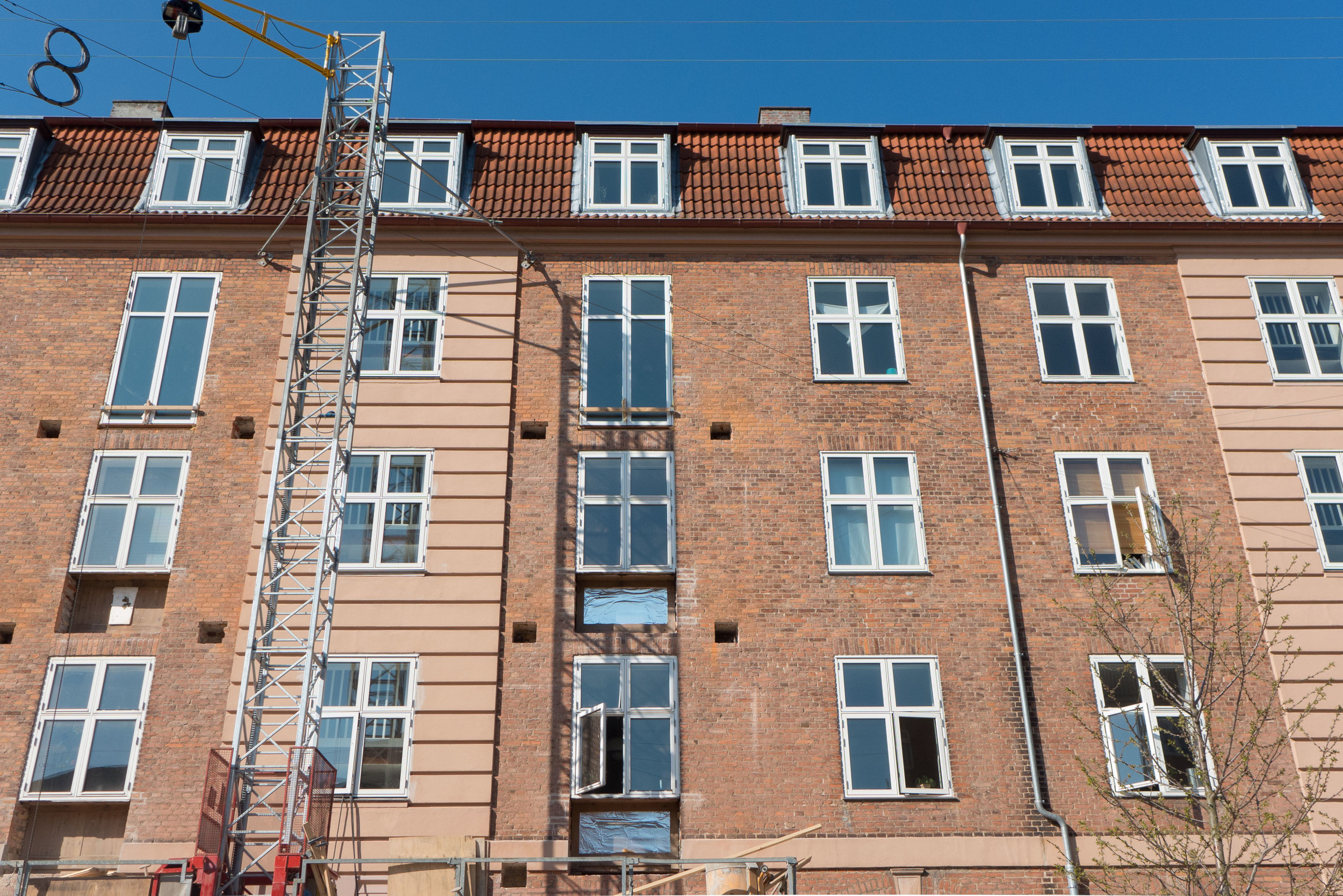
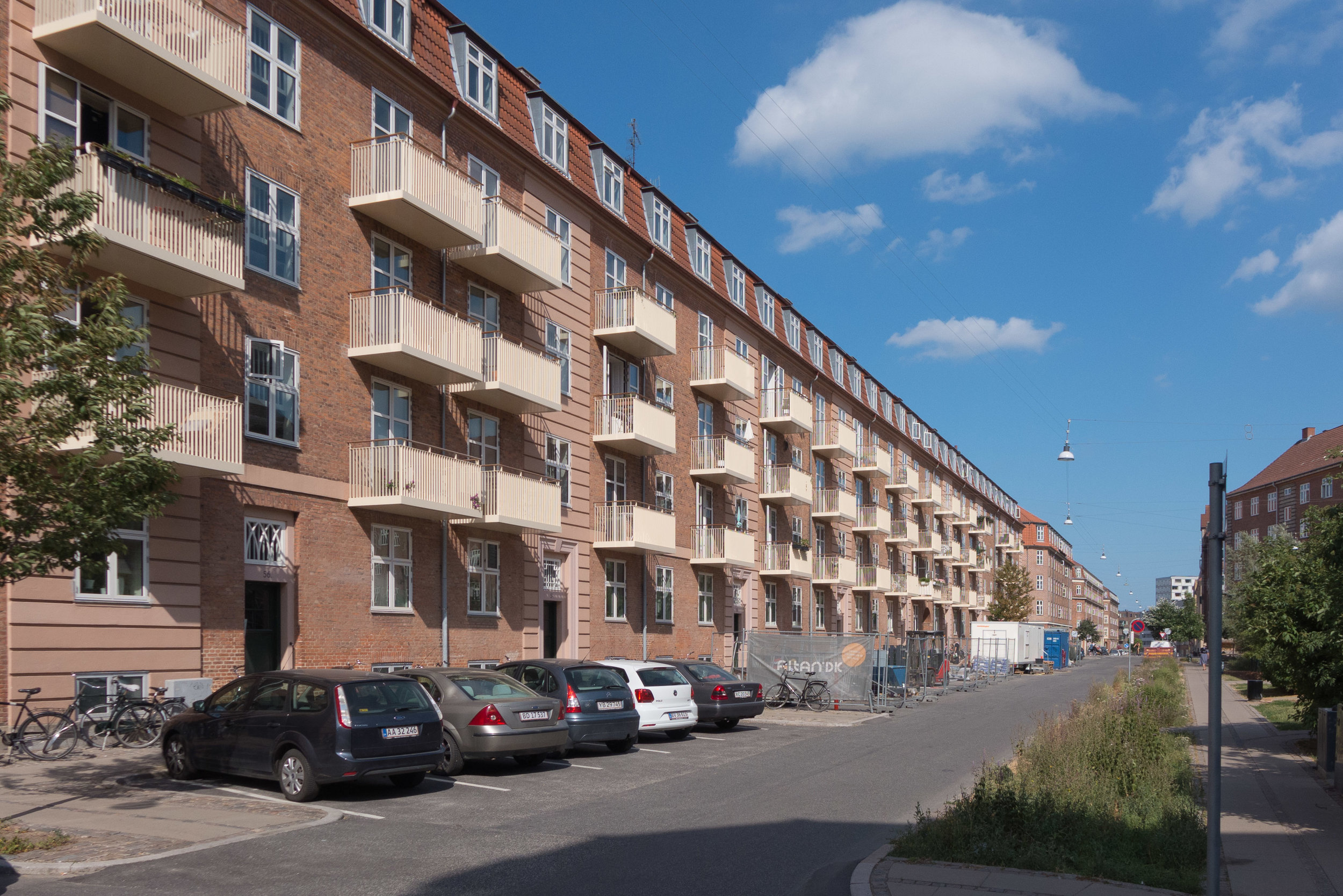
It's on the ground floor and at the corner of an apartment building that dates from around 1900 and, from the start, it was a shop with a small apartment behind as accommodation for the shopkeeper. This was a common arrangement in the city where many of the apartment buildings - from the late 19th century and then on through the 1920s and 1930s and 1940s - have commercial and shop space on the street level and particularly at the corners of the buildings.

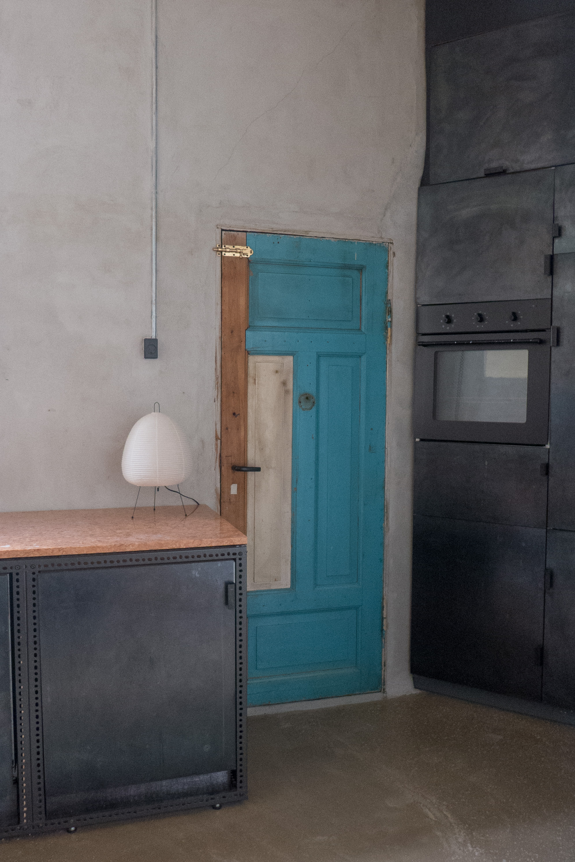
The entrance into the shop from the street - with the doorway set across the angle of the cut-off corner - is typical of the period as are the high ceiling heights. The FRAMA store in Fredericiagade is another, an up-market version, of the same building type …. there a former apothecary shop, at the corner of an apartment building, with ornate ceilings and with shelving from the late 19th century surviving.

Beyond the main front room of the shop in the Strandboulevarden building, the apartment was relatively small with the windows of its main rooms looking out to the side street and smaller rooms, including the kitchen, with windows looking into the courtyard and with a door in the corner of the kitchen for access to a 'back' staircase and access to the courtyard itself ... a practical and, again, a common arrangement.

The last occupant of this shop and apartment was a watchmaker although it had been empty for several years before Niels took over the property.

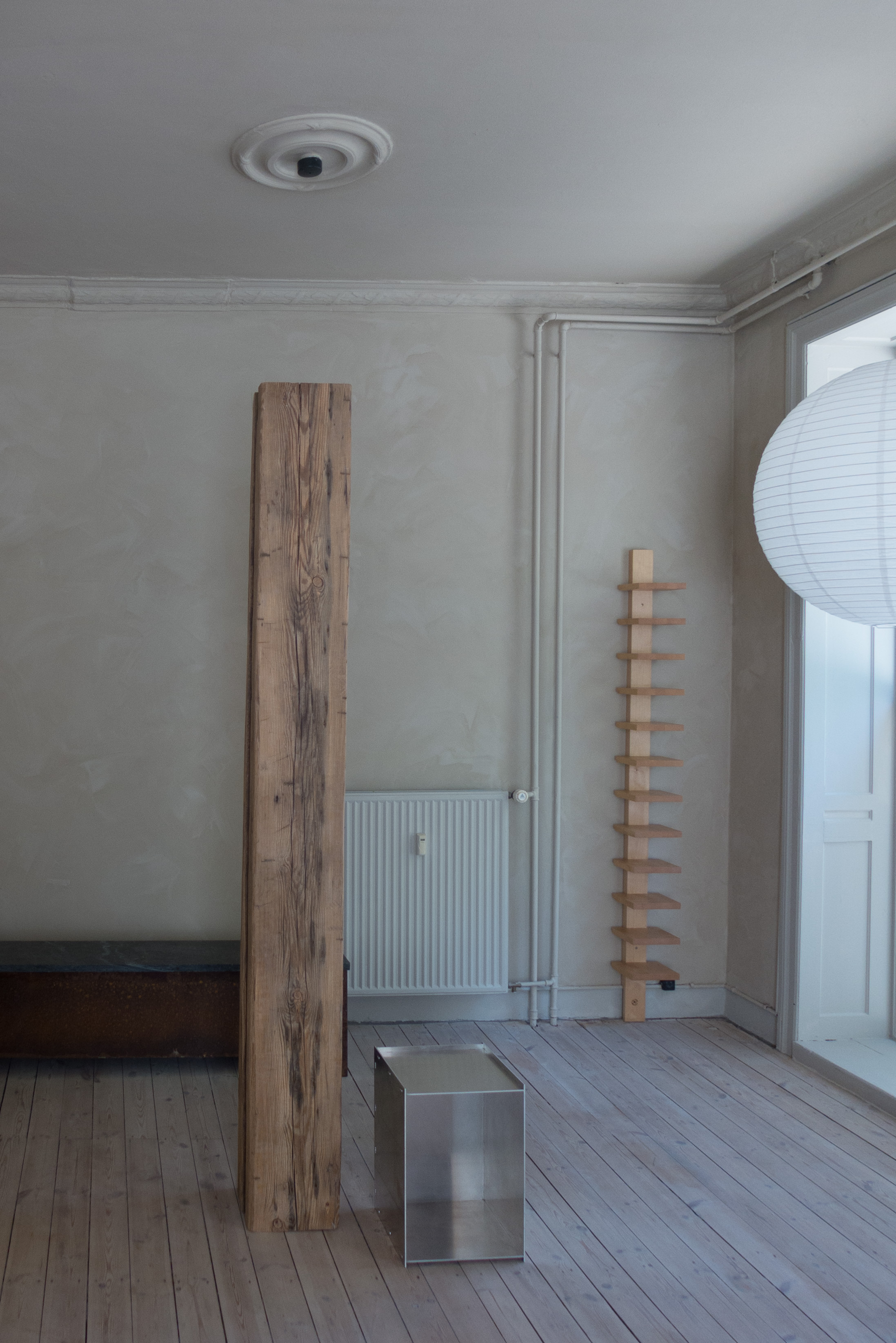
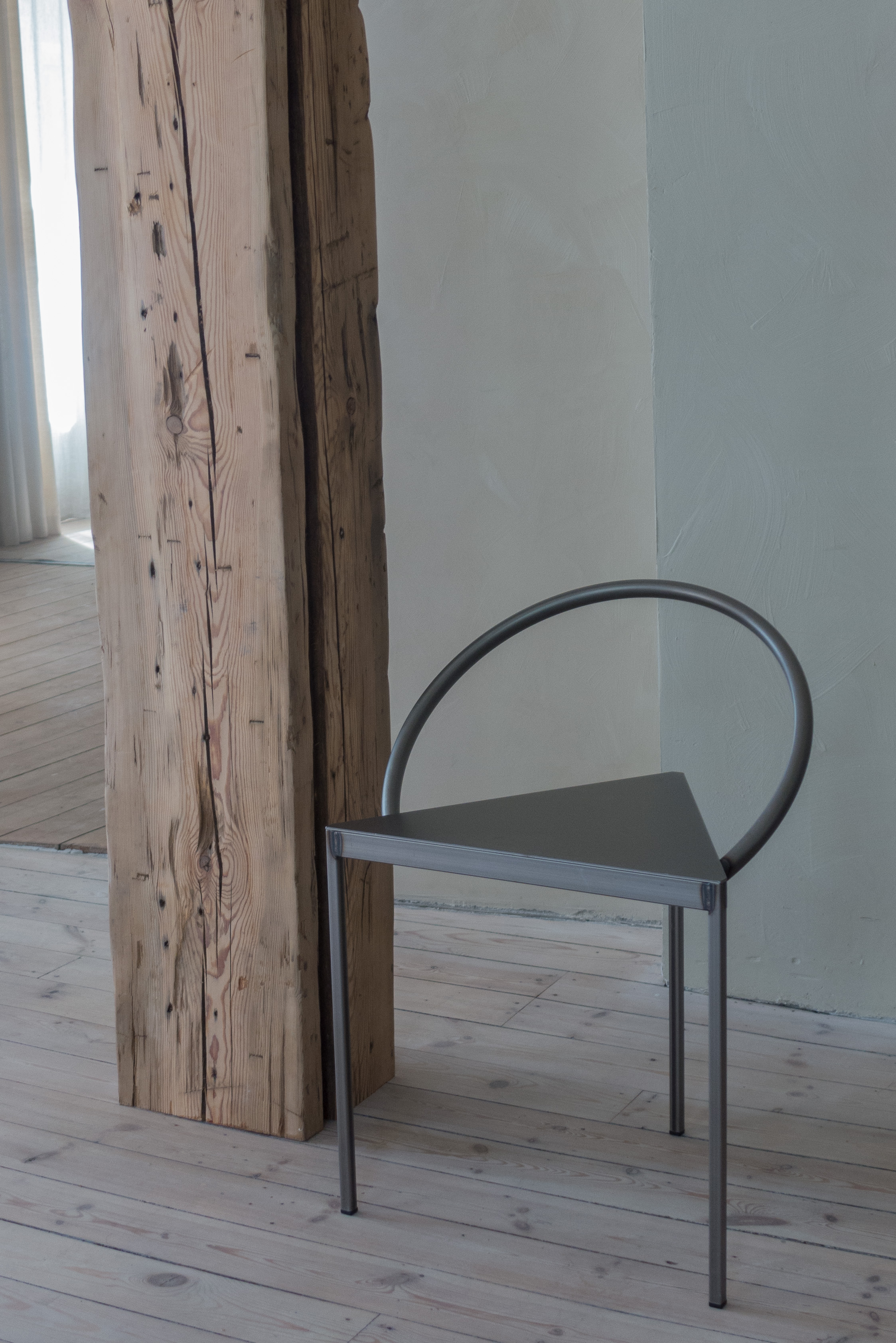
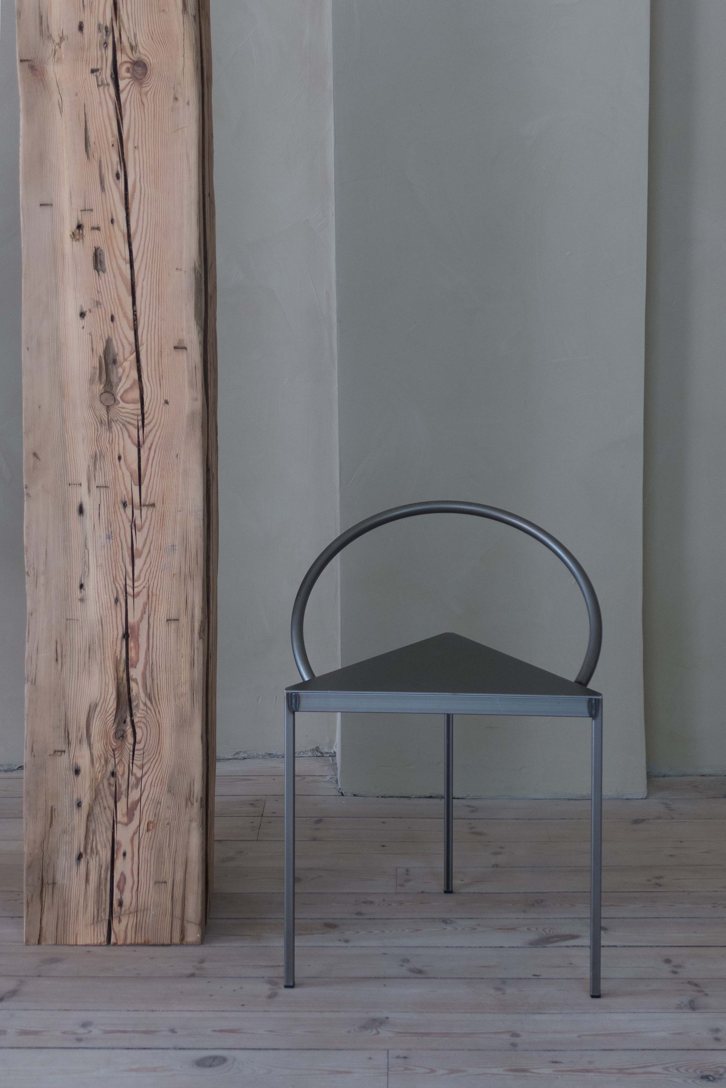
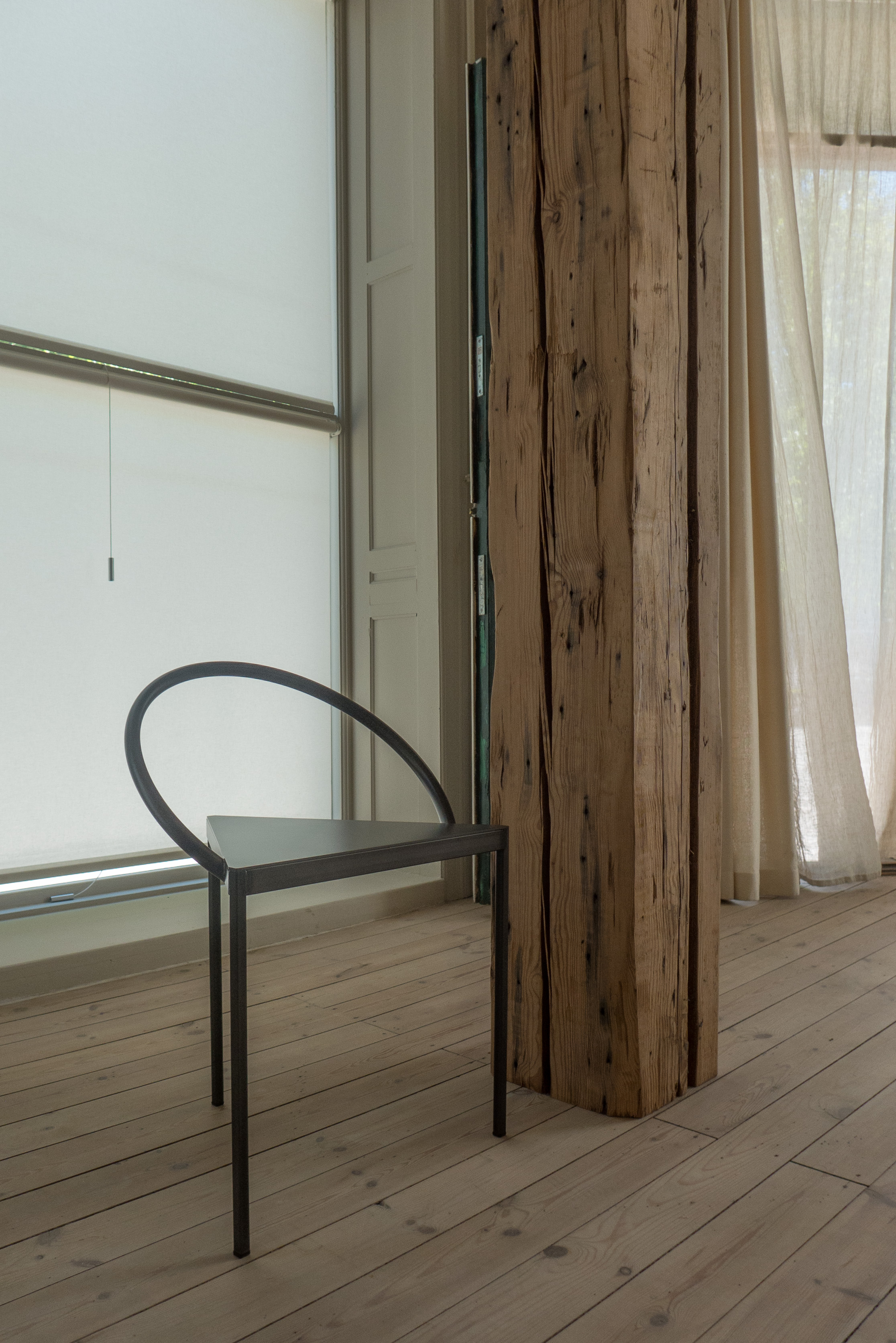
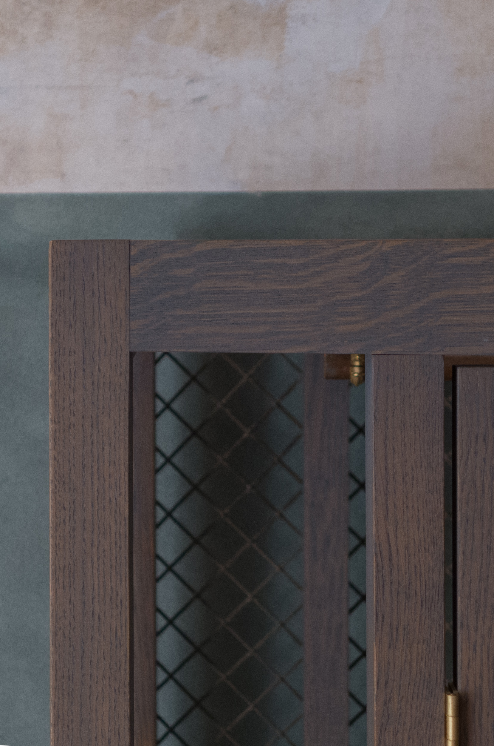
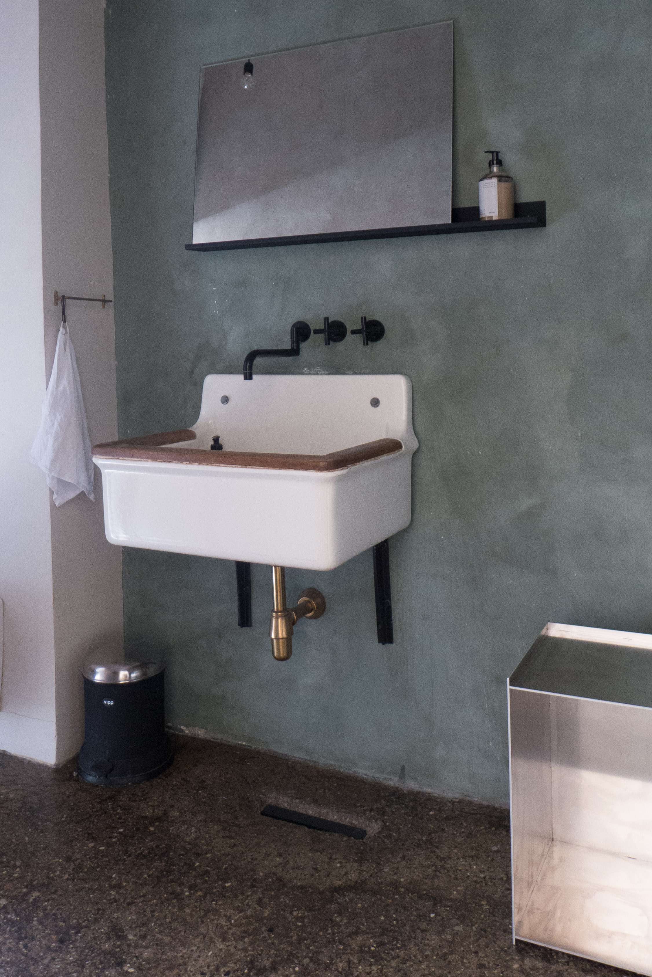
Niels has combined together the space of the shop and the apartment for his home. He has stripped back the walls to raw plaster but decorative mouldings of plaster cornices and moulded decoration on the ceilings, where they survived, have been kept. However, architraves and all doors have been removed so that the space flows from one area to the next.

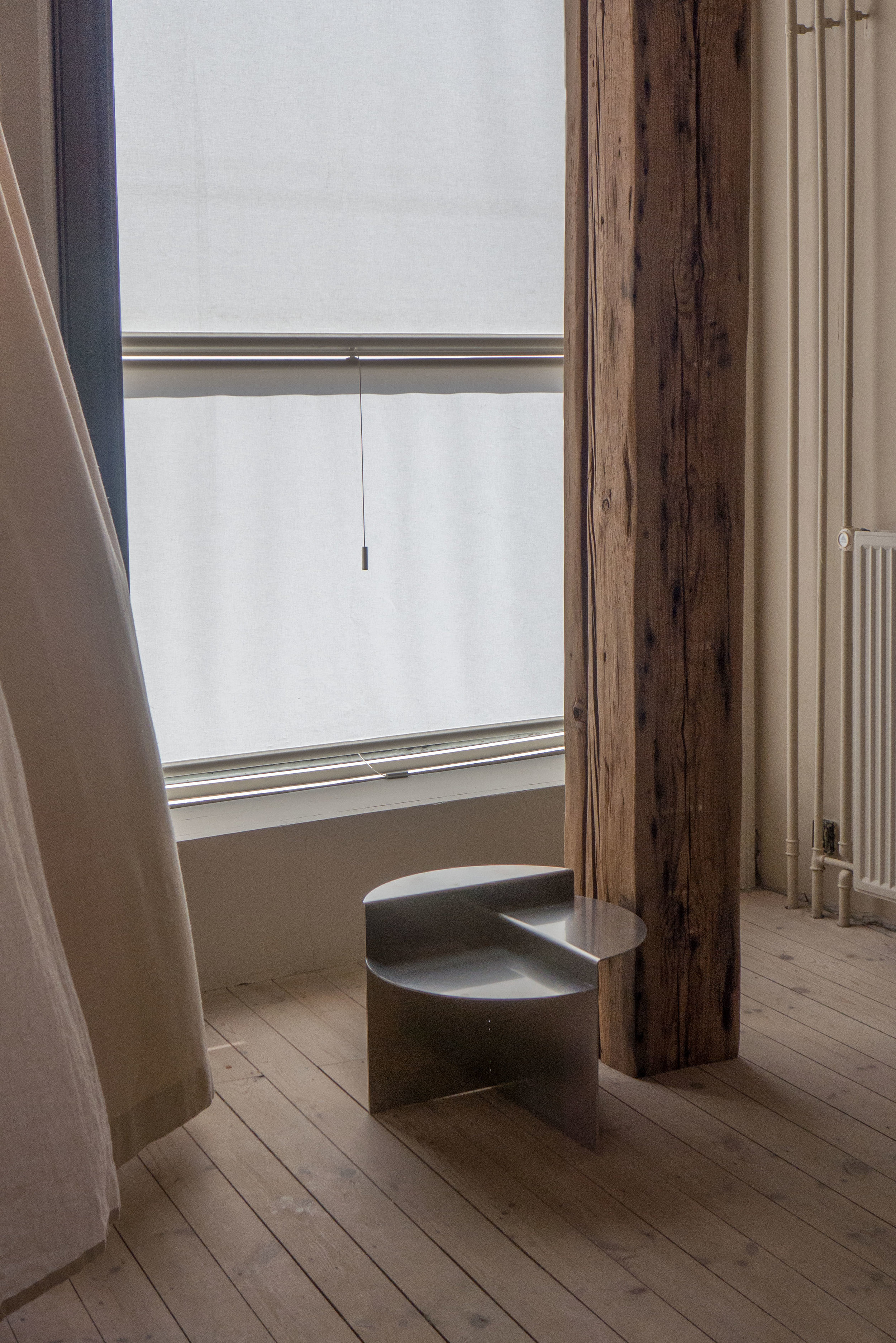
With the high ceilings, the windows are large but, because these look out directly onto the pavements to the street to the front and the street to the side, plain white blinds and plain full-length curtains in linen and in natural silk have been used to give some privacy. This use of plain textiles also means that there is a subtle control of light and a fluid and softer definition to the spaces and again the emphasis is on natural materials and in their natural colours.

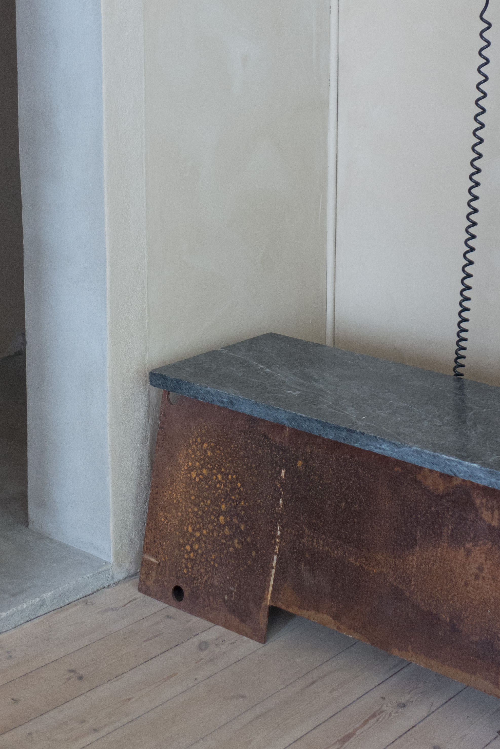
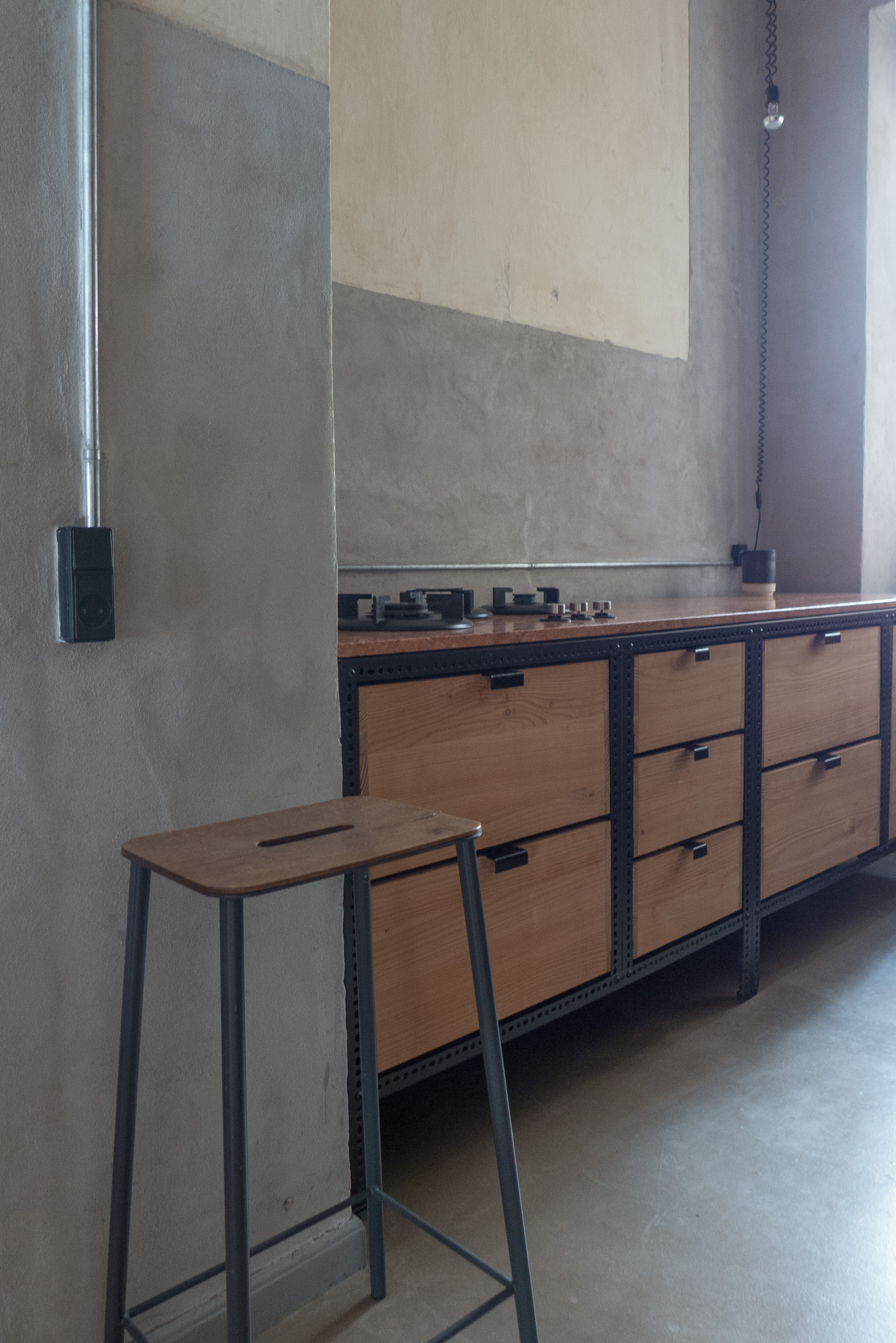
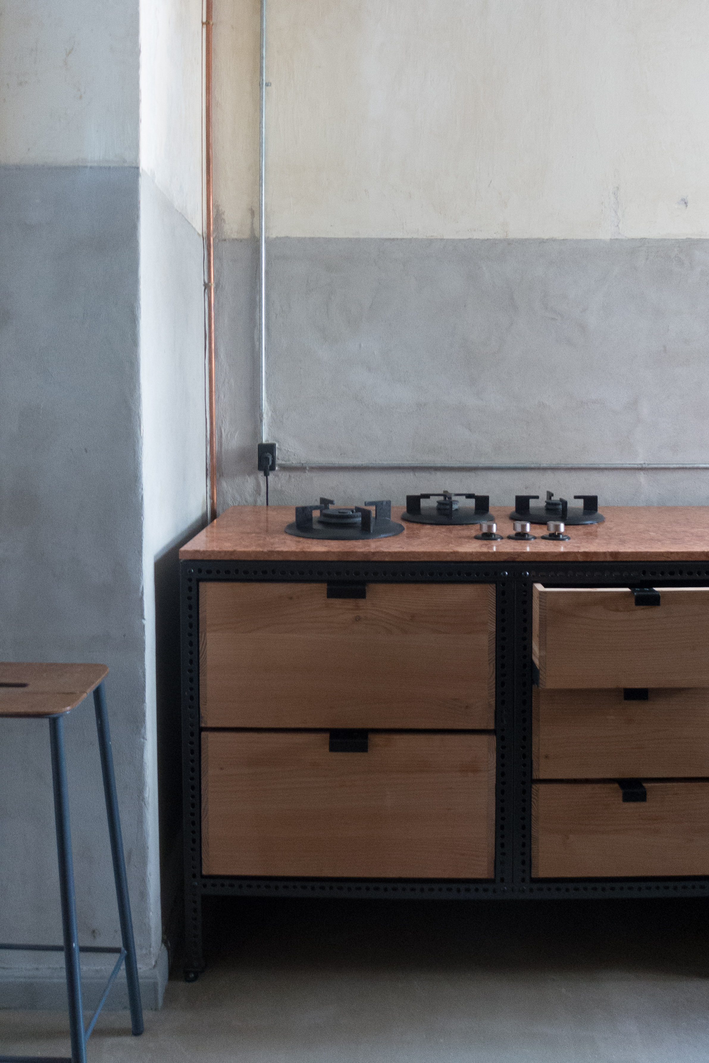
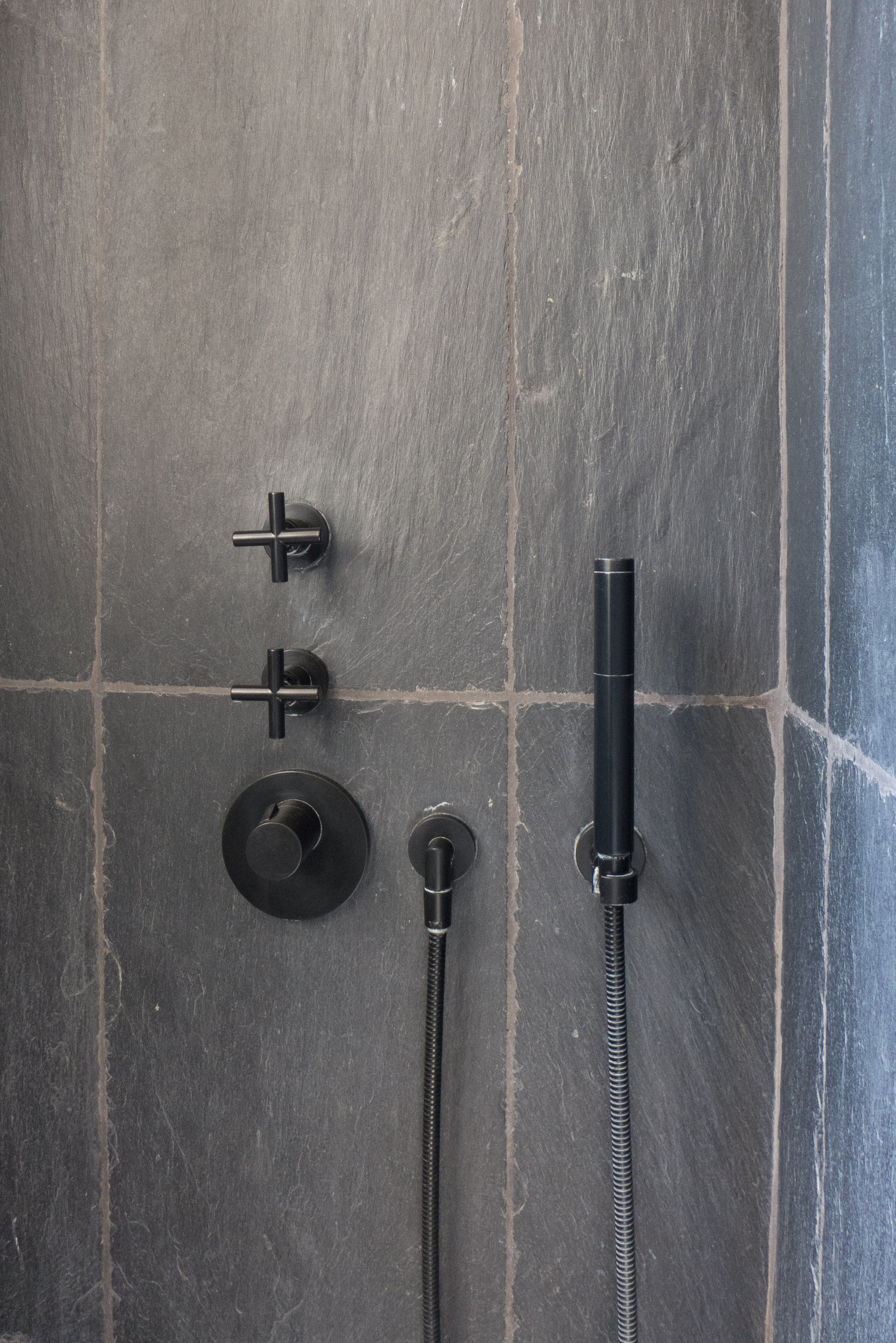
Furniture in the apartment is, of course, from the FRAMA collection, and in this setting looks, of course, absolutely right. Again, this furniture is about using natural materials, so steel plate or wood or stone, and again used to emphasise natural colours and natural textures. Forms are plain and tend to look industrial because they keep to relatively simple shapes and emphasise or respect techniques and methods of fixing determined by the way the material are used when they are used honestly so used without pretension and, ostensibly, without reference to historic styles or traditional forms and shapes.

Although plain and without decoration, the furniture and the interiors are far from being unsophisticated and far far from being crudely made or simply designed so this is about a distinct and rather intellectual aesthetic that looks at interiors and at furniture in a different way.

FRAMA might appear to be a life-style design studio - particularly now with their apothecary range and with the book they have published with recipes - but it is about a serious and coherent design aesthetic that looks at materials in particular but also at texture and colour and form in a different way. It has to be significant that Niels has not followed a traditional design-school training. His is not a unique but is a rare way of seeing the design world … so perhaps the most obvious comparisons should be with the work of the English architect John Pawson - particularly his photography and his publications - and with interiors by David Chipperfield or the work of Vincent Van Duysen.

This is an aesthetic that is stripped back but not strictly minimal - plain and, in part, close to industrial design - particularly early industrial design from the late 19th and early 20th century - but not brutal and although, ironically, about product design it is also about very careful consideration and calm reflection before acquiring anything.

From seeing the apartment, there is a strong sense that anything from anywhere might be considered for inspiration but essentially this is about materials used in a simple almost engineered way that has to respect intrinsic qualities of colour, surface and texture.


Bygningspræmiering … annual building awards in Copenhagen


Despite the actual name, the Building Awards are not just awarded to buildings so the list of winners includes a wide range of urban projects that make a big difference to how we see and how we enjoy the streetscape of the city.


This public telephone box - now in the collection of Designmuseum Danmark - was called ‘The Question Mark’ for obvious reason. It was designed by Klavs Heleweg-Larsens for Kjøbenhavns Telefon Aktieselskab and they were first installed in the city in 1981 and received an award in 1986. The last of these phone boxes was removed in 2017 although there is a proposal to bring some back after they have been revamped to provide tourist information.


The mural on a gable end in Halmtorvet was painted by Peter Abelin in 1991 and received an award in 1992. Over the years, several other murals around the city have been similarly recognised.


The marble pavement for Amagertorv was designed by the Office of the City Architect and received an award in 1994. This complicated geometric pattern, covering such a large and irregularly-shaped area, was designed using CAD, then new in drawing offices. The success of the scheme meant that adjoining public spaces were in turn redesigned with new paving in stone extending through Højbro Plads, Ved Stranden and Gammel Strand.


In Copenhagen, you can find yourself walking all over an award-winning design without even realising.


Bygningspræmiering / Building Awards 2018

On the 7th April 1902 the city council of Copenhagen voted to make awards annually for "beautiful artistic designs for construction projects on the city's land."  

There had been some discussion with the Association of Academic Architects about creating an award that recognised the best designs for new buildings in the city but from the start the awards were also to provide guidelines or a model and an incentive for owners and clients when they commissioned work. 

It is important to understand that the council appreciated fully the importance of historic buildings in the city so the awards were, in part, to encourage the design of new buildings of an appropriate quality to stand alongside the historic buildings but they also went further to include awards for major projects for the restoration of existing buildings and to recognise improvements to the townscape or urban scape that provided the best and most appropriate setting for those buildings.

Nor did the awards just focus on major or prestigious buildings but over 115 years they have also recognised the best private houses, new apartment buildings and commercial buildings, factories and schools in Copenhagen. 

For 2018, eight buildings have been recognised with an award but, for the first time, these will all go forward for the selection of an overall winner by a public vote.

That winner will be announced at a ceremony at the City Hall on 3 May. 


Axel Towers, Axeltorv 2
Lundgaard & Tranberg Arkitekter A/S

Five circular towers, tightly grouped and interlinked, with shops and a cafe at the lower level, a new public space at an upper level between the towers, offices and a restaurant at the top overlooking the city. The nomination for an award appears to be in part for the quality of the exterior and for the new or rather the replanning of the public space running back from the street across the west side of the new buildings.


Carlsbergfondets Forskersboligerne / Carlsberg Foundation Graduate Housing, Bohrsgade 7-13
Praksis Arkitekter ApS

Apartments on an important and sensitive site overlooking the JC Jacobsen Gardens. The award appears to be for the quality of the design, attempting to set a standard for the redevelopment of this area, previously the site of the Carlsberg brewery. There is an interesting loggia across the street frontage that takes its form from covered links between and across the front of original brewery buildings and the form of the brickwork, with panels of bricks set diagonally to create a zigzag dog-tooth pattern, shows a clever and sympathetic and appropriate respect for the facade of the adjoining brick building on the garden side by Eske Kristensen that dates from the 1960s and was itself an award-winning design.


Konstabelskolen, Luftmarinegade 1
Vandkunsten

New youth housing in buildings on Margreteholm that date from 1939 - an early and important concrete post and beam construction that has been derelict for some years.


Mærsk Tårnet / Mærsk Tower, Blegdamsvej 3B
C F Møller Architects
Landscape SLA

Prominent new building for medical research - for the university Panum Institute and the Novo Nordisk Foundation Centre on the Faculty of Health and Medical Sciences site. The award, in part, seems to recognise the technical aspects of the building, particularly energy saving for such a large structure; in part recognises the complex planning for such a complicated high-tech role and in part is for the landscape around the building that takes into account controls for surface water - as cloud bursts become more common, and potentially much more destructive with climate change - but also has interesting planting and a dramatic use of elevated public walkways to encourage people to enter the site or cut through.

L1260671.jpg


Dehns Palæ / Dehn’s Palace, Bredgade 54
Wohlert Arkitekter A/S

An 18th-century palace - designed by JG Rosenberg and close to the royal palace and the Marble Church - has been restored for Danmarks Apotekerforening / Denmarks Pharmaceutical Association following an extensive fire in 2010. The award recognises that because the building is so important, restoration work was completed using original materials with original working techniques.


Åbenrå 16
Entasis A/S

Apartment building constructed on a plot in the historic centre of the city close to the King's Garden that has been vacant since 1970 when a number of old houses were demolished ahead of a major scheme to rebuild the street that was then abandoned.


The Silo, Lüdersvej 15
COBE

Prestigious apartments and a roof-top restaurant in the conversion of a concrete silo for grain that was the largest industrial building in the North Harbour. The challenge was to give the building a relevant and financially viable function to justify its survival; respect the scale of the building, with what are exceptional heights between the floors, and to retain qualities and the drama of the raw concrete of the original building but bring the spaces up to current standards of insulation. 


the two silos in May 2015


Frihavns Tårnet, Helsinkigade 18-20
Praksis Arkitekter ApS

Housing in the conversion of a former DLG silo close to the Silo. The industrial building was given a distinctive framework of balconies on three sides and the award recognises the quality of the apartments - “the decor and the choice of materials” but also appreciates that the design has created “liveable” homes particularly in terms their orientation to the natural light.


note:

There is a page on the web site of Københavns Kommune - under Housing, Construction and Urban Life - on the Building Awards that has information about each of the nominated buildings with photographs, including some interiors, and a short video for an assessment of each of the projects by the City Architect Tina Saaby (in Danish).

Copenhagen Architecture Festival 2018


13th April 2018

Copenhagen Architecture Festival opens on the 3rd May and continues through to 16th May 2018. 

Yesterday the full programme was launched on line and this year, for the first time, there will be events in Odense as well as Copenhagen, Aarhus and Aalborg … all cities with a “strong architectural identity.”

The theme for this year is HOUSING HOMES / AT HUSE HJEM with lectures, film screenings, exhibitions, workshops and guided tours to look at ideas of home, housing and belonging … “to look at what constitutes a home, what does it mean to be home, and how homes are created in different and difficult situations.”

The ambition of the festival “has always been to share architecture with a wide audience by being unpretentious, curious, and bringing a new perspective to the table. We want to create new encounters between subjects, people, and ideas in the city’s space. The intention is for architecture to act as a character in the dialogue through the audience’s personal experiences of the spaces. Architecture is thus for everyone- not just for architects.”


download the programme from CAFx

the south harbour

looking north up the harbour towards the historic centre of the city from Cykelslangen - the cycle and pedestrian bridge near Fisketorvet


Obviously the harbour is a major asset for the city … after all Copenhagen was established here and prospered because of the harbour for both merchant trade and for a naval port.

The south part of the harbour below Langebro - the major bridges over the harbour at the south end of the old city - was busy wharves and commercial basins through into the 1950s and 1960s but, in terms of the history of the city, was relatively new as the land on either side had not been reclaimed from the sea until the late 19th century. 

Before that, this part of the harbour was a wide bay between Frederiksberg on the north shore and the Island of Amager on the opposite side. 

Vesterbro and the bay in 1860

These extensive port facilities were linked to a rapid growth in the population from 1850 or 1860 onwards so new meat and fish markets were built here to handle the large quantities of food coming into the city and then later there were wharves for the coal and diesel brought in for the power station.

Actually the harbour is still amazingly wide … some 330 metres wide just before Fisketorvet.

There was extensive new development in the late 20th century - mostly for offices but also a hotel on the city or west side - on Kalvebod Bygge below Langebro - and on the east or Amager side - along Islands Brygge - there is a line of large older apartment buildings, set back behind the commercial wharves, that was workers housing dating from around 1900 - but, since the late 20th century, land and some of the large redundant industrial buildings further south, including massive silos, have been converted to apartments and there are new apartment buildings on south under construction and nearing completion. 

Generally the architecture is inoffensive but generally flat roofed and large and depending on cladding rather than architectural form for any effect. It’s not that any outrageous or highly novel buildings are needed … people usually get tired of anything Post Modern fairly quickly or, come to that, get tired of anything trying too hard … but a little more colour and certainly more architectural features that create light and shade to have an effect across the blocks might have helped and more use of interesting sight lines through to buildings behind would reduce the impression of a string of boxes. Not much of this is bad architecture - just slightly boring architecture and easy architecture that barely does justice to the amazing setting. Future generations of architects and builders will probably look at this as a wasted opportunity.

looking across the harbour to to the buildings along Kalvebod Brygge from Islands Brygge

HC Ørstedsværket / HC Ørsted Power Station


Designed by the architect Andreas Fussing, work on the power station began in 1916 and was completed by 1920 although there have been several major additions. The long turbine hall with shallow curved roof in concrete was part of the first phase. Additions in 1924 and 1932 were designed by Louis Hygom and Waldemar Schmidt and for that phase Burmeister & Wain built what was then the world’s largest diesel engine.

Some roads around and through the works are open to the public and there is a museum here and open days when it is possible to see some of the machinery halls. 

This is certainly some of the most dramatic architecture in the city and could have been a model for some of the recent developments around the city - particularly for the Carlsberg redevelopment but also for the overall planning of the North Harbour area. 

The power station is Functionalism at its best - carefully controlled and beautifully proportioned buildings in the style known as New Classicism - and the power station is incredibly important industrial archaeology that tells the history of electric power in the city.

Of course, that’s not to suggest that new architecture in the city has to be a pastiche of industrial buildings of the past but that modern buildings achieve the scale but seem thin and flimsy and curiously rather cautious when compared with the bold compositions here that use very strong but carefully controlled colour; strong use of shadow and strong, simple but beautifully proportioned fenestration and rational design where function, generally, is expressed in the form.

A new metro station is due to be built here, just south of the power station and there are plans to build blocks of apartments along the water frontage but it is to be hoped that they respect the form and the importance of the architecture of the power station. There is also to be a new bridge to link this part of the harbour development with the new areas further south … all part of developing the circuit of the harbour to encourage people to cycle, run or walk around the harbour.

the harbour ferry - a video by Magasinet KBH


Back in February the online magazine site Magasinet KBH posted a video that shows the journey of the ferry from the south end of the harbour at Teglholmen to the landing stage at Nordre Tolbod.

The camera was set up on the front of a ferry so you see the whole harbour at ferry speed including turning in and docking at each of the landing stages and then backing out before heading on north. The film takes about 44 minutes because the ferry takes about 44 minutes and this really is the antidote to the swipe right and move on approach to much on the Web. This is slow web at its best and 44 minutes is not download but run time.

I took the ferry down to the south end of the harbour to take the photographs for posts here so it seemed like a good time to include this with a link to their site.


note:

Magasinet KBH is an online magazine with articles on buildings and planning in Copenhagen with general architecture and environmental news and interesting opinion pieces. There is also a regular news letter that you can sign up to receive automatically. It is in Danish but translating the tab in Safari or Chrome works well. 

Magasinet KBH

development of the south harbour in Copenhagen

 
  1. new apartments to the north east of the Aalborg university buildings

  2. looking south west from the Aalborg university buildings down Teglværksløbet with Sluseholmen on the right and the Bella Hotel on Amager in the distance

  3. the bridge between the two buildings of Aalborg University campus

  4. Teglholmen from the university buildings 

  5. new apartments at Teglholmsgade

  6. apartment buildings to the east of Fisketorvet from the south

Sluseholmen at the south end of the harbour - a development of apartment buildings facing onto the wider expanses of Teglværksløbet or Sluseløbet or built along a number of canals - now looks well established but the area of Teglholmen - the large area to the north - is still very much a building site but the new buildings are going up fast. There are now schools and shops here and a well-used bus service to the city centre and the area is at the end of the line of the harbour ferry. North again is the area around HC Ørstedsværket - the power station - but there work seems still to be as much about levelling and clearing the old buildings as it is about construction. Then north again, moving inwards towards the city there are now well-established offices and apartment buildings and Fisketorvet - a large shopping centre that is old enough to now be facing imminent rebuilding and upgrading that is necessary because of the rapid development of this area.

The whole area is defined by the harbour on one side but on the other side is Vasbygade - a busy road that is far from attractive - until recently a major dock road with fairly typical industrial buildings from the post war period but it is also a main road into the city centre from the motorway.

To the north is a tangle of railway lines heading into the central station but also with marshalling yards and the interesting engineering works for the railway at Otto Busses Vej. Until recently, maybe a decade ago, this would all have been seen by polite Copenhagen as marginal land but now it is desirable and extremely valuable land for redevelopment and all less than 4 kilometres from city hall and with Fisketorvet only just a kilometre from the central train station.

There has been some criticism in the press for the new housing that is seen by some as socially divisive … taking prime sites along the water for expensive apartments and muscling in in front of the older working-class housing of Vesterbro and the housing around Mozartsvej.

Nearly all this land has been claimed from the sea in various phases since the middle of the 19th century and until recently was wharves and industrial buildings. One way to appreciate just how much land has been claimed is when you realise that the original railway line into the city from the west was on the line of what is now Sønder Boulevard and for a short distance ran along the foreshore but the street is now back almost a kilometre from the harbour.

Sydhavnen Skolen by JJW Arkitekter


Almost every area of the city has a major new school and most by a major Danish architect or architectural partnership. The new school in the new development of the south harbour is by JJW Arkitekter.

It’s a large and dramatic building on an irregularly shaped plot with some parts towards the street supported on high columns so suspended over the pavement to provide public areas underneath opening off the pavement to provide some cover where children and parents can meet and talk or play when they come into the school or when they leave in the afternoon … an important part of the social life of any school here in Denmark. 

The school is in the centre of the new area, right on to the pavement, clearly visible from adjoining streets and nearby buildings and, looking out, the views are of the new neighbourhood. That’s not a limitation or a criticism but praise for how the school is designed to fit physically and obviously into the community. The building can be used by community so, for instance, dental care for the area is based in the building.

On the side away from the street, there are dramatic terraces, raised play areas, some at roof level, and broad walks and steps down to an inlet of the harbour, and as at Kids City in Christianshavn by COBE, smaller children are generally at the lower and more enclosed areas and more vigorous activities are higher up the building.

And again, as at Kids City, the arrangement of spaces deliberately reflects the organisation of the wider community so the description by the architect talks about the the lower level being like a town square.

Inside it is no less dramatic than outside - if anything more dramatic - with sections opening up through two or three floors with upper levels and narrower staircases cantilevered out or supported on thin columns or with wide flights of steps doubling as lecture rooms or forming places to meet.

Curiously this is what I like most and like least about the building. It’s a complicated, dramatic and fascinating building inside and out and children here presumably develop agility and stamina quite quickly and a head for heights. This is certainly the antidote to the one classroom-fits-all style of schools from the late 19th and early 20th century or the all-on-a-level schools of the post-war period. There are self-contained classrooms but they entered from wide wide and long open spaces with a variety of areas where different types of teaching or different activities can take place with smaller or larger numbers. The architects talk about the school having “an extremely high functional, spatial and tectonic quality” but architecture has and should have a clear vocabulary and in that sense should be readable … you should be able to see where to go and to some extent identify functions from the style and form of the architecture. That’s not to suggest it should not be fun but maybe just slightly more rational and slightly more solid. Perhaps, more of the architecture should be the background providing the venue for life here and not be the subject.

Having said that, photographs of the interior show masses of natural light - despite this being such a large and deep building - and strong confident use of colour and really good details like deep window seats or areas on the terraces that are more intimate. Encouraging and reinforcing friendship bonds seems to be an important part of the Danish education ethos. Certainly, with school buildings like this, you can see exactly why Danish children grow up appreciating good design and grow up to see good design as a strong part of their day-to-day lives.

Sydhavnen Skolen by JJW Arkitekter


for comparison see Kids City in Christianshavn by COBE


catching the sun


20 March 2018

This photo was taken today when walking back along the quayside at Islands Brygge on the east side of the harbour.

There had actually been snow in the morning and it had been cold enough to settle but at lunch time the cloud lifted and by mid afternoon the sun was out … low but surprisingly warm and people came out to make the most of it. 

It’s been a grey and dull Spring where February and March in Copenhagen can be clear with blue skies … cold but bright. So far this year there have not be many opportunities to sit outside and people who live in Copenhagen do sit outside … they take ownership of the streets at every opportunity and the city and the planners know that and wherever possible provide seating … so here it's a long curved bench with a high back to keep off the wind and trap the sun.

This is far from being a new use for street space ... using public space for leisure or exercise or just for sitting to watch the World go by is basically the way people here have worked out to live in a tightly-packed urban space so there are paintings in the National Gallery from the 18th century that show the citizens of Copenhagen promenading on the ramparts or sauntering across the squares. 

This area along the south part of the harbour - in front of a line of large apartment buildings from about 1900 - was busy commercial wharfs through the 1950s and 1960s but as the port facilities were moved out then the area was made into a very popular harbour-side park. Close to here is the harbour swimming area that is used all through the year - with a temporary sauna there in the winter - and the wide areas of grass on either side of this sitting area are used for sport, outdoor exhibitions and events. 


the outdoor library at Islands Brygge

Islands Brygge in the Autumn

a new metro line

Metro_Sydhavnslinjen-til-web.jpg
 

In March it was announced that a contract has been signed for work to start on constructing a new metro line - Sydhavnslinjen or South Harbour Line - with new stations at Ny Ellebjerg, Mozarts Plads, Sluseholmen, Enghave Brygge and Havneholmen. 

There will be a major transport interchange with the suburban railway at Ny Ellebjerg and the line will serve the large area of housing to the south of the western cemetery before running in a long arc through the new development of the South Harbour and from there to Enghave Brygge - just to the south of the power station - and then on to a new station at the west end of the shopping centre at Fisketorvet which is to be enlarged and remodelled.

Just to the west of the main railway station the south line will join the new metro line - Cityringen - the new metro line that opens next year. 

The new metro line from Ny Ellebjerg will be finished in 2024 and it has been calculated that each day there will be 29,000 journeys along the new line so around 9 million passengers a year.

Sydhavnslinjen

work on the new metro stations from the air

Kongens Nytorv - photograph from MAGASINET KBH


Last November the online site MAGASINET KBH published an amazing set of aerial photographs of the nineteen metro stations now being built for the new City Ring in Copenhagen. These show just how extensive the major engineering project has been but they also hint at just how much the new metro stations will change so many parts of the city. 

Of course the obvious change will be in how people will be able to move rapidly and easily from one part to another but the new stations will also revitalise areas and for key interchanges will influence how people use the surrounding streets and buildings and how they move around; how often they go to an area and how long they stay. 

Just how much change these patterns of movement will bring can be seen in the effect at Nørreport. There was a major train station there on the railway running east to west, from the old terminal at Østerport to the main central station, dating from the early 20th century, so long before the first stage of the metro was completed. Initially the metro station below the railway, serving a metro line running north south, seemed simply to reinforce routes taken by people as they arrived at or left the station … most people were heading into the shopping area. So it seemed to be more a matter of the number of people rather than what they were doing or where they were going. But the extensive remodelling of the street level by COBE has completely revitalised the area. 

Surely there will be a similar impact at the new stations on the new line - particularly at major transport interchanges including the square at Kongens Nytorv; at the square in front of the City Hall at Østerport and at Frederiksberg but other new metro stations are at key public open areas … particularly Trianglen - close to Fælledparken and the national football stadium - Nørrebro, at the centre of perhaps the most diverse and densely occupied part of the city; the station at the corner of the cemetery, Assistens Kirkegård, at Nørrebros Runddel and at Enghave Plads, out to the west of the central station, which will be an access point to the massive redevelopment on the old site of the Carlsberg brewery.


The photographs also include the engineering works for the spur line that will run out from the ring to the north harbour and there will be a second spur down to the south harbour.

Nordea bank have moved


Nordea Bank have moved a main office out of a building in the centre of Copenhagen on the south side of Knippelsbro - the main bridge between the city centre and Christianshavn at the centre of the harbour - and are now in a new purpose-built block about 2 kilometres further south … close to the concert hall, studios and office buildings of the Danish Broadcasting Corporation at DR Byen.

This building, their old office by the bridge, dates from the late 1950s and was constructed as the headquarters of the shipyard of Burmeister & Wain. After they closed around 1990, it was taken over by a series of banks … presumably, in part, because of the convenient size of the building and possibly, in part, because of the proximity to the National Bank of Denmark; to the headquarters of the rival Danske Bank and to the buildings of parliament and the main government ministries over the harbour just on the other side of the bridge.

Now an application has been submitted to the planning department to convert the office building to a hotel to be run by the Hilton Group. 

The building is set back from the road but on a high base or terrace with an ugly high and blank concrete wall along the public pavement that runs down from the bridge to the level of Torvegade - the main road from the bridge, through Christianshavn to Amager. An initial proposal seems to be to break through this wall with windows and presumably an entrance into the hotel - which is good if it creates a less grim and forbidding frontage onto the pavement - and there are also proposals to open through from this lower level through to the harbour quay. 

At the moment there is no public route for pedestrians to get down to the quay directly from the bridge on this side although there are steps down on the other side of the road and steps down to the quay on both sides on the city side of the bridge. The only real objection to this would be if the hotel gains - by making the quay part of its domain or, at least, part of its facilities - but the citizens gain little in return.

But really the big problem - and it is literally about being big - is that the current proposal is to add at least another floor on top of the building. It is already a massive block of a building nearly 100 metres, along the street, and about 34 metres deep with seven main floors above that concrete base and, of course, a certain amount of service works on the flat roof for air con and lifts and so on. 

Why does the hotel need even more floor space in a huge building that already dominates this part of the harbour and dominates not in a good way? If it is simply for roof-top restaurants then should local people object to tourists admiring the roof scape of the historic city as a pleasant backdrop as they look out but with the building dominating the skyline even more for those walking past or living nearby?

In terms of the historic townscape, the real problem is if additions to the building undermines the setting of Christians Kirke and its forecourt and churchyard immediately to the south or dominates and disrupts the buildings along Strandgade … both the historic buildings immediately opposite the narrow end of the building away from the harbour or it dominates or undermines the streetscape from further north from the other side of Torvegade. Strandgade is still, despite losses, the finest group of 17th and 18th-century merchants houses and warehouses in the city and not only its buildings but its wider context should be protected.

It is important to note that when the shipyards closed in the 1990s, the large site that had been engineering workshops and yards was redeveloped with new offices along the harbour and new apartment buildings along the two sides of the site that face towards the canal but the architects Henning Larsen had to respect the level of the cornice of the church - so the distinctive roof and tower of the 18th-century building designed by Nicolai Eigtved were not compromised. It is a pity that the planning restrictions in the 1950s were not as sensitive but surely adding a floor to the building could not mean that two wrongs make a right … or at least in terms of the townscape and roof scape of the city. 


Knippelsbro - the present bridge was designed by Kaj Gottlob

Redevelopment of Torvegade in the 1930s

Redevelopment of the shipyard site by Henning Larsen in the 1990s


Strandgade looking towards the church with the corner of the grey and glass box of the Nordea / Hilton building just visible on the right. This is at the junction where Torvegade, running out from the bridge to the right, crosses over Strandgade and continues on to the left across Christianshavn and on to Amager. One more floor on a large building does not sound excessive but it changes further the dynamic of the street scape and emphasises even more just what a large hole was punched through Strandgade when 17th and 18th-century buildings were demolished to widen Torvegade and to build the approach ramp up to the bridge. It might seem odd to worry about a streetscape that was so drastically altered in the 1930s but the photograph below shows the run of historic buildings that run right up to the church on the opposite side of the road to the hotel. These are of huge historic importance to the city and at the very least deserve respect.

view along Torvegade looking towards the city. The buildings in the distance are an apartment block on the far side of the harbour that survives. The block of buildings in the right half of this view were demolished to construct the south approach to the bridge and the buildings to the left of the trams were on the site of what became the Nordea building and is to become a hotel