

news, notes, photographs and thoughts about design, architecture, planning and townscape and exhibitions in Copenhagen


an unbuilt tram station for Rådhuspladsen
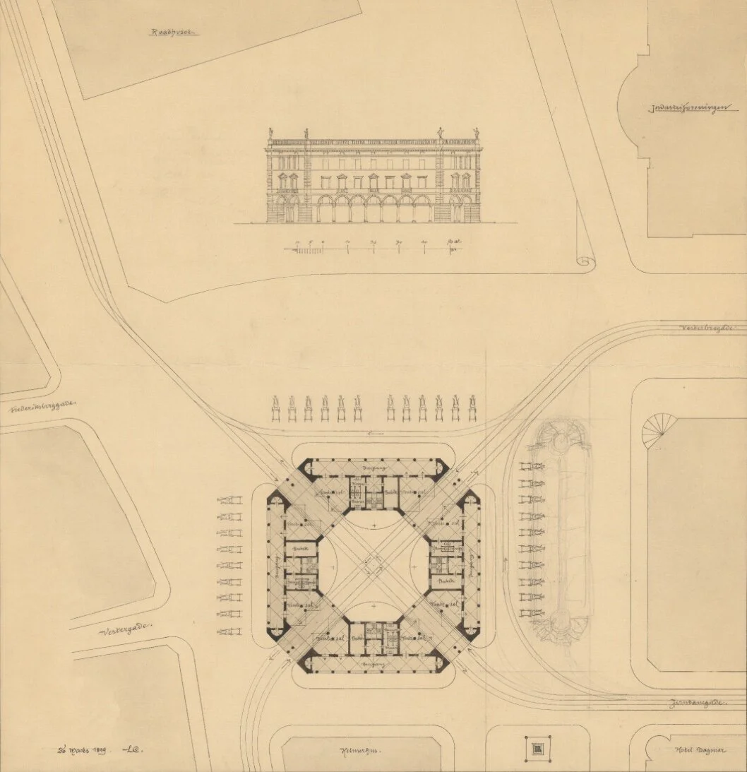
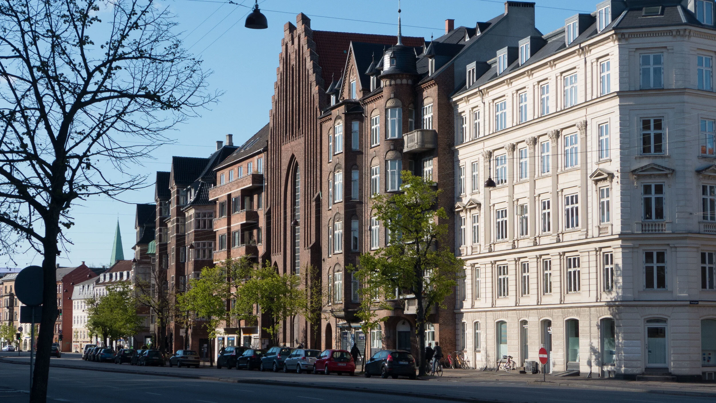
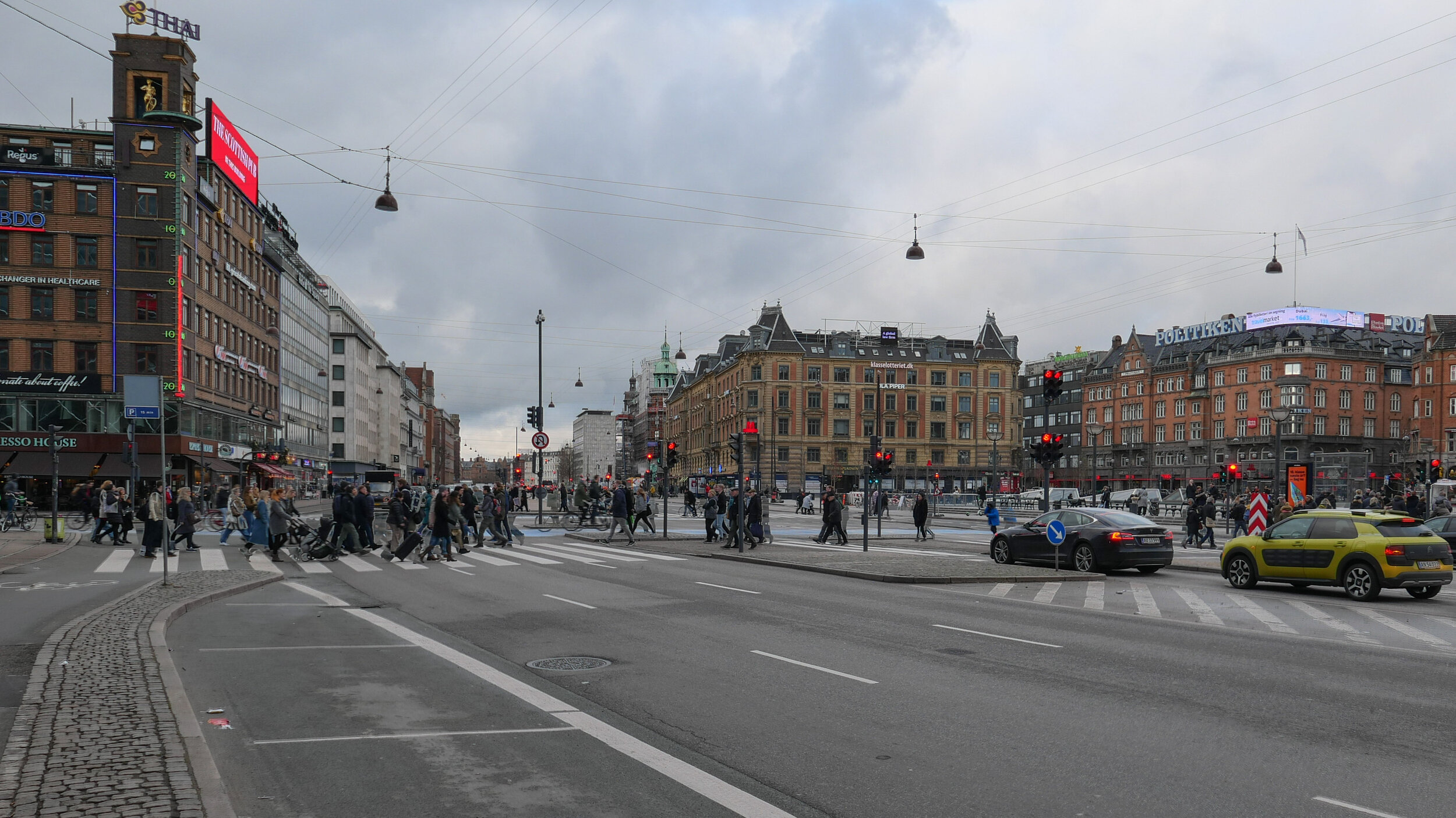
/Looking for old photographs and drawings of the buildings around Rådhuspladsen - the square in front of the city hall - I came across this amazing proposal by the architect Ludvig Clausen for large and elaborate tram station - a Sporvejsstation - that was designed in 1899 but was not built.
It would have been across the north side of the square so opposite the city hall and over the new metro station that opened recently.
In plan it would have been a large square building but with strongly chamfered external corners but with a courtyard that was a regular octagon. Tram lines would have entered through double arches on each of these corners and the trams would have crossed over in the centre, with pairs of lines crossing over like a cross of Saint Andrew, but also with curved lines on each side so that trams could come in and then exit through adjacent corners.
The four main elevations would have had arcaded loggias facing outwards and the building would have had three floors with a balustraded parapet. Windows on the main first floor are shown with architraves and pediments so it was a modern transport hub in the style of a renaissance palace in Italy.
And it would have been an enormous building … the plan shows it as wider than Helmerhus - the large apartment building with commercial space, designed by Arne Petersen and Henrik Hagemann, that was finished in 1893 and survives across the north side of the square.
The tram station would have been laid out to respect the alignment of what were then the most recent buildings on the square rather than being set square on to the city hall or being lined up with the older buildings along the east side of the square.
Note the 31 horse-drawn cabs that are shown standing in ranks on three sides and facing out and ready to take passengers into the city. This was clearly intended to be a busy and important transport hub.
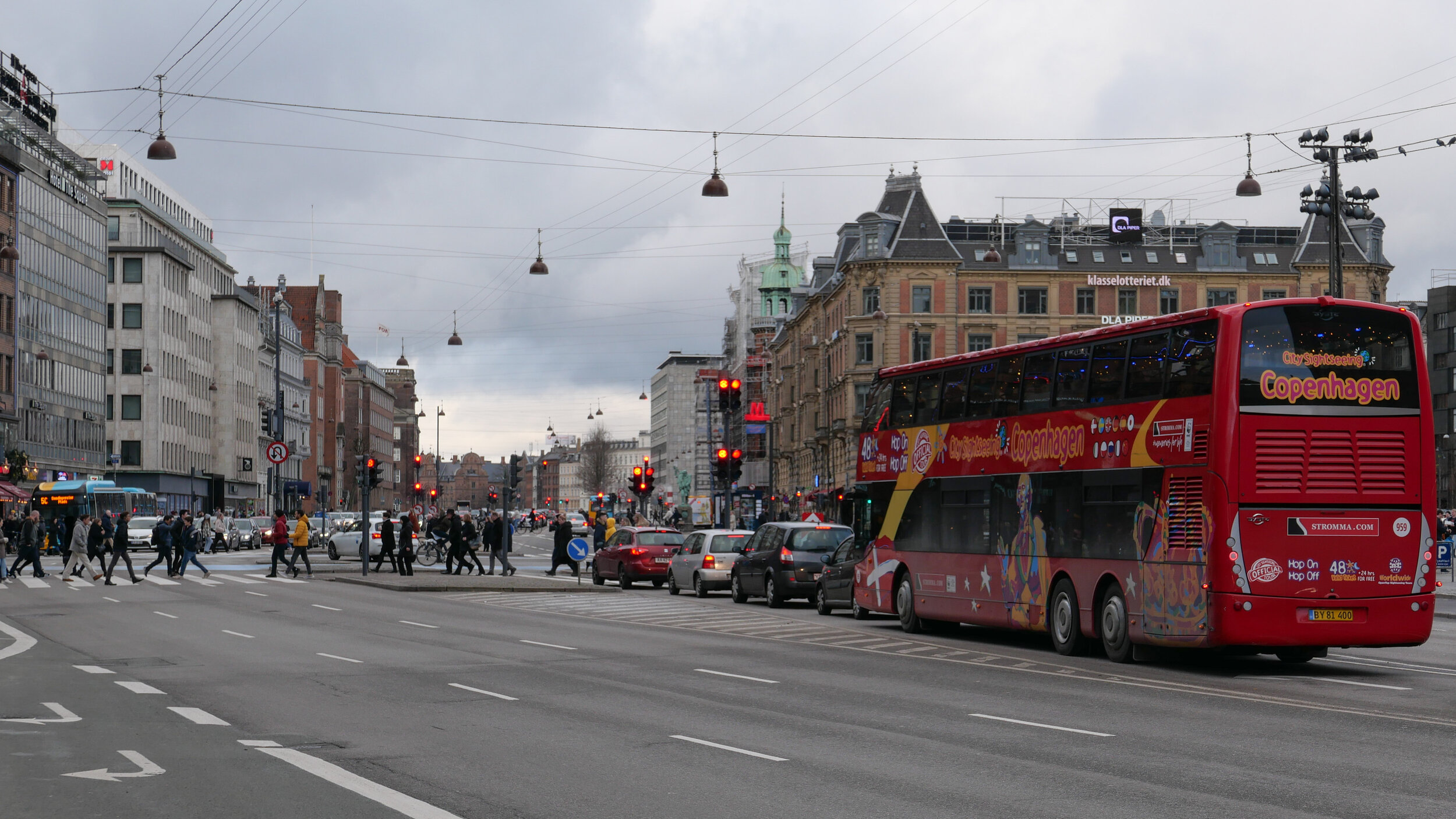
The main tram lines were in and out of the square along Vesterbrogade, as you would expect, but also up and down Vester Voldgade, on the east side of the city hall, rather than along what is now HC Andersens Boulevard on the west side of the square. That only became the main street for traffic in the 20th century. A fourth tram line went out of the square and down Jernbanegade that was then not the street to Vesterport station, as it is now, but led to what was then the main railway station then on the north side of Vesterbrogade.
In the archive, there is a second drawing by Clausen for an alternative version of a tram interchange that is in the style of grand Danish architecture in the 17th-century, with polygonal turrets and cupolas, as if the architect had imagined trams driving in and out of Frederiksborg.
drawing in the archive of Danmarks Kunstbibliotek
the north end of Rådhuspladsen with Helmerhus to the right and, beyond, the shallow dome of Dagmarteatret opened in 1883 but closed in 1937 and was then demolished - the trams are there but, sadly, not the renaissance tram station
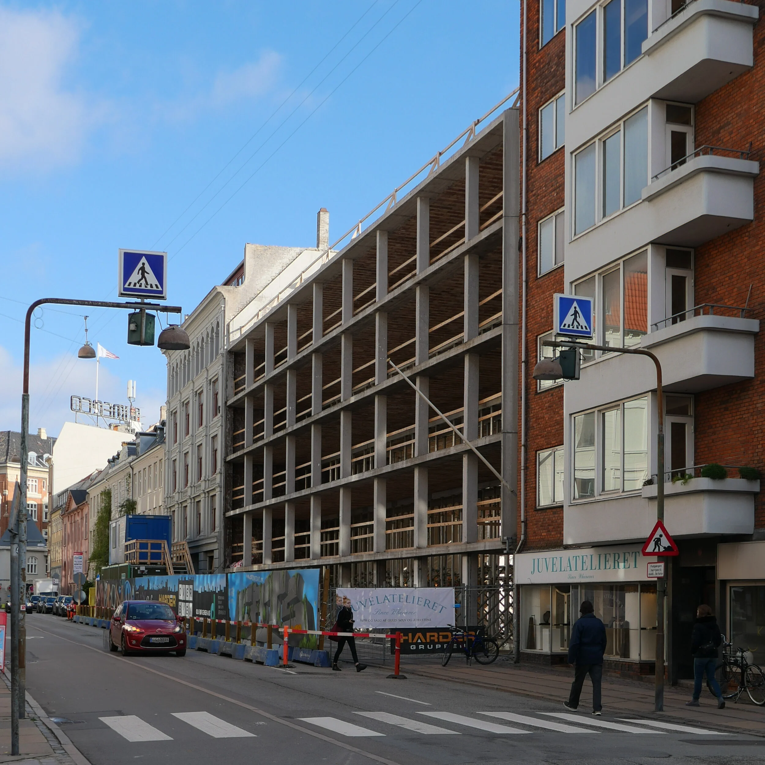
the Hirschsprung cigar shop on Gammeltorv
/The building on the west side of Gammeltorv, at the corner of Frederiksberggade, is under scaffolding and there is clearly a major restoration in progress.
The building, designed by the architect Johan Schrøder, dates from 1899 and has frontages to the square itself and to Frederikdberggade - although the street is better known as Strøget or The Walking Street.
Gammeltorv is a strange irregular shape with the building line on this side cutting back to the north-west corner so, although the building is more-easily described as L-shaped around two sides of an internal courtyard but, when seen from the air, the two ranges form a broad V shape.
In part for this reason, so to mask or disguise the angle, but also, presumably, because Schrøder understood the importance of the corner site, the corner of the building is rounded. That round shape is cut back in to form what is almost two-thirds of a rounded turret and that is emphasised with an order of attached pillars in dark stone at an upper level and by a prominent and ornate copper dome.
The main frontage is to the square with an elaborate stone doorway at the centre, with balconies above, but there is also a good frontage to Frederiksberggade and again with a central doorway but with a simpler surround with a pediment. These doorways gave access to apartments above but, from the start, there appear to have been shops on the ground floor to both the square and to the street.
The most important of these shops was at the corner with its entrance on the corner at the base of the turret. This was a cigar and tobacco shop owned by Hirschsprung & Sons and had a significant interior that was designed by Povl Baumann and Kaare Klint that was installed in 1916-1917.
That interior won an important City Architecture award in 1918 but very little survives … even internal walls have been removed to incorporate the space into adjoining shop units.
Will DESIGNGROUP Architects, responsible for the design work for renovation of the building, create something more appropriate with their refurbishment? They were the design team responsible for restoration of the building immediately opposite, on the other side of Frederiksberggade, so together these buildings form the entrance to the west part of Strøget and this could mark the start of a significant and overdue improvement to this section of what is a major street.
earlier post on the cigar shop June 2018
the building from Gammeltorv
Frederiksberggade or Strøget - The Walking Street - cuts across east to west between Gammeltorv - with it’s ornate fountain - and Nytorv with the 18th-century city hall on the west (here left) side.
the Hirschsprung building is on the west (left) side of Gammeltorv and on the north side of Strøget forming a V-shaped building with an ornate green copper dome on the corner.
scaffolding around the building has heavy tarpaulins that are printed with interesting historic images from the collection of Copenhagen Museum … here a view of the building from Nytorv with Gammeltorv beyond and taken before the buildings on the south side of Frederiksberggade were rebuilt.
an axis on the line of an avenue that was never planted
/the view from Dantes Plads to Christiansborg above and the plan fot an extension of the city drawn by Conrad Seidelin in 1857 below with a long double avenue or ride to the corner of a large new garden that appears to have been designed for irregular paths through densely planted trees with a terrace out to the bay and an avenue of trees returning along the shore to Langebro that then crossed to Christianshavn from the end of what is now Vester Voldgade.
Note: the plan shows the original railway station, built in 1847, with the railway line along what is now Sønder Boulevard, and what might have been a proposal for a new U-shaped station on Vester Voldgade.
Standing on Dantes Plads - just out from Holckenhus - the buildings across the north side of the square - it becomes obvious that there is a straight view down the street called Ny Vestergade to Christiansborg on its central east/west axis, across the Marble Bridge, and through the outer stable court to the great tower over the east entrance.
In the other direction, west from Dantes Plads, this line cuts close to the corner of Ny Carlsberg Glyptotek but continues as far as the side entrance to Øksnehallen - the meat market - even following across the bridge taking Tietgensgade over the main railway lines at the south end of the platforms of the central station.
Copenhagen is not a city of long straight roads let alone grand avenues and bombastic planning so the line and the length of this axis - 1,300 metres in all - is curious.
Although the central axis through the courtyards of Christiansborg and out over Marmorbroen / the Marble Bridge was created in the early 18th century - when the castle was rebuilt - the axis on further to the west was not a viable proposition then as it was blocked by the high bank of the defences on the outer side of what is now Vester Voldgade, and, beyond the defences, the sea of the bay to the south west cut in much closer than it does now so the sight line from the Marble Bridge - the west exit from the palace - would have looked along the beach. It might have been possible that this had been planned as a grand route from Christiansborg to the palace at Frederiksberg but that would have needed a new gateway through the defensive bank and, in any case, the alignment is wrong.
What seems more plausible is that this axis as far as the meat market has its origin in a scheme for extending the city that was proposed by the Danish architect Conrad Seidelin in the 1850s in anticipation that the old defences of the city would be dismantled.
In the end, by the time the high banks of the defences were taken down and the ditches filled in, the ownership of much of the land around the city had changed hands and some new streets had already been laid out so little of the plan by Seidelin was realised.
Here, west of the old city, he had proposed a long tree-lined avenue or boulevard on the central axis of Christiansborg that created a ride or esplanade out from the Marble Bridge to a large informal garden or park on the line of the lakes. This seems to have been envisaged as a royal garden comparable to the Queen's gardens that had been laid out to the north of the city at Sophie Amalienborg in the second half of the 17th century. Seidelin also proposed an avenue or ride returning along the harbour.
The axis, from Christiansborg to the meat market, seems to have survived by default despite the fact that the avenue and new gardens became less and less likely as the decades passed.
NA TUR I BYEN på Regnbuepladsen / nature in the city on Rainbow Square
/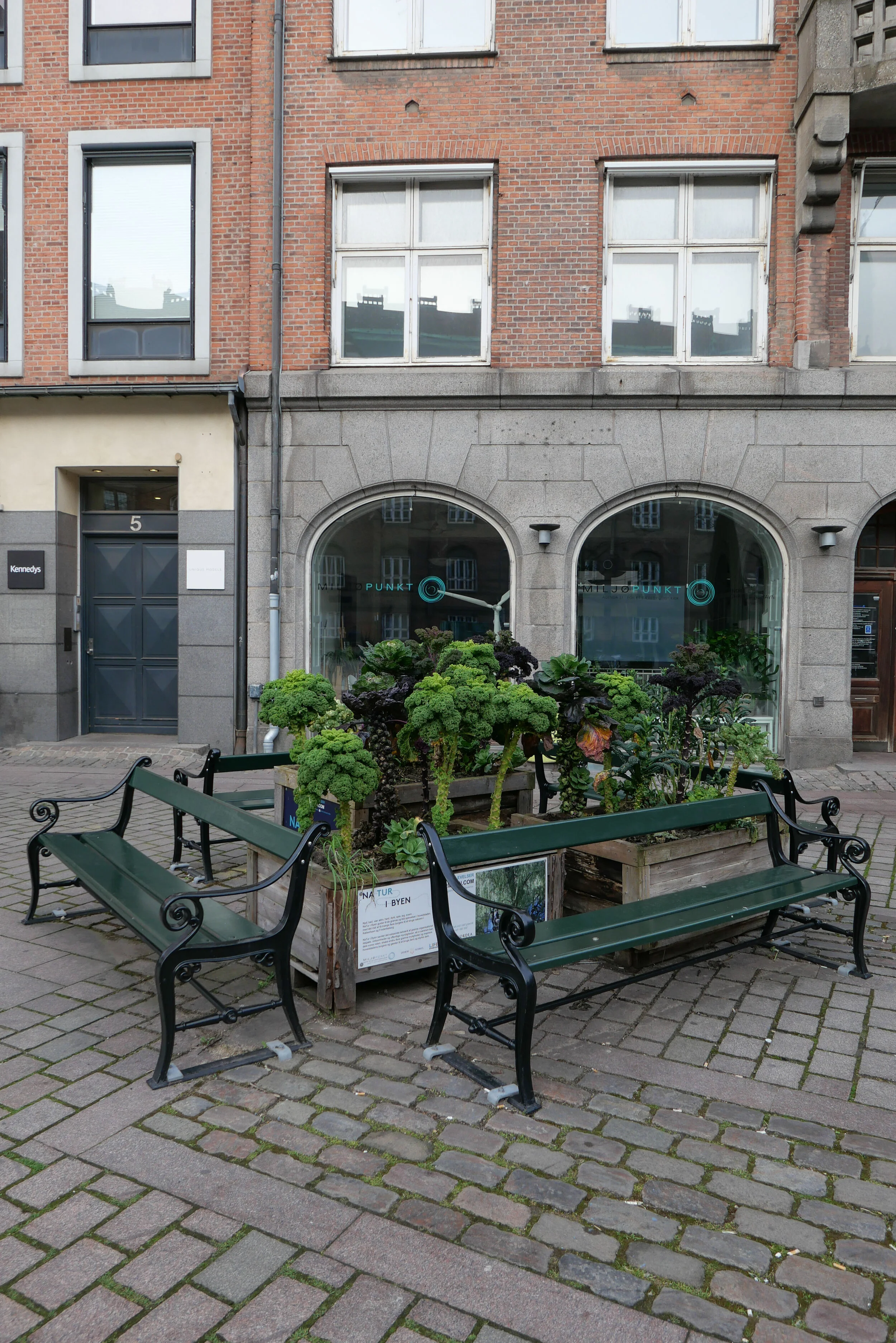
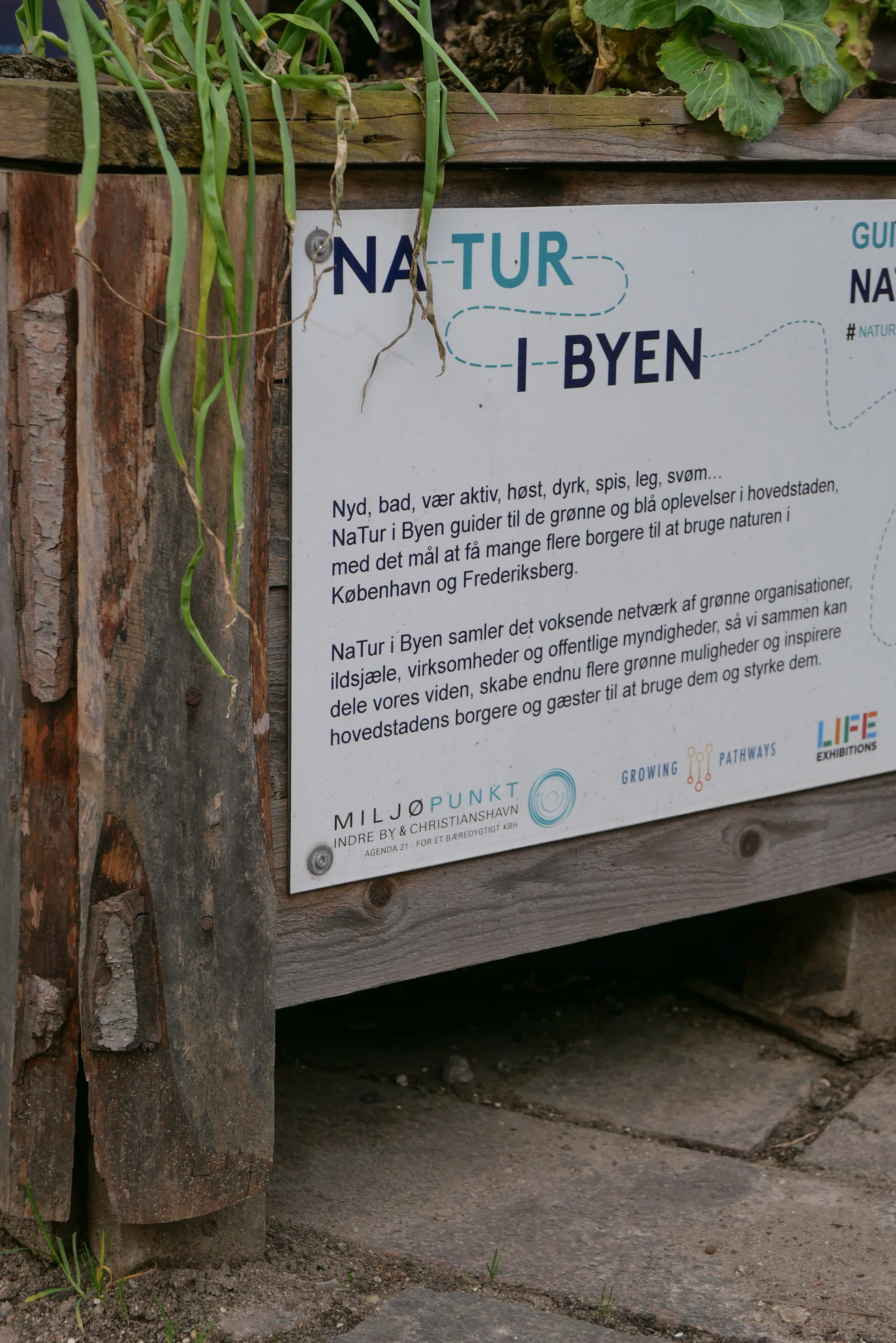


Planting of vegetables on Regnbuepladsen / Rainbow Square, the square alongside the city hall, to bring nature into the city centre. This was set up with an outdoor exhibition of photographs from Life Exhibitions.
“Studies show that urban nature is essential for our health and wellbeing. Therefore, it is important to communicate and experiment with how closely the city can be combined with a rich nature and a healthy environment.”
Sankt Kjelds Plads and Bryggervangen climate-change scheme - winner of the Arne Prize 2020
/On Friday, it was announced that the climate-change scheme for Sankt Kjelds Plads and Bryggervangen by SLA architects and the engineering company NIRAS has been awarded the Arne Prize for 2020 …. the major annual award from the Danish Association of Architects.
The selection of a climate-change project for the Arne Prize has, if anything, more significance because this year there was a short list of six projects that included very strong contenders for the prize with the extensive work on Karen Blixens Plads - a huge project by the architects COBE that is at the centre of the south campus of the university - and the stunning stations of the new line of the Metro that opened in September.
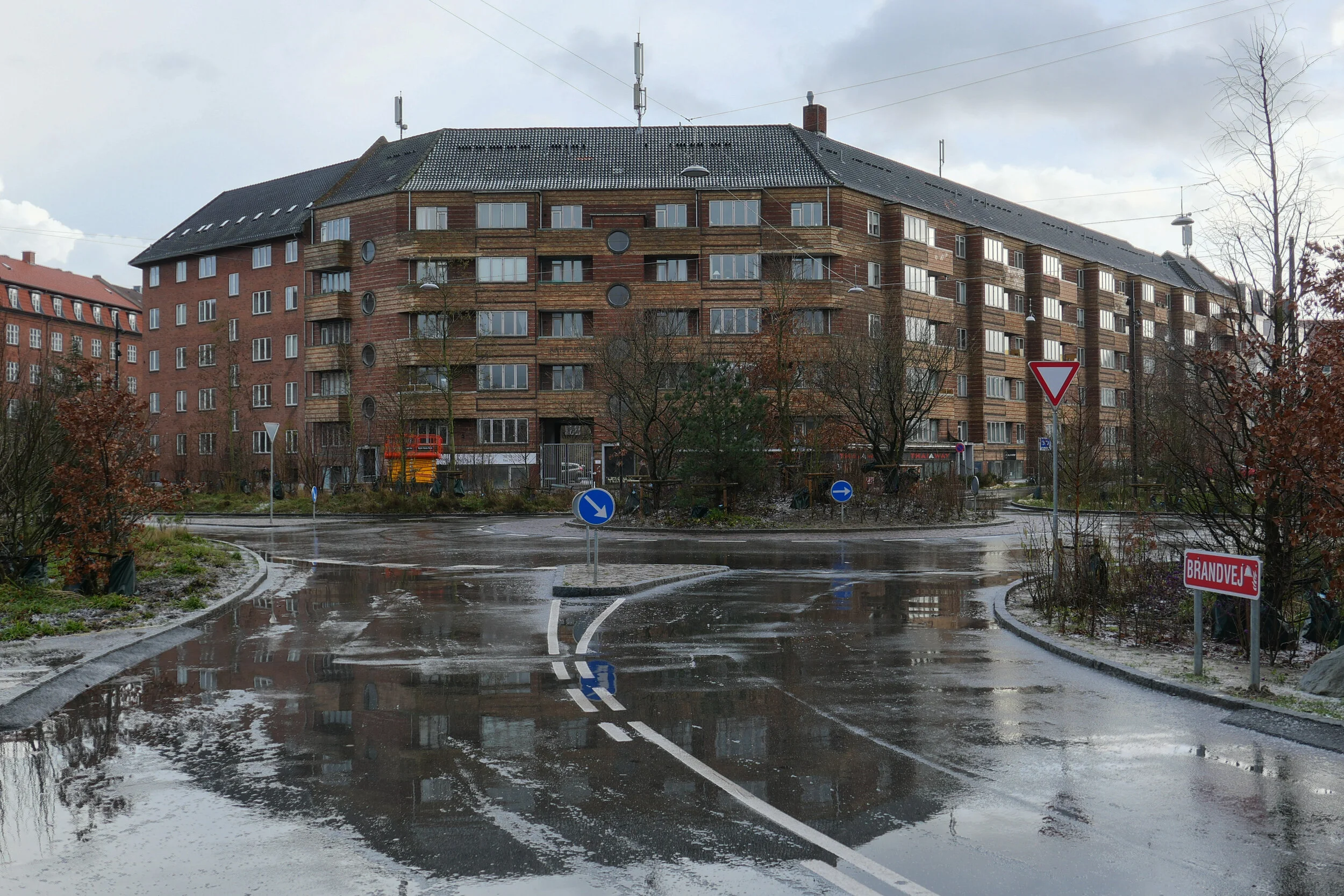
Sankt Kjelds Plads is at the centre of a densely-built residential area immediately north of Fælledparken so it is about 4 kilometres north of the centre of the city. Most of the apartment buildings here date from the first half of the last century with most buildings of five storeys around attractive but enclosed courtyards and with wide but slightly bare and bleak streets.
Storms with sudden and increasingly severe rain have meant severe threats from flooding both as drains block and streets flood but also as rain-water floods down from the roofs.
This extensive and essential scheme to control storm water in the area was designed in 2015 with construction work and then planting undertaken between 2016 and 2019 and had to include extensive and disruptive engineering works for new drains and for sunken holding areas for water so sewers are not overwhelmed with cloud bursts.
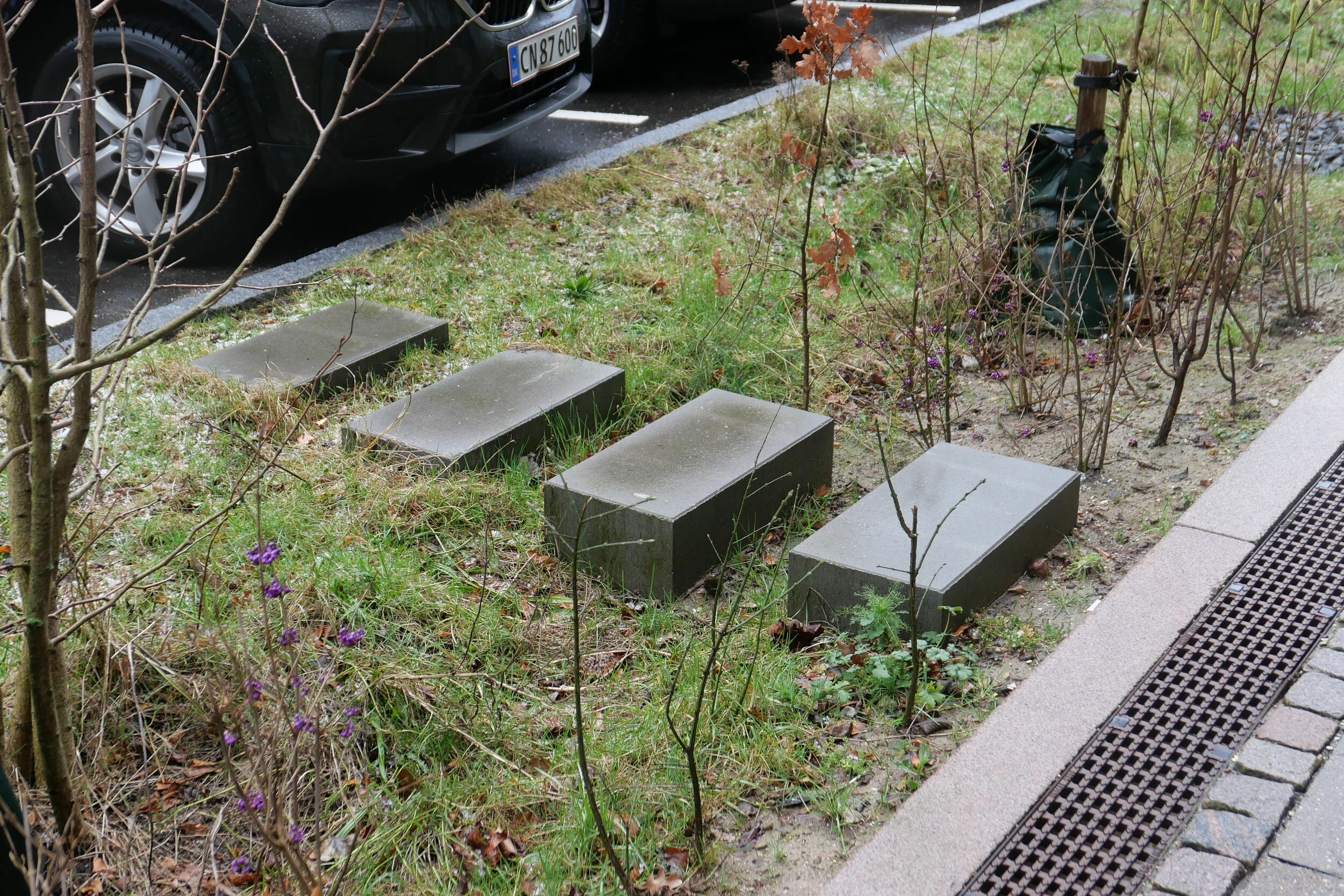
A crucial part of the scheme was to rationalise on-street parking for cars and to reduce and slow down through traffic so large areas of what had been tarmac could be replaced with pedestrian areas with seating and with dense planting more like urban woodland than simply shrubbery around newly excavated hollows that act as temporary water-holding tanks but are otherwise planted with vegetation that can withstand occasional flooding.
Shale has been used around water pipes to slow the water that cascades from down pipes in a storm and there are large domed sumps with wide vertical drops to deal quickly with water from street gulleys.
What is already clear is that there has been major social gain from the work with new cafes and new businesses attracted to the square and to the nearby and related climate-change scheme for Tåsinge Plads just 80 metres to the east of Sankt Kjelds Plads.
initial assessment posted to Danish Design Review in April 2019
Tåsinge Plads


note:
Each year, alongside the main Arne Prize, there is a second award - the Lille Arne or Little Arne Prize - that recognises excellence across a broader range of work associated with architecture. This year the Lille Arne was awarded to Sydhavnens Folkmøde that provides a platform for local residents to have a democratic involvement in the on-going development of the south harbour.
update - Bispeengbuen
/Bispeengbuen is a raised section of motorway in the north part of the city that opened in August 1972.
It has three lanes of traffic in each direction but with slip roads and with high sound baffles, added in the 1990s, it is intrusive as it cuts through and divides a densely-built residential neighbourhood. The heavy traffic using the road as a fast route into or out of the city is close to apartment buildings at the level of second-floor windows and, from the start, there were strong local protests with the opening marked by demonstrations and even a bomb threat.
The road is owned by the state but one suggestion now is that it should be transferred to the city and to the municipality of Frederiksberg - the road runs between the two - and, in 2017, politicians from both Copenhagen and Frederiksberg suggested that the road and its traffic could be taken down into a tunnel and the elevated section demolished.
This would provide an opportunity to reinstate a river that had flowed through a meadow here since the late 16th century although the river itself did not run along a natural course. In the 1580s, it was diverted to bring water to low marshy ground around the west side of the city, outside and below the defensive embankments, to form a stronger outer defence and to provide a supply of fresh water for the city.
Around 1900, at the city, end the river, Ladegårdsåen, was taken down into a covered culvert and the road to the lakes became a major route into the city from the north.
From the north end, from Borups Allé, traffic coming into the city goes under the suburban railway line - just to the east of the station at Fuglebakken - and then, immediately south of the railway line, the traffic is taken up onto the raised section that continues on for about 700 metres to Borups Plads where the road returns to ground level but the tunnel would continue on further, closer to the intersection with Jagtvej to make this north part of the proposed tunnel about a kilometre in length.
If the river is reinstated with extensive planting to create a park here, the work could be part of major climate-change mitigation on this side of the city and would create a significant amenity for this residential area.
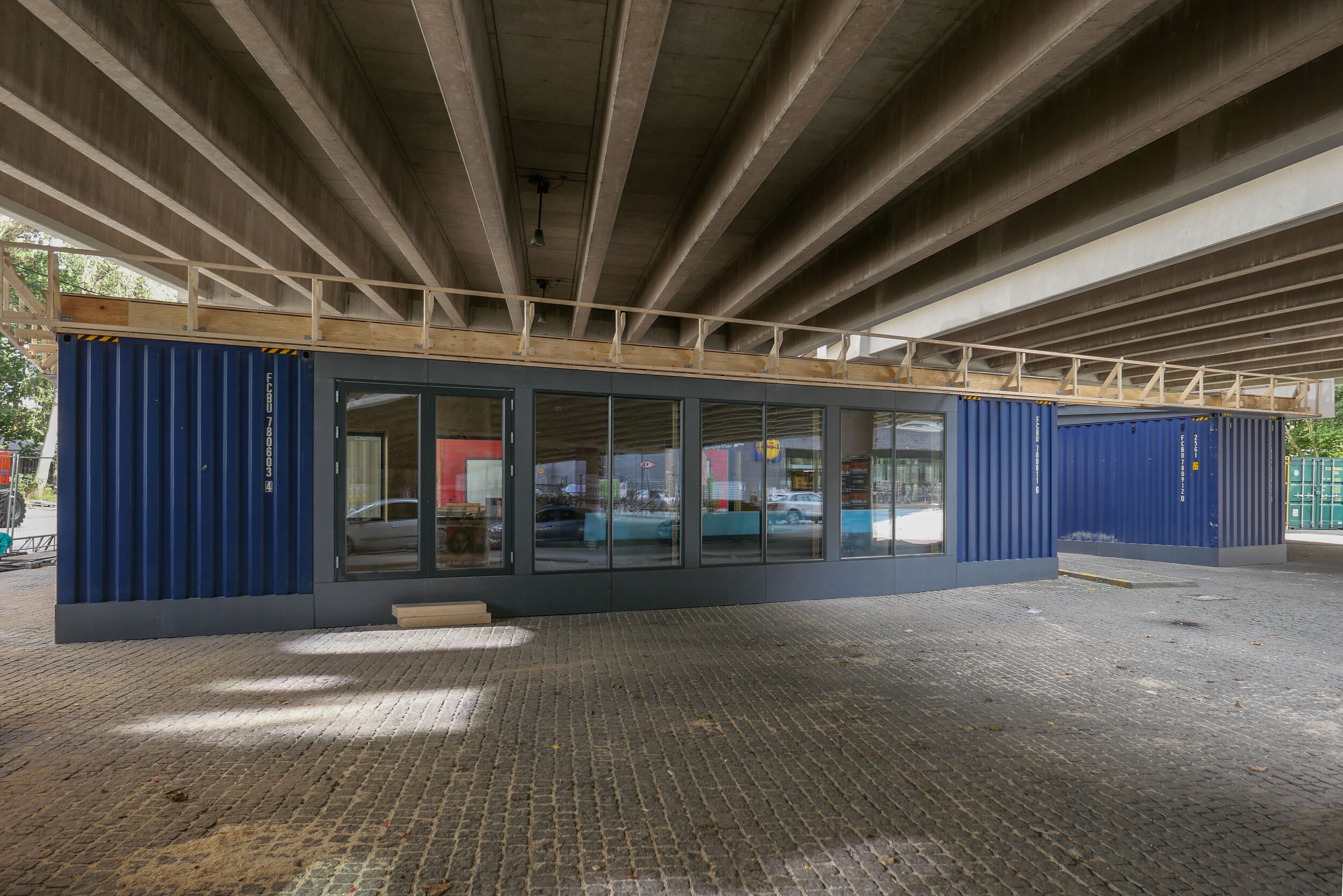
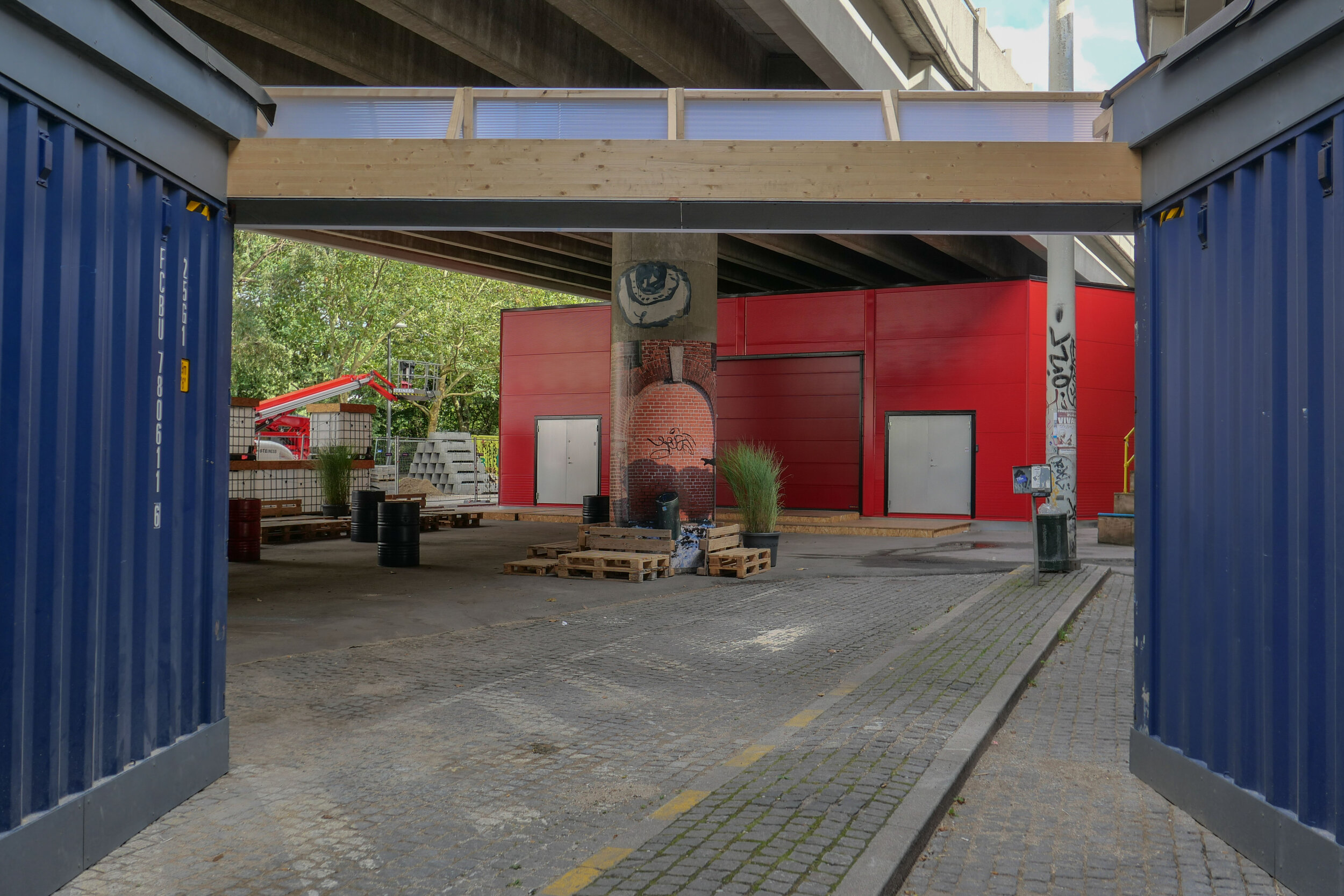
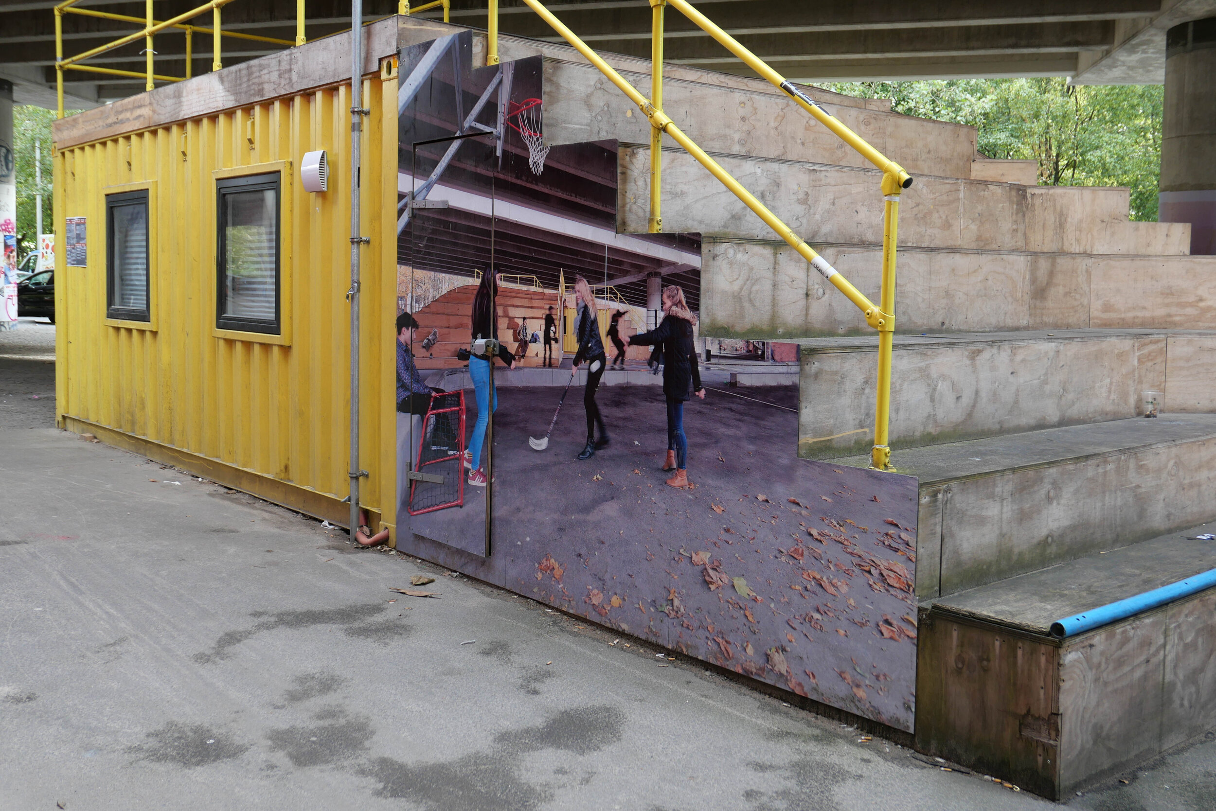
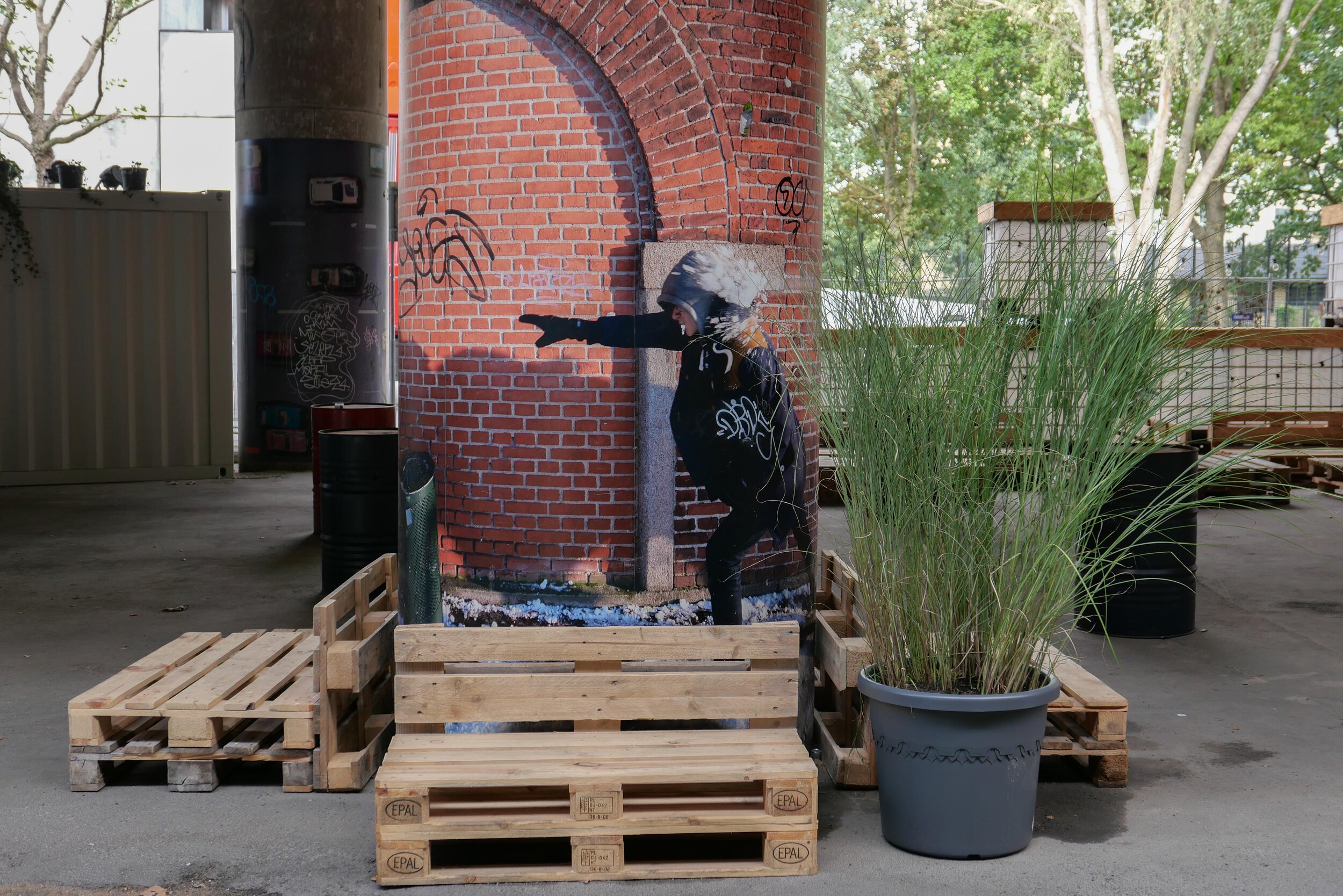
With a decision on the tunnel delayed, the area under the raised section of the road has been improved with the opening in April 2019 of Urban 13 - “a creative urban space.”
Designed by Platant, shipping containers have been adapted to create a cafe and a function room for local events and an area with steep blocks or steps for seating forms an outdoor concert venue and there is new planting in containers.
proposal from PLATANT to build a deck over the elevated motorway for housing and gardens with access by new towers against the edge of the road
Container City will be here for five years and, even then, work on the elevated roadway may be delayed so Platant have put forward an imaginative and ambitious scheme to adapt the motorway itself with an upper deck that could be constructed above the road deck to support new housing and gardens and with access by way of a number of new towers built along the road edge. It would be designed so that this could be dismantled and the materials reused if work on demolishing the road and building the tunnel does go ahead.
view from Google Earth with the curve of the elevated section of motorway top left
a tunnel, to take the main through traffic underground, could replace the motorway and it could be continued down Åboulevard, following the line of an old river to the lakes, and the river, now in a covered culvert below the road, would then be returned to the surface
the line of the proposed tunnel from the suburban railway line at Fuglebakken to the lakes and from there along the line of HC Andersens Boulevard and on under the harbour to Islands Brygge to connect with a north harbour tunnel that is also being considered.
there would be a limited number of entry and exit points from the tunnel because it is not for local journeys but for through traffic
the tunnel from Fugglebakken to Islands Brygge is just over 4.5 kilometres
proposal for the park and the reinstated river if Bispeengbuen - the elevated motorway - is demolished and the traffic taken down into a new tunnel
update - a road tunnel below Åboulevard and then on below HC Andersens Boulevard
/
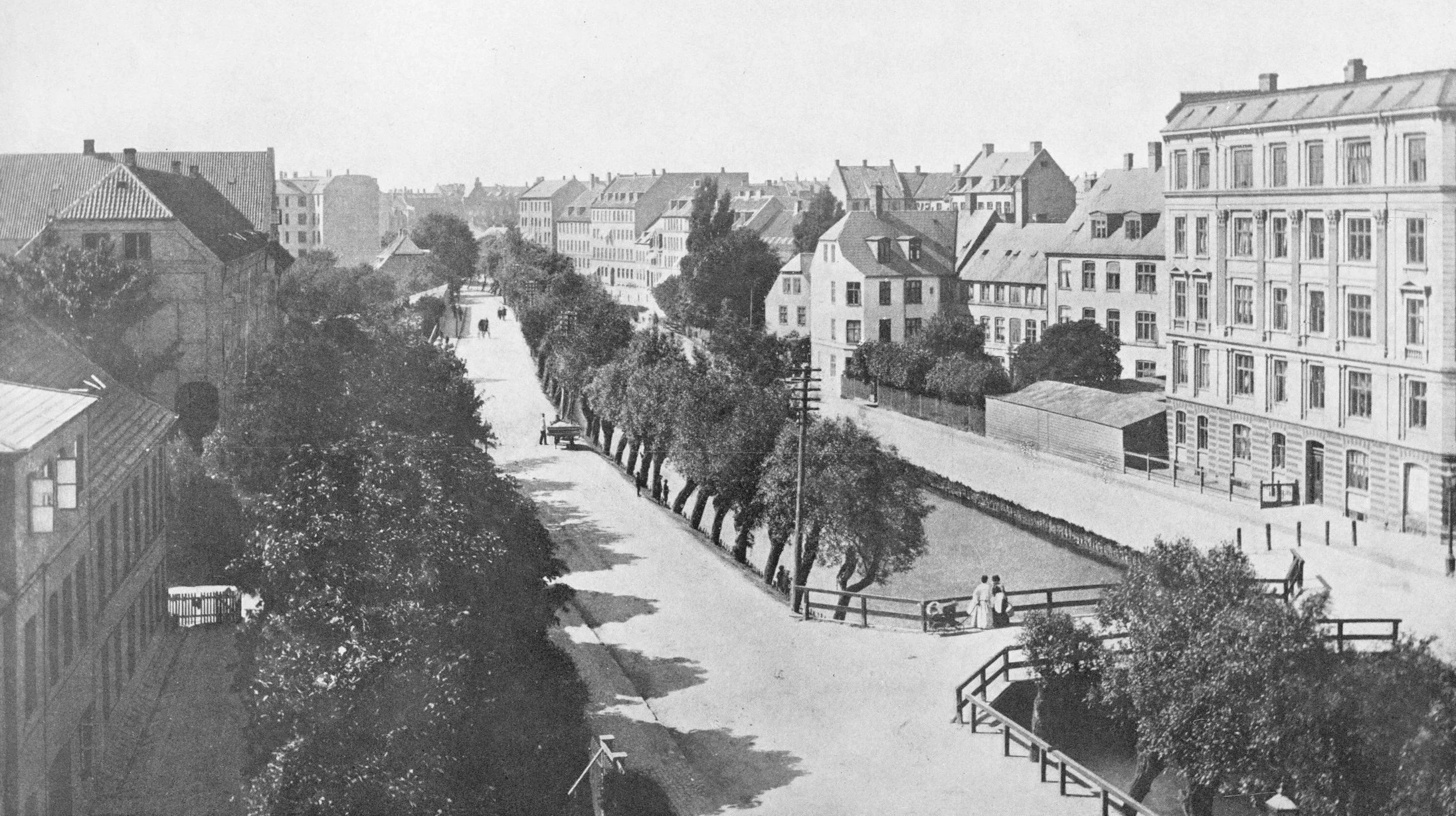
Åboulevard in the late 19th century looking north with the river still at the centre
Bethlehem church designed by Kaare Klint was completed in 1938 but the apartment building dating from around 1900 is on the right on both the historic view and the photograph of Åboulevard now
A proposal for a major engineering project, to construct a traffic tunnel down the west side of the historic city centre, is now in doubt.
It would take underground much of the traffic that now drives along HC Andersens Boulevard, on the west side of the city hall, and is part of a plan to remove the elevated motorway at Bispeengbuen - bringing traffic into the city from the north - and this would make it possible to reinstate a river that flowed into the lakes that now flows through a covered culvert below Åboulevard.
From Jagtvej, at the south end of the elevated highway at Bispeengbuen, and following the line of Åboulevard to the outer side of the lake, is about 1.6 kilometres and, from the lakes, a tunnel running between Jørgens Sø and Peblinge Sø and on along the line of Gyldenløvesgade to Jarmers Plads and then down the full length of HC Andersens Boulevard and then under the harbour to Islands Brygge is another 2 kilometres so, including the proposed tunnel at Bispeengbuen, that would be between 4.5 and 5 kilometres of tunnel in total.
For comparison, in Oslo, the Festning tunnel - opened in 1990 to take traffic away from the square in front of Oslo city hall - and then an extension to the east - the Operatunnelen completed in 2010 - form, together, about 5.7 kilometres of underground motorway.
The landscape and architecture studio Tredje Natur and the engineering specialists COWI have drawn up a feasibility study for the proposed scheme for the finance directors of the city and of the municipality of Frederiksberg - the road runs between the two areas.
Reinstating the river and extensive landscaping would be an important part of storm water protection for the low-lying areas of Frederiksberg with planting, surface drains, and culverts controlling storm floods before taking it away from the area in substantial storm drains in the bottom half of the tunnels below the road decks in the upper half of the tunnel.
Tredje Natur have produced drawings for the planting that would be possible along HC Andersens Boulevard if the heavy traffic that uses the road is taken down into a new tunnel. There could be a narrow road for local traffic, an open water course and extensive planting.
a suggestion for new landscaping along HC Andersens Boulevard proposed by Tredje Natur
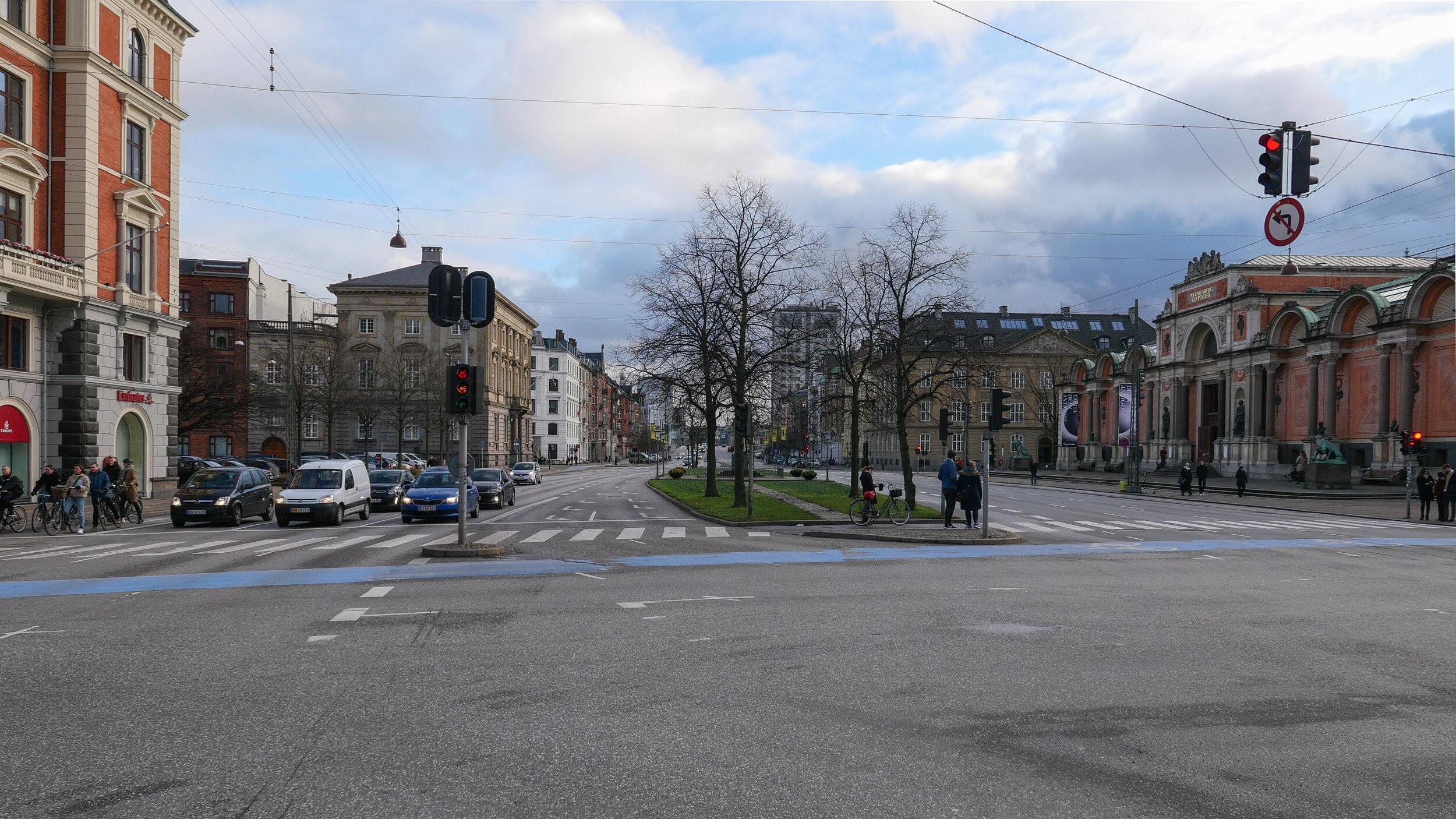
1 south end of the boulevard looking south towards Langebro with the Glyptotek to the right
2 looking north from the Glyptotek with Tivoli to the left and the city hall to the right
3 from the south-west corner of the city hall square
4 crossing the city hall square heading north
5 the north end of HC Andersens Boulevard looking to to the tower of Realdania on Jarmers Plads
the map was published in 1860 and shows the river flowing into the lakes at the south end of Peblinge Sø with the road on the south bank and just a narrow lane, Aagade, at the back of gardens on the north bank
the river was moved down into a culvert and Åboulevard - the road above the culvert - is now wide and busy with traffic to and from the centre of the city
the lakes to the top with Sankt Jørgens Sø to the left and the end of Peblinge Sø to the right
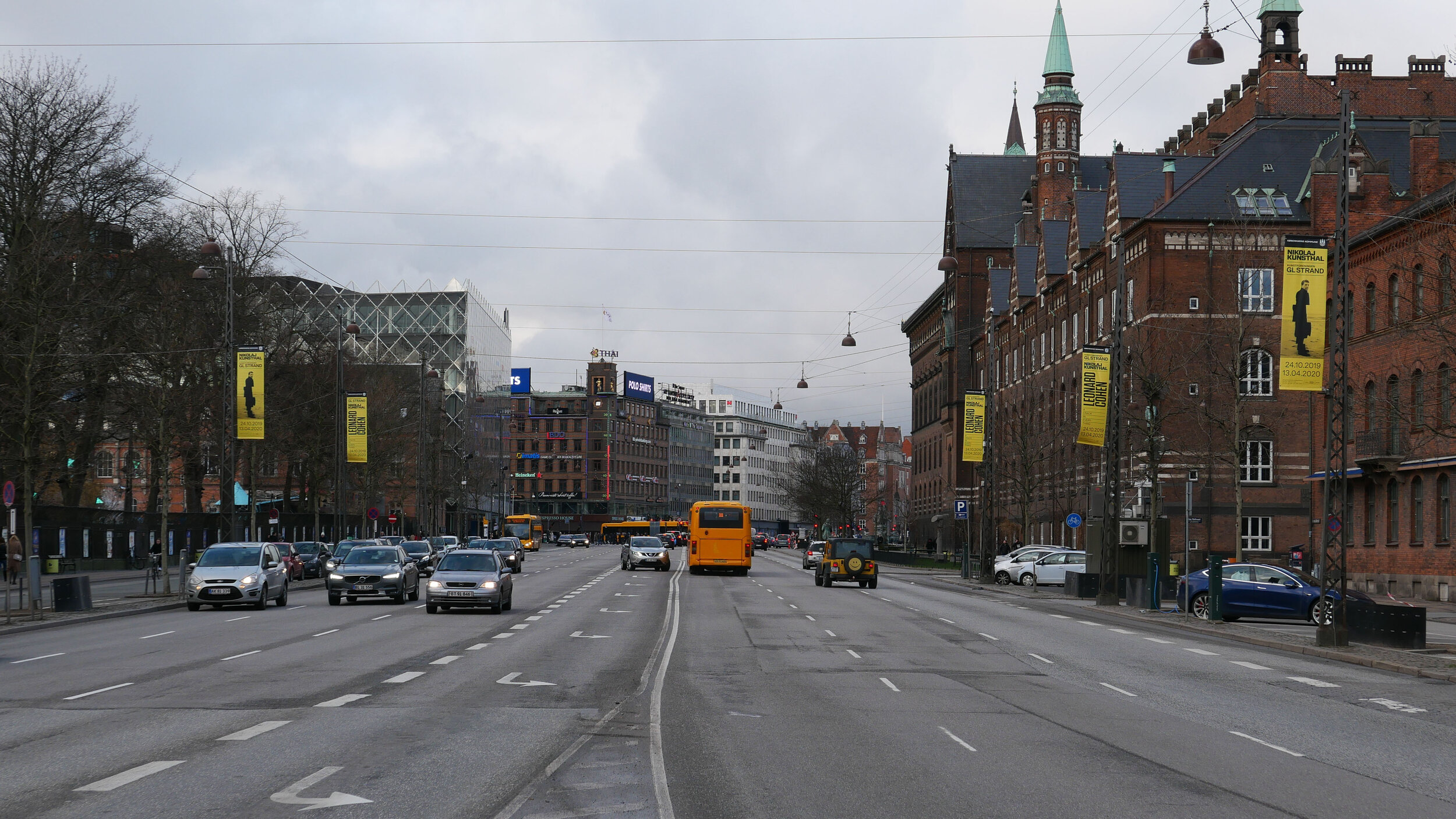
the road over the causeway comes down to Jarmers Plads and then past the west side of the city hall at about the centre of the photograph with Tivoli to the left and then HC Andersens Boulevard continues on down to Langebro as a main route to cross from the city to Amager
historic aerial view showing the bridge over the harbour at Langebro that was built in 1903 and the first part of HC Andersens Boulevard with densely-planted trees down the centre rather than bumper to bumper cars now
an earlier scheme for a new hotel in the Tivoli gardens
/

Towards the end of 2006, the British firm of architects Foster + Partners won an international competition to design a hotel for Tivoli.
That design, like the more recent design by BIG, was to have a tall circular tower and was described by the architects as:
“driven by a careful urban strategy concerned with the preservation of Copenhagen's low skyline, the scheme comprises an elegant cluster of interconnecting cylinders that combine to form a generous podium corresponding to the heights of the surrounding rooflines. Elegantly rising from the podium, a slender sculptural tower acts as a marker for the scheme and relates in scale to the City Hall tower opposite, adding to the language of spires in Copenhagen. The landscaped roofs of the lower buildings extend the greenery of Tivoli and reinforce the buildings sustainable profile. In addition to allowing for rainwater collection, the buildings are oriented to maximise natural light and views while reducing unwanted solar gain in the summer, but capturing the suns rays in the cooler winter months.”
A photograph of a model of the proposed hotel shows just how high the tower would have been - tall enough to throw a shadow across the square in front of the city hall in the later part of the day and, visually, it would have competed with and from angles it would even have blocked views of the tower of the city hall.
If built as designed, the hotel would have had a frontage to HC Andersens Boulevard and that would have meant the demolition of Slottet - or Tivoli Castle - the building designed by Vilhelm Klein that was completed in 1893. that would have been an unfortunate loss as not only is it a good building in itself and part of the extensive and important new building works across the west side of the city in the late 19th century but it was the first home of what was then called the Kunstindustrimuseet before it was moved to Bredgade. The museum is now known as Designmuseum Danmark.
the building designed by Vilhelm Klein that was completed in 1893 and was the first home of the Kunstindustrimusset before it was moved to Bredgade in the 1920s
a BIG hotel for Tivoli
/Back in June, newspapers in the city published an illustration (above) to show the proposal for a new hotel that Tivoli want to build towards the north-east corner of the pleasure gardens - close to the back of the Dansk Industri / Danish Industry building - along with a scheme to close Vesterbrogade to traffic to create a new urban park across the front of the main entrance to Tivoli that has been drawn up by the studio of Jan Gehl.
This would link the gardens to the new square on the north side of the road - part of the relatively new development called Axeltorv designed by Lundgaard & Tranberg Arkitekter - and it would create a much more attractive route from the central railway station - a block west of Tivoli - to the public square in front of the City Hall to the east.
From the drawing it is difficult to judge the scale of the space but this part of Vesterbrogade - from Bernstorffsgade to HC Andersens Boulevard, the main road running north south between Tivoli and the square in front of city hall, is about 220 metres. Although the alignment of the front of buildings vary slightly - it is around 50 metres from the buildings on one side of the street to the front of buildings on the other.
The drawing suggests at least two obvious and major concerns that surely have to have very careful consideration.
The round tower for the hotel has been designed by BIG - The Bjarke Ingels Group - and, described as a pagoda , is shown with large terraces or balconies that are covered with greenery but neither the description nor the greenery disguise the fact that the building proposed would have eighteen floors and be around 70 metres high. There are towers within the gardens but these are relatively insubstantial - most formed with open frameworks of steel - and a tower here, so close to the north-east corner of Tivoli, and a building of this height and mass would block and compete with the views of the tower of the City Hall immediately to the east and with the silhouette of the SAS hotel by Arne Jacobsen to the north west that is just under 70 metres high.
The form of planting and hard landscaping along the street is schematic - this is simply an initial proposal - but is it appropriate for an urban context? Would a better model be the formal avenues of the King’s Garden with simple gravel walkways or the trees of Kongens Nytorv, at the east end of the old city, where the surface is cobbled and has double lines of trees to provide an area where people walk.
Are running water and meadow-like planting really appropriate for an urban and city-centre setting?
Cobbles over wider areas of pavement and double avenues of trees with space under the natural canopy for people to walk and creating space for occasional small-scale events would be more robust and provide a stronger but simpler foil to the buildings along the street.
Initially, traffic could be restricted to a lane in each direction along the centre for essential access and relatively short traditional lamp posts could provide a better level of good light at night. That is not to suggest something staid but lower lighting …. lower in height not in brightness … would compete less with the more important lighting of the gardens and of the electric advertising signs high up on the buildings.
If a major project to construct a tunnel - to take the heavy traffic from HC Andersens Boulevard down underground - and to create a landscaped area between Jarmers Plads and the harbour does go ahead then the two areas of new park would link together to create an extensive area of green from what are now some of the busiest roads in the city.
historic view of the entrance to Tivoli from Vesterbrogade.
the entrance was designed by Richardt Bergmann and Emil Blichfeldt and built in 1890 to replace an earlier gateway - note the wide pavements; large open area in front of the pleasure gardens - a deep but uncluttered set back from the pavement where people can meet and the relatively narrow cobbled road; low street lighting and double line of young trees
proposal from 2017 by Tredje Natur to divert most of the traffic from the city end of Vesterbrogade to create an area of trees and water across the front of the main entrance into Tivoli … published by Magasinet KBH
looking across Vesterbrogade from Axeltorv to the main entrance to Tivoli
the problem is not just the traffic but the narrow and crowded pavements and the clutter of street furniture and bikes
Ⓐ City Hall
Ⓑ Rådhuspladsen Metro station
Ⓒ Vesterbrogade
Ⓓ Axeltorv
Ⓔ SAS tower by Arne Jacobsen
Ⓕ Central Railway Station
Ⓖ Main entrance to Tivoli
Ⓗ proposed hotel?
yet another new hotel
/
The turn of the year - particularly this January as we move into a new decade - is a time to check back on what has happened over the last year and think about what might happen next year.
In Copenhagen there are several major building projects where work is ongoing and several projects still at the planning stage but many of the big projects in the centre of the city could have massive consequences for the city and for the people who live here.
This historic building, dating from the late 19th century, is close to Trinity Church and work has just started on converting it into a large hotel with some shop units.
A few years ago there were articles in newspapers stating that Copenhagen lacked good hotels but that is hardly the case now.
And surely, all these hotels are changing the character of the city and the nature of work here. Yes, hotels can make use of large old buildings that might otherwise not have an obvious new use and yes there are jobs but how many of these are long-term and well-paid jobs?
The huge strength of the city is that so many people actually live in the centre. Too many historic cities empty of ordinary life at the end of the working day and Airbnb and swish hotels and everything that go with them make a city a great destination to visit but maybe not such an easy place to live.
Ørkenfortet / Desert Fort, Christianshavn
/

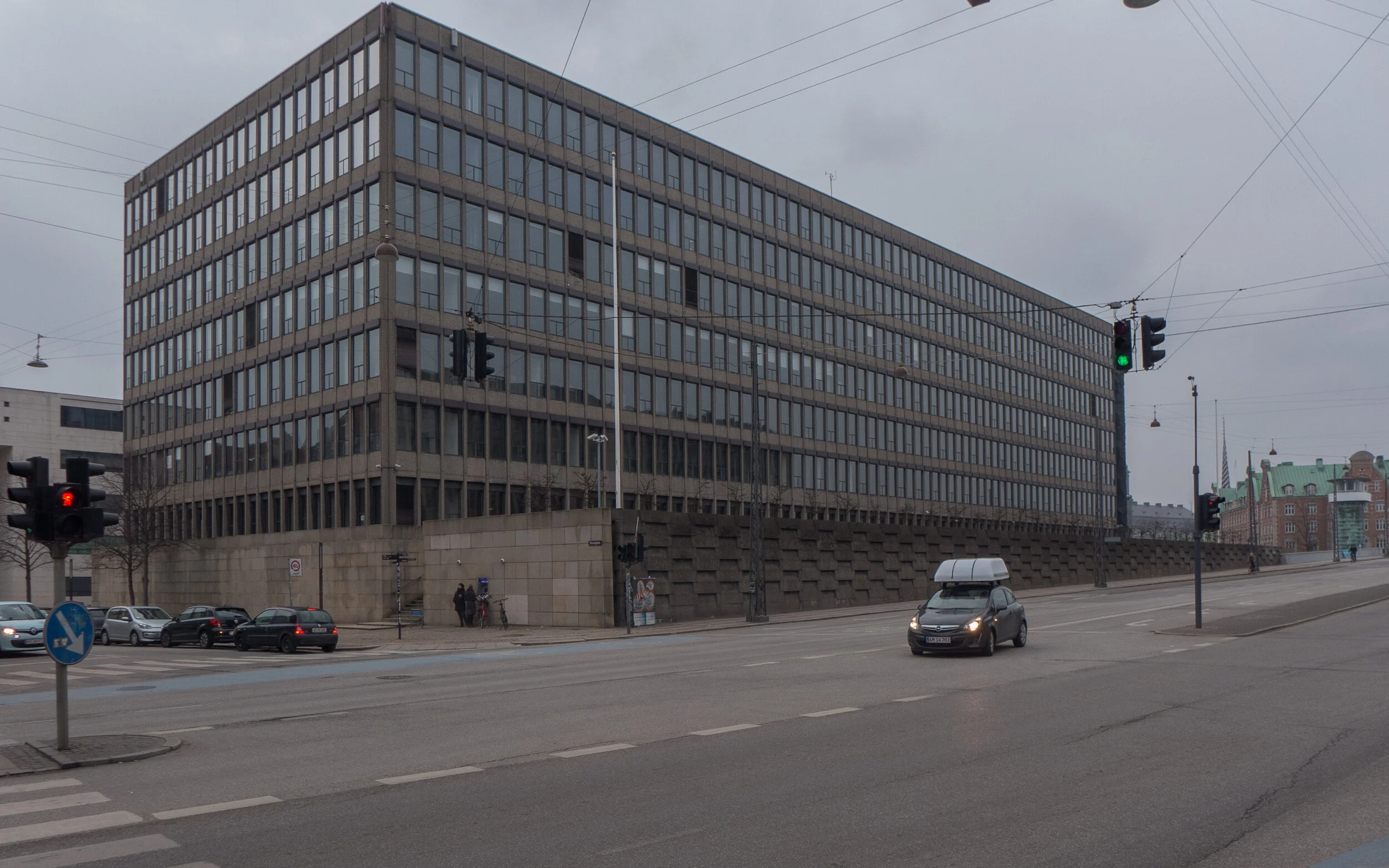

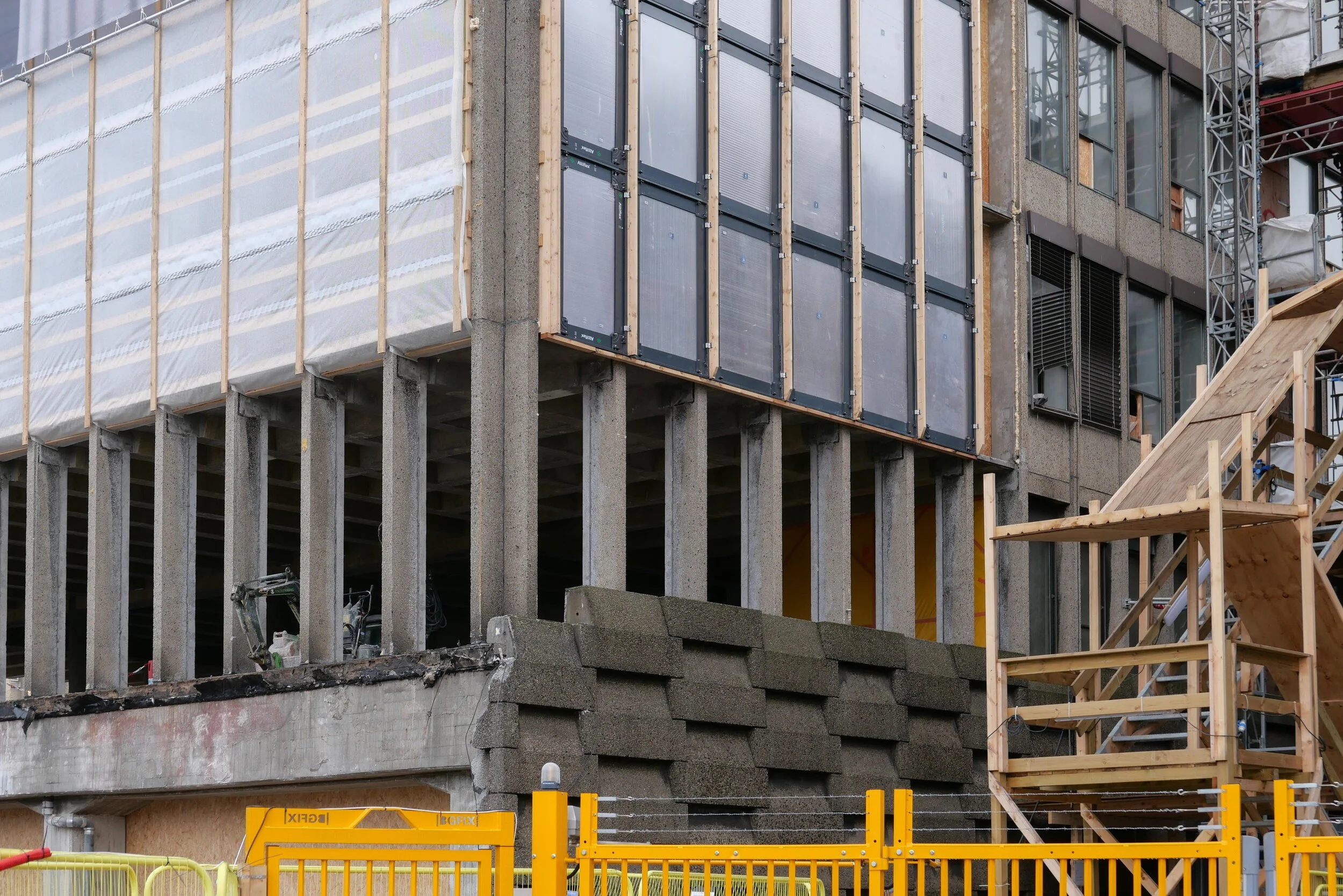
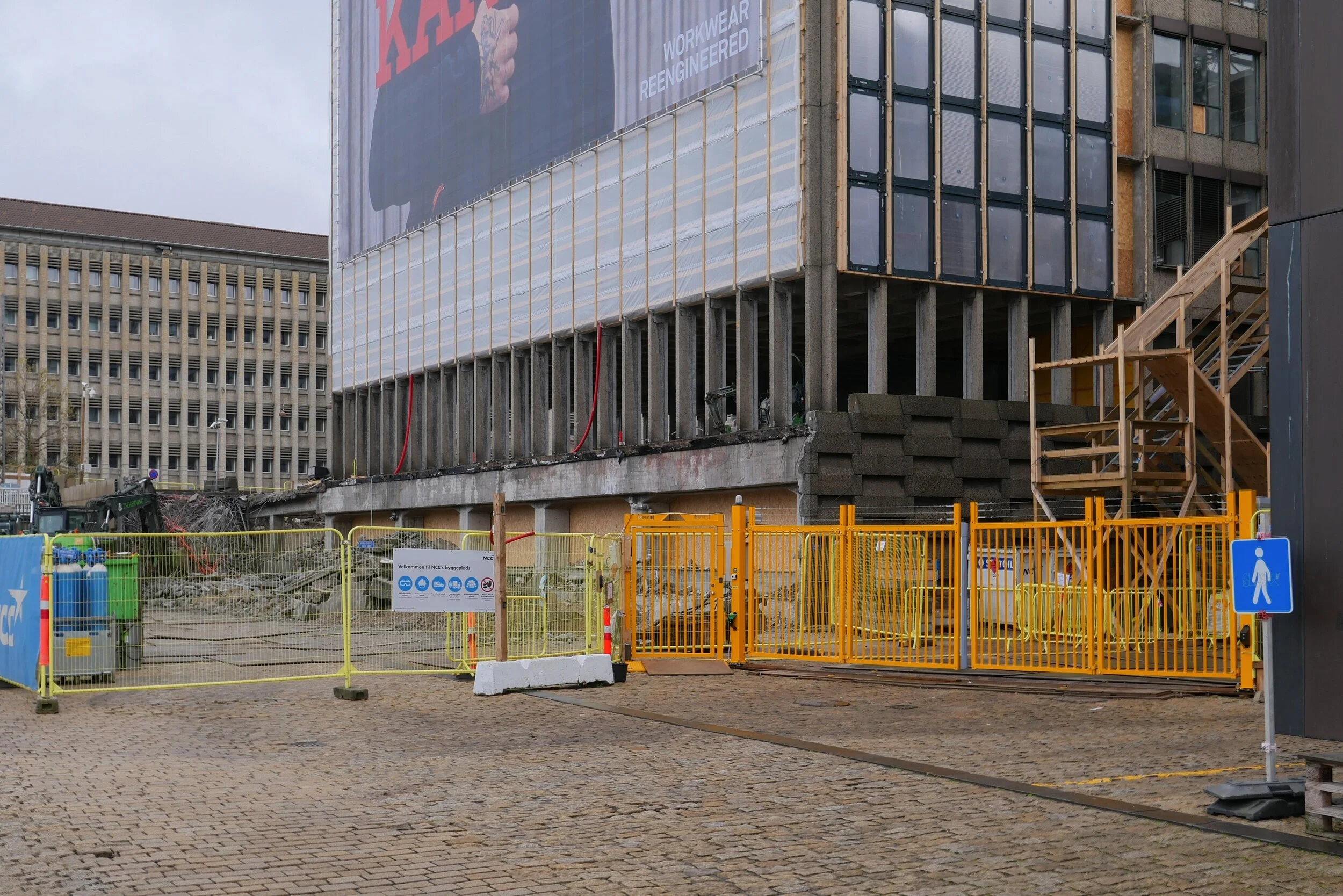
Work is moving forward fast on Ørkenfortet, the Desert Fort - the large office building that is at the centre of the harbour at the Christianshavn end of Knipplesbro - the central bridge that crosses the harbour between the centre of the city and Christianshavn.
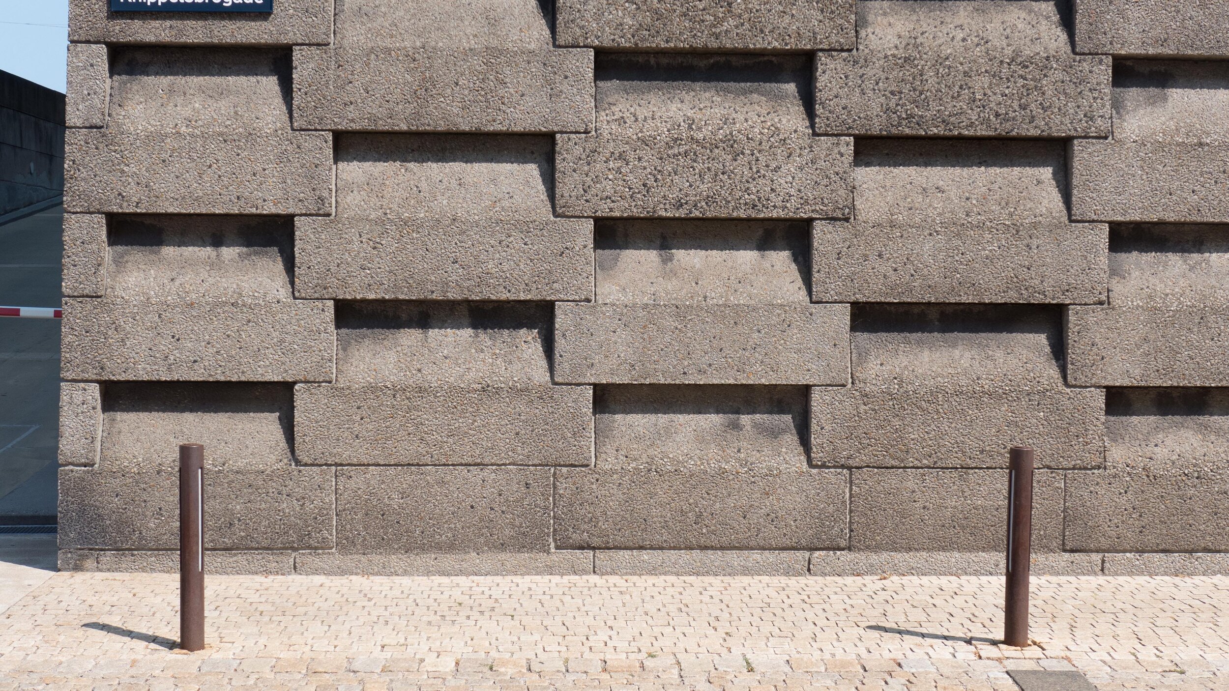
The interior at all levels has been gutted and all original windows and all external cladding have been removed. Work has started on cutting down new internal courtyards or light wells within the concrete structure of the block and on removing hefty concrete retaining walls along both the street frontage towards Torvegade and at the level of the quay on the end of the building towards the harbour that formed a base for the building.
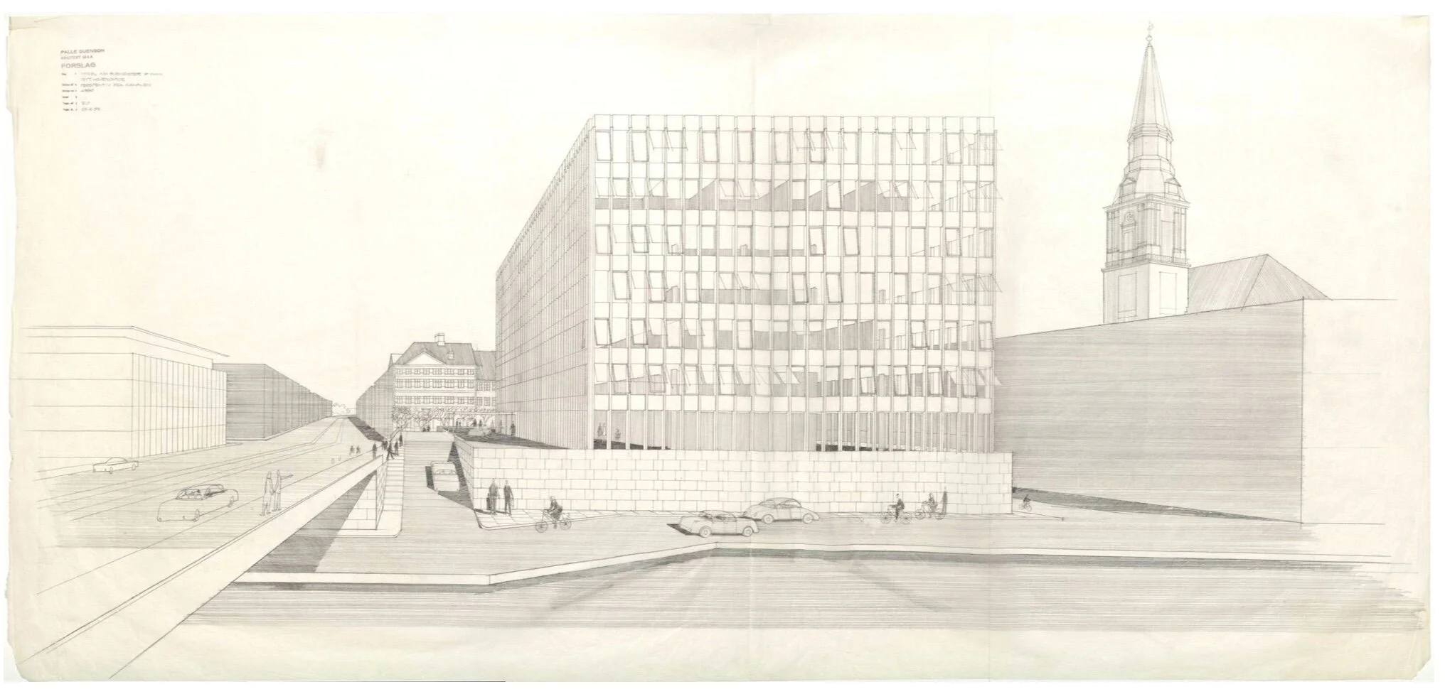
Ørkenfortet was designed by Palle Suenson (1904-1987) and was completed in 1962 as offices for Burmeister & Wain who were a well-established and major engineering and ship-building company in the city. However, the engineering works closed in the 1990s and many of the buildings were demolished and replaced with office blocks along the harbour and large apartment buildings along the canal to the south.
The building by Suenson was taken over by Nordea Bank in the 1990s but, in 2017, they moved to a new office close to the metro station at DR Byen further south on Amager and the harbour building is now being converted into a hotel with almost 400 rooms for the Hilton Group.
Planning Statement - appendix to the Local Plan
updated news on the development from atp ejendomme
notes:
In Danmarks Kunstbilbliotek / the Danish Art Library in Copenhagen there is a drawing of the building by Palle Suenson Inv. nr. 53296 - a perspective from Knippelsbro
While tracking down information on the building I came across a web site that revealed that the building was given a nickname by locals who called it Røven or The Arse. Initially, I assumed that was because the building was thought to be butt ugly but actually it was because at lunchtime workers in the office came out onto the forecourt and sat along the parapet of the wall along Torvegade and, for people walking along the pavement below, the only thing that could be seen from the street was a line of backsides.
photograph from 1965 showing Knippelsbro and Torvegade with the office building designed by Palle Suenson in the foreground and the engineering works of Burmeister & Wain beyond along the harbour as far as the canal and around the south and east side of Christians Church


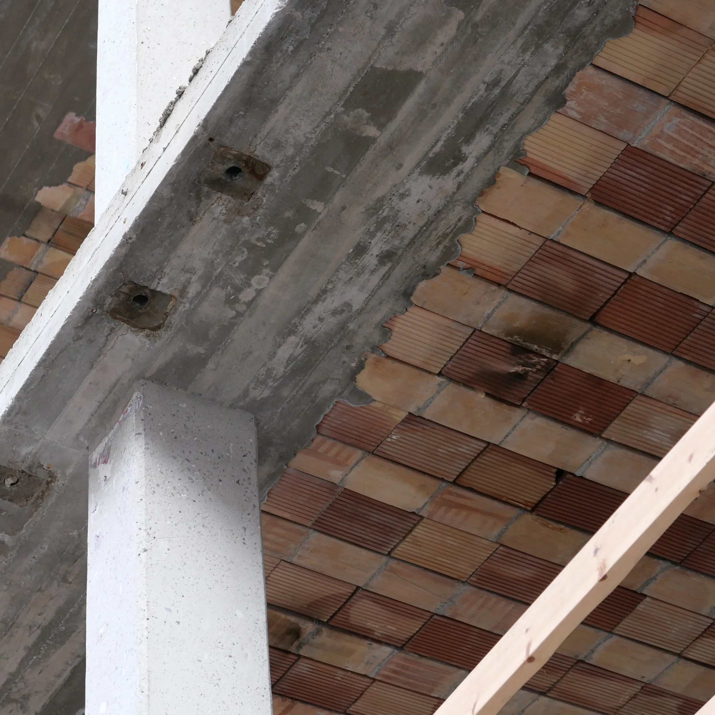
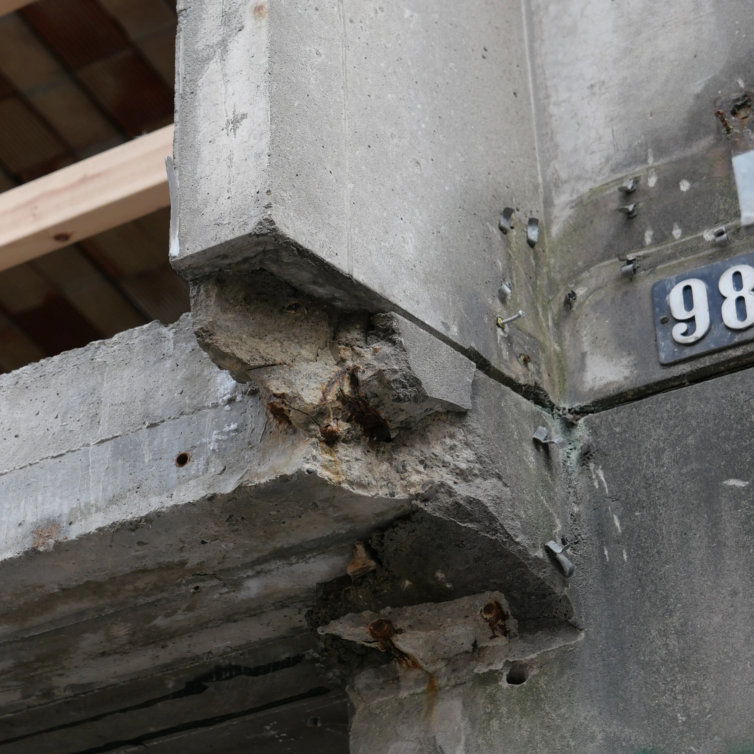
retaining the frame
/

work for the new Hilton hotel on the harbour where the concrete frame of an office building designed by Palle Suenson and completed in 1962 will be retained although all exterior cladding has been removed and the interior gutted
With the major redevelopment of the Ørkenfortet / Desert Fort building on the inner harbour, it would be interesting to see calculations for any environmental gain from retaining the concrete frame against the carbon footprint or cost from demolishing the building from the 1960s and disposing of that building rubble and then constructing a new building that would, almost-certainly, require substantial amounts of new steel and concrete.
Copenhagen, unlike many European capital cities, did not suffer from a massive and unrestrained programme of “urban renewal” in the 1950s and 1960s so there is a relatively small number of concrete and steel buildings from that period. One building that is being remodelled now is on Store Kongensgade - below - where the windows and framing of the street frontage have been removed and the interior has been gutted to expose the concrete frame before the building is completely remodelled to form student accommodation.
In the second half of the last century and even through into this century one model for developers was to assume a relatively short life for any new building … sometimes little more than twenty years. This is only acceptable in exceptional situations and, presumably, planning applications will now have to include environment impact assessments - not just for the impact on existing buildings around the site but the environmental impact of demolishing and removing any buildings on the site with an impact assessment and carbon footprint for new construction and clearly defined plans for later adaptation or for later reuse of those building materials.


100-106 Store Kongensgade
Sankt Jørgens Sø - planning for climate change
/

Planning for one of the most dramatic and extensive climate-change schemes in Copenhagen has been put on hold for more detailed consideration.
This is a proposal to change Sankt Jørgens Sø - the southernmost of the three lakes that form an arc around the west side of the historic city - so that it can hold back flood water when (not if) there is a major rain storm.
the remodelled entrance courtyard for Designmuseum Danmark
/Major work on the entrance courtyard of the deign museum in Copenhagen has just been completed.
The gate piers and ironwork across the street frontage of the 18th-century building has been rebuilt, cobbles across the area re-laid, the entrance and ticket area for the museum has been moved out to a pavilion on one side of the courtyard along with a small coffee shop.
Five free-standing display cabinets have been constructed so that objects from the collection can be brought out from the museum to the forecourt and the first exhibition in this revitalised space has opened.


explore copenhagen design news by category …..
- archaeology 3
- architects 150
- architecture for leisure 84
- architecture for pleasure 1
- art fair 4
- book review 7
- books 4
- bridges 4
- buildings 143
- catalogue 1
- citylife 15
- climate 5
- climate change 26
- colour 52
- converted industrial building 23
- copenhagen by bike 5
- craftsmanship 44
- design & trade fairs 13
- design market 40
- design store 54
- design studio 37
- designers 62
- education 54
- engineering 97
- environment 97
- event 68
- exhibitions 264
- fashion 11
- films 12
- food & drink 60
- furniture 91
- glass & ceramics 49
- graphics & typography 44
- hotel 2
- housing 35
- just a thought 12
- just to quote 3
- kitchenware 9
- kunsthåndværk 51
- light & lighting 36
- magazines 27
- materials & conservation 37
- museums & galleries 80
- on the table 12
- painting 18
- parks & gardens 58
- photography 29
- planning 197
- product design 30
- renovation 7
.... and longer articles about architecture and design are posted on danish design review
