Autumn at Islands Brygge


Autumn seems to have come early to Copenhagen this year. Nobody was swimming in the harbour baths at Islands Brygge today although I have seen some - the hardy or the foolhardy - swimming there on much much colder days than this.

But the park was still being used … by a group being put through an exercise regime and by a group huddled under umbrellas having a picnic and there was a group on bikes being given a lecture … my guess … this was one of the events for the 850th anniversary of the city being celebrated this week and next.

The quay here was a bustling part of the port through into the 1950s and 1960s with cranes and gantries and railway lines for loading and unloading the ships. Some of the evidence from that working port survives but not much. 

The park is crowded in the summer with people laid out in the sun … and watching people laid out in the sun ... and being seen ... a really good example of the way the city has been very careful about providing good space for people to colonise and use.

Even if it was a bit cold and wet today, this really is Our Urban Living Room ...... the subject of a major exhibition at the Danish Architecture Centre back in January.

The quay of Islands Brygge in the early 20th century - before the construction of Langebro.

The apartment buildings on the right and the buildings of the sugar factory - the ornate gable in the distance - and some sections of the gantries and parts of the railway track survive

Søringen - a motorway along the lakes


Not all major road schemes proposed for Copenhagen have been good but, fortunately, not all major road schemes get built.

Perhaps the most ambitious and most contentious and, if it had been built, the most destructive road scheme proposed was the lake motorway that was planned in 1958 and approved by parliament in 1964.

Two problems had been identified by planners. The first was how to get road traffic in to the centre of the city quickly and how and where to build a brave new metropolis to show Stockholm and Paris that anything they could do to be thoroughly modern, Copenhagen could do too.

read more

Nordhavnsvej and a northern harbour tunnel 


The planning proposals for Copenhagen dating from 1947, known as the Finger Plan, has served the city well as it expanded out to new suburbs in the north and the west but as the centre of the city becomes more intensively built up - for instance in the area south and south west of the main railway station - and as there is more extensive and more intensive development of the harbour and on Amager - south and east of the centre - in the opposite direction to the spread-out hand of the Finger Plan - then rather different and very ambitious engineering works for new infrastructure are needed. Extensive new road tunnels have been proposed to take traffic around the south side of the city.

read more

a new road tunnel alongside city hall?

proposal by Tredje Natur for the new landscape of HC Andersens Boulevard
if most of the traffic is taken down into a new tunnel

possible routes for a new North Harbour Tunnel and a possible tunnel
from Bispeengbuen to Islands Brygge


A proposal for a major engineering project, to construct a tunnel down the west side of the historic city centre, is now in doubt.

It would take underground much of the traffic that now drives along HC Andersens Boulevard on the west side of the city hall and would have much more impact on the inner city than a north-harbour tunnel. 

It is also more controversial than the north tunnel because it would be expensive; because there would be complicated gains; some people would resent this as the first stage of banning traffic from the centre with all the restrictions that implies and there could be considerable disruption during construction work … although, actually, most people in the city seem to accept major engineering works as now somehow part of everyday life in Copenhagen with the extent of the works and the time scale for the current work on building a new metro line.

read more

the Finger Plan at 70 


There is another major anniversary for the city this year because the famous Copenhagen Fingerplan - a planning framework for the city - was produced in 1947.

It accepted that following the war, and for clear economic reasons, there would have to be not just rebuilding and regeneration in the city itself but extensive growth outwards but there was also a determination to control unplanned suburban spread.

So the Fingerplan recognised that although people wanted to move out of the overcrowded city they would have to travel back into the city either for work or for shopping and leisure and took, as a starting point, existing lines of a suburban railway system or S-trains that ran out from the city.

By restricting the sites allocated to new housing as broad but clearly defined lines, there could be areas of countryside left between the new municipalities that could be used for agriculture and for leisure and the plan proposed that some large areas could be planted with trees for new woods and forests.

The plan has served the city well and now covers 34 municipalities with over 2 million people living within the area and the new buildings constructed through the 1950s and 1960s and onwards included housing, municipal shopping centres, new schools, new city halls for local government and new factories.

read more

a museum on the move


Københavns Museum - the museum of the city - is between homes as building work moves forward on what will be their new home close to City Hall at Stormgade 18 but for the harbour festival they have had a temporary display in the harbour park at Islands Brygge.

Staff and archaeologists were there with historic maps and with archaeological finds to talk to people about the history of the harbour and about the amazing finds from their work at the major engineering excavations for the new metro. They have uncovered major sections of the defences at the old gates of the city and on the site of the historic wharfs along Gammel Strand … and this is not just about the extensive banks and ditches that protected the city but about the day-to-day life of the citizens with incredibly well-preserved finds that include shoes, a woolly hat, pottery vessels and glass ware and even a needle for mending fishing nets.

information about the new museum

Kulturhavn - the harbour festival


This weekend it is Kulturhavn - the harbour festival of culture in Copenhagen - with events not just in the central harbour but over the eight kilometres from Nordhavn to Sydhavn and with everything from demonstrations of belly dancing to an oom-pah-pah band on a boat sailing around the canals to swimming and kayak competitions. 

This was celebrating diverse culture - in the broadest meaning of the word culture - so what has this to do with a design blog? Well, rather a lot.

For a start - with historic working boats and tall ships moored in the central harbour - you realise that here are all the key elements of good design … a clear pushing of the boundaries of what was then up-to-date technology; an appreciation of the best materials and the skills with tools and machinery to work them along with a strong sense of style … so here is a key part of the Danish design heritage. We might not have talked and written about Form and Function in design until the 20th century but we didn’t invent the concept.


The noise and bustle on Ofelia Plads - the recently rebuilt wharf by the national theatre - brought back some of the vitality of the docks when they were working with ships loading or unloading. New apartments along the harbour are fantastic and no one would have swum in the docks then - or at least not for leisure - but it was the working harbour that is the very reason that Copenhagen is here and why it thrived. It is great that some of the cranes and rail tracks and bollards, where the ships tied up, do survive but maybe not enough. 

So the festival is a reminder of just how vital the water way of the harbour is to the city and it is to the credit of the planners that since the navy and commercial shipping moved out in the 1990s they have done so much to not just reuse the buildings and develop the land but are trying to put the harbour very much at the centre of life in the city.

It really is an incredible resource.


view of what is now Ofelia Plads when it was a working wharf

the harbour cranes to the east of the Opera House

Donkey bikes


I guess I spend too much time looking up at buildings as I walk around Copenhagen and don’t give enough attention to things on the pavement because I have only just noticed these bright orange hire bikes from Donkey Republic that have appeared around the city. Actually, I only noticed these ones because a clutch of three were left near the front of the apartment. Is there a collective term for bikes? Presumably not a fleet ... like for cars when they are for hire.

The design of their web page is pretty good with clear instructions for how to set up a hire and unlock the bikes, some advice about rules for riding a bike in the city and some good recommendations for places to visit but I was a bit curious about the text on the bike carriers. Several Danish friends have told me that they don’t understand English puns … or rather their grasp of the meaning of the words is spot on … it's just that they can’t understand why the English find puns quite so funny. But then I suspect that these are aimed at tourists and visitors and not so much the locals. 

Looking at the map on the Donkey app this evening one bike seems to have got as far as the airport and another to Ballerup so if I’m bored I might keep tracking that one to see if it is heading for the west coast.

Donkey Republic

KADK Afgang Sommer’17


This weekend is the last opportunity to see the exhibition of the projects and work of this year's graduates from the Royal Danish Academy of Fine Arts Schools of Architecture, Design and Conservation … a densely packed show of the talents and the phenomenal imaginations and skills of the students who have just completed their courses in Copenhagen.

There are profiles of the students and photographs and descriptions of their work on the KADK site.

The exhibition ends on 13th August. 

KADK, Danneskiold-Samsøe Alle, Copenhagen

Art of Many and the Right to Space


This is the exhibition that was the Danish contribution to the Venice Biennale of Architecture last year. The main section is an extensive display of architectural models from major architects and design partnerships in the country and the aim is to illustrate the importance of high-quality architecture in Denmark and, in a broader sense, the contribution of architecture to the community as a whole.

There is an important audio visual show by Jan Gehl about the work of their planning office in Copenhagen.

at the Danish Architecture Centre in Copenhagen until 1 October 2017


you can now cycle ... or run ... around the harbour in Copenhagen

the information panel at Nyhavn


on the far side of Inderhavnsbroen looking across to Paper Island


With the opening of Belvederebroen at the south end of the harbour at the end of last year … along with Cirkelbroen or Circle Bridge designed by Olafur Eliasson that opened in August 2015 to cross the canal on the Amager side of the harbour and the Inderhavnsbroen that opened in July 2016 to link across the harbour between Nyhavn and Holmen … it is now possible to bike, run or walk around the harbour in Copenhagen. 

The complete circuit is 13 kilometres although shorter loops around smaller chunks using the older bridges at Knippelsbro or Langebro or by crossing over Bryggebroen - the bridge at Fisketorvet - there are shorter circuits of two or four or seven kilometres.

At intervals there are distinct signs in dark blue … appropriately close to the paint colour called Copenhagen Blue. Each post is at a key point on the route and they give, in Danish and in English, a short description of the immediate area and its history. If I was running the circuit I’d probably be using the sign for support as a tried to regain my breath … well beyond taking in the information but trying to pretend I was doing a few stretches before lurching off on the next section. My guess would be that most Danes running and certainly all Danes on bikes are going much too fast to read anything as they dash by.

These signs also have a map that shows the route and the stops of the harbour ferry - the Havnebus - if you feel like seeing the harbour from the water. But what is interesting, and more important, is that the maps mark the dedicated cycle routes into and across the city. This tells you something significant about the planning policy in Copenhagen … there is a historic core where transport has to be co-ordinated and there is the well-known and well-established and coherent policy to encourage cycling rather than car use but, more than that, the cycle routes and the harbour circuit are about linking the city together, to make places accessible to everyone so this circuit is about much more than the regeneration of the docks.

A map of the harbour can be downloaded if you want to plan your route but why not live dangerously and just go for it ... follow the signs ... you could end up back where you started ... or somewhere you hadn't planned to end up ... so much more interesting.

down by Belvederebroen

Belvederebroen


A new bridge for cyclists and pedestrians was opened in the south harbour area of Copenhagen in October last year. 

Constructed over the Belvedere inlet - a narrow cut at the end of Frederiksholmsløbet - it connects Frederiks Brygge with Enghave Bryyge and completes a 13 kilometre circuit around the inner harbour for walkers, runners and cyclists and allows local cyclists to avoid heavy traffic on Vasbygade.

Designed by the architect SLA, this bridge is 25 metres long and is a generous width at 6 metres across. 

The sides or parapets are formed with large but thin tabs of steel that appear to have been folded upwards at different angles so they are close to vertical at the centre of the span but drop outwards and downwards in stages until they are almost horizontal towards the banks. It feels as if the bridge is open and welcoming as you approach and then gradually encloses you and protects you as you cross before opening out again as you reach the far side.

This folding is reminiscent of origami, of course, but it also looks a bit like the effect you get as pages of a book drop open.

There are three folds … the first just up from the bottom to form vertical at the bottom where the panel is attached to the side of the deck of the bridge so the next part is angled out. Then there is a fold up to form a vertical section that is more pronounced towards the centre and then, except on the outer tabs, a fold for a narrow almost horizontal section outwards to make what is, at the centre, the handrail of the bridge.

There is a striking contrast between the colour of the outside of the parapet in deep shiny iron-oxide red - rather like a Chinese lacquer red - and a matt grey inner surface and deck that is rubberised to reduce noise and provide better grip for bike tyres.

Sydhavnen - South Harbour - is an extensive area of new and ongoing redevelopment below HC Ørstedsværket - the power station at the south end of the harbour. The bridge is actually temporary and will only be here for about eighteen months before a permanent bridge - designed by the architectural practice COBE - is built to cross Frederiksholmsløbet to connect Enghave Brygge and Teglholmen.

SLA

5C - design project


Back at the beginning of May there was a post on the site about the new buses that have been put onto the 5C route through the city. But the buses are simply the most obvious part of a complicated and carefully co-ordinated design project.

New bus stops have been built along the route and the longer buses meant that bus bays had to be extended at some stops so the work was co-ordinated with the city roads planners. 

There is a clear colour scheme for the buses with a strong blue and rich yellow and this continues across textiles and graphics but this was not simply a matter of creating a new “house style” because it had to be seen as a step on from existing designs … not too close so it was boring or barely worth the obvious investment but not too much of a difference to require a steep learning curve. Staggering back from work or carrying loads of shopping and pushing a kids buggy you don’t need to be confronted by something so unfamiliar that you are not sure where to go or what to do.

There are far more doors to get on and off the buses so whereas before the entrance was generally at the front past the driver, the new buses can be entered at any of the five doors so there had to be new graphics to explain this and now the doors do not open automatically but with the press of a button … both on the inside but also on the outside. The machines for clocking in and out, some with options for adding extra passengers to your ticket, that have until now been found only on railway and metro platforms are now used actually in the buses.

There are novel features that reflect the much larger number of people on each bus so vertical poles at some points actually split into three - so more people can hold on - and at the articulated join of the two parts of the bus there are barriers to stop you falling against the concertina of the link but this bar is padded so you can use it as a bum rest if you are standing on the join between the two sections.

There are also much-improved graphics for passenger information at a high level - to be seen over people standing - and as the bus follows a long route with a lot of stops that cross other bus routes and rail stations the graphics on a long panel at the centre mark the progress of the bus and the options to change to other routes at each stop.

It would be interesting to know just how many designers were involved on the full project and what the timetable was to interact with quite so many different contractors. This is an extremely good example of just how important good design is even if, for many, it exists very much in the background of their lives. 


Karen Blixens Plads


Work has now started on clearing the ground and erecting temporary hoardings on Karen Blixens Plads at the centre of the south campus of the University of Copenhagen in North Ørested. The reorganisation of this important urban space by COBE will create sunken areas and low man-made hills over them to provide storage for over 2,000 bikes but also create 

“a central urban living room connecting the three main entrances of the university buildings. The new square will be a campus landscape, offering high functional performance as well as recreational resource. The necessary infrastructure is turned into a three-dimensional student hang out.”

quote from Our Urban Living Room - Learning from Copenhagen Arvinius+Orfeus 2016

Walking from the metro station at Islands Brygge, going through the wide opening under the buildings and entering the square at the north-west corner then the space seems vast. From there to the canal to the east it is 185 metres and in width, from the blocks of the humanities buildings to the north front of the library – the square building at the centre of the area – is over 40 metres and from those northern buildings down to the arc of water in front of Tietgenkollegiet – student housing by Lundgaard and Tranberg built around a circular courtyard – is around 170 metres.


Jægersborg Water Tower by Dorte Mandrup


In any major city, industries change or the way that utility services are provided have to adapt or are modernised and substantial and striking buildings can become redundant.

In Copenhagen many of these industrial buildings have been converted in an imaginative way to become housing or major gallery spaces for exhibitions or have become venues for concerts or theatre … buildings mentioned here recently include the former locomotive works that are now an exhibition hall - used for Finders Keepers and the installation by Hiroshi Sambuichi in The Cistern - an imaginative conversion of an underground water reservoir in Frederiksberg that is now a dramatic gallery space.

Many of the buildings are not just striking or unusual but are normally exceptionally robust - they were built well and built to last - and some were designed by well-established or well-known architects and engineers so, from that point of view alone, they merit being retained but in reality that means justifying the cost by finding new uses.

It seemed worth starting an occasional series of posts here about some of those buildings.

The water tower at Jægersborg is on a high point above the city - about 12 kilometres to the north of the city centre and close to the rail line and Jægersborg suburban station. Designed by Edvard Thomsen and completed in 1954, it has a large circular water tank supported on a complicated and tight arrangement of concrete columns with 12 outer columns and 6 inner columns forming an inner hexagonal pattern of cross beams. 

The initial scheme included a plan for apartments but it seems the idea was abandoned because of noise pollution.

An extensive remodelling of the tower by Dorte Mandrup Arkitekter was completed in 2006 to provide leisure facilities on the three lower levels and student housing above. Accommodation is in pods with bed-sitting rooms with large, full-height windows angled to make the most of the views and the sunlight.

Det Byggede Danmark - The Built Denmark - Part of Our Lives

This exhibition, created in collaboration with the Home Economics Research Center, looks at the built environment in terms of quantities and statistics rather than architecture and engineering and aesthetics. So, this is the real information about the cost of what we do and how we live and this is the information that should inform how we plan for the future … what we can do but also what we should do and what we have to do to mitigate for how we have lived up to this point.

This is the hard and unforgiving but fascinating and crucial data about the built environment and about the infrastructure of everyday life - information that a country needs to make major planning decisions for the coming decades - but that data is presented clearly and well because there has to be a general level of understanding about what and why so that there can be broad consent about how and when.

continues at Danish Architecture Centre in Copenhagen until 2 July

read more


industrial buildings on Refshaleøen and Prøvestenen


view of Refshaleøen from the south - presumably from the 1950s before more land was claimed and the huge sheds were constructed to the east


Comparing maps of Copenhagen from the 18th century or the 19th century with modern maps, you can see just how much of the city is built on land claimed from the sea. These interventions with extensive engineering works started in the late 16th and the early 17th century as naval dockyards were constructed on either side of Borgen - the royal castle that is now the parliament building but was then an imposing fortified building on an island just off shore from the wharves of the town along Gammel Strand. 

Then, in the 1620s, Christianshavn was built up in the water between the castle and the island of Amager to the south - closing in almost 2 kilometres of the sea between the old city and the island - and the naval yards were moved to that side of the harbour … to the sea-ward side of Christianshavn. 

At first these naval facilities were little more than sheltered moorings that were enclosed and protected by outer defences but over the subsequent decades and in the next century islands were formed inside the defences and permanent buildings were constructed … many of which survive.

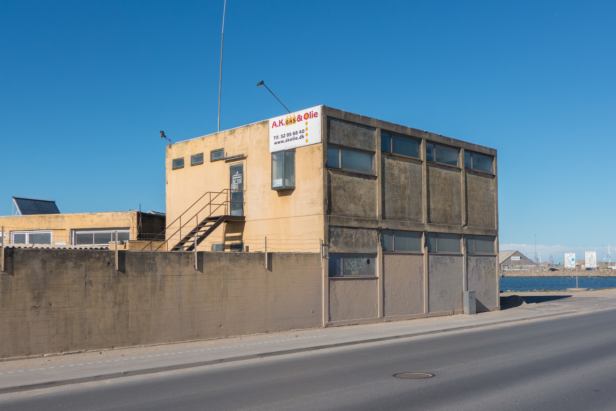
Commercial wharves and large buildings for industry and utilities - the first power stations, railway yards, gas works, pumping stations and sewage works of the city - were nearly all built on land claimed from the sea. The harbour below Langebro is still a wide and impressive channel of water but nowhere near as wide as the original bay before coal yards, a meat market and then a power station were all built on new land out from the natural shore line.

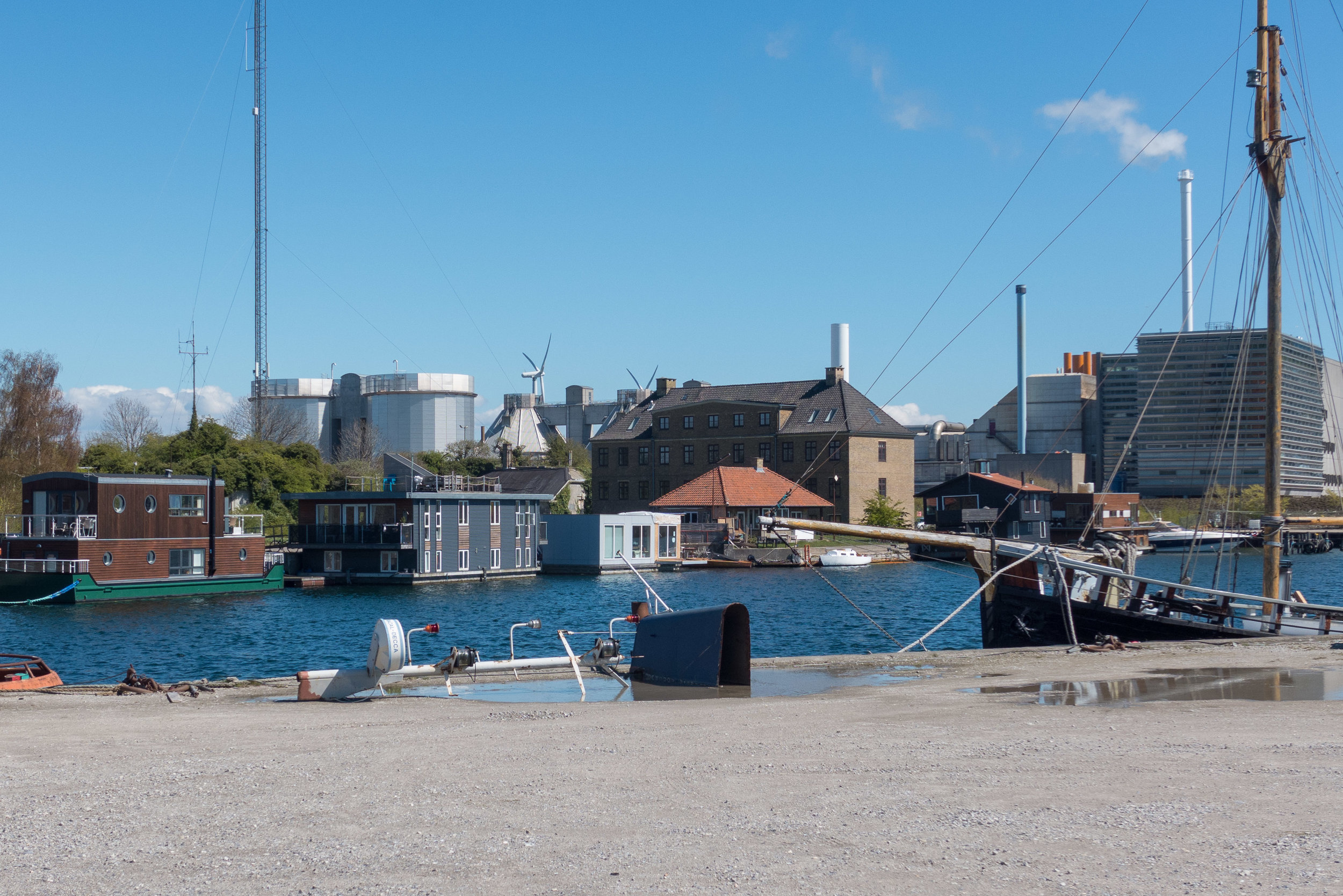
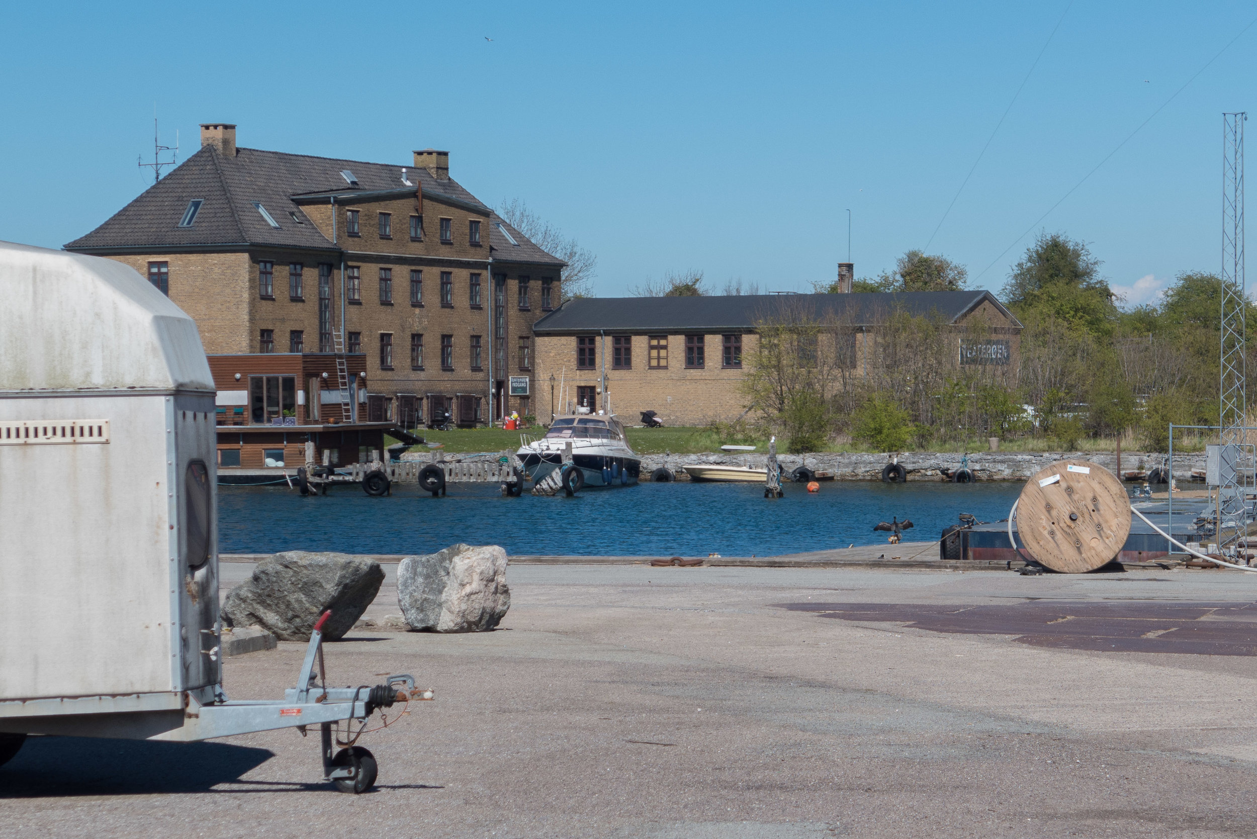
And this process - pushing the shore line outwards or constructing new islands - includes all of what is now Refshaleøen at the top north end of Amager.

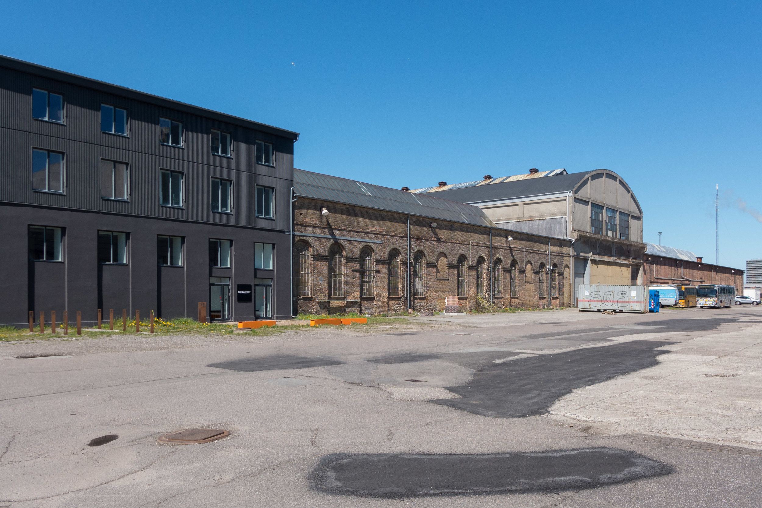
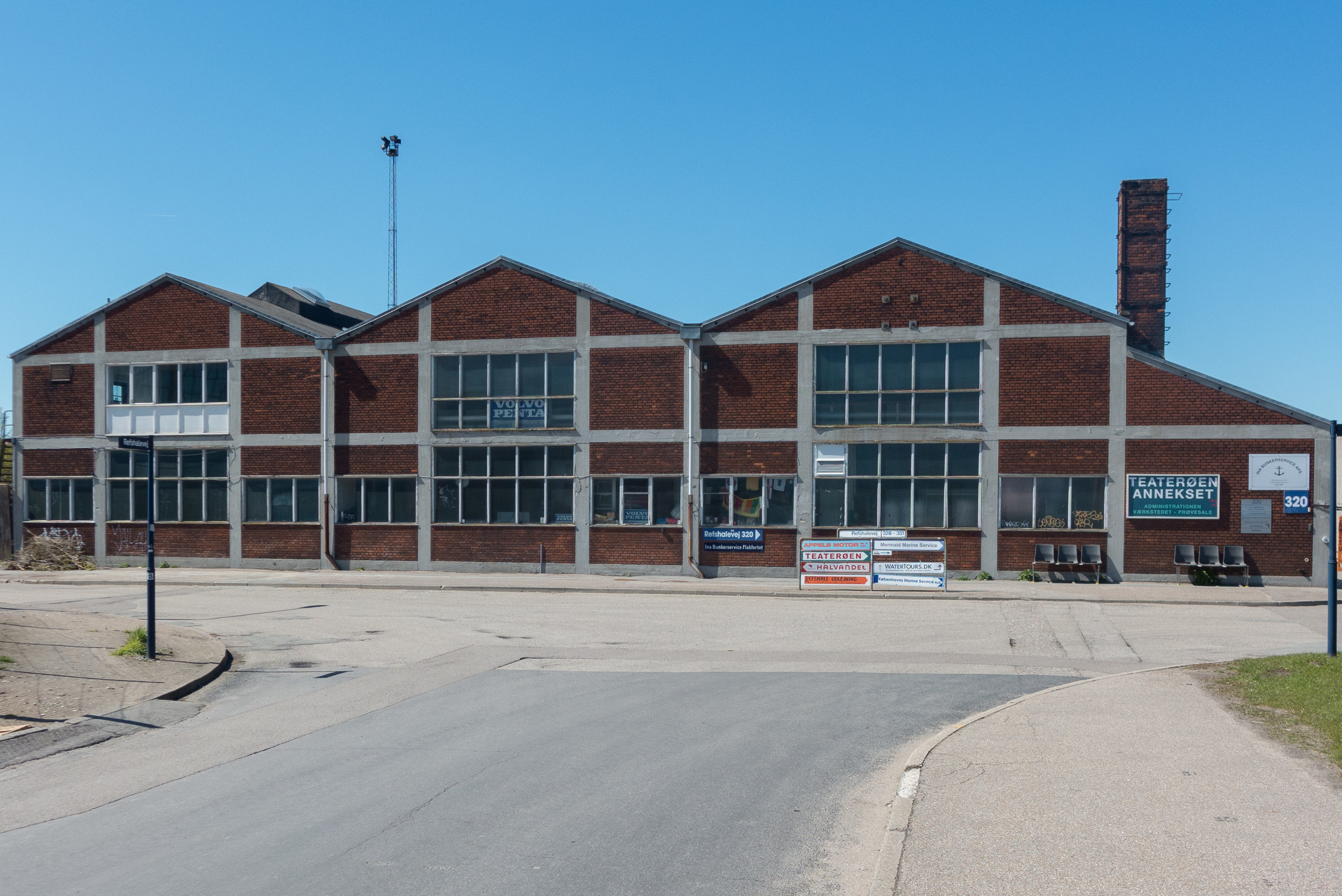
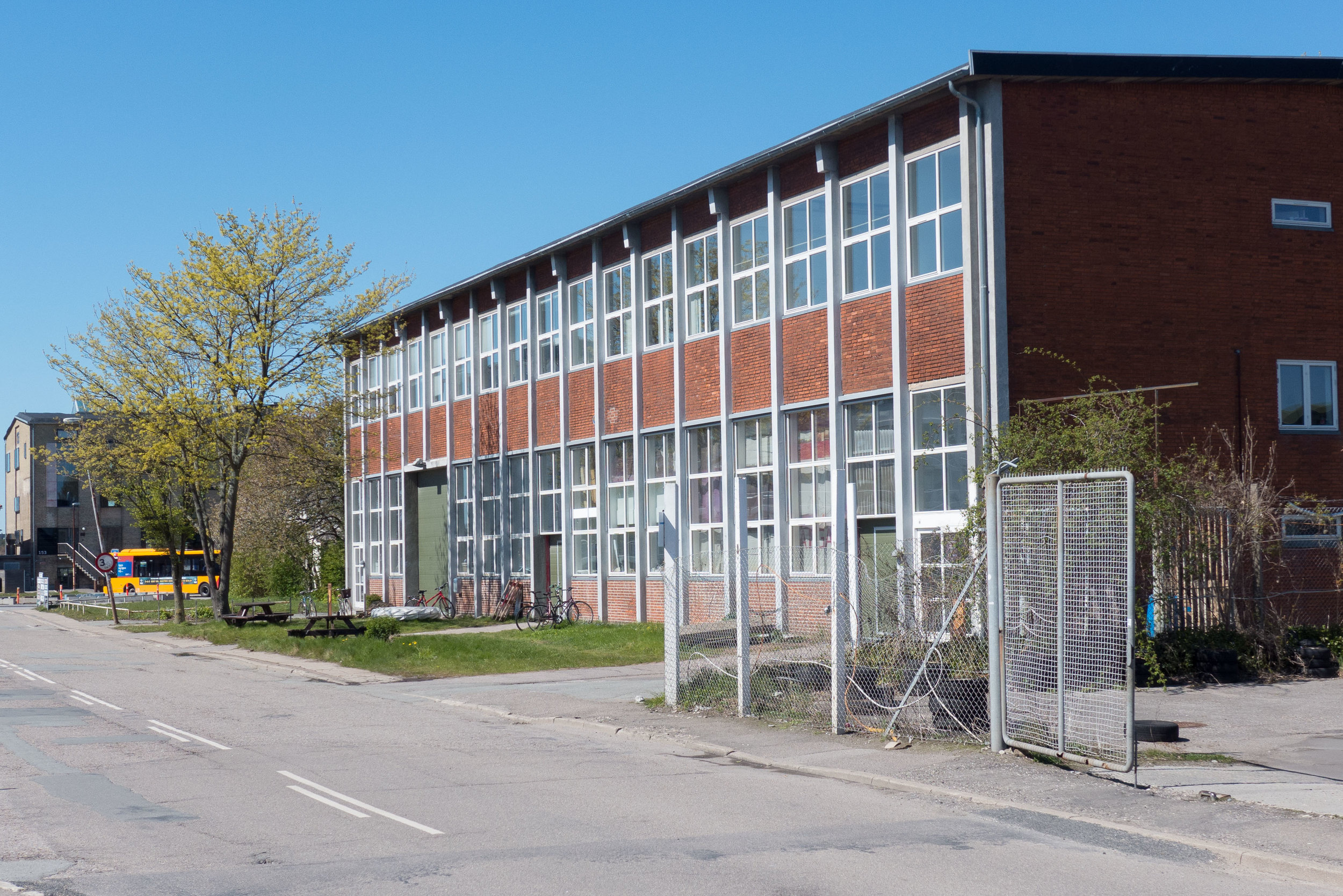
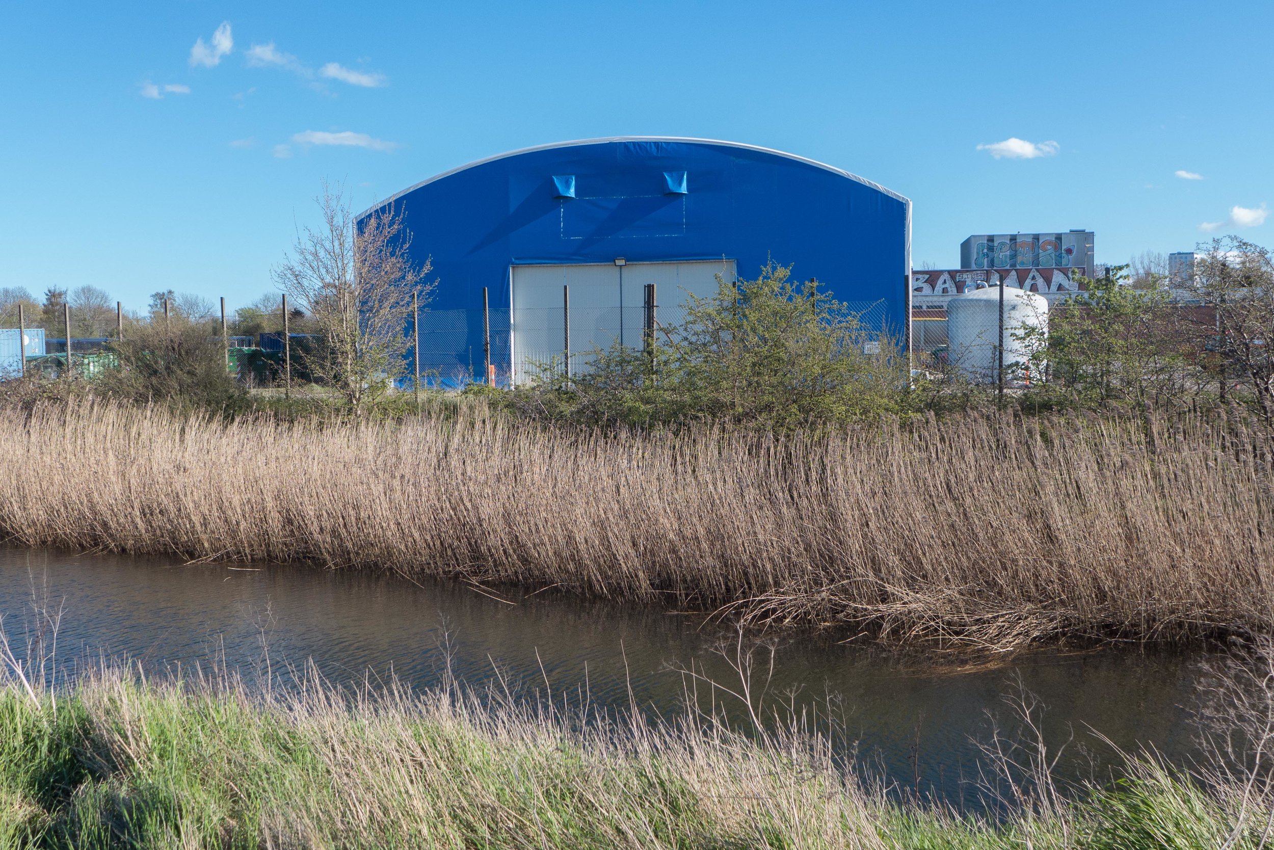
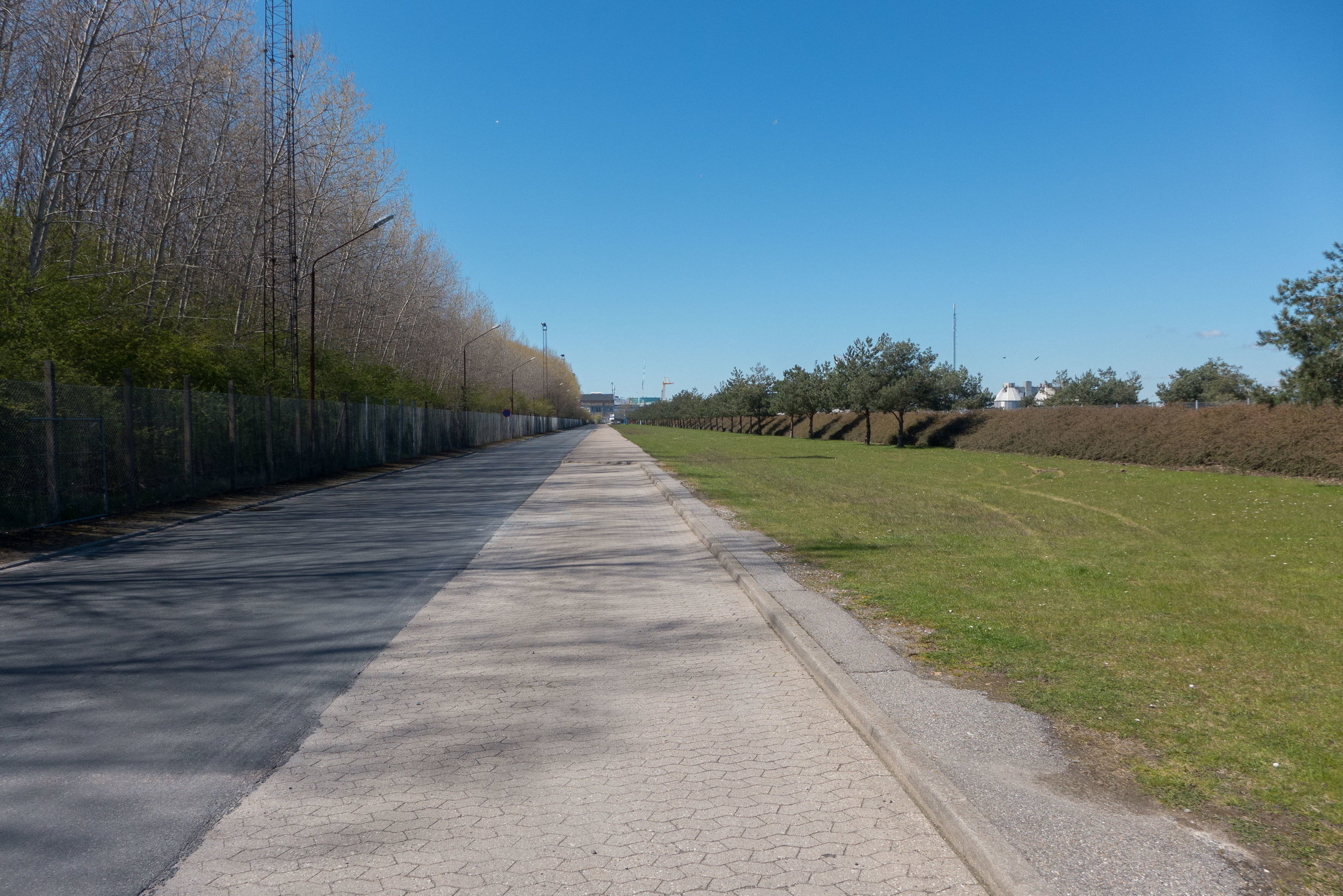
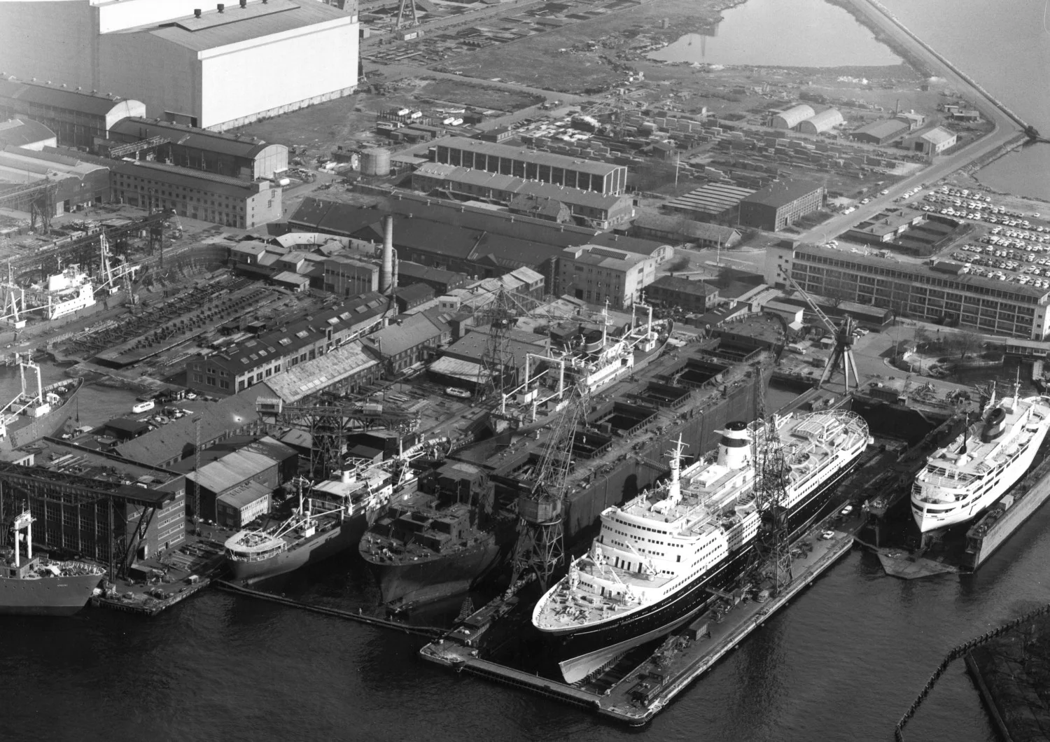
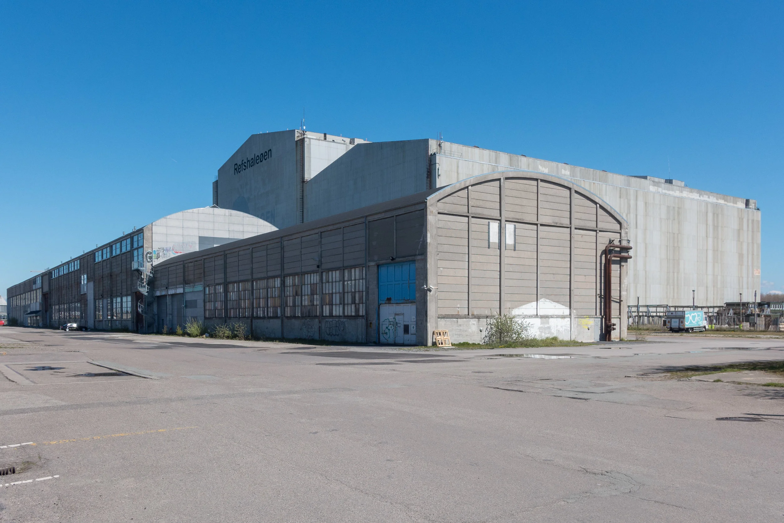
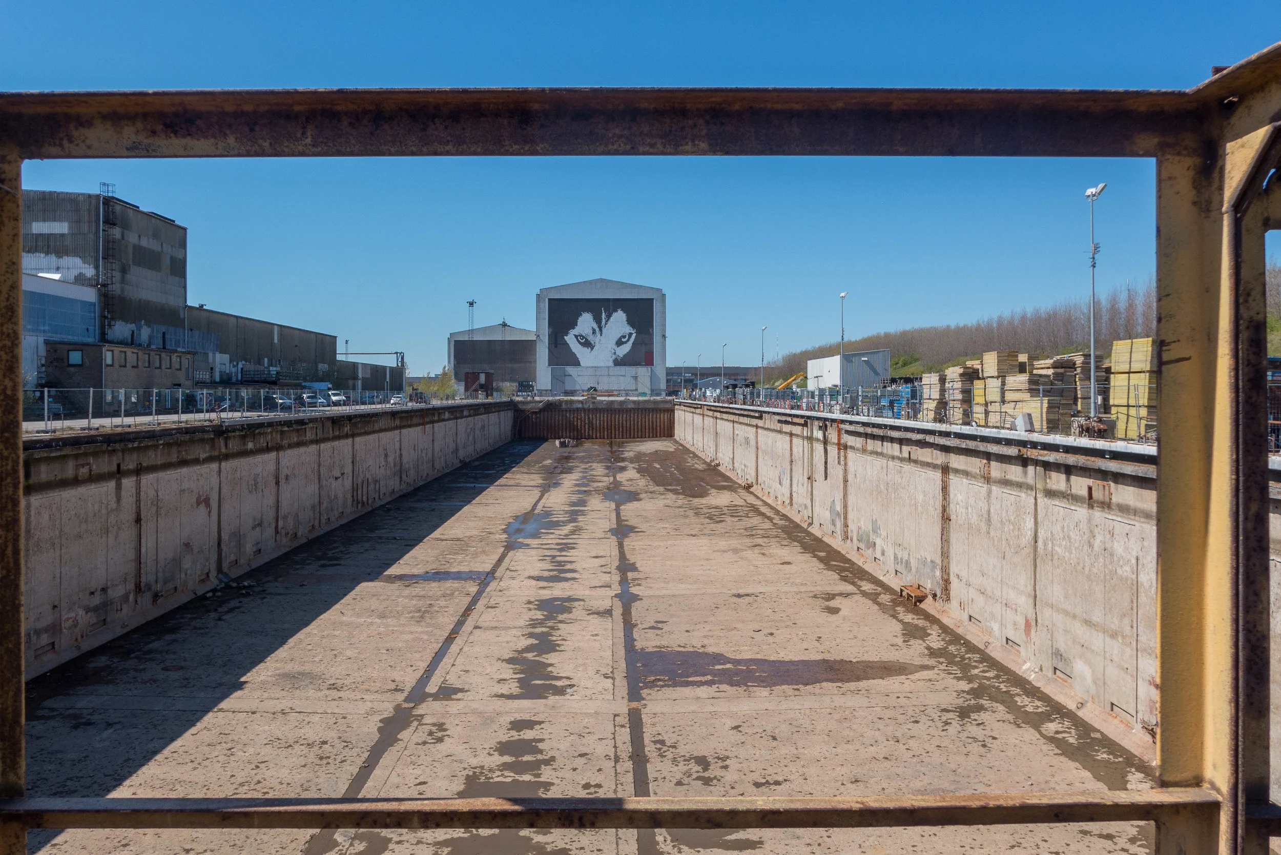
Then, inevitably, over years or decades, an industry or the economy changes and even large companies fail or move on and away - in the case of the great concrete sheds for the Burmeister and Wain shipyards at Refshaleøen, they were in full use for only around 30 years - and then buildings fall into disuse or are demolished and the landscape becomes marginal … or what is now described as 'post industrial.' Refshaleøen is post industrial and has been in a sort of limbo for twenty years.

But surely there are good reasons that any city needs this sort of open space … a place for paint balling or go karts and boat yards and scrap yards? ... but, unfortunately, it's politicians who define marginal but developers who identity and define potential.

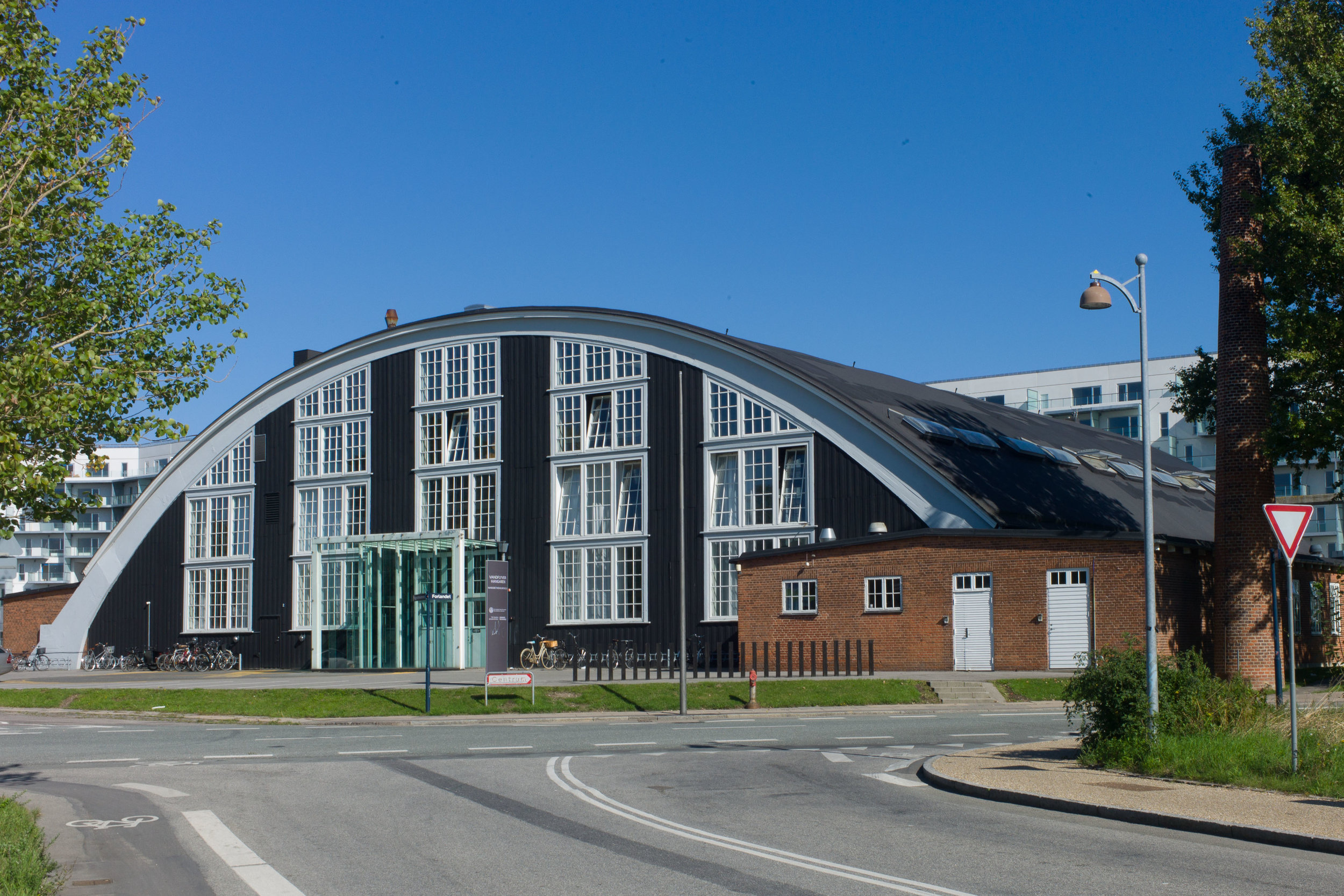
And Refshaleøen is only two or three kilometres from the centre of the city so it’s too valuable to be left marginal for long but, in terms of future use, the remaining buildings - the vestiges of the industry that was here - are pretty amazing and with a lot of imagination - and a fair bit of investment - they can be given new roles.

Just as long as it is not too sanitised. Scruffy and lively can be good. Surely the worthy citizens of Copenhagen need scruffy sometimes?


Kløvermarken - The Clover Field


on the left edge of the view is the spire of Christians Kirke and on the right is just a glint of gold from the dome of the Marble Church - so the full width of the centre of the city


Kløvermarken - The Clover Field - might be just a kilometre or so from the centre of Copenhagen but it feels a world away from a big city. It’s a flat open area of grass just outside the old defences of the old city so its just outside the waterways and embankments and bastions built around Christianshavn and the south side of the harbour of Copenhagen in the 17th and the 18th centuries.

On some early maps the area is marked as Christianshavns Fælled and presumably this was grass or pasture that was at the top end of the island of Amager at that point where the city meets the countryside and the sea.


Now less than a kilometre wide and maybe 700 metres from north to south, it is a crucial green area for the city and mainly because the landscape is not over managed. Parks in Copenhagen are amazing but this is a really important area of what is just grass so people can play football on the many pitches marked out here or can run or whatever. It’s just grass so people don’t have to worry about damaging anything or avoiding anything …. it’s interesting that this space was in fact the location of the first air field for the city before Kastrup.

The open space is important for another reason because from here there is an unbroken view of the city sky line. What skyline? Well that’s the point. It's not a dramatic modern city skyline because from here you can see just about the same view that Christian IV would have seen in the 1630s. Some of the church spires are a bit more ornate than they were then and higher and there are a lot more trees … because the approaches to the city then were kept clear of buildings and trees so Christian’s soldiers could see you coming.

It’s a crucial area in terms of modern planning - not just as somewhere to kick a football but as crucial marginal land … and marginal meant as a compliment. Around the fringes are amazing groups of self-build housing in well-kept gardens and there are allotments, tennis clubs, tree lined country lanes, an abandoned rail line and open water … plenty of water. Never let an accountant tell you this is a wasted development opportunity just a kilometre from the royal palace … it’s actually one of the many reasons why Copenhagen comes towards the top or at the top of lists of cities where its people vote it to be the best place to live.

the architecture of Kløvermarken


architecture, design and planning in Copenhagen ........... 


the houses of Dyssen and the area between the water of the 17th-century defences and Kløvermarken on Amager


good architecture in Copenhagen is not just about aluminium window frames, sealed glazing units and Scandi-clean design ... here is cladding and the use of materials and a sense of colour at its best

Refshaleøen

Burmeister and Wain was founded in the middle of the 19th century with a foundry and engine works in Christianshavn but they established a new shipyard at Refshaleøen in 1871 and by the 1930s there were 8,000 people employed in these yards.

The company survived the war and seem to have been very successful through the 1950s and 60s but struggled through the economic challenges of the 1980s and finally closed in 1996.

Since then, buildings have been demolished - air photographs of the area from the 1950s show just how many buildings, yards and docks and quays there were - but one prominent building survives - the looming concrete bulk of the Sektionshaller that can be seen as a clear landmark for visitors on the approach into the harbour - if they arrive by ferry or cruise liner - and the halls can be seen from most places on the inner harbour. That's hardly surprising as the main hall is 65 metres high, 165 metres long and about 60 metres wide. 

It was built around 1960 on land claimed from the sea and behind a long line of earlier welding sheds across the west end - the front of the building seen from the harbour - and with a massive dry dock to the east that is about 240 metres long and almost 40 metres wide.

This is now a venue for major concerts and events … the sheds and dock had their moment in a European spotlight when DR (Danish Radio) hosted the Eurovision Song Contest here in 2014 but the music most associated with Refshaleøen is a bit more … well … robust so coming up is Engage on 27th May, Distortion at the beginning of June and Copenhell on the 22nd and 23rd June.

Refshaleøen