a curious design but a serious message

Benches like this have appeared in about half a dozen places around the city.

My first thought was that it seemed like a rather extreme way to stop people stretching out and sleeping on park benches. Then I wondered if it was a particularly thick apprentice in the ironworks who got the measurements wrong but that seemed more than a bit unlikely as these benches have been made here since 1888 so, really, they should know what they are doing by now.

Then I saw an article in the newspaper that sort of explained everything. They are 85 cm too high and that's the height that some scientists have suggested that sea levels will rise by the end of the century if we do not tackle CO2 pollution and sort out climate change.

The pedant in me thought that it's a bit of an obscure way to represent impending disaster and that it only really works if the benches were at the end of Ofelia Plads where the concrete runs down into the sea of the harbour but then anything helps if it makes people stop and think .... even if it is only to think how the hell would I get up there or, come to that, get down without breaking an ankle.

design classic: the Copenhagen bench
the Copenhagen bench
high water in the harbour
Ofelia Plads


Halmtorvet - a new storm water drain

Sønder Boulevard - the wide street running out to the south east through Vesterbro from the west side of the main railway station - is now partly blocked with high hoardings like those that were used around main sites for engineering work when the metro was constructed. However, this site is not for the metro but for major engineering work to construct a massive storm drain.

It is part of a scheme for rain-storm mitigation for Frederiksberg and, when completed, it will be about 1.25 kilometres long to take storm water from Sankt Jørgens Sø out to the harbour with an outlet just east of the Copenhagen Island Hotel on Kalvebod Brygge … close to the swimming area in the harbour at Fisketorvet.

A plan by the water and engineering company HOFOR shows how new drains and gullies will take water from the streets and roofs of the densely-built area of Frederiksberg and Vesterbro out to the lakes on the west side of the city centre and from there it will be released, as and when appropriate, to keep surface water on roads to a minimum, to prevent the flooding of basements and to ensure that house drains and sewers are not inundated.

There is a proposal, not yet confirmed, to lower the level of Sankt Jørgens Sø that is now kept at it’s current level by a dam across the south end so the surface of the lake is well over a metre above Gammel Kongevej - the road across the south end of the lakes. If it was kept at a lower level, then, if there was a storm, the lake could be used as a large emergency reservoir to hold considerably more flood water, for a short period.

A well-illustrated booklet from the water company Hofor sets out why the mitigation work is necessary and the extent of the work and can be downloaded from their on-line site.

HOFOR - Skybrudsplan


building out into Kalle Bod - the bay between Frederiksberg and Amager

The map of 1788 shows the wide channel between the city and Amager that had been narrowed by the construction of Christianshavn in the 17th century and then the construction of the defences to protect the area where the ships of the Danish navy were moored.

Presumably, the bay to the south slowly closed with silt as the sea could no longer flow freely between the city and Amager.

From the middle of the 19th century land was claimed from the sea on both sides of the bay - first for the first railway line and then the meat market and a gasworks on the Frederiksberg side and then timber yards close to the entrance to the harbour.

In the late 19th century, the Danish army - the artillery - moved out to Amager, just beyond Langebro, where they built a rifle factory and shooting ranges and then around 1900 commercial quays were built to create Islands Brygge that extended well out into the bay.

The photograph above - taken between 1867 and 1869 from the tower of Vor Frelsers Kirke on Christianshavn - is the view looking to the south west with Kalle Bod, the wide bay that opened out to the south of the harbour, with Frederiksberg to the right and Amager, out of the view, to the left.

Key buildings shown in the photo that survive are Christians Kirke to the right ① and the large house on the canal. ② Buildings beyond the church was a shipyard and engineering workshops that do not survive and the basin has been infilled.

The long building ③ was a rope walk on the north side of what is now Langebrogade. The buildings ④ are on the bastion to the east of the entrance to the harbour and survive but the outer defence ⑤ is now under the roadway on the west side of Langebro, the present bridge that was completed in 1954. The earlier Langebro ⑥ was on the line of the new pedestrian and bike bridge called Lille Langebro.

Mills and breweries ⑦ are on the site that is now BLOX ⑧ and the low buildings ⑨ was the bathing station. Beyond, between the bathing station and the shore was a timber yard just outside the defences and that is now the site of the Ny Carlsberg Glyptotek. Further along the foreshore, early infill of the bay created land for the first buildings of the meat market and a gas works.

photograph from the City Archive reference 25925

Copenhagen City Archive reference 40015

In the late 19th century, massive timber, earth, brick or stone walls and embankments were built down the harbour in a number of stages with infill behind for the present railway that runs into the central station from the east and for the railway works and the road now called Kalvebod Brygge. The office buildings between Langebro and Fisketorvet - on the left in the photograph - are all on land claimed from the bay. The buildings on the right or east side of the harbour are on Islands Brygge and also on man-made infill of the bay


the south harbour looking from the cycle bridge at Fisketorvet towards the city with Langebro in the distance

It would seem ridiculous to claim that the harbour here is narrow - it’s almost 400 metres wide - but if you had been swimming in this area of the harbour in the middle of the 19th century - in the area where the harbour swimming is at Fisketorvet - just to left of this view - then you would have been 800 metres from the beach on the Frederiksberg side and at least 700 metres from the shore on the Amager side.

detail of a map of 1749
on the left is the distinct plan of the gardens of the palace at Frederiksberg and, at that time, there were only a few houses along the road that led to the west gate of the city - Vesterport - that was approximately where the square is now at the front of the city hall
what is obvious is the width of the bay to the south of the old city
when the first railway line was built it followed the shore of the bay on the line of what is now Sønder Boulevard


Sankt Jørgens Sø


Through the 17th century, the lake here was much more irregular in shape and spread out at the south end where it drained out to the harbour across low-lying marshes to the bay about 500 metres away.

Presumably, both Gammel Kongevej and Vesterbrogade - the road from Frederiksberg to the city through the West Gate were on causeways.

In part, the new storm drain is only needed now because so much land was claimed from the sea that the south end of Sankt Jørgens Sø is now 1.2 kilometres from the harbour.

a proposal to lower the level of the lake and to create wide new areas of grass and planting but if there was a major rain storm then the area could be flooded, returning it to the present level, as a giant holding tank before the water would be released into the harbour at an appropriate time and in a carefully controlled way.

Sankt Jørgens Sø from the north
steps up on the walk around the lake from Vodroffsvej

the path on the dam across the south end of the lake
Gammel Kongevej and the steps up to the lake … the level of the lake is approximately 1.5 metres above the level of the road
flood water will be taken from here to the harbour through the new drain


climate change and policies about sustainability are not just about the cities and towns

model of the new Wadden Sea interpretation by Dorte Mandrup

This blog is about Danish architecture - about buildings and the built environment - and about design and making or design and manufacturing so, in the recent posts about climate-change mitigation, the schemes discussed have been urban examples and mainly about dealing with flooding from rain storms.

This is crucial because it has been predicted that, as a consequence of global warming, annual rain fall in Denmark could increase by as much as 30% but this will not be spread evenly through the year but there will be more sudden and dramatic storms with torrential rain falling over a relatively sort period of thirty minutes or an hour.

I was not in the city for the devastating storm of 2011 so I did not see first-hand the damage done then as streets flooded - although I have seen some of the videos that people took - but only a month after moving to Copenhagen there was a storm that flooded local streets and where I was living, each apartment had storage space in the basement and I lost packing boxes and tools and some books left down there were ruined. Then the water was just about 30 cm deep across the basement with water running down from the street but pumps had to be brought in. In 2011, I was told, water had come up to the level of the basement ceiling so I can see why city politicians have spent so much money and time and effort on trying to make Copenhagen more resilient. Some 300 schemes have been completed or are, to use a bad pun, in the pipe line.

Denmark is renowned for its modern architecture and for furniture design but the country also has a strong and world-wide reputation for its engineering and this is crucial for the successful completion of appropriate mitigation projects.

Recent statistics from 2018 show that 88% of the Danish population live now in towns but clearly this is not to suggest that all climate problems and all major protection plans are urban.

Denmark is a relative small country but it is a country made up of islands - there are some 443 named islands - and so it has a long coast line of around 8,750 kilometres. To put this in perspective, there is one land border - the border with Germany - and that is just 68 kilometres across.

The country is low - not as low as large parts of the Netherlands of course - and the highest point is just 171 metres above sea level. The sea takes away and then redistributes sediment and builds up new land elsewhere to such an extent that the official statistics for the calculated area of the country is changed regularly.

So, extensive engineering schemes are needed to protect coast lines around the country and with ongoing discussion about other policies needed to protect some areas, particularly important rare or unique natural landscapes habitats, like the Wadden Sea area on the west coast, and last week there was a debate in the newspaper about returning areas of peat bog in Jutland at Vejen Mose to their original state. Draining the land for agricultural use release carbon deposited there …. as much as 1.4 million tonnes of carbon emissions each year.

These decisions are not easy and not cheap but are now urgent and, as with all policies about climate change and sustainability, complicated compromises will have to be made.

Wadden Sea dikes
Dorte Mandrup Wadden Sea Centre


climate change and sustainability in Denmark? - start with a search for information on line

Many of the reports on new policies to tackle climate change and directives on sustainability from the Danish government and by city councils and by organisations such as Realdania or Danish Industry are published on line and many published in English although it is now relatively easy to translate even pdf files from Danish using Google.

Both the title/heading for each report and the image of the report cover are links to the on-line site where the report can be read and, in most cases, downloaded as a pdf file.


CPH2025 Climate Plan - A Green, Smart and Carbon Neutral City (September 2012)

This is an initial assessment and the proposition for a climate plan for Copenhagen. Published in English as well as in Danish, it’s a good introduction to how planners and politicians in the city and the country approached a growing realisation that there had to be a response and then a plan for action.

In 2009 the City Council unanimously adopted a Climate Plan for Copenhagen with the aim to reduce CO2 emissions by 20% by 2015 and then a plan was formulated for Copenhagen to become a carbon-neutral city by 2025.

“The CPH 2025 Climate Plan, is the City of Copenhagen’s plan for achieving carbon neutrality by 2025. In addition to transferring relevant initiatives from the 2009 Climate Plan into CPH 2025, the CPH 2025 Climate Plan contains those objectives, main efforts and initiatives adopted by the City Council which must be implemented in order to achieve the goal of carbon neutrality. ”

 There are four main areas of action and each with goals and initiatives. These were …..

• Energy consumption
• Energy production
• Mobility
• City administration Initiatives 

…. and were to provide the city with "a sound local-government economy and the most favourable conditions for green growth" and, and as important, the authors of the report realised that this could not be achieved without “the engagement and understanding of the people of Copenhagen.”


Copenhagen Solutions for Sustainable Cities (January 2014)

In his introduction to the report, Frank Jensen, the mayor of Copenhagen, emphasises a positive approach.

Of course, this is not to trivialise the threat of climate change - the city is spending a phenomenal amount of money on storm water control - but to emphasise the threat and the cost might mean that some citizens could question the predictions. Danes are practical, well educated and generally realists but it helps in the decision making process if there are also some gains. So, cleaning the harbour of pollution has created an incredibly popular public amenity and increased property values for homes near the water and an integrated and efficient transport system using environmentally  friendly fuel “not only reduces traffic congestion, it also saves us billions of euros and keeps the city efficient and competitive.”

The extensive system of cycle lanes and dedicated cycle-friendly routes through the city means that more and more people use bikes to commute so, with fewer cars on the city roads, there is less congestion and traffic fumes are reduced so more people are drawn to using their bikes and as they become fitter so they are happy to cycle further and, for many, with greater fitness, health problems and health-care costs reduce. Isn't this what is called an accumulator?

The report sets out the way that the use of bikes is integrated into the city transport system and for longer journeys people combine different forms of transport in a single journey. Bike storage is found at most metro and suburban railway stations and there is readily available information on line with a reliable route planner with real-time data on buses to monitor any wait at an interchange ahead so, for instance, platform details and imminent times of departures for trains on monitors on the bus as it approaches a station. Buses and bikes are given priority over cars at traffic lights. Text message ticketing reduces time as people get onto the bus.

The popularity of the harbour swimming areas shows the level of success in clearing the water of pollution - it's described as a “blue transformation” - and was achieved through a working and ongoing partnership between planners, the municipality, environmental experts, engineers, architects, researchers and the private sector.

The report sets out how the supply of drinking water has been protected and emphasise why this is important - particularly as the population of the city is increasing.

There is strong public support for wind power and that was encouraged by creating community-owned facilities and the rapid and successful development of the technology has created jobs and meant a high level of expertise in this sector for designing, manufacturing and exporting wind turbines.

Incineration of waste created an important communal heating and hot water system that was established in the 1920s and this will be maintained but there is now a focus on recycling and waste management and waste treatment and there are developments to exploit biomass as a fuel. With higher summer temperatures predicted, district cooling networks are being developed to reduce the demand for power for individual systems for commercial buildings.

Existing buildings are being renovated or retrofitted to comply with increasingly tough energy and insulation regulations and there is a growing movement to reuse building materials and a public interest in planning homes so that they can be adapted as needs change. It is described as planning for “energy efficiency over the entire life cycle of a building” and there is a certification scheme for sustainability.

The city pursues strategic planning for economic, environmental and social gains so, for instance, the development plan for Ørestad on Amager encouraged companies to remain in the city, rather than moving out to suburban sites or moving abroad, but at the same time encouraged people to stay and live in the city rather than move out to dormitory settlements with all that means for increased commuter traffic.

Finally the report sets out the plans and the data and the advantages for the goal to make the city carbon neutral by 2025 by focusing on solutions that are greener and healthier and that will also make the city more profitable and make it a cheaper place to live … the calculation at the time of the report was that, if all the proposals were implemented, each household would save €537 a year on heating and electricity bills and with the bonus and benefit from living in a greener and cleaner city.


Chapter divisions give an indication of the focus of the report ….

Mobility
Cycling: the fast way forward
Giving integrated transport the green light

Water
The harbour turns blue
Meeting the rising demand for water

Energy and resources
The force of public support for wind power
A city without waste
Keeping the city warm efficiently
Keeping cool under CO2 pressure
Creating buildings for life

Strategy
Urban planning: economic and social benefits
Copenhagen - Carbon-neutral by 2025


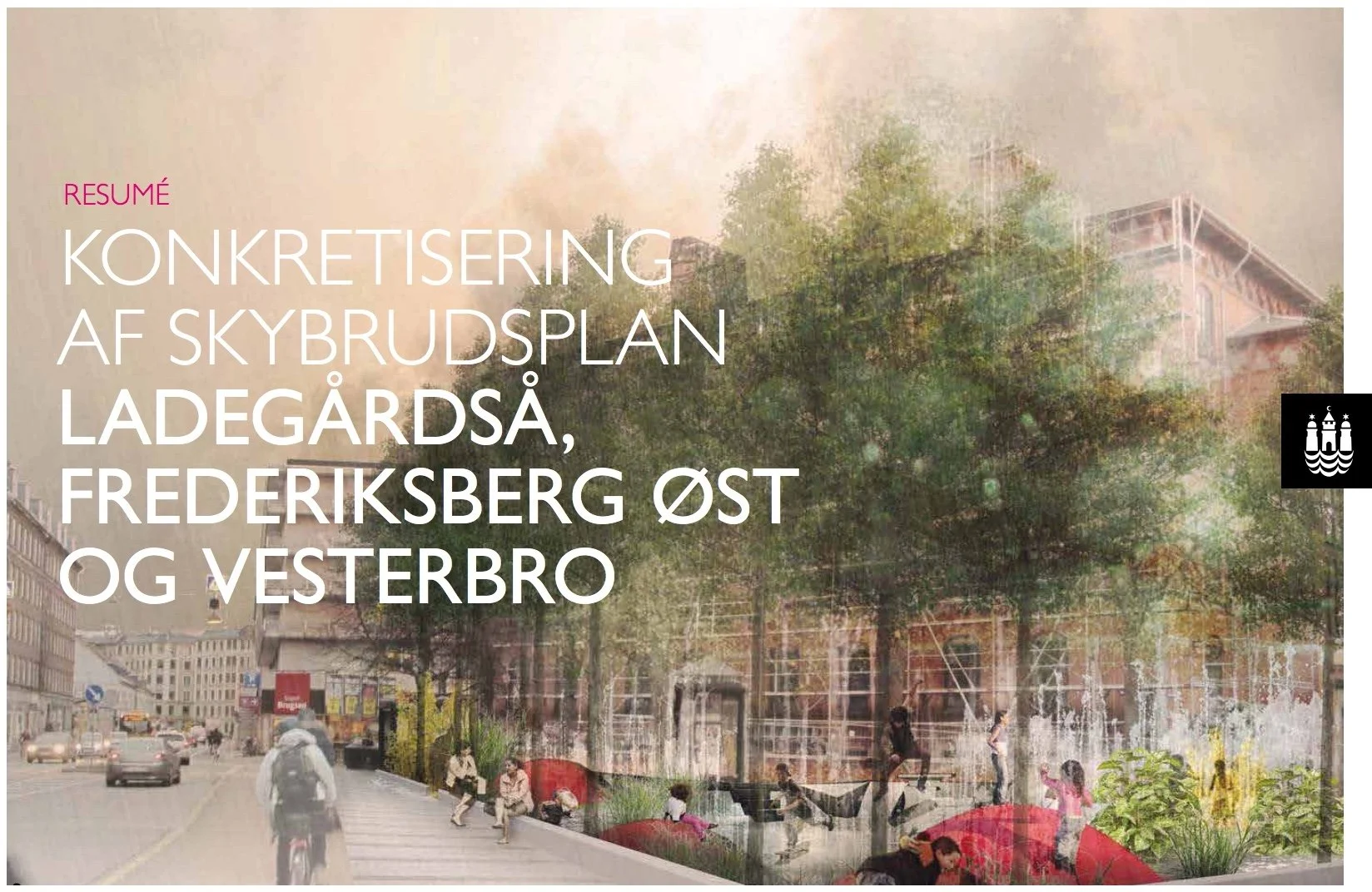
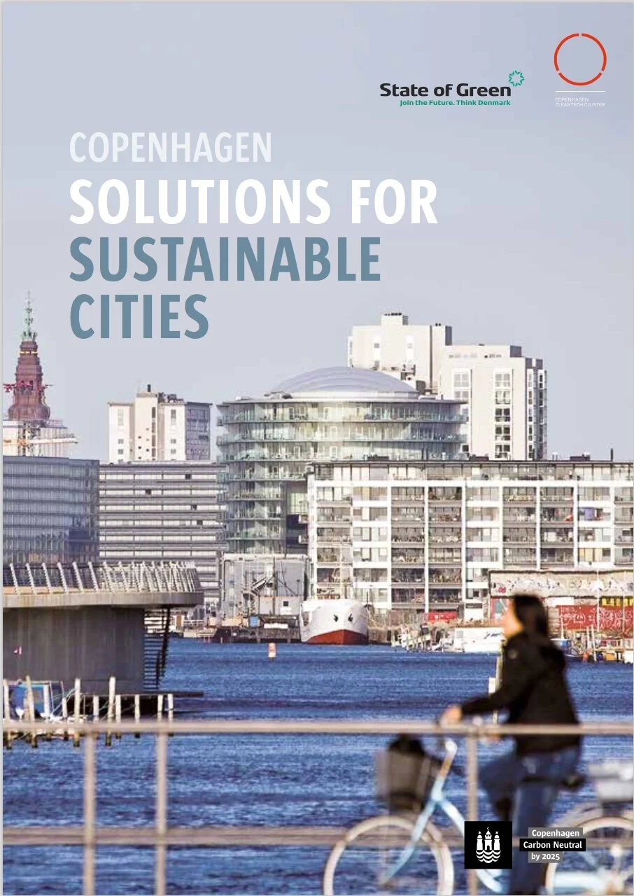
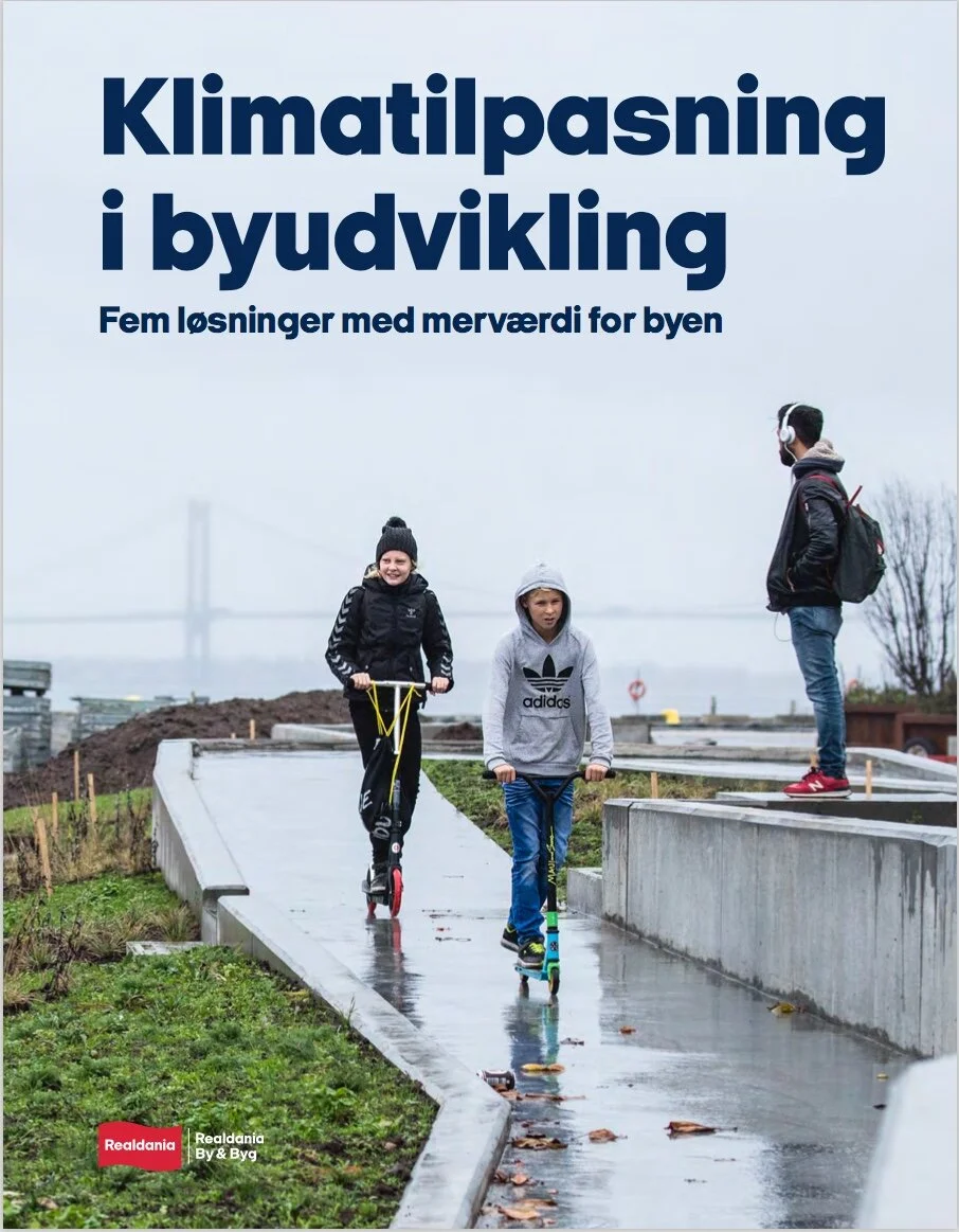
Klimatilpasning i byudvikling - Fem løsninger med merværdi for byen (2016)
Climate adaptation in urban development - Five solutions with added value for the city

This publication from Realdania looks at climate adaption solutions for five major urban developments where, starting with the challenge from climate change, these project also show that solutions can and do have a positive impact on the quality of urban life, providing new recreation facilities.

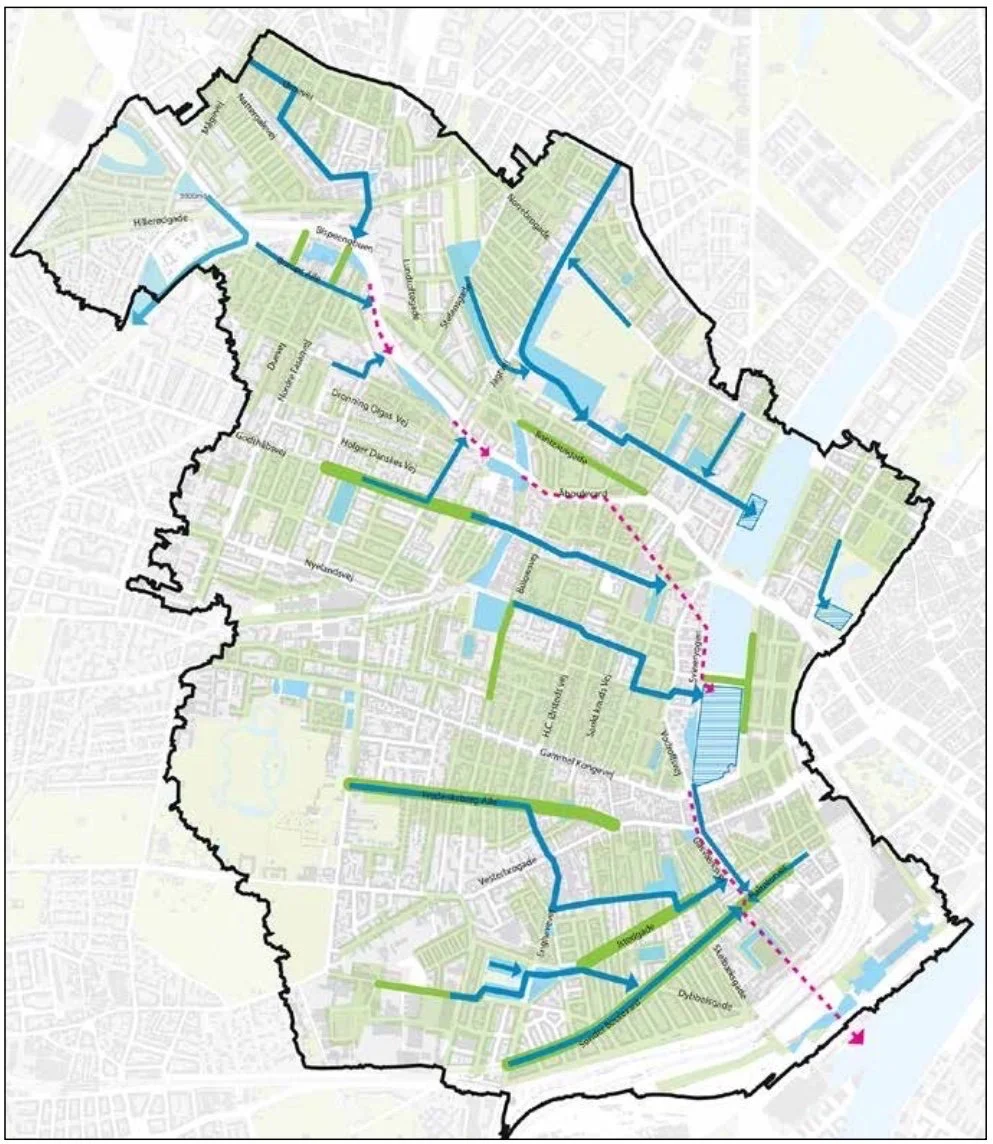
Climate change presents a very real challenge in Denmark. A report by the Norwegian Coastal Directorate concluded that by the year 2100, sea levels around Denmark will have risen by 1 metre and all parts of the country will have increased rainfall and will have to cope with sudden and intense rain storms.

For each of the projects, there is a general and well-illustrated assessment; an interview with a engineer, manager or professional involved with the project and a useful summary of the key points or 'facts' for each scheme.

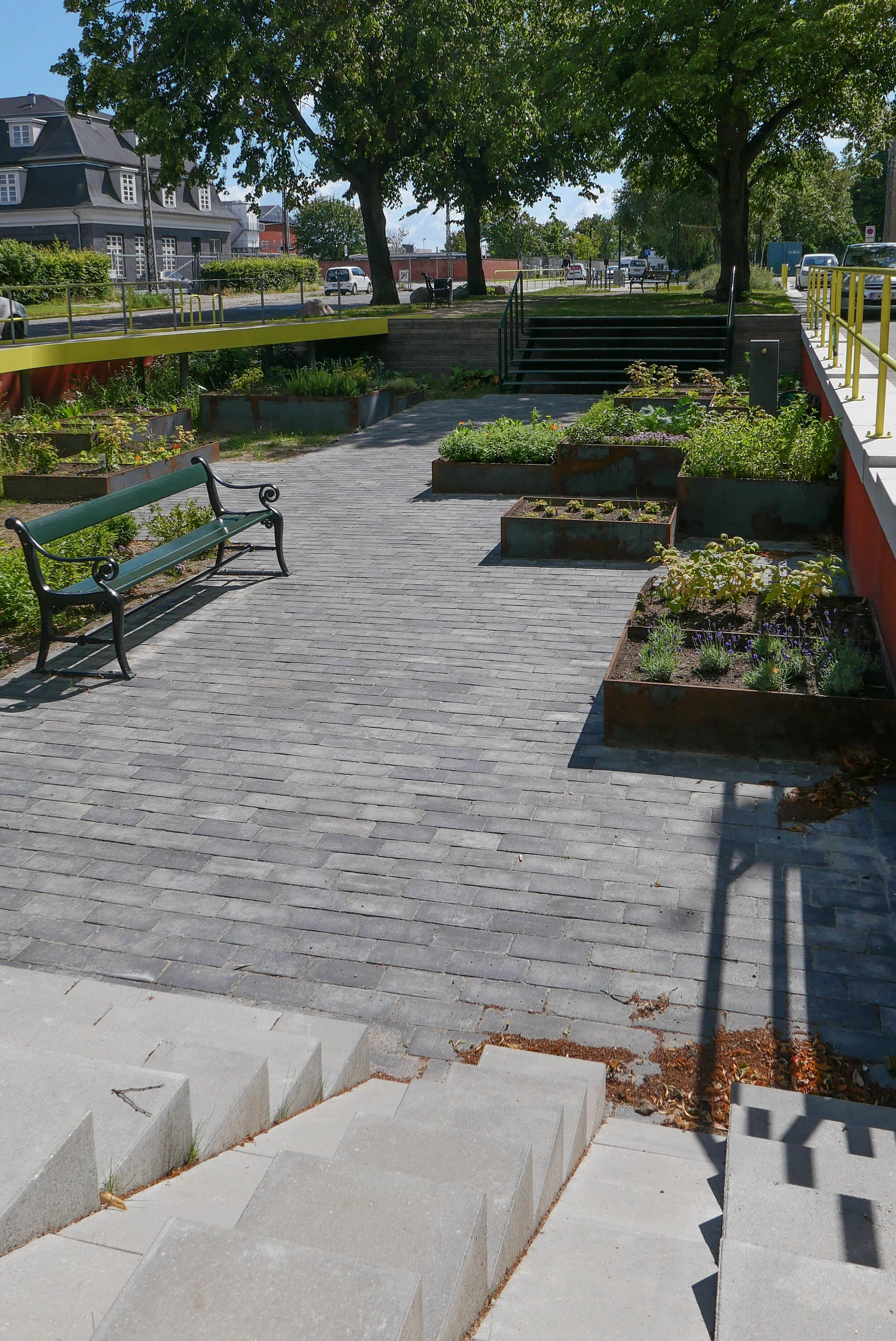
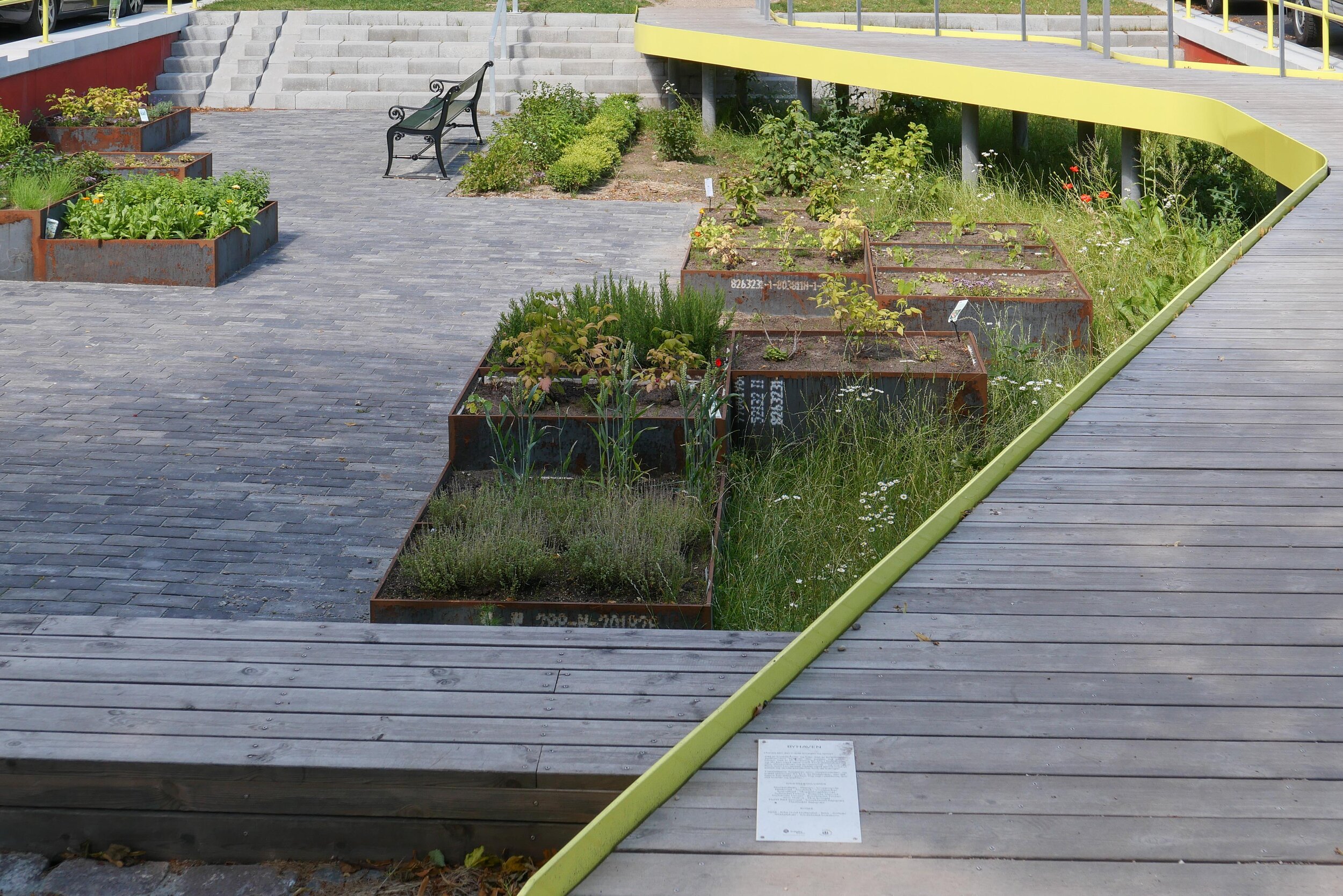
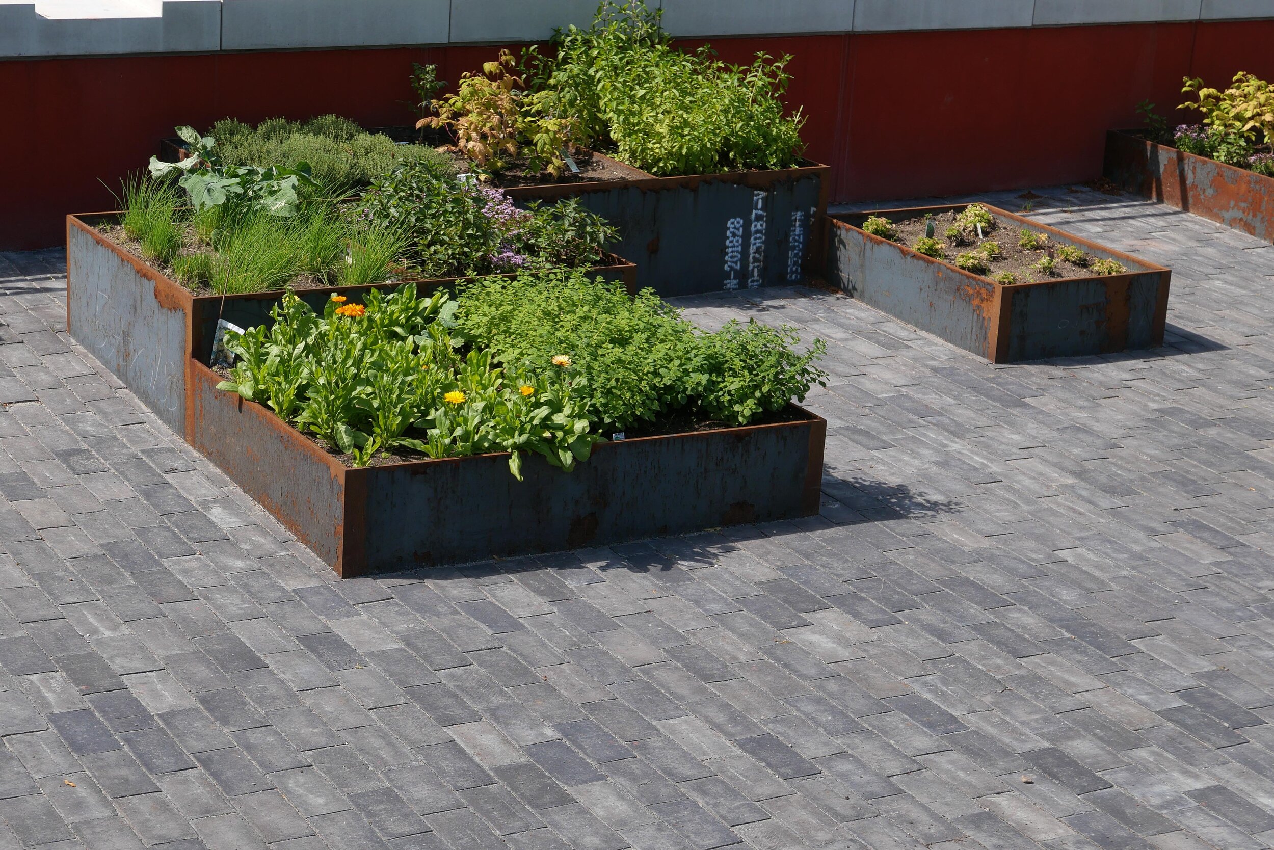
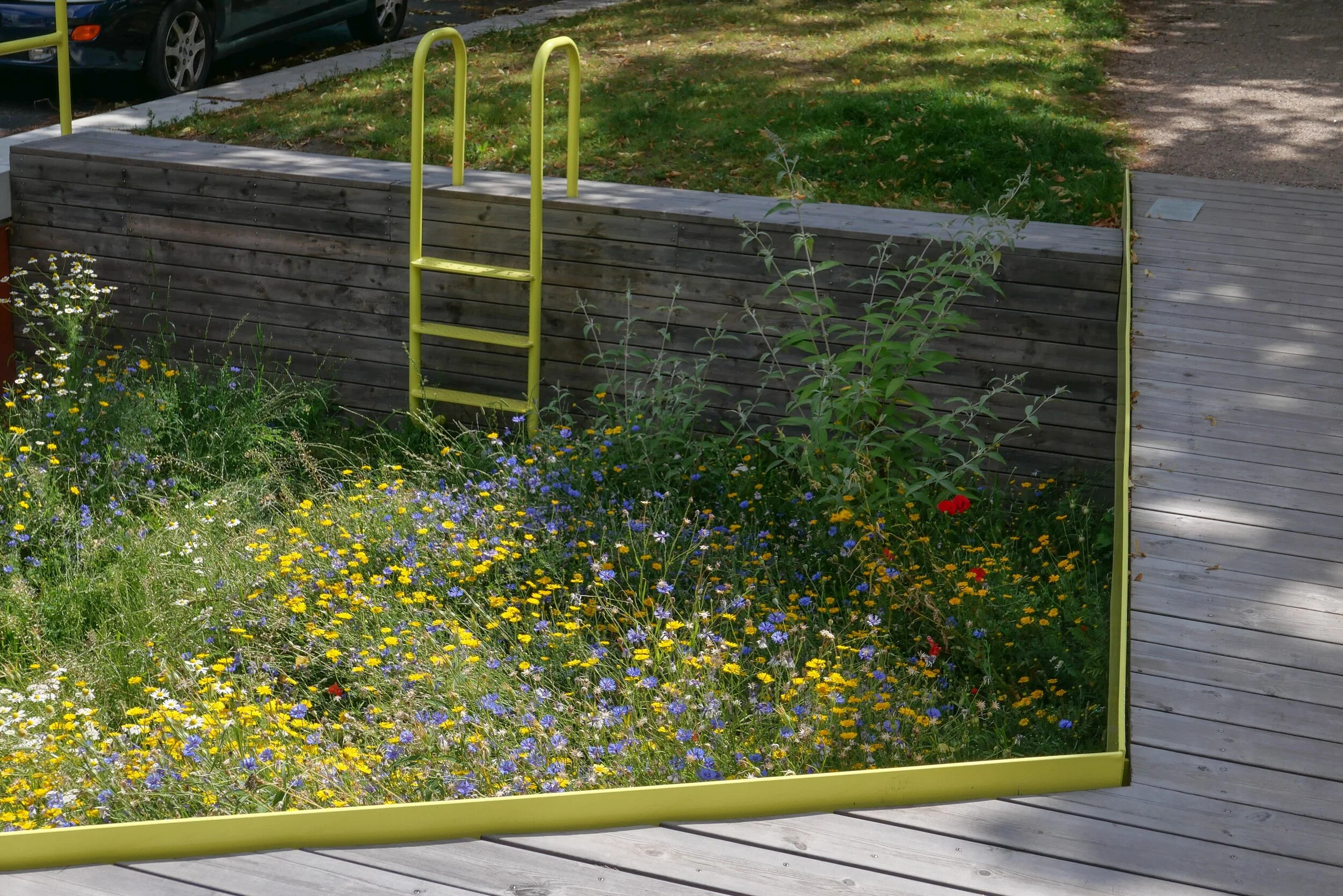
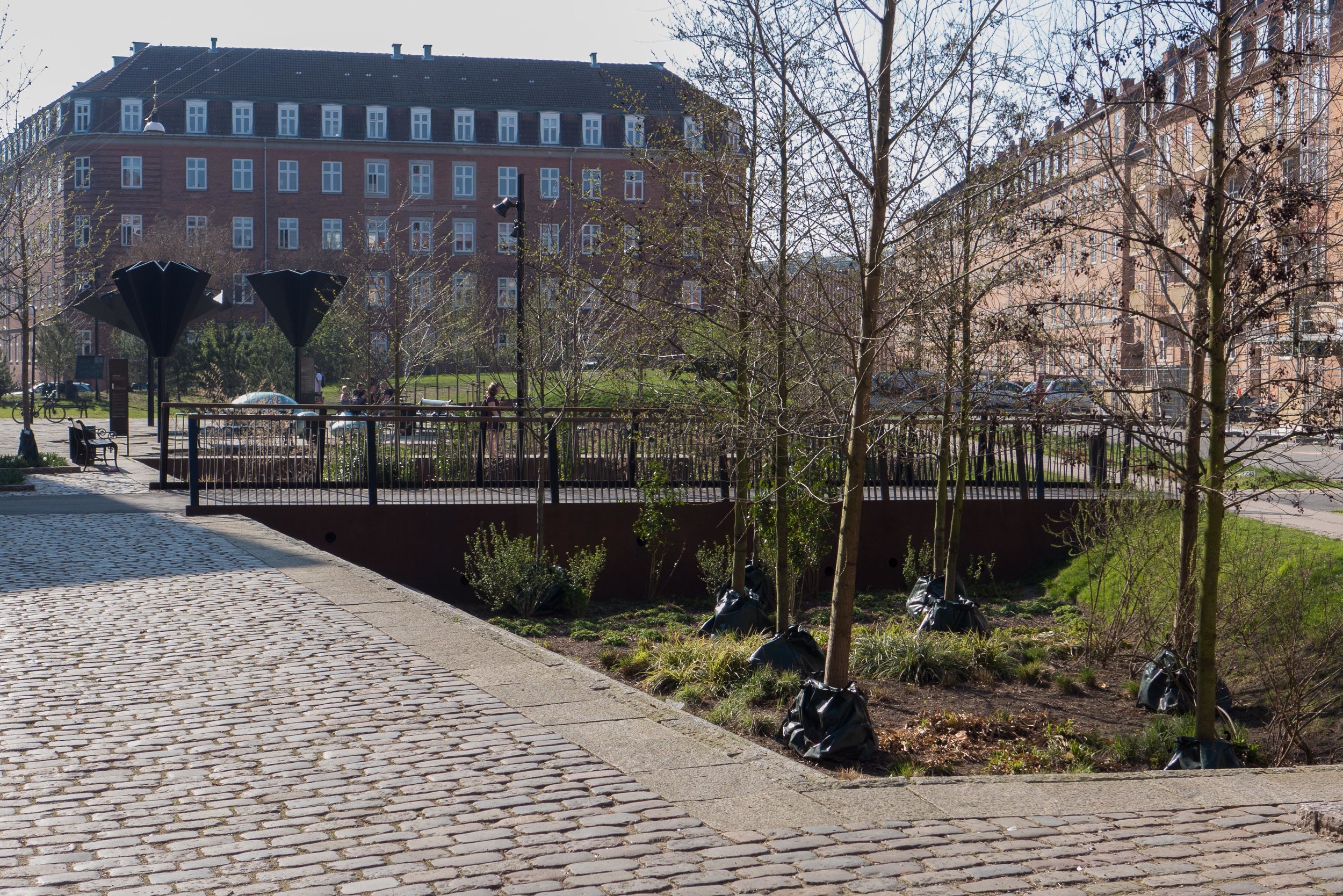
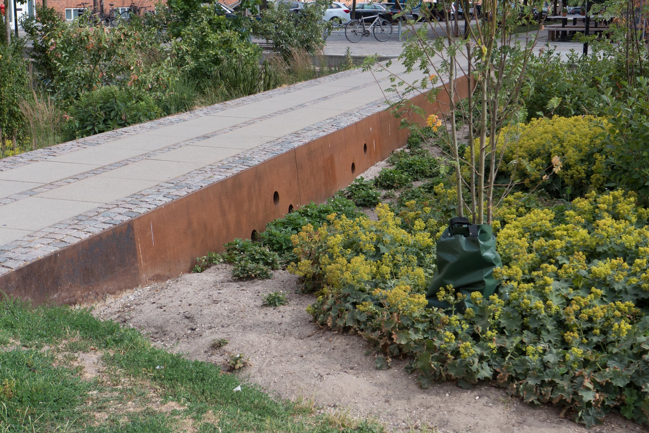
In Fredericia, on the east coast of Jutland, an area adjoining the historic city is being developed within a substantial dyke or defence that will protect the whole area from rising sea levels.

Tim E. Andersen, project director for Fredericia urban development project observes that:
Climate adaptation is a major challenge, but also the way to create some benefits, such as climate change, to improve the port environment and create some attractive spaces and green urban spaces where people can meet. If you have the opportunity to take the time to step back and look at the context of things, you can turn something that is a big problem into something that can provide value. At the same time, there is money to be saved if you solve your problems in one go.

It is a long-term investment but there are clear and, in some cases, immediate gains from this long-term investment so that citizens can appreciate why the work has been undertaken.

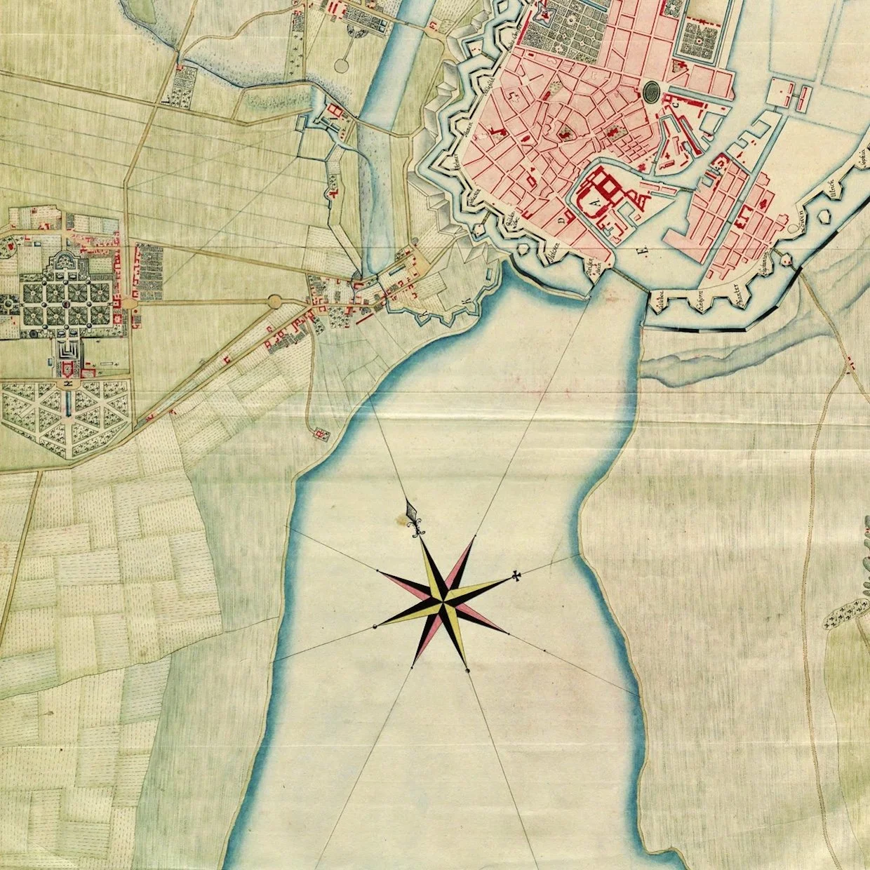
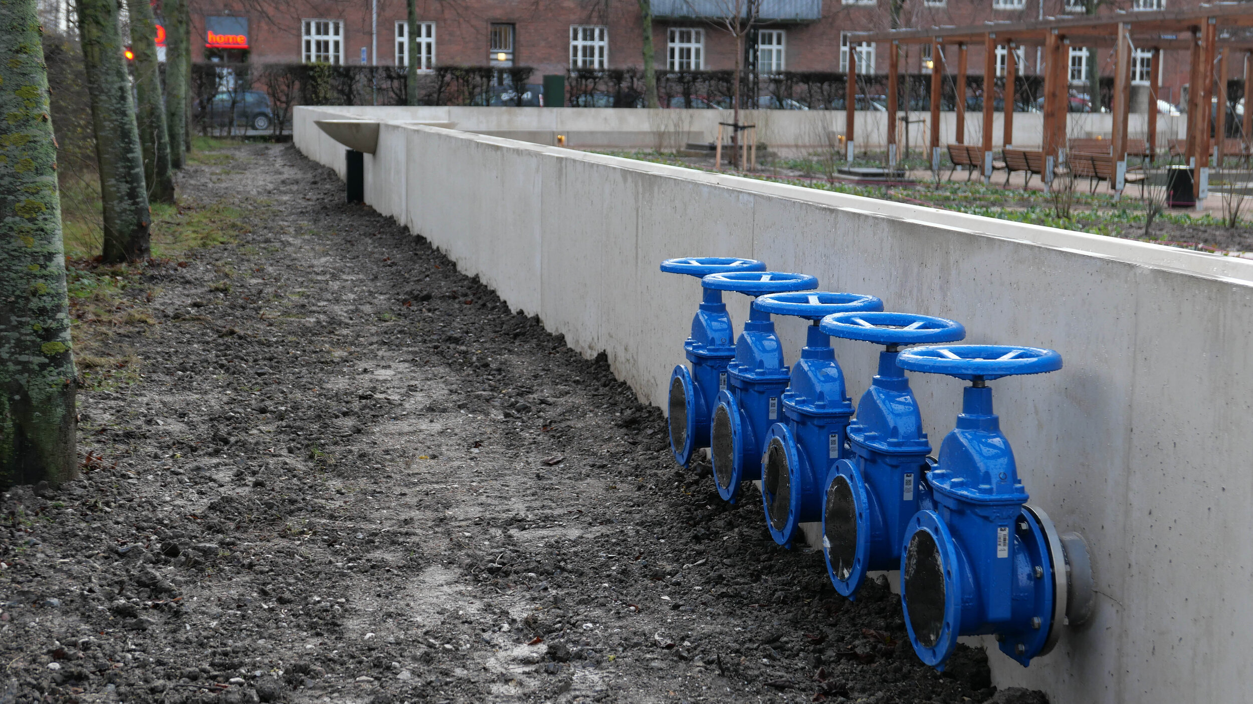
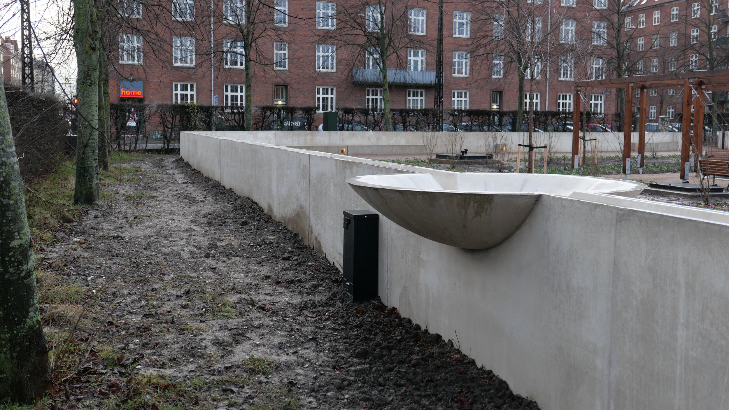
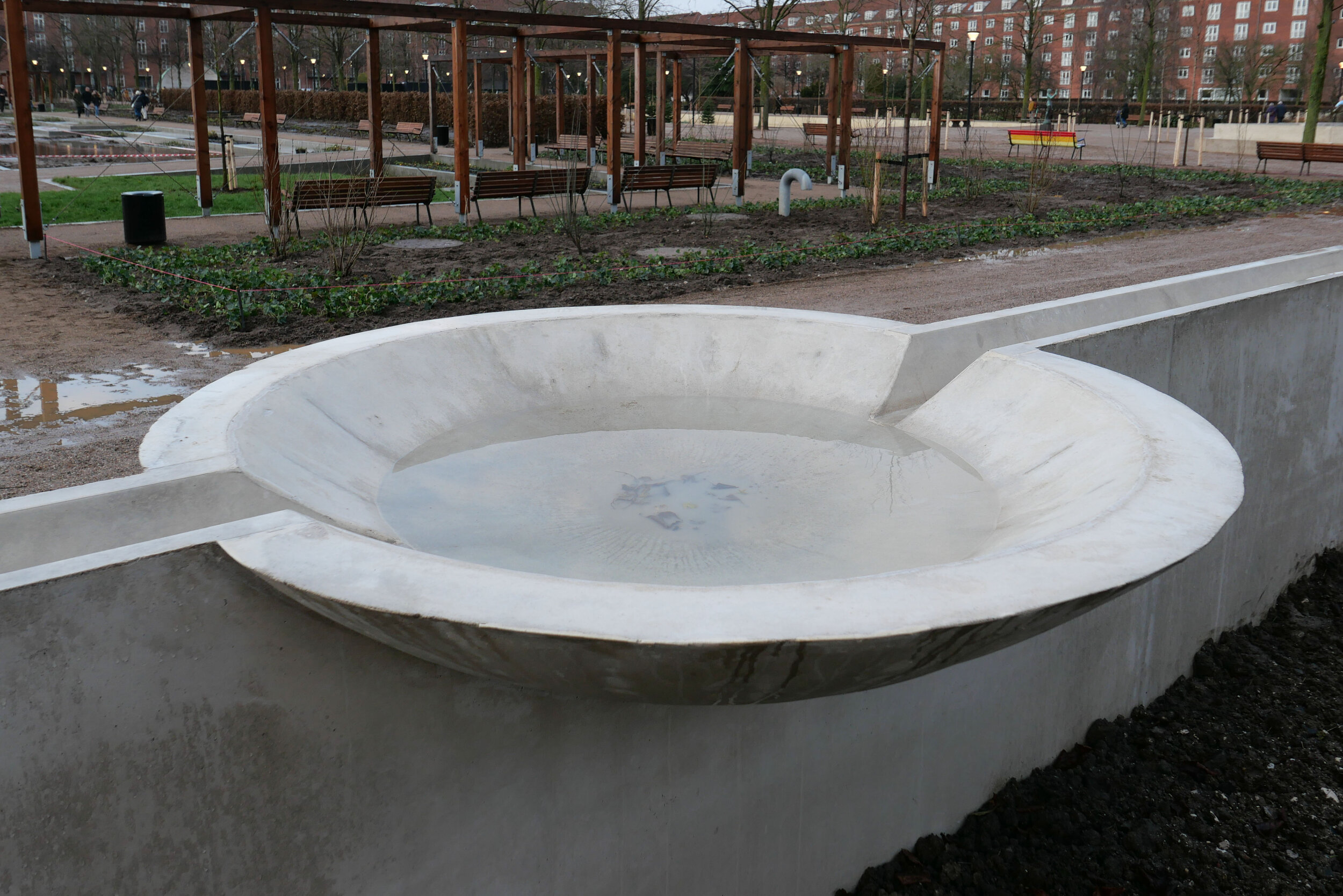
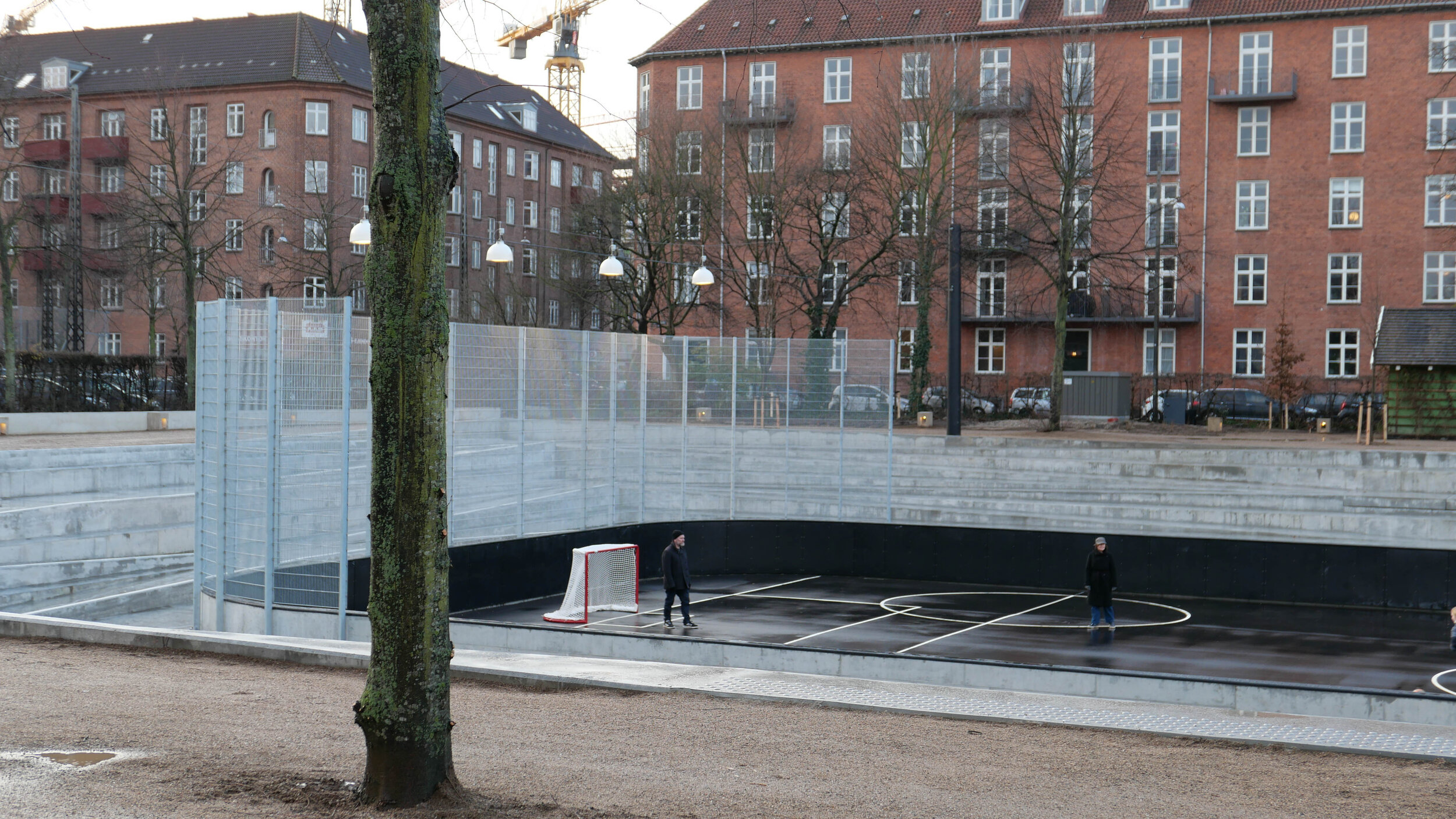
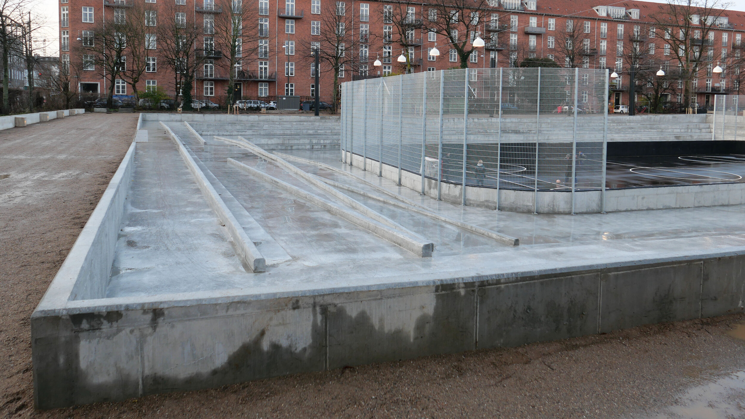
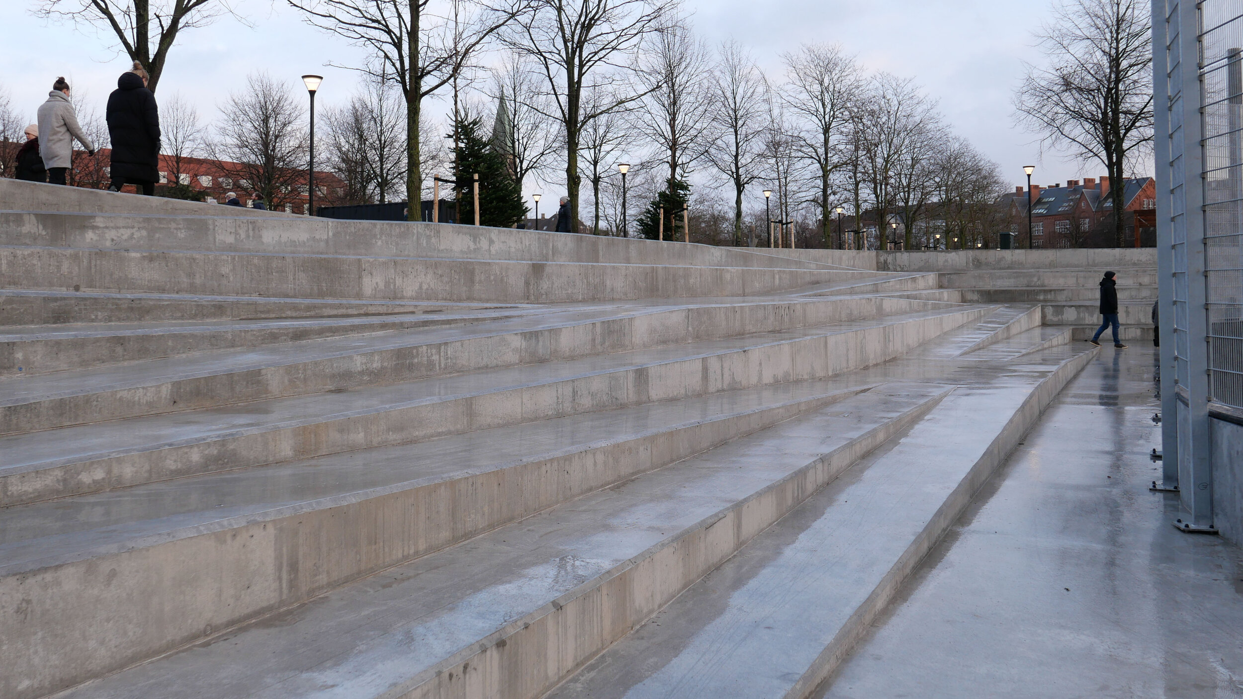
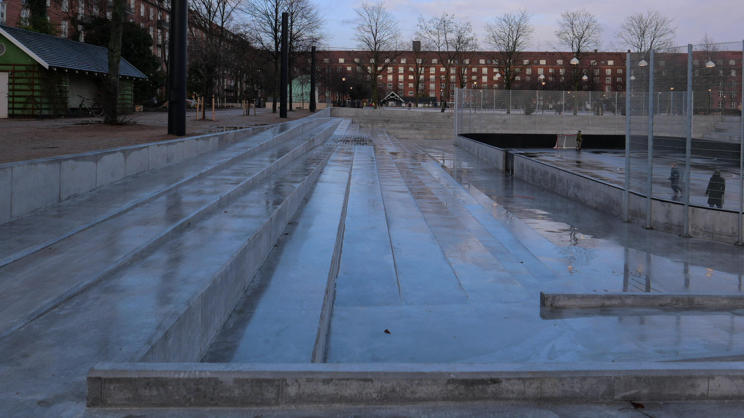
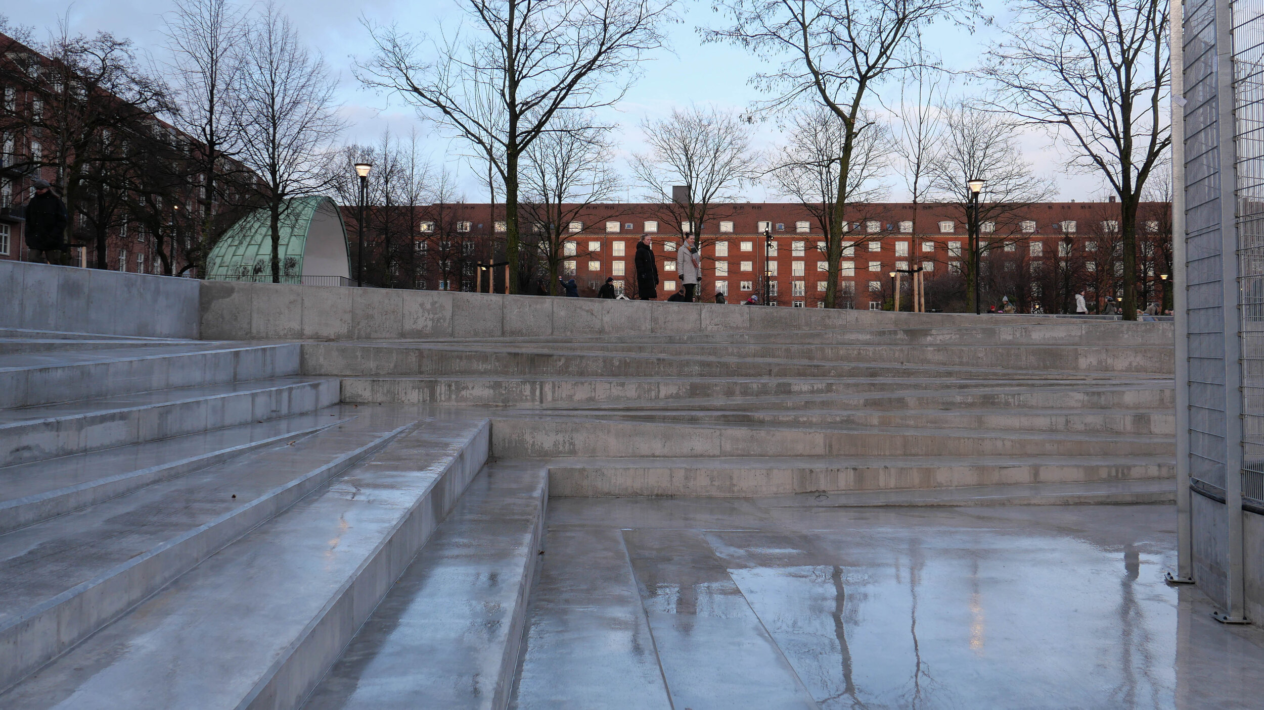
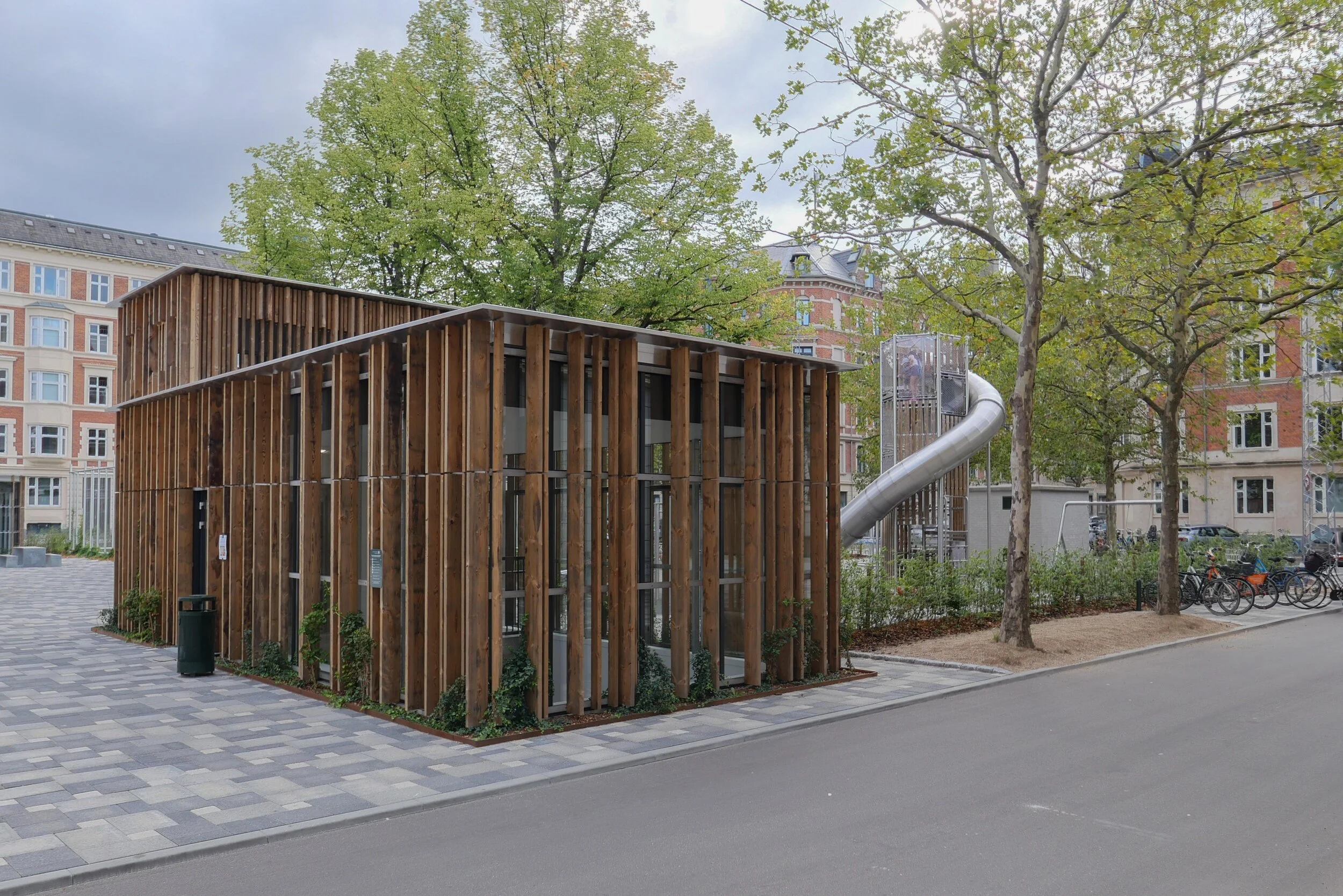
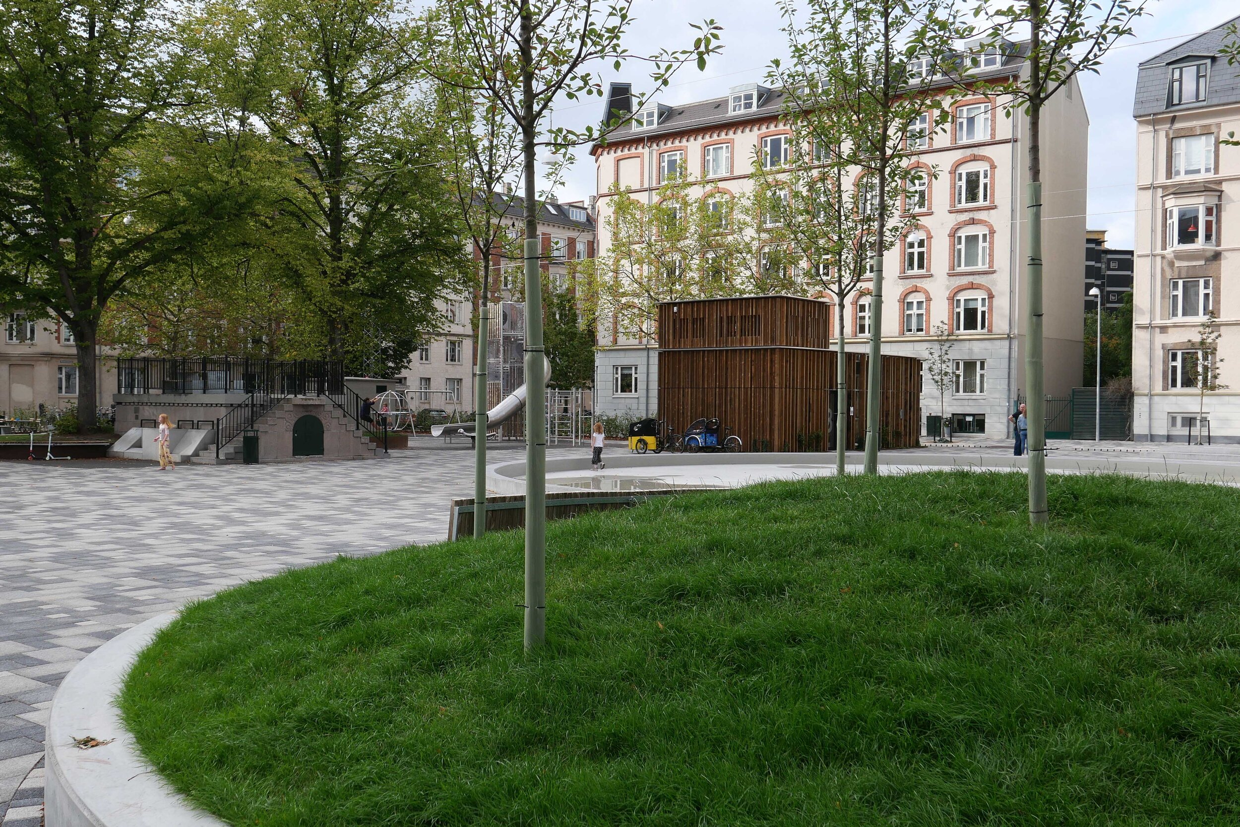
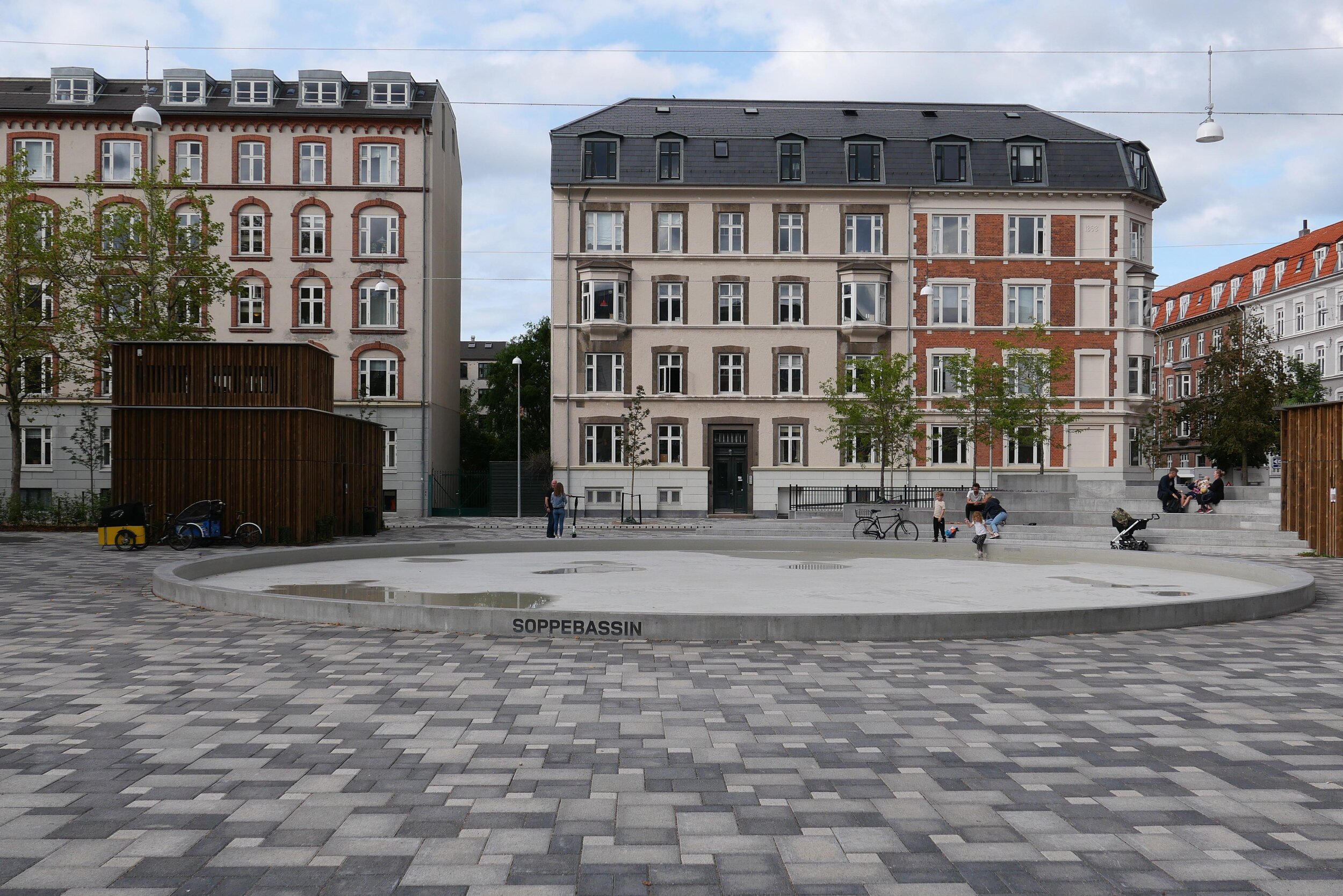
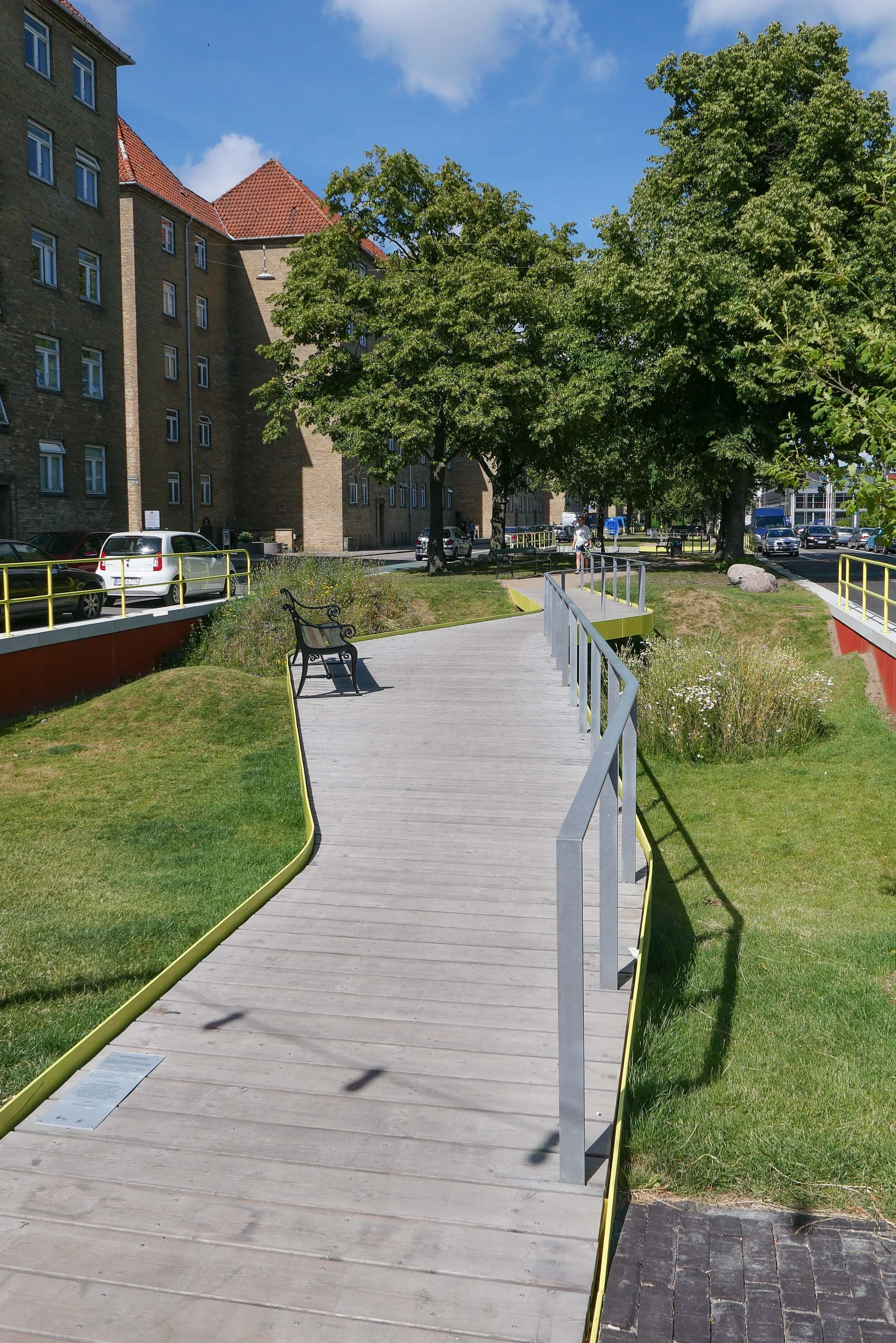
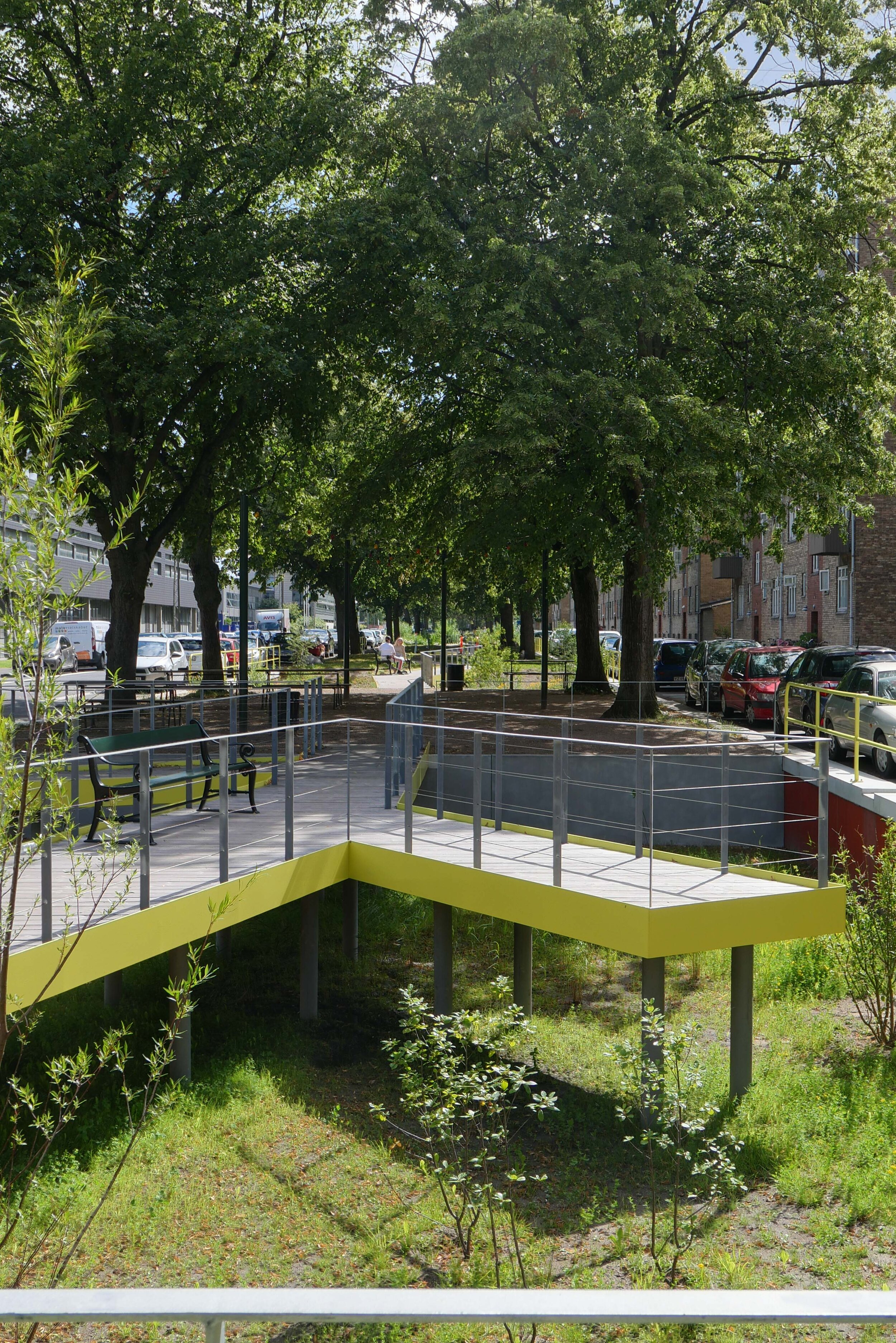
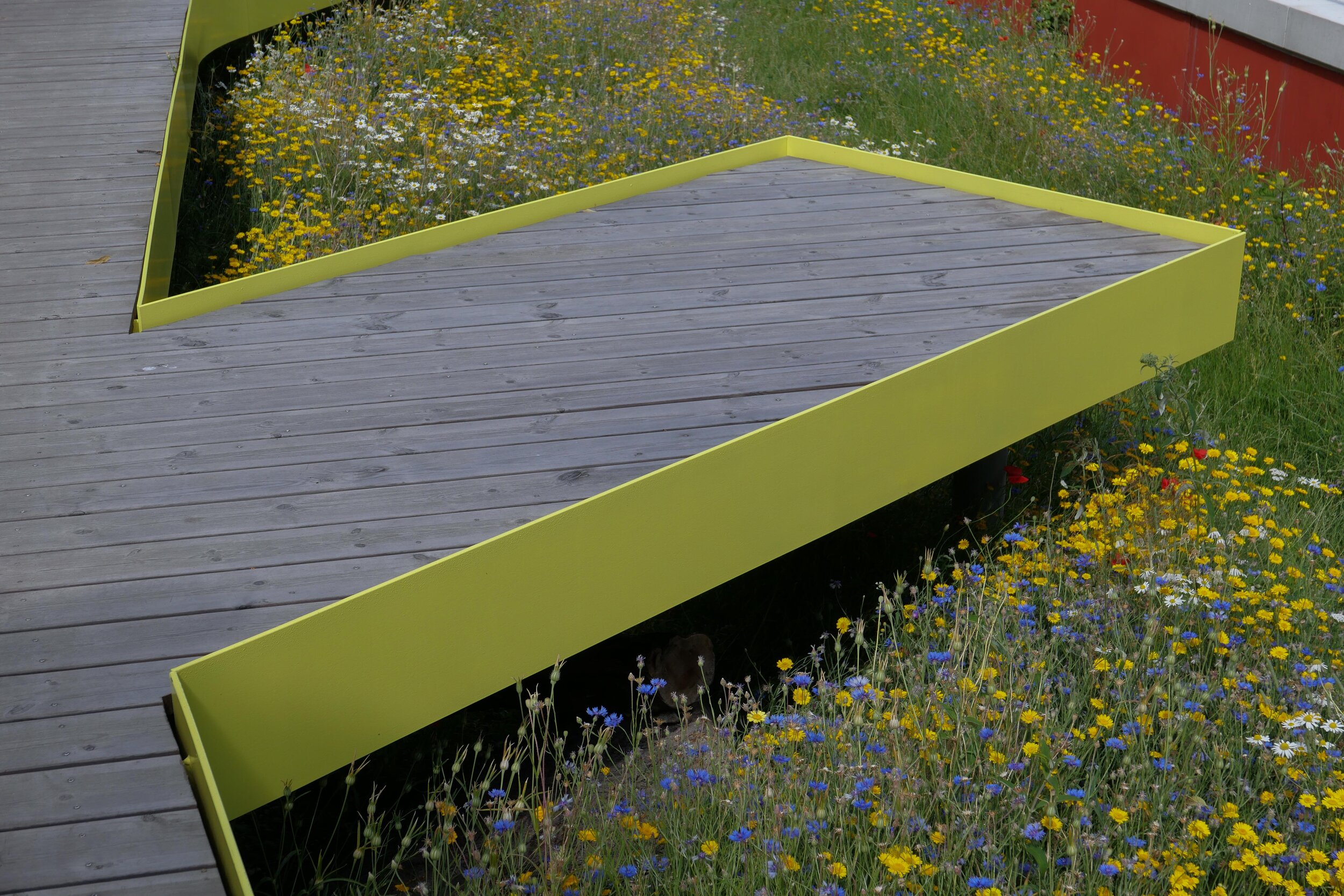
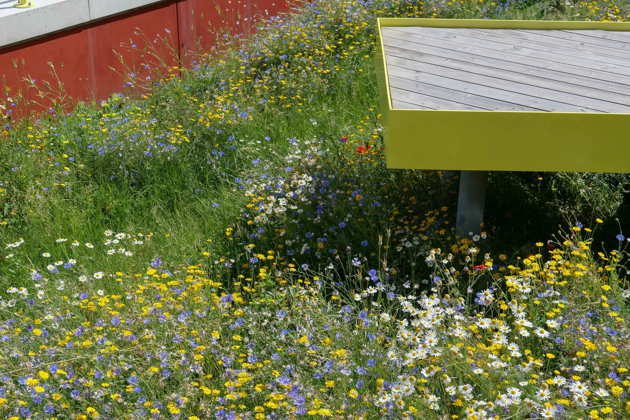
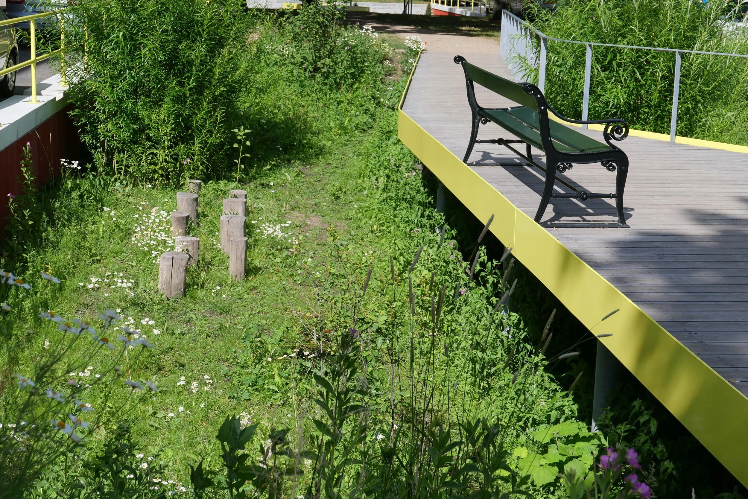
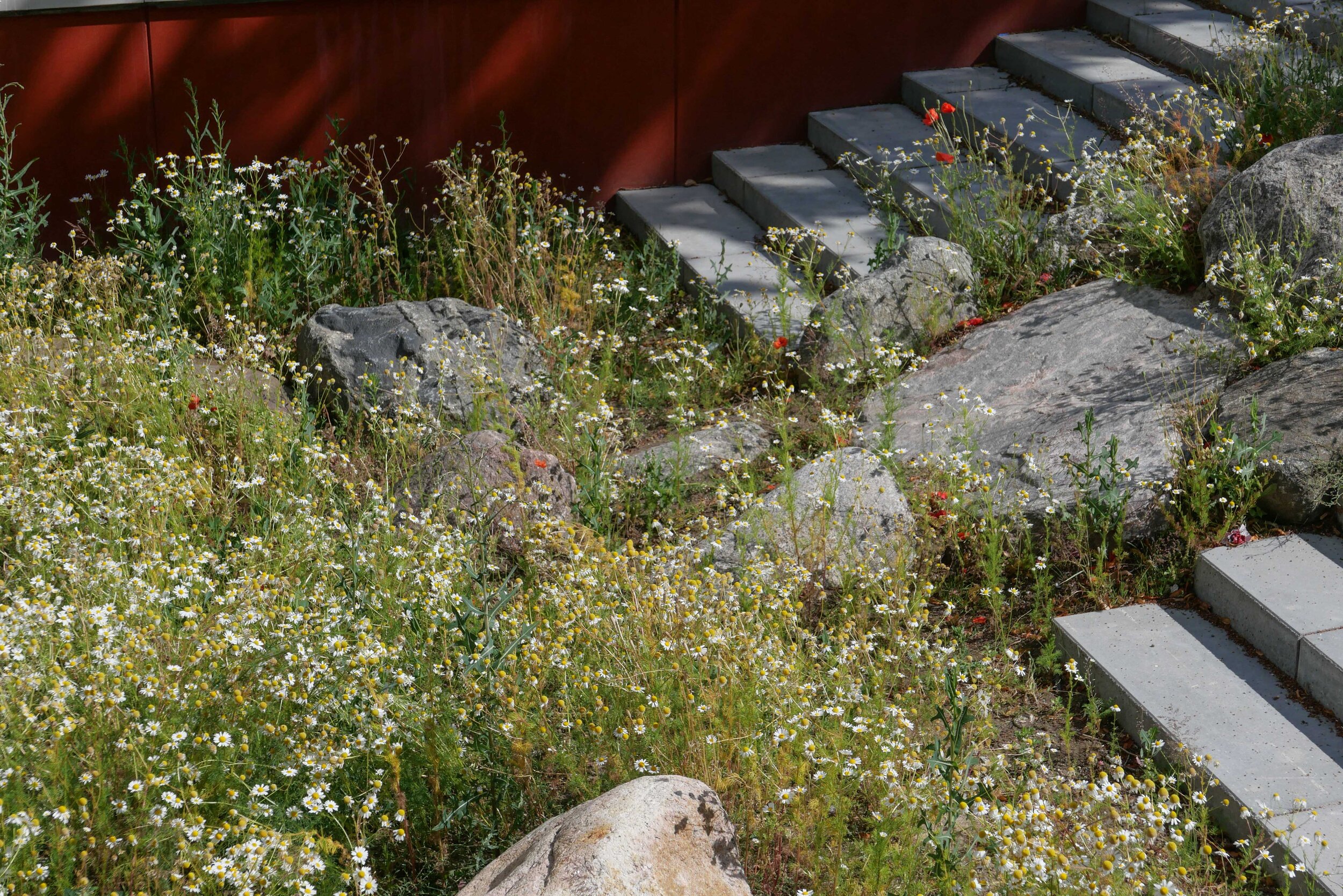
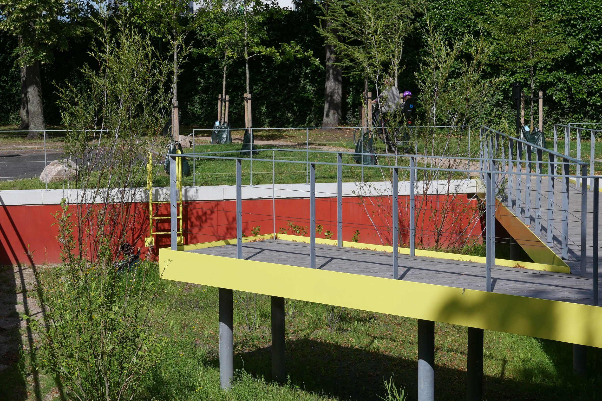
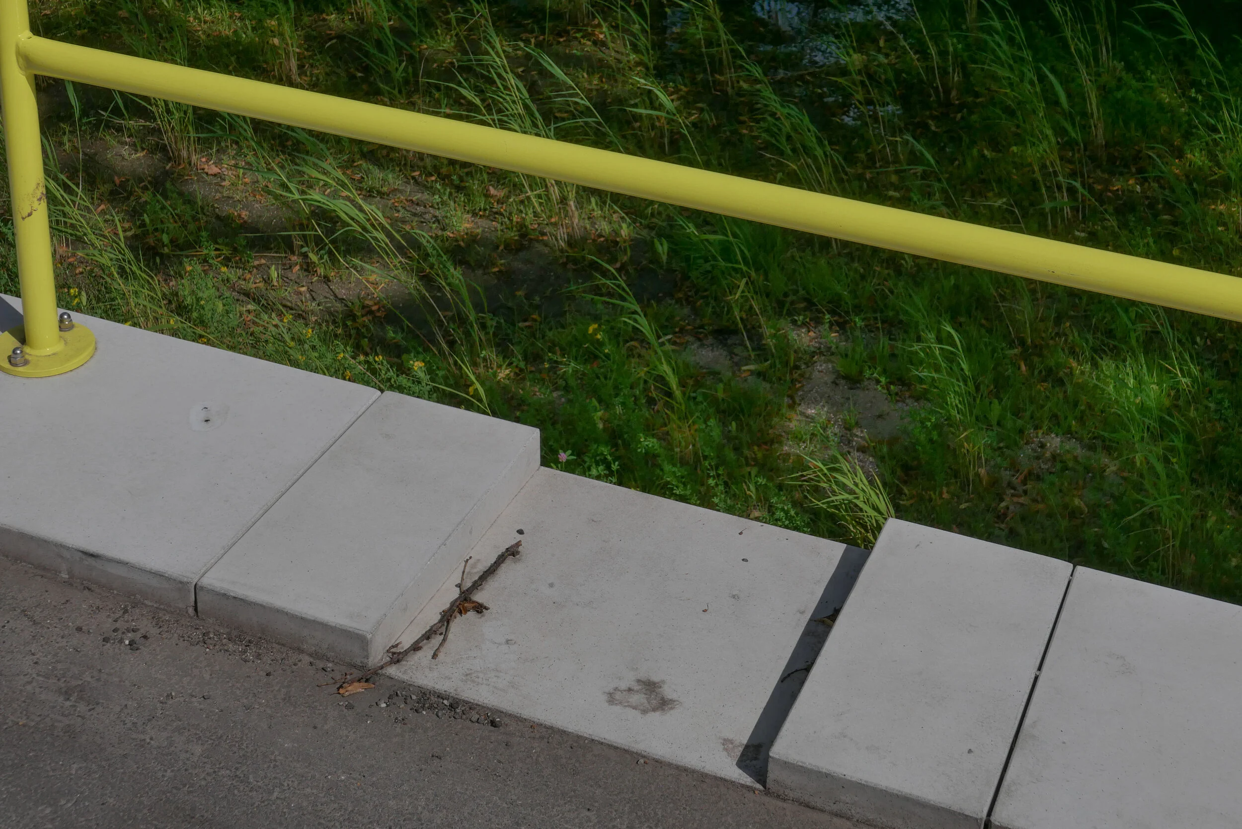
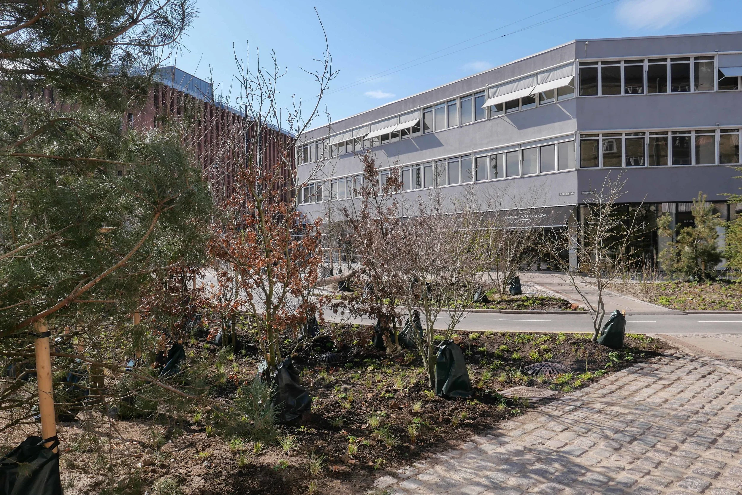
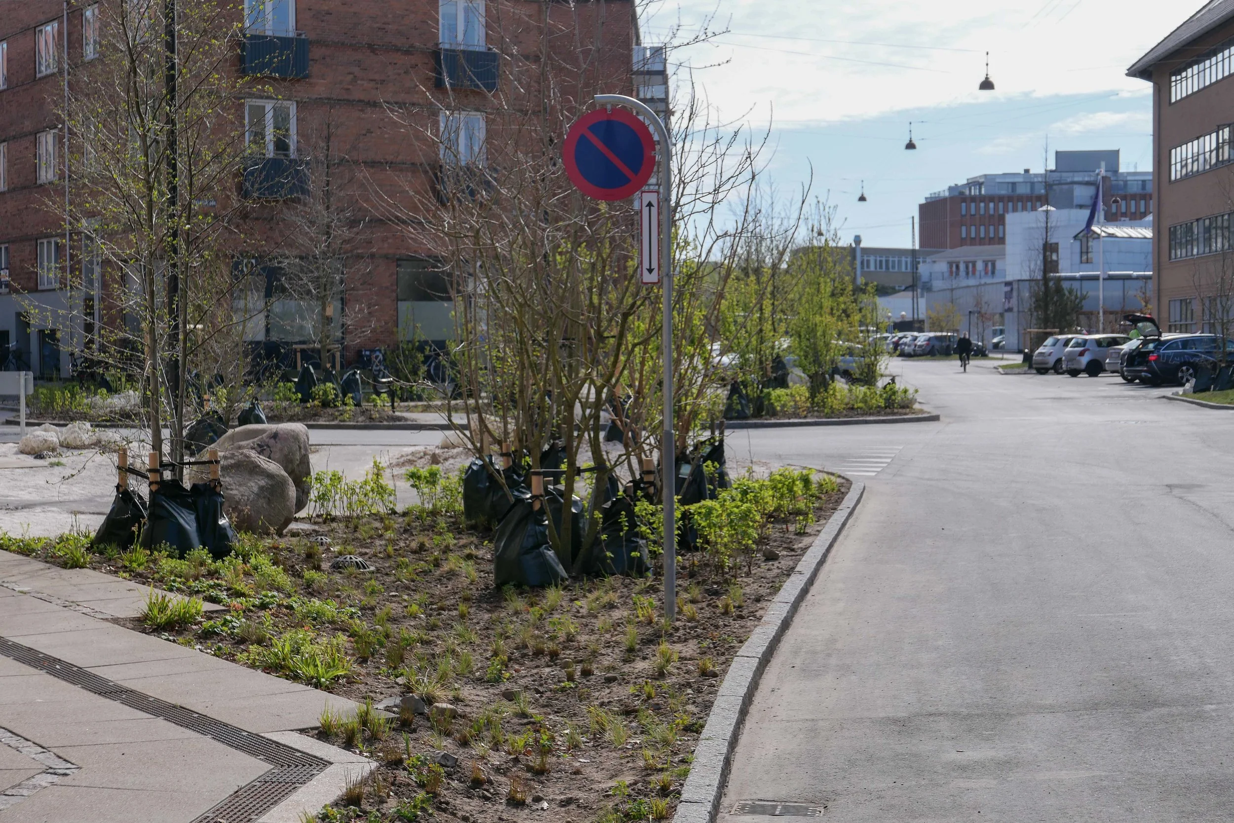
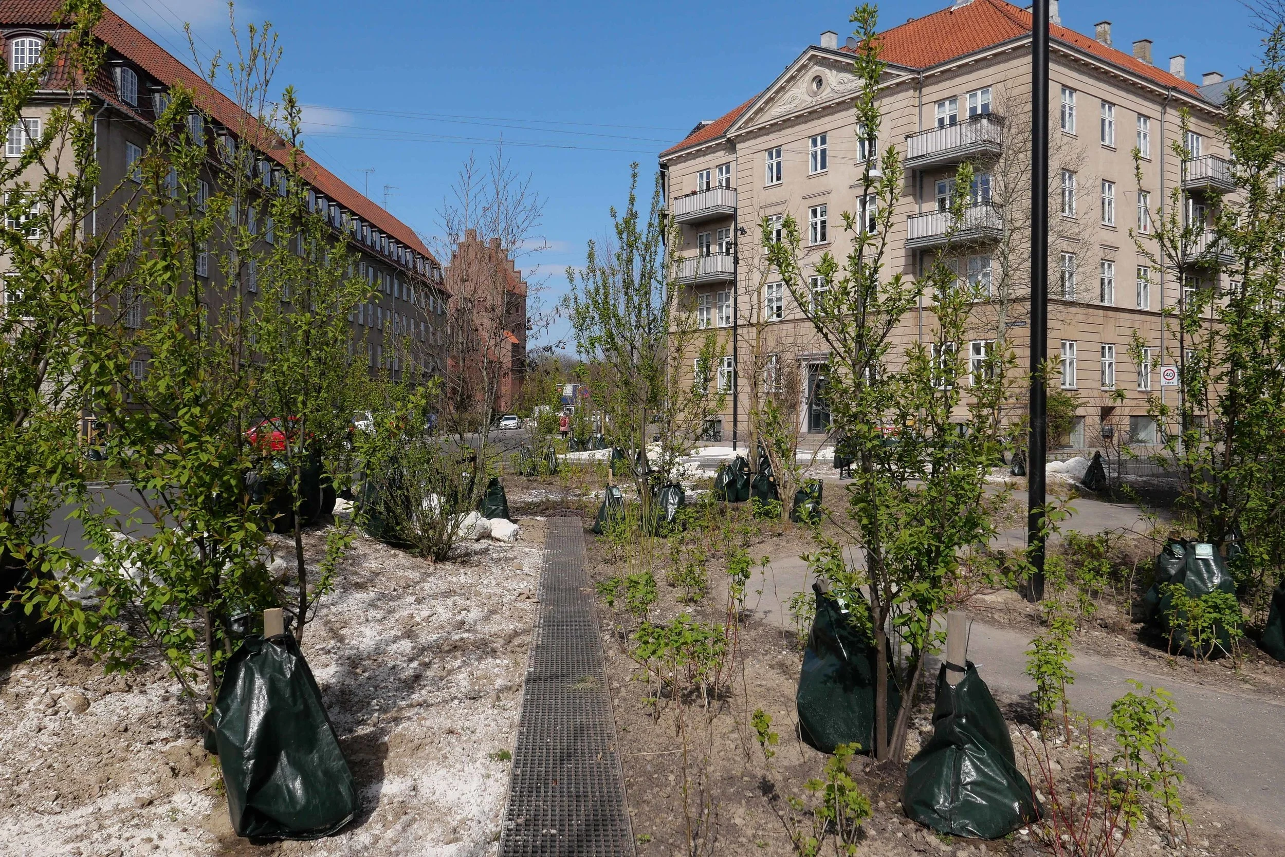
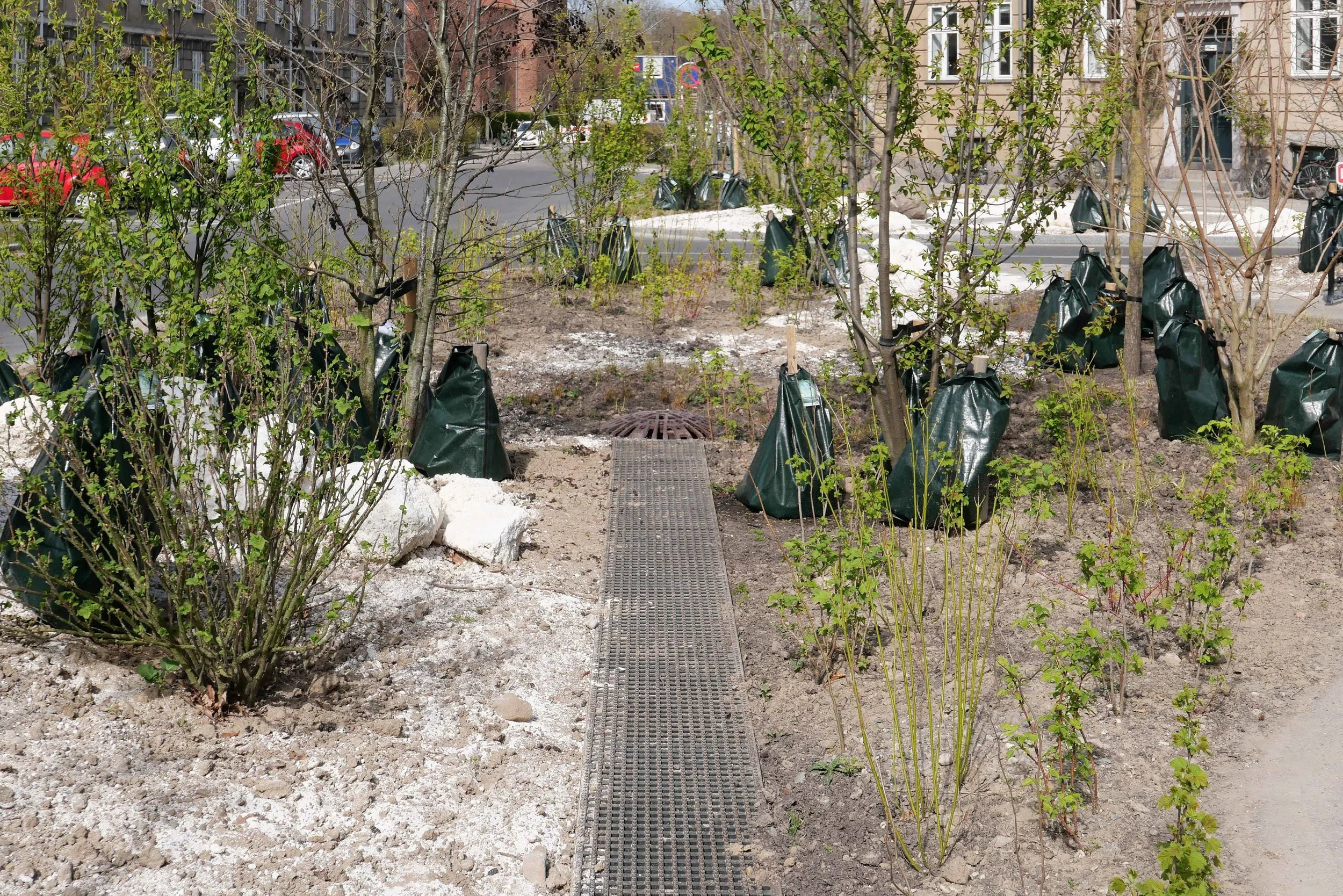
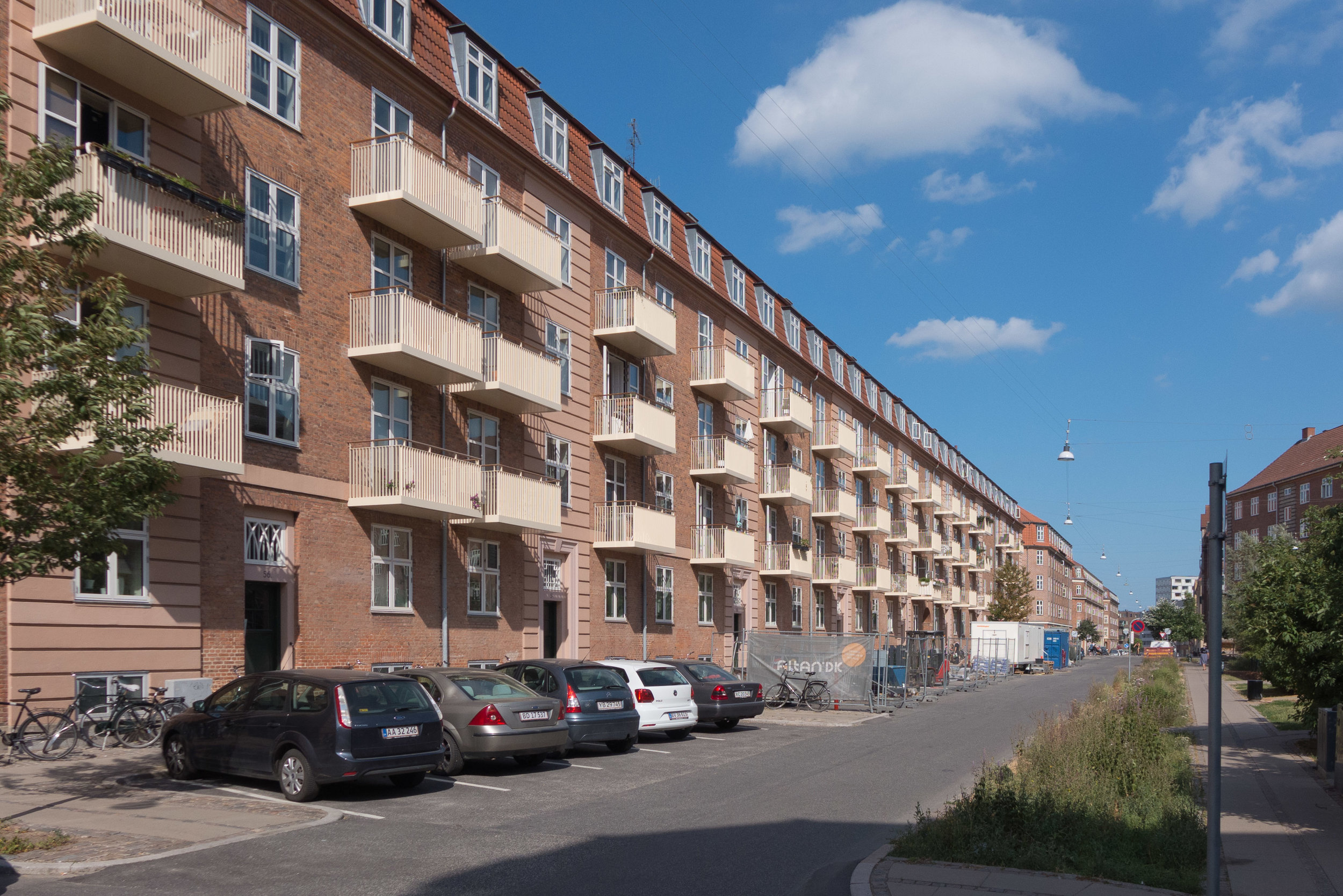
In Køge - an historic port 35 kilometres south west of Copenhagen - an extensive redevelopment of a former industrial site will have the edges raised to protect not only new housing but also protect the historic centre. A ridge across the site will direct water back down into the development which might sound counter intuitive but rain-storm water can then be controlled. Flood water will be held back in the streets and courtyards to protect sewers and drains. As in Fredericia, there will be steps down to the water and meadow beyond the flood defence - so access to the natural landscape is retained - and the new housing will be raised up above service basements with parking underneath so streets can be free of parked cars and can be planted to bring nature into the urban area.

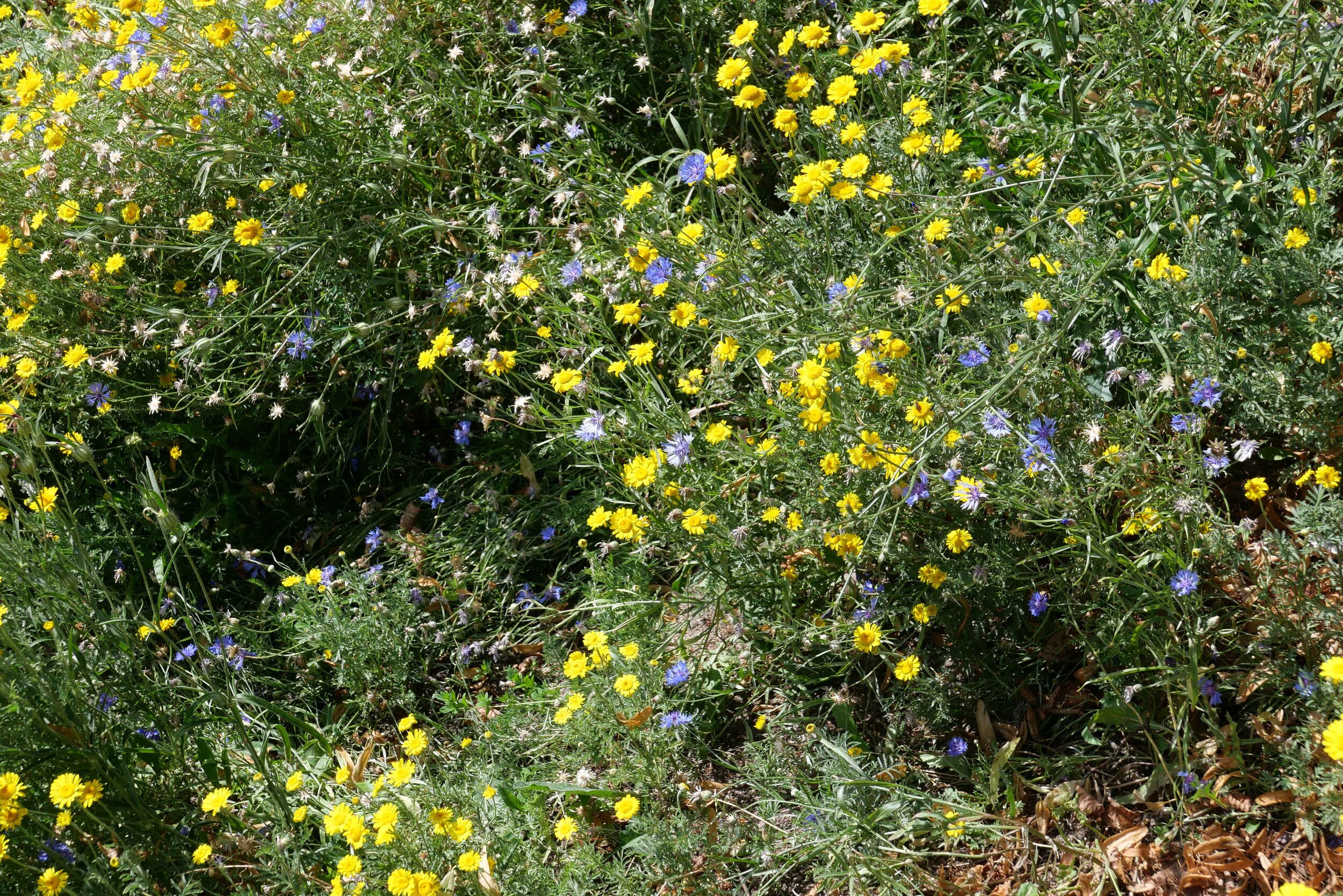
A distinct feature of the project at Ringkøbing is that an area or streams and lakes is being constructed first on what has been agricultural land to form an open natural area for drainage before a low-level development with 1,000 new houses is constructed. Here, the climate mitigation scheme is described as 'future proofing'.

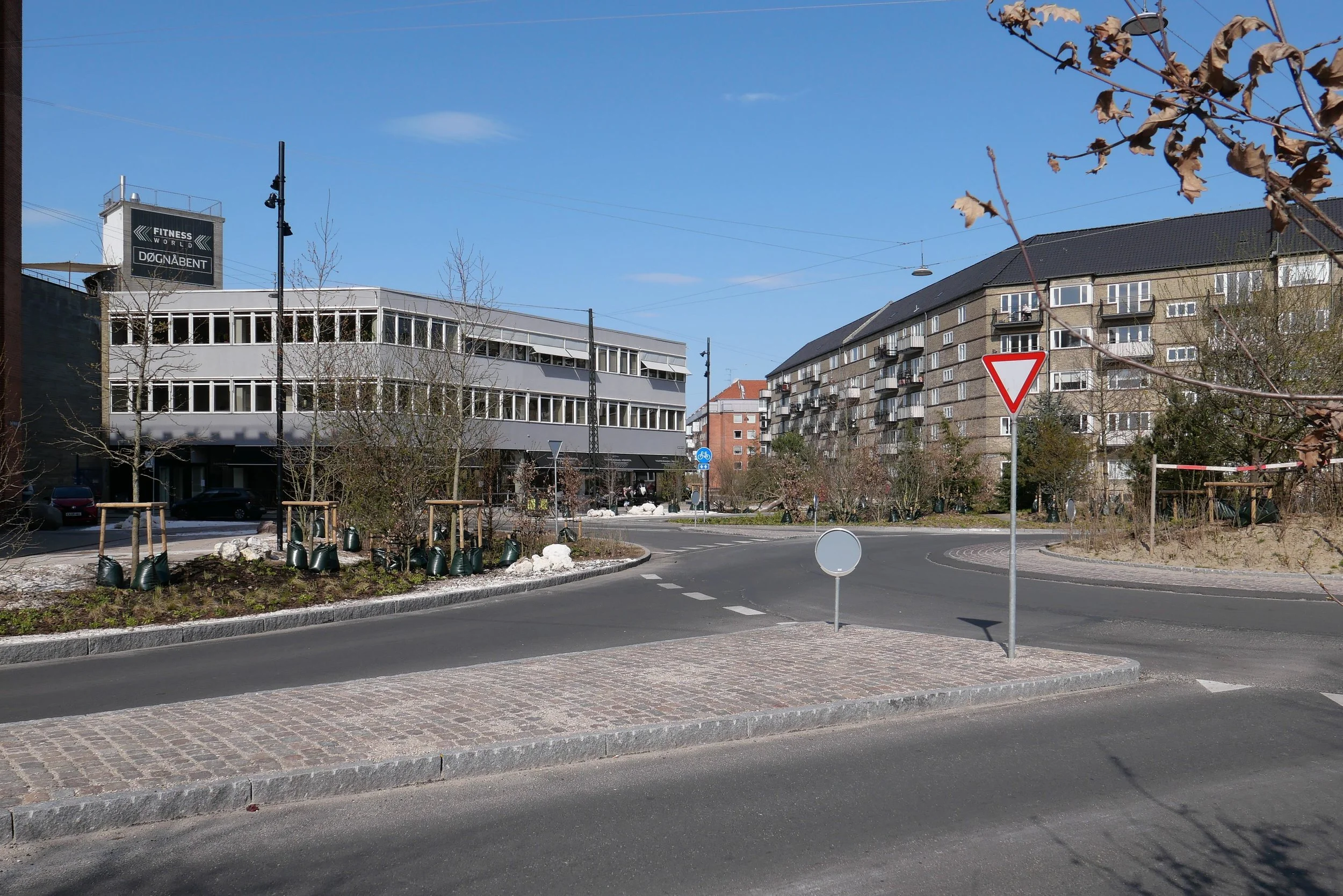
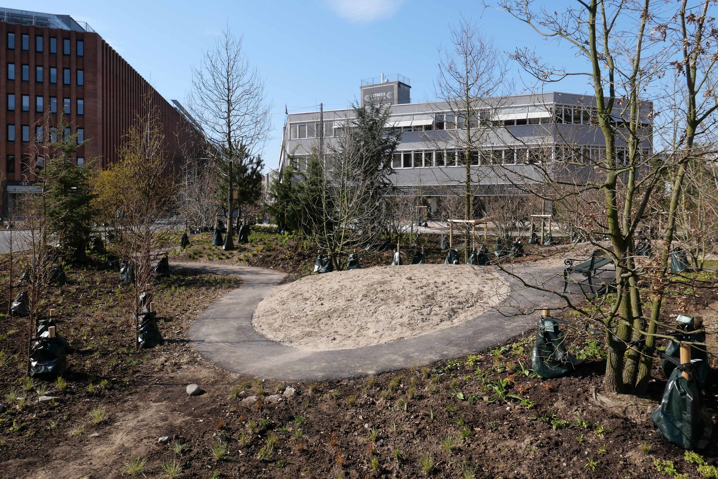
NærHedens is a development on 65 hectares south of Hedehusene station - a settlement just over 20 kilometres - west of Copenhagen -close to Roskilde - where there will be 3,000 new homes for about 8,000 people.

Ole Møller, the project director, explains that “cities face some major challenges when it comes to adapting to a harsher climate. But there are some possibilities in using the water recreationally. It is about getting the rainwater away to protect physical values ​​- and about keeping it to increase recreational values. This requires a great deal of analysis work, where you have to deal with soil, landscape, subsurface conditions and much more. The task is simple, but the solutions can be a bit complex.

It is hoped that the development will become a role model for future suburban development where nature becomes an integral feature of living in a neighbourhood and an important part of social life.

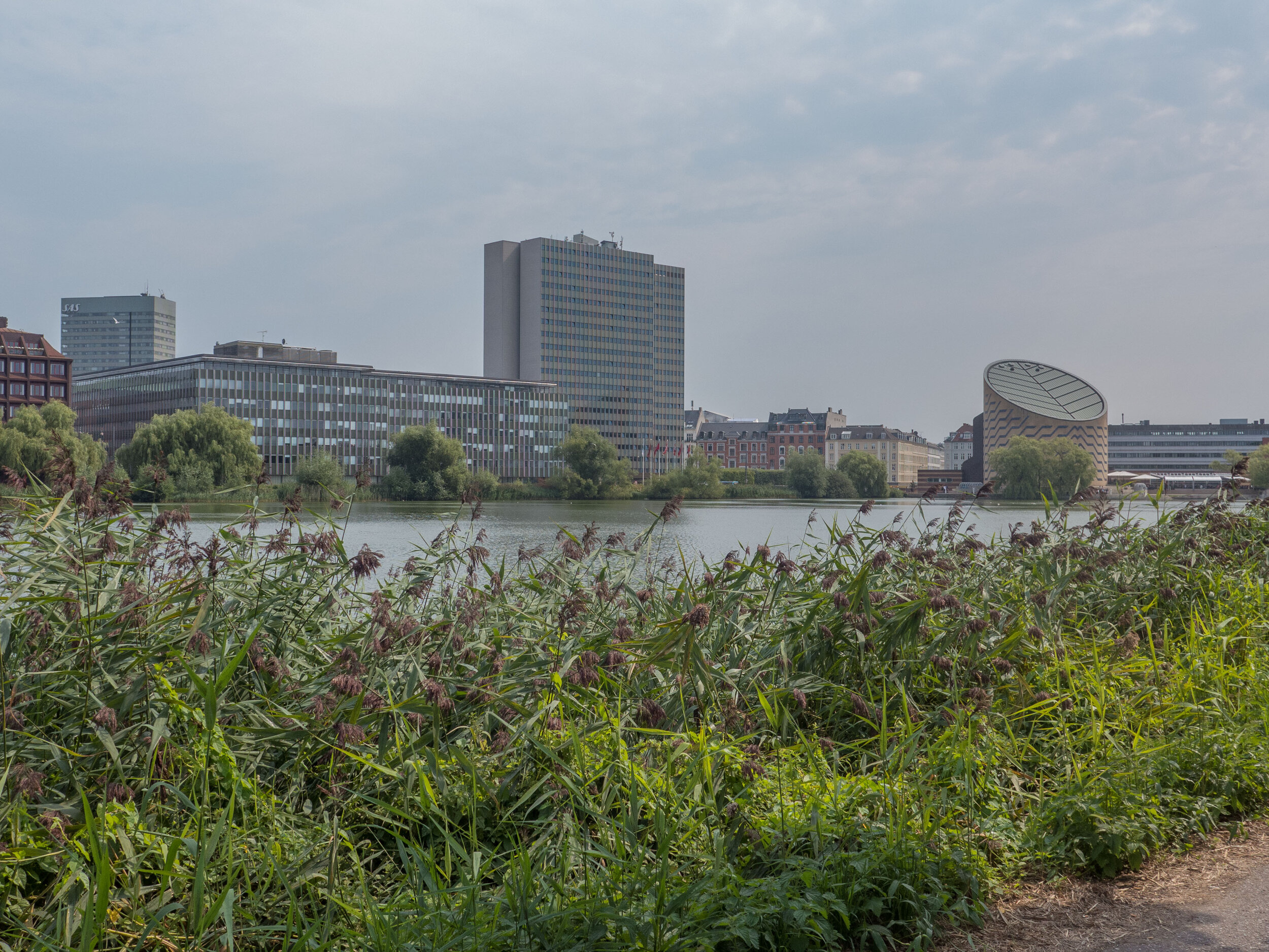
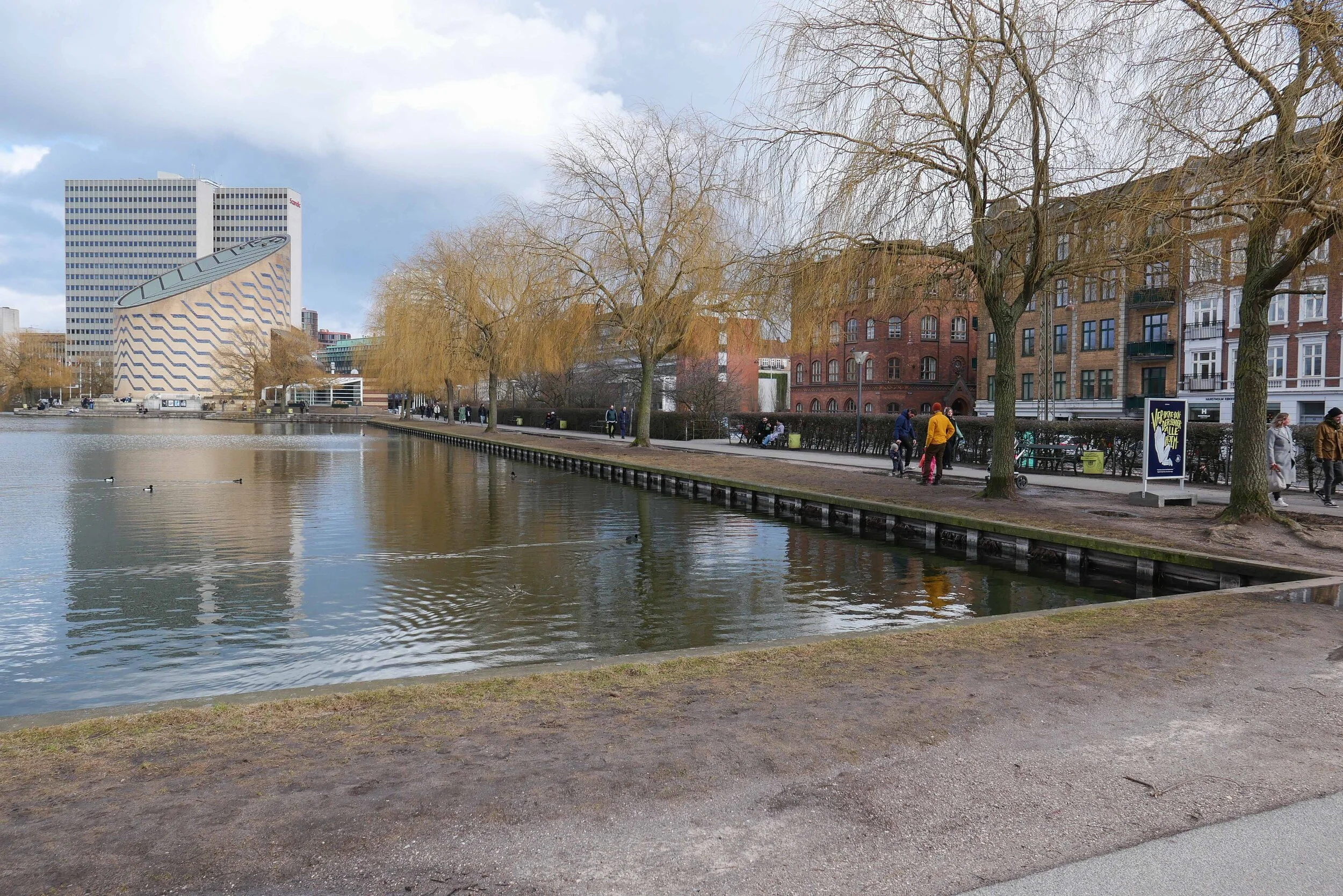
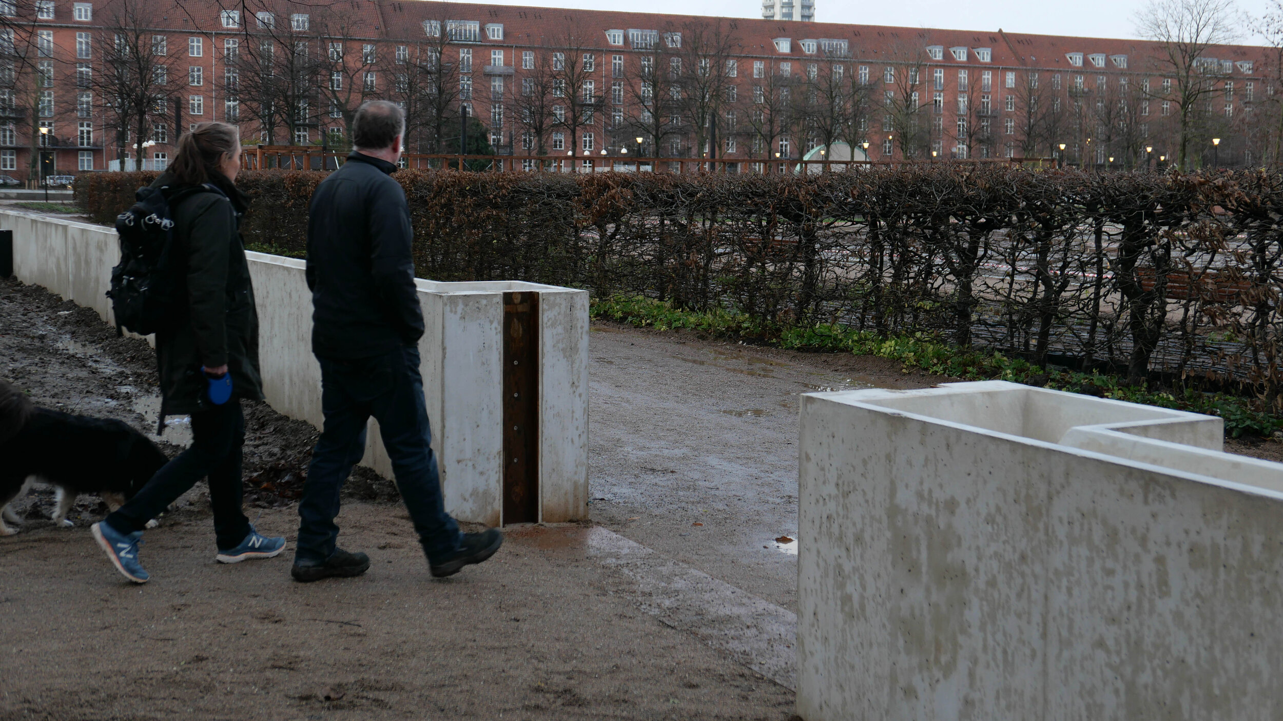
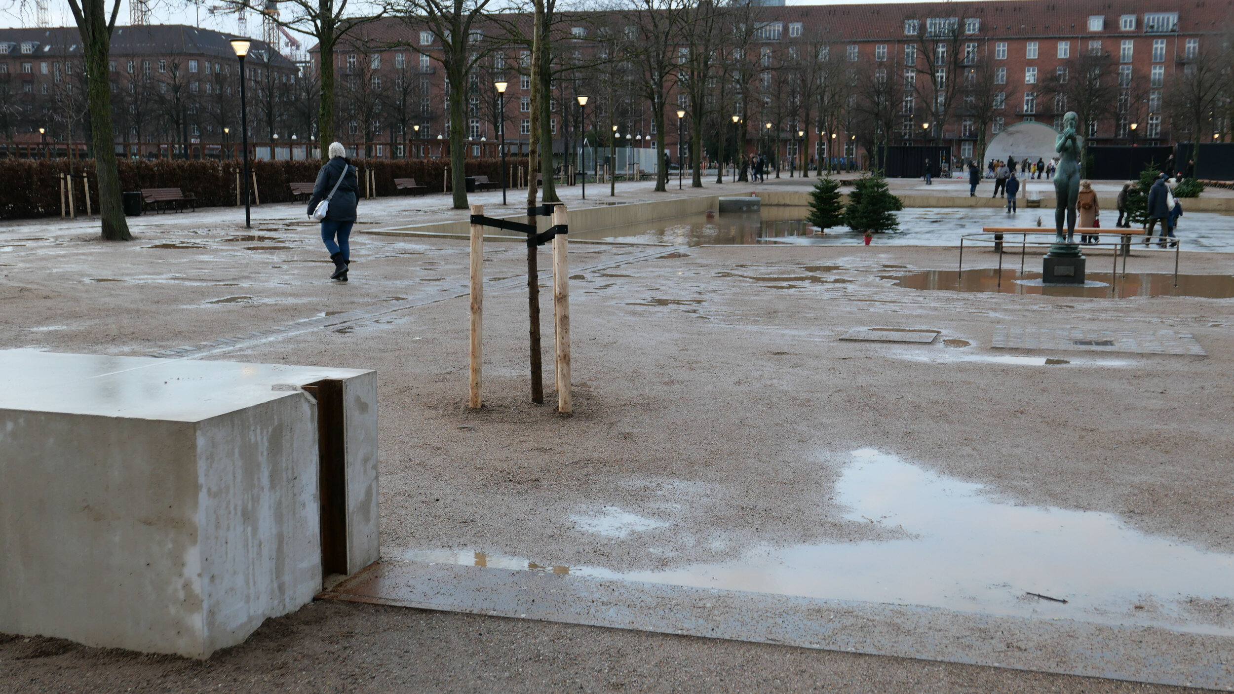
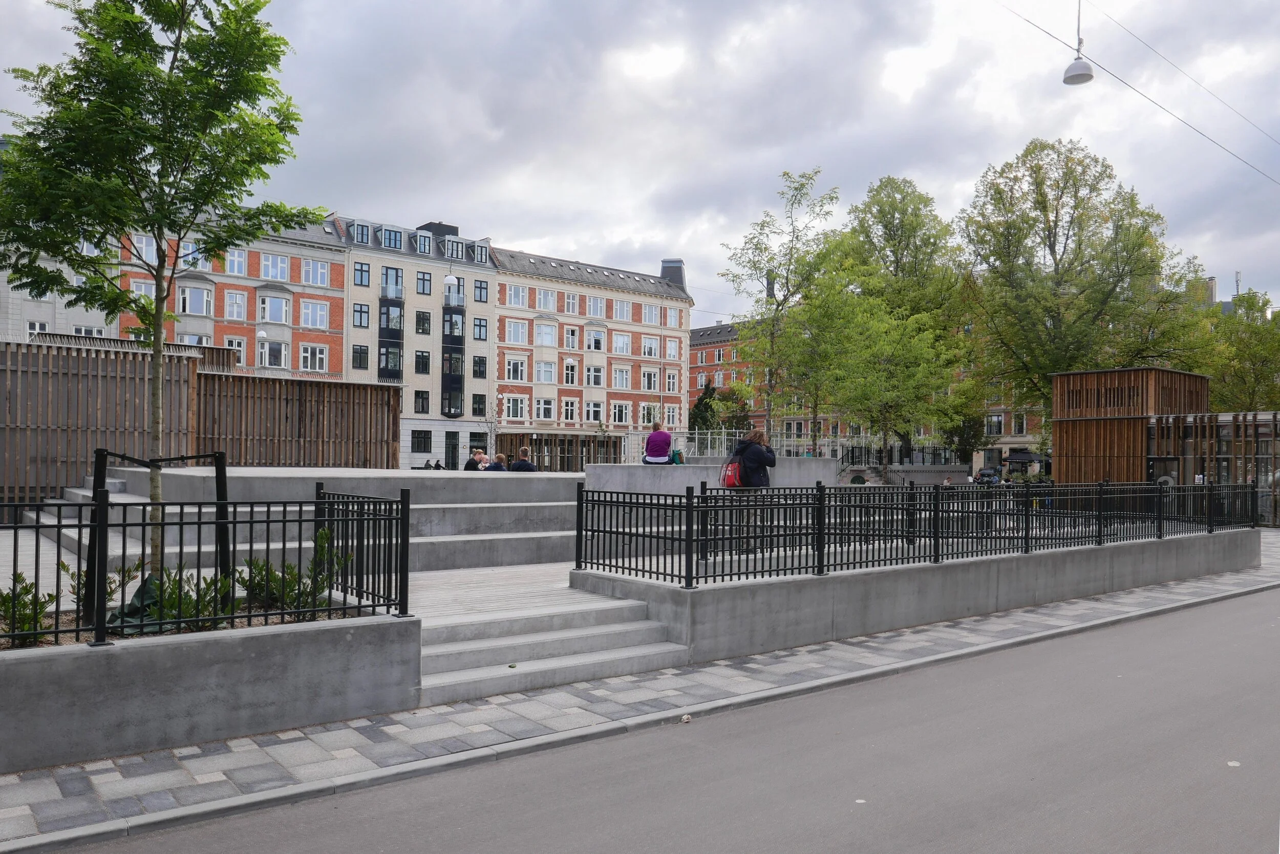
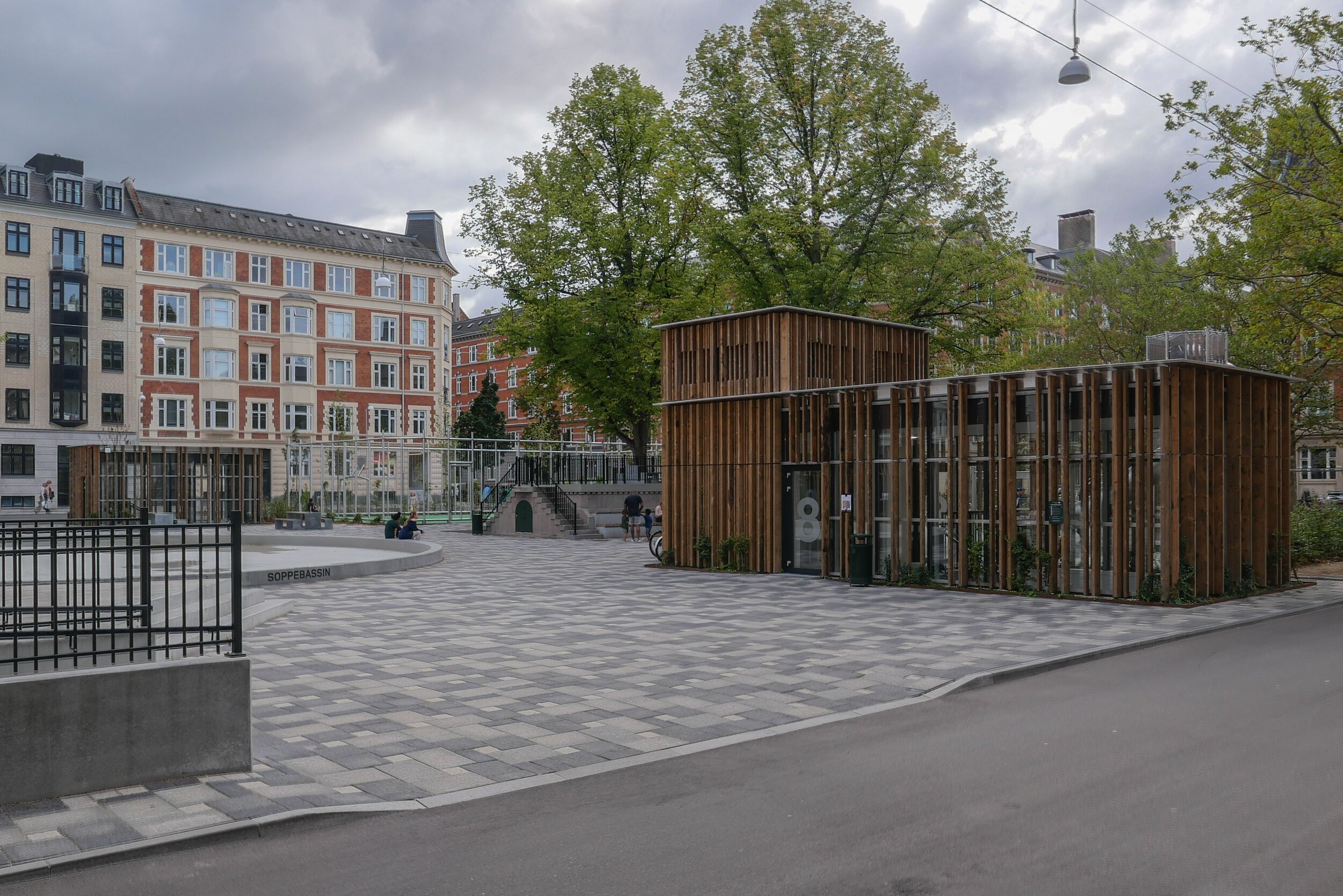
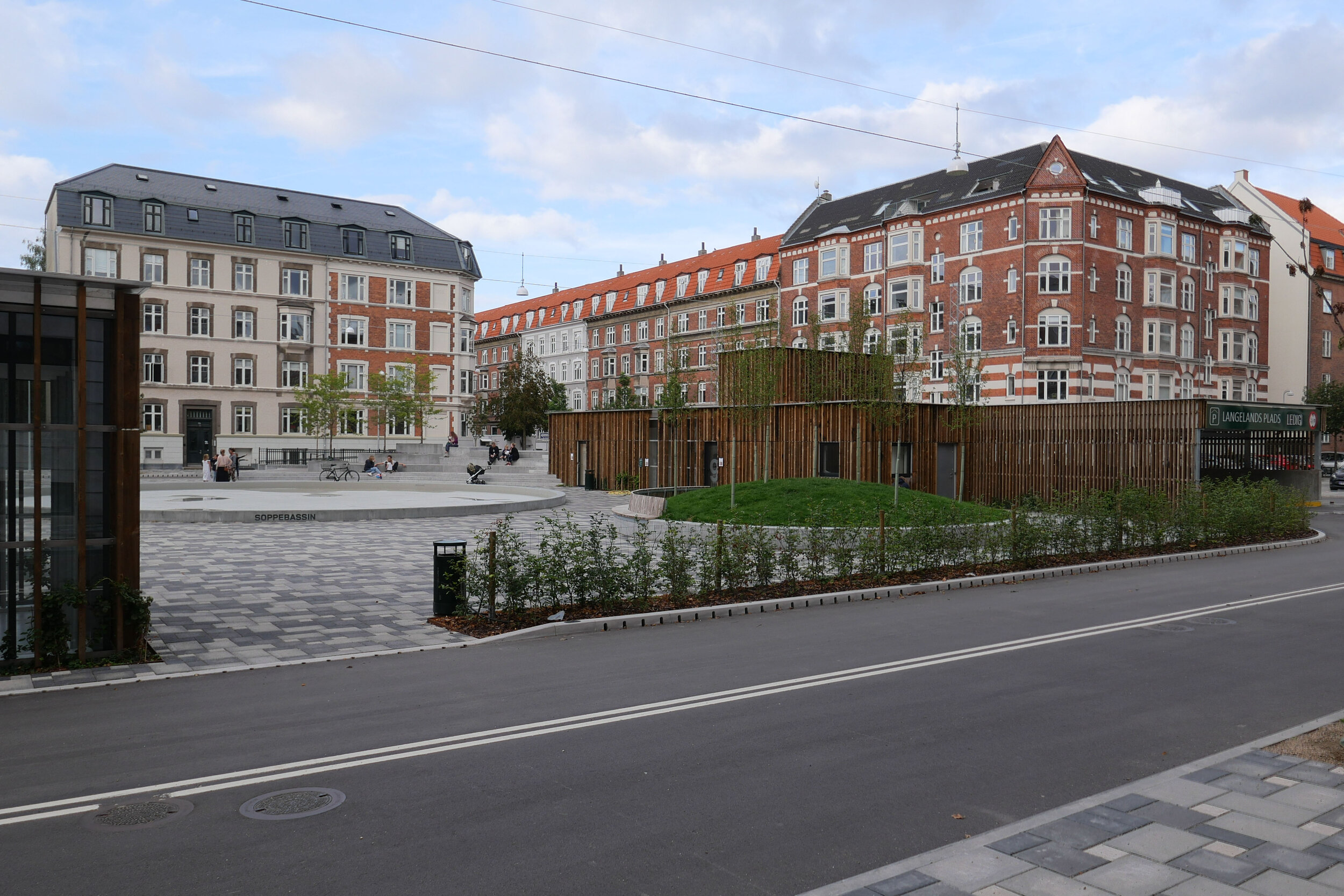
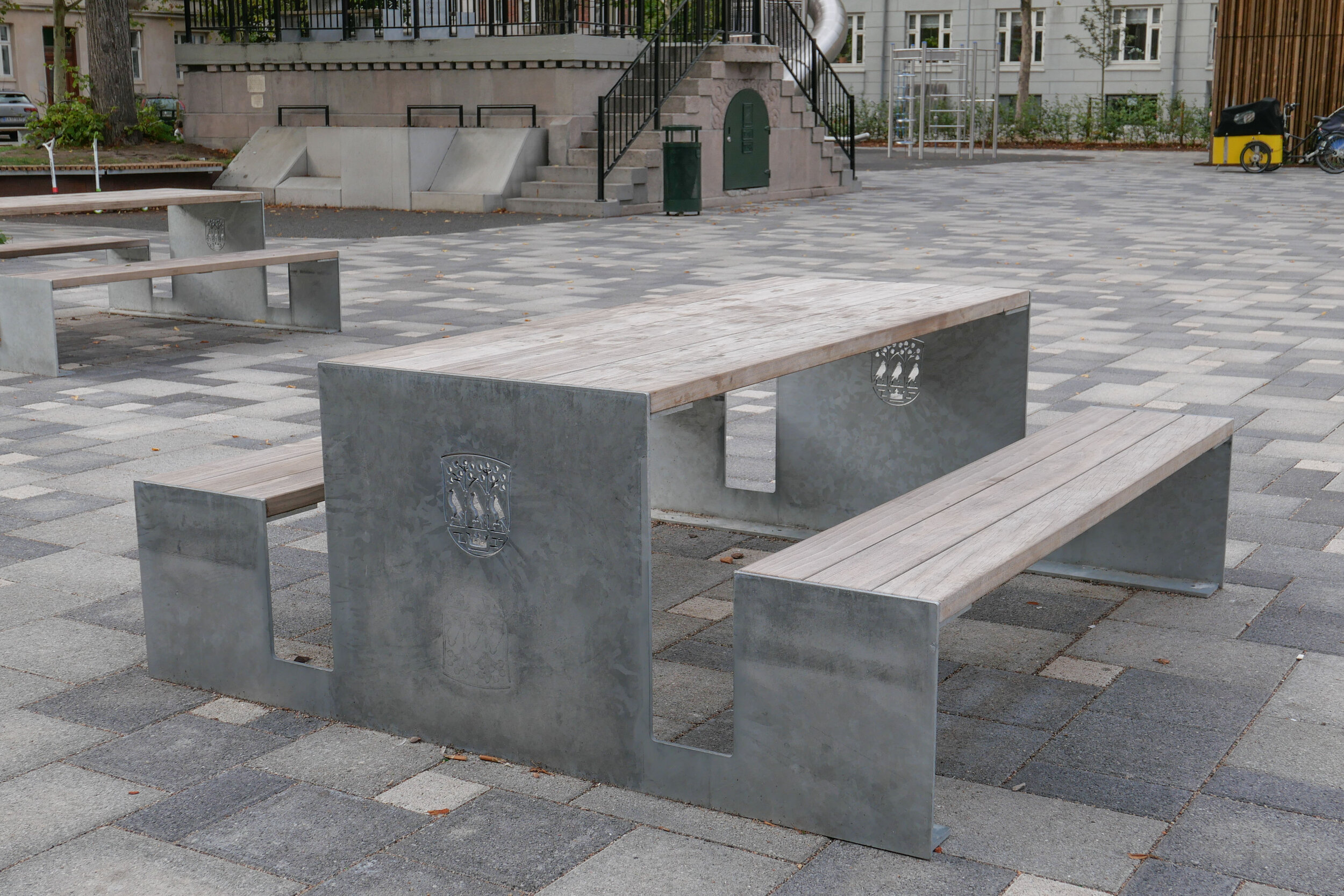
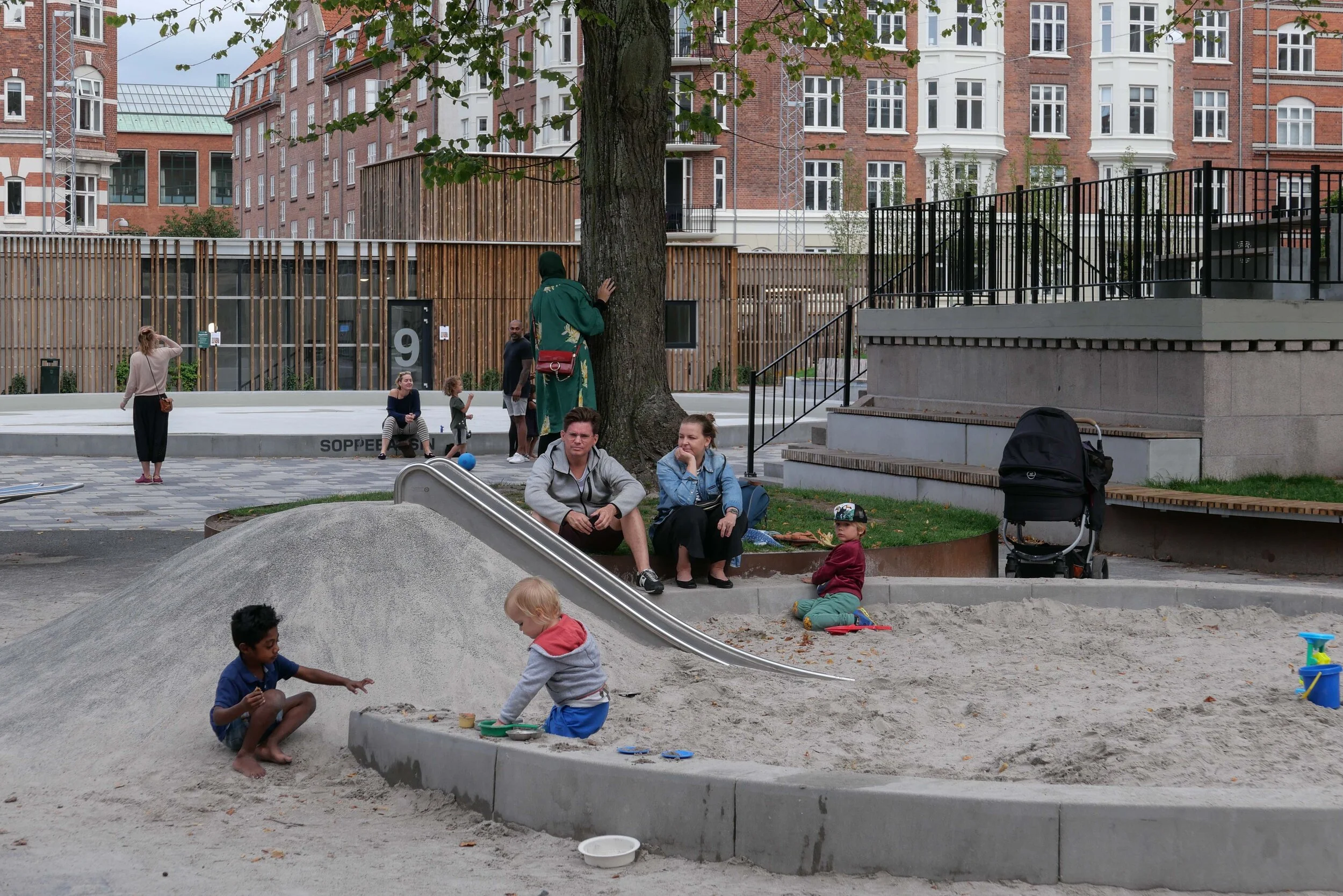
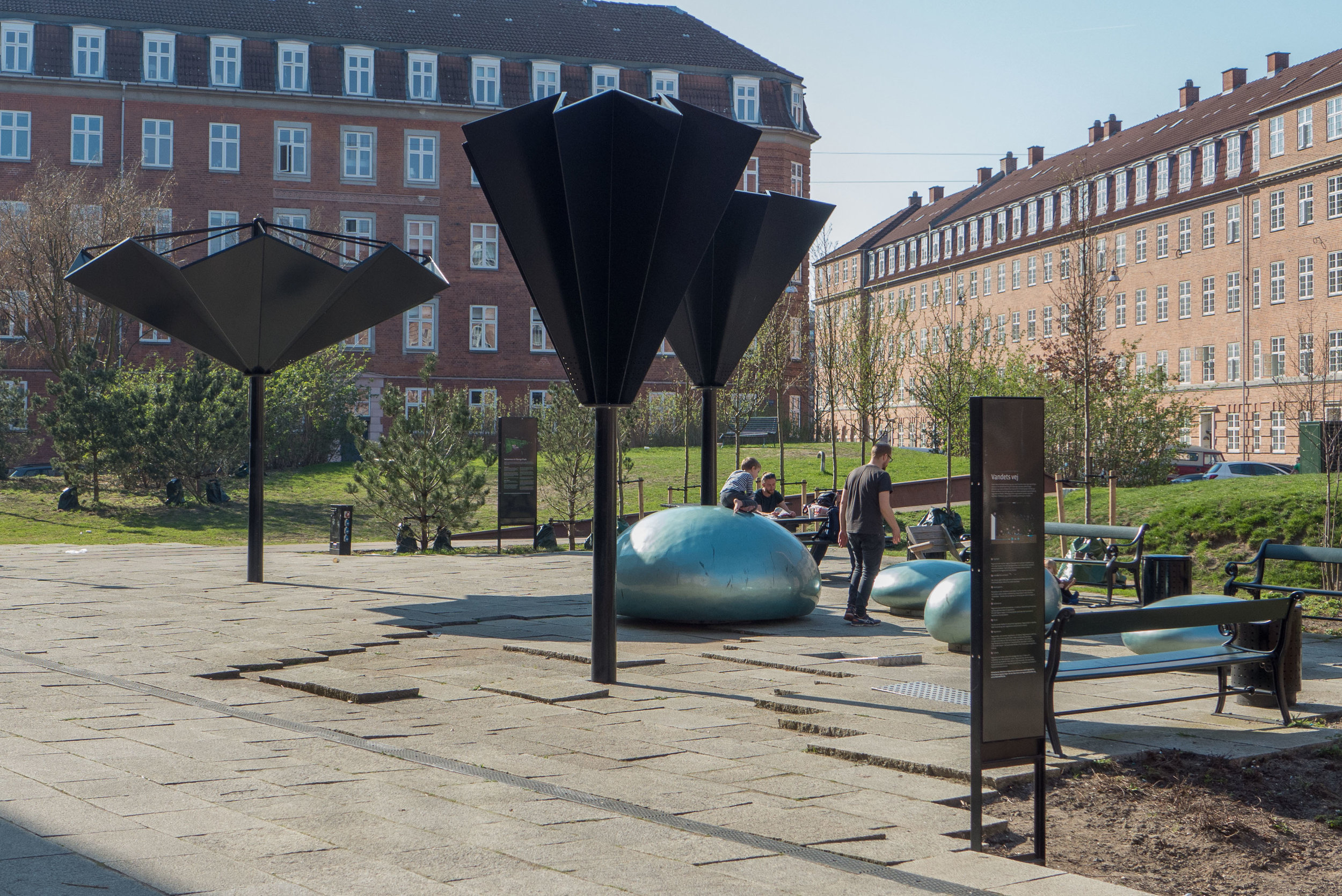
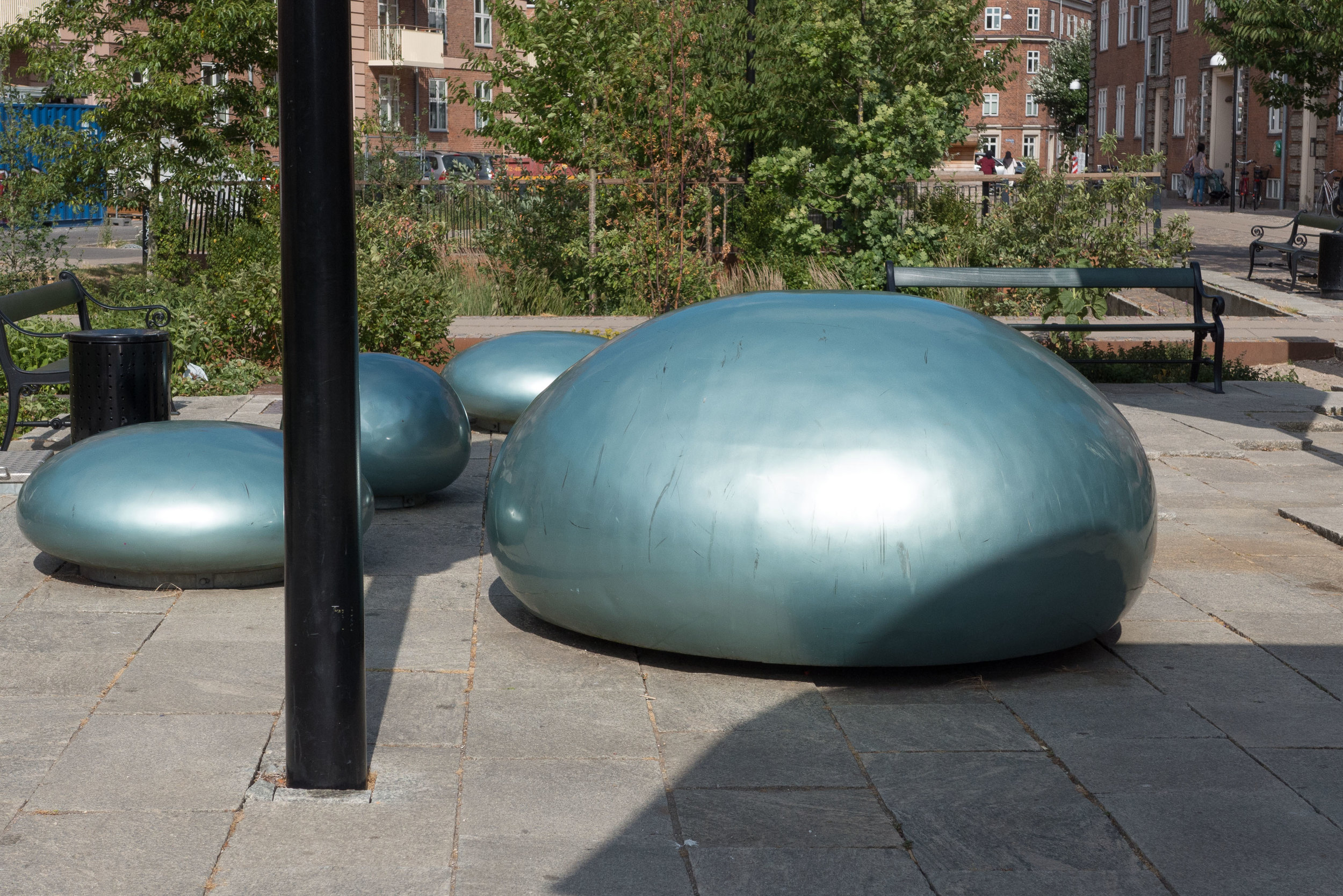
In Sankt Annæ Plads in the centre of Copenhagen, an extensive engineering scheme has been completed where rainwater is drained first into the slightly sunken garden down the centre of the long and relatively narrow park. In the work, traffic lanes were narrowed on both sides and pavements extended out to a width of 6 metres for seating ouside cafes and restaurants and there are new sitting areas and play facilities in the garden down the centre. Part of the project was the creation of a new car park going down three floors below the pier or mole in the harbour at the end of the square with  parking for 500 cars that takes parking off the street. This new parking facility meant that the south end of Nyhavn, just a block to the south, could also be pedestrianised.

Ole Bach, project director for the Sankt Annæ Society points out in the report that:
If you are to succeed in implementing combined climate solutions in urban areas, you must be able to collaborate and communicate.”

You cannot do it properly if you are unable to get all the professional groups, each of which is specialists in cloud mining, trajectory, design, architecture, etc., to understand each other's challenges and work together.

In addition, citizens must be included from the start. It is the citizens who need to use the urban spaces, which is why they have to contribute to their mark and to demonstrate the knowledge they have as a local in the area.


Klimaløsninger til danske kummuner / Climate Solutions for Danish municipalities
Good-practice guides Oct 2016 - Dec 2017
Realdania April 2018

“This on-line publication brings together seven good practice guides, published by Realdania between October 2016 and December 2017. These seven guides present a total of 70 good-practice solutions in energy policies, transport organisation, waste management, urban planning, climate-change adaptation and financing and, to inspire Danish municipalities in their work for climate change planning, there are practical approaches to reduce greenhouse gas emissions. The reports are based on results from the network of cities C40 and Ramboll has translated international insights to a Danish context.”

C40 is a global network of mayors from 91 cities who work together to reduce greenhouse gas emissions and increase resilience of cities to climate change.


Urban Nature in Copenhagen - Strategy 2015-2025 (May 2015)

In Copenhagen, nature in the city is seen as a major resource.

"Whether this is about developing Amager Fælled or increasing the number of green courtyards, our goal is to create a city where Copenhageners can enjoy and live in harmony with urban nature. But it goes beyond that. To me, it is also about transforming the way we view nature in the city. Adding nature to Copenhagen roofs and courtyards and appreciating that a bicycle ride can include flowers, shrubs and bees and not just asphalt."

So this is not just about large public spaces like Fælledparken or open land on Amager Fælled but about trees and plants on the streets and in the courtyards and increasingly about green walls and green roofs.

One goal is that, by 2025, at least 75% of citizens will see Copenhagen as a green city. That might seem to be easy - it could be simply a matter of not building on an open space and leaving nature to take over - but, of course, even that needs official and controlled intervention, often considerable expenditure and often policies need to protect what natural landscape is there but at the same time allow the city to change, grow and thrive.

There have to be and there are policies for the city on biodiversity; climate adaptation; the designation and protection of natural areas; interventions on inappropriate developments; the protection of trees and the deliberate planting of new or replacement trees; the enhancement of the street scape and programmes of work to maintain clean water in streams, lakes and the harbour.

Nature has a new and an important part to play in mitigating floods that can follow sudden storms or cloud burst and there has to be public access to open space because nature is now recognised for its role in relieving stress and there are less-obvious benefits so, for instance, where trees act as a screen or a sound barrier or provide shade to create a micro climate.

The report emphasises five "quality parameters" …. biodiversity; climate adaptation; functionality; spatial qualities and maintenance and points out that understanding these is crucial for the practical implementation of the policy and, ultimately, to its success. That section of the report is reproduced here because it is a key statement of serious intent.

Four themes are identified ….

Urban nature in green municipal areas
Urban nature in urban development areas
Urban nature on municipal land
Urban nature on non-municipal land

Although these appear to be less themes than a simple way of identifying different types of land and ownership they have different problems and dictate different approaches.

Each theme has within it a practical framework so the report assesses:

tools
catalogues
action plans
organisational changes
and partnerships.

Included in the report are case studies including Fælledparken; ongoing plans to develop the old vegetable market in Valby; a case study of Amager Fælled School with the first 'wooded schoolyard' and an assessment of green courtyards in the city.

These courtyards, normally within and enclosed by the blocks of private apartment buildings, are rarely visible from the street but are one of the hidden gems of the green city and are one particularly good example of the city encouraging green enhancement of non-municipal properties. In the city, between ten and twelve courtyards a year are improved. In total 600 courtyards have been improved since the 1960s and that has been a remarkable achievement because it has meant the establishment of 450,000 square metres of lawn and planting 15,000 trees.


Baseline for verdensmålene / Baseline for the Global Goals in Denmark
Goal 11: Sustainable Cities and Communities

published 2019

The Danish report, Baseline for the World Goals, complements that of the United Nations World Goals on Cities, with Danish indicators on urban development.

This is Goal 11 and states “We must make cities, communities and settlements inclusive, secure, robust and sustainable". Each country must translate the World Goals into local conditions, and with Baseline for the World Goals, Goal 11 has become the pilot project for the Danish objectives.

The baseline shows that there are still many weak points where the present development of sustainable cities is not adequate …. the baseline has a number of technical indicators that can be used to analyse Danish urban development, and only five out of 20 indicators show truly positive development.

The Danish 2030 panel has therefore decided that the baseline reports for Denmark and the remaining 16 world targets must also be prepared. They are expected to be completed in the first half of 2020 and will give Danish authorities, businesses and civil society a complete analysis tool for the necessary choices that society must make to strengthen the necessary transition to ensure that Denmark achieves the 17 World Sustainable Development Goals.


BYERNE HAR POTENTIALET TIL AT ÆNDRE VERDEN
– en artikel om Verdensmål 11 og status i Danmark


CITIES HAVE THE POTENTIAL TO CHANGE THE WORLD
- an article on World Goal 11 and status in Denmark

A short but realistic report from Realdania that warns about the problem of being complacent.

Much has been achieved to slow or reverse levels of pollution and there are successes like the use of bikes in Copenhagen or the improvements in water quality in the harbour but there is real pressure as more and more people move from the countryside to the city so climate change schemes have to be flexible or adaptable and serious decisions will have to be made about coastal communities where individuals may not be able to afford the insurance they would need to rebuild after storm or flood damage and the community may not be able to justify the substantial amounts of money needed to provide physical defences.


Lokalplanner i København / Local Plans in Copenhagen

For the city of Copenhagen, plans for proposed developments - including extensive schemes to deal with flooding from rain storms - are published on line as part of the public consultation process and, for planners and architects from other countries, these readily-available reports provide an introduction to developments in planning and major engineering projects for climate change mitigation in the city.

The front page has a map where the reader can zoom in to find a specific report for a district or city block or square or specific building and the map is live so with links to a pdf report.

More recent reports have extensive research on historic context and function so they are as much an impact assessment as a public consultation document.


Enghave Parken - restoration and climate-change mitigation

November 2015

December 2019

Enghave Park was laid out in the 1920s on land that had been allotments. The overall design for the park was by the City Architect Poul Holsøe (1873-1966) who also designed the brick apartment blocks that were built around the large square and work was completed by 1929.

Holsøe was a leading proponent of neo-classical  or classically inspired architecture in Denmark in the years around 1920 and he was a leading architect in Landsforeningen Bedre Byggeskik - the National Association for Better Building - so advocated robust and honest architecture that was based on well-established and traditional building methods. The apartments have a simple and almost stark but solid form, stripped of decoration and based on good and carefully-considered proportions. The square itself has a regular layout with avenues and cross-walks that form regular and slightly formal rectangular or square spaces and was the work of the city landscape architect and gardener Valdemar Fabricius Hansen (1866-1953).

An obvious source of inspiration was formal Renaissance gardens and specifically here the King's Garden in Copenhagen that was laid out in the early 17th century.

The public square - Enghaven Parken - is at the west end of the Copenhagen district of Vesterbro so it is between Vesterbro and Carlsberg. The Carlsberg brewery was established in the second half of the 19th century on higher ground west of Copenhagen and south of Frederiksberg. Vesterbro, a suburb outside the old city, grew rapidly around 1900 and was markedly working class with many of the families employed in the railway marshalling yards; the meat market; the port to the south and, of course, in the Carlsberg brewery to the west and then, from the 1930s, in the power station HC Ørstedsværket.

The streets of apartment buildings in this part of the city are about as far from a regular grid as you can get with the position and alignment of streets reflecting earlier field and property boundaries and the piecemeal way in which the area developed. Many of the cross streets do run north to south but several of the main roads are at angels including Istedgade and Sonder Boulevard that run down towards Enghave Plads from the central railway station.

Ny Carlsberg Vej, crosses the area, and was the main road to the Carlsberg brewery. It runs approximately from south east to north west and is the road that runs through the famous Elephant Gate at the centre of the brewery site.

Ny Carlsberg Vej forms the south side of Enghave Plads and the main north to south road - Enghavevej - runs across the east side with the main entrance into the park from Enghavevej. Across the west side of the park is the cross street Ejderstedgade and Lyrskovgade runs across the north side. Early photographs indicate that the long apartment block along Lyrskovgade was the last block that was completed sometime after the park.

Because of the different angles of the streets, the area of the park is not square but slightly tapered - splaying out from 170 metres wide across the entrance frontage towards Enghavevej to a width 208 metres across the back. On the central east-west axis, the park is 197 metres deep from the  entrance to the back boundary.

The outer edge has a relatively high fence with a series of entrance gates marked by bold, simple stone gate piers and the park had a fairly solid hedge around the perimeter, immediately inside the fence. Some have criticised this as making the inner area of the park seem isolated or cut off from the adjoining streets although the other way of looking at this is to say that the inner area of gardens and lawns is peaceful because it is protected from the noise of traffic and the noise and overview of people on the streets and in the housing blocks around.

Inside the park, much of the area, perhaps surprisingly, is wide gravel walks. Inside the main gate was a long rectangular area of gravel running back on the main axis although early aerial views show this was planted with trees. Beyond that entrance area is a shallow rectangular lake 45 metres long on the axis by 27 meters although it was not given it's final form until the 1940s. The edge of the lake was marked by a border planted with flowers.

Beyond the lake and still on the central axis was a further large gravelled area and then a bandstand that is just in from the west boundary. This bandstand is a simple copper-covered shell, in effect a quarter of a sphere, that is designed to project sound forward. It is raised up on a stone plinth that forms a stage with facilities for performers in the basement. There is a shallow decorative relief in plasterwork, within the otherwise smooth and plain shell. By Aage Nielsen-Edwin - it is a classical scene depicting Apollo and the Nine Muses.

Inside the entrance to the park is a small statue of Venus by Kaj Nielsen (1882-1924) and then in 1933 one other statue was added - Youth by Einar Utzon-Frank (1888-1955) Danish sculptor, professor at the Royal Academy, and uncle of the architect Jørn Utzon - but it is noticeable that there is less sculpture here than in the older parks in the city.

The areas to the north and south of the central axis had lawns and planting with shrubs and perennials in the garden to the north and formal rose gardens and pergolas around the main lawn to the south. There was a play area north of the bandstand and sports courts in an area to the south so at the south-west corner of the park.

historic aerial view with Enghave Plads in the foreground - the site of the recently opened Metro Station and with Carlsberg Brewery in the background at the top of the view

the restored pergola at the west end of the Rose Garden with the statue
Youth by Einar Utzon-Frank added to the park in 1933

the lawn of the Rose Garden in December 2019 as work is completed

the north part of the garden from the west so looking towards Enghave Plads

1 - Playground
The manned playground has been opened with increased access from the park
2 - The Scene
The site has been renovated and will serve as a skating rink during the winter months
3 - Fountain
The fountain garden In the middle of the park where, during the summer, there will be recreational play with purified rainwater
4 - Multibanes
The multi-sport court is recessed by 3 metres and has integrated seating as well as rainwater retention capacity
5 - Library Garden
The plan of the garden has been brought back to the original and is a tranquil perennial garden for picnics and informal stays
6 - The Lake
Centrally located is the lake with a permanently lowered water level, which provides extra cloud burst capacity.
7 - Foyer / Entrance
The entrance to the park is framed by two restored Arne Jacobsen stalls, from which there will be outdoor seating
8 - Rose Garden
In Rosenhaven there are old scented roses in the beds and on the two pergolas. The garden has been submerged by 0.5 m and will hold rainwater both on the garden and also underground in pipework that takes 2000 m3 of storm water.

Arne Jacobsen at Enghave Parken

The band stand and pavilions on either side - both with shelters and toilets under a pitched roof covered with wood shingles - were restored in 2016 and the original pale-green colour reinstated along with trellis for climbing plants.

Research for the restoration work was undertaken by Bente Lange and it would seem that in looking at original drawings in the city archive it was found that the designs for these buildings were by Arne Jacobsen (1902-1971) . He had just graduated and was working in the office of Poul Halsøe before he established his own architectural practice in 1929. The drawing style and handwriting on these drawings have been attributed to Jacobsen by experts and so these are some of the architects first known works.

These three buildings are not in a style that would normally be associated with Jacobsen's work although some of the first houses he designed in Ordrup and Charlottenlund were in a simple vernacular style and the house for Mrs Steensen at Krathusvej 3, has a roof with a similar low pitch and with the ends of the rafters exposed along the long sides.

More important, in terms of the later architectural style of Jacobsen's work, are two small stone and glass pavilions that originally flanked the main entrance gate but were demolished in the 1970s. They too have been attributed to Jacobsen and reinstated or reconstructed as part of the most recent work on the park.

These have side walls in fine ashlar and shallow pitched roofs with the gable ends to the road and to the park but the front and back walls are glazed. The proportions are good and the detail of the steel framework and small touches, like the curved steps to the front and back doors, are superb. These surely are Jacobsen's interpretation of the 18th-century pavilions along the side of the King's Garden that had been added when the high wall around the formal garden that dates from the 17th-century was removed.

one of the entrance pavilions, designed by Arne Jacobsen, demolished in the 1970s but reconstructed from original design drawings in the city archive as part of recent and extensive restoration of the park

stone gate piers at an entrance on the south side of the park with the new flood wall beyond

the bandstand from the north with steps down to rooms below the stage

the restored buildings on either side of the bandstand


the restored bandstand with the area in front with an ice rink photographed in December 2019
photographs survive in the archive of the newspaper Politiken that show that the park was a popular venue for music -
one photograph from the 1950s shows the area in front of the bandstand crowded with people jiving


Climate-change mitigation

Extensive engineering works within the park have just been completed for one of the largest climate change mitigation projects in the city.

A large sections of the south side of the park was excavated to form underground holding tanks for flood water from sudden and potentially destructive rain storms and a concrete retaining wall has been built across the entrance side of the park that returns back along both sides and, in an extreme storm, solid barriers can be raised across each of the entrances and the whole area will be flooded.

The retaining wall has a rill or channel along the top as a water feature and on the left side of the entrance there is a large, shallow, new basin on top of the wall that will fill with water. The form of the basin is appropriately classical in style.

Giant stop taps in the wall give some indication of just how much water the system will cope with in a major storm.

There are holding tanks for water under the rose garden but the most dramatic area of the new flood defences is the sunken courts for games in the south-west part of the park. This has been taken down three metres with a series of angled runs on each side for access and for the rain to drain down but these steps also provide seating for people to watch the sports on the court.

Engineering work has been by Cowi with landscape design work by the Copenhagen studio Tredje Natur.

This is not the best time of year to take photographs but at least with leaves off the trees then it is easier to see how the different parts of the park relate.

The north-east area of the garden with shrubs and trees around the lawn was barely effected by the work so is recovering first but work on the lawn of the Rose Garden is ongoing although the sea of mud here at the moment does show well just how wet the ground gets in rain and how quickly. That part of the garden has also been lowered and the pathways now slope down so rain water flows naturally into the area and will be taken into pipework of a holding tank under the lawn.

The park has had fairly traditional 'municipal' planting but there are plans for greater bio diversity.

Eighty-three new trees have been planted in the park, with 10 different varieties. Most are planted in connection with the re-establishment of the alleys. There will be 11,000 perennial plants, consisting of 55 different varieties in the Library or north-east garden as well as 950 fragrant roses planted in the Rose Garden and over the park 220,000 bulbs have been planted so altogether this will create habitats for urban wildlife including insects and small animals and presumably ducks and herons will return to the lake.

Enghave Parken was formally reopened on 14 December 2019.

account of the restoration work in 2016 by the AP Møller Foundation
drawings by Jacobsen published on line by the Royal Academy Library
Tredje Natur


across the east side of the park and returning back along the north and the south side is a new retaining wall in concrete with a rill or water channel along the top

if there is a major rainstorm then barriers can be raised across each the entrances to form a continuous dam so that the whole east side of the park will be flooded to protect nearby streets and properties


courts for a number of different ball games at the south-west corner of the park has been lowered by three metres and will hold flood water before it is released into the harbour under careful control so that drains and sewers are not damaged

stored rain water will be used to water trees and filtered water will be fed back to fountains near the lake that will be a play feature for children


Langelands Plads - a new underground car park with climate landscape

Langelands Plads in Frederiksberg is about 400 metres north of the main shopping centre and Frederiksberg metro station.

It's a relatively small urban space - a public square - just over 90 metres wide and 70 metres across from north to south - with apartment buildings on all four sides. Most date from around 1900 and are of a fairly conventional form with five floors and most built in brick with stone or plaster for relatively restrained decoration. This is not a grand square but comfortable and pleasant with some mature trees.

A much larger and distinct public square - Aksel Møllers Have - that is unusually long - is a block to the east and is shown on a map of 1888 but with what appear to be field or plot boundaries on the site of Langelands Plads so the area was being laid out and developed at the end of the 19th century.

The most straightforward layout for a square in a city is within a grid of streets so the roads on each side of the square run through and when walking or driving you enter such a square at a corner and the space opens up on one side or the other.

At Langelands Plads, Langelandsvej across the east side and Bentzonsvej across the west side run on north and south in this standard way.

However, there is only one road, Falsrevej, on the west side that enters the square at the centre of the west side and on the east side there is Bjarkesvej - not even on the axis of the square - that is a short street to Aksel Møllers Have but enters that space slightly south of the corner of the main square so the street, looking from Langelands Plads, is terminated by the striking building of the municipal swimming pool and public baths that were built across the south side of Aksel Møllers Have in 1934.

This means that when walking to or around or through Langelands Plads, there is a more dynamic and a more interesting experience than with a standard square and this also suggests a more complicated history for the planning and development of these streets than might be immediately obvious.

Langelands Plads has pavements and roads on all four sides so the central area is just 70 metres by 50 metres.

Work on a extensive scheme to remodel and develop Langelands Plads began in the Spring of 2017 and was completed and the square was reopened at the end of May 2019.

A new underground car park was excavated across the east side with three levels below ground that has parking for 200 cars. Access is down a ramp at the south-east corner of the square but with separate access points for pedestrians leaving or retrieving their cars.

Mature trees were kept on the west side of the space and the area was resurfaced and paved and is now tightly packed with features with raised steps for seating across the north-east corner; a large, shallow pool; seating, including picnic tables and, of course, play equipment including a slide; a sand pit and an area for ball games enclosed by high fencing.

There are interesting spaces and interesting views through and across the space and it forms an important public area. As in many other parts of the city, the apartment buildings have internal courtyards at the centre of the street block with enclosed green space so the public gardens in the square have a slightly different role in the community. There is a café and bar - Mocca & More - on the west side but otherwise no other shops or commercial buildings so the square feels quiet and domestic …. on the evening I took the photographs there were parents meeting up and talking as their children played and their were small family groups that appeared to include grandparents.

The square is also part of storm water planning for the district so the paving tiles are actually a permeable surface and there are holding tanks for water below the square.

The design was by the architectural consultants RUM

Frederiksberg Svømmehal
RUM


aerial view from Google Earth shows Langelands Plads while the new underground car park was exposed.
The south end of Axsel Møllers Have is to the right with the roof of public swimming pool and public baths bottom right. The baths were designed by AAK Lauritzen and opened in 1934. Apartments around the squares would have had toilets but would have used the public baths.


note:

Frederiksberg is an independent municipality, densely packed with buildings and surrounded by Copenhagen so, in effect it is land-locked, and there is very little space for development.

It is generally an affluent area with streets of expensive apartments and with streets of villas but there are over 100,000 residents in Frederiksberg within an area of just 8.7 square kilometres so this is the most densely populated municipality in Denmark.

The construction of the car park at Langelands Plads clears on-street parking and provides crucial green space. There is an extensive open area of green around the Palace of Frederiksberg and areas of green have been left around the new buildings of the Copenhagen Business School - on land that was formerly rail yards - but the general feeling is that there is not enough open green space for the number of families living here which is probably why planners seem to have been keen on recent proposals to alter Sankt Jørgens Sø that would have seen the level of the lake lowered as part of a major scheme for control of rain storm water that would also have created a large new park on the east boundary of Frederiksberg.

climate change - Scandiagade

Rain storm works at Scandiagade were completed and formally opened in June 2019 and I visited a few days later to take some photographs and explore the area but have only just got around to writing the post.

I'm not sure why it has taken so long and it now feels like a serious oversight because this is a brilliant piece of landscape planning and the designers - the architectural studio 1:1 Landskab - have created a beautiful and really quite amazing new public space.

This street is in Sydhavnen - out to the south-west of the city centre and some 3 kilometres from city hall. It is still a distinct, working-class part of the city and local people are fiercely proud of that.

A few years ago I read a strongly-worded  criticism of the gentrification of Vesterbro - the area immediately west of the central railway station and once - how should I put this politely - the most robust part of the city - some would argue that it is still is - but the man was complaining about how the real character of Vesterbro had been ruined by the middle classes colonising the district and ended by saying he felt so strongly about the way the part of the city he had lived in all his life had been ruined that he had been forced to move from area to the only 'genuine part of the city left …. Sydhavn.

The area is certainly not on the normal tourist routes and does feel slightly isolated, cut off from the rest of the city by the main railway lines to the north and a very busy road in and out of the city to the south and east that until recently was still a main dock road and then became the way out to the motorway and a route out to the airport and the bridge to Sweden.

More recently there have been criticisms in the newspapers because expensive new housing that has been built at the south end of the harbour has cut off the people who live here even more by blocking access to the water.

The area has extensive blocks of public housing so it is important that when new rain-water scheme was found to be necessary - to stop storms flooding streets and properties - then not only was the work as good as anywhere else in the city but the local residents were consulted from the start and had an impotrtant input into what was done and what was planted.

The street is a dual carriageway with a central reservation that is 13 metres wide. There are apartment buildings along one side, hard on the pavement, and offices and what appear to be small factory units all along the other side although these later buildings are set back from the pavement so the road is actually 35 metres wide and feels light and sunny. Ironically, those posh blocks of apartment around the harbour have much higher blocks and for many there are tighter spacing with much narrower streets - some just 14 metres wide - because of the escalating value of the land.

The new park at Scandiagade is 360 metres long and runs at an angle but basically from north to south from Sydhavnsgade down to Børgmester Christiansens Gade and is now one of the important linear parks in Copenhagen … earlier versions of these long parks where road traffic on either side of a dual carriageway has been restricted and constricted to free up the central reservation for planting or play equipment or for places for local people to sit in the sun. These earlier linear parks include Sonder Boulevard in Vesterbro and Prags Boulevard on Amager. At Scandiagade one interesting difference is that instead of car parking being against the pavement in front of the buildings, here it is along the inner edge against the park. Curiously this makes the park feel not isolated or threatened by the cars but actually enclosed and somehow more and not less important.


Fortunately it was possible to keep mature lime trees along the centre - only two were felled - and these form a depth and volume to the design and, from the completion of the extensive construction work, it feels well established.

The design has eight sunken areas for storm water to flood and where rain water will be held to drain away slowly without damaging property or damaging the drain and sewer system that would otherwise be overwhelmed in a downpour.

Each sunken area has a different theme and a distinctly different character and these were worked out with the residents who also helped decide on planting so there is a really rich bio diversity with well over 100 different plant types. Information panels and labels have been included to encourage people appreciate and learn more about nature and about plants and their care.

The sunken areas include a play area; a butterfly garden; a beach with a volley-ball net; a kitchen garden; a 'hilly' landscape; a stone or rough moorland garden; an area inspired by Tippen - an important and popular nature reserve to the south on landfill - and an area that has been fenced in and left to see what grows in a wild and self-seeded garden.

These areas are linked by a striking raised walkway that zig-zags down the park with a sharp yellow metal edging and a hand rail on one side - rather than both - and this links different sections at road level where there is plenty of seating but there are also steps and swimming-pool or harbour-style ladders down into each garden.

1:1 Landskab

 
20180503_Plan farve_0.jpg


Sankt Jørgens Sø - planning for climate change

Sankt Jørgens Sø from the north with the Tycho Brahe Planetarium at the south end

Planning for one of the most dramatic and extensive climate-change schemes in Copenhagen has been put on hold for more detailed consideration.

This is a proposal to change Sankt Jørgens Sø - the southernmost of the three lakes that form an arc around the west side of the historic city - so that it can hold back flood water when (not if) there is a major rain storm.

To understand what is now proposed, it is important to understand the topography and something of the history of this part of the city and its development over the last five centuries.

In fact, Copenhagen as a settled site, dates back over a thousand years. The settlement was established on slightly raised ground on a gentle, south-facing slope with the open sound between Denmark and Sweden immediately to the east but the trading settlement was tucked around slightly, with its water frontage facing south and protected by the low-lying island of Amager across shallow water almost 2 kilometres to the south and with higher land of what is now Fredriksberg to the west that provided some protection from the worst of the winds and rains that come from the west.

one of the proposed schemes showing the lower level of the lake and a new park

a proposal for lowering the lake
and setting out a new park
by the engineering consultants Ramboll

1658

this map was produced as the military defences of city were extended north - out to the Citadel - Kastellet

1860

the military defences including the north and the west gates into the city were not removed until the 1870s but the lakes had already taken on their more regular outline and there were settlements or suburbs out beyond the lakes

1888

note here the railway line out of the main station then went from marshalling yards east of the lake and left the city across the broad causeway across the north end of Sankt Jørgens Sø

now

image from Google Earth
Tycho Brahe Planetarium at the south-east corner of the lake was designed by Knud Munk and opened in 1989


Between that settlement and more open countryside to the north and west there was an arc of low and poorly-drained ground that provided a natural defence across the back or landward side of the trading city …. open ground that could be defended from the defences of the city itself and, better still, wet bogey ground that would slow down an advancing army.

In the 1580s, in a major piece of landscape engineering, a river to the west of Copenhagen that drained naturally to the south, was diverted in a great loop to flood this lower ground. That river entered the lakes at what is now Åboulevard - at the top end of Sankt Jørgens Sø and although this is now a main road route into the city, the river survives in a covered culvert below the road.

The line of lakes not only improved the defence barrier - any army attacking the city from the land side would have to cross this water - but the system also provided a constant supply of drinking water for the expanding city.

There were extensive military defences at the north end, between the lakes and the sound, and at the south end, between the lakes and the south end of the harbour, and with smaller defences around causeways across the low land. These lower defences went around Sankt Jørgens Sø suggesting that the city was protecting its water supply.

Until the 18th century, the area of water in the lakes was irregular in shape - particularly at the south end - and there were few buildings - statutes kept the area clear so there was no cover for attackers. The margins of the lakes seem to have had low scrub and reeds.

In the late 19th century, after the defences and the old city gates were removed, the city expanded rapidly outwards, first across the line of the defences, then up to the edge of the lakes and then on outwards beyond the lakes to new districts of housing in Østerbro, Nørrebro and Vesterbrø - all beyond the lakes.

With the construction of a wide new "bridge" across the lakes 1887 - on the line of the original approach to the old medieval north gate - the sides of the lakes were straightened and embanked to form a sharper edge and for a pathway all round the lakes …. over 6 kilometres for a complete circuit so the lakes are a major amenity for walkers, runners and for families … feeding the ducks is popular. 

The current level of the water in Sankt Jørgens Sø is maintained artificially. Kampmannsgade - the road across the centre of the lake is below the level of the water in the lake; the west bank - called Svineryggen or Pigs Back acts as a retaining bank although the small park at the centre of the west side, outside the bank and much lower than the path, always seems to be bogey and a broad pathway across the south end of the lake disguises just how much the difference is between the level of the lake on one side and the level of Gammel Kongevej below the bank.

The proposal being considered would mean returning the lake to it's natural level so that if there was a major rain storm then the area would be allowed to flood, taking water from the densely built-up streets of Fredriksberg to the west and holding the water to prevent it damaging drains and sewers and flooding streets.

a map from 1705 shows the course of the river that was diverted in the 1580s to bring water into the lakes at a point between Peblinge Sø and Sankt Jørgens So - on the line of what is now Åboulevard - and this and the historic map below show the military defences of the city enclosing the lake


painting by Christen Købke of the north lake in the 18th century looking across to the city


Management of water levels in Sankt Jørgens Sø - surface water flowing into the lake and the release of water out to the harbour - and the control of the quality of the water in the lake are part of the management of drainage in Frederiksberg, Vesterbro and in the western part of the centre of Copenhagen by the water supply and drainage company Hofor.

A well-illustrated report, published by Hofor, shows how Sankt Jørgens Sø fits within the overall management of storm water in this part of the city.

Konkretisering af Skybrudsplan Ladegårdså,
Frederiksberg Øst og Vesterbro


There are three possible schemes that are being considered for the management of storm water flowing through Sankt Jørgens Sø.

The first is the most dramatic in that the level of the south part of Sankt Jørgens Sø, the part south of Kampmannsgade, would be lowered by over 3 metres and in compensation, or as a new amenity, the exposed land would become a large new park that would be allowed to flood if there was a storm.

The second scheme would see both parts of the lake lowered but not by as much so there would be a narrow park along the whole of the west side.

In the third option there would be less change in the level but new large pumping stations, to deal with flooding, would have to be constructed.

After further consultation, an impact assessment will be completed in 2020 and a final decision will be made in 2022.

report from the Kommune for the proposed scheme


Sankt Kjelds Plads - climate change landscape

Sankt Kjelds Plads in July 2018 - looking towards Hahnemanns Køkken - the cafe on the north side of the square


the same view in April 2019


Sankt Kjelds Plads is in a densely-built area of older apartment buildings about 4 kilometres directly north from the city hall.

Many of the buildings here date from the 1930s but there are large modern office buildings and large and relatively recent industrial buildings and a large supermarket to the west.

The area has a distinct urban character with relatively wide streets but little planting and not just on street parking but also fairly heavy through traffic. From the air you can see that most of the large apartment blocks have extremely pleasant courtyards with planting but the real problem for this area is that climate change has meant occasional but very destructive flooding from sudden rain storms with traditional street drainage unable to deal with surface water on the streets and with rain running off the roofs of the large buildings.

The solution has been to put in fast-flowing storm drains, surface channels to take water away to tanks or sumps where it can be controlled, and, where necessary, filtered and then released into the drainage system but at an appropriate rate. These sudden storms may last for only an hour but in that time there can be a depth of 30 centimetres of water across the road that stops traffic, floods basements and ground-floor apartments and businesses and takes road-level pollution through the drains and to the harbour and the sound.

Along with this hard landscaping of drains and surface gullies, the other solution is extensive planting that absorbs rainfall - apart from the most severe storms - and adds considerably to the amenity value of the street scape.

Here at Sankt Kjelds Plads, seven roads converge at what was a very large traffic round-a-bout. That was planted with shrubs and trees but it certainly was not a place to sit. In fact, with the heavy traffic, it was not a place where many people even cut across.

With the current scheme, small areas of pavement in front of the buildings have been pulled forward and the traffic discouraged and the round-a-bout reduced significantly in size. The new areas are densely planted and have pathways curving through them with seats . Sunken areas will flood when there are storms, to act as holding tanks, but have planting that will cope with short periods of partial submersion.

This will be the first full growing season for the trees and shrubs and ground cover so it is not fair to judge the scheme until everything becomes more established but already the transformation is obvious.

This large open space links through with the climate-change landscaping of Tåsinge Plads, about 85 metres away to the east, and the main north south road through Sankt Kjelds Plads - Bryggervangen - is also being planted to form a green corridor from the large park - Fælledparken - to the south and continuing through to an open area and pond to the north beyond Kildevældskirke.

post on Sankt Kjelds Plads July 2018
post on Tåsinge Plads July 2018

aerial view of Sankt Kjelds Plads after the main landscape work on Tåsinge Plads had been completed - that is the thin triangular street space on the right towards the bottom - but just before construction work on Sankt Kjelds Plads began so this shows the original traffic island with areas for people to walk kept to the edge immediately in front of the buildings

Three architectural and landscape design companies worked on the scheme - SLA Copengagen, Tredjure Natur and GHB Landskabarkitekter - and their online sites have more information and more images.

by SLA
the new climate district - by Tredje Natur
GHB Landskabsarkitekter

looking across Sankt Kjelds Plads from the south side - although it is hard to see through the new planting, the traffic island is still at the centre but has been reduced significantly in size

Large_Skt_kjeld_1_500.jpg

proposal for the scheme by SLA Copenhagen showing the green corridor from the church in the north and down to Fælledparken to the south


new drains and new planting along Bryggervangen - north of Sankt Kjelds Plads with the tower of the church - Kildervældskirchen - at the north end


note: the grills covering large buried drainage channels and the cover to a sump in the sunken area of garden where storm rain water will be held until it can be released into the main drains

select any image to open full screen in slide show


Copenhagen: Solutions for Sustainable cities - a report from Arup


This report from the engineering consultants ARUP sets out many of the important principles that now guide planning policies for the city of Copenhagen.

It has a short introduction by Frank Jensen - the major of Copenhagen - where he writes about the efficient use of limited resources and concludes that "It was thought that environmentally friendly development would limit economic growth. However, quite the reverse turns out to be true. Green growth can, indeed, boost economic development and the quality of life .… the business of introducing sustainability into the city poses very different issues than affecting it in the country as a whole … and require city specific solutions."

The report sets out the problems and some of the solutions that the city has adopted - often through the use of innovative technology - and the achievements, in terms of environmental gains, along with lessons to be learnt.

There are good, clear graphics, a lot of information and interesting details about projects under eight main sections.

Headings for those sections of the report give a good indication of priorities for the city, in terms of sustainability, both now and for the future ….

THE HARBOUR TURNS BLUE
MEETING THE RISING DEMAND FOR WATER
CYCLING: THE FAST WAY FORWARD
TRANSPORT: THE GREEN LIGHT
MAKING THE MOST OF WASTE
THE FORCE OF PUBLIC SUPPORT FOR WIND POWER
KEEPING THE CITY WARM EFFICIENTLY
KEEPING COOL UNDER CO2 PRESSURE 


ARUP - Copenhagen: Solutions for Sustainable cities

ARUP publications


just a few of the facts:

  • 22% of Denmark's total electrical consumption is produced from wind turbines … the highest proportion in the World

  • there are 42 kilometres of Greenways through the city where cycling is prioritised

  • waste sent to landfill is now less than 5% of the amount dealt with in that way in 1988

  • the city heating system is one of the largest in the World and supplies 500,000 people with reliable and affordable heating


the rain is coming - Sankt Kjelds Plads

Sankt Kjelds Plads looking south from Æbeløgade and the view up Bryggervangen towards the Plads with the new areas for planting under construction in July 2018

new storm drains going in along the road edge (above)
drawing from SLA showing the extent of the scheme from Sankt Kjelds Plads and north and south along Bryggervangen  (below)


Less than 100 metres from Tåsinge Plads is Sankt Kjelds Plads - a second phase of work for new drain systems with hard landscaping and appropriate planting to cope with the inundation of water from rain storms. 

Here there is a large traffic intersection with Bryggervangen running through from north east to south west and three other roads - Nygårdsvej from the east, Æbeløgade from the north west and Sejrøgade from the south west - meeting at a large space that was until recently laid out as a large traffic round-a-bout.

A new scheme with holding tanks for rainwater, new storm drains and a series of water features and extensive planting have been designed by SLA.

New areas of paving and traffic calming with new marked bays to control car parking is well in hand.

It is not just the road intersection that will have new planting but the long diagonal run of Bryggervangen is part of the work and this will form a new green corridor from a small lake and open ground several blocks to the north at Kildevældssøen and continuing south towards the open space of Fælledparken.

the new climate district - by Tredje Natur


A local store has a window covered with a huge illustration of the finished scheme.


the rain is coming - Tåsinge Plads three years on


There was a post here about Tåsinge Plads back in 2015 along with a review of an exhibition called The Rains are Coming that was at the Danish Architecture Centre and was about how the city is dealing with climate change and the problems from sudden and torrential rain storms flooding streets and squares as drainage systems fail to cope.

Then, the main engineering work had been completed with new drains around the square to take surface water and water running off the roofs of the buildings and low holding tanks had been constructed. It seemed like time to go back to photograph the area now that the trees and shrubs are well established.


THE FIRST CLIMATE RESILIENT DISTRICT IN THE CITY
the pierced domes are drain covers for the deep and wide new drainage channels below
there are two sunken areas planted with appropriate water plants that are holding tanks for storm water to stop it overwhelming the drains and at the west end is a raised mound
bridges and passageways across the square are in Corten
paving drops down in shallow steps to channel surface water and excess water is taken down into holding tanks
rain from the side streets is contaminated by surface dirt and traffic pollution so is dealt with separately in 'swales' that replaced the street gutters with ditches and plants and with filters below


It is interesting to see how the square is now used by people living in nearby apartments.  On-street parking for cars has been either removed or rationalised - so in neighbouring streets cars park now on just one side, usually the side in the shade, and they park front on to the kerb rather than parallel with the pavement.

On the square itself, the road along one side has been paved over and the local café has moved tables and chairs out onto the square. People were sunbathing on the new raised slopes of the hillock at the west end and one local lady was using a wood sculpture as a place to sit and read her newspaper in the shade on a hot day.

balconies being fitted earlier in the summer and the finished work with large new balconies to the apartments looking south and looking down onto the new landscaping of the square


The apartment building across the north side has new balconies fitted across the frontage so people can sit in the sun and look down on the square.

This has been a very dry and untypical summer so it was not possible to watch the rain umbrellas and the channels through the water gardens actually doing what they are supposed to do … that just means another visit sometime soon when it is raining hard.

The landscape and drainage solutions were designed by GHB Landskabsarkitekter.

Sankt Annæ Plads / St Anne’s Square or Saint Anne’s Place


Work on the old pier to the north of the theatre was completed in tandem with work on Sankt Annæ Plads that is not a square, which the name might suggest, but a long, broad and pleasant tree-lined street with grass, statues and play areas for children down the centre. The Plads starts at Bredgade with a large equestrian statue of Christian X and extends for 450 metres down to the harbour and the pier, the Plads and the pier meeting at right angles with the theatre at the outer corner.

Sankt Annæ Plads was excavated for engineering works to construct storm drains to cope with sudden and devastating downpours that are now much more frequent as a consequence of global warming. A holding tank can take up to 9 million litres of rain water so that it can later be released in a controlled way into the harbour protecting property and protecting sewers and street drains … expensive infrastructure that otherwise would not cope and could be damaged. 

So - in essence, Copenhagen has laid a drain and built an underground car park … but what a drain and what a car park. 

Together, and without pomp or any shouting, the square and the pier will not only transform this part of the city but also deal with very specific problems - there was a lack of parking for cars … not for local people but for the phenomenal number of visitors drawn to the area for major events; there is a bus turning area for public transport that comes right down to the north entrance to the theatre; the open space is clear enough to give room for pedestrians and bikes; potentially devastating flooding from surface water after heavy rain will be held back in tanks so that it can be released into the harbour in a controlled way to protect property and drains including sewers that would otherwise be overwhelmed; the square will form a suitable and very attractive approach to the theatre and to the harbour front and the pier forms a huge level, uncluttered open space that will be a venue for a wide variety of public events including outside performances by the theatre.


The selection of appropriate colours and texture and tone for hard surfaces enhances rather than competes with the historic buildings on either side but also help to define where cars and pedestrians should go and trees have been planted to make the area down the centre as green and as pleasant as possible with seats and statues to encourage people to sit and relax. Not over designed but very very carefully designed.


The city end of Sankt Annæ Plads in November 2015 with new surface drains (below) being installed between the pavement and the road and between the road and the central area


May 2016 and an early opportunity for people to start using the newly-planted centre space ... the sunken area holds flood water from rain storms to prevent it from flowing back along Bredgade and into the basements of properties there


rains and drains -
more on new schemes in Copenhagen to deal with flooding from the sudden and severe rain storms that are becoming more common with global warming

Ofelia Plads