Halmtorvet - a new storm water drain

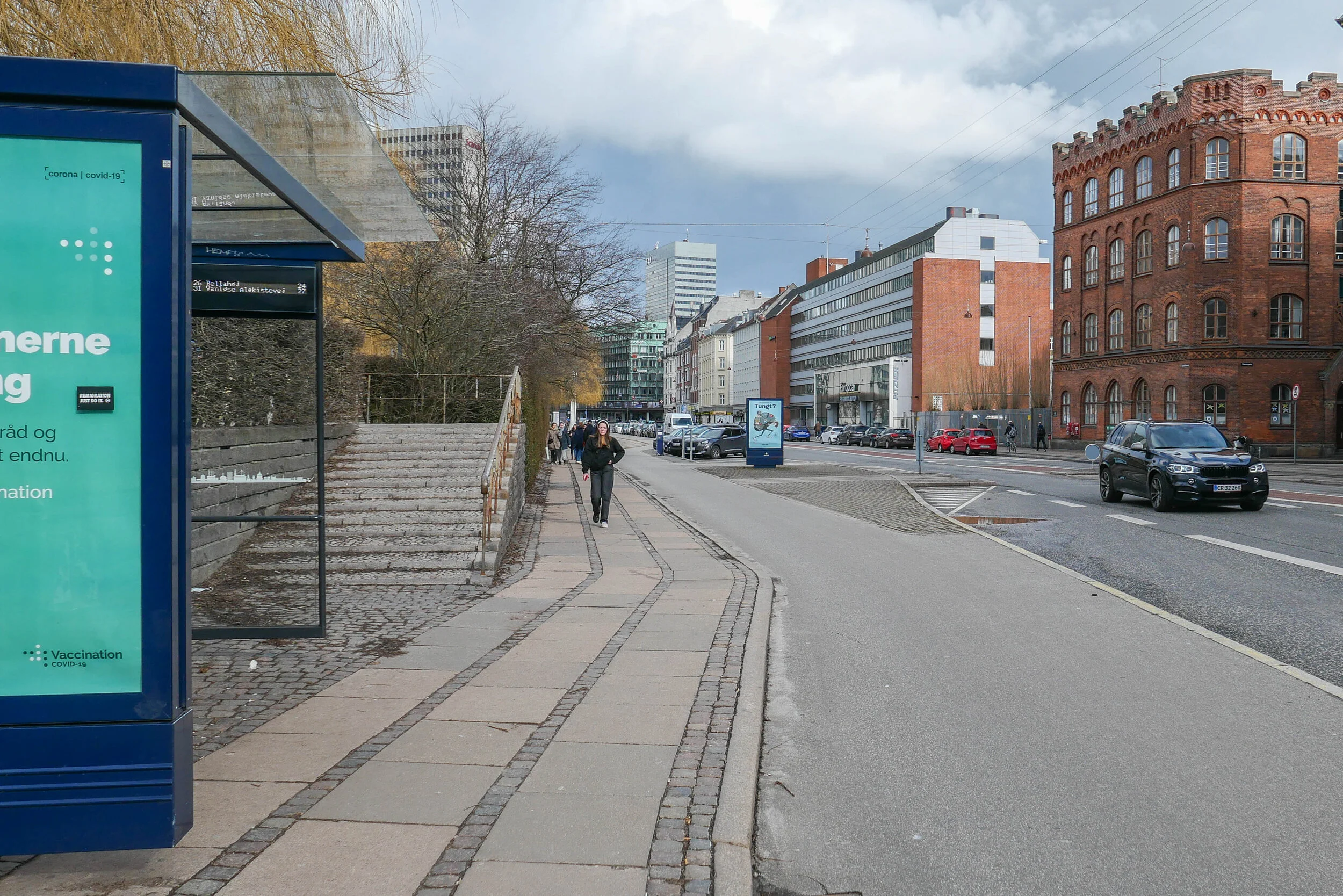
Sønder Boulevard - the wide street running out to the south east through Vesterbro from the west side of the main railway station - is now partly blocked with high hoardings like those that were used around main sites for engineering work when the metro was constructed. However, this site is not for the metro but for major engineering work to construct a massive storm drain.

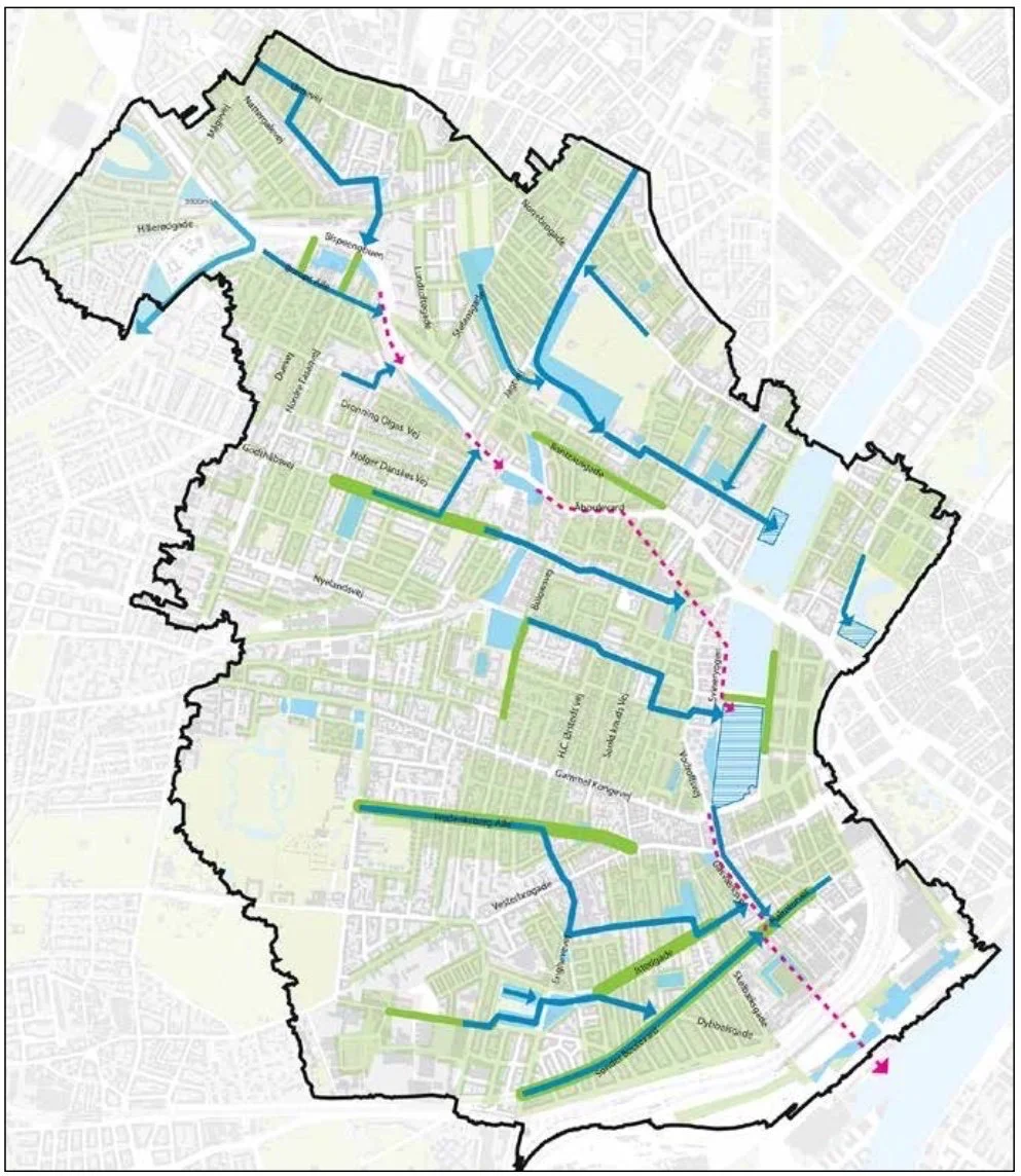
It is part of a scheme for rain-storm mitigation for Frederiksberg and, when completed, it will be about 1.25 kilometres long to take storm water from Sankt Jørgens Sø out to the harbour with an outlet just east of the Copenhagen Island Hotel on Kalvebod Brygge … close to the swimming area in the harbour at Fisketorvet.

A plan by the water and engineering company HOFOR shows how new drains and gullies will take water from the streets and roofs of the densely-built area of Frederiksberg and Vesterbro out to the lakes on the west side of the city centre and from there it will be released, as and when appropriate, to keep surface water on roads to a minimum, to prevent the flooding of basements and to ensure that house drains and sewers are not inundated.

There is a proposal, not yet confirmed, to lower the level of Sankt Jørgens Sø that is now kept at it’s current level by a dam across the south end so the surface of the lake is well over a metre above Gammel Kongevej - the road across the south end of the lakes. If it was kept at a lower level, then, if there was a storm, the lake could be used as a large emergency reservoir to hold considerably more flood water, for a short period.

A well-illustrated booklet from the water company Hofor sets out why the mitigation work is necessary and the extent of the work and can be downloaded from their on-line site.

HOFOR - Skybrudsplan


building out into Kalle Bod - the bay between Frederiksberg and Amager

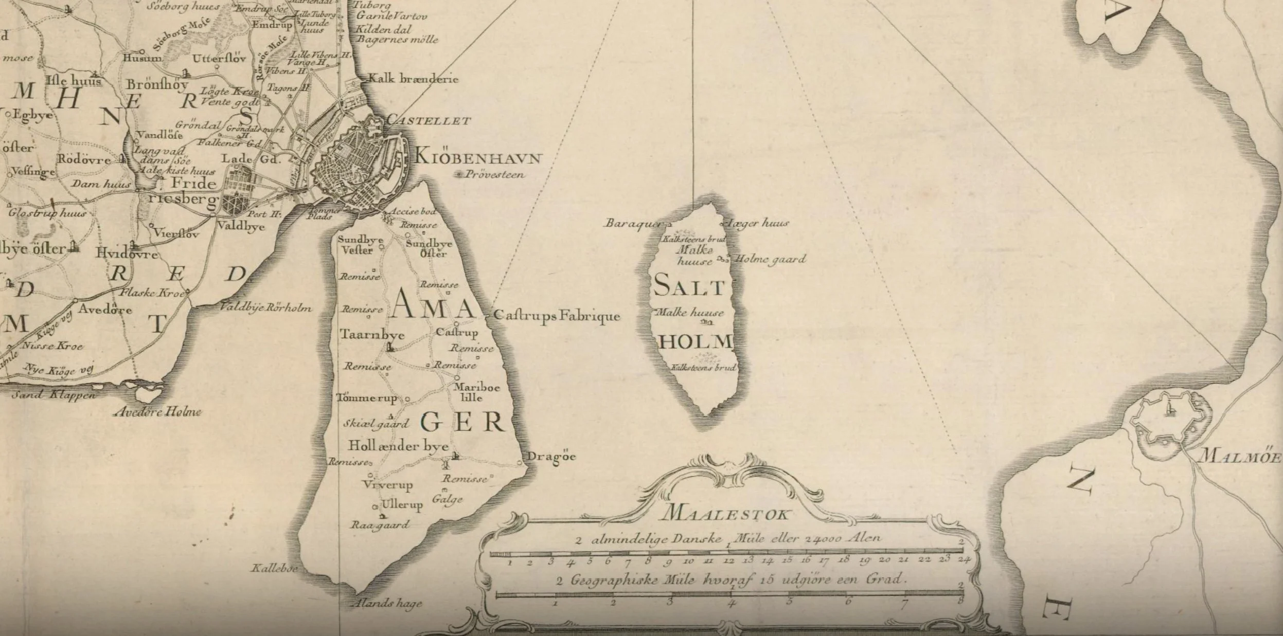
The map of 1788 shows the wide channel between the city and Amager that had been narrowed by the construction of Christianshavn in the 17th century and then the construction of the defences to protect the area where the ships of the Danish navy were moored.

Presumably, the bay to the south slowly closed with silt as the sea could no longer flow freely between the city and Amager.

From the middle of the 19th century land was claimed from the sea on both sides of the bay - first for the first railway line and then the meat market and a gasworks on the Frederiksberg side and then timber yards close to the entrance to the harbour.

In the late 19th century, the Danish army - the artillery - moved out to Amager, just beyond Langebro, where they built a rifle factory and shooting ranges and then around 1900 commercial quays were built to create Islands Brygge that extended well out into the bay.

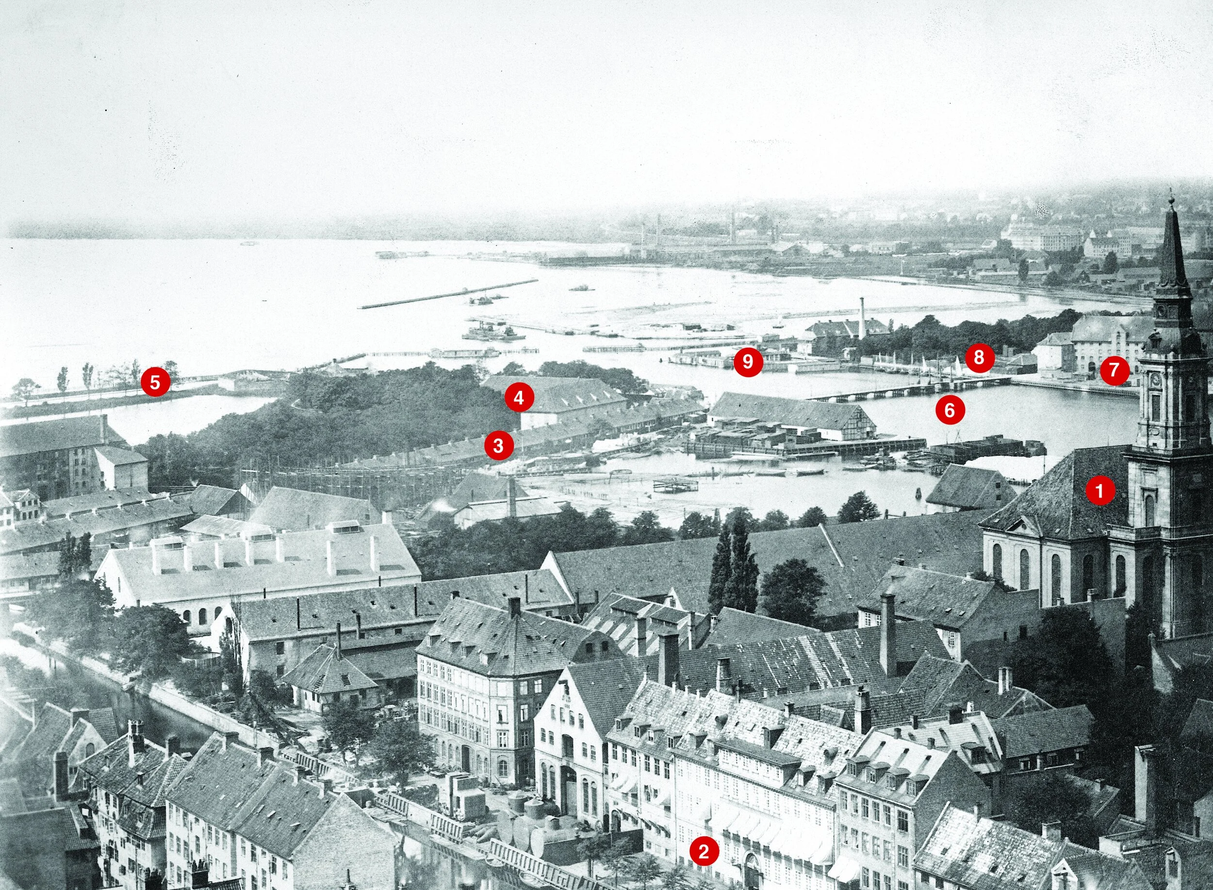
The photograph above - taken between 1867 and 1869 from the tower of Vor Frelsers Kirke on Christianshavn - is the view looking to the south west with Kalle Bod, the wide bay that opened out to the south of the harbour, with Frederiksberg to the right and Amager, out of the view, to the left.

Key buildings shown in the photo that survive are Christians Kirke to the right ① and the large house on the canal. ② Buildings beyond the church was a shipyard and engineering workshops that do not survive and the basin has been infilled.

The long building ③ was a rope walk on the north side of what is now Langebrogade. The buildings ④ are on the bastion to the east of the entrance to the harbour and survive but the outer defence ⑤ is now under the roadway on the west side of Langebro, the present bridge that was completed in 1954. The earlier Langebro ⑥ was on the line of the new pedestrian and bike bridge called Lille Langebro.

Mills and breweries ⑦ are on the site that is now BLOX ⑧ and the low buildings ⑨ was the bathing station. Beyond, between the bathing station and the shore was a timber yard just outside the defences and that is now the site of the Ny Carlsberg Glyptotek. Further along the foreshore, early infill of the bay created land for the first buildings of the meat market and a gas works.

photograph from the City Archive reference 25925

Copenhagen City Archive reference 40015

In the late 19th century, massive timber, earth, brick or stone walls and embankments were built down the harbour in a number of stages with infill behind for the present railway that runs into the central station from the east and for the railway works and the road now called Kalvebod Brygge. The office buildings between Langebro and Fisketorvet - on the left in the photograph - are all on land claimed from the bay. The buildings on the right or east side of the harbour are on Islands Brygge and also on man-made infill of the bay


the south harbour looking from the cycle bridge at Fisketorvet towards the city with Langebro in the distance

It would seem ridiculous to claim that the harbour here is narrow - it’s almost 400 metres wide - but if you had been swimming in this area of the harbour in the middle of the 19th century - in the area where the harbour swimming is at Fisketorvet - just to left of this view - then you would have been 800 metres from the beach on the Frederiksberg side and at least 700 metres from the shore on the Amager side.

detail of a map of 1749
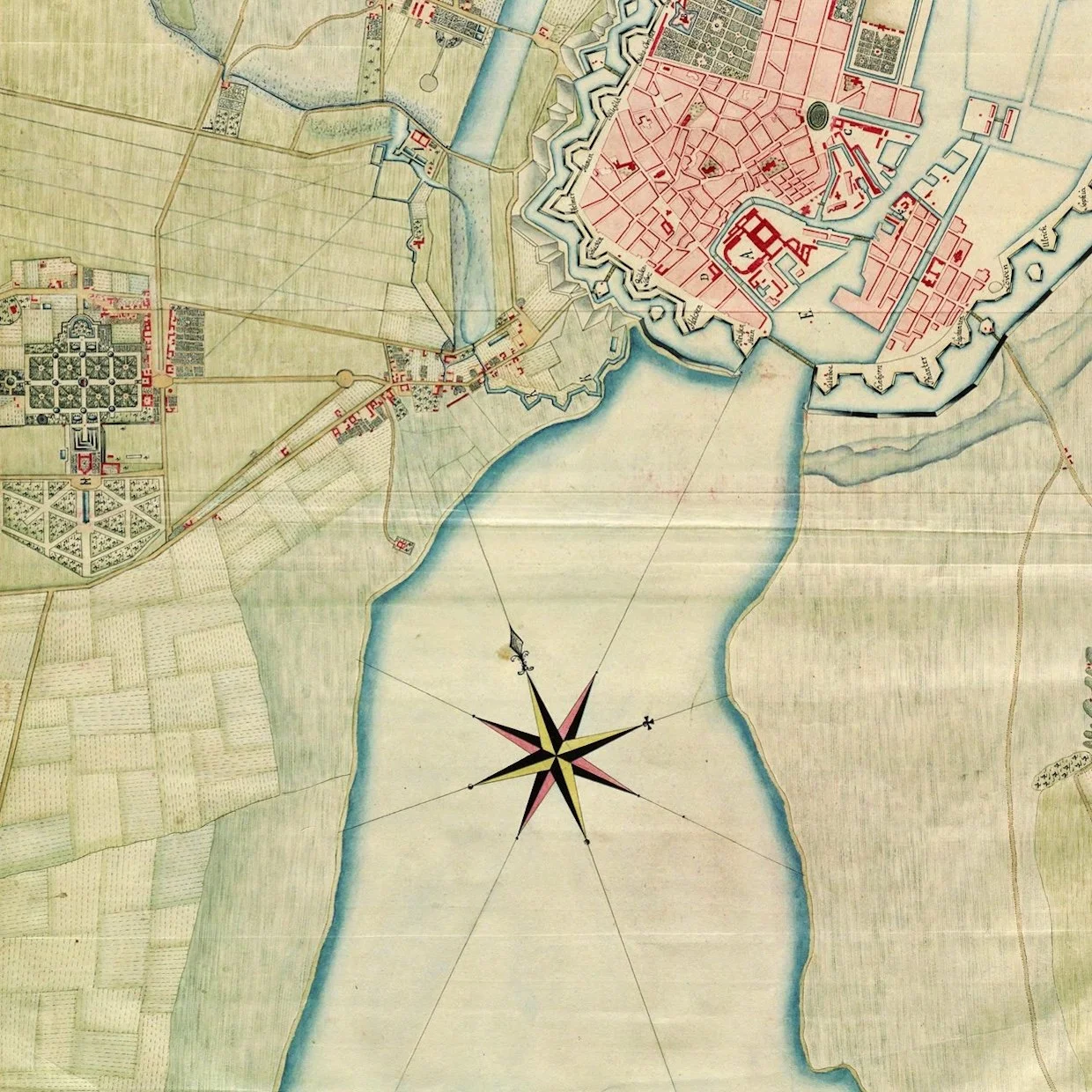
on the left is the distinct plan of the gardens of the palace at Frederiksberg and, at that time, there were only a few houses along the road that led to the west gate of the city - Vesterport - that was approximately where the square is now at the front of the city hall
what is obvious is the width of the bay to the south of the old city
when the first railway line was built it followed the shore of the bay on the line of what is now Sønder Boulevard


Sankt Jørgens Sø


Through the 17th century, the lake here was much more irregular in shape and spread out at the south end where it drained out to the harbour across low-lying marshes to the bay about 500 metres away.

Presumably, both Gammel Kongevej and Vesterbrogade - the road from Frederiksberg to the city through the West Gate were on causeways.

In part, the new storm drain is only needed now because so much land was claimed from the sea that the south end of Sankt Jørgens Sø is now 1.2 kilometres from the harbour.

a proposal to lower the level of the lake and to create wide new areas of grass and planting but if there was a major rain storm then the area could be flooded, returning it to the present level, as a giant holding tank before the water would be released into the harbour at an appropriate time and in a carefully controlled way.

Sankt Jørgens Sø from the north
steps up on the walk around the lake from Vodroffsvej

the path on the dam across the south end of the lake
Gammel Kongevej and the steps up to the lake … the level of the lake is approximately 1.5 metres above the level of the road
flood water will be taken from here to the harbour through the new drain


Enghave Parken - restoration and climate-change mitigation

November 2015

December 2019

Enghave Park was laid out in the 1920s on land that had been allotments. The overall design for the park was by the City Architect Poul Holsøe (1873-1966) who also designed the brick apartment blocks that were built around the large square and work was completed by 1929.

Holsøe was a leading proponent of neo-classical  or classically inspired architecture in Denmark in the years around 1920 and he was a leading architect in Landsforeningen Bedre Byggeskik - the National Association for Better Building - so advocated robust and honest architecture that was based on well-established and traditional building methods. The apartments have a simple and almost stark but solid form, stripped of decoration and based on good and carefully-considered proportions. The square itself has a regular layout with avenues and cross-walks that form regular and slightly formal rectangular or square spaces and was the work of the city landscape architect and gardener Valdemar Fabricius Hansen (1866-1953).

An obvious source of inspiration was formal Renaissance gardens and specifically here the King's Garden in Copenhagen that was laid out in the early 17th century.

The public square - Enghaven Parken - is at the west end of the Copenhagen district of Vesterbro so it is between Vesterbro and Carlsberg. The Carlsberg brewery was established in the second half of the 19th century on higher ground west of Copenhagen and south of Frederiksberg. Vesterbro, a suburb outside the old city, grew rapidly around 1900 and was markedly working class with many of the families employed in the railway marshalling yards; the meat market; the port to the south and, of course, in the Carlsberg brewery to the west and then, from the 1930s, in the power station HC Ørstedsværket.

The streets of apartment buildings in this part of the city are about as far from a regular grid as you can get with the position and alignment of streets reflecting earlier field and property boundaries and the piecemeal way in which the area developed. Many of the cross streets do run north to south but several of the main roads are at angels including Istedgade and Sonder Boulevard that run down towards Enghave Plads from the central railway station.

Ny Carlsberg Vej, crosses the area, and was the main road to the Carlsberg brewery. It runs approximately from south east to north west and is the road that runs through the famous Elephant Gate at the centre of the brewery site.

Ny Carlsberg Vej forms the south side of Enghave Plads and the main north to south road - Enghavevej - runs across the east side with the main entrance into the park from Enghavevej. Across the west side of the park is the cross street Ejderstedgade and Lyrskovgade runs across the north side. Early photographs indicate that the long apartment block along Lyrskovgade was the last block that was completed sometime after the park.

Because of the different angles of the streets, the area of the park is not square but slightly tapered - splaying out from 170 metres wide across the entrance frontage towards Enghavevej to a width 208 metres across the back. On the central east-west axis, the park is 197 metres deep from the  entrance to the back boundary.

The outer edge has a relatively high fence with a series of entrance gates marked by bold, simple stone gate piers and the park had a fairly solid hedge around the perimeter, immediately inside the fence. Some have criticised this as making the inner area of the park seem isolated or cut off from the adjoining streets although the other way of looking at this is to say that the inner area of gardens and lawns is peaceful because it is protected from the noise of traffic and the noise and overview of people on the streets and in the housing blocks around.

Inside the park, much of the area, perhaps surprisingly, is wide gravel walks. Inside the main gate was a long rectangular area of gravel running back on the main axis although early aerial views show this was planted with trees. Beyond that entrance area is a shallow rectangular lake 45 metres long on the axis by 27 meters although it was not given it's final form until the 1940s. The edge of the lake was marked by a border planted with flowers.

Beyond the lake and still on the central axis was a further large gravelled area and then a bandstand that is just in from the west boundary. This bandstand is a simple copper-covered shell, in effect a quarter of a sphere, that is designed to project sound forward. It is raised up on a stone plinth that forms a stage with facilities for performers in the basement. There is a shallow decorative relief in plasterwork, within the otherwise smooth and plain shell. By Aage Nielsen-Edwin - it is a classical scene depicting Apollo and the Nine Muses.

Inside the entrance to the park is a small statue of Venus by Kaj Nielsen (1882-1924) and then in 1933 one other statue was added - Youth by Einar Utzon-Frank (1888-1955) Danish sculptor, professor at the Royal Academy, and uncle of the architect Jørn Utzon - but it is noticeable that there is less sculpture here than in the older parks in the city.

The areas to the north and south of the central axis had lawns and planting with shrubs and perennials in the garden to the north and formal rose gardens and pergolas around the main lawn to the south. There was a play area north of the bandstand and sports courts in an area to the south so at the south-west corner of the park.

historic aerial view with Enghave Plads in the foreground - the site of the recently opened Metro Station and with Carlsberg Brewery in the background at the top of the view

the restored pergola at the west end of the Rose Garden with the statue
Youth by Einar Utzon-Frank added to the park in 1933

the lawn of the Rose Garden in December 2019 as work is completed

the north part of the garden from the west so looking towards Enghave Plads

1 - Playground
The manned playground has been opened with increased access from the park
2 - The Scene
The site has been renovated and will serve as a skating rink during the winter months
3 - Fountain
The fountain garden In the middle of the park where, during the summer, there will be recreational play with purified rainwater
4 - Multibanes
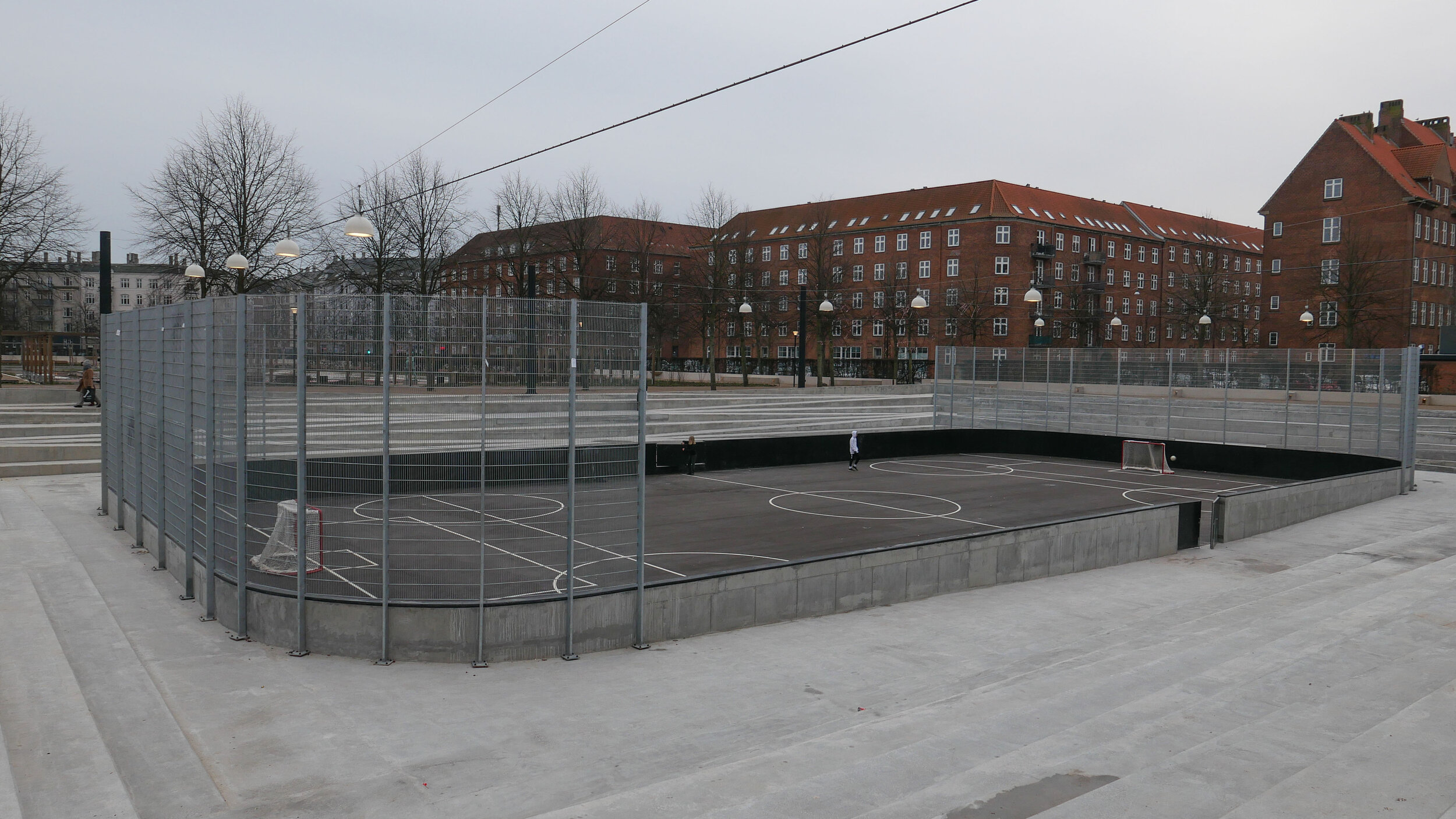
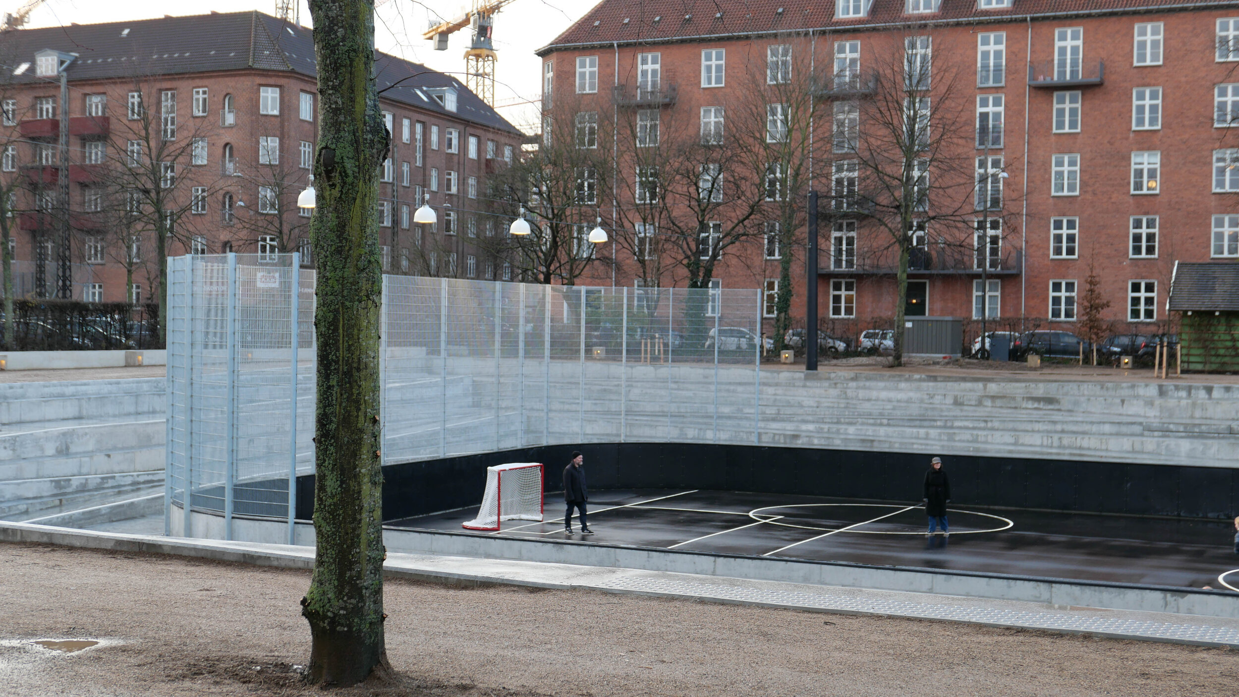
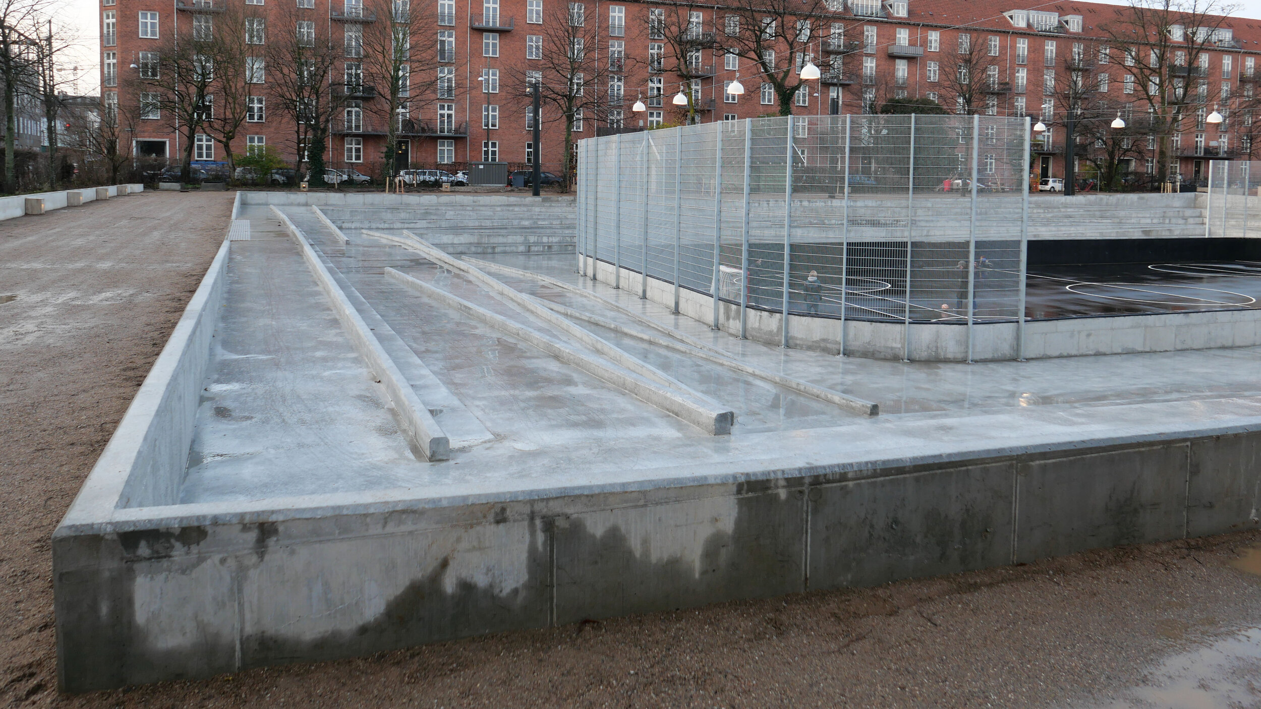
The multi-sport court is recessed by 3 metres and has integrated seating as well as rainwater retention capacity
5 - Library Garden
The plan of the garden has been brought back to the original and is a tranquil perennial garden for picnics and informal stays
6 - The Lake
Centrally located is the lake with a permanently lowered water level, which provides extra cloud burst capacity.
7 - Foyer / Entrance
The entrance to the park is framed by two restored Arne Jacobsen stalls, from which there will be outdoor seating
8 - Rose Garden
In Rosenhaven there are old scented roses in the beds and on the two pergolas. The garden has been submerged by 0.5 m and will hold rainwater both on the garden and also underground in pipework that takes 2000 m3 of storm water.

Arne Jacobsen at Enghave Parken

The band stand and pavilions on either side - both with shelters and toilets under a pitched roof covered with wood shingles - were restored in 2016 and the original pale-green colour reinstated along with trellis for climbing plants.

Research for the restoration work was undertaken by Bente Lange and it would seem that in looking at original drawings in the city archive it was found that the designs for these buildings were by Arne Jacobsen (1902-1971) . He had just graduated and was working in the office of Poul Halsøe before he established his own architectural practice in 1929. The drawing style and handwriting on these drawings have been attributed to Jacobsen by experts and so these are some of the architects first known works.

These three buildings are not in a style that would normally be associated with Jacobsen's work although some of the first houses he designed in Ordrup and Charlottenlund were in a simple vernacular style and the house for Mrs Steensen at Krathusvej 3, has a roof with a similar low pitch and with the ends of the rafters exposed along the long sides.

More important, in terms of the later architectural style of Jacobsen's work, are two small stone and glass pavilions that originally flanked the main entrance gate but were demolished in the 1970s. They too have been attributed to Jacobsen and reinstated or reconstructed as part of the most recent work on the park.

These have side walls in fine ashlar and shallow pitched roofs with the gable ends to the road and to the park but the front and back walls are glazed. The proportions are good and the detail of the steel framework and small touches, like the curved steps to the front and back doors, are superb. These surely are Jacobsen's interpretation of the 18th-century pavilions along the side of the King's Garden that had been added when the high wall around the formal garden that dates from the 17th-century was removed.

one of the entrance pavilions, designed by Arne Jacobsen, demolished in the 1970s but reconstructed from original design drawings in the city archive as part of recent and extensive restoration of the park

stone gate piers at an entrance on the south side of the park with the new flood wall beyond

the bandstand from the north with steps down to rooms below the stage

the restored buildings on either side of the bandstand


the restored bandstand with the area in front with an ice rink photographed in December 2019
photographs survive in the archive of the newspaper Politiken that show that the park was a popular venue for music -
one photograph from the 1950s shows the area in front of the bandstand crowded with people jiving


Climate-change mitigation

Extensive engineering works within the park have just been completed for one of the largest climate change mitigation projects in the city.

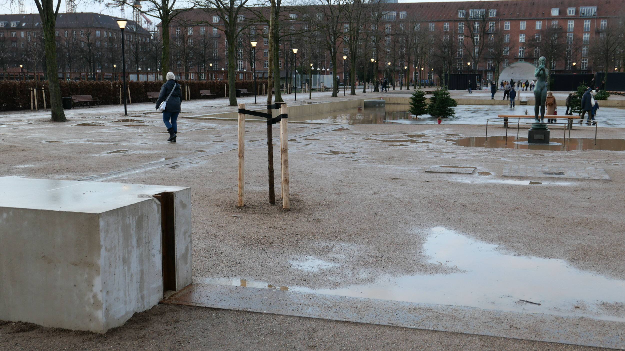
A large sections of the south side of the park was excavated to form underground holding tanks for flood water from sudden and potentially destructive rain storms and a concrete retaining wall has been built across the entrance side of the park that returns back along both sides and, in an extreme storm, solid barriers can be raised across each of the entrances and the whole area will be flooded.

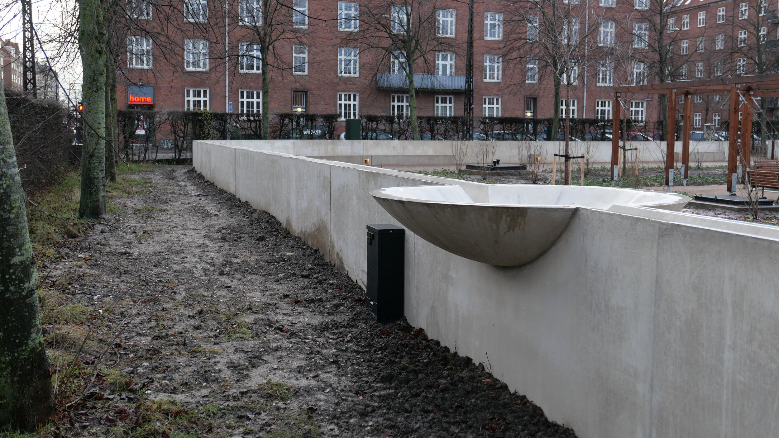
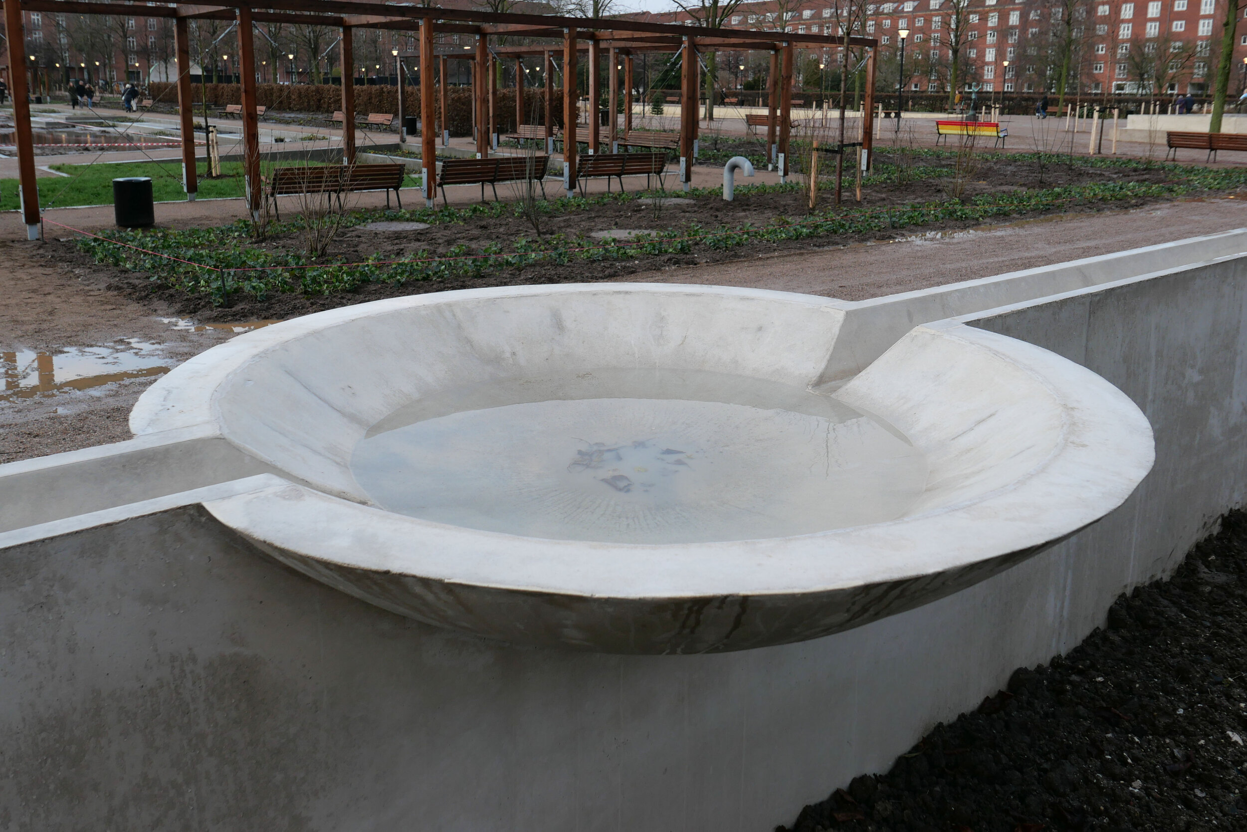
The retaining wall has a rill or channel along the top as a water feature and on the left side of the entrance there is a large, shallow, new basin on top of the wall that will fill with water. The form of the basin is appropriately classical in style.

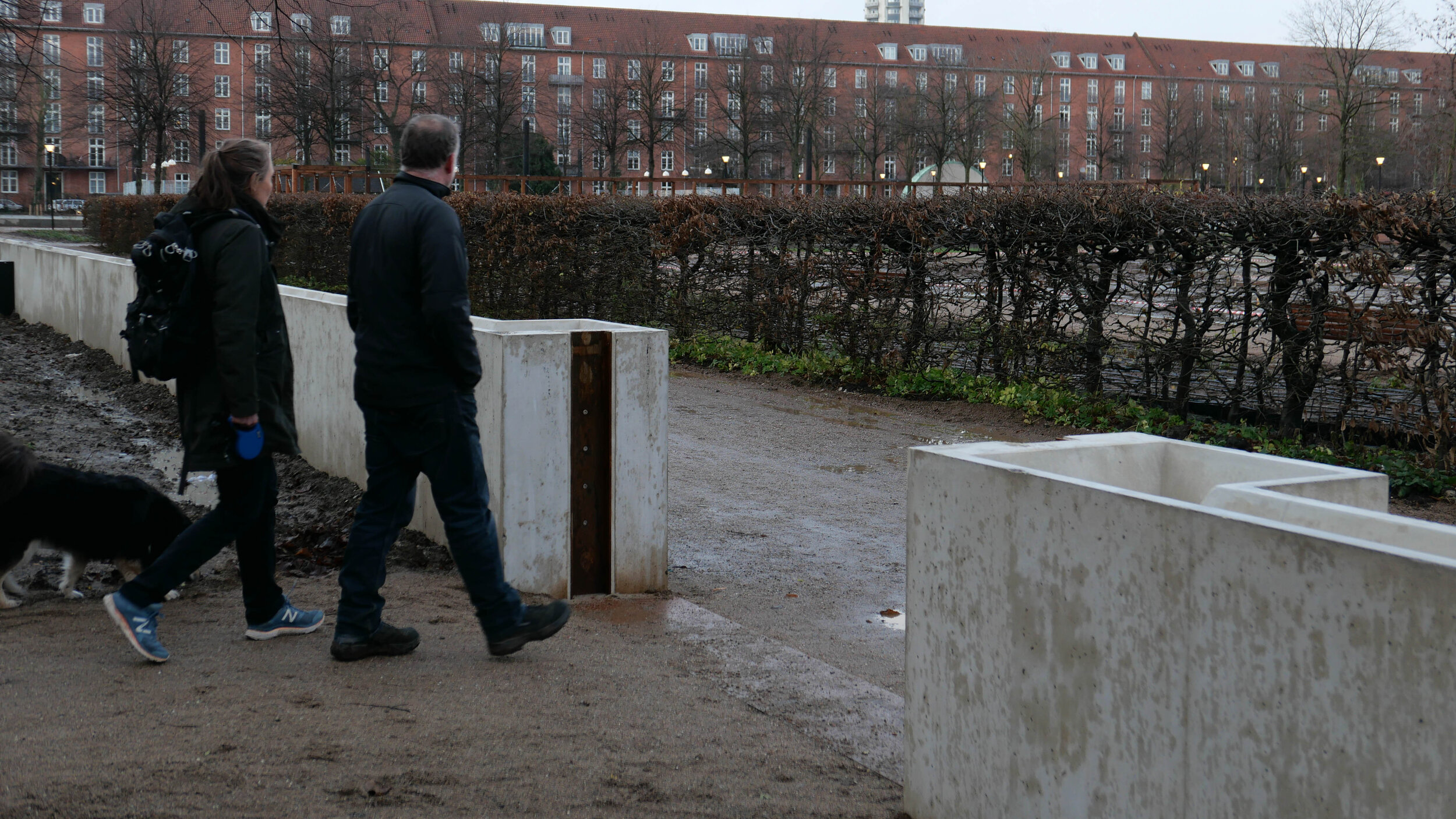
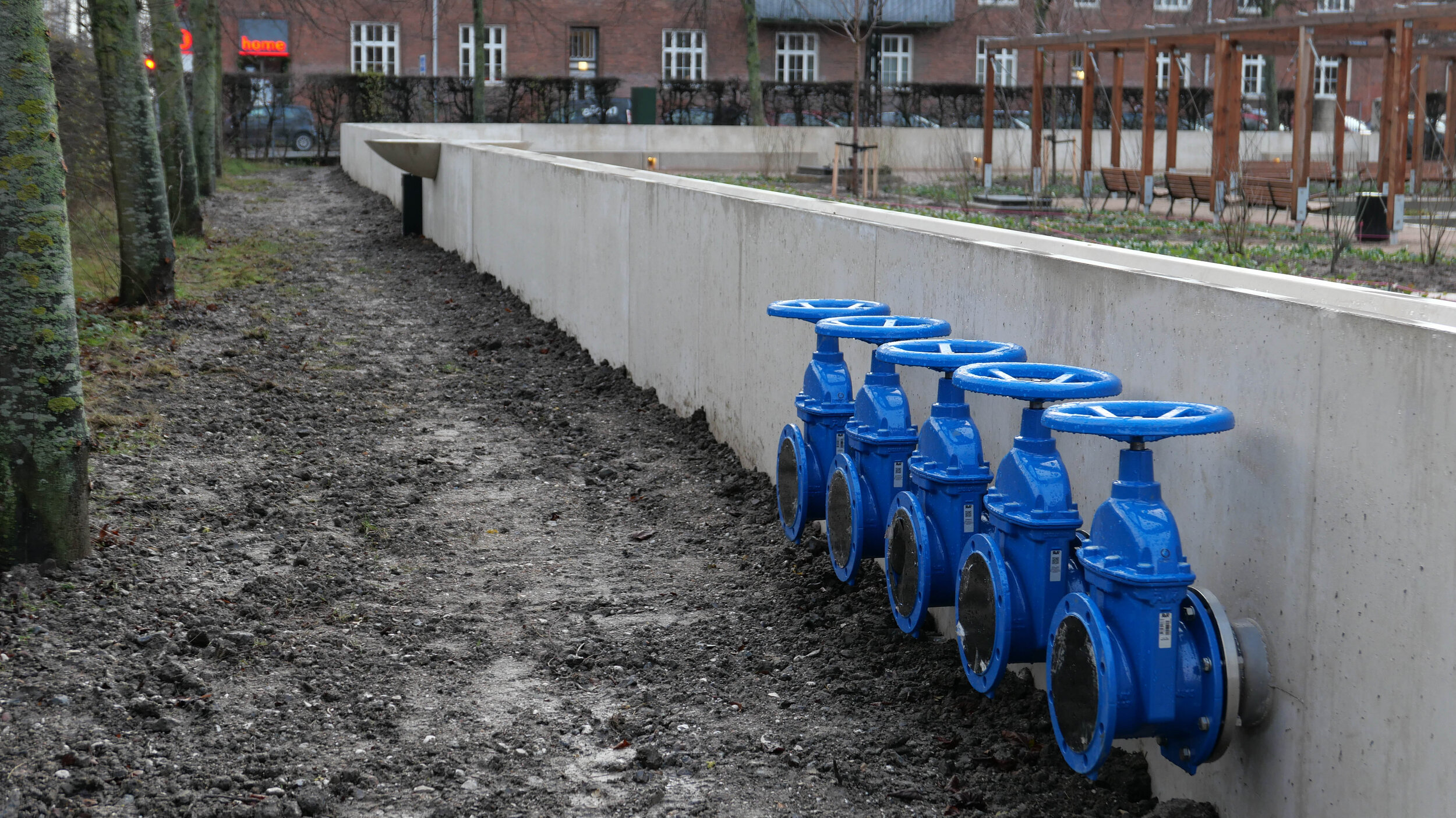
Giant stop taps in the wall give some indication of just how much water the system will cope with in a major storm.

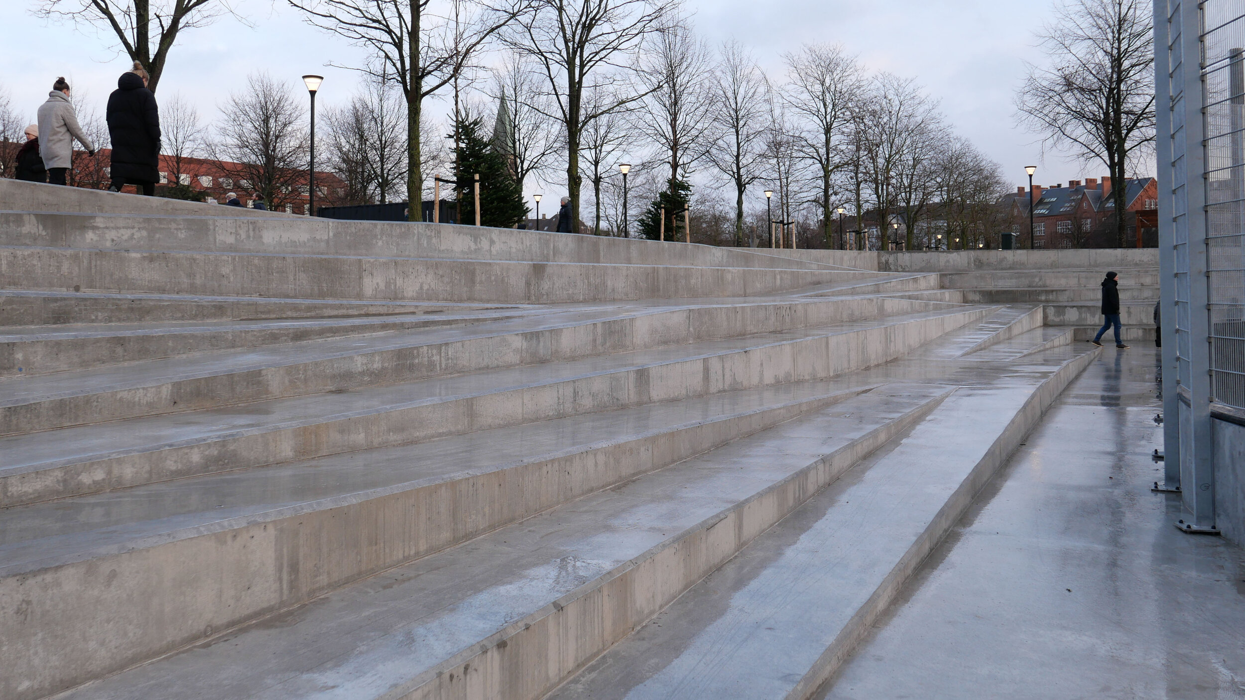
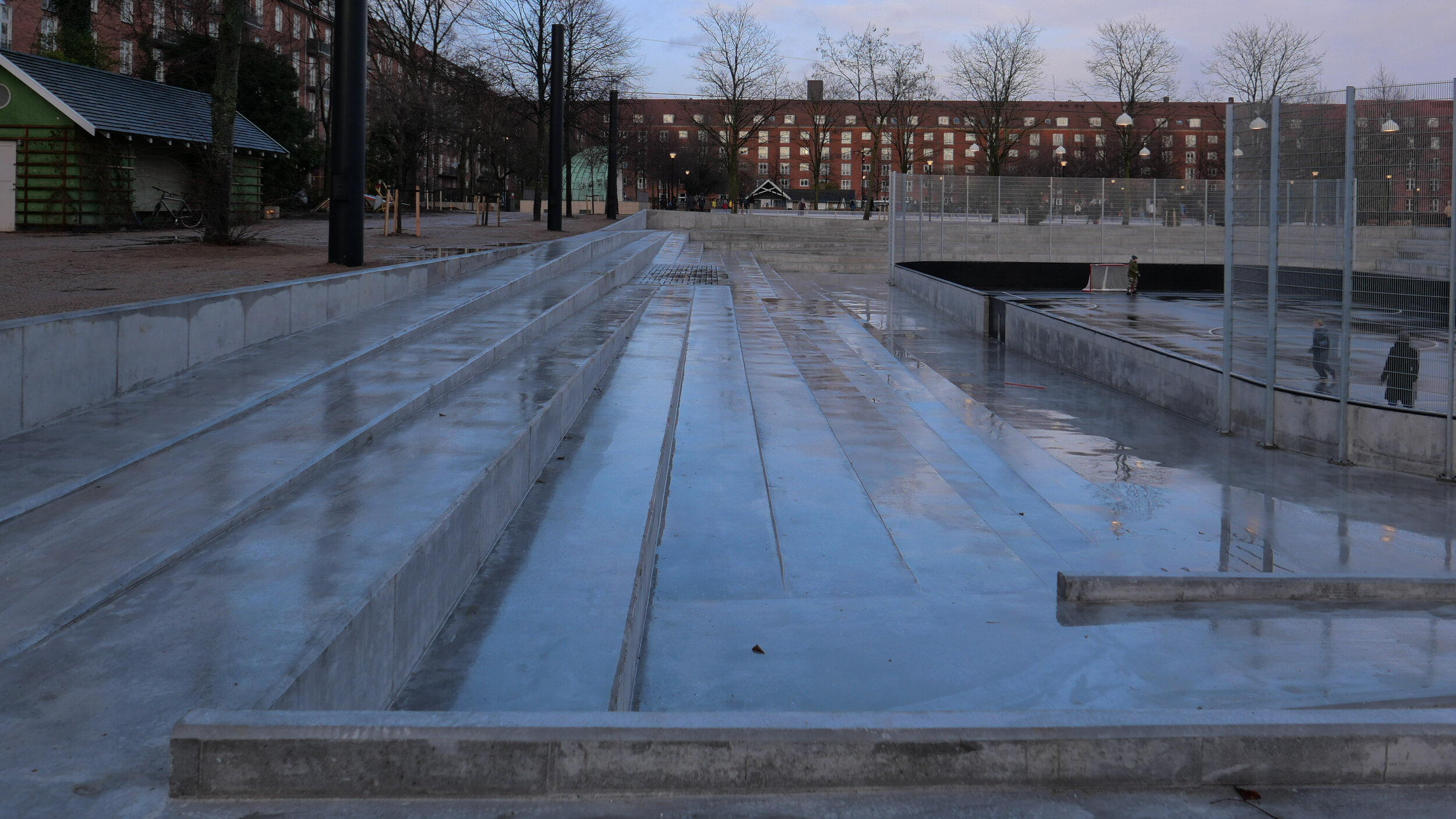
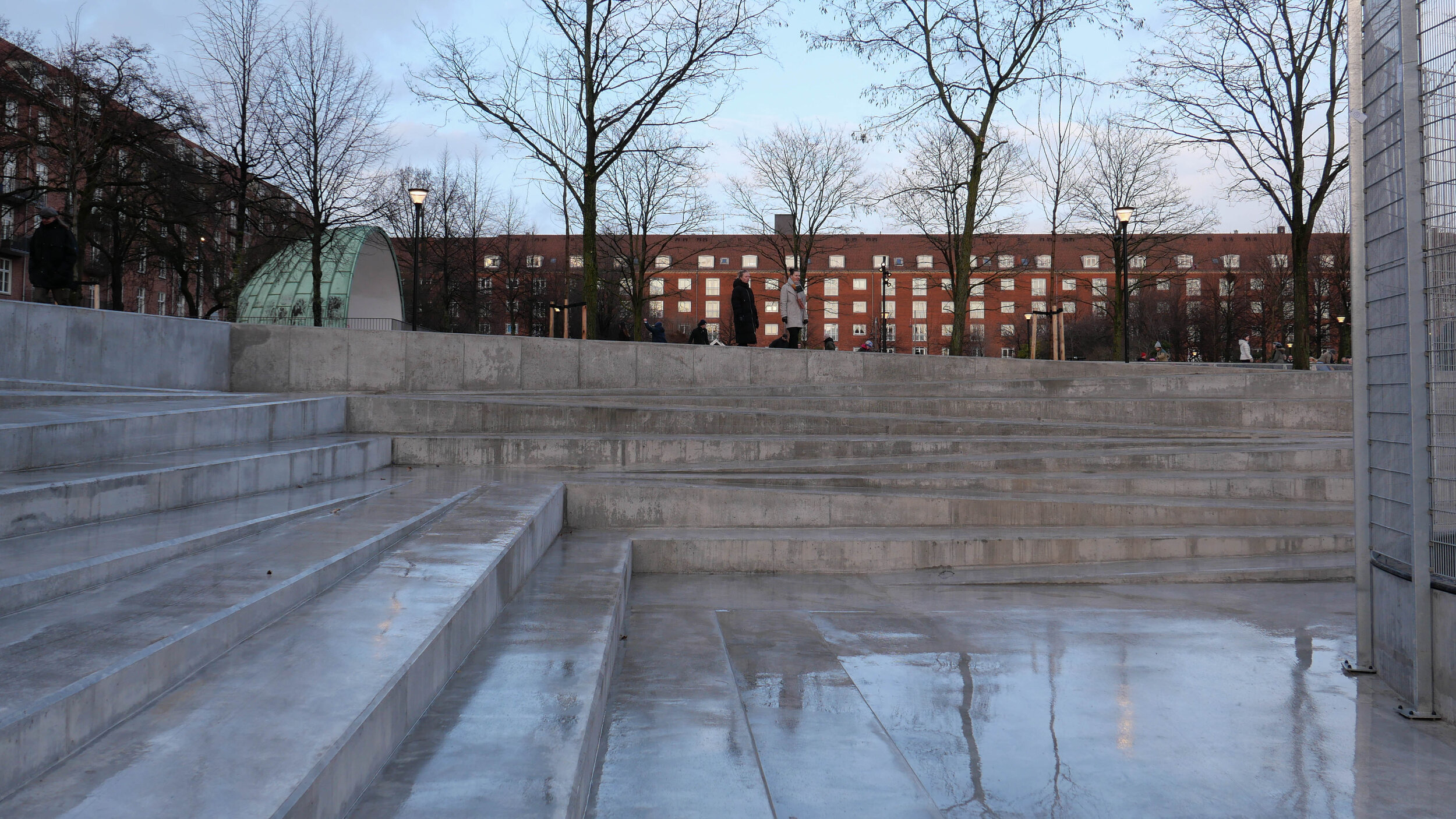
There are holding tanks for water under the rose garden but the most dramatic area of the new flood defences is the sunken courts for games in the south-west part of the park. This has been taken down three metres with a series of angled runs on each side for access and for the rain to drain down but these steps also provide seating for people to watch the sports on the court.

Engineering work has been by Cowi with landscape design work by the Copenhagen studio Tredje Natur.
This is not the best time of year to take photographs but at least with leaves off the trees then it is easier to see how the different parts of the park relate.

The north-east area of the garden with shrubs and trees around the lawn was barely effected by the work so is recovering first but work on the lawn of the Rose Garden is ongoing although the sea of mud here at the moment does show well just how wet the ground gets in rain and how quickly. That part of the garden has also been lowered and the pathways now slope down so rain water flows naturally into the area and will be taken into pipework of a holding tank under the lawn.

The park has had fairly traditional 'municipal' planting but there are plans for greater bio diversity.

Eighty-three new trees have been planted in the park, with 10 different varieties. Most are planted in connection with the re-establishment of the alleys. There will be 11,000 perennial plants, consisting of 55 different varieties in the Library or north-east garden as well as 950 fragrant roses planted in the Rose Garden and over the park 220,000 bulbs have been planted so altogether this will create habitats for urban wildlife including insects and small animals and presumably ducks and herons will return to the lake.

Enghave Parken was formally reopened on 14 December 2019.

account of the restoration work in 2016 by the AP Møller Foundation
drawings by Jacobsen published on line by the Royal Academy Library
Tredje Natur


across the east side of the park and returning back along the north and the south side is a new retaining wall in concrete with a rill or water channel along the top

if there is a major rainstorm then barriers can be raised across each the entrances to form a continuous dam so that the whole east side of the park will be flooded to protect nearby streets and properties


courts for a number of different ball games at the south-west corner of the park has been lowered by three metres and will hold flood water before it is released into the harbour under careful control so that drains and sewers are not damaged

stored rain water will be used to water trees and filtered water will be fed back to fountains near the lake that will be a play feature for children


Sankt Jørgens Sø - planning for climate change

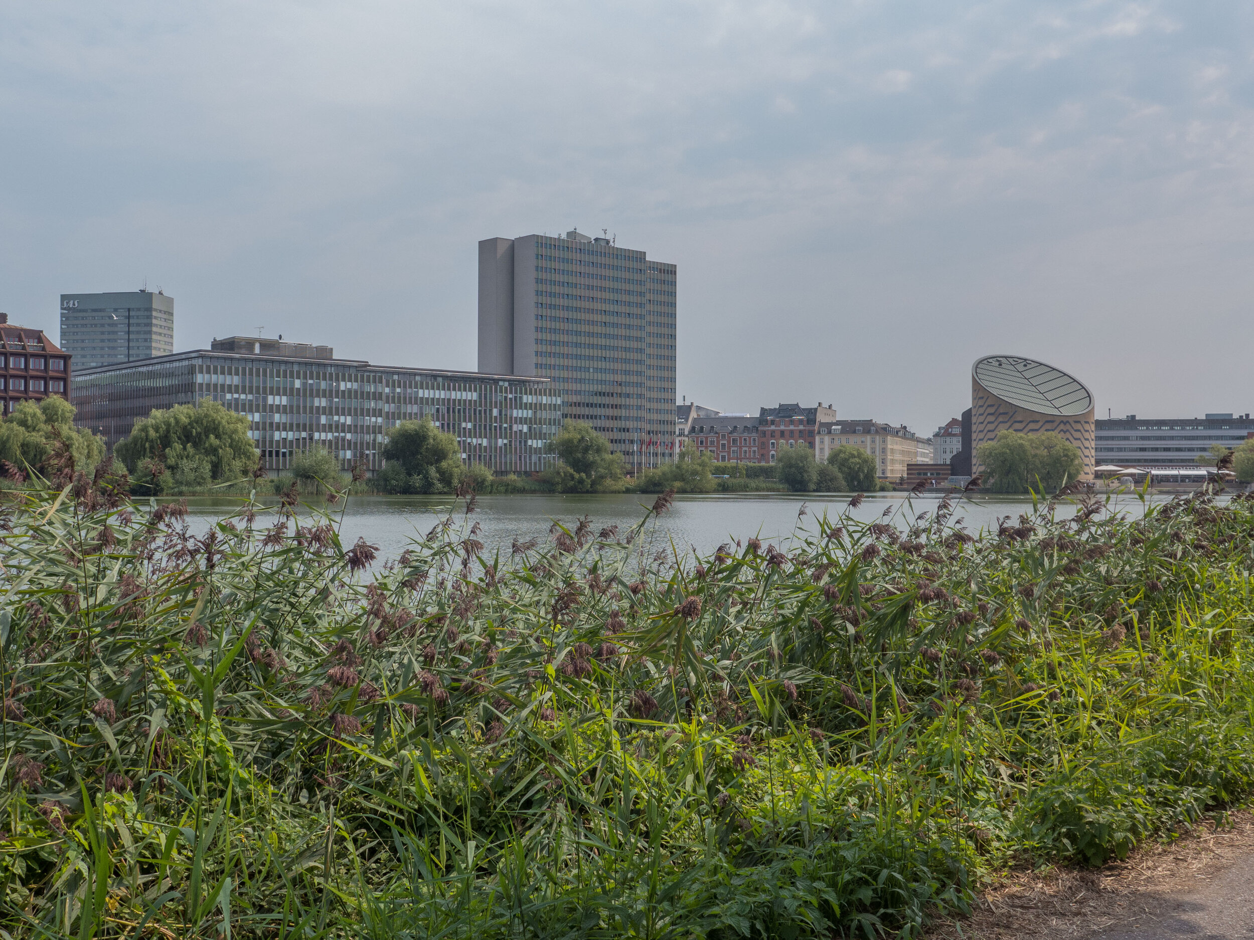
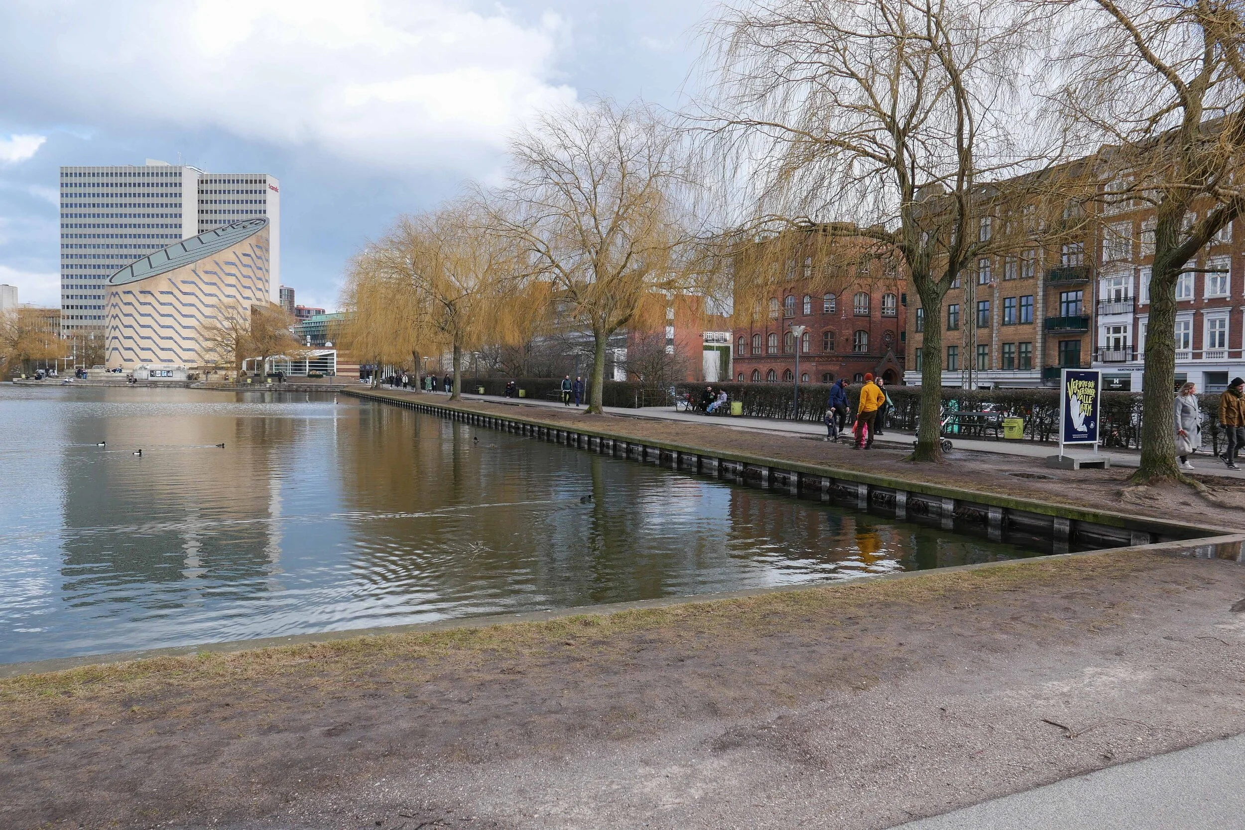
Sankt Jørgens Sø from the north with the Tycho Brahe Planetarium at the south end

Planning for one of the most dramatic and extensive climate-change schemes in Copenhagen has been put on hold for more detailed consideration.

This is a proposal to change Sankt Jørgens Sø - the southernmost of the three lakes that form an arc around the west side of the historic city - so that it can hold back flood water when (not if) there is a major rain storm.

To understand what is now proposed, it is important to understand the topography and something of the history of this part of the city and its development over the last five centuries.

In fact, Copenhagen as a settled site, dates back over a thousand years. The settlement was established on slightly raised ground on a gentle, south-facing slope with the open sound between Denmark and Sweden immediately to the east but the trading settlement was tucked around slightly, with its water frontage facing south and protected by the low-lying island of Amager across shallow water almost 2 kilometres to the south and with higher land of what is now Fredriksberg to the west that provided some protection from the worst of the winds and rains that come from the west.

one of the proposed schemes showing the lower level of the lake and a new park

a proposal for lowering the lake
and setting out a new park
by the engineering consultants Ramboll

1658

this map was produced as the military defences of city were extended north - out to the Citadel - Kastellet

1860

the military defences including the north and the west gates into the city were not removed until the 1870s but the lakes had already taken on their more regular outline and there were settlements or suburbs out beyond the lakes

1888

note here the railway line out of the main station then went from marshalling yards east of the lake and left the city across the broad causeway across the north end of Sankt Jørgens Sø

now

image from Google Earth
Tycho Brahe Planetarium at the south-east corner of the lake was designed by Knud Munk and opened in 1989


Between that settlement and more open countryside to the north and west there was an arc of low and poorly-drained ground that provided a natural defence across the back or landward side of the trading city …. open ground that could be defended from the defences of the city itself and, better still, wet bogey ground that would slow down an advancing army.

In the 1580s, in a major piece of landscape engineering, a river to the west of Copenhagen that drained naturally to the south, was diverted in a great loop to flood this lower ground. That river entered the lakes at what is now Åboulevard - at the top end of Sankt Jørgens Sø and although this is now a main road route into the city, the river survives in a covered culvert below the road.

The line of lakes not only improved the defence barrier - any army attacking the city from the land side would have to cross this water - but the system also provided a constant supply of drinking water for the expanding city.

There were extensive military defences at the north end, between the lakes and the sound, and at the south end, between the lakes and the south end of the harbour, and with smaller defences around causeways across the low land. These lower defences went around Sankt Jørgens Sø suggesting that the city was protecting its water supply.

Until the 18th century, the area of water in the lakes was irregular in shape - particularly at the south end - and there were few buildings - statutes kept the area clear so there was no cover for attackers. The margins of the lakes seem to have had low scrub and reeds.

In the late 19th century, after the defences and the old city gates were removed, the city expanded rapidly outwards, first across the line of the defences, then up to the edge of the lakes and then on outwards beyond the lakes to new districts of housing in Østerbro, Nørrebro and Vesterbrø - all beyond the lakes.

With the construction of a wide new "bridge" across the lakes 1887 - on the line of the original approach to the old medieval north gate - the sides of the lakes were straightened and embanked to form a sharper edge and for a pathway all round the lakes …. over 6 kilometres for a complete circuit so the lakes are a major amenity for walkers, runners and for families … feeding the ducks is popular. 

The current level of the water in Sankt Jørgens Sø is maintained artificially. Kampmannsgade - the road across the centre of the lake is below the level of the water in the lake; the west bank - called Svineryggen or Pigs Back acts as a retaining bank although the small park at the centre of the west side, outside the bank and much lower than the path, always seems to be bogey and a broad pathway across the south end of the lake disguises just how much the difference is between the level of the lake on one side and the level of Gammel Kongevej below the bank.

The proposal being considered would mean returning the lake to it's natural level so that if there was a major rain storm then the area would be allowed to flood, taking water from the densely built-up streets of Fredriksberg to the west and holding the water to prevent it damaging drains and sewers and flooding streets.

a map from 1705 shows the course of the river that was diverted in the 1580s to bring water into the lakes at a point between Peblinge Sø and Sankt Jørgens So - on the line of what is now Åboulevard - and this and the historic map below show the military defences of the city enclosing the lake


painting by Christen Købke of the north lake in the 18th century looking across to the city


Management of water levels in Sankt Jørgens Sø - surface water flowing into the lake and the release of water out to the harbour - and the control of the quality of the water in the lake are part of the management of drainage in Frederiksberg, Vesterbro and in the western part of the centre of Copenhagen by the water supply and drainage company Hofor.

A well-illustrated report, published by Hofor, shows how Sankt Jørgens Sø fits within the overall management of storm water in this part of the city.

Konkretisering af Skybrudsplan Ladegårdså,
Frederiksberg Øst og Vesterbro


There are three possible schemes that are being considered for the management of storm water flowing through Sankt Jørgens Sø.

The first is the most dramatic in that the level of the south part of Sankt Jørgens Sø, the part south of Kampmannsgade, would be lowered by over 3 metres and in compensation, or as a new amenity, the exposed land would become a large new park that would be allowed to flood if there was a storm.

The second scheme would see both parts of the lake lowered but not by as much so there would be a narrow park along the whole of the west side.

In the third option there would be less change in the level but new large pumping stations, to deal with flooding, would have to be constructed.

After further consultation, an impact assessment will be completed in 2020 and a final decision will be made in 2022.

report from the Kommune for the proposed scheme


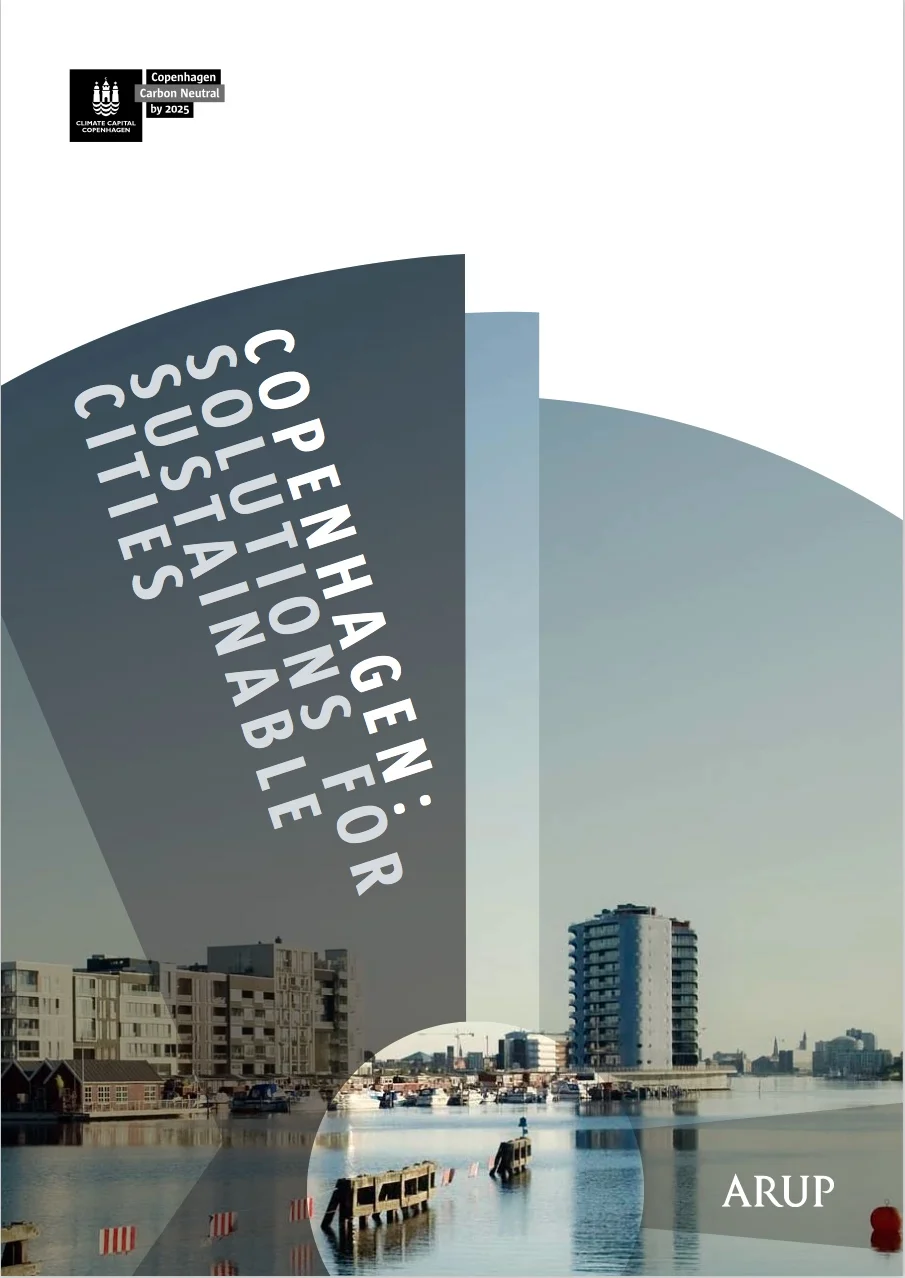
Copenhagen: Solutions for Sustainable cities - a report from Arup


This report from the engineering consultants ARUP sets out many of the important principles that now guide planning policies for the city of Copenhagen.

It has a short introduction by Frank Jensen - the major of Copenhagen - where he writes about the efficient use of limited resources and concludes that "It was thought that environmentally friendly development would limit economic growth. However, quite the reverse turns out to be true. Green growth can, indeed, boost economic development and the quality of life .… the business of introducing sustainability into the city poses very different issues than affecting it in the country as a whole … and require city specific solutions."

The report sets out the problems and some of the solutions that the city has adopted - often through the use of innovative technology - and the achievements, in terms of environmental gains, along with lessons to be learnt.

There are good, clear graphics, a lot of information and interesting details about projects under eight main sections.

Headings for those sections of the report give a good indication of priorities for the city, in terms of sustainability, both now and for the future ….

THE HARBOUR TURNS BLUE
MEETING THE RISING DEMAND FOR WATER
CYCLING: THE FAST WAY FORWARD
TRANSPORT: THE GREEN LIGHT
MAKING THE MOST OF WASTE
THE FORCE OF PUBLIC SUPPORT FOR WIND POWER
KEEPING THE CITY WARM EFFICIENTLY
KEEPING COOL UNDER CO2 PRESSURE 


ARUP - Copenhagen: Solutions for Sustainable cities

ARUP publications


just a few of the facts:

  • 22% of Denmark's total electrical consumption is produced from wind turbines … the highest proportion in the World

  • there are 42 kilometres of Greenways through the city where cycling is prioritised

  • waste sent to landfill is now less than 5% of the amount dealt with in that way in 1988

  • the city heating system is one of the largest in the World and supplies 500,000 people with reliable and affordable heating