Halmtorvet - a new storm water drain
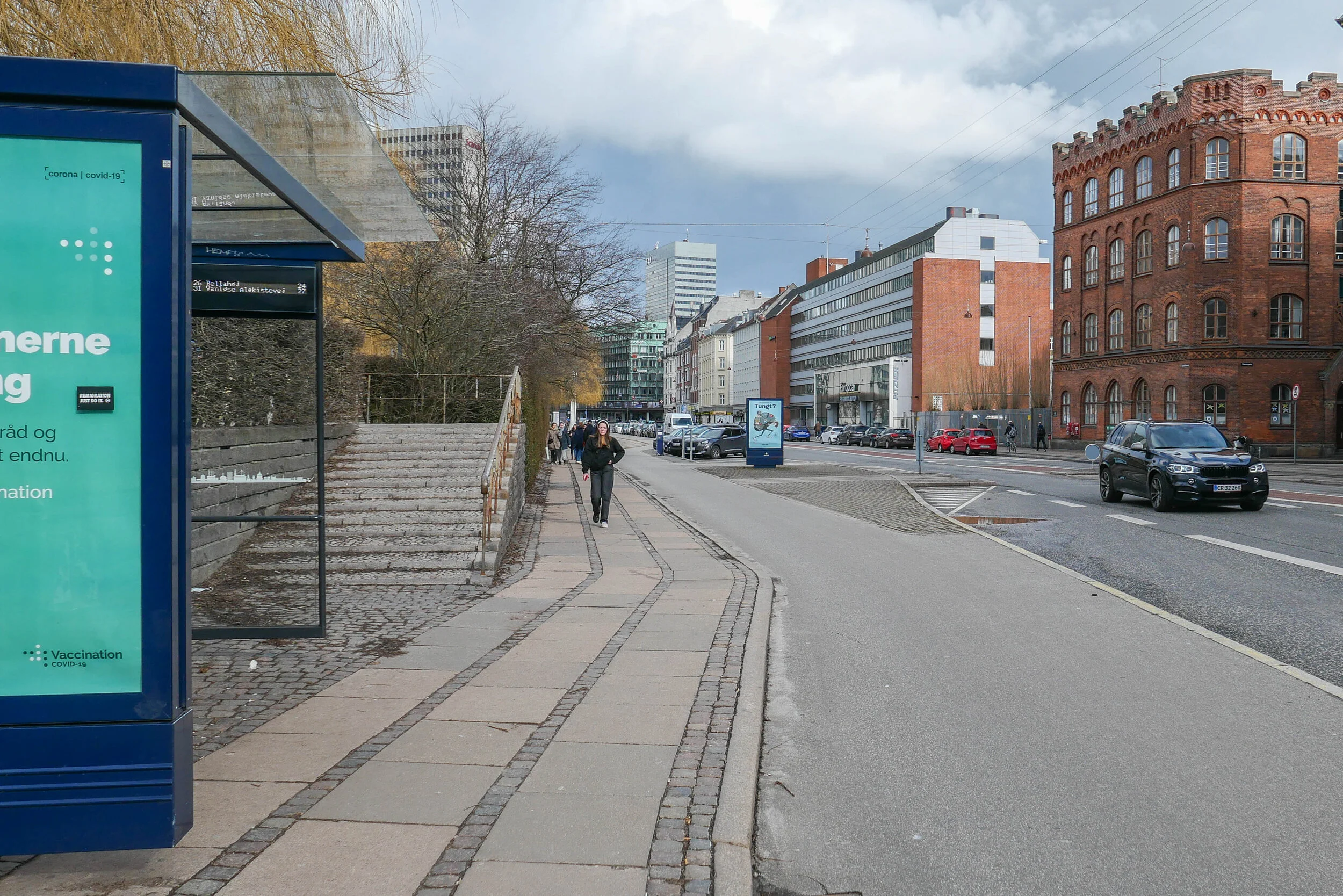
/Sønder Boulevard - the wide street running out to the south east through Vesterbro from the west side of the main railway station - is now partly blocked with high hoardings like those that were used around main sites for engineering work when the metro was constructed. However, this site is not for the metro but for major engineering work to construct a massive storm drain.
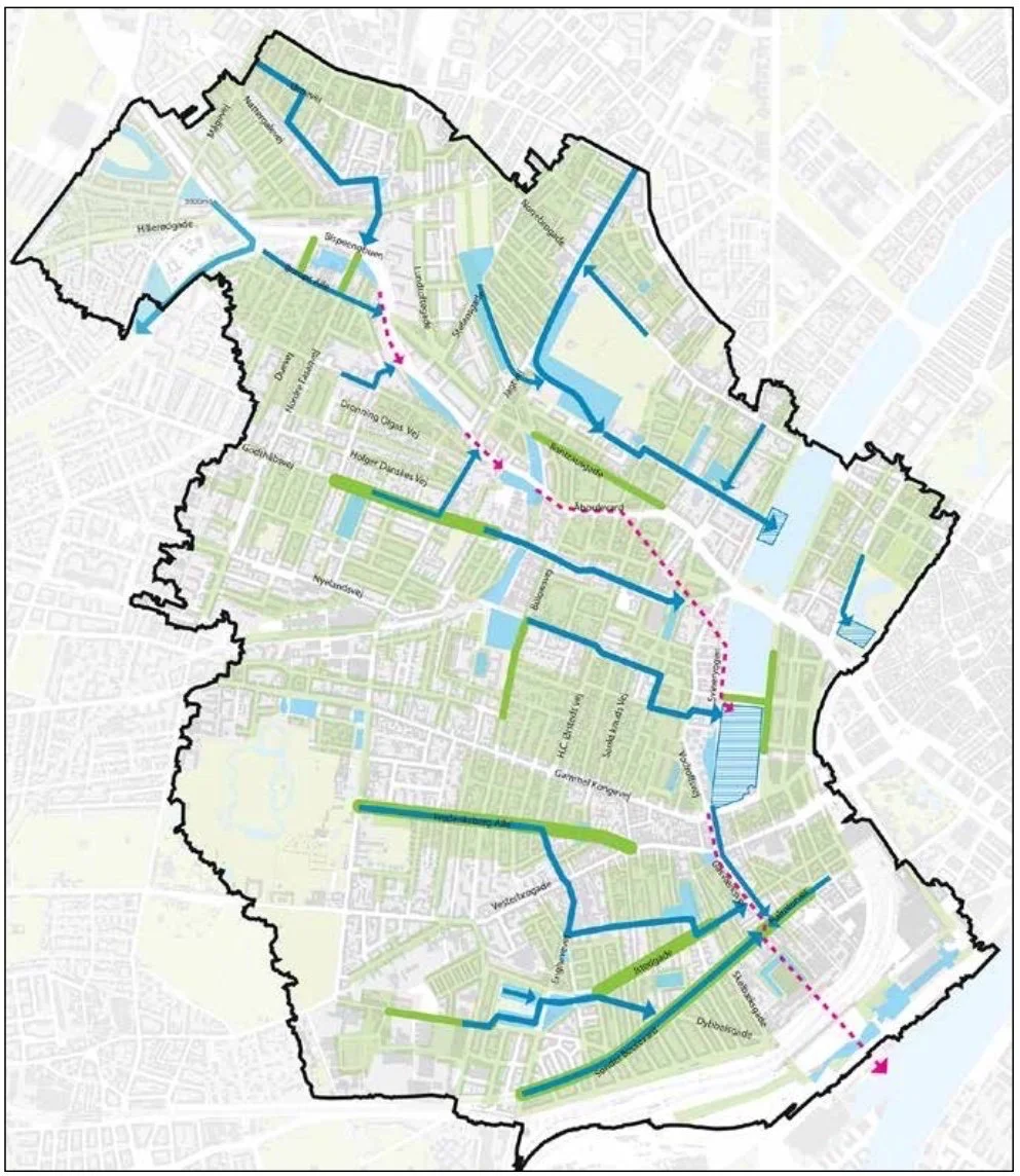
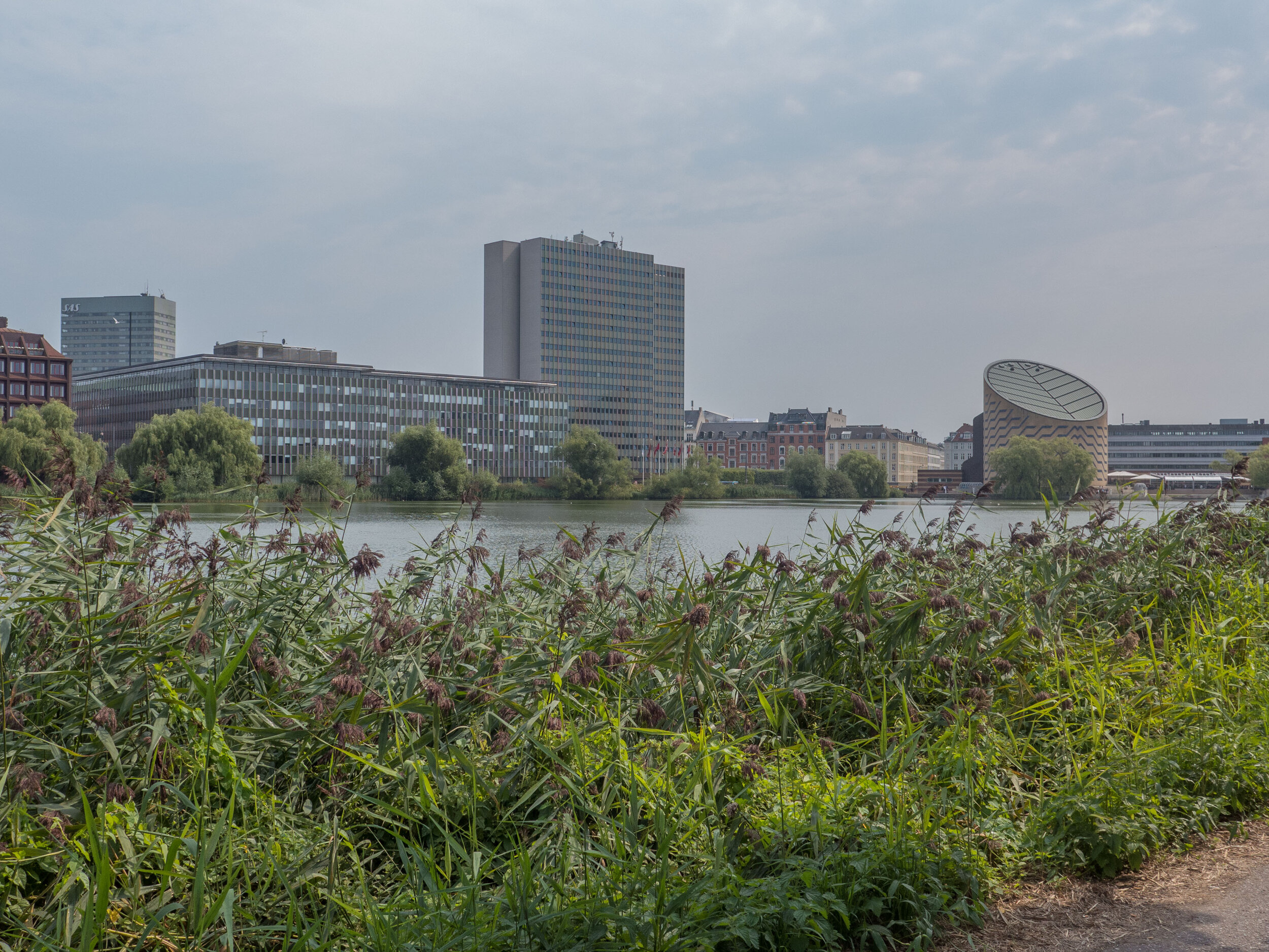
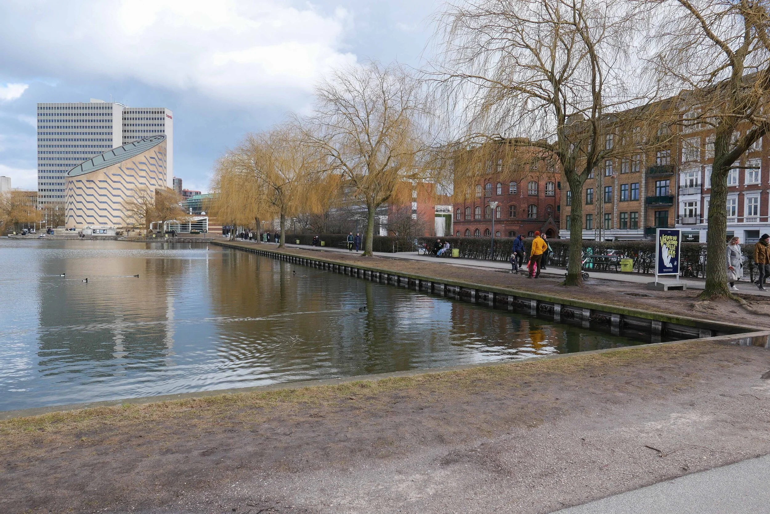
It is part of a scheme for rain-storm mitigation for Frederiksberg and, when completed, it will be about 1.25 kilometres long to take storm water from Sankt Jørgens Sø out to the harbour with an outlet just east of the Copenhagen Island Hotel on Kalvebod Brygge … close to the swimming area in the harbour at Fisketorvet.
A plan by the water and engineering company HOFOR shows how new drains and gullies will take water from the streets and roofs of the densely-built area of Frederiksberg and Vesterbro out to the lakes on the west side of the city centre and from there it will be released, as and when appropriate, to keep surface water on roads to a minimum, to prevent the flooding of basements and to ensure that house drains and sewers are not inundated.
There is a proposal, not yet confirmed, to lower the level of Sankt Jørgens Sø that is now kept at it’s current level by a dam across the south end so the surface of the lake is well over a metre above Gammel Kongevej - the road across the south end of the lakes. If it was kept at a lower level, then, if there was a storm, the lake could be used as a large emergency reservoir to hold considerably more flood water, for a short period.
A well-illustrated booklet from the water company Hofor sets out why the mitigation work is necessary and the extent of the work and can be downloaded from their on-line site.
building out into Kalle Bod - the bay between Frederiksberg and Amager
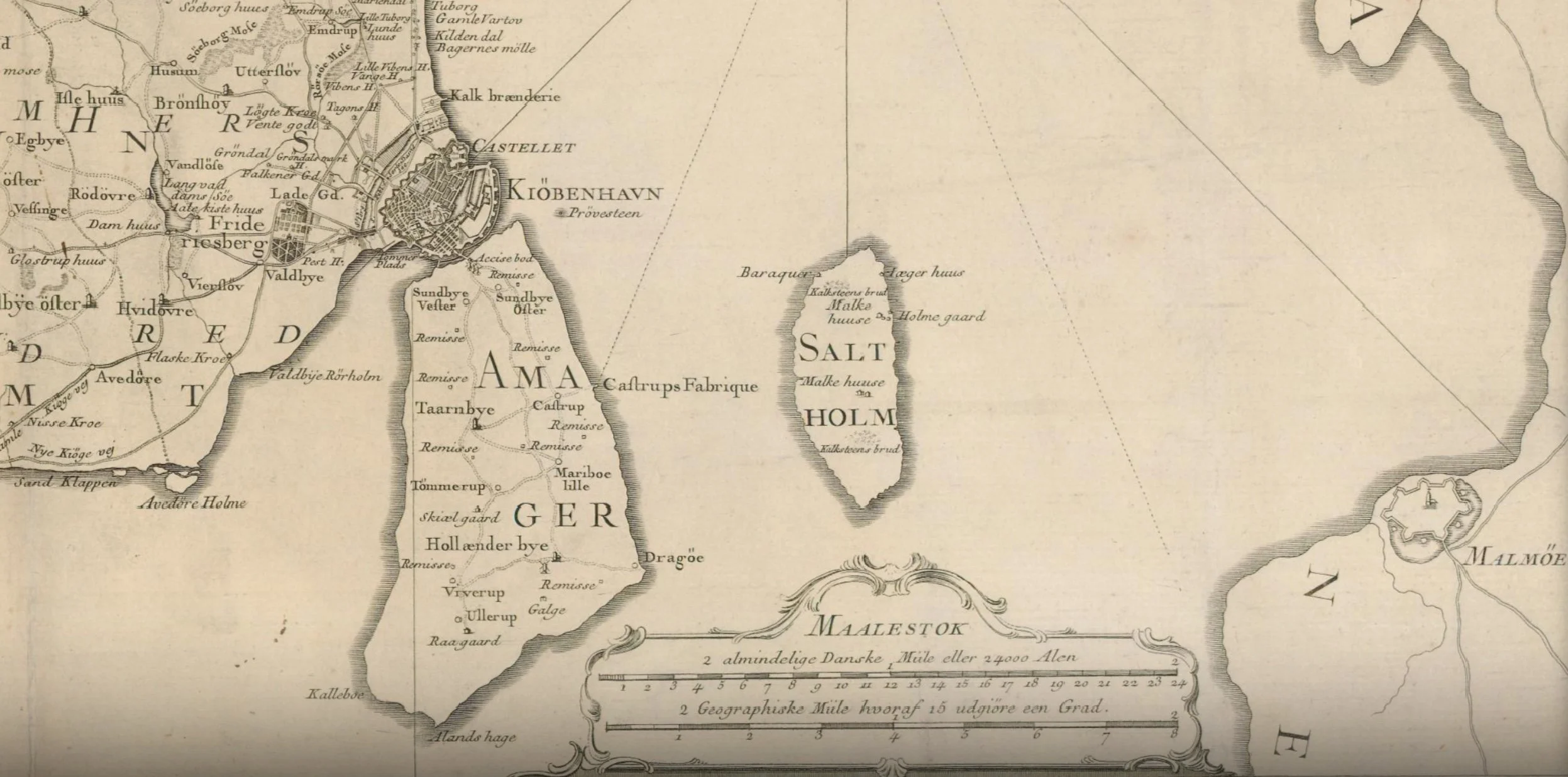
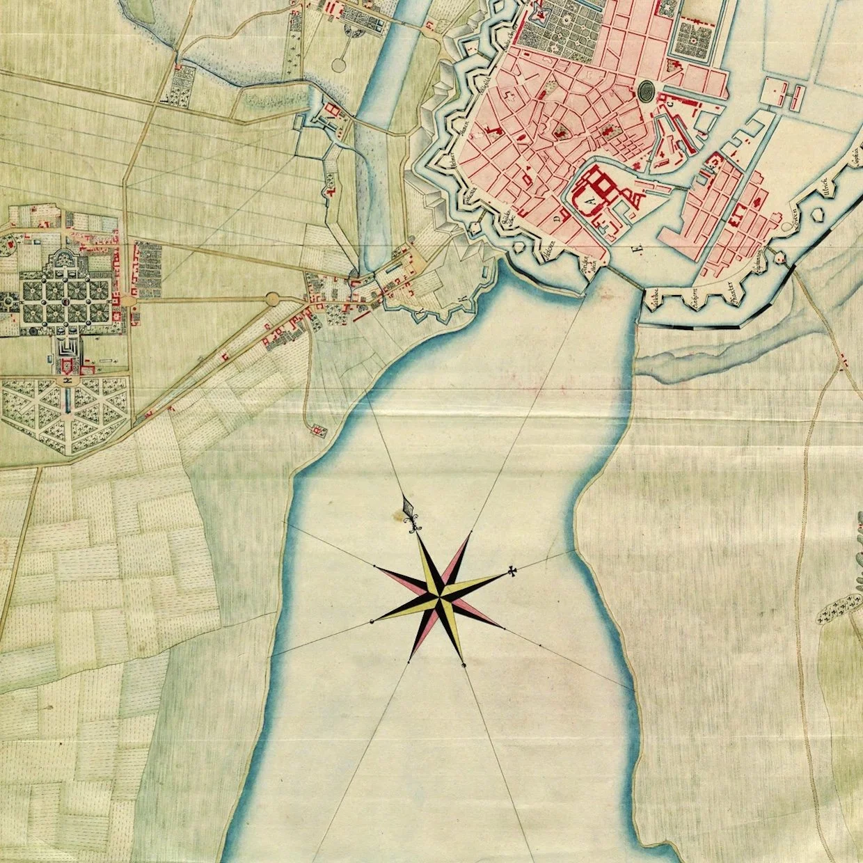
The map of 1788 shows the wide channel between the city and Amager that had been narrowed by the construction of Christianshavn in the 17th century and then the construction of the defences to protect the area where the ships of the Danish navy were moored.
Presumably, the bay to the south slowly closed with silt as the sea could no longer flow freely between the city and Amager.
From the middle of the 19th century land was claimed from the sea on both sides of the bay - first for the first railway line and then the meat market and a gasworks on the Frederiksberg side and then timber yards close to the entrance to the harbour.
In the late 19th century, the Danish army - the artillery - moved out to Amager, just beyond Langebro, where they built a rifle factory and shooting ranges and then around 1900 commercial quays were built to create Islands Brygge that extended well out into the bay.
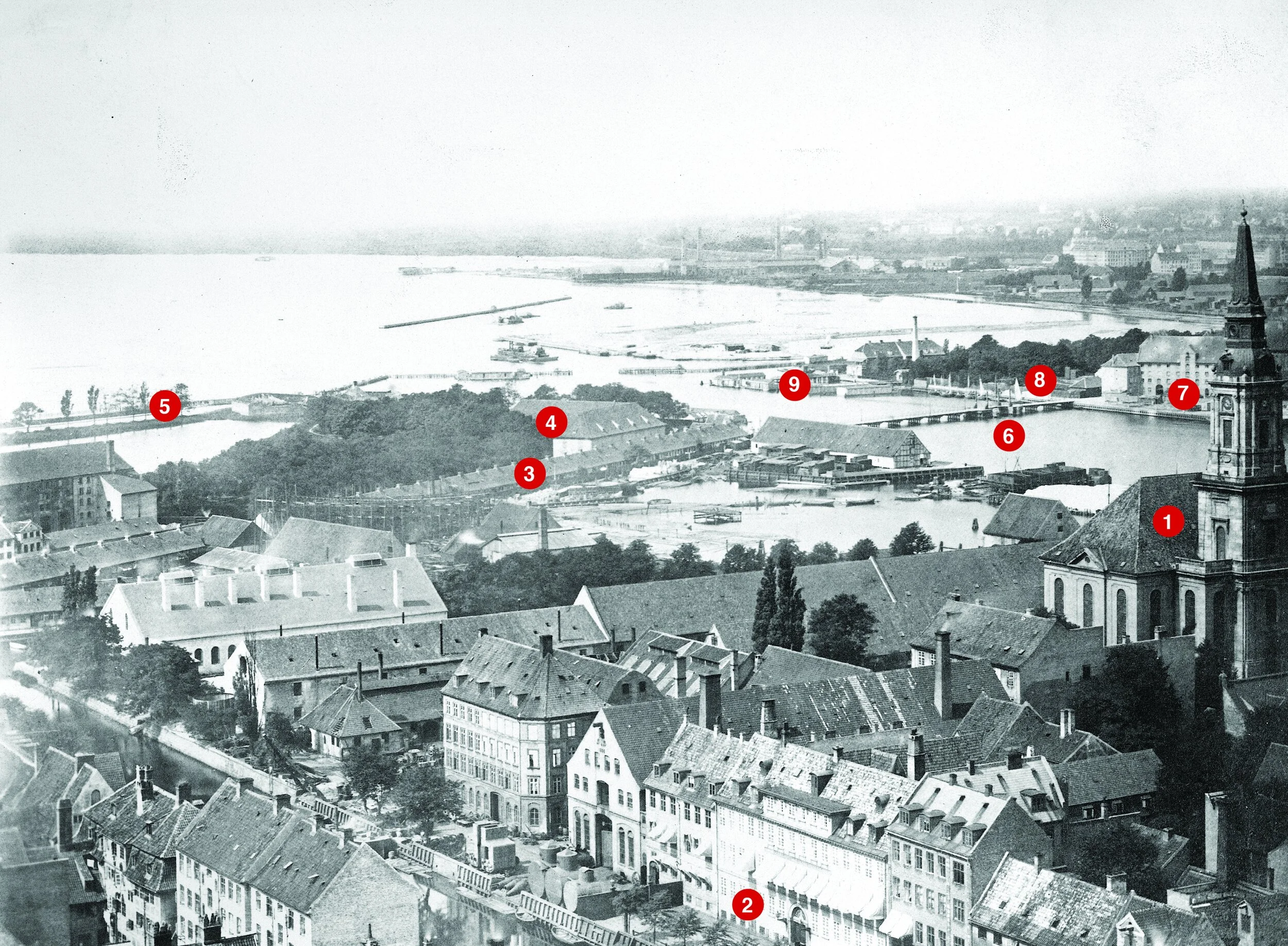
The photograph above - taken between 1867 and 1869 from the tower of Vor Frelsers Kirke on Christianshavn - is the view looking to the south west with Kalle Bod, the wide bay that opened out to the south of the harbour, with Frederiksberg to the right and Amager, out of the view, to the left.
Key buildings shown in the photo that survive are Christians Kirke to the right ① and the large house on the canal. ② Buildings beyond the church was a shipyard and engineering workshops that do not survive and the basin has been infilled.
The long building ③ was a rope walk on the north side of what is now Langebrogade. The buildings ④ are on the bastion to the east of the entrance to the harbour and survive but the outer defence ⑤ is now under the roadway on the west side of Langebro, the present bridge that was completed in 1954. The earlier Langebro ⑥ was on the line of the new pedestrian and bike bridge called Lille Langebro.
Mills and breweries ⑦ are on the site that is now BLOX ⑧ and the low buildings ⑨ was the bathing station. Beyond, between the bathing station and the shore was a timber yard just outside the defences and that is now the site of the Ny Carlsberg Glyptotek. Further along the foreshore, early infill of the bay created land for the first buildings of the meat market and a gas works.
photograph from the City Archive reference 25925
Copenhagen City Archive reference 40015
In the late 19th century, massive timber, earth, brick or stone walls and embankments were built down the harbour in a number of stages with infill behind for the present railway that runs into the central station from the east and for the railway works and the road now called Kalvebod Brygge. The office buildings between Langebro and Fisketorvet - on the left in the photograph - are all on land claimed from the bay. The buildings on the right or east side of the harbour are on Islands Brygge and also on man-made infill of the bay
the south harbour looking from the cycle bridge at Fisketorvet towards the city with Langebro in the distance
It would seem ridiculous to claim that the harbour here is narrow - it’s almost 400 metres wide - but if you had been swimming in this area of the harbour in the middle of the 19th century - in the area where the harbour swimming is at Fisketorvet - just to left of this view - then you would have been 800 metres from the beach on the Frederiksberg side and at least 700 metres from the shore on the Amager side.
detail of a map of 1749
on the left is the distinct plan of the gardens of the palace at Frederiksberg and, at that time, there were only a few houses along the road that led to the west gate of the city - Vesterport - that was approximately where the square is now at the front of the city hall
what is obvious is the width of the bay to the south of the old city
when the first railway line was built it followed the shore of the bay on the line of what is now Sønder Boulevard
Sankt Jørgens Sø
Through the 17th century, the lake here was much more irregular in shape and spread out at the south end where it drained out to the harbour across low-lying marshes to the bay about 500 metres away.
Presumably, both Gammel Kongevej and Vesterbrogade - the road from Frederiksberg to the city through the West Gate were on causeways.
In part, the new storm drain is only needed now because so much land was claimed from the sea that the south end of Sankt Jørgens Sø is now 1.2 kilometres from the harbour.

