a new metro line across Amager

Reports in newspapers this week suggest that politicians at city hall have agreed on a new route for the next new line to be added to the metro system in Copenhagen.

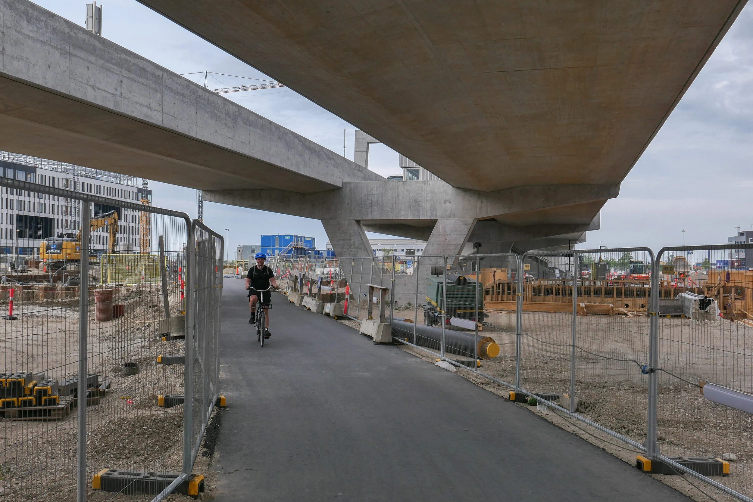
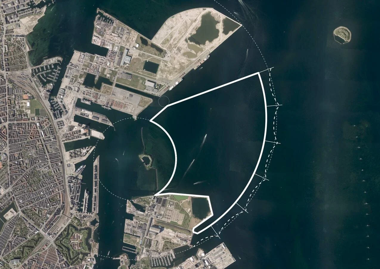
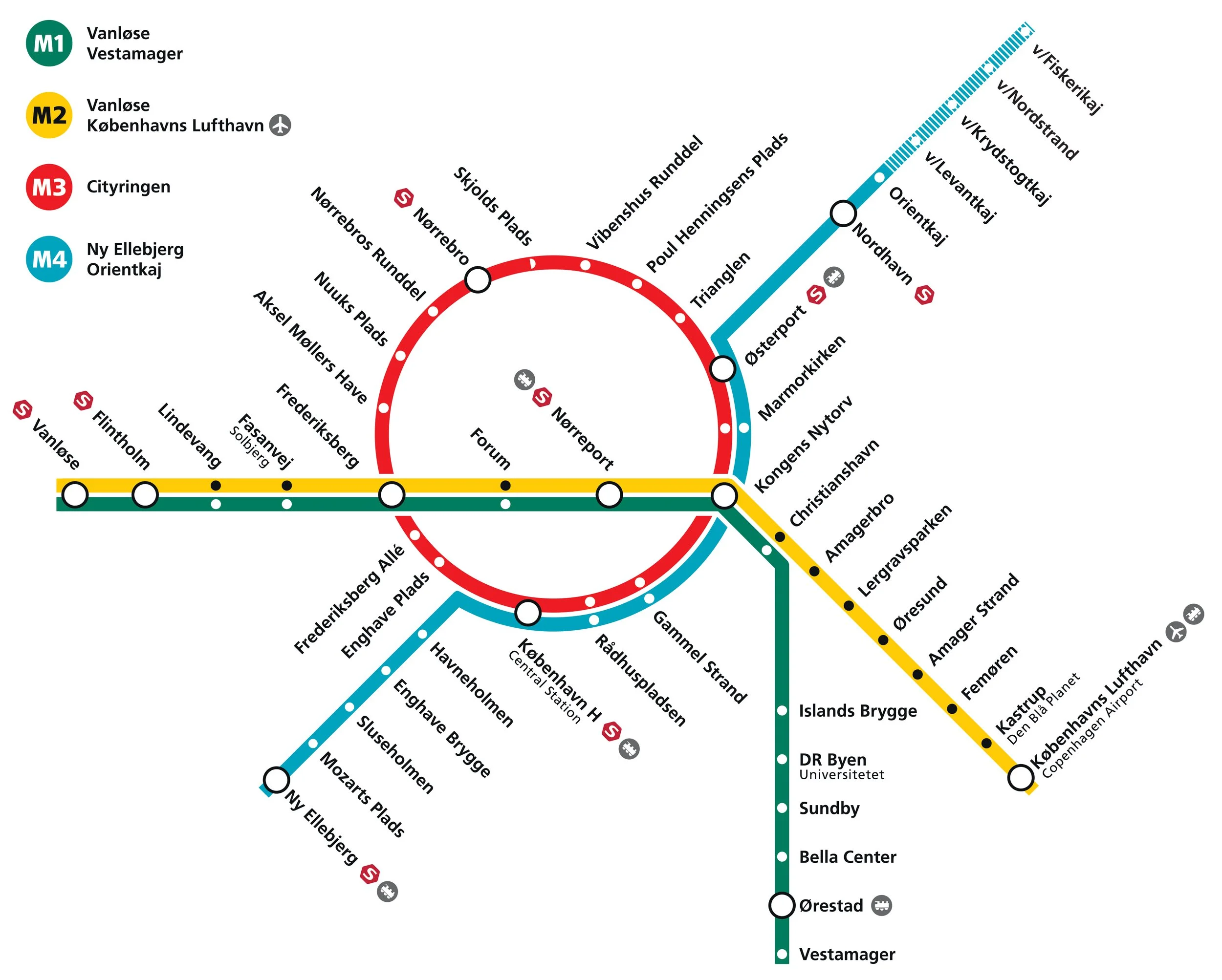
Identified as the M5 line in previous plans, it is to run from the central railway station to serve Amager and Refshaleøen and the controversial new island of Lynetteholm.

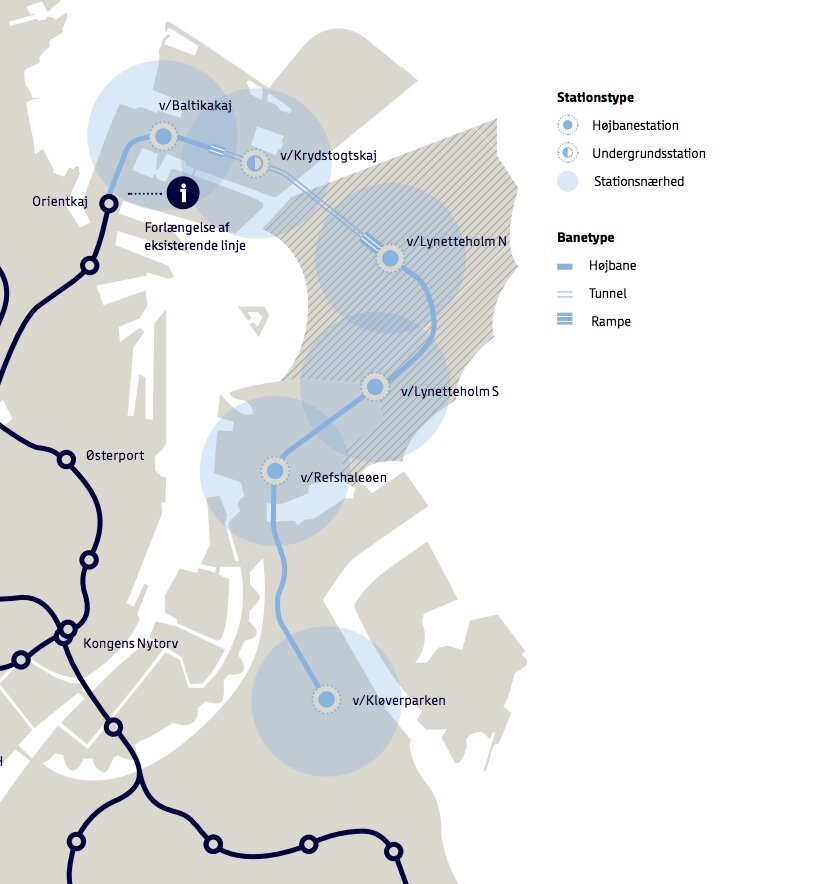
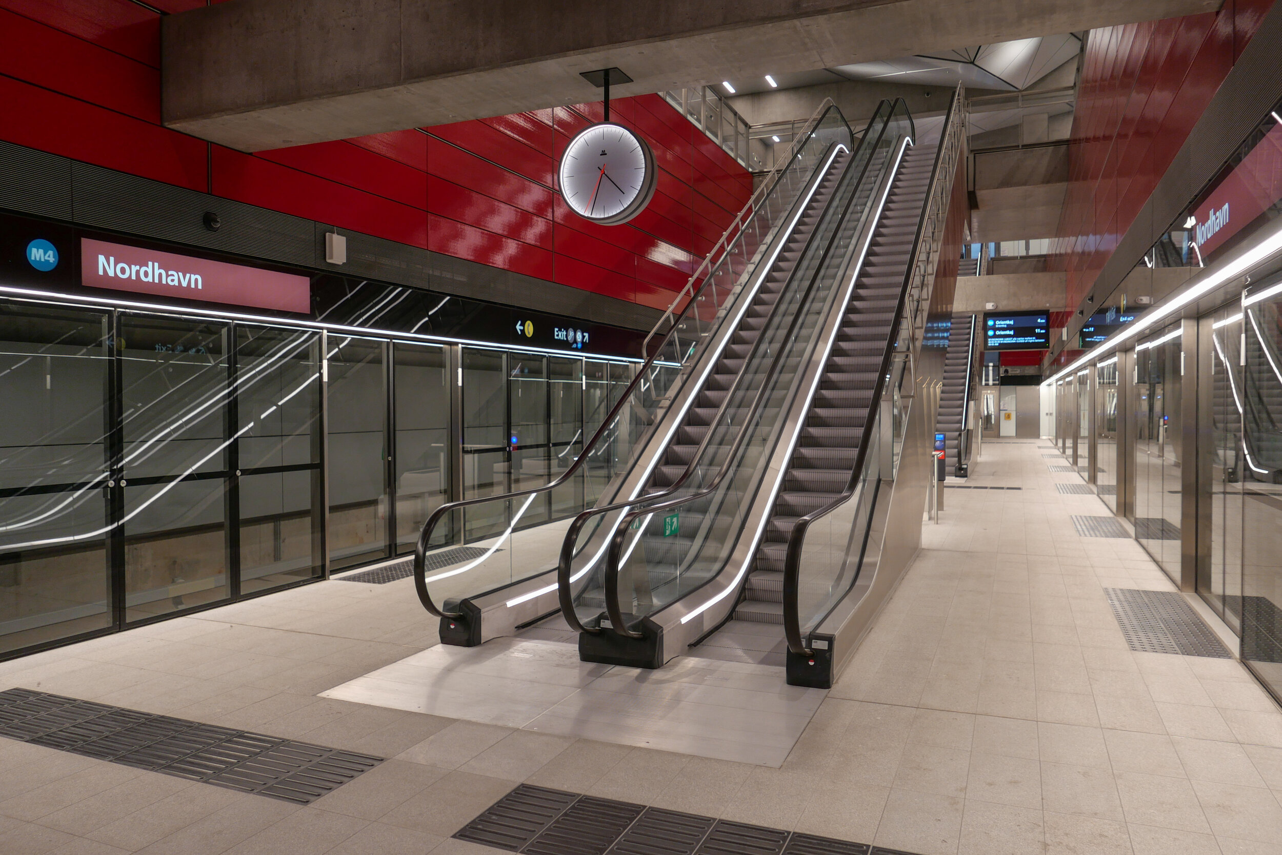
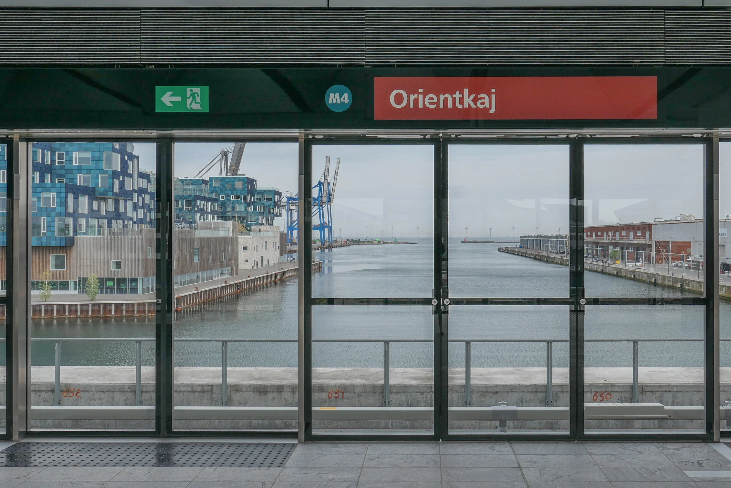
Back in the Autumn of 2020, several options were published by Metroselskabet - the company that runs the metro - as they explored possible ways to extend the metro on from Orientkaj on Nordhavn to the new island of Lynetteholm and then, from there, down to Refshaeløen.

In a tight arc, the new line would have continued across Amager with major interchanges with the existing metro lines at Amagerbro and Islands Brygge before going under the harbour to the central railway station. It was also suggested, in the report, that there was also the possibility to extend the line on from the central station to serve the inner area of Nørrebro and the main hospital.

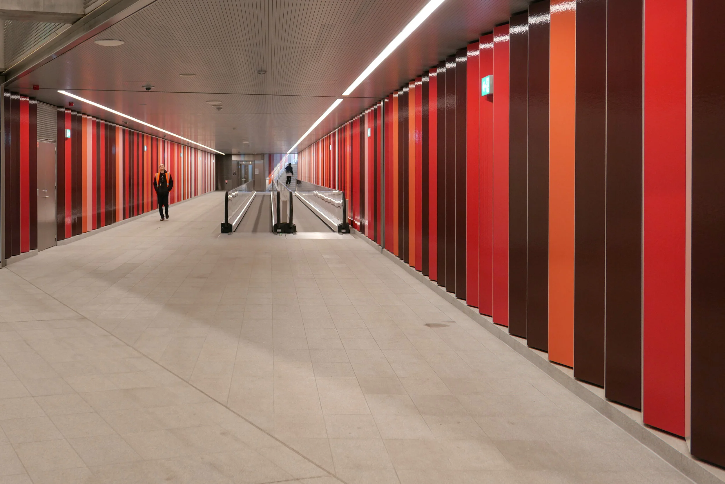
Two years ago, the priorities were to provide a metro service for the cruise ship terminal on Nordhavn and to serve the proposed housing on Lynneteholm along with an alternative route to reach the centre of the city from Amager that would relieve pressure on the original metro line from the airport and from Ørestad through Christianshavn to Kongens Nytorv that is now close to maximum capacity.

An obvious problem with those schemes was that there was a great gap in the middle where the new island might or might not be constructed ... the loop would only be fully operational when the two stations on Lynetteholm were open and it's housing completed and, current estimates suggest that will be sometime after 2070.

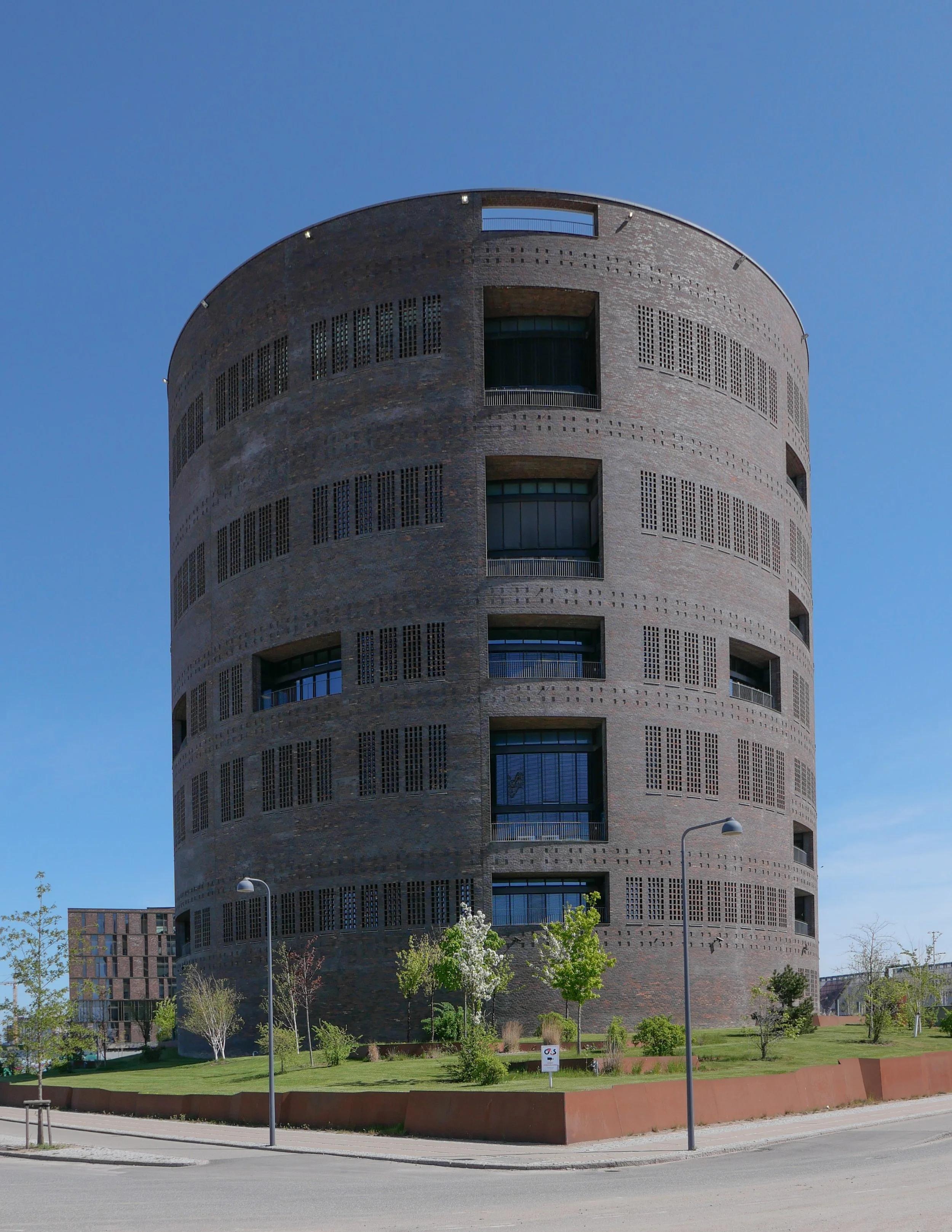
In addition, in order to work at optimal efficiency, any new line should have it's own service centre for it's own trains .... comparable to the service area at Metrovej in Ørestad for the original metro lines and Metro Service between Otto Busses Vej and Vasbygade for trains from the Cityringen.

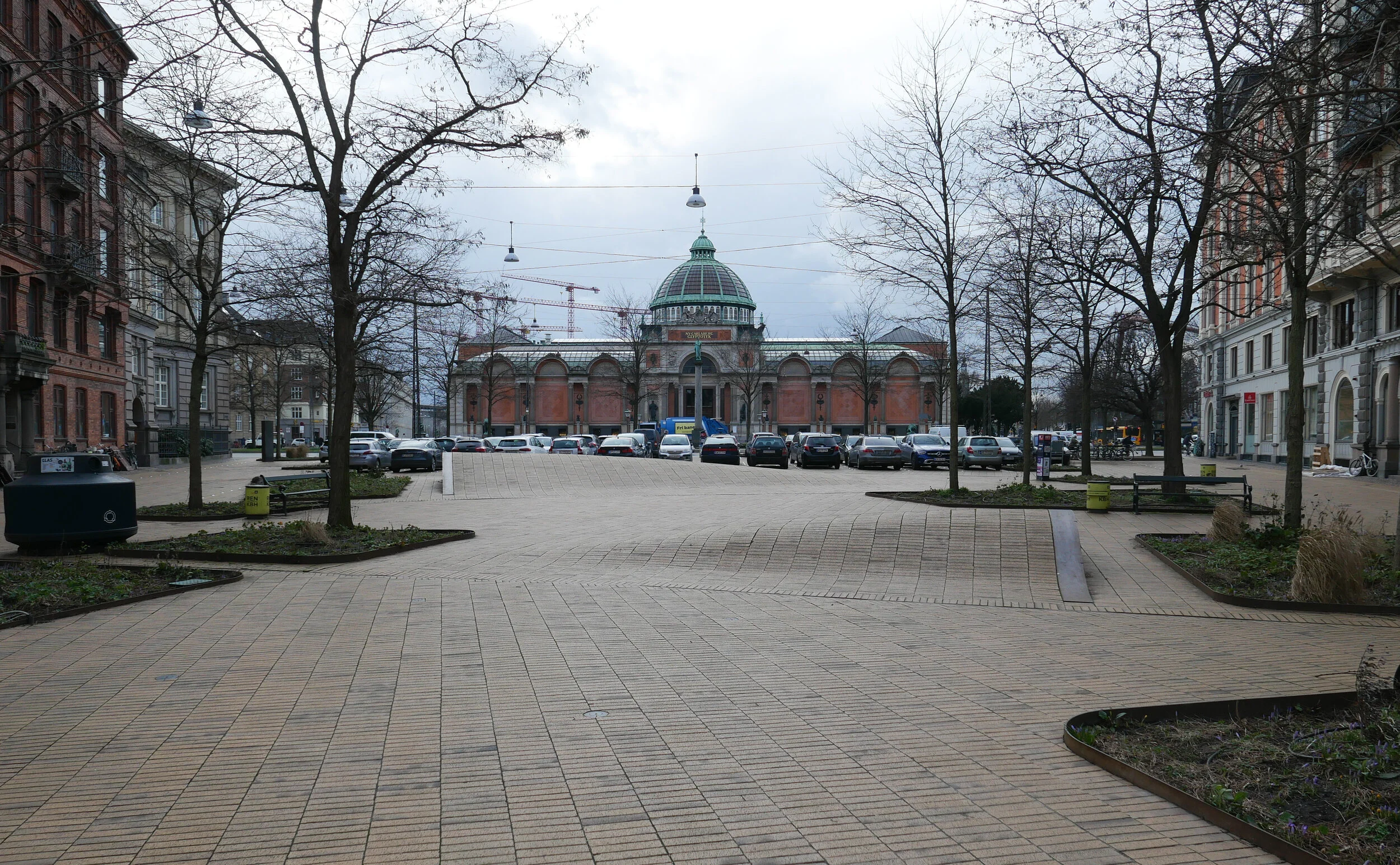
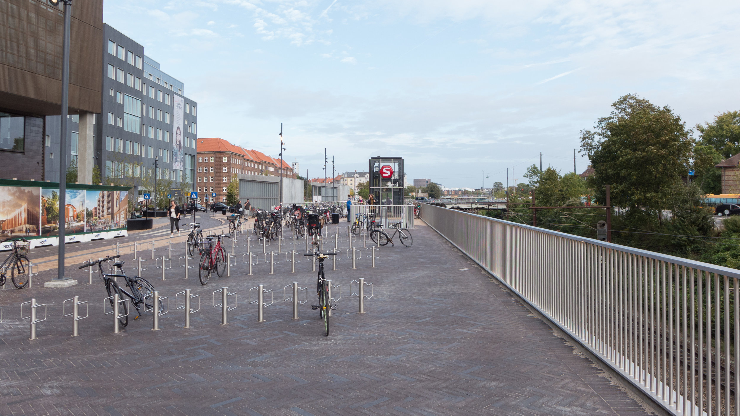
In this, the most recent proposal for a new metro line from the central railway station, the line would take a wider curve across Amager to serve extensive areas of housing - both new developments and the revitalisation of older housing - where the only public transport is the bus services.

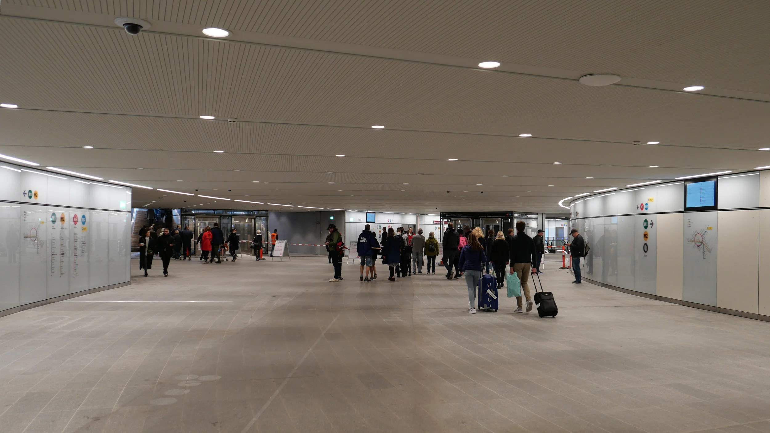
A new metro line from the central station would go under the harbour to a new station at Bryggebroen, at the south end of Islands Brygge, and then on to the existing metro station at DR Byen - rather than the original plan for an interchange at Islands Brygge metro station - and then to a new station on Amagerbrogade - further south than the interchange at the Amagerbro shopping centre proposed in earlier plans - and then on to an interchange at Lergravsparken - where passengers could change trains to get out to the airport. This new route would then continue north, close to the line of earlier route, to Prags Boulevard and Refshaleøen.

An area where the trains from this metro line could be serviced would be constructed out on the island of Prøvestenen.

This new metro line could be completed by 2035 but could then be extended on to Lynetteholm - if and when the island is finished - and, at the city end, the line could be extended on from the central station to inner Nørrebro and Rigshospitalet.

This is an important example of just how plans for major infrastructure projects have to evolve as other problems or other demands come to the fore or as the economic situation dictates.


Bispeengbuen - a new plan

Yesterday, an article in the Danish newspaper Politken reported that planners and politicians in Copenhagen might have come to a decision on the fate of Bispeengbuen - the section of elevated motorway that runs down the border between Frederiksberg and the Nørrebro district of Copenhagen.

One of several major schemes to improve the road system in the city in the late 1960s and 1970s, Bispeengbuen was planned to reduce delays for traffic coming into the city from suburbs to the north west.

At the south end of the elevated section, at Borups Plads, traffic, heading into the city, drops back down to street level and continues first down Ågade and then on down Åboulevard to the lakes and, if it is through traffic, then on, past the city hall, and down HC Andersens Boulevard to Langebro and across the harbour to Amager.

Between the elevated section and the lakes, the road follows the line of a river that, from the late 16th century, had flowed through low-lying meadows - the Bispeeng or Bishop's Meadow - and brought fresh water in to the lakes. In 1897, the river was dropped down into a covered culvert and it still flows underground below the present traffic.

From the start, the elevated section was controversial as it cuts past and close to apartment buildings on either side - close to windows at second-floor level - and the area underneath is gloomy and generally oppressive. Traffic is fast moving and generates a fair bit of noise and it forms a distinct barrier between the districts on either side.

There has been an ambitious plan to drop the road and its traffic down into a tunnel with the river brought back up to the surface as the main feature of a new linear park. The full and very ambitious plan - for ambitious read expensive - was to extend the tunnel on to take all through traffic underground, to Amager on the south side of the harbour.

There has been talk of a less expensive plan to demolish the elevated section, to bring all traffic back down to street level, which would be cheaper but would not reduce the traffic and would leave the heavy traffic on HC Andersens Boulevard as a barrier between the city centre and the densely-populated inner suburb of Vesterbro.

This latest scheme, a slightly curious compromise, is to demolish half the elevated section. That's not half the length but one side of the elevated section. There are three lanes and a hard shoulder in each direction and the north-bound and city bound sides are on independent structures. With one side removed, traffic in both directions would be on the remaining side but presumably speed limits would be reduced - so, possibly, reducing traffic noise - and the demolished side would be replaced by green areas although it would still be under the shadow of the surviving lanes.

It was suggested in the article that this is considered to have the least impact on the environment for the greatest gain ... the impact of both demolition and new construction are now assessed for any construction project.

There is already a relatively short and narrow section of park on the west side of the highway, just south of Borups Plads, and that is surprisingly quiet - despite alongside the road.

On both sides of the road, housing is densely laid out with very little public green space so it would seem that both the city of Copenhagen and the city of Frederiksberg are keen to proceed. Presumably they feel half the park is better than none although I'm not sure you could argue that half an elevated highway is anywhere near as good as no elevated motorway.

The situation is further complicated because the highway is owned and controlled by the state - as it is part of the national road system - so they would have to approve any work and police in the city may also be in a position to veto plans if they feel that it will have too much of an impact on the movement of traffic through the area.

update - Bispeengbuen - 14 January 2020
update - a road tunnel below Åboulevard - 15 January 2020

note:
Given the brouhaha over each new proposal to demolish the elevated section of the motorway, it is only 700 metres overall from the railway bridge to Borups Plads and it takes the traffic over just two major intersections - at Nordre Fasanvej and Borups Allé -  where otherwise there would be cross roads with traffic lights. I'm not implying that the impact of the road is negligible - it has a huge impact on the area - but, back in the 1960s, planners clearly had no idea how many problems and how much expense they were pushing forward half a century with a scheme that, to them, must have seemed rational.

My assumption has been that the motorway was constructed, under pressure from the car and road lobby, as part of a tarmac version of the Finger Plan of the 1940s.

The famous Finger Plan was an attempt to provide control over the expansion of the city, and was based on what were then the relatively-new suburban railway lines that run out from the centre. New housing was to be built close to railway stations and with areas of green between the developments along each railway line .... hence the resemblance to a hand with the city centre as the palm and the railway lines as outstretched fingers.

Then, through the 1950s and 1960s, the number of private cars in Copenhagen increased dramatically and deliveries of goods by road also increased as commercial traffic by rail declined.

I don't know who the traffic planners were in Copenhagen in the 1950s and 1960s but, looking back, they barely appreciated old building or existing communities, and, presumably, looked to LA and, possibly, to the Romania of Nicolae Ceaușescu for inspiration. Their ultimate aim, in their professional lives, seems have been to design a perfect motorway intersection where traffic flowed without any delays.

They wanted to build a motorway down the lakes and when that was thwarted they proposed a massive motorway system that was to be one block back from the outer shore of the lakes - sweeping away the inner districts of Østerbro and Nørrebro - and with new apartment buildings along the edge of the lake - between their new motorway and the lake - that would have formed a series of semi-circular amphitheatres looking across the lakes to the old city. The whole of the inner half of Vesterbro, including the meat market area, and the area of the railway station would have become an enormous interchange of motorways where the only purpose was to keep traffic moving.

We have to be grateful that few of those road schemes were realised but there is also a clear lesson that, however amazing and visionary a major plan for new infrastructure may appear, it can, in solving an immediate problem, create huge problems for future generations to sort out.

approaching the elevated motorway from the south
the motorway from Ågade on the east side
the motorway crossing Borups Allé

the river close to the lakes at Åboulevard but now in a culvert below the road

Bispeengbuen under construction showing how it cut a swathe through the existing neighbourhood - city archive 50675

the earlier proposal to bury the road in a tunnel and bring the river back up to the surface as the main feature of a new linear park

small area of park on the west side of the road

a new bus station to be built on Carsten Niebuhrs Gade


In March, Vejdirektoratet / the Danish Road Directorate, confirmed that a new terminal for long-distance buses will be built on the narrow strip of land between Carsten Niebuhrs Gade and the railway lines.

The land is about 500 metres long but only 20 or 25 metres deep from the edge of the road to the boundary fence of the railway so the buses will pull in and park at an angle.

The terminal will open in the Spring of 2023 and will replace bus stops closer to the main railway station that are along the pavement on Ingerslevsgade - the road on the inside curve of the railway tracks.

At Carsten Niebuhrs Gade, there will be 15 stands for buses with waiting facilities for passengers, including toilets and a kiosk, and there will be space for 200 bicycles to be left at the lower level and a lift up to the bridge to transfer to the suburban railway station at Dybbølsbro to the north or to a new metro station at the west end of Fisketorvet - the shopping centre to the south.

A report by the engineering consultants MOE from August 2019, showed details for traffic flow in and out of the bus terminal from Kalvebod Brygge with necessary road markings and lane markings at all the junctions. The bus terminal will deal with 195 buses a day and approximately 1.4 million passengers a year.

When completed, the terminal will be handed over to the city but will be run by the transport company Movia.

Vejdirektoratet
MOVIA

view along Carsten Niebuhrs Gade - looking east from under Dybbølsbro towards the new Hotel Cabinn.
the site for the new bus station and buildings along the railway are to the left and the site of the new IKEA store is to the right. The blank grey rectangle in front of the hotel is the end of the raised walkway waiting to be linked on to the garden across the roof of the IKEA store

Kalvebod Brygge to the top and the railway terrain to the bottom with Tivoli Congress Center, the bridges over Arni Magnussons Gade and Hotel Cabinn to the left and then the site where work on the new IKEA store has restarted and with the bridge from Dybbølsbro station to the Fisketorvet shopping centre on the right
the new bus station will be between the railway and Carsten Niebuhrs Gade


Trafiktårnet Øst / Traffic Tower East by Tranberg Arkitekter

This is where the raised landscaped gardens of Det Grønne Strøg / The Green Line - drops back down to pavement level.

Det Grønne Strøg starts at the SEB towers over a kilometre away at Bernstorffsgade where a path winds up between two office buildings by Lundgaard & Tranberg and with the steep slope planted with trees.

That section of the landscape climbs up to 7 metres above the pavement and was completed in 2009 so the whole scheme has taken well over a decade to complete. In fact, the idea was conceived in 2006 in the local plan for the development of this area of office buildings and hotels along Kalvebod Brygge and there is still a large break in the middle where work has only just started on building a new IKEA store. That is where the garden will be across the roof of the store at the highest point of the green line.

The Traffic Tower is set on a grass mound and, at the outer edge, the landscape is raised just above pavement level with the garden area retained by Corten steel.

The tower is a regional control centre for Danish Railways and is built in dark brick … a reference to the extensive number of railways buildings and stations from the late 19th and the early 20th century that were generally in brick.

Using a brick that is almost mauve but with some bricks that are deep rust in colour gives the brickwork a texture and colour range without which a building of this size would look oppressive.

The brickwork is relieved by small, blind, recessed panels but the brick also continues across the windows as open grids that give the tower a more uniform look that emphasises the cylindrical shape and a gives a strong sense of security. These open grids of brick throw an attractive, broken or dappled light across the rooms behind.

The tower rises through nine floors with a double-height control room with balconies and with a high parapet that shields an open area of roof terrace used by staff and visitors.

Inside, the interior is light, mostly white, in contrast to the fortress-like exterior, but with areas of wood slats for acoustic control. There is an atrium that rises up through all nine floors and a dramatic spiral staircase through the full height.

The sculptor Henrik Plenge Jakobsen has created a bronze and steel African mask to the left of the entrance and designed a striking, geometric, tiled floor in the atrium, at the level of the entrance, that continues through into the canteen.

There is a second but smaller version of the tower - with five stories - in Fredericia.

Tranberg Arkitekter
Trafiktårnet Øst, København
Trafiktårnet Vest, Fredericia
Henrik Plenge Jakobsen

Traffic Tower East from the corner of Carsten Niebuhrs Gade and Otto Busses Vej

the garden is higher than the pavement on the north-west and south-west sides of the plot and the ground is retained by Corten creating a barrier between the street and the area of shrubs and trees.
the colour of the steel is a subtle contrast with the brickwork - that has rust-coloured bricks along with mauve - and the raw material is appropriate on what is, after all, an industrial site


plan of the Kalvebod Brygge high landscape with the Traffic Control Tower to the left and the SEB buildings at the right end
from the Local Plan 485 2016

Det Grønne Strøg


the landscape of Det Grønne Strøg starts over a kilometre away from the control tower and, when completed, will run from Bernstorffsgade to Otto Busses Vej.

Lokalplan 485 2016

the small, recessed panels act as a subtle version of string courses in 18th-century architecture by forming a horizontal band that indicates the floor levels and breaks what would otherwise be unbroken vertical emphasis

the large windows of the canteen are treated in a slightly different way with a broken and irregular grid of bricks

bronze mask to the left of the entrance by Henrik Plenge Jakobsen


The railway control tower is 42 metres high and it raises some interesting points about just how high buildings in the city should be and when and why high buildings should or should not be given planning consent.

Curiously, to me the control tower looks taller than its width but, in fact, the diameter is the same as the height so that would suggest that possibly we see and we are aware of height more acutely than width.

There is a fantastic free-hand sketch of an early concept on the architects online site but the idea of a simple cylinder set within a cube suggests that there is a strong geometric framework for the realisation of that idea.

When the green line of a raised landscape through the new buildings along Kalvebode Brygge was first proposed in the Lokalplan of 2006, there was a height restraint or glass ceiling of 36 metres for all the buildings although that was soon increased to a height limit for new buildings of 40 metres .... so very close to the height of the control tower.

Presumably, because this land was on former railway sidings, so potentially polluted, and partly because of the position, close to the city centre but between a busy road and the main railway into the city, this was designated to be a business district rather than being zoned for housing or recreation but the aim was to ….

create an urban business area that appears green and natural’ ...
The green line must clearly appear as the areas "lifeblood" and must clearly make visible the whole underlying idea.

Basically, the green landscape was to be the key element of the area that should be visible and obvious.

However, by 2011, a new Lokalplan had increased the limit on the height of the buildings to 47 metres but the suggestion was still that upper floors should be set back in a series of steps to reduce the visual impact, when seen from below, and to control the amount of shadow thrown across the area and across nearby buildings. It is also obvious that the buildings as realised are larger in terms of footprint than those suggested in the Lokalplan. In realisation, the planted area of the landscape was reduced in area.

The Hotel Cabinn is 32 metres high and the IKEA store will be 26 metres high but several of the buildings along the Kalvebod development have broken through those original height restrictions.

The Tivoli Congress Center is 48 metres high and the two round towers of Kaktustårnene by Bjarke Ingels - now being fitted out and due to open soon - are 60 metres and 80 metres high and the Post Towers, on the site of the old post office buildings at Bernstorffsgade - immediately north of the start of the green line and to be completed by 2027 - will be 67 metres, 93 metres and 115 metres high.

a high-rise tower building not just throws shadows across nearby streets but often disrupts the street pattern of historic areas but it can also have a huge and detrimental impact on views from and along historic streets

Vesterbro is a densely built residential area with apartment buildings that date generally from around 1900
the towers of the new Carlsberg development can be seen as the focal point of many streets and not in a good way
the railway control tower is on the far side of the railway tracks and , because of its relatively modest height - if you call 42 metres modest - it does not loom over the streets that look towards it and the restrained colour of the brickwork reduces the impact
this is the view of the tower from Vesterbro down Arkonagade


it’s 50 years since the last trams ran through the city

Today is an interesting anniversary because it's now fifty years since the tram service in Copenhagen was shut down with the last trams running through the city on 22 April 1972.

The first trams in the city were horse drawn but electric trams were brought in from the 1890s and the first tram routes were established by private companies but in 1911 the city took over the operation of the tram system.

New trams, tram terminals and street furniture for the tram service were then designed by the city architects department.

At one stage the length of the tram routes through and around the city was just under 100 kilometres in total.

an unbuilt tram station for Rådhuspladsen March 2020
Bien at Trianglen July 2018

horse-drawn trams on Kongens Nytorv in 1913
Copenhagen City Archive reference 51787

a tram on Amager in 1966


tram designed for the city in 1910 by Knud V Engelhardt (1882-1931) - Denmark’s first industrial designer


three new stops for the harbour ferry

Until the end of last month, Havnebuser - the harbour buses or harbour ferries in Copenhagen - have run from Refshaleøen, at the north end of the harbour, to Teglholmen in the south harbour with eight ferry stops. *

Now, there are two new stops in the south harbour and in April the service will be extended north with the ferries sailing on from Refshaleøen to Nordhavn and a new ferry stop at Orientkaj.

Islands Brygge, on the Amager or east side of the harbour, about 600 metres south of the bridge at Fisketorvet, and Enghave Brygge on the west or city side of the harbour, came into operation on 27 February.

These will serve new areas of housing, on both sides of the harbour, close to HC Ørestedværket - the power station, constructed in the 1930s, that is now an important and iconic historic building in the south harbour.

These new stops are almost opposite each other, so they also provide an important cross-harbour link for pedestrians and cyclists. The Enghave Brygge ferry stop will be less than 200 metres from a new metro station that will open in 2024 and Islands Brygge Syd is just 300 metres from the edge of Amager Fælled so there will be an important link from the city side to the large and popular open area of park.

In April, when the harbour ferry service is extended on from Refshaleøen to Nordhavn and a new ferry terminal at Orientkaj, the journey time from Nyhavn to Orientkaj will take 39 minutes.

Movia, the operating company, have added two new electric-powered ferries to their current fleet of five. The electric ferries came into service in 2019 and each can carry 80 passengers and with space on the front deck for eight bikes and four wheelchairs or prams.

These ferries provide an important and successful service for commuters but there is a growing problem with overcrowding because they are now also a popular water bus for tourists.

For safety, the number of passengers on each ferry is strictly controlled - at busy times people are counted on and counted off - so it is frustrating if you wait for a ferry but do not manage to get on because not enough passengers have disembarked. The ferries now run every 30 minutes so more ferries at peak times might help but differential pricing with preferential rates for commuters has to be considered.

the metro, the bus and the ferry January 2019
new ferries for the harbour May 2020

press release on the new stops from movia

the ferry stop at Nyhavn and the new apartments on Papirøen


* a ferry stop at Holmen Nord - north of Operaen and just south of Nyholm - was closed when it was found that the new electric ferries could not manoeuvre safely around the large number of hire boats in the tight space at the bridge where Danneskjold Samsøes Allé crosses over the channel between Tømmergraven - the inner area of water - and Flådens Leje and the main harbour

the if or when and the how much and why of new islands and tunnels under the sea

This week, politicians in Copenhagen have to agree a budget for the city for the next financial period and the main item on their agenda will, presumably, be discussions about moving to the next stage their ambitious plans to construct a large new island across the entrance to the harbour …. a major engineering project that has been agreed in principle by both the national government and by the city and agreed across most political parties.

Initial plans set the new island immediately beyond and close to the Trekroner Fort - built in the late 18th century to guard the entrance to the harbour - but the most recent drawings published show that it will now be further out into the Sound and will cover a larger area of about 3 square kilometres. There will be a large park along the eastern edge - planned to be larger than the well used and popular Fælledparken on the north side of the city - with homes on the island for 35,000 people and work there for at least 12,000 people although some assessments have suggested that as many as 20,000 new jobs will be created.

But the new  island is not simply the next version of Nordhavn - just larger and further out - but it is also an integral part of an expansion of traffic infrastructure on this side of the city and there will be extensive flood defences on the east or outer side of the island that faces out across the open Sound …. defences that will be an important part of the protection against storm surges that could flood the inner harbour as the climate changes and as sea levels rise.

The name for the new island - Lynetteholm - was, In part, inspired by the shape with a broad curve to the east side - the side facing out across the Sound - and is from the Danish version of the French word lunette and that has been combined with the Norse word holm for a low island that was usually in a river or estuary and was often meadow.

However, Lynette is not a new name in this area of the outer harbour because it was the name of a curved outer fortress built in the Sound in the 1760s that, with large guns set up there, was an important part of outer defences that protected the entrance to the harbour.

One proposal is to extend the metro to the island from the recently-opened metro line to Nordhavn and that link, from Nordhavn to Lynetteholm through a tunnel uner the entrance to the inner harbour, could be extended on to Refshaleøen and possibly on through to Amager and even on round via the metro stations at DR Byen or Islands Brygge and back to the central railway station. An alternative proposal is for a separate metro line starting from Østerport that would run directly out to Lynetteholm and then continue south to Refshaleøen and Kløverparken and from there to either Amager or to join the existing metro line to the airport from the station at Øresund.

Access to the island for road traffic from the south will be straightforward as the island, in this the most recent version, is now much closer to Refshaleøen and connections could be by a number of short bridges although these would have to allow for the boats with tall masts that would continue to have access to the marina at Margretheholm.

A road connection to Lynetteholm from the north would have to be in a tunnel so that boats could still enter the port without having to navigate under bridges. That road tunnel would start just north of the Svanemølle power station and go under the bay, first to Nordhavn and then on, under the entrance to the harbour, to Lynetteholm.

If that is not enough of a project, then that road tunnel, to get to the island from the north, will, almost certainly, be extended on to form a major new eastern road link.

The preferred option seems to be for a tunnel built just off the east shore of Amager to take traffic from the north around the east side of the city and from Lynetteholm that would link to the existing east-west motorway - Øresundsmotorvejen - for fast and direct access to the airport and to the Øresund bridge. This major road tunnel could be constructed using the same method as the new Femern tunnel that will link Denmark to Germany. There the tunnel will not be cut through below the sea bed but will be constructed as prefabricated sections which will be moved out and lowered into a trench and then covered.

An alternative route for the east road tunnel would cut it along below the present coast or beach road of Amager and again that would form a major road link from the north part of Copenhagen to first Lynetteholm and from there on to the airport and the bridge to Sweden.

There is still a plan for a tunnel to link Nordhavn to Refshaleøen and from there to Islands Brygge, at the top of Amager, that could continue on to Sjællandsbroen. This is not an outer motorway link but more an inner ring road to serve Amager that would take road traffic in and out of the area so for traffic to get either to the north to Hellerup and the coast road or to Helsingørmotorvejen and south to Sjællandsbroen and from there to the south side of the city and out to the west.

Discussions about the infrastructure for road traffic on the east side of the city has resurrected that old but still unresolved problem of Bispeengbuen … a section of elevated motorway, that brings traffic into the city from the north west. It now needs extensive and very expensive repairs and it has been argued that, rather than repairing or replacing an elevated road that cuts through and divides a residential area, through traffic could also be taken down into a tunnel and if that tunnel was extended south then it would remove much of the heavy traffic on HC Andersens Boulevard and all through traffic that now uses Langebro to cross the harbour to get to and from Amager.

Together … major work on storm protection; a large new island for housing; a new east motorway to take road traffic around the city, rather than allowing it to come through the city, and the possible permutations for at least three different routes for new metro lines around the south side of Copenhagen … this is a major and relatively long programme for major engineering and construction work in the city that will not be completed until 2070.

An extension of the metro is the easiest part to justify because that would have clear and obvious benefits for the city itself - building rationally on the success of the new inner ring of the metro that opened a year ago.

However, an obvious problem is the cost of these major projects although it makes sense to complete them together and the state will, presumably, contribute to the cost of the road tunnels that are part of a national road system.

But will fast road tunnels taking traffic under or around the city not just deal with current traffic congestion but actually attract more traffic to city roads? It has been shown in other cities that if new ring roads make it quick and easy to get around a city they also make it quicker and easier to get to and into the city. For the sake of the environment, road traffic has to be reduced … not simply shunted past the city as fast as possible.

① road link and tunnel to Nordhavn - north of Svanemølle and south of Hellerup
② tunnel to link Nordhavn to Lynetteholm and then on to the bridge to Sweden
③ alternative route for a traffic tunnel below the coast road of Amager
④ route for tunnel from Nordhavn to Sjællandsbroen - bridge over the harbour

⑤ if the elevated motorway at Bispeengbuen is demolished then there is a plan
to construct a road tunnel from Fuglebakken to Amager - including a tunnel
under Åboulevard and under HC Andersens Boulevard and on under the
harbour and possibly as far as Artilerivej


There is also an important social problem that has to be addressed because, until now, the construction of the metro has been financed from the sale of new land for new developments around the harbour and so Copenhagen appears to have gained both housing and a metro system with little or no financial demand on the citizens but the final return, realised from any development of the land, has to cover not only the cost of claiming the land from the sea and the building costs but also has to generate enough additional profit to pay for the metro.

In Ørestad - the first stage where land was sold to fund the construction of the metro - developers built large and prestigious commercial properties and a mixture of housing including what appears to be a large proportion of social housing. In the later developments, around the south harbour and in Nordhavn, there is still a proportion of social housing but developers have built much more expensive and therefore more exclusive housing to generate an appropriate return. This appears to have skewed the cost of land and housing in the rest of the city so, even with social housing in each scheme, not only are low-paid families excluded from these prime areas along the harbour but they are also being forced out of inner city areas like Vesterbro as prices there have also risen.

This has, to put it bluntly, created middle-class ghettoes that undermine what is perhaps the strongest quality of the city … it’s sense of being a dynamic and tightly-packed community with a strong awareness that everyone should have equal access to what the city has to offer.

Potentially, there is also a problem with the logic of what appears to be a circular argument to justify linking together these major schemes.

Actually, an island is not needed for coastal storm defences. It is one option but the city could build a flood barrier across the harbour without a new island. You have to have an island for the large number of houses that are needed to finance an extension to the metro not just to the island but across a wider area of the city and if you build the housing then it follows that you have to have that metro link and if you construct a metro tunnel then the best place to put all that earth is out in the sea to build a new island so how do you justify an island? …. well either as somewhere to put the soil or as somewhere to put the housing to house the people attracted to live in that new housing by the fast metro link. It does begin to sound like a very complicated Danish version of the nursery rhyme about an old woman who swallowed a fly.

And, to throw another spanner in the works, Copenhagen is an absolutely amazing city … one of the best cities in the World …. but that, in and of itself, is not an argument that the city can or should grow and grow.

In so many ways, it is a fantastic place to live and it works as a city because, although it is a capital city, it is relatively compact and being densely occupied is actually its strength - not its weakness.

It could be claimed that, in terms of lifestyle and infrastructure, it is an ideal model for small and middle-sized cities around the World. For many reasons it cannot be a model or suggest solutions to all the horrendous problems of the mega cities of the World.

Perhaps now politicians - both in the city and nationally - have to address a more interesting and more difficult conundrum. Should or could the growth of Copenhagen be gently but firmly constrained? Is it now time to focus on making Odense and Aarhus larger and equally attractive and popular centres for city life in Denmark?

The government will argue that they have already tried to achieve this by moving out government departments and government jobs but, if that failed, it simply means new incentives have to be tried rather than abandoning the idea and leaving Copenhagen to grow and grow.

A pattern of strong and semi-autonomous cities as regional centres - even in a relatively small country like Denmark - is a rational way to cope with population growth and to cope with the trend world-wide for people to move from the countryside and into cities. According to the UN, by 2050 about 70% of the population of the World will live in “large” cities.

Should Copenhagen really continue to grow by 10,000 new citizens a year?

If so, then yes a large new island is one solution. If not then other questions have to be asked and different problems tackled.

posts on danish design review :
the elevated motorway at Bispeengbuen
the proposed tunnel below HC Andersens Boulevard
Lynetteholm

recent reports published on line:
Forundersøgelse Metrobetjening af Lynetteholm /
Metro Services for Lynnetholm Preliminary Study

FORUNDERSØGELSE AF ØSTLIG RINGVEJ
BY&HAVN - Lynetteholm


the end of the line for now but from here will the metro go north or east?

60 metres beyond the platform at Orientkaj - this is the end of the line for now

In March 2020, a new section of the metro in Copenhagen opened …. the north end of the new M4 line with new stations beyond Østerport at Nordhavn and Orientkaj.

From Østerport, trains for Orientkaj follow the existing M3 track - the metro inner ring north towards Trianglen - but 500 Metres from Østerport, below the north end of the lakes, they branch off onto the new line and follow a curve to the east.

The new Nordhavn metro station is just under 2 kilometres from Østerport, below ground on the east or sea side of the suburban railway line so it’s on the east side of the suburban train station at Nordhavn and actually on the east side of the main coast road.

Immediately after the metro station at Nordhavn, trains rise rapidly up a steep slope and up onto a section of elevated track immediately before the second new metro station at the inner end of the Orientkaj dock.

For now, just beyond the platforms of Orientkaj, the track ends abruptly waiting for the next phase of work.

Maps of the metro - even those from as recently as last Spring - show the next stage of the metro line running on to new stations at Levantkaj, Krydstogtkaj, Nordstrand and then, finally, to Fiskerikaj, at the end of the line … so four new stations that will not only serve new housing that will be constructed in the last phase of building for Nordhavn but would also take passengers out to the terminal for cruise ships at Oceankaj.

That new line, as proposed, would form a large curve - running first east out to the cruise ship terminals and then north and west in a large arc - so it has been nicknamed “Lille Spørdmålstegn” or the Little Question Mark.

But now there is a real and a very large question mark over this whole next stage for the metro because all decisions are on hold waiting to see if a recent proposal to construct a large new island for housing across the entrance to the harbour goes ahead.

Constructing that large artificial island would not be completed until 2070 but it is also entangled with a complicated series of planning decisions that have to be made in the next year:

  • A new tunnel is to be built north of Svanemølle power station for road access to Nordhavn from the north but this could be extended down the east side of Amager, in a tunnel, to the airport and the bridge to Sweden. It would not only be a major eastern bypass for the city but would also provide road access to the new island from the north and south.

  • If the island is constructed across the entrance to the harbour then it would also be part of new storm-surge protection to stop water from the Sound flooding into the inner harbour and flooding the inner city. That flood barrier has not been allocated a budget and, already, some have raised doubts about an island being the best form for storm protection.

  • A large and expensive and relatively new sewage and water treatment plant to the east of Refshaleøen would have to be relocated and again that is not in the budget.

  • Because the island would be built out in to the Sound and because a major road bypassing the city would link to the airport and the Øresundsbroen - the rail and road bridge between Copenhagen and Malmo - an eastern ring road should be seen as part of a wider regional transport policy - including a proposal to build a rail and road link at the north end of the Sound, between Helsingør and Helsinborg - so both regional planning and environmental concerns in Sweden have to be taken into account.

This is becoming one of the most complicated and, certainly, the most contentious infrastructure plan for the city.

new metro stations at Nordhavn and Orientkaj
Lynetteholm
the if, when, how much and why of the new island


Forundersøgelse Metrobetjening af Lynetteholm /
Metro Services for Lynnetholm Preliminary Study

If you want to follow and to understand the planning issues that are involved or if you are interested in the engineering problems that will have to be resolved then I would recommend a report from the metro company - Forundersøgelse Metrobetjening af Lynetteholm / Preliminary Investigation of Metro Service to Lynetteholm.

It can be downloaded from their web site and sets out in some detail and with good maps and illustrations, the options and possible routes for extending the metro line on from Ørientkaj.

This is far from a simple matter of drawing lines across a map.

Any new metro lines will have to link into the current service and this means also looking at an opportunity to extend the metro system into parts of the old city that are not served by the current metro lines.

In addition, the current line out to Ørientkaj runs in sections along existing lines and uses existing service facilities but there is now an opportunity to build new depots and to make sure that new services do not have an impact on the running of the existing lines.

Not only could a new service out to the new island form important new and fast links across the city but it will have to thread it’s way through and under or over existing infrastructure and any new interchanges will have to work in a rational way with what is happening in the streets and squares above.

For some new interchanges on the system - like at Islands Brygge - there are three or four options for the site of a new station above ground and several options for how connections and platforms will link below ground.

If the construction of Lynetteholm does get approval, the island will not be completed until 2070 so any new lines or new stations would either have to wait until then or new lines might be phased and built so that the line out to stations on the island would be simply the last stage that closed the loop.

Forundersøgelse Metrobetjening af Lynetteholm /
Metro Services for Lynnetholm Preliminary Study


If Lynetteholm is given a green light then the new island will influence any future extension of the metro


Before the construction of a new island was proposed, this was plan for the new M4 line of the metro system.

It shares a long section of track with the metro ring between the central station and Østerport. A short new section of track out to Ørientkaj has just opened and the long south section of the line that will provide a service out to the south harbour and on to the major railway interchange at Ny Ellebjerg is underconstruction but will not open until 2024.

The new stations will have distinct designs that reflect the character of the areas that they serve. The station at Havneholmen is on the south side of the shopping centre at Fisketorvet and work has started on an extensive restoration and upgrading of the centre. It is also close to the site for a new bus station for the city on Carsten Niebuhrs Gade on a site parallel to the railway and on the opposite side of the tracks to the station at Dybbølsbro.


M4 Blå linje

This option to extend the M4 line to the new island is possibly the most straightforward.

A line out the north coast of Nordhavn might or might not be constructed but the M4 line would be re aligned to go first to a new station at Baltkakaj and then on to the cruise ship terminal and then, when the island was constructed, trains would go in tunnels under the new and constricted entrance channel for the harbour to two new stations on Lyntteholm and then on to Refshaleøen and Klovermarken that are not served by the current metro but will have extensive new areas of development and housing over the next twenty years.

The line could be extended beyond Klovermarken to provide a fast service across the top of Amager and then back under the inner harbour to the central railway station to relieve pressure on the existing metro stations at Christianshavn and Islands Brygge where passenger numbers are close to capacity.


M5 Lilla linje


This option is more radical.

The metro line out to Nordhavn would be completed as planned but there would be a new and potentially faster service out to Lynetteholm directly from Østerport station with a new long tunnel under the inner harbour.

If Lynetteholm gets approval then the plan is for housing for 35,000 people and work for almost as many so passenger numbers would be large.

From Lynetteholm, the new line would also be extended down to Refshaleøen and on across Amager to the central railway station to form a sweeping curve that forms a large reverse C.


M5 Vest Orange linje

This option takes the curve of the new metro line the other way so in effect starts on Lynetteholm (or ends on Lynetteholm as the last stage of a phased construction ending in 2070).

It would serve the major regional hospital - the Rigshospitalet on the south side of Fælledparken - and part of the inner area of Nørrebro that are not served by the current metro lines and with a new interchange at Forum where the exhibition centre may be redeveloped and the line will then go on to the central railway station and again across the top of Amager but in this option it will end at Prags Boulevard where there is extensive new housing.

A new metro station at the central railway station may be constructed on the inner, city side of the railway tracks and would be under Bernstorfsgade …. under the very busy street and the bus station between the railway station and Tivoli.

Whichever option is chosen, it looks as if the citizens of Copenhagen can look forward to 40 years or more of engineering works, earth moving and high green hoardings.


a new link between the platforms of the central railway station and the new metro station

A key part of ongoing construction work to complete the new metro station at København H - the metro station at the central railway station in Copenhagen - has opened with access to a wide tunnel under the platforms of the train station so that passengers can now go directly from the metro trains to the platforms for suburban and national and international trains.

Until this tunnel opened, passengers from the metro had to go up to street level and then cross over a road and go up a flight of steps to get to the main station concourse before then going back down to the train platforms that, at the central station, are below street level. 

Now, as you come up the escalators from the metro platforms, there is a large circulation area just below street level and, from that lower circulation level, you can walk straight ahead into the tunnel where there are steps and lifts up to each of the train platforms.

I’m not sure what to call this lower part of the metro station. The lower concourse?

When the first underground stations on the original metro line opened nearly twenty years ago it was the area where passengers bought tickets and where there were maps and information panels so it seemed reasonable then to call it a ticket hall. 

Now, almost twenty years later, virtually everyone has an app on their phone and even the rejsepas - the plastic travel card - seems old fashioned so fewer and fewer people are buying printed tickets. 

As long as you check information about which platform you want for which suburban train service, it’s a quick and easy way to avoid the people milling around on the busy station concourse and - looked at the other way round - if you arrive in Copenhagen on a train then now there is a quick way down to the metro.

If people wonder about the general process of planning and designing then most would surely think about what happens out at street level - the part they can see - but this example shows just how much thought and work and money goes into threading together the new and the old parts of the infrastructure of a densely-built and busy city.


the Metro to Nordhavn

At the end of March, the north part of the new M4 line of the Metro opened for trains to run from København H - the central railway station - to Orientkaj, out at the north harbour.

This new service follows the Cityring to Østerport but then, just north of the station, there is a large junction or intersection at the north end of Sortedamsø and immediately below the lake where the new line heads out to the north east. It goes under the main railway line and railway station at Nordhavn and under the main coast road - Kalkbrænderihavnsgade - to a new underground metro station just north of Nordhavn Basin.

Trains then climb steeply to the start of a new elevated section of track to terminate at a new elevated station at Ørientkaj, just over 2 kilometres from Østerport.

For now, the track stops just 70 metres beyond the new station but it will be extended on to serve new but as yet unbuilt housing and businesses at the outer or north part of Nordhavn and there are plans for it to continue to the terminals for cruise ships and, possibly, on further, back underground, to take passengers under the harbour and to Refshaleøen.

Going in the other direction, trains starting from Ørientkaj now terminate at København H - the central railway station - but the south end of the M4 line out to Sydhavn - the south harbour - is due to be completed in 2022 and then trains on the M4 line will continue on to Sluseholmen and on to what will be a major interchange with the suburban rail service at Ny Ellebjerg.

The new metro station at Nordhavn follows the same form as the other stations on the new Cityring …. so with the train tracks set apart and with a central platform between them. There is what is essentially an open concrete box above the platform that is rectangular in plan, the width of the platform and the length of the trains. This contains very open escalators, rising from the centre of the platform and free of the walls of the box and, just below street level, there is a large circulation area below street level where there are ticket machines, information panels and maps and so on with the open escalators at the centre. There are steps up to the street and, at many stations, access to underground bike storage at that level below the street. All the stations also have lifts - most with glass superstructures at street level and stops below at the ticket hall/circulation area and then at the platform.

But, here at Nordhavn, there are some distinct differences from that arrangement.

First, and perhaps most obvious, there are no skylights over the escalators. The public square above the station is only crudely laid out for now, with temporary paths for access, so it’s difficult to see how this will be organised and difficult to see why the distinct pyramid-shaped sky lights of so many of the other stations have been omitted here. These pyramid-shaped skylights over the escalators are important because they provide at least some natural light right down to the platform.

And where the other stations are set to the orientation of the streets or squares above - so with entrances and staircases and elevators that are either at each end or, in some, at the centre of each side - here at Nordhavn the tunnels and the station platform are set at an angle to the streetscape above. The east exit and entrance to Nordhavn runs out at an angle from the corner of that main hall just below street level as a short tunnel with steps to take passengers up to the street above but there is also a long pedestrian tunnel, for passengers to walk under the road and under the suburban railway, to connect the metro station to the suburban railway station and that runs out at an angle from the diagonally-opposite corner at the main ticket hall level immediately below ground. So, the main circulation area, immediately below the pavement, has a strong and distinct diagonal axis.

A unique feature in the new metro stations is a moving pavement for the main part of that long tunnel between the metro station and the suburban train station.

The walls of the box down to the platforms have the deep red cladding of other metro stations where there is an interchange between the metro and suburban trains and that deep red is also taken through the tunnel between the metro station and the suburban rail station as narrow vertical panels or stripes. In contrast, the flight of steps up to the square has striking black and white stripes.

I’m curious about this colour coding. From the train, passengers can just see the red above the platform so it might remind them to get off the train here for a railway interchange but how are visitors to the city to know that? And locals, who might have spotted the colour code, probably know where they are going anyway.


Just beyond the station at Nordhavn, trains emerge from the tunnels and run within hefty concrete channels that rise up steeply past Sundkaj to the new station at Ørientkaj that is just before Levantkaj where the track stops.

Of all the metro stations on the system, Orientkaj stands out with its strong style that owes more to engineering than to architecture.

Like the other stations, the platform at Orientkaj is set between the tracks - rather than on either side, outside the tracks - but the platform area and the tracks on either side are within a large glass box that has spectacular views straight down the dock to the Sound.

The platform area and its roof are supported on hefty concrete work with a broad V shape of supports rising from the ground and with a massive concrete cross beam that supports the platform but extends well beyond the platform with shallow notches in the top that take the troughs of the concrete track. Above, and supported on the ends of the cross beam, are large n-shaped concrete superstructures that seem to support the box of the platform. The design has echoes of the cranes on the docks that move containers along the quayside … so is this a clever visual game? Is the box hanging from the supports or simply paused before sliding on along the track?

Of course, the starting point for the design of the station may well be more mundane and more practical than anything to do with romantic evocations of the gantries of cranes for shipping containers …. it could be simply that, set at the head of the basin and close to the open sea, the glass box was needed to protect passengers and trains from the worst of the weather.

Unlike stations on the older above-ground sections of the Metro - on the lines running down to the  airport and to Vestamager - there is a central tower here with two elevators together rather than single elevators at each end of the platform.

And instead of the industrial, gantry-style metal staircases down to the pavement at those first above-ground stations, here there are dog-leg staircases with solid parapets covered with small white, hexagonal tiles and the staircases are set at an angle rather than being straight and parallel to the tracks.

This has a vaguely Art-Deco feel that might or might not be a reference to the white beach-side architecture of Bellavue and Bellavista by Arne Jacobsen that is just along the coast to the north.

Copenhagen Metro
Arup on the extension to Orientkaj


can Lynetteholm - the new island - be car free?

A recent article in the newspaper Politiken has suggested that the proposed development of Lynetteholm, on a new island to be constructed across the entrance to the harbour, will not be designed to be car free even though the initial plans include good links by public transport.

A new report has concluded that by making the residential areas completely car free, property and land values would be reduced so the sums do not stack up for the returns required to make the project viable.

The report by the consulting engineers Rambøll and MOE Tetraplan looked at three scenarios for the new island ranging from almost completely car-free (10 to 15 cars per 1,000 inhabitants) through partially car-free (120 to 130 cars) and finally without restrictions imposed so with average car ownership of 250 cars per 1,000 residents.

If the development goes ahead, there would be homes on Lynetteholm for around 35,000 people and jobs for 35,000.

However, this new island is not simply a development for homes and jobs but also plays a complicated part in the construction of a barrier that is necessary to protect the harbour from storm surges and there will also be recreational areas along the new shoreline that will attract people from all over the city.

Initial plans for the island included a link to the metro that would be a 'relatively' straightforward extension of the recently-opened line to Nordhavn but the new report has concluded that a metro line would only generate the level of service required, if there were no cars on the island and if the line was built to complete an arc across Amager so to continue round to the metro station at Christianshavn and then on under the harbour in a new tunnel to the central railway station and that, of course, that would add very considerably to the cost.

The report also suggests that the harbour ferry service, that now terminates at Refshaleøen, should not just be extended to Lynetteholm but, if the area is to be completely free of cars, would have to run every ten minutes rather than every 30 minutes with the present service.

Lynette after.jpeg

new ferries for the harbour

Copenhagen is to have new, battery-powered, ferries for the regular service up and down the harbour.

Movia, the operating company, have taken delivery of five of the ferries and they are now being put through the last stages of testing before going into regular service and I'm not sure I like them.

Don't get me wrong. They are exactly the right way to go for the environment and it’s impressive technology. After all, they are large vessels that will carry around 90 passengers and they will have to work hard through every day on a 7 kilometre route from Teglhomen to Refshaleøen. Batteries will be completely recharged at night but will be topped up at each end of the route on the brief turn around.

So my objections?

Well there are two but basically they come down to much the same thing. Because they don't sound right and they don't look right so they don't feel right.

I will have to wait until they are in service before I see inside and can judge what they are like for passengers but recently, as I was taking photographs of the CPH container housing at Refshaleøen, one of the new ferries snuck into the dock and snuck seems like the right word.

At first, I thought it was drifting but then it came round the corner of the quay sideways, like a crab, and pulled forward to the ramp with little more than a gentle hum but quite a lot of bubbles. It's going to take some getting used to because I realised then that I like the churning water and the deep throb of the engine you get on the old ferries. Maybe that’s simply because they sound as if they really can take on the weather and the rain and everything that the harbour and the Sound will throw at them. The old ferries are reassuring - not in a comfort blanket way but you know what I mean.

I like standing on the back platform of a ferry as the churn of the water and the sound of the engines drown out any inane chatter around me so, even on a busy day, I can focus on the view and the light over the harbour - from dazzling sun of a good day to the lowering steel grey of an imminent storm - and I suspect I'm going to miss that. For a start, the new ferries do not have an open platform at the back.

And the new ferries look too swish - so sharply angled rather than reassuringly rounded - so stylish but somehow not solid. They don't look as if they were built in a shipyard but as if they were manufactured in a nice clean factory. No obvious plates of heavy metal and rivets from ship builders who know how to build a vessel that would survive most things that could happen at sea … and I know it’s a sheltered harbour but at the north end, around Refshaleøen, it's more open and exposed and more like real sea than the tame and domesticated water at the south end of the harbour.

I have to confess that, of the ferries now in service, I even preferred the older ferries with their steps at the back of the cabin, only marginally less steep than a ladder, with a hefty iron door at the top to get to the back deck and a bulkhead you had to step over rather than the more recent version with fully-glazed patio doors that know you are approaching so open automatically … well at least they did as you moved from inside to outside but with a well disguised button to get from outside on the deck to back inside.

The new ferry I saw 'dropped' its ramp down and even that glided and hovered and it looked narrower and looked light and for some strange reasons, that I don't quite understand, I know I'm going to miss the ramps of the old ferries that drop down onto the pontoon with an almighty clang that makes everyone jump - even hardened commuters who use the ferry twice a day every day - but, somehow, that's a solid and reliable sound.

Basically, the new boats don't sound or look like a workhorse ferry but like a tourist water bus.


will a car park be built underneath Dantes Plads?

It looks as if the construction of a new underground car park at Dantes Plads is going ahead despite objections.

Dantes Plads is a trapezium-shaped open public space between HC Andersens Boulevard and Vester Voldgade and is immediately opposite Ny Carlsberg Glyptotek.

A section of the display at the new Museum of Copenhagen about the development of this area - laid out after the banks and ditches here of the old city defences were removed in the late 19th century - suggests that the square was created to appease Carl Jacobsen who was unhappy about the prospective outlook from the entrance to his new museum.

Vester Voldgade is now an important and increasingly well-used cycle route running down from the square in front of the city hall to the new Lille Langebro bicycle and pedestrian bridge that crosses the harbour to Christianshavn. The entrance and exit to the ramp down into a new underground car park will be on the Vester Voldgade side of the square so all cars will have to cross over that bicycle lane entering and leaving.

It seems curious to be constructing a new car park in the centre of the city when the general policy is moving towards reducing the number of cars in the historic centre and a large new underground car park at BLOX - less than 300 metres to the south - seems under used. Some residents will be able to move their cars off the square but that hardly seems to justify the size of car park proposed.

Dantes Plads is at the centre of the aerial view with HC Andersens Boulevard, the wide road running top ro bottom and Ny Carlsberg Glyptotek to the west (left)
To the right is the Marble Bridge over Frederiksholms Kanal and the gatehouse to the outer courtyard of Christiansborg


view (above) from Vester Voldgade looking towards Ny Carlsberg Glyptotek on the far side of HC Andersens Boulevard and (below) the view from the front of the Glyptotek looking across HC Andersens Boulevard and across Dantes Plads and down Ny Vestergade to Christiansborg with, in the distance, the tower and spire of the great east gateway


Cityringen / The City Ring

Today - Sunday 29 September 2019 - Cityringen / The City Ring - the new metro line in Copenhagen opened with a ceremony on the square in front of city hall. For the afternoon and through to midnight transport around the city was free and people were out in large numbers to see and to use the new stations and the extended train system.

Construction work started over eight years ago so citizens are now reclaiming large parts of the streetscape and squares of their city that have been fenced off behind high green hoardings as the seventeen new stations were constructed.

Bus routes too will alter drastically on 13 October with fewer buses actually crossing the city … buses will come in to a station on metro City Ring and then head back out again or will run around the edge of the city centre rather than cutting across. So, inevitably, over the coming months and years, the ways in which people move around and through the city will change.

There will be major interchanges at Kongens Nytorv and Frederiksberg where the existing lines and the new metro circle line intersect and major interchanges to other forms of transport at the new metro stations at existing stations for suburban and country-wide trains at Østerport, Nørreport and the central railway station.

All these new stations have extensive areas for leaving bicycles at street level or underground so it is clear that people will make their journeys by swapping from bike to metro to foot to bus or whatever combination makes for the best or the easiest or quickest route.

The engineering work - constructing over 15 kilometres of tunnels and huge excavations below street level for the new stations much of the work below important historic buildings, below residential area, under the canals or under existing infrastructure of water pipes, sewage pipes and so on - is clearly very very impressive but, and quite deliberately, the new stations follow the form of the existing stations so are relatively low key at street level with simple glass boxes over the lifts to the platforms and simple steps down and, for most stations, glass pyramids that throw light down into the station concourses below.

But that does not mean that the stations will not have a huge impact as most have been constructed along with dramatic improvements to the squares and streets around the station so, over the coming years, the real change will be in the ways that the metro will revitalise and transform some areas of the city - areas such as the newly renovated square and the streets around Enghave Plads or the area around Trianglen - and the metro will mean quicker and easier access to and from the densely-occupied residential areas of Vesterbro and Nørrebro and - with the next phase of work - the new residential areas of the north and south harbour …. planning that has been described by the newspaper Politiken as “binding together the suburbs.”.

the Copenhagen metro

the impressive new concourse below Kongens Nytorv and the area to leave a bicycle below street level at Marmorkirken / The Marble Church

you can be certain that it will never be possible to take a photograph like this again ….. that is with the cycle store empty


Nordhavnsvej and a northern harbour tunnel 


The planning proposals for Copenhagen dating from 1947, known as the Finger Plan, has served the city well as it expanded out to new suburbs in the north and the west but as the centre of the city becomes more intensively built up - for instance in the area south and south west of the main railway station - and as there is more extensive and more intensive development of the harbour and on Amager - south and east of the centre - in the opposite direction to the spread-out hand of the Finger Plan - then rather different and very ambitious engineering works for new infrastructure are needed. Extensive new road tunnels have been proposed to take traffic around the south side of the city.

Coming in towards the city from the north, from Helsingør, the E47 swings out and around Copenhagen to the west but at Jægersborg, where the motorway crosses over the old Kings Road - an interesting piece of late medieval infrastructure - there is now an intersection where traffic can sweep round to head into the city along what is, at that point, called the Helsingørmotorvejen. Just over 4 kilometres out from the centre of the city the motorway reaches a broad valley running east west which is the place of a complicated intersection of railway lines around the station of Ryparken. The motorway merges into a main city road, Lyngbyvej, but immediately north of the railway, a new road has been built to cut out to the east, to the coast south of Hellerup and to a new tunnel that will go under this part of the harbour, under the marinas, to Nordhavn - the new development area with its massive terminal for cruise ships and with new housing and new work places for 40,000 people. This is infrastructure and development on an impressive scale is moving forward fast but it also shows clearly that any new infrastructure has to work with a complicated pattern of existing transport links.

The proposal is to extend that tunnel on so that traffic could continue on from Nordhavn to Refhaleøen, on the other side of the harbour, and then on again south, running roughly parallel to the harbour, before emerging first at the the south end of Langebro and then on again in a tunnel to west Amager to link back with that western outer arc of motorway that by this point is called the E20 as it heads for the bridge, for Malmö and for Sweden.

So a new tunnel system - under the harbour to Nordhavn and then on under Amager - would be the eastern half of a ring road. 

The only problem, as always, will be that motorways or relatively fast-moving main road do not just take traffic out or take traffic round but bring traffic rapidly in where it then finds itself backed up or tangled in the traffic of the existing smaller and busy and slower urban streets. A reality is that motorways and tunnels rarely solve a problem but simply move it along and, too often, have consequences that somehow had not been predicted. Add to that the fact that big infrastructure takes time so planning is an odd mixture of being reactive, proactive and, even if unintentionally, creatively obstructive or possibly destructive as the world and its problems change or move on faster than the project timetable.

The tunnel, if completed, will bring new options for development and therefore significant change to Refshaleøen and to the coast of Amager - particularly in the area just beyond the important open space of Kløvermarken. Inevitably citizens or rather their politicians and planners will have to decide if that is what Copenhagen as a city wants or needs but it will certainly mark a clear change from what, with hindsight, now seems to be the simpler and somehow gentler and slower-moving overall plan for the expansion of the city that was envisioned with the Finger Plan. 

5C - design project


Back at the beginning of May there was a post on the site about the new buses that have been put onto the 5C route through the city. But the buses are simply the most obvious part of a complicated and carefully co-ordinated design project.

New bus stops have been built along the route and the longer buses meant that bus bays had to be extended at some stops so the work was co-ordinated with the city roads planners. 

There is a clear colour scheme for the buses with a strong blue and rich yellow and this continues across textiles and graphics but this was not simply a matter of creating a new “house style” because it had to be seen as a step on from existing designs … not too close so it was boring or barely worth the obvious investment but not too much of a difference to require a steep learning curve. Staggering back from work or carrying loads of shopping and pushing a kids buggy you don’t need to be confronted by something so unfamiliar that you are not sure where to go or what to do.

There are far more doors to get on and off the buses so whereas before the entrance was generally at the front past the driver, the new buses can be entered at any of the five doors so there had to be new graphics to explain this and now the doors do not open automatically but with the press of a button … both on the inside but also on the outside. The machines for clocking in and out, some with options for adding extra passengers to your ticket, that have until now been found only on railway and metro platforms are now used actually in the buses.

There are novel features that reflect the much larger number of people on each bus so vertical poles at some points actually split into three - so more people can hold on - and at the articulated join of the two parts of the bus there are barriers to stop you falling against the concertina of the link but this bar is padded so you can use it as a bum rest if you are standing on the join between the two sections.

There are also much-improved graphics for passenger information at a high level so that it can be seen over people standing. As the bus follows a long route - with a lot of stops that cross other bus routes and rail stations - the graphics on a long panel at the centre mark the progress of the bus and the options to change to other routes at each stop.

It would be interesting to know just how many designers were involved on the full project and what the timetable was to interact with quite so many different contractors. This is an extremely good example of just how important good design is even if, for many, it exists very much in the background of their lives. 


an extended bus designed for an extended route

A new design of bus has been introduced on one of the most heavily used bus routes in the city that runs across Copenhagen from Husum Torv to Sundbyvester.

The new 5C is five metres longer than the old 5A buses they replace but they hold far more passengers - in fact 65 more so up to 147 people - and there are more doors with five entry / exit points along the length of the bus and these can be opened by passengers - with large push buttons on the doors - rather than just being controlled by the driver - so more like the system passengers are familiar with on suburban trains.   

There will be significant environmental gains as the buses are CO2 neutral - fuelled by Biogas, they will emit 72% less NOx and 33% fewer particles and there is also a reduction in noise when compared with the old buses.

Statistics for this route are astounding - there are 20 million journeys a year - and, with the new larger buses and new stretches of dedicated bus lane to relieve some congestion on the route, the passenger numbers are predicted to increase by around 5% to an average of 2,200 people an hour. To put that into context Copenhagen airport had just under 29 million passengers last year.

This is an important example of co-ordinated planning as the buses have been funded by the municipalities of Herlev, Copenhagen and Tårnby and upgrading the route has included those new dedicated bus lanes - to reduce delays - and work on new bus stops with wind breaks and more digital traffic information. 


more information on the web sites for movia and State of Green

a new railway station in Copenhagen


This summer Copenhagen gained a railway station and lost a railway station or, rather, the city gained a large area of paving and a bike park to serve the new development of the old Carlsberg brewery site and the platform of the old Enghave station - about 200 metres to the east at street level but much closer along the track - has been demolished. An extensive redevelopment of this large area - 330,000 square metres to the west of the city centre - has to have a much larger station for commuters than could be accommodated on the site of the old Enghave station buildings and, in any case, that old station was on the far side of a relatively busy road into the city.

A first phase of densely-packed college buildings, student housing, and commercial buildings at the south-east part of the new district is almost finished but this is to be followed with new squares and towers further north and west between the railway and the famous historic buildings of the Carlsberg brewery that date from around 1900 but are to be retained and adapted to new uses. The construction of a new station was clearly a priority. 

Although Carlsberg station will not have to cope with as many passengers as the interchange on the suburban system at Flintholm or the recently-remodelled suburban rail, metro and bus interchange at Nørreport - one of the busiest stations in Denmark - the new station at Carlsberg does seem oddly like a lost opportunity.

For a start there is no station building … just stark low blocks at street level for the top of staircases and lifts down to the platform and for the ventilation for underground parking. Partly, this is an inevitable consequence from people using travel cards and mobile-phone apps rather than buying tickets - few commuters need a ticket, let alone a ticket hall. 

So there is just a large area of paving at street level, with plenty of space for leaving bikes, and then below, at a much lower level, a long platform with good but stark fittings and very plain surfaces that are practical but predominantly concrete. With the north side set into the hillside and with its concrete roof, the platform area seems dark. Trains stop here every few minutes so there is no reason to hang around and certainly no incentive. There are cafe’s and supermarket nearby, in the base of the new buildings, so the priority is simply to get as many people through the area as possible and as quickly as possible.

But it also seems like a waste of the topography of the site because here the rail track is in a deep cut with steep, well-planted sides - as close to a ravine that Copenhagen gets - with some quite dramatic bridges across, further to the west, and a view along the rail line to the east that opens out with the distant skyline of the city centre. Rather than exploiting this and, presumably, to give as much land as possible for the new buildings, the paving in front of the main tower has been extended out over the track as a sort of apron that also acts as the roof to the platforms with lifts and steps straight down from the street level to the centre of the platform with rail tracks on each side.

Temporary hoardings around the construction site showed CGIs of the finished station with lights blazing warmly and the square above teeming with people. Maybe because it was a rather wet and grey Sunday afternoon, reality seemed to fall a long way short of the architects’ and the developer’s hopes. Returning on sunny and clearer days and it was better but not much better.

the view from the old station buildings towards tower and the new station

the new station from the west


staircase down to the platform from the street level

view from the west end of the new platform with the old Enghave station beyond - demolished since the photograph was taken


Flintholm station completed in 2004 by KHR Arkitekter … an elegant and dramatic engineering-led design for a complex interchange of suburban trains at different levels along with buses and a station on the metro system.