climate change - Scandiagade
/

Rain storm works at Scandiagade were completed and formally opened in June 2019 and I visited a few days later to take some photographs and explore the area but have only just got around to writing the post.
I'm not sure why it has taken so long and it now feels like a serious oversight because this is a brilliant piece of landscape planning and the designers - the architectural studio 1:1 Landskab - have created a beautiful and really quite amazing new public space.
This street is in Sydhavnen - out to the south-west of the city centre and some 3 kilometres from city hall. It is still a distinct, working-class part of the city and local people are fiercely proud of that.
A few years ago I read a strongly-worded criticism of the gentrification of Vesterbro - the area immediately west of the central railway station and once - how should I put this politely - the most robust part of the city - some would argue that it is still is - but the man was complaining about how the real character of Vesterbro had been ruined by the middle classes colonising the district and ended by saying he felt so strongly about the way the part of the city he had lived in all his life had been ruined that he had been forced to move from area to the only 'genuine part of the city left …. Sydhavn.
The area is certainly not on the normal tourist routes and does feel slightly isolated, cut off from the rest of the city by the main railway lines to the north and a very busy road in and out of the city to the south and east that until recently was still a main dock road and then became the way out to the motorway and a route out to the airport and the bridge to Sweden.
More recently there have been criticisms in the newspapers because expensive new housing that has been built at the south end of the harbour has cut off the people who live here even more by blocking access to the water.
The area has extensive blocks of public housing so it is important that when new rain-water scheme was found to be necessary - to stop storms flooding streets and properties - then not only was the work as good as anywhere else in the city but the local residents were consulted from the start and had an impotrtant input into what was done and what was planted.
The street is a dual carriageway with a central reservation that is 13 metres wide. There are apartment buildings along one side, hard on the pavement, and offices and what appear to be small factory units all along the other side although these later buildings are set back from the pavement so the road is actually 35 metres wide and feels light and sunny. Ironically, those posh blocks of apartment around the harbour have much higher blocks and for many there are tighter spacing with much narrower streets - some just 14 metres wide - because of the escalating value of the land.
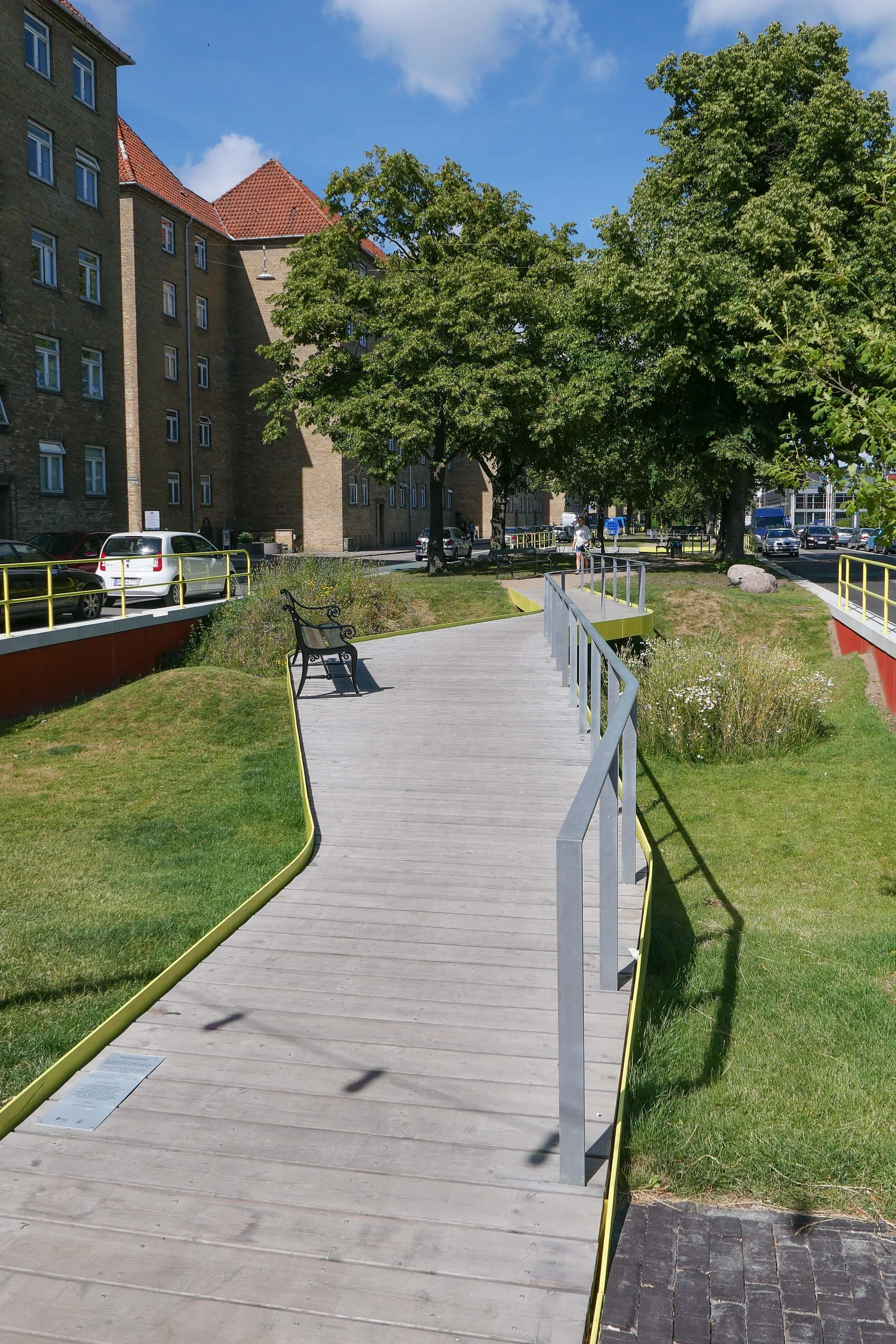
The new park at Scandiagade is 360 metres long and runs at an angle but basically from north to south from Sydhavnsgade down to Børgmester Christiansens Gade and is now one of the important linear parks in Copenhagen … earlier versions of these long parks where road traffic on either side of a dual carriageway has been restricted and constricted to free up the central reservation for planting or play equipment or for places for local people to sit in the sun. These earlier linear parks include Sonder Boulevard in Vesterbro and Prags Boulevard on Amager. At Scandiagade one interesting difference is that instead of car parking being against the pavement in front of the buildings, here it is along the inner edge against the park. Curiously this makes the park feel not isolated or threatened by the cars but actually enclosed and somehow more and not less important.
Fortunately it was possible to keep mature lime trees along the centre - only two were felled - and these form a depth and volume to the design and, from the completion of the extensive construction work, it feels well established.
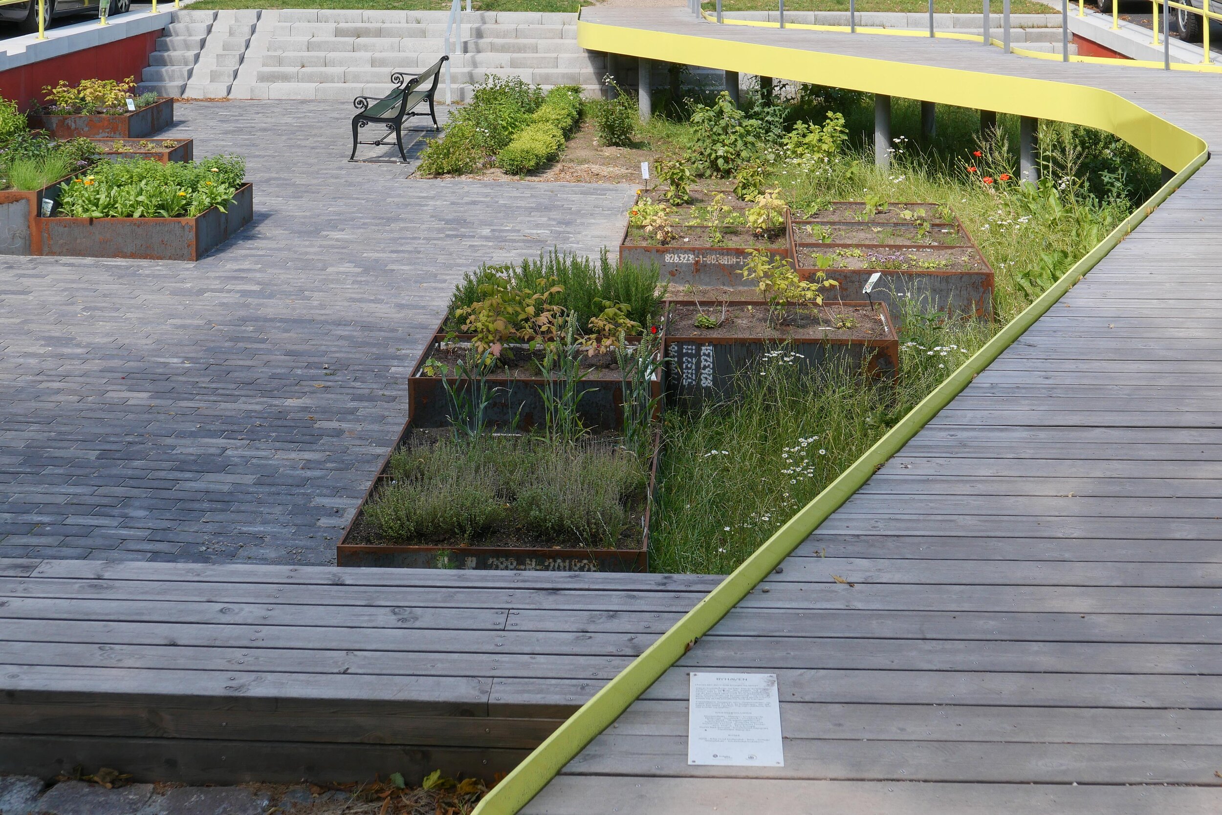
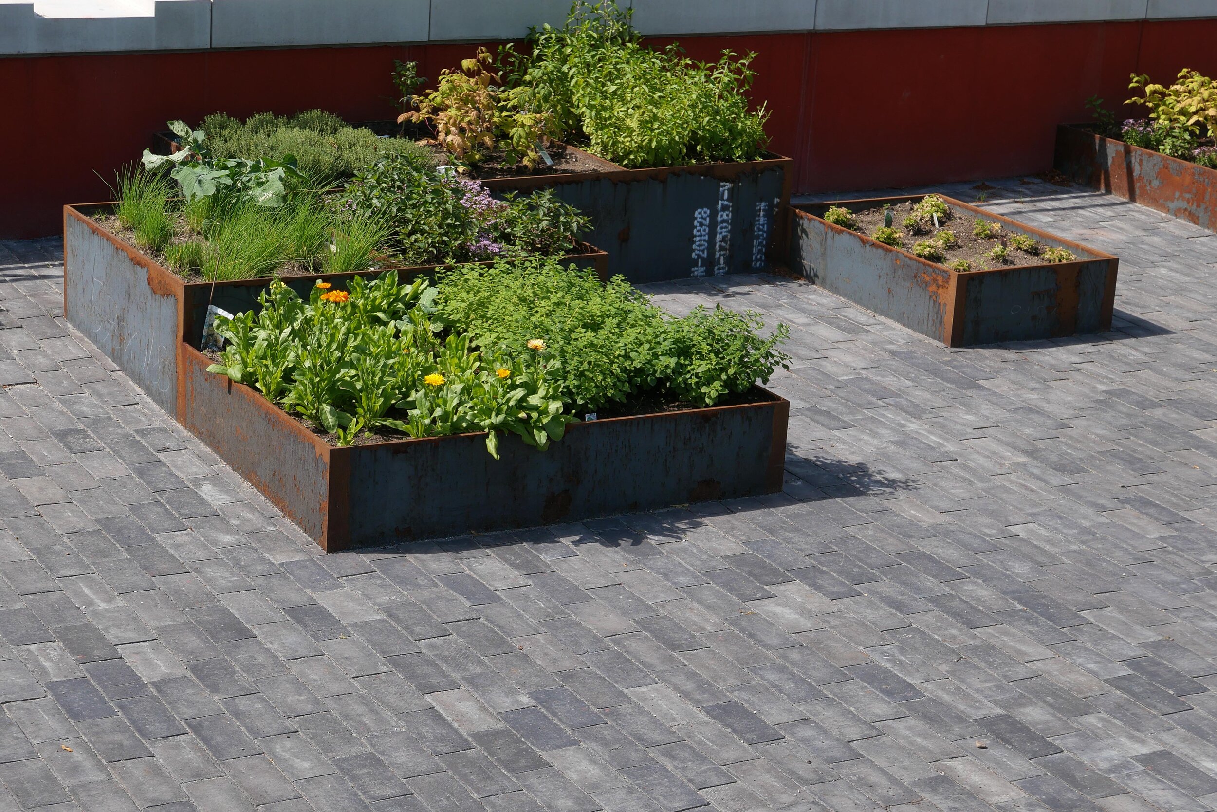
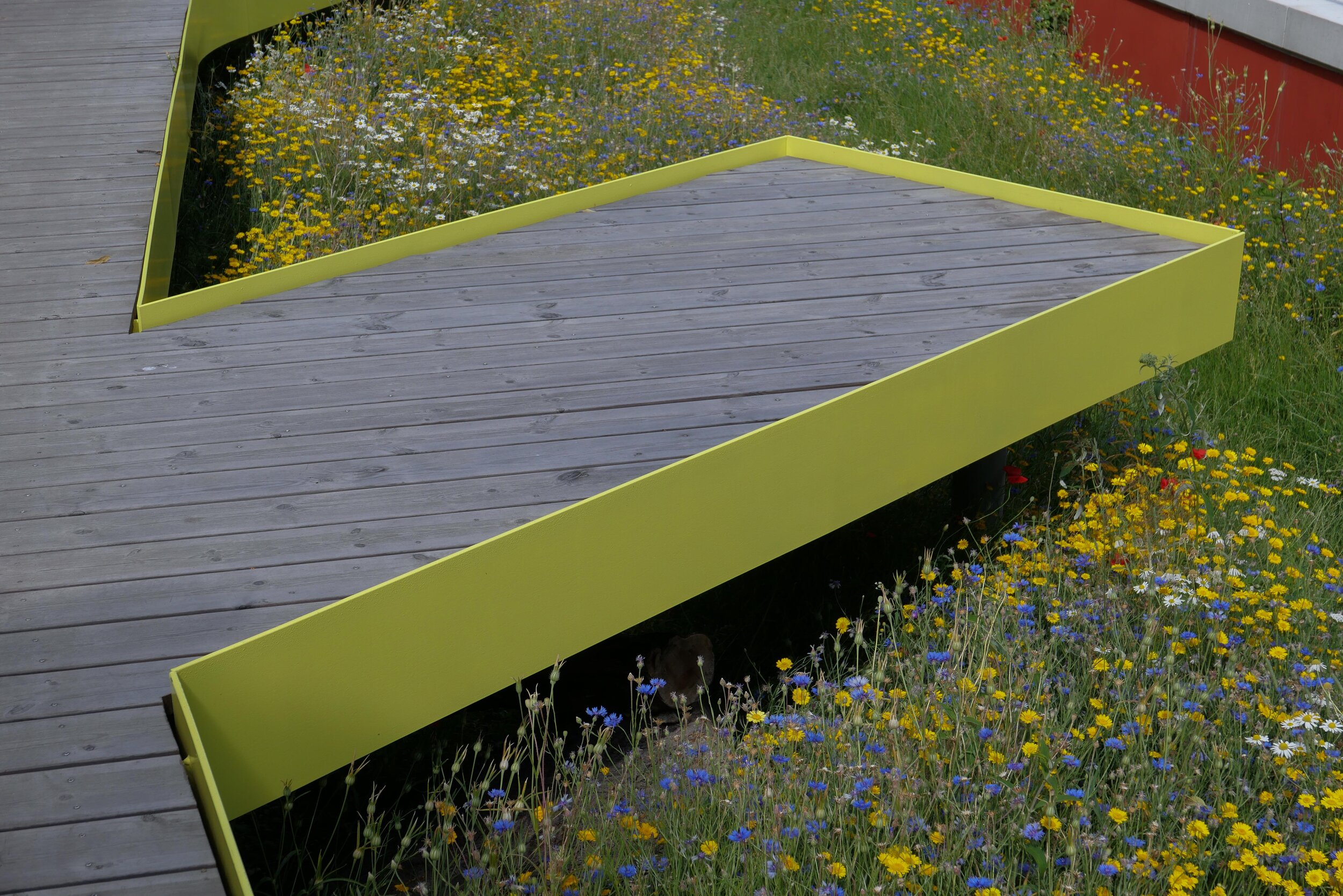
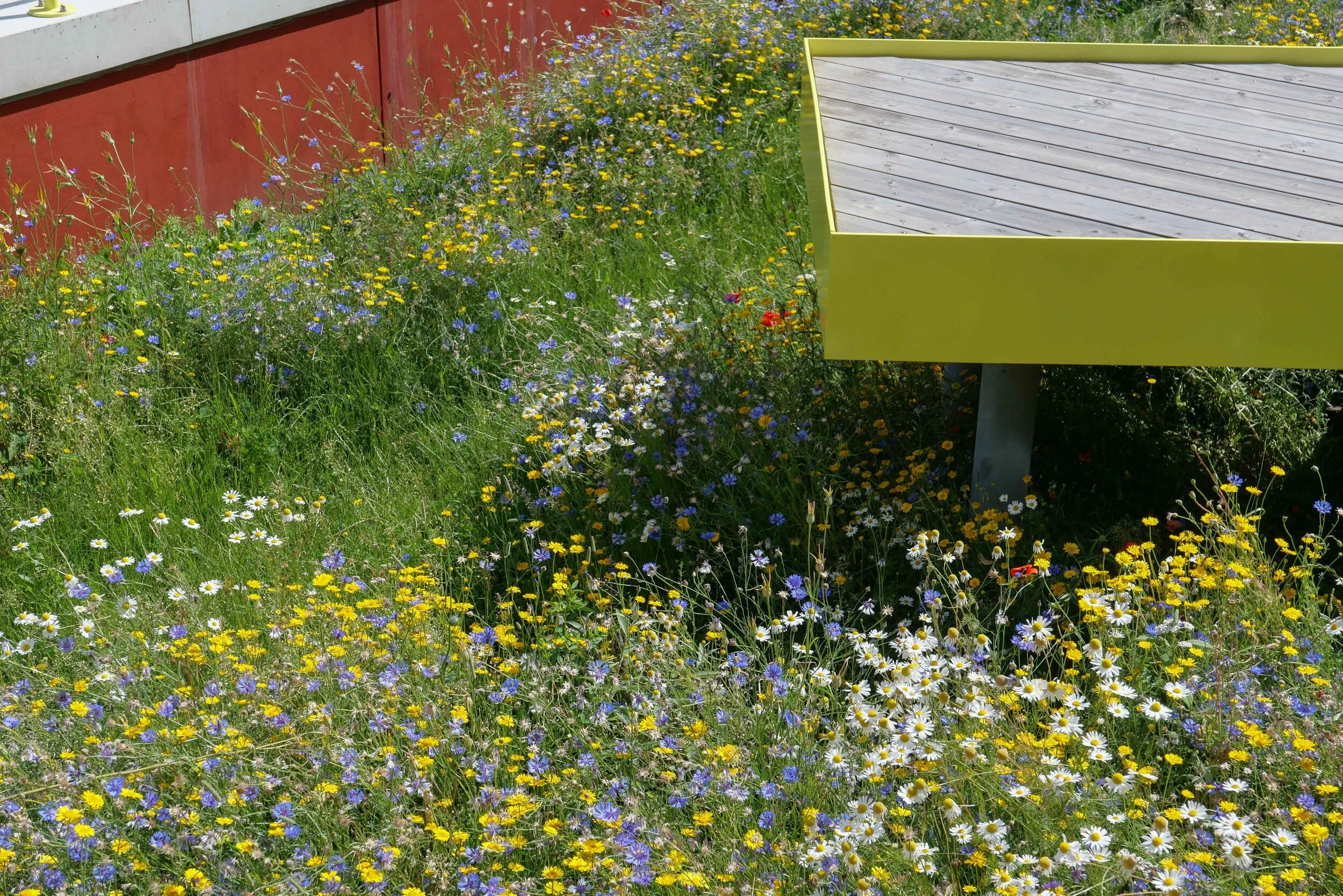
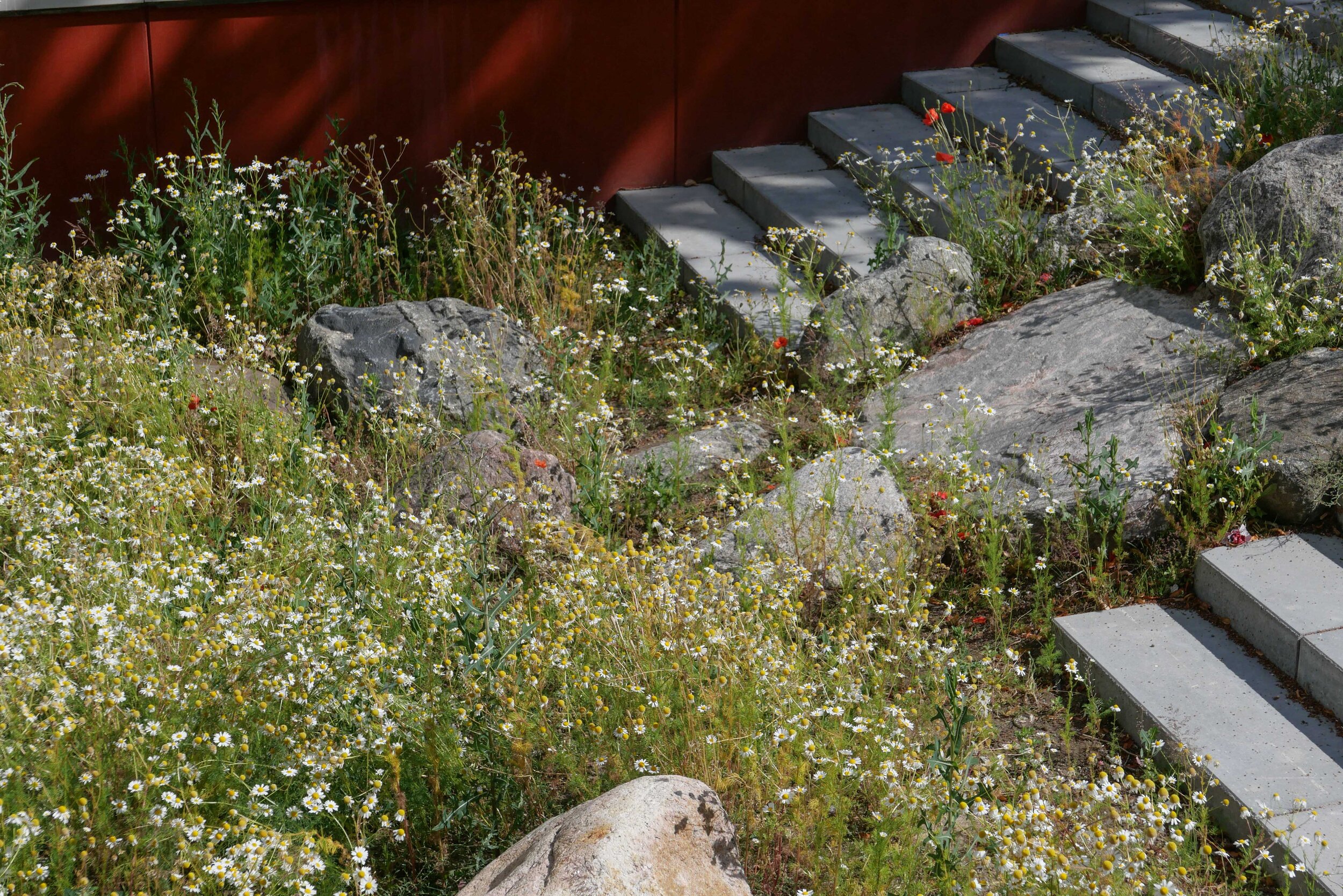
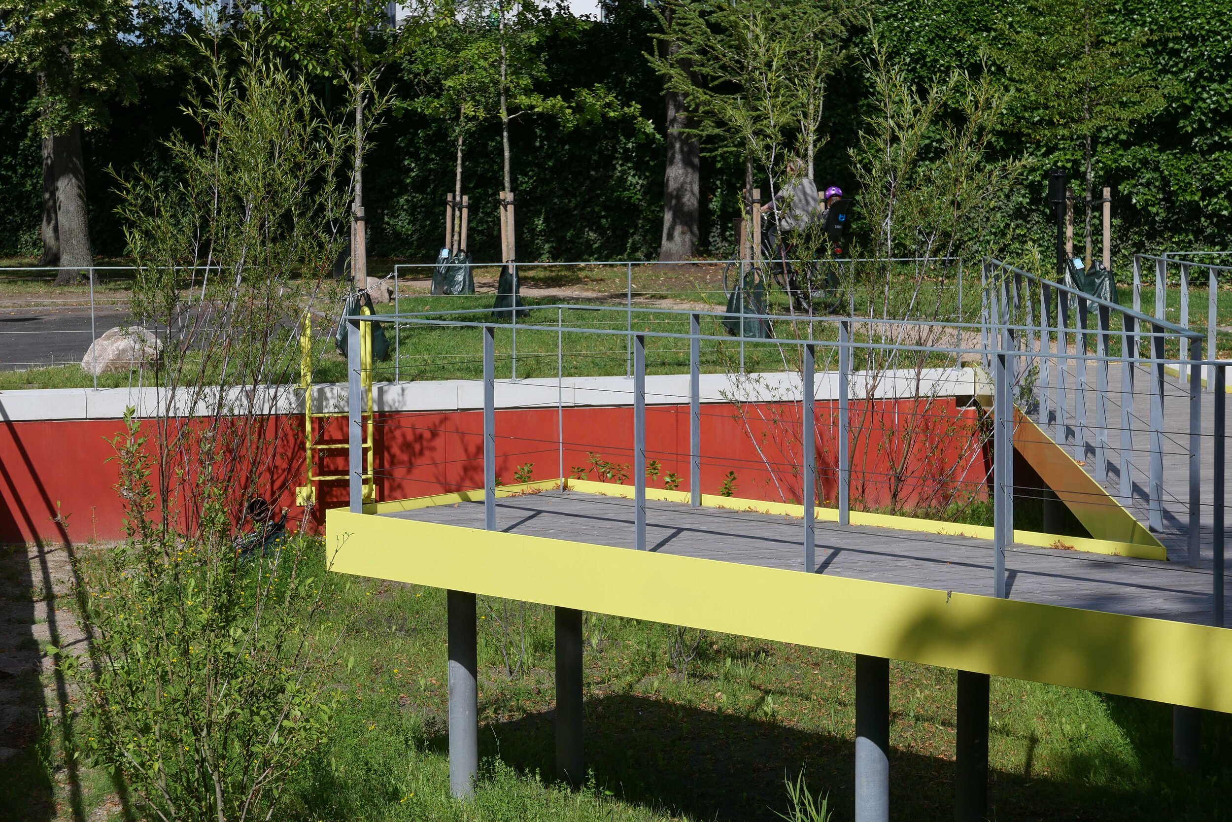
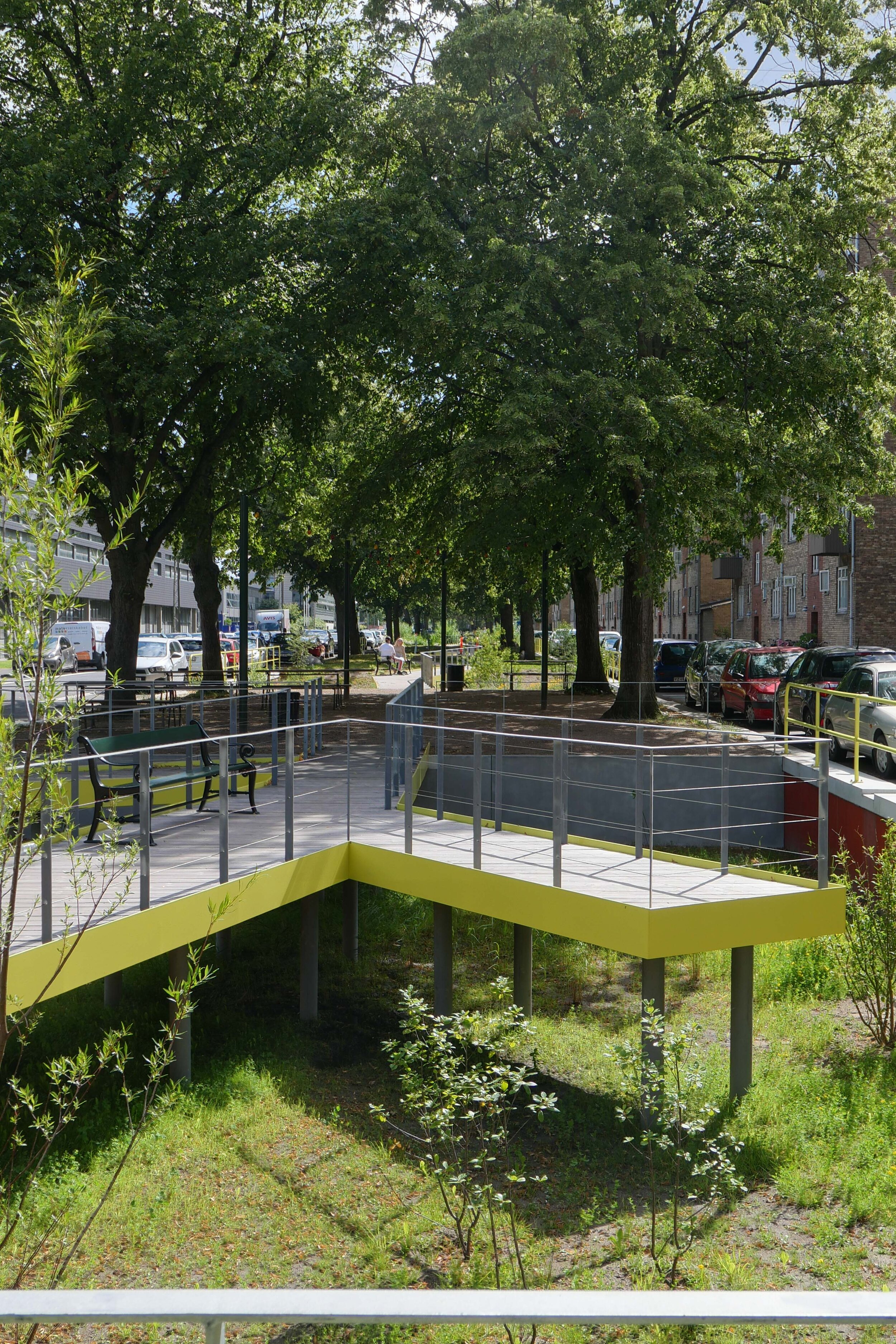
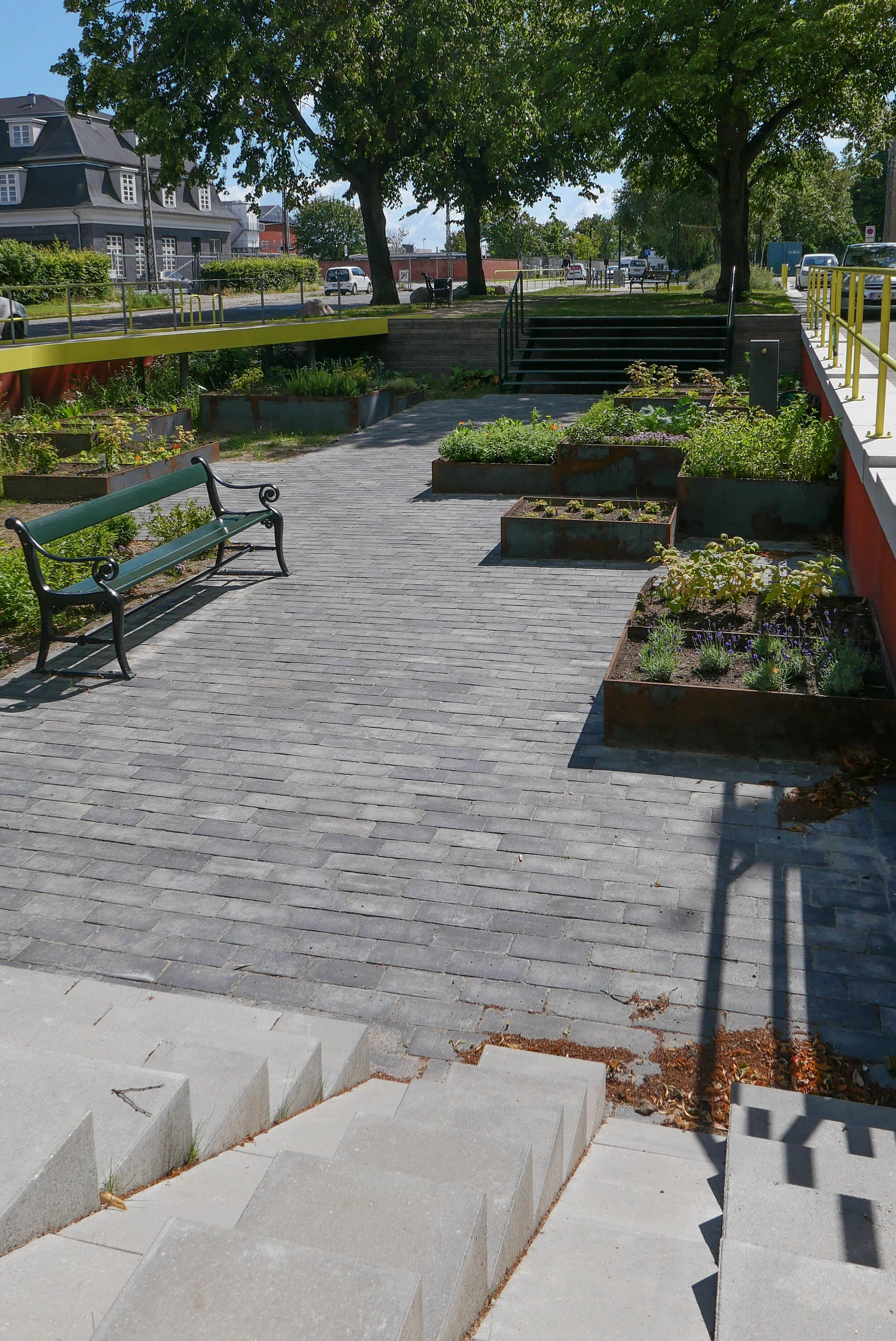
The design has eight sunken areas for storm water to flood and where rain water will be held to drain away slowly without damaging property or damaging the drain and sewer system that would otherwise be overwhelmed in a downpour.
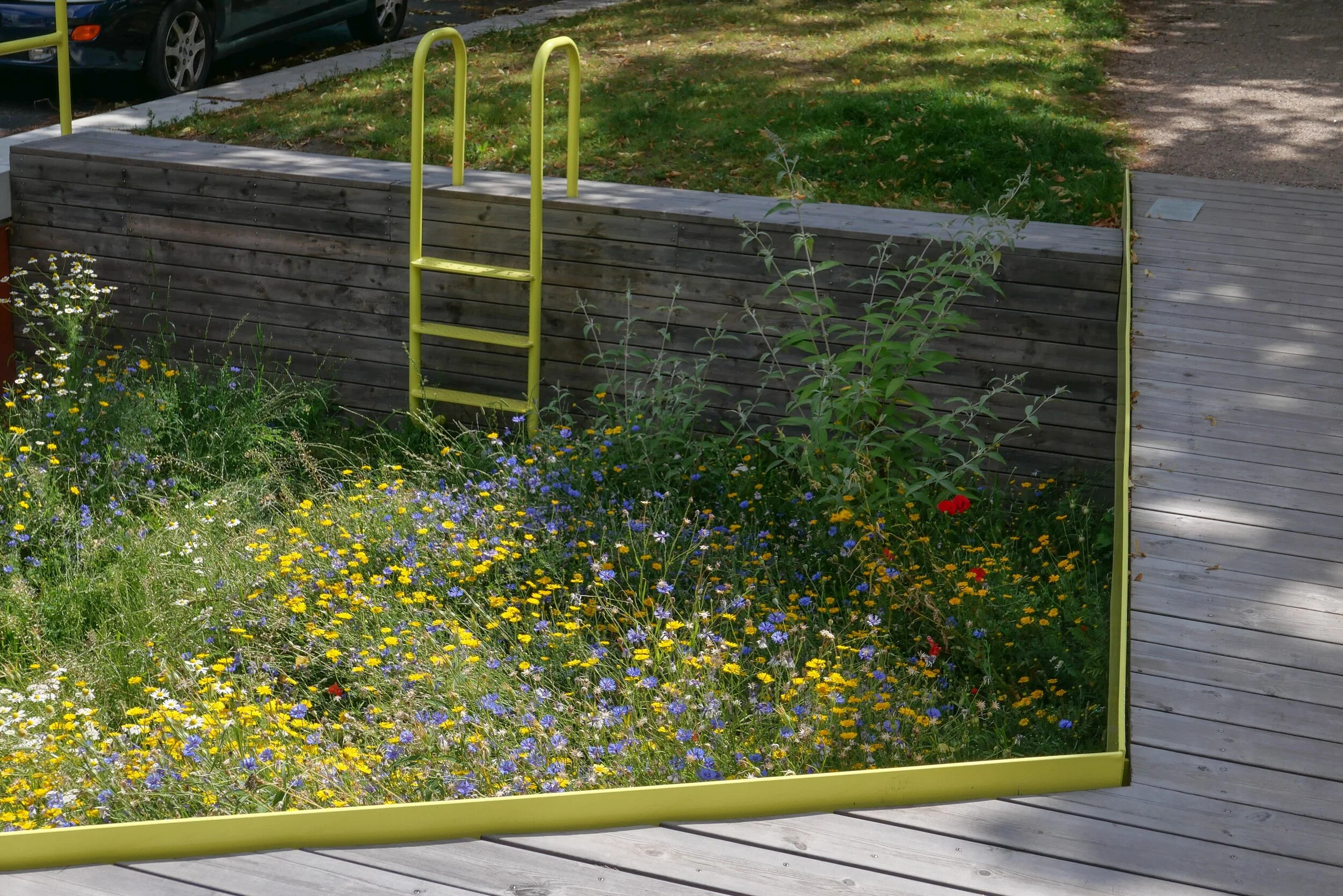
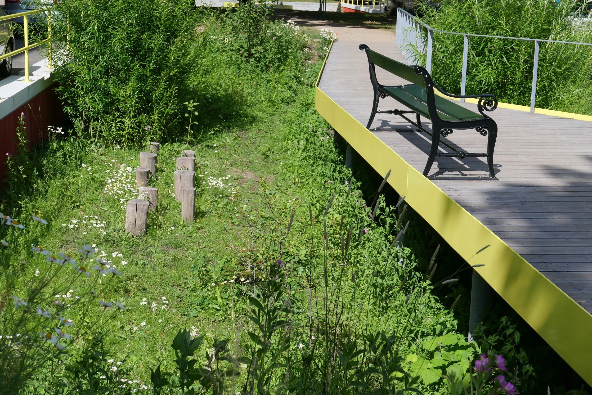
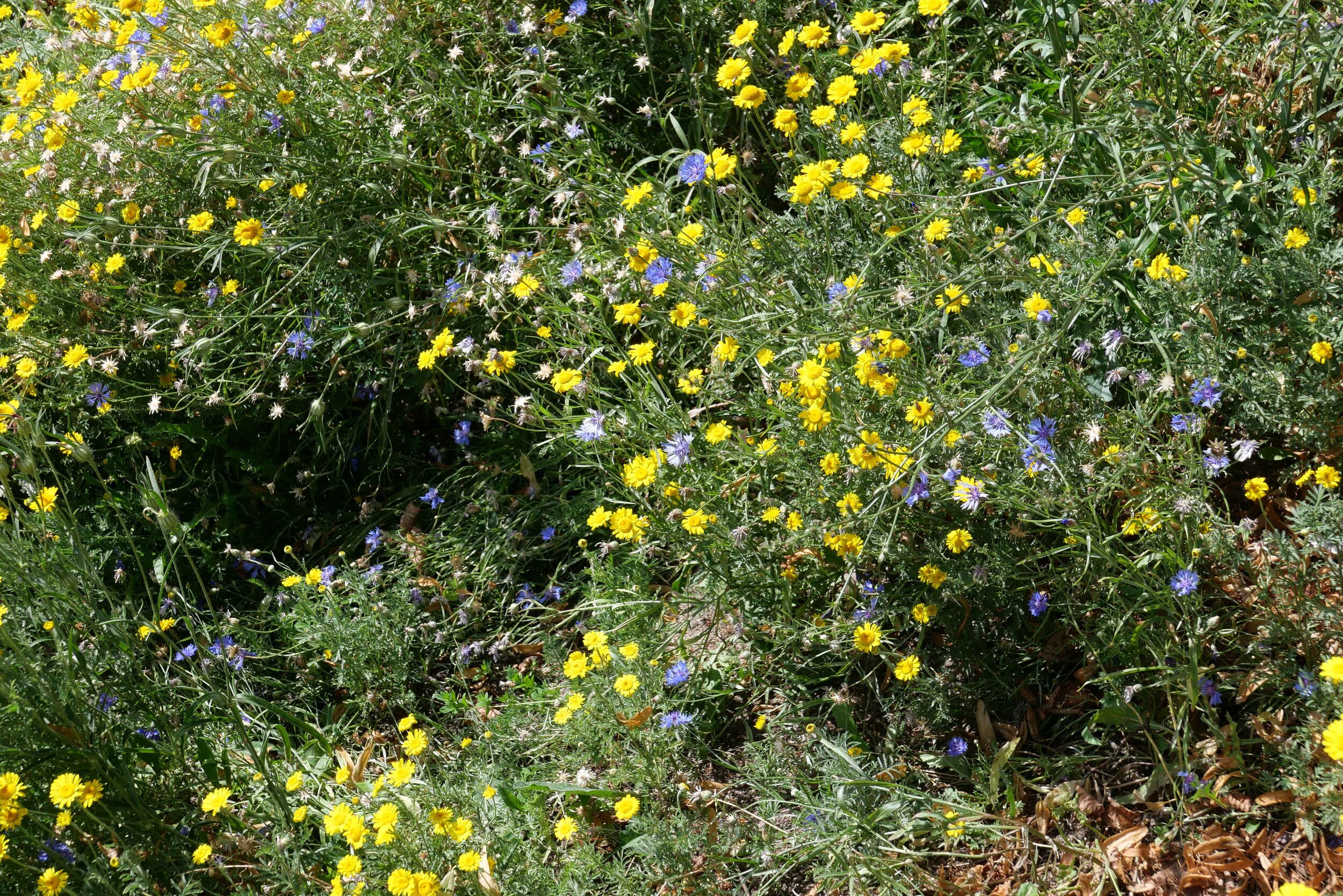
Each sunken area has a different theme and a distinctly different character and these were worked out with the residents who also helped decide on planting so there is a really rich bio diversity with well over 100 different plant types. Information panels and labels have been included to encourage people appreciate and learn more about nature and about plants and their care.
The sunken areas include a play area; a butterfly garden; a beach with a volley-ball net; a kitchen garden; a 'hilly' landscape; a stone or rough moorland garden; an area inspired by Tippen - an important and popular nature reserve to the south on landfill - and an area that has been fenced in and left to see what grows in a wild and self-seeded garden.
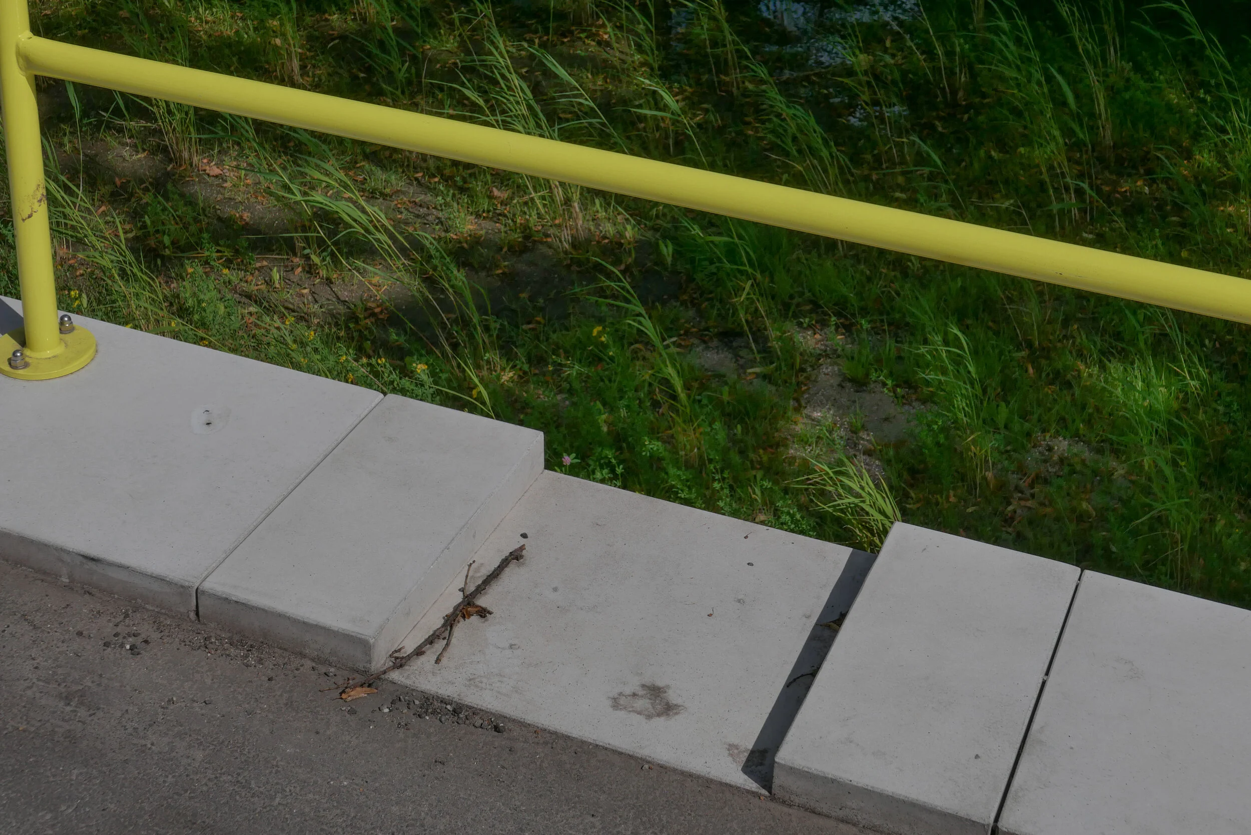
These areas are linked by a striking raised walkway that zig-zags down the park with a sharp yellow metal edging and a hand rail on one side - rather than both - and this links different sections at road level where there is plenty of seating but there are also steps and swimming-pool or harbour-style ladders down into each garden.