

Aborreparken - the lost park
/photograph from about 1900
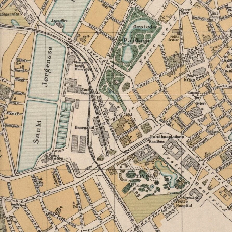
A distinct and attractive feature in the plan of the centre of the city in Copenhagen is an arc of civic buildings and public parks across the north and west sides of the old city. These were laid out in the late 19th century after the old city gates were demolished and the defensive banks and most of the water-filled outer ditches were removed.
Østre Anlæg - the largest of the parks with Statens Museum for Kunst (the national art gallery) at the south-west corner - was begun in 1872. Botanisk Have - the Botanical Gardens - were laid out between 1871 and 1874 and the park at the north-west corner of the old city, Ørestedsparken, was laid out between 1876 and 1879.
It was only when I was looking for old photographs of buildings in the area around the city hall that I came across a series of views and postcards of a fourth city park … the last to be laid out but the only park not to have survived.
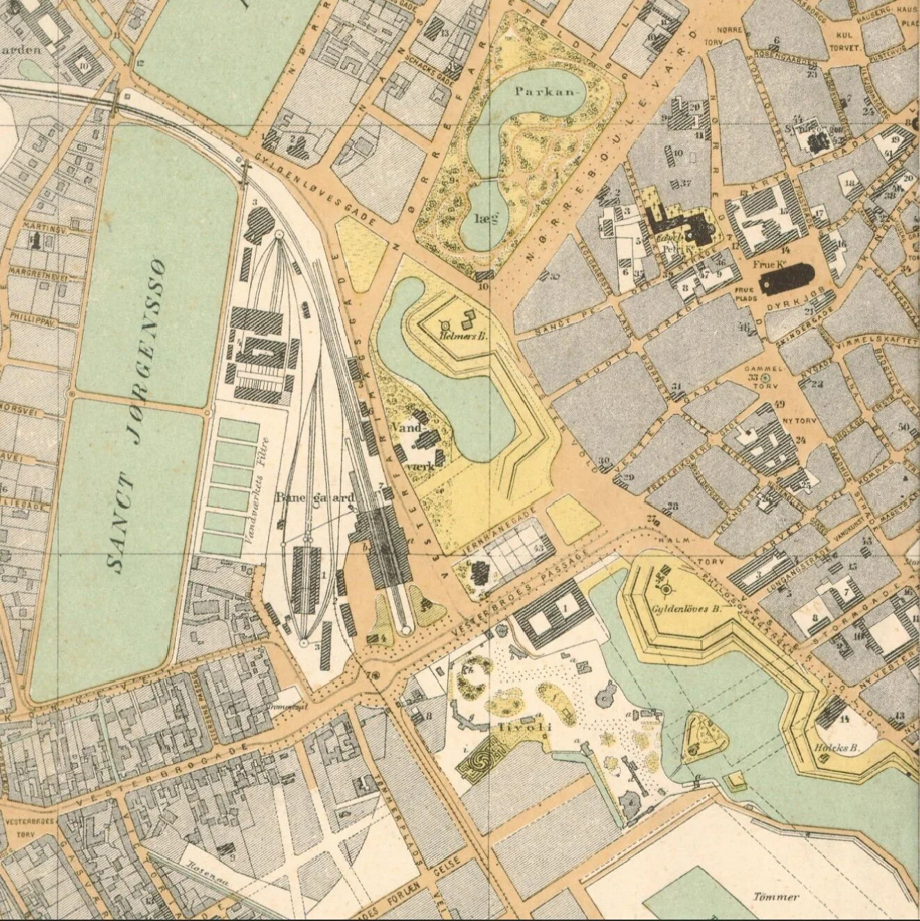
Aborreparken opened in 1886 but was closed in 1910 when work started on building a new railway line to connect the main railway station to what was then a terminus for suburban trains from the north that came into Østerport station.
The view of the park, with its large lake and a steep bank planted with trees and shrubs, shows just how impressive the city defences were. The building here with turrets and domes is Ny Rosenborg and that survives. Designed by Louis Clausen and Henrik Hagemann, it was completed in 1895 and was built on the line of the defensive bank. Vester Voldgade, the road on the east side of the building, was on the line of the road around the city on the inner side of the defences.
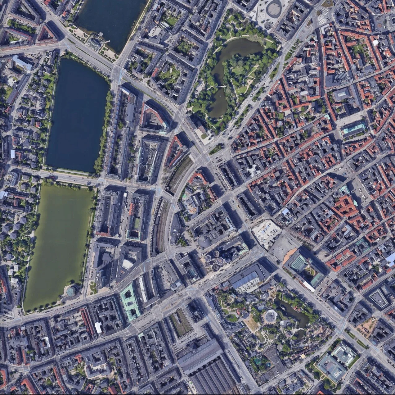
When the railway was constructed, the main road from the north-west corner of the old city to the harbour was swapped from what is now Vester Voldgade, down the east side of the square in front of the city hall, to what is now called HC Andersens Boulevard across the west side of the city hall. That wide road is at the level of the avenue of young trees across the west side of Ny Rosenborg and there are now substantial buildings at that level above what is here, in the photograph, the embankment, and the lake and is now the line of the rail tracks set down below street level in what now appears to be a cutting.
A waterworks shown on early maps at the south-west corner of the park survives. It too was built in response to the loss of life in the outbreak of cholera.
The photograph hints at the extent of the huge changes to the city around 1900 and also shows that some impressive engineering was required, moving the earth of the embankment and building out over the ditch, and that even relatively new works could be changed quickly and dramatically as life in the city changed and evolved.
1890
the railway station was then on the north side of Vesterbrogade and the railway crossed over the lakes heading for a station in Frederiksberg
1897


