Ét Danmark uden parallelsamfund / One Denmark without a parallel society

 
ghetto.jpeg

This was a difficult post to write because it is about sensitive political and social issues but the subject is important and not least because there very specific implications for planning and housing in Denmark that will influence future policies for planning and should have a much wider relevance and for many if not most countries.

In the New Year the government published a report - Ét Danmark uden parallelsamfund / One Denmark without a parallel society - that sets out a policy to tackle problems in some urban areas in Denmark that will now be defined officially as ghettoes.

My immediate image of a ghetto - the picture conjured up by that word - is of crowded and poorly-built and or badly-kept buildings that are occupied by people kept there by poverty, isolated from wider society and from wealthier neighbourhoods, often nearby - so slum housing - so people, for different reasons, trapped and living with high levels of deprivation.

Here, obviously, I have to admit that I have had a relatively privileged and very middle-class life growing up in a very beautiful university town and then in well-designed modern housing in a new town. When I went away to university I went to Manchester to study art history - you can hardly get more middle class - and I loved the grandeur of the Victorian city and lived initially in what had been, in the 19th century, a private gated street of large villas. But that was just two blocks away from Moss Side … then defined officially as being the worst slums in Europe. Worse than Naples or Marseilles or Glasgow. Recently I came across some images of the slums in Moss Side and other parts of Manchester taken by Nick Hedges - a photo journalist - at exactly the time I lived nearby and I was truly shocked because it made me realise that time has blunted my memory of just how grim that area was and my memory had blotted out what was the reality of life for many people who lived there less than fifty years ago.


Since then I have driven through Soweto, seen Baltimore and travelled through much of South America so I am not naïve about the reality of poverty and deprivation - just naïve about how you deal with it.

I feel strongly that anyone and everyone visiting New York should go to the Tenement Museum and people should look at photographs of slum housing in London in the 1930s and in the 1950s and 1960s for a realistic context to understand just how recently that sort of housing was a reality in what are now very wealthy cities. There is a tendency in the affluent west to be blind to just how recently that sort of poverty and that sort of housing existed in their own countries.

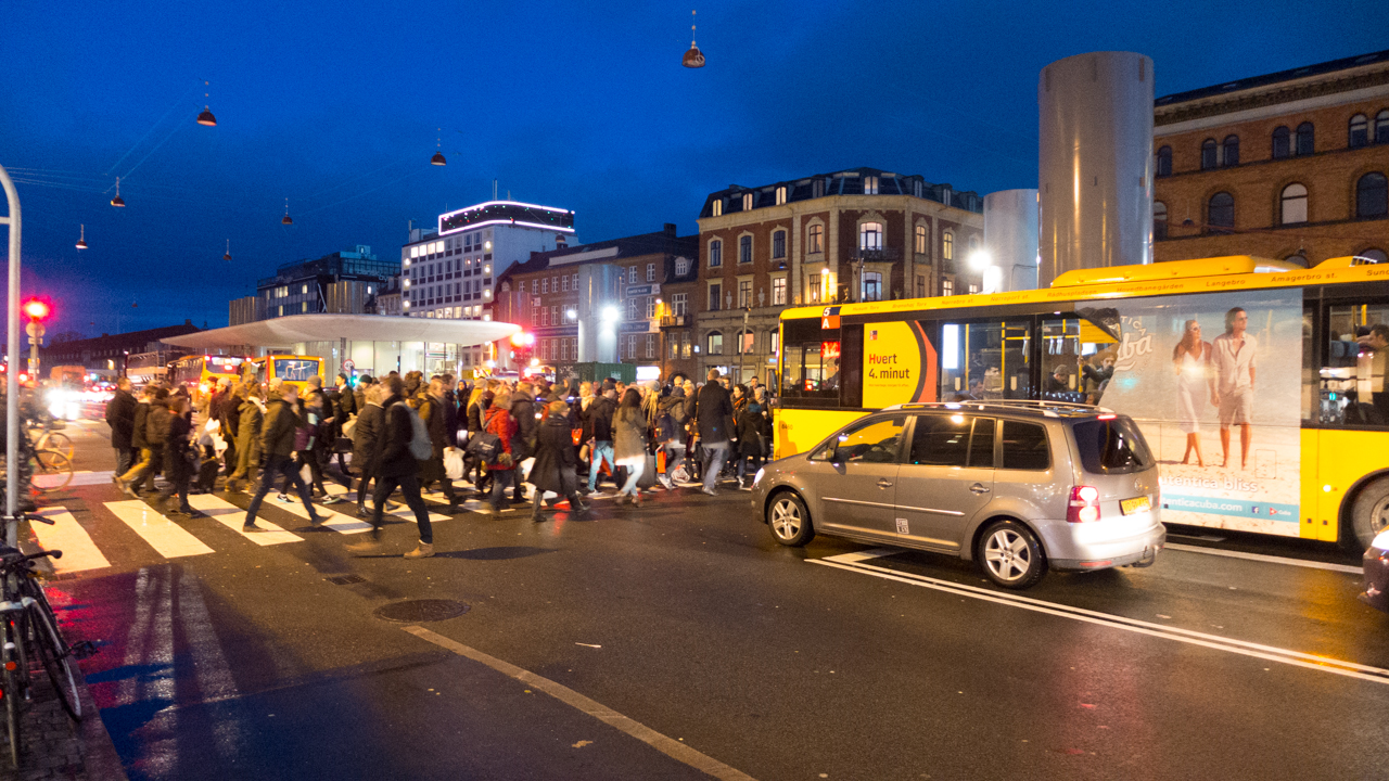
In Denmark the definition, by the current government, of specific housing or distinct areas as ghettoes does not, in fact, stem from or define that extreme sort of housing but is about what problems that have developed as people migrate to Denmark but want, as most humans do, to be with people who have a common background and often a common language. Many Danes are aware that, in the worst situations, this can lead to isolation of communities and then on to a cycle of relative poverty and problems with education and employment that can trap people. And when people are trapped they do not benefit, as much as they should, from being an integrated part of Danish society. There is a growing concern that being isolated really does increase social problems - particularly for boys and young adults, and their membership of gangs - and it is that isolation that is described as living in a parallel society.

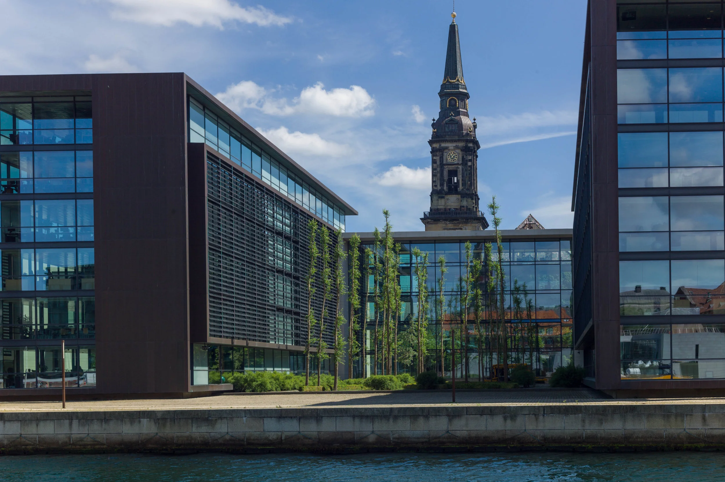
It is difficult because visitors - and presumably many migrants - coming to Denmark see affluence and see tolerance and see a freedom of life with enviable choices and then make the assumption that that was and is an easily achieved privilege. Actually, it has to be remembered that for older Danes, many can remember the slum housing in Vesterbro - as bad as anything in Manchester - or the slums that were cleared away in the 1950s from the area around Borgergade - not far north of the royal palace - and they know that their high quality of life now has been achieved through social and political changes and not simply dished out. I cannot recommend enough a visit to Arbejdermuseet - the Workers' Museum in Rømersgade - to find out more about working conditions and living conditions for many families in Copenhagen through the 19th and 20th centuries.

Of course the problem for migrants, in search of a better life but finding themselves isolated and trapped, is not just a problem in Scandinavia or for the affluent west but is a global problem and not just about the equitable distribution of opportunity and resources but how you can expect people to be taunted by affluence through advertising and merchandise sold to them, but remain content with what they do or, more often, don’t have.

And, of course, the problems tend to be seen as the consequence of migration from one country or one continent to another but is just as relevant with mass movements of people from rural to urban areas within a single country. This is really about managing expectations and managing numbers.

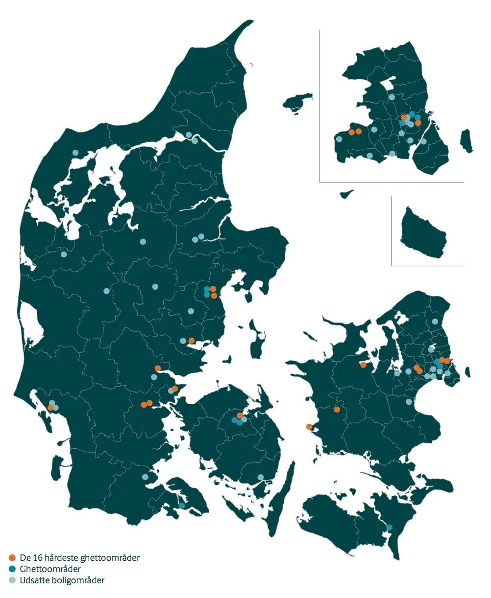
In Denmark, twenty-two initiatives have been set out by the government for urban areas that have problems seen to come from people living in a community that, for many different reasons, are isolated and parallel communities. Funding will now be available for demolishing some housing and for improving some areas but also there will be measures targeted at education with a focus on vulnerable children. Sixteen ‘ghettoes’ have been identified and substantial amounts of funding have been allocated to make the changes set out in the report.

Much of the programme to deal with these ghettoes is about social housing and about the stock of older housing - some from the 1920s and 1930s but also from the post-war period - so housing that would not be built in that way now … and it's about learning lessons and about trying to prevent more problems down the line through intervention now through education and through focused urban planning.

data to help plan for housing in the future


Danskerne i det byggede miljø / Danes in the built environment is a detailed annual survey that asks Danes about their homes.

Information for the most recent report was gathered in April 2018 when 7,090 people completed a questionnaire from Kantar Gallup A/S for Bolius. The results have been published by Realdania and the most recent edition is now available on line.

These surveys have been conducted each year since 2012 so they now provide an important data base but they also track changing attitudes so they should influence decisions by planners and should prompt architects, builders and designers to assess carefully the real problems people encounter because the surveys show how people perceive problems and show how these are prioritised.


The survey is published with general points and summaries but most of the information is set out in a large number of tables. These provide a fascinating insight not just into day-to-day practical problems people have and about the way they complete maintenance and repairs but also broader issues about neighbourhoods - about what makes a good neighbourhood - and how all these factors together influence how people rate the quality of their lives.

More than 6 out of 10 Danes believe that their home is important when they consider the quality of their life … for 22% of Danes  their home is of very high importance and for a further 41% their home is of high importance when they consider the quality of their lives. 

It is interesting that large numbers are concerned about problems with general maintenance - in fact around 90% - and least concerned about problems with buying or selling a home.

Danes are concerned most about mould and about burglary … and more in Northern Jutland than in other parts of Denmark. To this should be added that tenants are also concerned about rising rents so, from the most recent survey, over 50% of tenants are concerned about rising rents; 30% are concerned about mould and a similar percentage are concerned about a bad neighbourhood.

Further down the list are concerns about bad neighbours and lower still problems with hidden electrics and hidden piping.

There also seem to be major concerns about what is described in the survey as poor indoor climate - so ventilation and, as a consequence, mould or fungi and, along with problems with poor neighbours, these concerns are more significant for families with children.


summary of concerns:

Ventilation and cold 22.5%
Cold walls 18.2%
Condensation and mould 13.9%
Noise 11.2%
Heat or too high temperature 7.0%
Daylight (too much or too little) 6.3%
Smoke (from kitchen, wood-burning stove, fireplace, etc.) 6%
Dust and house dust mites 5.8%
Poor air quality 5.3%
Radon from underground 1.2%


On first looking through the tables there appear to be some strange contradictions so seven out of 10 Danes are satisfied with their neighbours and their neighbourhood but, on the other hand, every third Dane admits that they hardly know or don't know their neighbours.

To be more positive, one in five have street parties or garden or courtyard parties with their neighbours.

Even in terms of social life in a neighbourhood, there are some interesting differences, depending on the type of home, so 20% of Danes who own their home actually invite neighbours for a meal but in a housing co-operative - where being sociable might be considered to be more important - only 15% invite their neighbours round for a meal although that is better than where people are renting and only 10% invite their neighbours for a meal.

Generally, older Danes say that they are satisfied with their neighbourhood. Does that mark a change over generations - with younger people having less connection with the place where they live or different priorities and a different focus for social life - or does it suggest that feeling settled in a neighbourhood takes longer than might be assumed?

There is a fairly uniform satisfaction across all levels of education and nor does income have a clear connection with good neighbourliness. It is interesting that the people most dissatisfied with their neighbours and their neighbourhoods are those with the highest and the lowest household incomes.

People in the survey indicated that a better choice of shops is important for 18% of Danes - as an average across the survey - but it varied across the country with 24% in rural areas but less, so around 15%, in the city and across the whole survey 16% think restaurants are important so relatively high in general priorities.

In comparison only 6% see better broad band as a priority (10% in rural area and 5% in cities) but this might simply reflect a general satisfaction for present services that seem to be relatively good. In the same way, better schools are a priority for just 4% and better day care for 1.5% but this, presumably, does not suggest that education is well down the list of priorities because Danes do not care about schools and day care but must reflect tangible and clear improvements over recent decades so now, generally across the country, the provision of day care and nursery and then schools is of a high quality and so no longer a major concern.

Although "proximity to nature" is given frequently as an explanation for a choice of home, only every sixth Danes make use of nature or natural areas on a daily basis, and only 40% seek out nature at least once a week.

Again it is probably not surprising that the region of Southern Denmark has the largest share of citizens who use outdoor areas in their neighbourhood most frequently.


In apartments people seem to have higher levels of concern over most categories … 30% are concerned about ventilation and cold, 25% complained about cold walls and 15% about moisture and mould and curiously 8% are concerned about being too hot while 10% are concerned about too little or too much daylight in their home.

In more general questions, people living in older homes, as you might expect, tend to be concerned about cold and people in properties built after 2000 tend to be concerned more about being too warm and occupants of modern homes also tend to be more concerned about air quality.

For homes built before 1930, 24% are concerned about cold walls but for homes built after 2000 that has dropped to just over 4%.

Conversely, feeling too hot in their home was the concern of 5% in homes built before 1930 but 14% in modern home so presumably that suggests modern insulation is good but it is difficult to get the balance right. Possibly, local or district heating systems are not as easy to control but it is interesting that older people opened doors and windows most often to improve ventilation.

For admirers of the Danish concept of hygge, perhaps the most worrying statistic suggests that 12% of Danish households have cut down on using hearths, stoves and candles because they are concerned about air quality.

There are some marked differences by age so it is obvious that younger people tend to consult the internet rather than family or friends about maintenance problems but, across the age ranges, the use of craftsmen to do work has declined from 67% in 2014 to 60% in 2018 so, presumably, DIY in Denmark is on the increase.

If all this seems to suggest that Danes fret about their homes then across the survey, on a score of 1 to 10, general levels of satisfaction with the quality of homes ranged from 6.7 to 8.2.

Finally there were some general statistics that should interest designers and builders because only 21% of the participants in the survey indicated that they felt that maintenance or building work should make the home more up to date and, overall since the surveys began, there had been a decline in number of people undertaking major refurbishments.

Perhaps Danes are less concerned about fashion than magazines and blogs might suggest and rather more concerned about very practical aspects of comfort.


 the report can be read on line or downloaded as a pdf file from Realdania

the forecourt of the design museum


Work continues at Designmuseum Danmark where the entrance gates, railings and stone piers along the street are being rebuilt and the setts of the forecourt relaid to form a new ramp to replace the steps up to the front entrance door and to install lighting and so on for new outdoor exhibition cases. 

The project - designed by the architectural practice COBE - includes a new ticket area, book shop and new cafe in the lower part of the old pharmacy … that’s the pavilion to the right of the forecourt.


As new blocks of stone have been brought to the site and set up, the work is an opportunity to see some of the details of 18th-century stone masons’ techniques that have been replicated … so it is possible to see the way bold mouldings are cut across large blocks to form plinths and caps to the piers.

The large ashlar blocks of the stone piers and the blocks that form the moulded bases and caps are dressed back with strong vertical tooling which contributes a distinct surface texture and gives a darker tone to the architectural details. Note how at each end of the ironwork screen the outer piers are not butted against the brickwork of the pavilions but are set into them which would suggest that the brickwork and stonework were built up at the same time … not one built against the other.

top left - the door into the former pharmacy of the hospital which will be the access to a new arrival space with ticket desk, book shop and new cafe. Note the silhouette in the brickwork of the ball finial and moulded cap of the stone pier that has been dismantled.

top centre - an iron pintel, set into the stonework of the pier, that will hold the strap of the lower hinge of the gate


Heavy spiked or barbed railings and the ornate iron gates are held in sockets cut into the blocks.

At this stage the gates are back on site but are on pallets so it is possible to see the robust quality of the iron work and to see how the straps of the gate hinges form a loop that will be dropped over hefty iron ‘pintels’ set into the stonework. 

This major project has also been an opportunity to repair some of the stonework on the entrance front of the main building and it is interesting to see around the doorway that although the stone frame or architrave of the door looks hefty or robust, it is, in fact, made up with relatively thin slips of stone with pieces forming the moulded front and separate pieces forming the reveal or jamb running back to the door frame and the brickwork behind is surprisingly crude.


Den Hvide Kødby Lokalplan nr. 562 / The White Meat City - Local Plan - report 562

the Local Plan covers both the White and the Grey markets ... this is the boundary between the Brown Market to the left and the Grey Market to the right


select the image of the cover above and this is a link to a pdf file of the report published on line by the city

the oldest part of the meat market is Denbrone Kødby that was built out over what had been the foreshore with a new quay for ships beyond that marks approximately the line of the present railway as it approaches the main station from Roskilde


At the end of June a local plan - number 562 - was published by the city for Den Hvide Kødby /  the White Meat City district of Copenhagen. 

This is the west part of a large area of market buildings and slaughter houses that developed here from 1879 onwards when the meat market was moved from a site further north, closer to the lakes.

The market, sometimes referred to now as the Meat District, is west of the present central railway station and immediately south of a long open public space called Halmtorvet that continues on west into Sønder Boulevard and forms the north boundary of the site. 

Den Brune Kødby, the Brown Meat market, was the first part of the market to be built and is in brick. The buildings to its west - sometimes referred to as Den Grå Kødby or the Grey Market and included in this plan - were extensive additions to the market from around 1900 in grey or white brick and Den Hvide Kødby or White Meat City - primarily low and mainly flat-roofed buildings in concrete with white facades was a large addition to the meat market dating from the 1930s. 

In part because these are essentially industrial buildings but also because of the clean simple outlines with no decoration, then, in terms of style, this part of the market built in the 1930s is generally described as an important example of Functionalist architecture.

Note that the popular reference to the east part as the Brown Meat market only emerged after the construction of the additions of the 1930s - to distinguish the different parts the names refer to the colour of the buildings and not to the colour of the meat.

The area is owned by the city and this is certainly important for the long-term conservation of this area and for appropriate controls on detrimental development .

Changes to the market began around 2005 as meat processing here - from the sale of animals and their slaughter and on to finished meat preparation before selling on to shops and commercial buyers - declined. It is still an important part of the day-to-day life of the area but creative industries and restaurants and cafes began to move in alongside the whole-sale food markets and as new neighbours for the meat traders.

The plan acknowledges this:

"The local plan area together with Den Brune Kødby has a special atmosphere and authenticity with business, cultural and school and leisure activities in conjunction with the original food-producing wholesale businesses. Market functions, galleries, bars and musicals help create city life 24 hours a day."

The local plan for the brown market (Lokalplan / Local Plan 262) was produced at the end of 1995 and updated in June 2005. These plans should be read alongside the City of Copenhagen Municipal Plan published in 2015.

In 2014 a planning decision was made to allow the building of some homes on part of the site … up to 25% by area but mostly on upper floors. In 2017 there was a first official proposal to build a new school on land at the south corner and both will mean the demolition of some existing buildings.

This local plan tries to quantify these changes and it indicates that the commercial wholesale food markets and food businesses will be 40% of the usage but the plan specifically acknowledges the potential that the other buildings have for small craft-based industries.


during the summer there are  weekend food markets with stalls set out around the main square


The area is surrounded by parts of the city that are themselves undergoing major re-development with changes or new building on former brown-field sights so a coherent policy statement and a long-term plan for the meat markets was required: any plans for the White Meat market also has to be seen in close relationship to developments on the other side of the railway along, Kalvebod Brygge; radical changes along the north side of the area with work on Halmtorvet and along Sønder Boulevard and long-term changes that will come to this part of the city with the opening of a new line of the metro next year. It was construction work for the metro that was the reason why the central part of Sønder Boulevard for the full length of the street was behind massive green fences for years as engineering works for the new line were completed.

The published plan has extensive maps that identify the historic buildings and the text describes briefly how the different areas and structures were changed or adapted as their use has changed.

An important part of the discussion is about how the squares and open spaces and the roads and paths through the area are laid out and how they are used now and then suggests how they can be improved.

This is because the plan has to be integrated with what are, in some cases, competing access requirements for transport into and through the area … so there will be new bike parking at Dybbølsbro - the railway station to the south - bike routes that are cutting through the area have to be considered - so people coming from one place outside the area and going to somewhere outside - and the requirements for safe road systems around the school. There will be tight and necessary restrictions to protect the new metro line tunnels so weight limits for commercial traffic and very clear controls on nearby excavations for new buildings or underground services.

It is implied that demolition of some buildings within the area may be allowed for what is considered to be appropriate new buildings so overuse and density of use might become more of an issue … part of the attraction of the area is that it is often empty of people and is an amazing place to explore but that is difficult to maintain or justify in terms of sustainability. There could be a problem with overshadowing and sight lines through and out of the area being compromised by new buildings immediately outside the area. The present sense of large and open spaces are crucial to the character of the area and a serious mistake is being made now with the overdevelopment of the Carlsberg site, where important historic industrial buildings have been swamped by new development, and that should not be repeated here.

The report spotlights issues about dealing with potential pollution on land that had heavy industrial use - there was a gas works here and a large cooling plant using large quantities of ammonia - and there will be ongoing problems with bringing more people and a school into an area that is used for industrial processes that means some heavy commercial traffic.

There are very clear recommendations for controls for a wider area that is primarily domestic but with social and entertainment uses so premises here can be shops and cafes but not banks or estate agents.

The implication is that if an existing building is demolished then the new building must be of the same overall height and number of floors above ground and have the same roof form and have similar facing materials.

There are some general points about the protection and conservation of important historic buildings that apply throughout the historic city but this report also points out problems specific to this district so roofs can be green - sown with moss and so on - but not with gardens or living spaces and roof-top service features like ventilation and lift turrets will generally not be allowed to maintain an appropriate silhouette or outline for the buildings in the west part that gain much of their character from having flat roofs.

Existing trees, several of which are what are called specimen examples, will be preserved but there are suggestions for planting new trees. For the city as a whole this is clearly a good policy but in this part of the city it was and still is a working area that has practical and often stark urban features and there is a problem if planting, however desirable from an ecological point of view, could make the streetscape here softer and more domesticated and polite than it has ever been.

The plan recommends keeping original windows and original glazed doors - in part because of the intrinsic high quality of some of these fittings - that should mean a long potential period of use - but also recommends keeping original glass for the quality of the light and the quality of the external appearance that is rarely matched by modern industrially-produced glass.

When discussing architecture in terms of style, or even when setting out the history of a complicated group of buildings like this, it is much too easy to describe a design as say Functionalism without then actually considering what that means. The meat markets were essentially an amazing and highly efficient factory system so if you want to understand why these buildings were designed and built in this particular form then look at the film made of the working market in 1936 but be warned that it is not a film to watch if you don't like to think about what happened to your meat before it went into the plastic tray for the supermarket. The film also raises interesting questions about architecture used to create an impression that wasn't true in its reality - so here Functionalist architecture implying clean, hygienic and efficient design for a process that was far from that. How can a local conservation plan limit the extent to which any important historic building becomes sanitised and divorced from its original function ... the very reasons it was built like that and looks like that? 

Strategy for Den Hvide Kødby
Den Hvide Kødby - Lokalplan Nr.562
history and old photographs
film of the market in 1936

select any image and the photographs will open in a high-resolution slide show


note:

People from other cities and other countries will easily and quickly understand planning policies that talk about creating a green city but it is fascinating that in Copenhagen the planning policies now talk automatically about developing a green and blue city. Open water is now seen as a very positive resource in an urban landscape. If you live in Copenhagen that is hardly surprising … the removal of pollution from the harbour - so people can and do swim anywhere - the long beach front of Amager and Hellerup and now Nordhavn have all been and are continuing to be much appreciated as a public asset and the lakes on the west side of the city are really important in terms of their ecology, in terms of their visual contribution to the streetscape and as a place to walk and relax and socialise so it is hardly surprising that water is now included in all planning assessments but of course this also tallies with the need for detailed planning to cope with climate change and cope with storm rain that often means the construction of new urban water features. Here, in this local plan for the meat markets, controls are outlined for protecting services and plant in buildings if there is a storm and drainage will have to be designed so that in the event of a major storm - often described as a once in a hundred years storm - then the surface water of any flood should be less than 10cm deep.

within 500 metres of the new metro station at Trianglen

When writing about architecture, guide books for the city tend to start with obvious buildings and sights that are close to the centre or are easy to reach.

Walking around Trianglen - and around that part of Østerbro - to take photographs for recent posts, it was obvious that here are important buildings that probably do not get the attention they deserve.

Together they illustrate an interesting period in the history of the city around a hundred years ago and also show how there is very good architecture in the outer districts of the city across a wide range of building types … so here is interesting social history and architecture with a strong sense of a specifically Danish style with buildings of a high quality. Much of the appeal is from a good use of materials and a subtle use of natural colour and texture to produce what is a very attractive urban landscape.

It might seem odd to start with the tram depot but it is a building that would be easy to miss and it is also a building that shows how this area north of the centre and out from the historic core, expanded rapidly through the late 19th century and through the first decades of the 20th century. It was the trams that took people living in all these new apartment blocks into the city to work and it was the trams that brought people out from the city to walk in the park or to watch a football match.

Much of the building work in Østerbro is about the expansion of the city; about apartments built to house the growing population and about city planning and about civic pride and about public buildings of a high quality.

It is also about new building types for that growing population so about public parks and swimming pools but also about engineering and new materials like concrete that together made such large buildings possible.

When the new metro station at Trianglen opens next year, all these buildings will be within 500 metres.


Blegdamsvej Remise

By the end of the 19th century, Trianglen was a major interchange and terminal for the tram system with lines running north, from the city from Østerport and lines across from east to west from the Free Port to Nørrebro.

Just on the south side of Trianglen was a major tram depot designed by Vilhelm Friederichsen and built in 1901. It looks as if at some point the south-west corner of the main tram shed was cut back to form a passageway so trams could head out directly onto Rysegade - the road a block south of Trianglen - and presumably to avoid too many trams crossing over at Trianglen.

The buildings have been converted to community use.


Ventesal ‘Bien’

Trianglen itself is typical of the new suburbs of the city that were built from the 1870s onwards with apartments often over shops or banks and set along broad new streets or around squares at major intersections. There is an extensive area of late  19th-century apartment buildings to the east of Trianglen between the lakes and a new Free Port where there were extensive wharves and warehouses that were constructed around 1900.

An oval-shaped building was opened in 1907 with a new kiosk, a waiting room with toilets and an office for the traffic manager for the trams to replace a wooden hut on the site at the centre of the triangle. Designed by P V Jensen-Klint with Poul Baumann, it has a curved and very distinctive copper roof topped by a pair of heraldic animals - actually chimney flues - and the building soon became known as The Terrine although it is also called Bien - The Bee - from one of the commercial names of the kiosk.

read more


Monument for the reunion of Sønderjylland

The monument by the sculptor Axel Poulsen was completed in 1930 to mark the return in 1920 of lands in southern Jutland that had been lost to Germany in the war of 1864.

The sculpture on a substantial stone plinth and flanking drinking-water fountains and lights were part of improvements to the entrance to Fælledparken - the large public park - established in 1908 on open land outside the city defences.

read more


Sansehaven / the sensory garden


Designed by Helle Nebelong and opened in 1996 - when Copenhagen was City of Culture - this was the first sensory garden in the country and was designed for children who have problems with access or might have impaired sight. This is a very calm and very beautiful area just to the right as you enter Fælledparken from Trianglen.

read more


Enigma Museum / Østerbro Post Office

A large and grand post office with a portico and with the entrance at the top of imposing stone steps. It was designed by Thorvald Jørgensen and opened in 1922.

With recent reorganisation of postal services in the city, the post office counter service has been scaled back but this building is now a museum of postal and telegraph services called Enigma. There is a good cafe.

ENIGMA


Østre Power Station

Designed by the municipal architect Ludvig Fenger with Ludvig Clausen, the power staion, the third in the city, opened in 1902. With its ornate façade to Øster Allé it forms an important backdrop to the entrance to the park.


Idræhuset stadium  and Øbro Hal swimming pool

Football was first played here in the 1870s but work on Idrætsparken - a new football stadium - was started in 1908 - just as the public park was established - and it was completed in 1911.

The present national stadium is on the same site and is by Gert Andersson and was completed in 1992.

Idræhuset stadium - for gymnastics and field sports - was designed by Søren Lemche and completed in 1914 and Øbro Hal, a swimming pool by Frederik Vilhelm Hvalsoe and Arthur Wittmark, was completed in 1930. A high arch at the east end of this building was built to form an impressive entrance to the stadium from Østerbrogade.


Brumleby

The Medical Association housing scheme was designed by Michael Gottlieb Bindesbøll and Vilhelm Klein and built between 1853 and 1872. These houses were built as a practical response to a major outbreak of cholera in the city in 1853 when 5,000 people died. This heavy loss of life was attributed to the overcrowded and insanitary courtyard housing in the centre of the city and plans were drawn up to demolish old and poorly built housing in the city and build new housing for the rapidly-expanding population of ordinary working families on land outside the city gates, so beyond the old city walls and in new and rapidly-expanding suburbs.

read more


Røde Kors / Red Cross Volunteer House

The headquarters of the Danish Red Cross is in a building that dates from the 1950s. The plot on Blegdamsvej is very wide but with tightly-constricted depth as the building backs on to Fælledparken. An addition to the existing building, designed by the Copenhagen architects COBE,  was completed in 2018 to form a new entrance on what was an open area across the front of the building but it also tries to form a new public space with open access from the street withsteps that face south and provide an area for sitting outside.


Hall of the Danish Order of Freemasons

A very large building designed by Holger Rasmussen and built between 1923 and 1927. The entrance has a giant order with two columns that are 16 metres high and are said to weigh 72 tons each. The proportions of the front seem slightly odd and extended and the column bases oddly tight to fit in the restricted space but the render of the façade and the quality of the architectural details could not be better.


Apartment building on Blegdamsvej

A general workers' housing association - Arbejdernes Andels Boligforening - the Labour employees Housing Association - was founded in 1912 by Jens Christian Jensen who was the first socialist mayor of the city and was a leading proponent for the public park - Fælledparken - that was established on open common land in Østerbro in 1908.

This large apartment building, around three sides of a large open courtyard faces onto Blegdamsvej but the main side ranges return each way along the street and shield long narrow side courtyards.

Designed by Bent Helwig-Moller and completed in 1935, most of the apartments run right across the block so are through apartments with windows to both sides. With balconies, lifts and rubbish shutes and a large communal courtyard garden it is typical of the best social housing of the period.

Original plans and elevation drawings in the national collection of Danmarks Kunstbibliotek are available on line.


Tower Playground

Tucked away at the south corner of the park, Tower Playground by GHB Landskabsarkitekter and the Spejlhuset / Mirror House by MLRP were part of extensive improvements made to Fælledparken in 2012.

read more


Fælledparken - the entrance from Trianglen

Entrance Faelled Park.jpeg
 

At the corner of Blegdamsvej and Øster Allé is a large area of gravel that is triangular in shape — the site of a major new metro station - and set back, beyond the triangle, is the entrance to Fælledparken.

Established in 1908, the main feature here, on the central axis of the entrance, is a memorial … a large figure group in bronze raised on a high stone base that was installed in 1930 to commemorate the return to Denmark, in an international settlements following the First World War, of land in South Jutland that had been lost to Germany in a war of 1864.

Lettering on the stone base reads:

TIL MINDE OM SONDERJYLLANDS GENFORENING MED MODERLANDET 1920

In memory of South Jutand's reunification with mother country 1920

The main figure is a woman who is looking down at an adolescent girl who holds or, rather, she clings to her side, looking up but not at the woman so up and away into the distance at the sky or to the heavens. It is a powerful depiction of a mother embracing or drawing in a child for their protection.

The woman is wearing a loose, finely- pleated costume, that is clearly classical in style, with an outer garment or stola that she is lifting to cover the girl who is naked … nakedness, at least here, implying both innocence and vulnerability.

The sculptor was Axel Poulsen who nearly twenty years later repeated the image of mother and child - a woman holding a dead youth slumped across her lap - for the incredibly powerful stone sculpture for the Mindelund Park in Copenhagen that is a memorial garden for the dead of the Second World War.

On either side of the reunification monument, there are elaborate stone drinking-water fountains.

Again the style is taken from classical architecture. For each there is a tall stone podium that is square in plan with a moulded base and cap and on the top are giant open bronze shells that are, presumably, a symbol of wisdom.

The front of these drinking fountains have very bold architectural treatment with squat but finely-fluted applied half column broken by a bold square block across the lower part in a form usually called rustication but here on a giant scale, and those blocks hold a fine bronze shell that drops water down into a round stone basin at the base.

Both drinking fountains are set at an angle, facing inwards towards the apex of the triangle and they frame the two paths on either side of the memorial that lead into the park, There are low retaining walls curving out to the buildings on either side to create a symmetrical arrangement that closes the open public space of the triangle and marks the transition to the open space and trees of the park beyond.

Around the curve behind the monument are nine lights  - low or rather not tall and each with a bronze stanchion and a simple pearl-like globe light.

There is a strong underlying geometry to the design that is not immediately obvious when you are walking through the space, in part because it is on such a large scale, but it gives the entrancea rational and clever underlying structure that creates a clear order to the space and to the procession from the urban space of Trianglen through to the open space of the grass area of the park. This should be read as if it is movement through a series of spaces, comparable to moving through a series of rooms and certainly not like moving through a natural landscape.

Also, the design shows how an architect or designer can pull together existing angles of roads and buildings - determined by topography or street alignments - and can direct the way in which people will move through the spaces but the plan also creates interesting and dynamic diagonal views that you would not get with a simple progress along a straight axis.

The statue and its plinth are set in a circle of cobbles but that is set within a larger but less obvious circle of gravel that is itself framed by a border of cobbles. That larger circles overlaps a large stadion on the axis that is set out with a gravel path beyond but the overlap is masked by a low hedge following the back curve of the circle of the statue.

A stadion is simply a long rectangle with semi circles across each end so there are long straight sides and curved ends so not an oval. The form is found most obviously as the shape of a running track so here it is a reference to the use of the public space of the park for sport. Seen from above, the statue is at the centre of its circle but also on the long axis of the stadion and actually sits across the path - so if you run around the stadion, as if it was a running track, then you have to divert around the statue.

At the far end of the stadion, towards the open park, the gravel path expands out into a curve that cuts into the main shape of the stadion. It mirrors the entrance end, but without the full circle of the setting of the statue, and has a set of curved stone benches where you can sit and look out across the park.


It is fascinating to see how a city or a country has seen itself at various points in history by looking at how a style of architecture is used to establish or reflect or reinforce a common sense of self identity.

Following the war of 1864, and the loss of much of Jylland - the south part of Jutland that was annexed by Germany - Denmark spent the last decades of the 19th century reassessing and then rebuilding and then moving forward.

Initially the style adopted for much of the new architecture at the end of the 19th century was inspired by the rebuilding of Paris in the period of Hausmann after the revolution of 1848 - so many of the new apartment buildings from that period in Copenhagen imitate pale stone ashlar, have large sash windows, mansard roofs and ornate wrought-iron balconies.

By 1900, and with the growing prosperity of the city based on trade, many of the new office building along Hans Christian Boulevard and even the new city hall itself looked to that other great trading nation of city states for inspiration so to Italy and to Florence and Sienna and to banks and civic buildings in those cities as a source of architectural forms and decorative motifs.

As the prosperity and success of the Copenhagen renaissance became more tangible, there was a growing sense of pride in architecture and achievements that were more specifically Danish or Scandinavian so architects and sculptors looked for inspiration to the buildings of Christian IV in the first half of the 17th century so towers and turrets and gables in the style of Frederiksborg or Kronborg, but dating from around 1900, can be seen all over the city.

But the entrance to the park and many of the new public buildings around the park are different in style again. Here, through the 1920s and 1930s, the inspiration is classical architecture - not Renaissance Italy but ancient Greece and Rome - and of course that seems appropriate for buildings like a swimming pool and the stadium so it appears that there was a new worship of fitness and the male body - or at least a sanitised view of what Hellenic sport was all about - and with it came a need to express or imply heroism and nationalism … and, in terms of style, a different form of nationalism to the power and wealth shown by the buildings of Børsen - the Royal Exchange - or Rosenborg or Kronborg.

This gets perilously close to the architecture of nationalism of the right in Italy or Germany in the 1920s and 1930s but maybe that slight uneasiness we can feel, when we see architecture like this, comes because we are looking back but of course, these architects could only look for styles of architecture that they felt were appropriate without our awareness of the dark consequences of some forms of nationalism some ten or twenty years later. The monument to the motherland at the entrance to Fælled Park - to mark the return of South Jutland to Denmark - implies a quiet national pride … it's certainly not bombastic, not vainglorious and not triumphalist because that's not the Danish way.

note:

Several architects produced designs for this entrance after the park was established.

Kaj Gottlob designed two large, U-shaped buildings on either side that were to be set at an angle determined by each of the main roads (so before the post office was built) with open courtyards to the back and with forward-facing facades and between them a tall and elaborate loggia with pairs of columns, one behind the other, on the side towards the triangle and matching pairs on the side towards the park and people entering the park would have walked across - not along - the loggia.

In 1917 Vilhelm Lauritzen designed a similar pair of large buildings to flank the entrance but he designed between them an arcade with five giant arches rather like a Roman viaduct.

In complete contrast, in 1918, Peder Pedersen designed a low geometric fence across the back of the triangle with a pair of pavilions on either side of the entrance, gate lodges between the triangle and the park so a rather rustic version of the fence and pavilions around the King's Garden in the city. The drawing by Pedersen in the national archive is also interesting because his plan shows the tram tracks and the triangle in front of the entrance had a large tram stop on the Øster Allé side and a turning circle for the trams in part across the triangle.

Søringen - a motorway along the lakes


Not all major road schemes proposed for Copenhagen have been good and, more important, not all major road schemes get built.

Perhaps the most ambitious and most contentious and, if it had been built, the most destructive road scheme proposed was the lake motorway that was planned in 1958 and approved by parliament in 1964.

Two problems had been identified by planners. The first was how to get road traffic in to the centre of the city quickly and how and where to build a brave new metropolis to show Stockholm and Paris that anything they could do to be thoroughly modern, Copenhagen could do too.

The solution? Traffic from the north came down what is now Helsingørmotorvejen and Lyngbyvej, Nørre Allé and Tagensvej to the shore of the lake. This was to be made into motorway all the way but instead of continuing on over the lake and down what is still Sølvgade it was to do a sharp turn south and continue down the lakes … literally down the lakes against the city side … with six lanes of traffic in each direction (that’s right - a 12 lane motorway so actually rather more like LA than Stockholm) and then, at the south end of the lakes, everything, or just about everything except the recently-completed SAS Hotel by Arne Jacobsen was to be cleared for a brave new world of office blocks and public squares over a huge area west of the main railway station.

Work actually started on clearing housing on the outer side of the lake in 1973 but, when the scheme was abandoned, that area became a rather odd long narrow park running up from the lake to the hospital. The Panum Institute, where building work started in 1971, was set back to respect the alignment of the new motorway.

from the hospital looking down towards the lakes - this is where buildings were demolished in anticipation of constructing the motorway

from the bridge looking out of the city where buildings were demolished - the roof of the hospital is just visible over the trees

from the bridge where the motorway would have turned down the lake with twelve lanes down the left or city side heading to Vesterbro

the new park looking from the lake towards the hospital - the exercise equipment is where there would have been six lanes of road heading out of the city


Note that the plan published in Politiken shows dotted the line of a harbour tunnel from just above Svanemøllen - from the east end of what was proposed as a middle ring road - across to Refshaleøen and on to connect to the top end of a main road running down the east beach of Amager. The bridge to Malmö was part of the scheme but the airport was to have been moved out to Saltholm and much of Amager was to have been a major new housing scheme.

south down the lakes towards Vesterbro


The lakes are a much-appreciated features of the city used for walking and talking, running and playing but they were so nearly reduced to a narrow strip of water beside an urban super highway.

a new road tunnel alongside city hall?


A proposal for a major engineering project, to construct a tunnel down the west side of the historic city centre, is now in doubt.

It would take underground much of the traffic that now drives along HC Andersens Boulevard on the west side of the city hall and would have much more impact on the inner city than a north-harbour tunnel. 

It is also more controversial than the north tunnel because it would be expensive; because there would be complicated gains; some people would resent this as the first stage of banning traffic from the centre with all the restrictions that implies and there could be considerable disruption during construction work … although, actually, most people in the city seem to accept major engineering works as now somehow part of everyday life in Copenhagen with the extent of the works and the time scale for the current work on building a new metro line.


the view along Åboulevard looking north - looking out from the city. The river feeding fresh water into the lakes is now in a culvert below this road 


The first north section of the tunnel was suggested some years ago to follow first under Åboulevard and then under the lakes to emerge on the city side at the north end of H C Andersens Boulevard. At present the road is wide but has very heavy traffic that would be taken underground but that was not, in fact, the primary reason for the scheme. 

Beyond the lakes, this road was, in fact, the line of a river feeding fresh water into the lakes until the early 1900s and by taking the road traffic down then the river could be reinstated on the surface, brought up from the culvert that it now runs through. This is not simply a nice piece of landscaping but the river would have a very serious part to play in plans by the city to cope with climate change. 

The problem now and a problem that is predicted to be much more serious in the future will come from sudden and intense rain storms that overwhelm the existing drain system; flood roads and property; break through sewage systems and take polluted water out into the harbour. By bringing the river back up to the surface - to run through a long, narrow and well-planted park - it would be part of a new and extensive system to control surface water. The lower part of a new road tunnel would be a substantial new storm drain and the road, in the upper half of the tunnel. could be closed to traffic to carry water through to holding tanks or out to the harbour in the very worst storms.

However, recently, there has been a proposal to extend the tunnel on beyond the lakes and on below H C Andersens Boulevard to the harbour and, going under the harbour, it could then link with traffic in a new tunnel down from Refshaleøen. It has even been suggested that if the tunnel drops down to a lower level than suggested initially then there could be extensive underground car parks close to the city hall that would be accessed from the tunnels so, stage by stage, the project has become more ambitious but much more complicated and considerably more expensive.

The advantage would be that very heavy traffic running along HC Andersens Boulevard - between the city hall and Tivoli - would be removed and the west area of the city, including the main railway station and the area beyond, could be more-effectively linked with the historic centre. Obviously, it’s not impossible to cross the road when walking from the railway station to the city hall but not pleasant for pedestrians and more than a bit frustrating for drivers. 

Drawings have been published that show a bucolic cycle route and pathway from the city hall to the harbour but in the end that may not be the deciding factor that swings the decision. The reality, unfortunately, is that the threat of terrorist attacks has brought back to the agenda the need to ban traffic from much more of the historic centre and HC Andersens Boulevard, to the west of the city hall, would become the outer line for traffic and that might well mean that, without the tunnel, it just could not cope.

Articles that have been published in newspapers and journals recently have pointed out that the present metro system is at full capacity and it is beginning to struggle. With an extensive new metro line opening next year or so and with work now given the green light for an extension of the metro north to Nordhavn and to the south, to the south harbour area, then perhaps what is needed is a little time to see how this itself changes the way people move around the city. Initial extensions to the area of the centre with restricted access for vehicles needs planning and road signs and a change of habit or routine for citizens but little infrastructure so it will soon become clear just how necessary a western tunnel is or if it should be pushed on down the road … if you see what I mean.

Fingerplanen / the Finger Plan at 70


Many articles have been written about the Finger Plan. This book from the Danish Architecture Centre in Copenhagen published in 2012 looks at some of the important housing that was built in the 1950s along each of the fingers

There is a major anniversary for the city this year because the famous Fingerplanen - a planning framework for the city by Steen Eiler Rasmussen and Christian Erhardt Bredsdorff - was published in 1947.

It accepted that following the war, and for clear economic reasons, there would have to be not just rebuilding and regeneration in the city itself but also extensive growth outwards and there was a determination to control unplanned suburban spread.

So the Finger Plan recognised that although people wanted to move out of the overcrowded city they would have to travel back into the city either for work or for shopping and leisure and so it took, as a starting point, existing lines of a suburban railway system - the electric S-trains - that ran out from the city. *

By restricting the sites allocated to new housing as broad but clearly defined lines, there would be areas of countryside left between the new municipalities that could be used for agriculture and for leisure or recreation and the plan proposed that some large areas could be planted with trees for new woods and forests.

The plan has served the city well and now covers 34 municipalities with over 2 million people living within the area and the new buildings constructed through the 1950s and 1960s and onwards included housing, municipal shopping centres, new schools, new city halls for local government and new factories.

In part the plan reflected clear social change after the war and new expectations for ordinary working families with the attraction of being able to live in a brand new home and to have not only a small garden but easy access to open space. So it was not just the anticipation that the population of the city would increase but It was in part a reaction to life in the old and often dark and overcrowded apartment buildings in the city itself - small apartments that had relatively poor provision of toilets and bathrooms and rarely had private laundry facilities and certainly most of the older blocks in working-class areas did not have lifts. So, at the core of the plan, was the need to build better housing for more people.

But the Finger Plan is seventy years old so not only have the ways that people want to live changed, but the plan did not and could not have anticipated the changes in the city and the developments of the late 20th century and in the last seventeen years of this century. 

Even in Copenhagen, despite the obsession with bikes, there was still a phenomenal growth in the private ownership of cars through the 1960s and 1970s and an increase in the number of not just longer commutes to work but, for the first time, extensive leisure traffic - so the idea of a trip out to the coast or to a museum or gallery by car, rather than by train or pleasure boat, and along with that the growth of tourism - so not just people wanting to drive into Copenhagen itself but car journeys to the increasingly busy airport or journeys from some distance away through or around Copenhagen en route to southern Sweden via the new bridge to Malmö and that was certainly not anticipated in the plan. So now, as well as the suburban rail lines, there are major motorways running into and around the city that have stimulated developments outside the inner city.

Nor could the plan have anticipated the extent of development on Amager to the south of the city, so really outside the Finger Plan, or the changes in the inner harbour area as the commercial port and the naval base in Copenhagen moved out in the 1990s and made available huge amounts of land along the harbour for redevelopment where there was no suburban train service or at best odd links.

There has also been a distinct change in the way that people now live in the centre of the city itself or rather a change in both the housing stock and a change in the patterns of family life with more people living alone and more couples starting a family later so needing a different type of home for the first years as an independent adult. 

Developments in insulation, improvements in window glazing - with double and triple glass units - modern materials and much-improved designs for heating and plumbing and sanitation, along with changes in ownership patterns, have all meant that an apartment in an older building can be improved immeasurably and with clearing out of buildings in courtyards, to form attractive communal space, and with new city parks and new city schools of the highest standard then, if young families are staying in the city centre so the movement out along the fingers has been reversed.

In the 1950s the availability of relatively cheap private vehicles and improvements to public transport meant people could move out further and further from the centre of the city but in the first decades of this century, massive improvements in housing in the city has meant people can live close to the centre and now, for many, the ideal is to live without cars or to use public transport as much as possible.

The next major stage in the development of the city could be the construction of new outer flood defences to the east and south with the possibility that more land will be claimed from the sea for housing and so on as at Nordhavn. This would all be in the opposite direction to the finger plan that was primarily to the north and west of the old city.

And the extension of the metro, with both a new inner ring and then new lines out to the south west and to the north east, will create new patterns of commuting that will overlay the radial form of the suburban train system. 

If plans for a second road bridge over the Øresund between Denmark and Sweden - between Helsingør and Helsingborg - is constructed then the possibility of a greater Copenhagen region, including Malmö and its hinterland, could be back on the agenda. At the very least the airport at Kastrup has grown beyond anything that could have been anticipated in 1947 and that gives it a regional role and puts demands on the transport and infrastructure of the area that takes the planning of the city, for the next seventy years, well beyond the shape of a hand with fingers spread out. 


* The S-train system dates from 1934


our sense of place


In an age when most airports look like most other airports and our 24-hour media means we can know what happened on the other side of the World as quickly as we find out what happened at the end of our street, are we beginning to loose our sense of place? If architects can work anywhere in the world and people can buy design from anywhere, if they have the money, then do our buildings or our homes, our furniture or clothes belong to a specific place?

Using a map app on a phone, zooming in and out, seems to undermine any sense of scale or distance so even a sense of locality can be vicarious even when you are there - particularly if the same app recommends the best hotel and the most popular restaurant so there's less and less chance of getting lost or going hungry or, come to that, discovering something that few others have discovered.

At a time when nationalism seems to be dominating politics but globalism seems to be controlling economics, do people still have a strong sense of place and difference and is that sense of place a sense of belonging to their country or perhaps to a more specific and narrower location to a city or a town or a specific rural area?

In terms of architecture and design then, is a clear national or regional style still important when a company might have a strong national image, when it comes to marketing, but it's designers might be anywhere and the manufacturers somewhere else?

Copenhagen does have a very clear sense of identity and much of its architecture and much of the design sold in the city has a strong Danish character but will that change?

The experience of arriving in the city as a stranger has certainly changed and the image a place presents to the outside world does usually tell you much about how a city or a town sees itself.


From the late medieval period and right through to the 1870s the city of Copenhagen was surrounded by military defences. That means little until you look at old drawings of the city that show that Copenhagen was surrounded by a high embankment and wide, water-filled outer ditches, and approaching by land there were just three gateways for entry. These gates and most of the embankments have gone although the surviving defences around Kastellet give a good idea of what the rest of the city looked like and just how imposing and impressive those embankments were. 


The surviving gate and the outer bridges at the castle of Helsingør is close to the form of the three gates into the city that survived until the late 19th century. 

So arriving by land the first clear impression was that the city was wealthy because clearly it had things worth protecting but apart from church spires sticking above the bank and a number of windmills on the bank, you had no idea what the architecture of the city was like until you got through a gate.

For the citizens, their lives were controlled and defined by the defences - the gates were locked at night - so they had a very strong sense of the place where they lived and it was a tightly-packed city of all classes from landed aristocrats, with a home in the city but land elsewhere in the country, through clergy and merchants and craftsmen and within the defences was most of what was needed to supply and maintain a strong army and a formidable navy - the navy and the army between them occupied more than half the area within the defences - and each day the city was filled by farmers and traders bringing in what they had to sell.


Arriving by sea there would have been an even clearer sense of a city whose wealth was based on trade and sea power. Thousands of visitors to the city each year now arrive on cruise ships but surely that gives them a very odd sense of place as they go to bed and get up in the same bedroom but the place outside has changed during the night.

Arriving in the city in the 1950s might still mean arriving by sea, by ferry or cargo ship, or by land it would have been by car or for many people train so their first impression of Copenhagen was the railway station but the airport at Kastrup opened in 1925 and so more and more people were arriving by air. For Arne Jacobsen, building the SAS hotel in the 1950s, the hope was that an international businessman or an international politician would get their first sense of the city, and their first feeling of having arrived in Copenhagen, when they got to the terminal in the hotel, transferred there from the airport by taxi. That was the reason it was fitted out with the very best of modern Danish design.

the lobby of the SAS Hotel in Copenhagen in the 1960s


So was that the point in time when the people of Copenhagen or at least the architects and designers and the planners of the city began to have a clear sense of what modern architecture and modern design in Copenhagen could and would be like? 

From Infrastructure to Public Space*


Dronning Louises Bro in the evening from the city side


Our Urban Living Room, is an exhibition at the Danish Architecture Centre about the work of the Copenhagen architectural studio COBE with a book of the same title published to coincide with the exhibition, and both are subtitled Learning from Copenhagen.

A general theme that runs through the exhibition is about the importance of understanding a city as a complex man-made environment to show how good planning and the construction of good buildings, with the support of citizens, can create better public spaces that improve and enhance our lives.

One graphic in the exhibition, in a section about infrastructure, shows Dronning Louises Bro (Queen Louise’s Bridge) as the lanes of traffic were divided in the 1980s and compares that with how the space of the road is now organised. 

The stone bridge, in its present form dating from the late 19th century, crosses an arc of large lakes on the west side of the city centre and is the main way into the centre of Copenhagen from the north so many people have to cross the lakes on their commute into the city in the morning and then again in the evening as they head home. In the 1980s vehicles were given priority with 6 lanes for traffic - two lanes of cars in each direction and in the centre a tram lane in bound and a tram lane heading out - so the pavements on each side were just 3 metres wide and cyclists had to compete for space with cars.   

Now, the width of the lanes given over to vehicles has been narrowed down to just 7 metres in the middle for a single lane for driving into the city and a single lane heading out but on each side there are dedicated bike lanes that are each 4 metres wide and then generous pavements that are 5 metres wide on each side of the bridge for pedestrians. So the space for cars and the space for pedestrians and cyclists has been swapped around. The bridge is just as busy - if not busier - with an almost-unbelievable 36,000 or more cyclists crossing each day and the pavements are actually a popular place for people to meet up … particularly in the summer when the north side of the bridge catches the evening sun so people sit on the parapet or sit on the pavement, leaning back against the warm stonework, legs stretched out, to sunbathe, chat or have a drink.


graphic showing changes made to the width of the traffic lanes over the bridge ... taken from an information panel for the exhibition Our Urban Living Room at the Danish Architecture Centre

the bridge looking towards the Søtorv apartments on the city side

even in November there can be enough sun so that it is warm enough to sit and wait or sit and chat


How many people crossing the bridge realise just how many dramatic changes to the city are reflected in the history of the bridge itself? Until the late 19th century what is now the inner city was still surrounded by the high banks of the city defences and there were few buildings in the area between the outer ditch and the lakes - so across what is now Nørreport railway station, Israels Plads and the wide streets of apartment buildings beyond was open land. In fact the lakes were irregular in shape and there in part as an outer defence and in part as a source of ‘fresh’ drinking water for the city. The stone edges and wide gravel paths around the lake, now a popular place to walk, date only from work of 1928.


the well known painting of the lakes in the early 19th century by the Danish artist Christen Købke and now in the collection of Statens Museum for Kunst - the National Gallery in Copenhagen


There was a bridge over the lakes at this point from the 16th century onwards but it was only when the city defences were demolished about 1870 and blocks of apartments were built between the lakes and the site of the old north gate - hence the name Nørreport for the railway station - that a new bridge was commissioned that opened in 1887. 

An even grander bridge had been proposed but that scheme was abandoned although this important approach to the city was part of some very ambitious planning. Søtorv - four enormous apartment buildings on the city side of the bridge were designed in the style of French chateaux with a total frontage towards the lakes of 240 metres and in the green areas on either side of the bridge, on the city side, are statue groups - the figure of the Tiber on one side and the Nile on the other - so pretty grand aspirations and pretty grand planning from the worthy citizens ….. even by modern standards. At the centre of the new wide streets and squares and blocks of apartments built after 1870 was a large open square that was a food market so presumably in part the bridge was that wide because it was seen as one main way into the city each day for produce for the market. 

The market? Now the incredibly popular food halls of Torvehallerne and Israels Plads … the square that is another area recently transformed by COBE.


the lake, Søtorv and the bridge from the north in the late evening


* the title of this post is a section heading from the exhibition Our Urban Living Room and a chapter heading in the catalogue


defining our urban space


The last post was about a new school - Kids’ City in Christianshavn designed by the architectural studio COBE - where the spaces - both the spaces within the buildings and the spaces outside between the buildings - have to be flexible to respond to a huge range of very different activities - and many of those activities are about creativity and things done together and achieved together.

At the opposite end of Christianshavn, but possibly a world away, is a large city block, that covers more than 10 times the area of the school. A local development plan was drawn up 20 years ago for the site of what had once been an important ship yard and diesel engine works - a tightly-packed group of industrial buildings of different periods and different styles - that were all to be demolished. Now, in their place, there is a line of imposing and expensive commercial office buildings - six blocks lined up along a harbour frontage - and three large courtyards of expensive apartments. But in those buildings and in that plan too there are interesting lessons to be understood about how architects and planners create and manipulate urban spaces and how we, as occupants or as users or maybe simply as citizens walking past, respond to and use those public spaces.

Also, these Christiansbro buildings designed by Henning Larsens Tegnestue seemed to be a good place to end, at least for now, the series of posts on this blog over the last couple of months about cladding on modern buildings. Perhaps more than any other group of buildings in the city, they illustrate an important aspect of modern architecture that is not often discussed in books or in the more general media. That is that we live in an age where the individual - the star architect or the latest iconic building - takes centre stage so we tend to read a facade as belonging to and defining the building … so the facade is the public front to the building behind. On a narrow plot in a narrow city street the public will see and recognise a building from just its single entrance front although on a larger and more open plot, a prestigious new building will have four or perhaps more sides to admire and those facades define the volume of the building and possibly, but not always, define and express how the internal spaces are arranged and used.  

But what you see - and see clearly in the Nordea Bank buildings at Christiansbro by Henning Larsen and the apartment blocks at the end of Wildersgade - is that actually it is the public spaces that are defined by facades and, for people walking through the area or using those open spaces, what is behind the facade is probably not accessible, unknown and, to some extent irrelevant. So, for us, the materials used on the front of those buildings and the design and character of the facades define the urban spaces that we use and move through. At its simplest, a public square or even a space between buildings can be read as a volume - a box without a lid - defined by four walls that just happen to also be four facades. Looked at in that way then maybe our response to the design of some modern buildings should be different. Perhaps we should not see a facade as the interface they, the architect and the developer, provide between our space and theirs but as the walls and boundaries of our space.

What Dan Stubbergaard and his team at COBE seem to do so well is analyse how people might use the space and then they move their new building or the elements of new landscape into the gaps to reinforce and define the spaces and enable the activities. That is particularly obvious at Israels Plads or for the public area above Nørreport railway station but also at Forfatterhuset you can see, for instance, the perimeter walls pushed in to form spaces where parents and kids can stand and chat just off the pavement, half in and half out of the school as they arrive or leave.

The bank buildings and apartments south of Christiansbro might appear to be much more formal, much more detached, much less about being relaxed or entertained but there is a very very complex arrangement of work space and public space but also private housing and private but communal courtyard gardens - so part private but part public space - that provide a back drop to public activity. The architecture and landscaping plays a role in defining where people to do everyday things like sit out on a picnic table by the canal, walk a dog, sit in the sun in the peace of a historic churchyard or have a party and drink with work mates by setting up a bar or a marquee outside. It’s just that maybe there are not so many people or quite as much noise here as at Kids’ City but it is good architecture forming a backdrop to everyday life.


This block of the city is square, roughly 310 metres by 310 metres, and is immediately south of the main bridge over the harbour - Christiansbro or Knippelsbro that crosses from the centre of Copenhagen to Christianshavn - and south of Torvegade - the main road that runs from the bridge through Christianshavn and on to Amager. 

It was part of the area that was claimed from the sea for a new settlement established by Christian IV in the early 17th century and historic buildings survive along the south side of the Torvegade and at north end of the two streets - Strandgade and Wildersgade -  that run down from Torvegade.

At the centre of the area is a fine church dating from the middle of the 18th century that has a forecourt on the north side and a small rectangular churchyard to its east with mature trees and is enclosed by a wall with gates that are locked at night so this is a quiet and semi private green space. All this was retained in the redevelopment of the area and a condition set by the planners was that new buildings would be no higher than the cornice or gutter level of the church.


Burmeister & Wain shipyard and engineering works had been established here in the middle of the 19th century and gradually grew to cover the land on both sides of the church and across its south side.

Initially, it was suggested that some of the workshops, where diesel engines were assembled and tested, should be kept as examples of good industrial buildings that were an important part of the history of the area but in isolation these would have meant little and, although they were large and impressive spaces, it was difficult to justify the cost of repairs and upkeep if there was no obvious new and public use. 

All the shipyard buildings were demolished after the works were closed in 1987 although the piers and lamps of the works' gate survive on the quay side of the canal along with some older buildings at the north-east corner of the site that had been offices for the company.

New buildings had to be a mixture of commercial office buildings and housing. Initially city planners wanted housing along the harbour frontage but in the end agreed that the offices should face west towards the harbour and the housing should be onto the main canal across the south and east sides of the site.

Henning Larsen Architects produced a master plan in 1995 for six large office blocks and three large apartment buildings around courtyard gardens.

Stated like that, it sounds simple and straightforward, in terms of planning, but what was actually built is a very complex area of public and private spaces in a carefully-balanced area of offices and housing.  


There are wide new public quays along the two canal frontages and a large new public square against the church, on the opposite side to the churchyard, and the office blocks were set with their narrow ends to the harbour - to reflect the arrangement of 18th and 19th-century warehouses along the inner harbour - but they are linked by a number of different glass-fronted ranges and bridges to form a combination of public and private courtyards with areas of formal planting. The landscape architect was Sven-Ingvar Andersson.  

A wide quayside walk was also laid out along the harbour side and within the last year the area has been brought within a broader scheme for the harbour with the construction of a striking new cycle and foot bridge - Cirkelbroen by Olafur Elliason - to link the harbour-side walk here with the next section of quay to the south of the canal to form an important new public route from the main bridge down to Islands Brygge and the outdoor swimming area - the Harbour Baths by Bjarke Ingels and Julien De Smedt.


The office blocks all have the same external details which unifies the group but the six blocks are of different lengths running down to the quay and actually pick up on a slight change of angle between the bridge road to the north and the main canal running roughly parallel some 300 metres to the south. So the office blocks fan out almost imperceptibly so it is difficult to appreciate when walking along the quay - because of the large scale of the overall plan - but more obvious from the other side of the harbour. Some of the office blocks are longer, appearing to step forward because the front edge of the quay breaks forward on the south section so although initially it all seems incredibly regular it is actually not rigidly and neatly angular which gives the line of blocks more drama and even a little warmth although my guess would be that few people walking along the quay would be able to explain why it feels better or understand how it could have been much more rigid. There are also two short sections of canal taken back into the site so the quay-side walk is taken over narrow bridges.


All three quay-side walks and the roads within the development and the spaces and courtyards between the office buildings are paved with the dark grey and mauve Copenhagen setts or cobbles. This might look like the conservation of a historic feature but is a deliberate modern introduction to the area and with the use of simple gravel and dark sand for some surfaces in the central public square it provides a uniform colour and tone and an important element of texture to the setting of the starkly modern buildings.

The five-storey apartment buildings are set around courtyards with communal gardens but again there seems to be a game with three different layouts. The block nearest the harbour is around three sides of a courtyard that is open towards the space between two of the office buildings so forms an extension of that space but the courtyard is made rather more private by being raised up from the street level with short flights of steps and is partly closed by a low cycle store. The middle courtyard again has three ranges around an open court but here open towards the canal but made more private by a detached block in the centre of the open side that also helps maintain a stronger and more consistent building line towards the canal. The third apartment building, at the south-east corner, is again three ranges around a courtyard but here narrower and open to the north where the side ranges are in line and form an extension of another courtyard between a block facing the canal and an apartment building facing the church. There is a public footpath cutting across this long courtyard, an alley way between the ranges, so again the courtyard is ostensibly private but with public access.

The apartment buildings and the offices are built over underground car parks so on-street parking or surface parking is kept to a minimum.


below, the view north (8 on plan) of the public square between the church and the offices along the harbour


copper and Copenhagen buildings

Børsen - the Exchange in Copenhagen. Dragon Spire 1625

Copenhagen City Hall completed 1905

Apartment building by the harbour about 1900 lit by evening sun


Copper and the copper alloys of bronze and brass are amazing metals with a long history of use in Denmark for a wide range of uses including making domestic vessels; for coins; for making weapons, particularly ornate weapons for ceremonial use or to display status, and copper and bronze, because they are relatively easy to work, have been used in jewellery and in the decorative arts, particularly for cast sculpture. From the late medieval period onwards copper and bronze have also been used on a much larger scale in architecture, for covering and protecting the roofs of important buildings and, again, because the metals are durable but relatively easy to work and because they can be used as thin sheets that can be shaped and joined together, copper is particularly good for covering domes and spires where the metal layer can be supported by a strong formwork or framework.

Pure copper is found naturally as an ore that has to be processed or refined to separate out the metal itself which, initially, is a bright pink red in colour but with exposure to air the surface oxidises - particularly near the sea where salts in the air effect the process to produce copper sulphate. The surface of the metal gains a patina that can be a shockingly sharp and bright green and can have irregular stain marks and what appears to be a surface crust. The change to the surface can take five years or more and in some situations thirty years or more but then it forms a complete protective surface that stops further degradation of the material underneath.


ornate Bronze Age weapons in the Danish National Museum


Working with copper is amazing … if it is heated to melting point it can be formed into shapes in moulds but sheets of the metal can also be manipulated and beaten into shape with a hammer - like working iron on an anvil - or can be drawn out into wires and twisted or plaited and it can be joined by welding. Beating out with a hammer, to form a shape or a vessel like a bowl, is often done on a sand-filled leather cushion with a hammer with a rounded end. Beating and working changes the characteristics of the metal so that it becomes harder and more rigid but if it is reheated the original malleability returns although the shape formed is retained so more and more extreme shapes can be achieved.

Combining copper with another metal to form an alloy also changes the workability and final appearance and hardness or durability of the metal so when copper is combined with tin it forms the alloy bronze that has a lower melting point so the metal can be used more easily for casting but is also more resistant to corrosion. Copper with zinc, forms the alloy brass that also has a lower melting point for casting in a moulds but can also be turned in a lathe. Brass has a darker and heavier brown colour, itself attractive, but it has another interesting quality in that it resists microbes so was a natural choice for door handles and for the handrails of staircases particularly in hospitals but actually for anywhere with heavy public use and where people were or are concerned about the transfer of germs.


alloy handle Vesterport building Copenhagen 1931


Not only can copper sheet or thin sheets of the copper alloys be cut and formed into complex 3D shapes but separate sheets can be joined by using rivets or sheets can be welded together, to form water tight vessels, for instance for brewing, or can be crimped or folded together to form weather-tight joins that can be used over large areas to form a light roof covering for domes or dormer windows or spires, particularly if there is also decorative work. Copper is much lighter than clay tiles or stone slates and certainly much lighter than alternative metals, lead or steel, when used for roof coverings and drains and downpipes. Climb one of the church towers or climb up the Round Tower in the centre of Copenhagen and look over the city and you can see just how many of the important roofs and spires and domes in the city are covered with copper.

That copper and its alloys can be cast in a mould but then cut and worked or finished, has made it an important material for decorative work and statues, which, with a form work beneath, can be of almost any size … think Statue of Liberty.


statue in Hans Tavsens Park in Copenhagen with typical 'verdigris' patina


can cladding be good or bad or is it all just cladding and you can’t expect anything better?

Some people get upset when they see an apostrophe in the wrong place on a shop sign and seem to spend half their life looking for examples in order to be offended. Some graphic designers can name a font from 100 metres away and tell you the date and the name of the foundry or the designer and for many it's Comic Sans that sets them off. Me? Well I get worked up about cladding.

OK that's a slight exaggeration but I've spent my working life looking at and taking photographs of and writing about buildings so it really is hard to switch off. Walking along a street, I’ll suddenly spot an interesting or curious feature and then I realise, although I was not conscious that I was doing it, I've been scanning and registering buildings as I'm walking. Perhaps that's why it's difficult sometimes for me to understand that, for lots of different reasons, other people don't even see the awful buildings all around them or, come to that, appreciate when a building has been designed with enormous care.

If I mention cladding then you'll probably look slightly blank … then possibly recall that it's a word for the planks that people nail on the outside of garden sheds. But even architects can be a bit vague when talking about cladding and some manufacturers use the term façade panel and many use the word generically for the exterior skin of a modern building and some only where it is a curtain wall.

Using that tighter definition of curtain wall construction is probably a good starting point because that's where the different levels of a structure are built in concrete or in steel and are supported by pillars or piers in reinforced concrete or steel so that the external walls do not actually carry any load. So, when it comes to the facades, then anything goes … anything that keeps out the rain and keeps out or keeps in heat and keeps out … or keeps in … noise.

One benefit/problem with concrete or steel-framed buildings now is that there is a general sense of freedom … a sense of freedom or possibly the misconception that the outer face of the building, its cladding, does not have to be related to the interior spaces or to the functions of the building in any direct way.

For many architects that has released them from conventional restraints - anything is possible and anything should be possible. Recently I read an article by one of the team who worked with Zaha Hadid who said that many of her ideas could not be realised until computer drafting in 3D was developed to deal with the complex shapes of the cladding that those buildings demand. 

Also, of course, materials can now be shipped in from any manufacturer anywhere in the World so, even if that seems exciting or adventurous or exotic, it begins to undermine the specific character and continuity of place. And those materials cover an enormous range of colours and textures, including shaped and tinted glass, plastics of various forms, artificial stones and coloured and preformed panels of concrete and sheets of metal that will have no relationship to traditional local building materials. 

So some of the new buildings along the harbour in Copenhagen could be anywhere in the World and are ambiguous in terms of a possible date - they could have been constructed at any stage in the last 40 years - and, with several of those buildings, it is unclear from the outside if they are apartments or offices and, when it is an office building, it's not obvious if they have a civic function or are let to a fast turnaround of small companies or are the global headquarters of a vastly profitable organisation.

Quite often an ambiguous or bland exterior can be used deliberately to conceal what is happening inside … although of course the opposite is interesting where a flash and brash exterior to a building is used to exaggerate the importance of what is actually going on inside and is much more mundane than the front suggests. 

Cladding does not have to be novel or exotic - many building have brick or tile on the front but when you look carefully at the joins you can see they were applied as large, pre-formed panels - rather like a veneer - and that is completely unrelated to the traditional way those materials have been used in the past. This might seem proscriptive or even puritanical but one of the key principles of good design is that good design is honest about the materials and honest about the method of manufacture or construction.

Perhaps the easiest way to explain that is to look back to an early use of moulded plastic. Early household pieces in plastic would imitate glass … often ornate and highly coloured glass or might even imitate cut glass - basically to produce a cheap version - but the products looked wrong and certainly felt wrong because when you picked them up they were much lighter than you expected. Plastic is a fantastic material but only when it is used in ways that exploit it's own qualities. Plastic is a perfectly acceptable material for cladding as long as it looks like plastic and not, for instance, when it is given a colour and fake grain to pretend that it is timber.

If buildings work in the way planned and don't actually look horrendous - simply boring or nondescript - does the cladding matter? And doesn't it make the street or the square more interesting if architects and builders make their buildings look a bit more … well … exciting. Who needs drab in a drab life? 

But I'm not saying that buildings should be boring and deferential. I admire clever architect who are pushing the boundaries but I'm worried if a developer or their architect is simply being lazy; being bolshie or testing the limits just to be controversial or they are in a hurry or simply didn't give themselves the time to think or because it was the cheapest option or because they think it is fashionable in the sense of being trendy or edgy. Today's edgy rapidly becomes tomorrows tiring and boring.

I'm not sure I will convince anyone that cladding spotting is interesting or fun but maybe you can agree that inappropriate use of inappropriate cladding diminishes the quality of the urban setting of all our lives.


cladding in Copenhagen


the south end of the harbour in Copenhagen looking across to the Gemini  building by MVRDV and JJW Architects converted from silos to form 84 apartments in 2005


There are so many large new buildings in Copenhagen that the city could claim to have the International Reference Collection of Cladding. 

At the very least, if architectural students want to look at what is possible with different types of external wall for new concrete or steel-framed buildings then the city would be a good starting point.

I'm not saying that many of these examples are bad … no value judgements were intended … as they say … to avoid litigation. But some are curious in a bad way and many are curious in a good way … quirky or challenging or very revealing about what the architect or the planner or the client was trying to achieve.

Some are actually amazing and outstanding and tell us much about how and why architecture developed so rapidly in terms of both engineering and building technology through the 20th century and most might be worth looking at because they are interesting to think about … if it's not raining and you are not in a hurry.


early buildings with facing or cladding on a concrete or steel construction:


Copenhagen Teknisk Skole, Julius Thomsens Gade from 1938 by S C Larsen and Aage Rafn. The building is faced in brick rather than constructed in brick. Bricks over the windows in a conventional construction would have to have a lintel or a flat arch to support the weight of the wall above and stop the bricks dropping down. Here the facing bricks must be set against either a steel girder or the concrete floor


Vesterport commercial building Vesterbrogade 1932 by Ole Falkenthorp and Povl Baumann - an early and large steel-framed building with reinforced concrete floors with the exterior faced with copper


Arne Jacobsen - 

Arne Jacobsen (1902-1971) was one of the most important architects of the mid 20th century. He was one of the first Danish architects to establish an International reputation but the majority of the buildings he designed are in and around his home city of Copenhagen. He established a style that was intrinsically restrained, simple by the standards of many contemporary buildings yet explored and pushed forward engineering solutions for building types that we now take for granted ... so he refined the planning of complicated arrangements of civic offices, designed factories and petrol stations and new forms of housing. In these buildings he also explored new construction methods and, inevitably, experimented with cladding materials for buildings that were constructed with a framework of concrete and steel. Working on both innovative and important commissions, many of the materials he used were of the highest quality.


Arne Jacobsen faced several buildings with tiles - here in 1937 for the building for A Stelling at Gammel Torv 6 in Copenhagen


The Texaco Service Station on Strandvejen from 1937. Technically amazing for the date with the great concrete canopy above the petrol pumps on a single support but the kiosk and the adjoining car wash are clad in white tiles. Note how the markers of the clock face fit rationally with the lines of grout between the tiles and the glass blocks in the wall of the car wash fit precisely into the coursing of the tiles with two special tiles, with part cut out and with rounded edges, were made to fit precisely. Some would argue this is obsessive but it would stand out and be intrusive if it was badly done.


Søllerød town hall by Arne Jacobsen from 1942. A reinforced- concrete frame faced in marble from Porsgrund with copper clad roof. The success of the facade depends on the proportions of the design and the quality of the stonework as it has been stripped deliberately of architectural articulation with no plinths, no cornice and no architraves to the window openings. Somehow, though, this is not a stark minimalism ... rather it is architectural rationalism.


Jespersen & Son Nyropsgade Copenhagen by Arne Jacobsen 1955. Here again it is the precision of the design and the proportions of the panels and their relationships that makes the front so elegant


Housing in Rødovre by Jacobsen from the 1950s. This type of facade has not proved popular for domestic buildings


Rødovre town hall

completed in 1956 - marble cladding on a concrete structure


The National Bank in Copenhagen by Jacobsen that was completed in 1971.
It is perhaps his most sophisticated game with design and cladding in the city -creating panels and layers above the monumental blocks of stone that face the ground-floor level


Facing or cladding materials:


Den Danske Scenekunstskole, Per Knutzons Vej - a modern building on Holmen with timber cladding


Radiohuset, Frederiksberg by Vilhelm Lauritzen and completed in 1956
the cladding here is ceramic tiles


Fyrtårnet, Amerika Plads. Apartment buildings by Lundgaard and Tranberg 2007 an unusual use of slate hanging particularly for a high tower. Note the bent pins holding the overlapping slates in place.


CPH Conference Tietgensgade from 2009 by PLH Arkitekter and Schmidt Hammer and Lassen - glass curtain wall at its best?

the glass reflects but also takes on colours from nearby buildings and in sunlight the shadows on and inside the building add to the complexity


the huge area of glass and its support system of wires at the centre of the harbour front of the Royal Library - the Black Diamond - by Schmidt Hammer Lassen completed in 1999


Architects House,

Strandgade by 3XN from 1996. These details of the back of the building - towards the harbour - show an intricate design grid that links together the panels of a glass-roofed box and facing blocks on the archway. Horizontal lines continue into the building where there is a skeletal or grid-like staircase set just back from the window wall. This is a sophisticated game with lines and planes to create a building that is like complex three-dimensional graph paper


concrete balcony and facing blocks on one of the apartment towers at Bellahøjhusene housing scheme from 1951-1956


the headquarters of Mærsk in Copenhagen by Ole Hagen completed in 1978
initially, the impression of the building, particularly of the side towards the harbour, is that it is brutal and dominates this part of the city but the facades of concrete have good proportions with the glass of the windows set back with bold chamfers to the sides and the sill that creates a honeycomb pattern that is enlivened by shadows, light and reflections


Knippelsbro with copper cladding - originally known as Store Amager Bro or Langebro - this bridge was designed by Kaj Gottlob and opened in 1937


Blue Planet by 3XN competed in 2013 with a steel frame clad in aluminium


copper cladding and rounded corners of the tower at Amerika Plads by Arkitema from 2004


The Mountain - an apartment building from 2008 by BIG and JDS. There are three distinct types of cladding with timber on the south-east side, on the terraces of apartments, but to the east, north and west the lower level has panels of aluminium pierced with holes that create an image of a mountain range and above, for the apartments themselves, plain metal sheet in regular courses and blocks suggesting ashlar 


Toldbodgade 13 by BBP Arkitekter 2012 with perforated metal for the front and for horizontal shutters


Zinkhuset Amerika Plads with 60 apartments around a courtyard. Designed by Holsøe Arkitekter and completed in 2008. The strips of zinc vary in width but are consistent for the full height and carefully respect the edge of the openings or fenestration to give the building an interesting vertical emphasis. The colour is a dull grey green known in 17th-century England as 'drab'


Krøyers Plads by Vilhelm Lauritzen and COBE 2016.
Brickwork on large modern buildings is regularly used to give a more traditional look. Applied as a thin face, rather than used structurally, the brickwork does not have to have conventional courses or bonding patterns. Here the effect is slightly curious as the 'frogs' - the hollow normally in the top of the brick to take more mortar, and therefore normally hidden - is turned outwards and the bricks in each course are only slightly staggered with very narrow 'bats' at the end of every other course to fill the gap. The effect, with the thick mortar against the sharp precision of the window frames, is, if anything slightly crude, but then I guess my taste is boringly staid


Horten 3XN 2009. The distinct faceted face to the building has a new type of panel developed for this building with layers of fibreglass sandwiching high-insulating foam


The shaped glass panels of the Saxo Bank building by 3XN from 2008 against one of the three towers of Punkthusene by Vilhelm Lauritzen from 2009

Both Horten and these buildings are part of the redevelopment of Tuborg Havn in Hellerup immediately north of Copenhagen


Forfatterhuset

- a school designed by COBE and completed in 2014. The very unusual facing material is brick slats described as ceramic lamella. The detail of the fixing, hidden on the building, was photographed at the exhibition at the Danish Architecture Centre in the Autumn 2016 on the work of COBE - Our Urban Living Room


some odd problems with cladding?


This building has cladding that tries to imitate the coursing of ashlar blocks but has problems at the corners so curiously it ends up looking more like paving slabs applied to the building


Ordrupgaard Museum - north of Copenhagen. The addition by Zaha Hadid was completed in 2005.  A curiously inappropriate shape that dominates an historic house and good gardens. There are certainly odd problems resolving how the building sits on the ground - the external finish is described as black lava concrete


Tower at Ørestads Boulevard 106 with a dramatic north wall that bows inwards towards the base but there are problems reconciling the glazing with the shape of the silhouette and there is a curious effect with the heavy dark frames of windows forming a vertical line of squares above the entrance


8House by BIG. Apartments over shops and offices completed in 2010.
The plan is complex around two courtyards with access from a sloping walkway so adjoining apartments are at different levels and the courtyard facades are made more complex by upper floors over sailing and angled balconies that are in part enclosed to provide some privacy.
The result is an incredibly complex patchwork of cladding ... visually irrational and possibly with problems with joins. Every piece of cladding is a different shape creating a feeling of restlessness and at the upper level the top lines of windows appear to be sliding apart horizontally. The concept is brilliant and I am sure that Bjarke Ingels would argue, and probably be right to argue that, with constraints on budgets and with the pressure of time, it is better to build first and worry about drain pipes and cladding later.


Bohrs Tårn and the buildings immediately north of the new Carlsberg suburban railway station by Vilhelm Lauritzen.
A curious mixture of cladding types and odd junctions of different facades that somehow makes the cladding look like wallpaper. Is this architecture where facades have been reduced to surfaces or is it no longer necessary to relate cladding to the structure, plan, function and engineering of the building?

P-Hus Lüders - Parking House Lüders - Nordhavn Copenhagen


Copenhagen is the city of bikes. There are said to be more bikes than people … five bikes for every four people … and the statistics are mind boggling. Each day people in the city cycle 1.27 million kilometres. I’m not sure how that was calculated but if it was organised as a relay race it would be the equivalent of team Copenhagen riding around the World 1,000 times EVERY DAY.

There are five times more bikes than cars in the city but of course that doesn’t mean that there are no cars in Copenhagen … you can pile all your shopping plus all the kids and an elderly relative onto a cargo bike without any problems but how else could you get that lot out to the summerhouse without a car?

So for maybe 20 years, with many of the new apartment buildings constructed along the harbour and around the city, a common solution is to excavate first and build underground parking below the block.

The other planning imperative in the city is for open space where children can play and adults exercise … despite all that cycling an amazing number in the city run and then insist on adding a few pull ups and squats. This means that many larger apartment buildings have a courtyard with play or exercise equipment or apartment buildings are set around a public square or open space with play and exercise equipment. This seems to resolve several problems. Apartments in Copenhagen are generally larger than in cities like London or New York or Hong Kong - many are over 100 square metres and some over 200 - but even with balconies that does not stop people getting stir crazy and needing open space but also, of course, attractive space, used in a practical way, means that public space is appreciated and well used public space is much less likely to be vandalised.

In the new development in Nordhavn a slightly different approach to the problem of parking cars and getting exercise is being tried. The density of housing that is being built on former dock yards is higher than that of many recent developments and presumably excavation of deep car parks, on what has only been solid land reclaimed from the sea about 100 years ago, would be a challenge so here at Helsinkigade the solution is to build a large well-equipped public square and then hoik it up into the air by 24 metres and slip a multi-storey car park underneath.


model for the extensive new development around Århusgade in Nordhavn that is currently part of the exhibition at the Danish Architecture Centre on the work of the architectural studio of COBE. P-Hus Lüders is at the centre of the three buildings - on the far side of the canal - with the pronounced angle of the east end following the alignment of the canal. There are apartment buildings on either side and shows clearly the proximity of the Silo - just to the right - to the north - but set further back and there is the distinct shape of the two giant cylinders of the former concrete silo to the left - to the south - and set back slightly from the wharf of the Nordhavn basin. 


A competition in 2013 for a design was won by jaja architects and the work was completed and opened in the Autumn of 2016.

It is a substantial building, roughly rectangular although the east end is set at an angle determined by a canal between the main area and an oddly angled island beyond to the east. Parking is accessed from the ground level with seven floors or decks of parking above. There is a massive circular ramp for cars is at the east end and rather than having separate ramps, for going up and coming down, this has two lanes together so like a road spiralling to the top. Space around the ramp is dramatic, open through the full height. There are places for bikes to be left here and there will be lockers where people can leave possessions while they exercise on the roof … yup this is for serious exercise.

Access to the roof is by long straight flights of steps with one staircase up the south side rising to a landing at the east end of the south side but with intermediate landings at each level. The north staircase actually starts on the east side of the building, by the entrance to the bike store, and then turns the north-east corner to continue up the north side and again with intermediate landings at each level and each landing with a door into a parking level.


the full run of the staircase that rises up the south side of the building to the north-east corner of the building ... one of two staircases that give access to the car decks and the roof

the east end of the south side of the car park (above) and the staircase with pierced panels of Corten steel and planters (below)

portrait of Ferdinand Lüders at the landing of the north staircase at the north-east corner of the building

detail of pierced holes in the sheets of Corten steel that face the building - there are doorways at each landing of the external staircases for access to the car decks


The most striking feature of the building itself is the metal cladding. For adequate ventilation much of the metal sheet is an open-weave grill but on the staircases there are large sheets of Corten steel 3mm thick pierced with 20mm holes - like pixels on a screened newspaper image - to form a montage of scenes and characters from the historic docks in a bold design by Rama Studios. Their web site has drawings of the whole design and good photographs of the Corten panels as they were fixed into position as work on the building progressed.

The steel has the normal deep rust-red colour of Corten and this is picked up not just by the red metalwork of the exercise and gym equipment and the handrail of the staircases but also in red concrete for the steps of the staircases and large red planters on the side of the building at various levels that presumably will hold trailing plants.

The building is named after Ferdinand Lüders who came from from Odense and was a naval officer who trained as a mechanical engineer. He was an inspector of naval dockyards before being employed in Copenhagen from 1860 to build docks and wharves and was promoted to “harbour captain” or master of the port. The road was called Lüdersvej until 2013 when it was renamed Helsinkigade.


On the roof there is fixed equipment for a cross training gym and a sprint course as well as areas for ball games although the fencing is relatively low so if play gets a bit over enthusiastic then it’s a long way down and back to retrieve a ball.

For children there are swings and trampolines, climbing ropes and at the centre an amazing spiral rope walk. The surface is soft and in shades of red with red painted metalwork for all the equipment and the red is taken down the building as the colour for the handrails of the staircases.

From the roof there are incredible views across the city to the south and west, to the northern area of Nordhavn and the terminal for cruise ships and across the harbour and the sound to the east.


Konditaget Lüders
jaja architects
Rama Studio


above: view from the roof of the car park across the harbour to Refshaleøen and the new incinerator on Amager
below: the view east towards the triangular fort that guarded the entrance to the harbour and beyond the sound and the Swedish coast


to the north of the car park some parts of the container port are still in operation. Beyond the crane is the large area of land where there is to be major development and just to the right of the crane are the distinct roofs of the buildings of the cruise ship terminal


when the lights come on ......


Nordea Bank, Strandgade 3, Copenhagen -
a series of office buildings designed by Henning Larsen Architects and completed about 2000 and part of a major redevelopment on the site of ship yards. Taking a pattern from warehouses along the harbour, they are relatively narrow but high blocks with their narrow ends towards the water but with flat rather than pitched and tiled roofs. They look quite elegant but slightly severe during the day but that is softened by excellent landscaping and in the late afternoon and evening, with the offices lit, their real elegance and sophistication are revealed. It is then that you can appreciate how the blocks fan out slightly creating slightly different angles of view as you walk along the quay.


A gross generalisation I know, but historic buildings in traditional materials are usually best seen during the day because that is when you can appreciate ornate decoration or amazing stone work or complicated brickwork or a beautiful landscape setting of trees and planting.

At night those same buildings become much simpler solids and details are flattened and, particularly if they are large buildings, they can be dark and ominous. Walk past a fantastic medieval church or an 18th-century house at night and what might impress is the glow of light and the sense of an internal life from the bright windows but the design of the building - its massing and the design of it's facades and the quality of the external architecture - become softened or lost completely in shadow.

Everything changed in the 20th century in towns and cities with relatively bright and relatively cheap artificial light for inside and outside … so some shopping streets can have so many bright lights now that you can read outside - well almost - but that rarely does much for the buildings unless it's a son et lumiére or Tivoli and then, in many ways, the point of the whole business is to disguise or transform.

Very bright artificial light also has down sides because it will also flatten or bleach out textures and pattern.

But curiously some modern steel and concrete buildings come alive at night and often it is only at night, when they are lit from within, that you can see the internal structure of the building and begin to appreciate how they function and how they are arranged for people coming and going. 

Ironically, it is glass as a facing material that is transformed most by night and artificial light. A wall of glass during the day, if it is tinted or it's reflective glass, actually reveals very little from the outside and can distort or dull the view from the inside … it can be a uniform skin that hides a complex internal arrangement or can be like someone wearing sunglasses, just reflecting the outside world back at the viewer.


Denmark’s National Bank, Havnegade 5, Copenhagen
by ArneJacobsen from 1965 onwards and completed by Dissing + Weitling. An incredibly sophisticated composition by the greatest Danish architect of the modern period. On the shorter ends narrow panels of stone are separated by very thin vertical openings of glass but on the long sides to the north and south the bay system has the same proportions but with vertical panels of glass. During the day the windows reflect back the sky and the street scape - inscrutable - but at night the individual offices in use are lit so the pattern across the facades is like the display of a graphic equaliser on an audio system … a satisfying image of working into the night to balance the books … or is that taking it all a step too far?


The Royal Library, Sørens Kierkegaards Plads, Copenhagen
by Schmidt Hammer and Lassens completed in 1999. It is at night that the structural complexity of the building is revealed with the ground floor glazed and the whole weight of the building appearing to float above. The central stairhall providing access to the reading rooms on either side becomes a great canyon of light and at night there is a random pattern of narrow horizontal slits of light in the massive blocks on either side where some people are working late in their offices and some rooms are empty and dark.


Industriens Hus, H C Andersens Boulevard 18, Copennhagen
for Dansk Industri by Transform completed 2014. Actually a remodelling of a large brick-faced building that survives in part beneath the glass box. During the day the new building seems too high and somehow out of kilter with the 19th-century City Hall but at night with its advertising it takes a much more exciting part in the square and with the adjoining streets and with the lights of the Tivoli gardens so the area becomes an important hub for people heading home or for people heading into the city in the evening and this will become even more important as part of one of the main transport hubs when a new Metro station opens on the square in 2018.


N Zahles Gymnasieskole, Nørre Voldgade 5-7, Copenhagen
by Rørbæk og Møller Arkitekter 2012. This is an extension to the late 19th-century buildings of a well-established and famous school in the city. On a tightly restricted site, the only way was up but the buildings front onto an important street that already has a visually busy street scape. Extensive new facilities are set behind a filigree of blue-grey metal work that acts as a sort of visual baffle … almost like camouflage … but at night with the rooms lit up, the effect is actually more open and more exciting. 


a short history of tall buildings in Copenhagen


the Round Tower was built as an Observatory in the middle of the 17th century - the view south from the tower - above - taken in the early evening shows just how few tall buildings there are in the historic centre


Dronningegård housing scheme - a city-centre development begun in the 1940s. With nine floors, taller than historic buildings in surrounding streets.

For many, Copenhagen is an attractive city and a pleasant place to live because it has retained a human scale - both in terms of overall size and in the height of its buildings.

The inner city covers an area that is only about 1.3 kilometres across, from Nyhavn in the east to the City Hall on the west side of the centre, and it’s about the same distance from the quay of the inner harbour to Nørreport metro station. It’s easy to get around the centre on foot - certainly it’s quicker and easier to walk than to drive by car - and even from slightly further out, regular bus services, good suburban train services and, more important, well laid-out cycle routes make the city feel as if it is easily accessed.  

In that central area, few buildings are more than six storeys high. People relate to the streetscape because, to put it simply, they don’t feel dwarfed. For many centuries most of the tallest buildings in the city have been the towers of city churches.

Although it is attached to the Trinitatis Church, the famous Round Tower in the centre of Copenhagen is not a conventional church tower but was built to give access to the university library over the church and had an observatory on the top for the study of astronomy. Inside the tower a spiral ramp takes you up to a viewing platform 42 metres above the pavement and from there you can look out across Copenhagen and, even now, well into the 21st century, that view, across the old part of the city, is unbroken by skyscrapers.

Why are there so few high buildings in Copenhagen? Neither a compact street plan nor easy access to a city centre can, on their own, stop modern commercial and economic pressure to rebuild in city centres and to build high.

In part, it is because buildings in the centre of Copenhagen are primarily historic and are widely appreciated and have been deliberately retained, protected by planning laws, and have been carefully maintained. But again, in many other cities, a historic centre has not, in itself, constrained redevelopment.

Many of the administrative offices of local and national government, in many cities leading the demand for modern office buildings, have been accommodated within those older buildings and it’s the same with national and international companies who, generally, have managed to fit their offices within the street blocks and within the height restrictions of the inner city.

This relative restraint in Copenhagen, when it comes to rebuilding and new building, is actually more remarkable because Denmark has such a well-established and well-deserved reputation for its engineering and its modern architecture. So it is not that Copenhagen did not have the wealth or the skills to build high.

It is not surprising that the first pressure to build high, or at least to build higher, and to build in new materials and in different less-traditional forms came with post-war regeneration of the city. The Dronningegård housing scheme, under construction through the late 1940s and in the 1950s was the result of slum clearance and was a response to the desperate need for new homes. Clearly, the form is not that of a tower block although vertical emphasis with slightly lower and slightly recessed links between the vertical groups of apartments does make the elevations towards the square look rather like a series of linked towers, particularly in early photographs taken before the trees in the centre of the square grew. With nine storeys of apartments, the housing scheme was the first new building in the centre of the city that broke the skyline of the historic roof scape … the distinct gables being clearly visible from the King’s Garden above the roof line of the grand town houses across the south side of the park.


the Solbakken student housing block at Rektorparken from 1956 was the first modern tower to be built in the city

At 39 metres high - so actually shorter than the Round Tower - the first tall modern tower block in Copenhagen was the Solbakken student housing at Rektorparken completed in 1956. With a relatively modest 12 floors, the Solbakken block was designed by Ole Buhl and Harald Petersen. Perhaps more than the height it would have been the use of concrete and the stark and almost brutal form of the design that could have been controversial at the time it was built. Out in the south-west part of the city, it is some distance from the centre - over 3 kilometres or about 2 miles from the Round Tower.


Still outside the medieval core of the city but on a much more prominent site, just north of the central railway station, is the SAS hotel with a tower of 18 storeys set on a 2 storey base or podium that, overall, is 70 metres high. Designed by Arne Jacobsen, building work began in 1956 and the hotel and air terminal opened in August 1960. The design is elegant and simple and the blue/green colour of the facing reduces its impact by reflecting the colour and light of the sky and clouds …. or, as the publicity material produced by SAS before the hotel was completed described the design, “the hotel stories will be dominantly glass, in a lighter shade of gray-green a giant mirror to reflect the sky and the drifting clouds …”


One of the few office blocks in the historic part of the city - the police station on Halmtorvet from 1961

Nørreport


Kobbertårnet at the north end of the Amerikas Plads development of the former Free Port

In most cities, particularly in capital cities, a significant proportion of modern towers are office blocks, for banks or for the headquarters of national or international companies, or there are offices towers for city or national government. Copenhagen is unusual. Offices for Danmarks Nationalbank, for instance, are dispersed between a number of historic buildings with one central, architecturally important but relatively low mid-century building designed by Arne Jacobsen. Government departments are generally in older be it large buildings near parliament although some have been moved out to outer city or suburban locations.

There are some modern office buildings in the centre but these are generally infill or more often rebuilding and respect height restriction. 

Immediately outside the inner city there are some taller office buildings, one good early example is Borgenhus at Halmtorvet 20, to the west of the main station, from 1961. An area with more obvious and more intrusive modern commercial buildings is around Nørreport station but even there the tallest building, on the junction of Nørre Voldgade and Frederiksborgade, only has 12 floors but rather a lot of stuff on the roof … the proliferation of telecommunication masts being a relatively recent problem that adds to the clutter of our skylines.

Some recent commercial development has been along the harbour rather than in the centre of the city but even there, generally, it has been restricted to relatively low but large buildings around seven floors high. There are exceptions including the Carlsberg tower - originally a silo built in 1962 but since 1997 an office building 88 metres high and there are a number of new office towers including Kobbertårnet - the Copper Tower - in the Amerika Plads district, north of the centre, by Arkitema with 16 storeys and completed in 2004 and the Ferring Tower of 20 storeys that is 80 metres high on Amager by Henning Larsen Architects and completed in 2001 - part of the Ørestad development to the south of the city centre.

the Ferring Tower by Henning Larsen from below the tracks of the Metro

looking towards the city along Gammel Kongevej with the Scandic Hotel to the left built in 1971 and in the distance the tower of the SAS Hotel by Arne Jacobsen


There are a surprisingly large number of hotels in tower blocks in Copenhagen, the first being the Europa Hotel from the 1950s and then the SAS Hotel by Arne Jacobsen, as mentioned above, from 1956. The Scandic Hotel was built in 1971 and is 62 metres high but it is not so much the height as the length of the block that means that it dominates the south end of the lakes and not in a good way. 

Other tall hotels include the Radisson Blu, just south of Christianshavn, from 1973 and at present 86 metres high; the Crowne Plaza on Amager by Dissing+Weitling completed in 2009 at 85 metres high and of course the leaning towers of the Bella Sky Hotel from 2011 by 3XN that are just over 76 metres high.


Copenhagen has two substantial hospital towers. Close in to the centre of the city, just outside the lakes, is the Rigshospitalet, that was built in 1970 and is 75 metres high with a helicopter landing pad on the top and 10 kilometres from the centre of the city there is Herlev Hospital built in 1976 with 25 floors and, at 120 metres high, it is the highest building in Denmark.


the towers of the Bellahøjhusene housing scheme completed in 1956


Høje Gladsaxe 1968

Brondby Strand housing scheme completed in 1971

The majority of high towers around the city are apartment blocks but most are some distance out so, curiously, they should be seen as a suburban building type. All of these apartments were built for social housing and are arranged as clusters or groups or with carefully-spaced lines of tower blocks.

The first high-rise apartment buildings in Copenhagen, if you consider Solbakken as student housing and therefore not typical, were those of the Bellahøjhusene housing scheme with 1300 apartments in 29 blocks constructed between 1951 and 1956 and designed by a number of architects including Ole Buhl but these are well outside the historic centre - to the north west of the centre and almost 5 kilometres from the city hall.

Milestedet housing scheme with 2,500 apartments, in both widely-spaced tower blocks and in low housing between, were designed by Kay Fisker, Svend Høgsbro, Svenn Eske Kristensen, Gunnar Milthers and Erik Møller and completed in 1958.

Høje Gladsaxe, built between 1963 and 1968, has five long but narrow blocks in a line with 1,435 apartments but again lower buildings in an area at the west end for a further 486 units of housing. Designed by Hoff and Windinge, Juul Møller & Agertoft and Alex Poulsen, the scheme followed a master plan by Vilhelm Lauritzen that was drawn up in 1943 and the towers were arranged to take full advantage of this elevated site north of the city, with views out over what appears to be countryside, and the building were kept to the north of the site to free up a long park or terrace across the south side of the apartments.

Through the second half of the 20th century, these tower blocks provided the city with a phenomenal number of new housing units. Domus Vista in Frederksberg, designed by Ole Hagen and completed in 1969, was part of an extensive housing scheme and, at 102 metres, is the tallest residential building in Denmark with 30 floors for 470 apartments.

Brondby Strand housing scheme, 15 kilometres out of the city, was begun in 1969 and completed in 1973 with 3,000 units again with low rows of houses between but there are 12 substantial tower blocks 18 storeys high that were designed by Svend Høgsbro and Thorvald Dreyer. They are set in four groups of three with, in each group, a pair of towers on the road and between them the third tower set back. It is difficult to judge the scale of the scheme from photographs but the narrow park running along in front of the blocks is 2 kilometres long.

There have been no new housing schemes on that scale in recent decades although the form, with a series of blocks in line has been used at Indiakaj and at the Tuborg site in Hellerup. In both, the blocks have been kept down in height to six or seven floors. It is only with the redevelopment of the Carlsberg site that apartments in much higher tower blocks are again to be constructed in the city.


how tall is too tall for Copenhagen?


the Scandic Hotel built in 1971 from the opposite bank of the lake - Sankt Jørgens Sø


the inner harbour looking south - the distant blocks are the scene tower of the National Theatre and beyond it the tower of the Radisson Hotel - not exactly threatening but the proposal is to add 10 more floors.


the Kastellet - the gate and fortifications date from the 17th century. The towers of buildings around Amerikas Plads do not dominate the view but do break the silhouette

When buildings are tall, they have a serious impact on streets and buildings immediately around, creating shadows across lower neighbours and in some situations they funnel wind and rain in disconcerting ways, but they also have a much wider impact on the appearance and the character of a city and over a considerable area. 

And it’s not just a matter of their height but the impact of tall buildings also depends on the overall baulk of the tower and the colour and tone of facing materials. These are less-tangible problems than shadow and funnelled blasts of wind and driving rain … much depends on whether the design is subtle and polite or insensitive, egotistical and challenging. Basically here the problem comes down to judging style and taste which can be much more of a problem when a building is very high and very big - when the style of the architecture and the taste of the architect and/or of the client can be imposed on the whole area. 

Clearly, some developers and some architects want their buildings to be very big and very obvious … possibly because, having invested that much money, the last thing they want is for it to be ignored. Challenging architecture is often described in planning applications as being advanced or novel or setting a new trend … the implication there being that it is our problem and not that of the architect if we fail to appreciate the merits of a design.

Planning departments now stipulate that there has to be a thorough assessment of the visual impact of any proposed scheme and with modern CAD systems it should be relatively easy to judge but it really is difficult to assess the impact of a design even for planners who are used to dealing with architectural drawings. For a start, no architect won a commission or kept a client happy by producing ugly or simply realistic presentation drawings. That is why many drawings show people walking through the scheme - ostensibly to give a sense of scale, but invariably the groups include a toddler held by the hand or better still running ahead to play as a lazy way of suggesting these people are relaxed and happy. Conventional elevation drawings, without perspective, give a poor or no impression of what a building will look like when you are standing below it and looking up and do not show what the building will look like when seen above roof tops or through a gap between buildings.

In many cases, these large new towers loom over older buildings and even over a considerable distance they can change the silhouette or skyline to the detriment of major historic monuments. They look rather like a sumo wrestler invited to a wedding … when anyone looks at the wedding photos afterwards, all they see is the huge man at the back looming over everyone else. Size can be threatening even when that is not what was intended.

Many would argue that high-rise buildings are a clear expression of both progress and of economic success - or possibly the driving force of economic success - and some would argue that the price paid for protecting the historic core of the city in Copenhagen should be more freedom to build high around the edge. 

In most cases, these high-rise blocks around the city rarely seem to be justified on the basis of having too little land on their plot. In a tightly-packed city centre some would argue that the only way to get financial returns on an investment is to build up but that just isn’t true in the new development areas. It seems, rather, that building up is seen as an easy symbol for both modernity and status.

Tall buildings can provide a point of focus or mark an important topographic point in the streetscape, such as the visual expression of an important destination or marking the change of alignment in a long street, but that is difficult to achieve, both in terms of the architecture itself and in terms of strategic, long-term planning. Basically it needs the right amount of investment available for the right plot of land at the right time. 

The real problem is that tomorrow’s symbol of prosperity (or hope) quickly becomes yesterday’s misplaced investment in what is at best an unfashionable eyesore and at worst an expensive and brutal blot that is too expensive to demolish. 


Danhostel - formerly the Europa

Danhostel, previously called the Hotel Europa, is on H C Andersens Boulevard. This tower was planned in 1947 as part of the post-war regeneration of the city. Photographs from 1954 show the tower still under scaffolding but close to completion and for a short period, from 1955 to 1958, it was the tallest high-rise in Denmark.

Designed by Mogens Irming (1915-1993) and Tage Nielsen (1914-1991) the original idea was to have a matching building on the other side of the bridge to form a sort of gateway to the inner harbour.

At the beginning of this century the tower was remodelled by Henning Larsens Tegnestue. The effect of that work is curious: the original building was rather odd, quirky and clearly dated, looking its age, but is now just aggressively bland.

The site here, hard against the road bridge, is tightly restricted. Although there is a sort of lower base to the tower, essentially it rises straight off the pavement. In some situations, for instance in a modern financial district that is predominantly tower blocks, that can be dramatic but set in a historic street of much lower buildings it is difficult to make the transition anything but aggressive and stark and the tower certainly has no visual relationship to the apartment buildings to the east.

The Nykredit block, to the west of the hotel, by Schmidt Hammer Lassen, when it was completed in 2001, was the largest commercial space in the city but is only 9 floors high and accommodates that floor space by bulk rather than height and keeps the facade elegant but relatively transparent.


Nørreport

There is a relatively new building with 12 floors at the junction of Nørre Voldgade and Frederiksborgade that illustrates several problems when high blocks are constructed in a street of older and lower buildings. Obviously it breaks the roof line but here the office building also ignores the rhythm of the other facades along the street that all play with vertical and horizontal elements.

The elevation of the tower is just a stark grid and because the corner upright is given the same width as the spacing between the windows it actually makes the corner look weak. Large, simple square window openings are here inappropriate, again breaking the rhythm of the other facades where the windows are vertical rectangles and the lack of glazing details, fine in many situations, seems to lack character, as if large holes have been punched in the wall and left open or as if the building is somehow wearing dark glasses that give nothing away. Curiously it has picked up one feature in many of the buildings here in that the ground floor and first floor are treated in a different way to the floors above but with the tall block it is not obvious why. With the older buildings the second floor is given a more pretentious architectural treatment because that is where the best apartments were.


new buildings around 8Tallet - the 8 building

It is not just historic buildings that suffer when neighbouring plots are developed with tall buildings. The 8 House by the Bjarke Ingels Group was completed in 2010. One important feature of the design of this very large complex of apartments was that it stepped down rapidly and dramatically to the south where there is an expanse of water before open land that is a protected nature reserve. One problem with tall buildings on the edge of dense building is that they undermine the traditional transition when arriving in a city from the countryside where there has, in the recent past, been a gradual change through increasing density and height through fringe housing to suburbs to inner-city buildings, getting gradually higher and more densely packed.

Perhaps that is an unnecessary nicety or subtlety now but it was good to see the 8 building respecting that idea of transition. Clearly with the more block to the west, views over the countryside are the premium so it virtually maintains its full height right up to the lake and looms over the south end of the 8 building particularly from the courtyard.  


apartments in Ørestad

In Ørestad, an extensive new area of development to the south of the city, there is a new park, Byparken, running from east to west from the line of the metro and flanked north and south by large new blocks of apartments. Again, to some extent, land area available was not a problem so it seems strange that here the apartment buildings have been taken up much higher than is normally allowed in the city, up to 12 storeys on both sides of the park. Are the buildings, as a consequence, stark and grim?

It will be interesting to see if these buildings develop the same sense of community found in older apartment buildings in the city. The additional height from the ground may increase feelings of isolation. 


Bohrstårn 

Bohrstårn is part of the redevelopment of the site of the Carlsberg brewery. Designed by Vilhelm Lauritzen and 100 metres high, this is the first of nine new towers planned for the Carlsberg development which will be between 50 and 120 metres high.

The view from Enghave Station at the end of Sønder Boulevard is dominated by the tower but it is visible from much further away: the tower can be seen from the lakes - from Fredensbro - which is 3.75 kilometres or 2 ½ miles away. An eye catacher? A point of location? An intrusion that's imposing itself on the city skyline? 


the Panum building

Nearing completion, the Mærsk Building is an extension of the Panum complex on the north campus of the University of Copenhagen. It was designed by C F Møller and when completed will have 15 storeys and be 75 metres high.

The architects on their web site have said that the building is "intended to act as the generator of a positive urban development in its immediate neighbourhood and in relation to the entire city.”

As well as the overall height and massive size of the tower an additional problem seems to be an odd relationship to the streetscape breaking the line of the road frontage with a lot of glass. Again the explanation from the architects is that it is the "transparent ground floor that will help to blur the boundaries between the building and the city."

The main tower certainly looms over Sankt Johannes Kirke as you approach the church from Sankt Hans Torv and the it now stands out in the view across Sortedams Sø.

Perhaps the only view where its scale actually helps is with the large and rather brutal block along Tagensvej to the east, part of the complex built about 1970. It could be argued, be it grudgingly, that the view the from junction looking along Blegdamsvej has been improved with a stronger sense of block massing and recession of spaces between the buildings.


photographs flatter the building - in reality the design is grim. The refacing of the tower proposed might be an improvement by why does it need 10 more floors on the top?

the Radisson Blu hotel

The Radisson Blu was completed in 1973 - from designs by the architects Ejner Graæ (1914-1989) and Bend Severin (1925-2012) - and is 86 metres high with 26 floors for 544 hotel rooms.

Originally the hotel was owned by SAS and Graæ had worked in the office of Arne Jacobsen from 1936 until 1943 so there are obvious reasons why the basic arrangement of the Radisson is so like the SAS hotel in the centre of the city - with a high tower rising off a broad and deep block forming a base two storey high.

But the design is heavy and clumsy and has few redeeming features. It is also an inappropriate height for its location overlooking the historic and important outer defences of Christianshavn.

There is an ongoing proposal to add a further 10 floors to the tower - to add 300 more rooms and take the height to 120 metres. The foot print of high block itself is only approximately 60 by 16 metres so is a very poor use of the large plot of existing land it sits on.

The plot is 122 metres by 140 metres and there is a large area of car park beyond, behind a petrol station, so the additional rooms could be achieved by rebuilding that area without heightening the tower and would be an opportunity to improve the street scape by respecting the street line. The positive gain for the hotel would be some attractive and private courtyards for hotel rooms looking inwards. There is certainly space for the additional rooms … the Sankt Petri hotel has 268 rooms in an area 96 metres by 40 metres and is only 7 storeys high.

The photograph taken recently from the bridge over the canal between Ny Kongensgade and Tøjhusgade in the early evening shows the hotel beyond the cranes and building works for the Bryghusprojektet. The lights of the hotel look good but it is hardly an ringing endorsement of a building’s design to say that it looks good in the dark.

Nørreport streetscape


In an earlier post I wrote about extensive improvements that have been made to the railway and metro station at Nørreport in Copenhagen.

As the final parts of that major scheme of rebuilding are completed, there is now a clear incentive to restore or improve the buildings that line Nørre Voldgade and form the streetscape or backdrop to the new paved area that covers the three blocks from Gothersgade to Linnésgade.

When the street was set out in its present form in the 1870s, it was described as a boulevard and formed a wide elegant boundary between the old city and the new streets and squares with their large new apartment buildings that were laid out between here and the lakes.

In 1917 when a new railway line was constructed to link the central railway station with Østerport station - then a terminal stop on the railway from the north - it was called the boulevard line. The tracks were sunk well below street level by excavating a deep cutting and were then covered over and the street and pavements reinstated. From the start, the station at Nørreport was underground with round pavilions at street level to give access to the platforms.

The area declined in the post-war period and some rebuilding and redevelopment was allowed that is of relatively poor design and many of the shops and offices on either side around the station became rather scruffy.

The present buildings would certainly be improved by a careful programme of repainting and by tidying up signs, lettering and advertising.

This is not to suggest that the area becomes neat and prim …. just that bold, simple, well-chosen colours provide a better background to the busy crowds of people and the often visually confusing hubbub of life here.

Extensive rebuilding of the metro station and the square at Kongens Nytorv and the new metro station in the square in front of the city hall are also close to completion and will, with Nørreport, provide three very different transport hubs and entry points into the centre of the city that correspond appropriately with the three historic gateways into the old city.

These three areas are very different in character: 

The large square in front of the city hall, on the site of the old west gate, is a major public space and the route into the city from the main central railway station cuts across the centre. Crowds of people working in the centre and visitors pass through the square and the nightlife of nearby Tivoli means that the neon signs and the commercial appearance of the square are lively and absolutely appropriate.

When the planting of the square is re-installed at Kongens Nytorv, just outside the old east gate, it will restore this grand square lined with important historic buildings - an important open green space - and reinstate it as a crucial a hub between the packed shopping area of the Walking Street, the tourist bustle of Nyhavn and the dignified grandeur of the new town around the royal palace.

Nørreport, although it will still be a major entrance into the city centre from the station, with new steps up from the platforms for an exit directly onto the main shopping street Købmagergade, it will also become the gateway to the major galleries and museums in this part of the city and to the botanic gardens and the attractions of Israels Plads and the food halls. 

This will re-establish what appears to have been the original intention from the 1870s that the boulevard would be Copenhagen’s version of the Opera Ring in Vienna. With careful restoration of the facades along Nørre Voldgade, the area will form the central part of an inner ring of galleries and public spaces running around the city from the 17th-century citadel through Østerport, to the National Gallery, to a new museum of earth science, the entrance to the King's Garden and Rosenborg, the main entrance to the botanic gardens and on to the south to the inner park of Ørstedsparken and then further to the city hall, past Tivoli, the Glyptotek, a new site for the Museum of Copenhagen and on back to the harbour and the National Library and a new building for the Danish Architecture Centre.