defining our urban space
/The last post was about a new school - Kids’ City in Christianshavn designed by the architectural studio COBE - where the spaces - both the spaces within the buildings and the spaces outside between the buildings - have to be flexible to respond to a huge range of very different activities - and many of those activities are about creativity and things done together and achieved together.
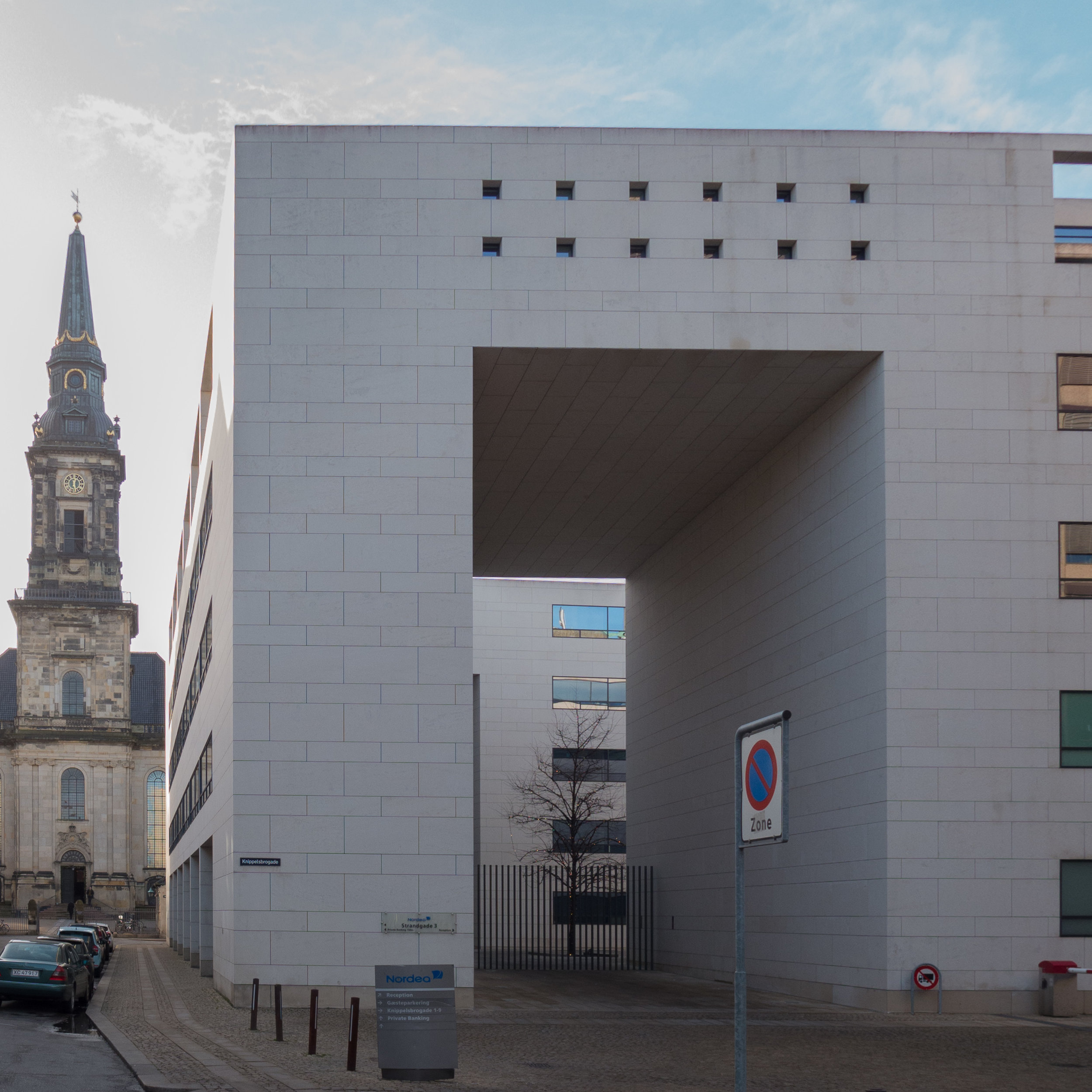
At the opposite end of Christianshavn, but possibly a world away, is a large city block, that covers more than 10 times the area of the school. A local development plan was drawn up 20 years ago for the site of what had once been an important ship yard and diesel engine works - a tightly-packed group of industrial buildings of different periods and different styles - that were all to be demolished. Now, in their place, there is a line of imposing and expensive commercial office buildings - six blocks lined up along a harbour frontage - and three large courtyards of expensive apartments. But in those buildings and in that plan too there are interesting lessons to be understood about how architects and planners create and manipulate urban spaces and how we, as occupants or as users or maybe simply as citizens walking past, respond to and use those public spaces.
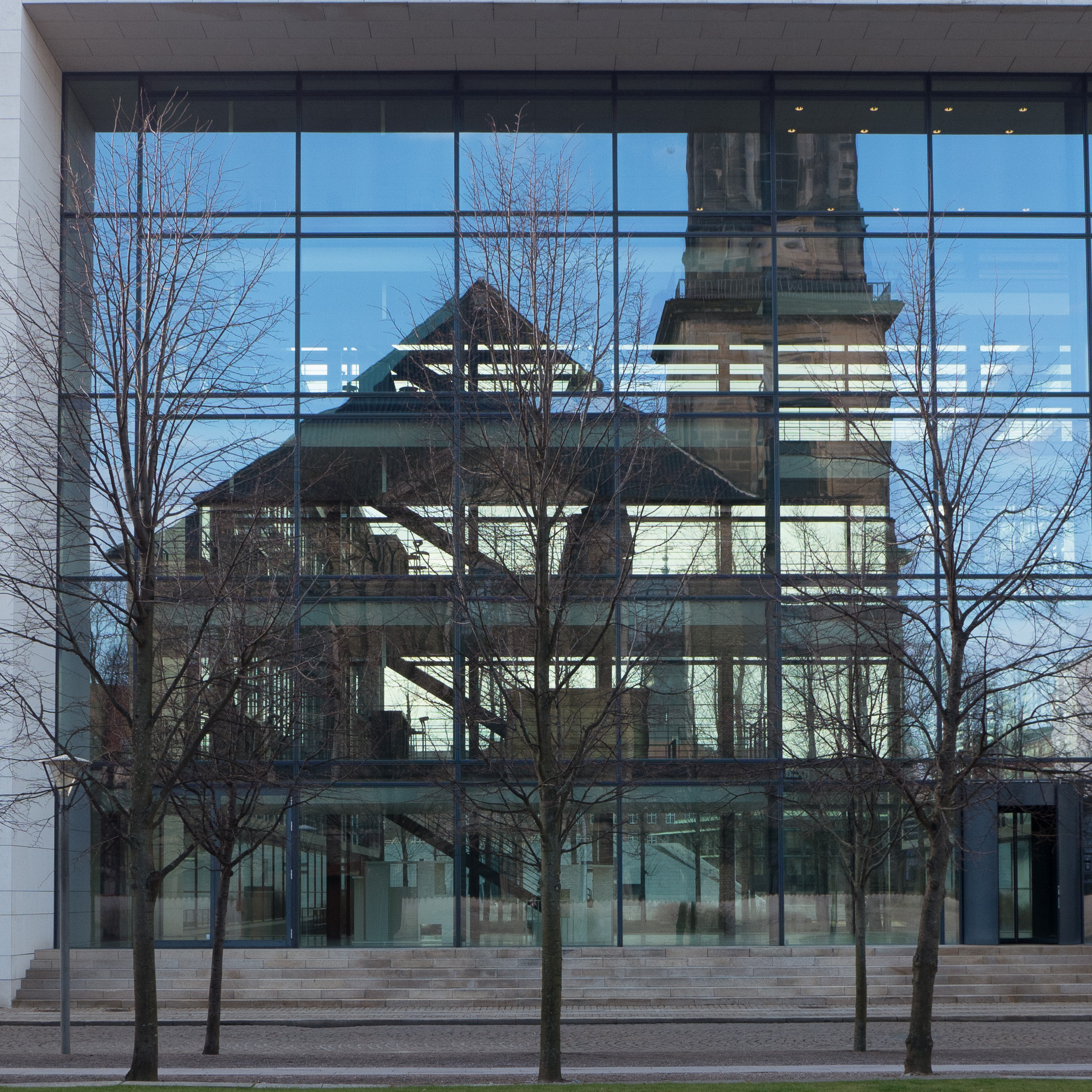
Also, these Christiansbro buildings designed by Henning Larsens Tegnestue seemed to be a good place to end, at least for now, the series of posts on this blog over the last couple of months about cladding on modern buildings. Perhaps more than any other group of buildings in the city, they illustrate an important aspect of modern architecture that is not often discussed in books or in the more general media. That is that we live in an age where the individual - the star architect or the latest iconic building - takes centre stage so we tend to read a facade as belonging to and defining the building … so the facade is the public front to the building behind. On a narrow plot in a narrow city street the public will see and recognise a building from just its single entrance front although on a larger and more open plot, a prestigious new building will have four or perhaps more sides to admire and those facades define the volume of the building and possibly, but not always, define and express how the internal spaces are arranged and used.
But what you see - and see clearly in the Nordea Bank buildings at Christiansbro by Henning Larsen and the apartment blocks at the end of Wildersgade - is that actually it is the public spaces that are defined by facades and, for people walking through the area or using those open spaces, what is behind the facade is probably not accessible, unknown and, to some extent irrelevant. So, for us, the materials used on the front of those buildings and the design and character of the facades define the urban spaces that we use and move through. At its simplest, a public square or even a space between buildings can be read as a volume - a box without a lid - defined by four walls that just happen to also be four facades. Looked at in that way then maybe our response to the design of some modern buildings should be different. Perhaps we should not see a facade as the interface they, the architect and the developer, provide between our space and theirs but as the walls and boundaries of our space.
What Dan Stubbergaard and his team at COBE seem to do so well is analyse how people might use the space and then they move their new building or the elements of new landscape into the gaps to reinforce and define the spaces and enable the activities. That is particularly obvious at Israels Plads or for the public area above Nørreport railway station but also at Forfatterhuset you can see, for instance, the perimeter walls pushed in to form spaces where parents and kids can stand and chat just off the pavement, half in and half out of the school as they arrive or leave.
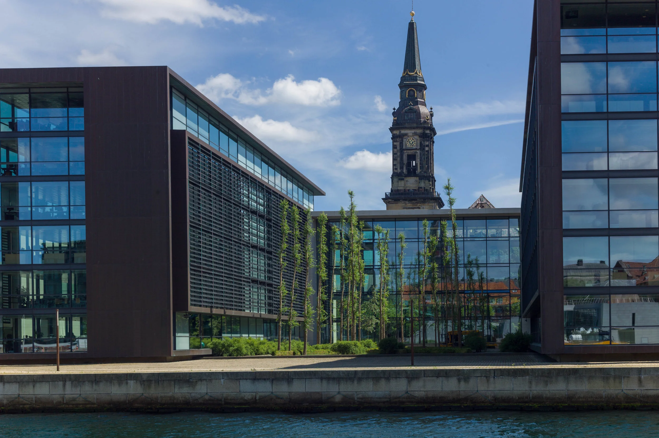
The bank buildings and apartments south of Christiansbro might appear to be much more formal, much more detached, much less about being relaxed or entertained but there is a very very complex arrangement of work space and public space but also private housing and private but communal courtyard gardens - so part private but part public space - that provide a back drop to public activity. The architecture and landscaping plays a role in defining where people to do everyday things like sit out on a picnic table by the canal, walk a dog, sit in the sun in the peace of a historic churchyard or have a party and drink with work mates by setting up a bar or a marquee outside. It’s just that maybe there are not so many people or quite as much noise here as at Kids’ City but it is good architecture forming a backdrop to everyday life.
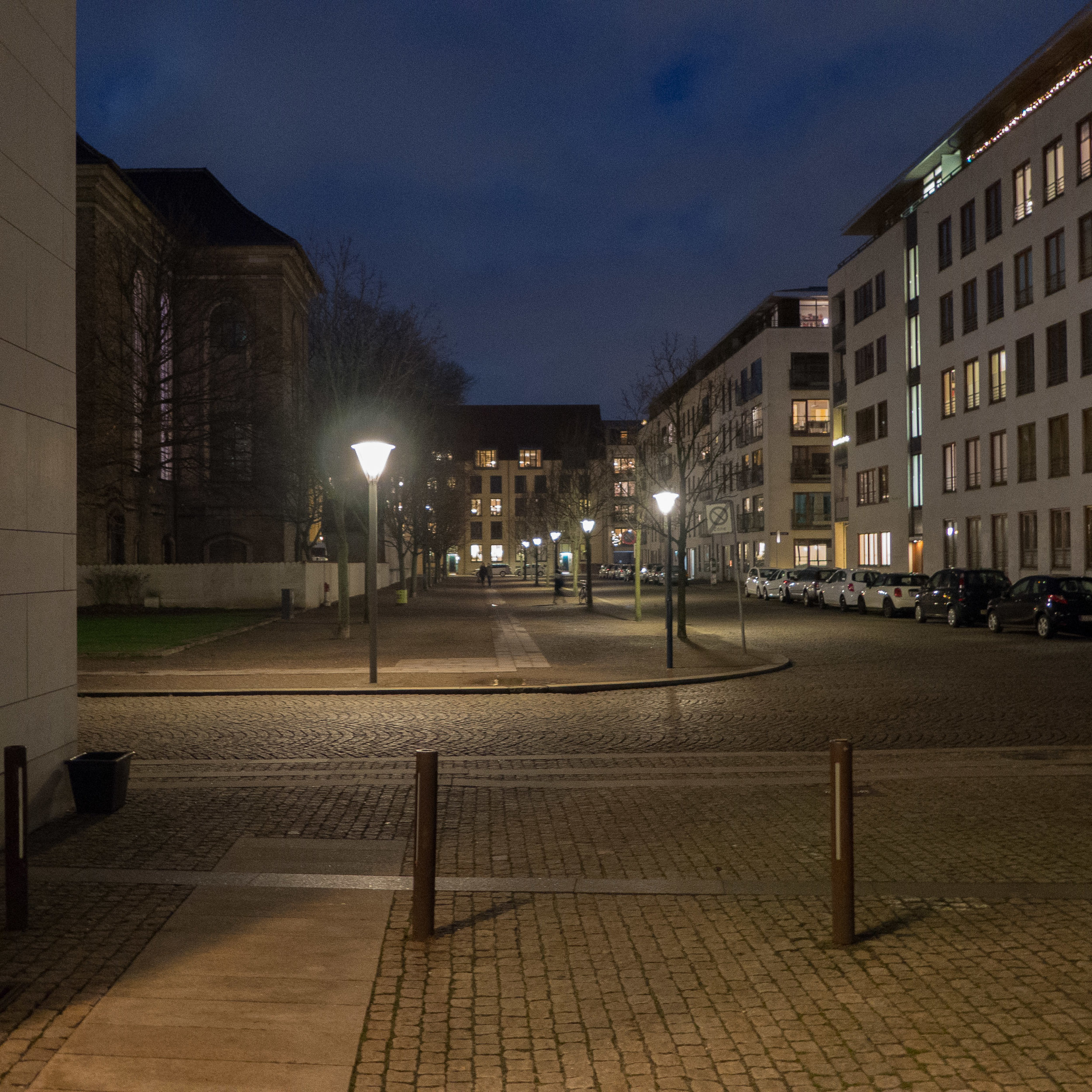
This block of the city is square, roughly 310 metres by 310 metres, and is immediately south of the main bridge over the harbour - Christiansbro or Knippelsbro that crosses from the centre of Copenhagen to Christianshavn - and south of Torvegade - the main road that runs from the bridge through Christianshavn and on to Amager.
It was part of the area that was claimed from the sea for a new settlement established by Christian IV in the early 17th century and historic buildings survive along the south side of the Torvegade and at north end of the two streets - Strandgade and Wildersgade - that run down from Torvegade.
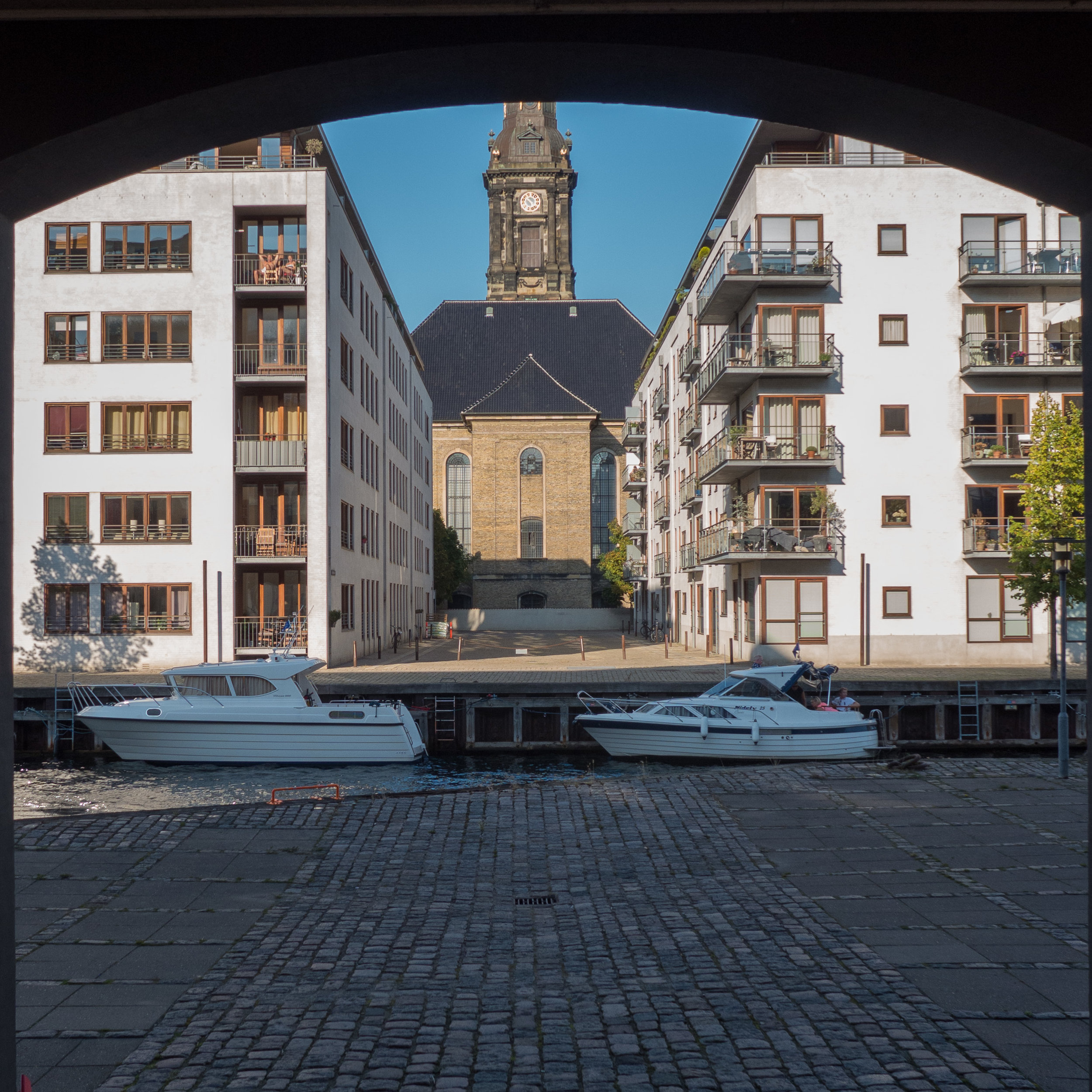
At the centre of the area is a fine church dating from the middle of the 18th century that has a forecourt on the north side and a small rectangular churchyard to its east with mature trees and is enclosed by a wall with gates that are locked at night so this is a quiet and semi private green space. All this was retained in the redevelopment of the area and a condition set by the planners was that new buildings would be no higher than the cornice or gutter level of the church.
Burmeister & Wain shipyard and engineering works had been established here in the middle of the 19th century and gradually grew to cover the land on both sides of the church and across its south side.
Initially, it was suggested that some of the workshops, where diesel engines were assembled and tested, should be kept as examples of good industrial buildings that were an important part of the history of the area but in isolation these would have meant little and, although they were large and impressive spaces, it was difficult to justify the cost of repairs and upkeep if there was no obvious new and public use.
All the shipyard buildings were demolished after the works were closed in 1987 although the piers and lamps of the works' gate survive on the quay side of the canal along with some older buildings at the north-east corner of the site that had been offices for the company.
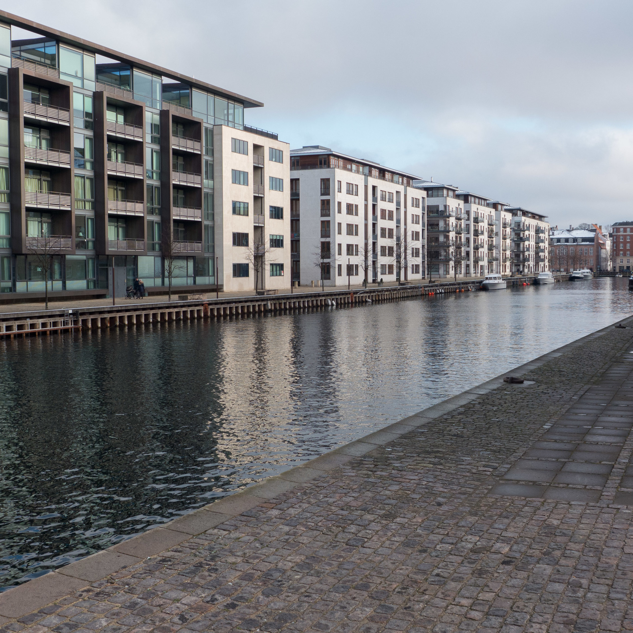
New buildings had to be a mixture of commercial office buildings and housing. Initially city planners wanted housing along the harbour frontage but in the end agreed that the offices should face west towards the harbour and the housing should be onto the main canal across the south and east sides of the site.
Henning Larsen Architects produced a master plan in 1995 for six large office blocks and three large apartment buildings around courtyard gardens.
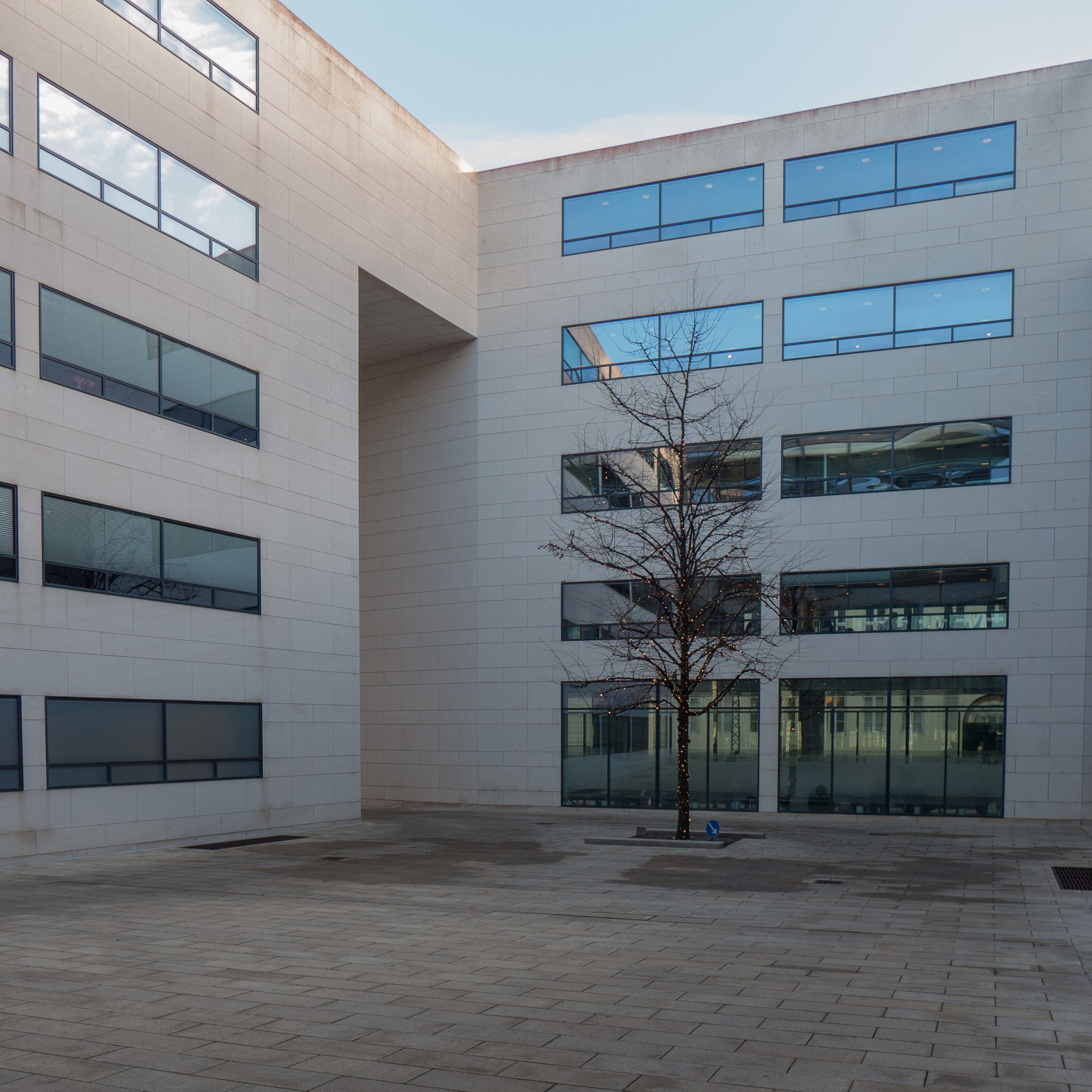
Stated like that, it sounds simple and straightforward, in terms of planning, but what was actually built is a very complex area of public and private spaces in a carefully-balanced area of offices and housing.
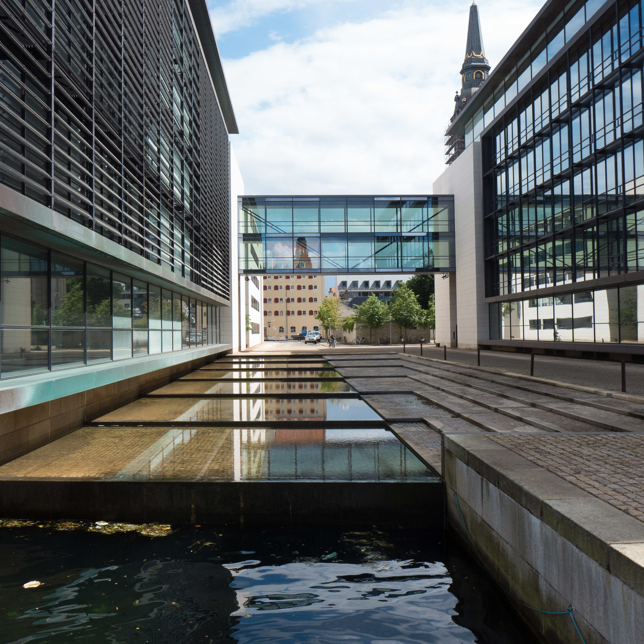
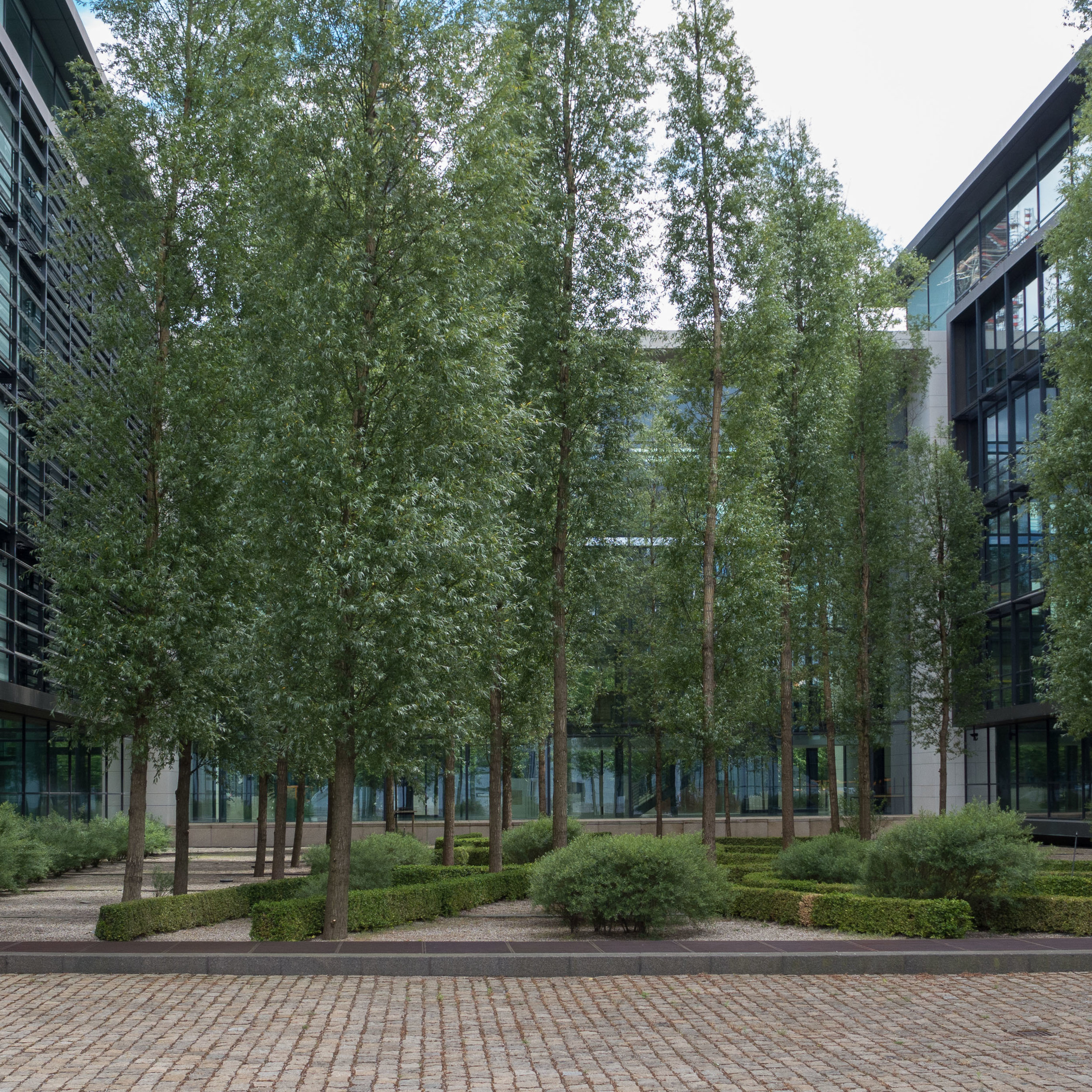
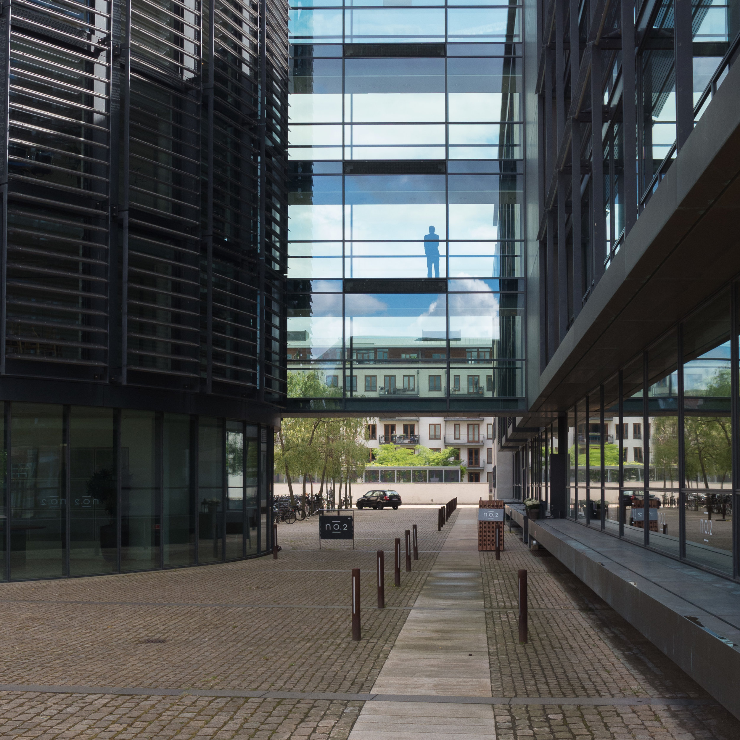
There are wide new public quays along the two canal frontages and a large new public square against the church, on the opposite side to the churchyard, and the office blocks were set with their narrow ends to the harbour - to reflect the arrangement of 18th and 19th-century warehouses along the inner harbour - but they are linked by a number of different glass-fronted ranges and bridges to form a combination of public and private courtyards with areas of formal planting. The landscape architect was Sven-Ingvar Andersson.
A wide quayside walk was also laid out along the harbour side and within the last year the area has been brought within a broader scheme for the harbour with the construction of a striking new cycle and foot bridge - Cirkelbroen by Olafur Elliason - to link the harbour-side walk here with the next section of quay to the south of the canal to form an important new public route from the main bridge down to Islands Brygge and the outdoor swimming area - the Harbour Baths by Bjarke Ingels and Julien De Smedt.
The office blocks all have the same external details which unifies the group but the six blocks are of different lengths running down to the quay and actually pick up on a slight change of angle between the bridge road to the north and the main canal running roughly parallel some 300 metres to the south. So the office blocks fan out almost imperceptibly so it is difficult to appreciate when walking along the quay - because of the large scale of the overall plan - but more obvious from the other side of the harbour. Some of the office blocks are longer, appearing to step forward because the front edge of the quay breaks forward on the south section so although initially it all seems incredibly regular it is actually not rigidly and neatly angular which gives the line of blocks more drama and even a little warmth although my guess would be that few people walking along the quay would be able to explain why it feels better or understand how it could have been much more rigid. There are also two short sections of canal taken back into the site so the quay-side walk is taken over narrow bridges.
All three quay-side walks and the roads within the development and the spaces and courtyards between the office buildings are paved with the dark grey and mauve Copenhagen setts or cobbles. This might look like the conservation of a historic feature but is a deliberate modern introduction to the area and with the use of simple gravel and dark sand for some surfaces in the central public square it provides a uniform colour and tone and an important element of texture to the setting of the starkly modern buildings.
The five-storey apartment buildings are set around courtyards with communal gardens but again there seems to be a game with three different layouts. The block nearest the harbour is around three sides of a courtyard that is open towards the space between two of the office buildings so forms an extension of that space but the courtyard is made rather more private by being raised up from the street level with short flights of steps and is partly closed by a low cycle store. The middle courtyard again has three ranges around an open court but here open towards the canal but made more private by a detached block in the centre of the open side that also helps maintain a stronger and more consistent building line towards the canal. The third apartment building, at the south-east corner, is again three ranges around a courtyard but here narrower and open to the north where the side ranges are in line and form an extension of another courtyard between a block facing the canal and an apartment building facing the church. There is a public footpath cutting across this long courtyard, an alley way between the ranges, so again the courtyard is ostensibly private but with public access.
The apartment buildings and the offices are built over underground car parks so on-street parking or surface parking is kept to a minimum.