Bispeengbuen - a new plan

Yesterday, an article in the Danish newspaper Politken reported that planners and politicians in Copenhagen might have come to a decision on the fate of Bispeengbuen - the section of elevated motorway that runs down the border between Frederiksberg and the Nørrebro district of Copenhagen.

One of several major schemes to improve the road system in the city in the late 1960s and 1970s, Bispeengbuen was planned to reduce delays for traffic coming into the city from suburbs to the north west.

At the south end of the elevated section, at Borups Plads, traffic, heading into the city, drops back down to street level and continues first down Ågade and then on down Åboulevard to the lakes and, if it is through traffic, then on, past the city hall, and down HC Andersens Boulevard to Langebro and across the harbour to Amager.

Between the elevated section and the lakes, the road follows the line of a river that, from the late 16th century, had flowed through low-lying meadows - the Bispeeng or Bishop's Meadow - and brought fresh water in to the lakes. In 1897, the river was dropped down into a covered culvert and it still flows underground below the present traffic.

From the start, the elevated section was controversial as it cuts past and close to apartment buildings on either side - close to windows at second-floor level - and the area underneath is gloomy and generally oppressive. Traffic is fast moving and generates a fair bit of noise and it forms a distinct barrier between the districts on either side.

There has been an ambitious plan to drop the road and its traffic down into a tunnel with the river brought back up to the surface as the main feature of a new linear park. The full and very ambitious plan - for ambitious read expensive - was to extend the tunnel on to take all through traffic underground, to Amager on the south side of the harbour.

There has been talk of a less expensive plan to demolish the elevated section, to bring all traffic back down to street level, which would be cheaper but would not reduce the traffic and would leave the heavy traffic on HC Andersens Boulevard as a barrier between the city centre and the densely-populated inner suburb of Vesterbro.

This latest scheme, a slightly curious compromise, is to demolish half the elevated section. That's not half the length but one side of the elevated section. There are three lanes and a hard shoulder in each direction and the north-bound and city bound sides are on independent structures. With one side removed, traffic in both directions would be on the remaining side but presumably speed limits would be reduced - so, possibly, reducing traffic noise - and the demolished side would be replaced by green areas although it would still be under the shadow of the surviving lanes.

It was suggested in the article that this is considered to have the least impact on the environment for the greatest gain ... the impact of both demolition and new construction are now assessed for any construction project.

There is already a relatively short and narrow section of park on the west side of the highway, just south of Borups Plads, and that is surprisingly quiet - despite alongside the road.

On both sides of the road, housing is densely laid out with very little public green space so it would seem that both the city of Copenhagen and the city of Frederiksberg are keen to proceed. Presumably they feel half the park is better than none although I'm not sure you could argue that half an elevated highway is anywhere near as good as no elevated motorway.

The situation is further complicated because the highway is owned and controlled by the state - as it is part of the national road system - so they would have to approve any work and police in the city may also be in a position to veto plans if they feel that it will have too much of an impact on the movement of traffic through the area.

update - Bispeengbuen - 14 January 2020
update - a road tunnel below Åboulevard - 15 January 2020

note:
Given the brouhaha over each new proposal to demolish the elevated section of the motorway, it is only 700 metres overall from the railway bridge to Borups Plads and it takes the traffic over just two major intersections - at Nordre Fasanvej and Borups Allé -  where otherwise there would be cross roads with traffic lights. I'm not implying that the impact of the road is negligible - it has a huge impact on the area - but, back in the 1960s, planners clearly had no idea how many problems and how much expense they were pushing forward half a century with a scheme that, to them, must have seemed rational.

My assumption has been that the motorway was constructed, under pressure from the car and road lobby, as part of a tarmac version of the Finger Plan of the 1940s.

The famous Finger Plan was an attempt to provide control over the expansion of the city, and was based on what were then the relatively-new suburban railway lines that run out from the centre. New housing was to be built close to railway stations and with areas of green between the developments along each railway line .... hence the resemblance to a hand with the city centre as the palm and the railway lines as outstretched fingers.

Then, through the 1950s and 1960s, the number of private cars in Copenhagen increased dramatically and deliveries of goods by road also increased as commercial traffic by rail declined.

I don't know who the traffic planners were in Copenhagen in the 1950s and 1960s but, looking back, they barely appreciated old building or existing communities, and, presumably, looked to LA and, possibly, to the Romania of Nicolae Ceaușescu for inspiration. Their ultimate aim, in their professional lives, seems have been to design a perfect motorway intersection where traffic flowed without any delays.

They wanted to build a motorway down the lakes and when that was thwarted they proposed a massive motorway system that was to be one block back from the outer shore of the lakes - sweeping away the inner districts of Østerbro and Nørrebro - and with new apartment buildings along the edge of the lake - between their new motorway and the lake - that would have formed a series of semi-circular amphitheatres looking across the lakes to the old city. The whole of the inner half of Vesterbro, including the meat market area, and the area of the railway station would have become an enormous interchange of motorways where the only purpose was to keep traffic moving.

We have to be grateful that few of those road schemes were realised but there is also a clear lesson that, however amazing and visionary a major plan for new infrastructure may appear, it can, in solving an immediate problem, create huge problems for future generations to sort out.

approaching the elevated motorway from the south
the motorway from Ågade on the east side
the motorway crossing Borups Allé

the river close to the lakes at Åboulevard but now in a culvert below the road

Bispeengbuen under construction showing how it cut a swathe through the existing neighbourhood - city archive 50675

the earlier proposal to bury the road in a tunnel and bring the river back up to the surface as the main feature of a new linear park

small area of park on the west side of the road

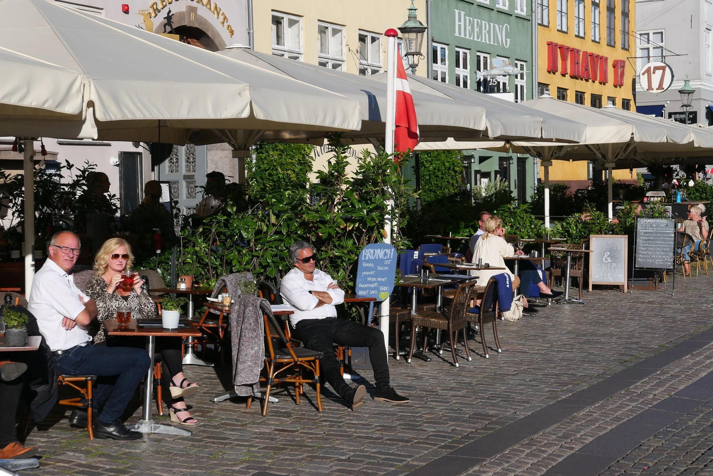
umbrellas on Nyhavn

Tourists are back in Nyhavn and all the umbrellas are back outside the restaurants with all but a couple of the restaurants open.

These large, canvas, umbrellas are now an almost-permanent feature of the quay .... some restaurants had them taken down through the lockdown but many, trying to be more hopeful, simply kept them furled so they were like a long line of pale, skinny sentinels waiting for better times.

Each umbrella is 4 metres square and is set into a permanent housing in the cobbles. They are mostly in blocks of three or four together with fixed gutters between them to take rainwater out to the outer side. There is a narrow space between the umbrellas and the fronts of the buildings so they form fairly self-contained dining spaces with their own electric power for lighting and many have heating and a free-standing bar for serving booze. Many were able to stay open - at least in some form for lunch or drinks or for take away food - when there were tight pandemic restrictions that stopped dining inside.

The restaurants rely on these outdoor spaces for several different reasons. They certainly draw in people passing; they attract customers who might still be reluctant to sit inside a crowded restaurant with the threat of Coronavirus still lingering, and these buildings along Nyhavn are relatively narrow and most have quite small rooms inside that cannot be altered easily to take more tables because these are important and protected historic buildings.

Nyhavn is, without doubt, one of the biggest tourist attractions in the old city but, along with the houses of Gammel Strand and the rows of merchant houses in Christianshavn, this is a major and very significant area, in terms of the history of the city. There are 35 houses between Store Strandstræde and the theatre and all, with courtyards and warehouses and the remains of workshops behind, date back to the late 17th century when Nyhavn was constructed.

The real problem is that the houses are now seen by many as simply facades - little more than a backdrop for selfie photographs - but they are so so much more important than that. For a start, you see glimpses inside of amazing staircases and plastered ceilings and who know’s what survives behind modern alterations?
The book on Historiske Huse i det gamle København has a list of the houses here with brief and good summaries of ownership and their basic history but that was published by the National Museum in 1972 and, as far as I know, there is no catalogue that assess the interiors or looks at the way the rooms in these buildings were arranged or at how that reflects how people have lived here over a period of over 350 years.
For instance, Hans Christian Andersen lived in a house just a few doors down from where I am now. Looking at letters about his furniture and his search for somewhere to live, it looks as if he just had a couple of rooms and there is no indication that he had a kitchen or ever cooked. We are all obsessed with living an independent and self-contained life, so how different was it in the 19th century? Did Hans Christian Andersen always eat out in the bars that must have been along here even then - it was a harbour with an itinerant population who had to eat - or did he have food sent in or a landlady who provide food that was cooked in a kitchen at the back or down in the basement? Do those different ways of living provide ideas for how we might change the way we live in a densely packed city now?

I know that many will argue that economic considerations now have to come first - to stimulate an economic recovery - but there is surely a long-term duty to protect these buildings that are a distinct and significant part of the built heritage of the city. There is a real danger of over exploiting the area so that it no longer becomes a pleasant place for anyone to visit.

During the pandemic it was obvious that more Danes and more citizens were coming to Nyhavn to eat because there were not as many tourists.

There has been a suggestion that restaurants should be allowed to expand onto boats moored here and fitted out for dining and drinking but that would attract even more tourists - and it does tend to be tourists rather than local people who eat here - and more customers has to mean more food deliveries, more waste and, to the detriment of the historic buildings, more kitchens and more food storage. If you have not been back into kitchens and food preparation areas in a busy restaurant then it is difficult to appreciate just how much venting and drainage and so on intrudes into the fabric and there is little space now for storage of packaging and food waste let alone chillers for storage. Will ever larger restaurants mean that they take over more of the residential accommodation so fewer and fewer people live here?

The umbrellas do form a cheap way of expanding the space of these businesses but that is part of a problem that now has to be discussed at a planning and at a political level.

These are profitable businesses and they will be anxious to return to and to increase the number of customers they had before the pandemic but is it time for planners and politicians to understand when enough is enough and find new areas that might be given the Nyhavn treatment to spread the pressure?


the umbrellas of Nyhavn are clearly visible on Google Earth
when they are all out, there are 66 umbrellas along the quay ….. that’s a lot of large umbrellas and well over 1,000 square metres of canvas

with the umbrellas furled and with fewer tourists, it is easier to appreciate the importance of the historic buildings


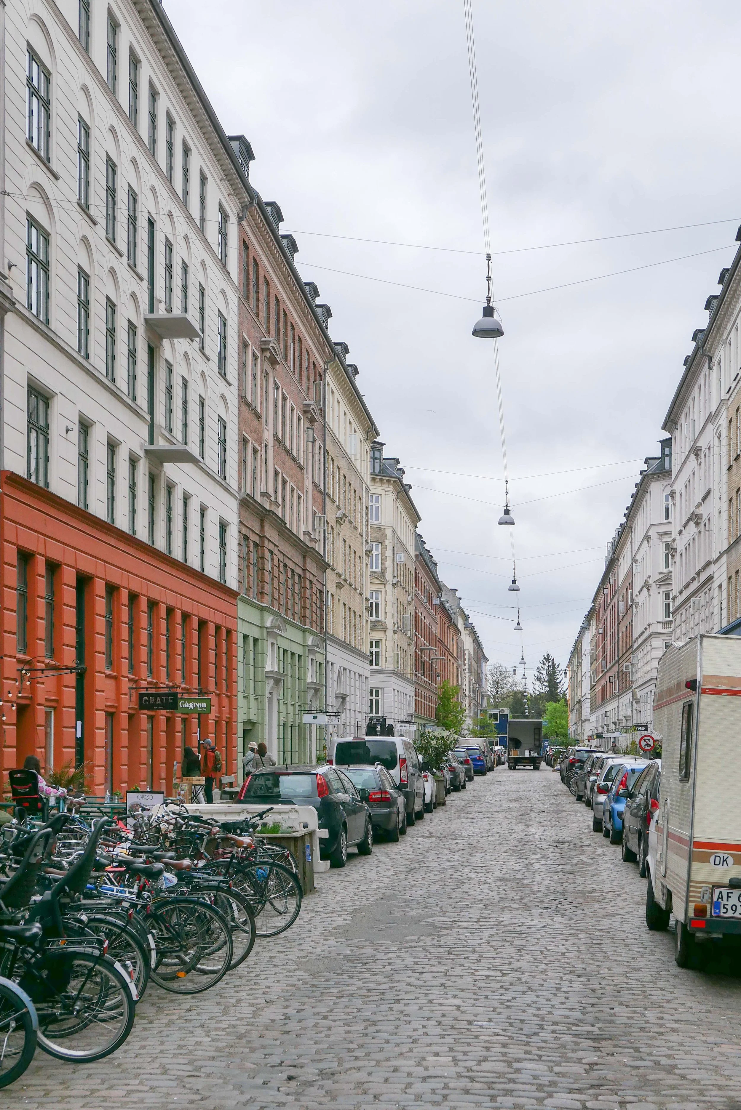
balcony blight has spread to Jægersborggade *

With Coronavirus lockdown restrictions, it has been many months since I have been up to Jægersborggade but Saturday was sunny, and I needed some exercise, so I walked up to the lakes and then on along Nørrebrogade and through Assistens Kirkegård.

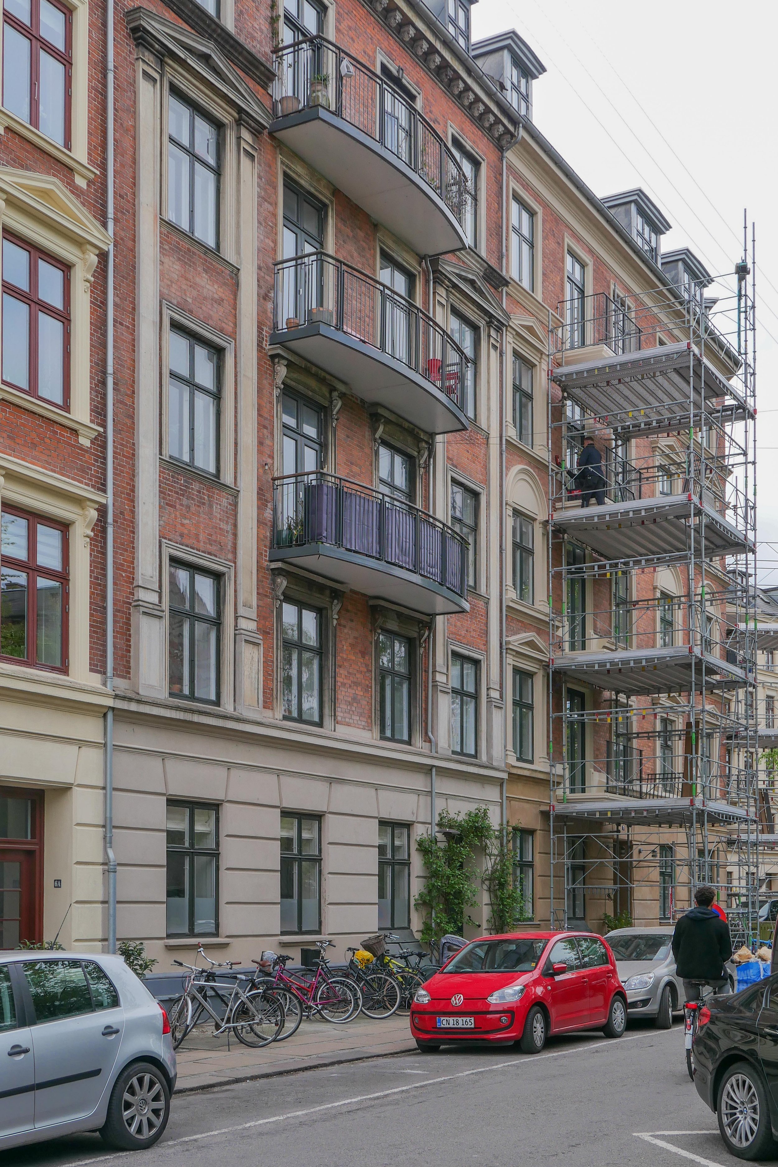
As soon as I got into Jægersborggade, opposite the north gate of the cemetery, I could see that construction work had started to add balconies to the front of several of the west-facing buildings.

This whole business of retrofitting older apartment buildings with new balconies has become a serious problem in the city.

Copenhagen has a phenomenal number of good apartment blocks that date from the 19th and the early 20th century ... apartments that were built on new squares and new streets as the city expanded rapidly with large new districts built over the fields and gardens beyond the old city gates.

Most of these apartments still form an important part of the housing stock in Copenhagen and most, even if the original arrangement of rooms was restricted or not completely appropriate for the way we live now, they can be easily adapted .... so heating and bathrooms and so on can all be upgraded. Even replacement doors and windows that comply with modern building standards for sound and heat insulation can be found in an appropriate style and colour that either replicate or compliment the original fittings.

But few of these buildings had balconies.

Of course, I can see why people want a balcony and particularly a balcony that faces the sun or looks across an attractive street or square. A balcony can bring extra light into a room; can be a space to grow herbs or plants; and, if large enough, can be a place to sit and sunbathe or even provide space outside to have a table and chairs for a meal.

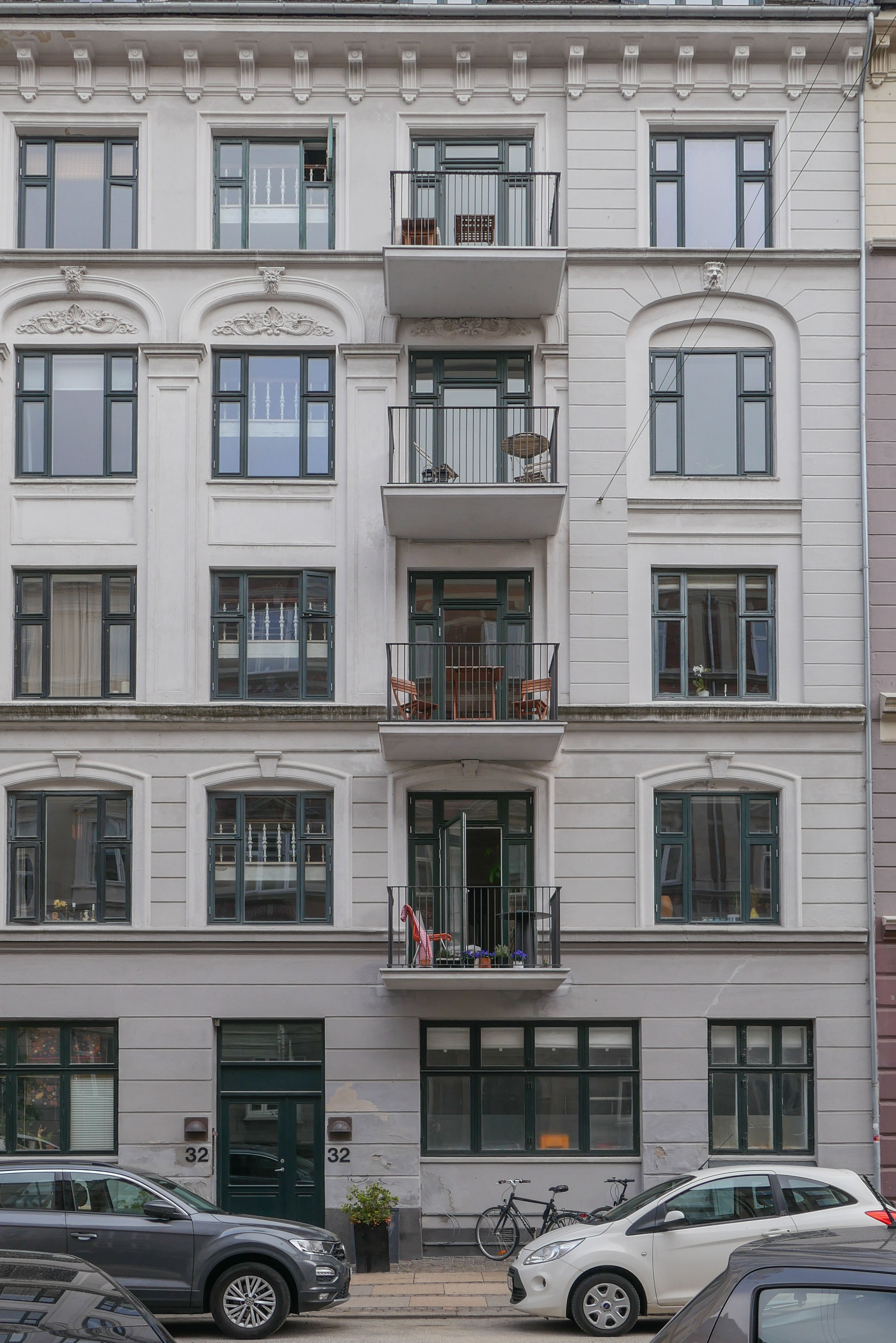
Balconies are fine when they form part of the original design and are part of the original construction on apartment buildings from the 1930s or on modern buildings but inserted on the street frontage, they inevitably slam through the original architectural features of the facade, compromise any architectural style the building may have; add what are often little more than stark metal boxes across the front and usually throw shadow across the windows of the apartment below.

With many of these older apartment buildings, the street frontage and a main staircase, are the only parts with any architectural coherence. In most, the back of the building is far less distinguished or, worse, a muddle of toilets and back or kitchen staircases but rooms on the back of the apartment can look down into gardens or attractive courtyards  so balconies added to the rear of building are rarely an issue.

* blight covers green leaves on a plant or tree with ugly and disfiguring areas

shopping in Jægersborggade - December 2018
Jægersborggade - May 2021
retrofitting balconies is a problem - January 2020 


new balconies from a walk down through Østerbro and on to Dronning Louises Bro

By coincidence, just two days before walking over to Jægersborggade, I had been up to Østerbro and walked back through Østerbro and through the streets on the outer side of the lakes.

Most of the apartment buildings on these streets date from the 1880s and 1890s or from the first decade of the 20th century and, again, it was possibly a year or more since I had been to this part of the city.

Yet again, I was amazed and depressed by seeing just how many of these good buildings had been altered with the addition of new balconies on the street fronts.

The city planning system really has to control this.

Even if permission is still given for new balconies to be added to the garden or courtyard side of a building, the presumption has to be that new balconies cannot be added to a street front unless there are exceptional reasons or an exceptional design and certainly not when it means cutting through original architectural features.

Can anyone in the city planning department defend the decision to give permision for the addition of any of these balconies or convince me that they contribute in any way to the street scape?


select any image to open as a slideshow


Blegdamsvej - new public space - new sculptures

Museums and art galleries in Copenhagen have had to close through this stage of the Coronavirus pandemic but it is still possible to see good art with a huge number of sculptures on streets and in squares and parks around the city.

Blegdamsvej is a main road that runs parallel to the lakes on the outer side. Here there are major hospitals and medical research institutes and two of the most recent buildings - the Panum Institute in the Mærsk Tower designed by CF Møller and the new north wing of the Rigshopitalet by the Danish architects 3XN - now have newly-installed statues on public areas of paving at the front. These are major works but could hardly be more different.

If you are a visitor, and do not know the city well, than it might be easiest to start from Trianglen metro station and from there it is 500 metres to the work by Kirsten Ortwed and then from there a further 550 metres to the Panum Institute, on the far side of the main road with Fredens Park, for the installation by Alicia Kwade.

Or, cross over the lakes, over Fredensbro, at the centre of Sørtedams Sø, and, at Blegdamsvej, the work by Alicia Kwade is to the west and the work by Kirsten Ortwed is to the east.

PARS PRO TOTO
Alicja Kwade

Panum Faculty ofHealth and Medical Sciences,
Mærsk Tårnet / Maersk Tower,
Blegdamsvej 3b, 2200 København

Alicia Kwade is a Polish artist who is now based in Copenhagen.
Her work was shown at Charlottenborg in 2018 under the title Out of Ousia
and Pars Pro Toto was shown at Louisiana
There is an interview with the artist on the Louisiana Chanel

The new forecourt is itself interesting as the surface is not level but has a great hollow with the grid of the paving creating an interesting visual effect - like the drawings you sometime see of a head or a body as a wire-frame profile - and here the artist uses that hollow to imply that the huge marble sphere has rolled here across the square only to be stopped by the posts there to stop cars driving in.

REFLEXTION
Kirsten Ortwed

Rigshospitalet,
Nordfløjen / North Wing
Blegdamsvej 80, 2100 København

Kirsten Ortwed is a Danish artist who is now based in Cologne.
Another of her works for a public space can be seen at Havnegade in Copenhagen - near the Nyhavn end of the kissing bridge.

Here the new building has been set back from the road but that area has been paved and kept open to the public with no barrier or fence so the life-size figure stands in our space and not on a plinth and the public has gained space to move up to the building and to even cut the corner to enter Fælledparken beyond. Too often, new buildings that break an existing street line undermines or destroys the visual continuity of the street and the sense of urban containment and enclosure but here the new space and the sculpture together enhance and add to interest and the value of the streetscape.


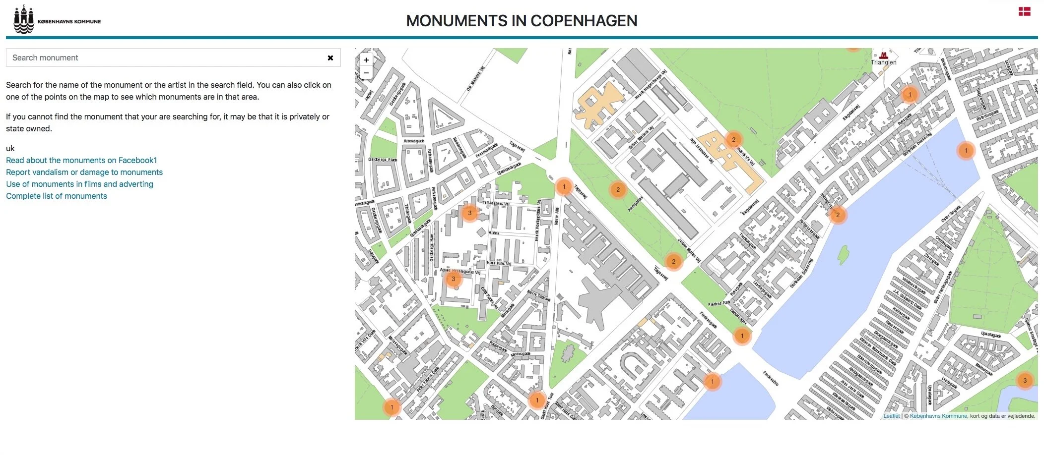
Monuments in Copenhagen.jpeg

Monumenter in København / Monuments in Copenhagen

The Kommune - the city council in Copenhagen - has an excellent online site with a catalogue of statues and decorative sculpture on the streets and in the squares and parks of the city.

There is a search option to enter the name of the artist or the subject of the sculpture but the easiest way to enter the data base is through the clear map that is dynamic so you can zoom and drag, if you are searching later, and can remember the area but not the street name.

The map is tiled and, again, this is dynamic so numbers on the map in orange circles refer to the number of statues in that area and these split up and redistribute to the right location as you zoom in and if you click on a number that is greater than one - so for instance the corner of the city hall towards the Vartov has six - so then they open out and each one has a slide that pops up so you can then go to the right one for information and images for the right statue.

The site is in Danish or in English and there are some good comments rather than simply basic facts so, The Lur Blowers by Siegfried Wagner and Anton Rosen, close to the city hall, was designed with a single figure for the top of the column until someone pointed out that Lurs are played in pairs …. now come on who didn't know that … so two lur players now stand on the top of the column. It means that it's a bit crowded up there and local wits began to describe them as the two bags of flour.


Ørkenfortet / Desert Fort, Christianshavn

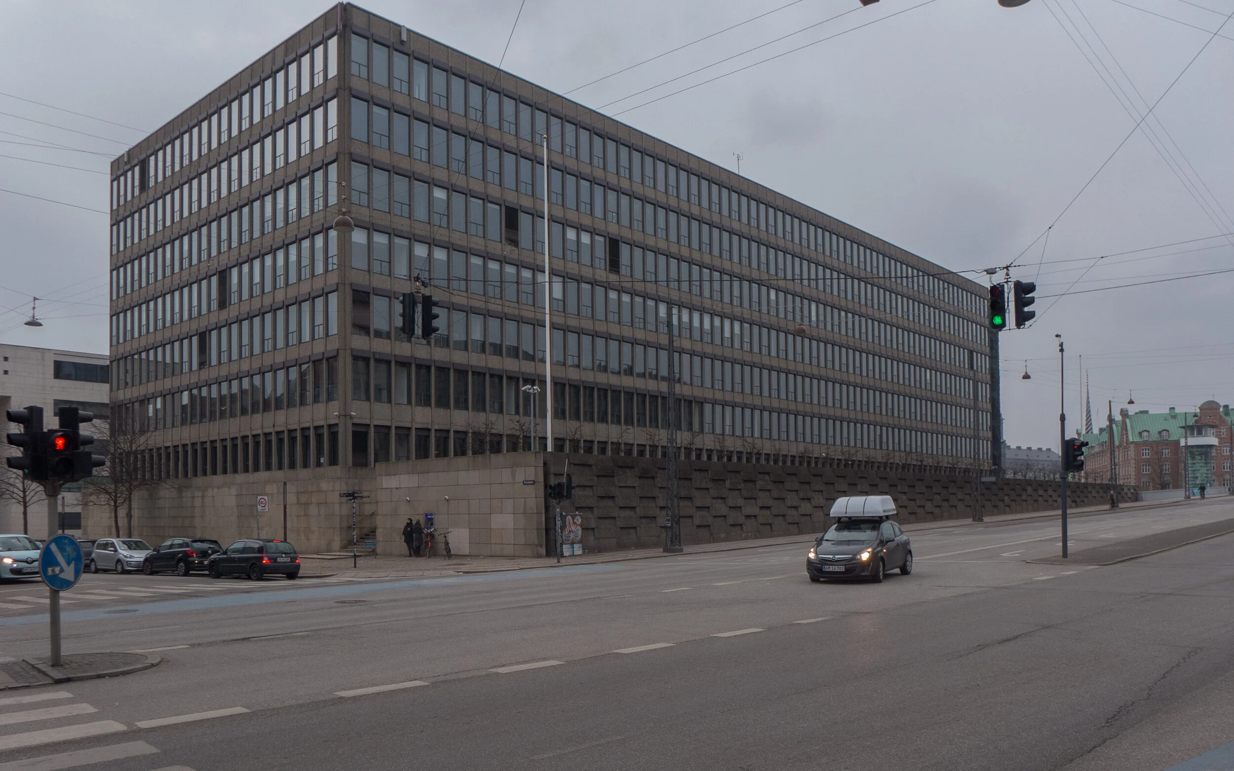
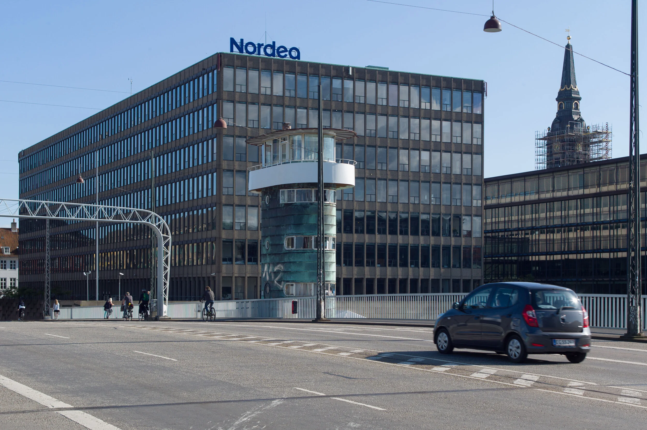
Work is moving forward fast on Ørkenfortet, the Desert Fort - the large office building that is at the centre of the harbour at the Christianshavn end of Knipplesbro - the central bridge that crosses the harbour between the centre of the city and Christianshavn.

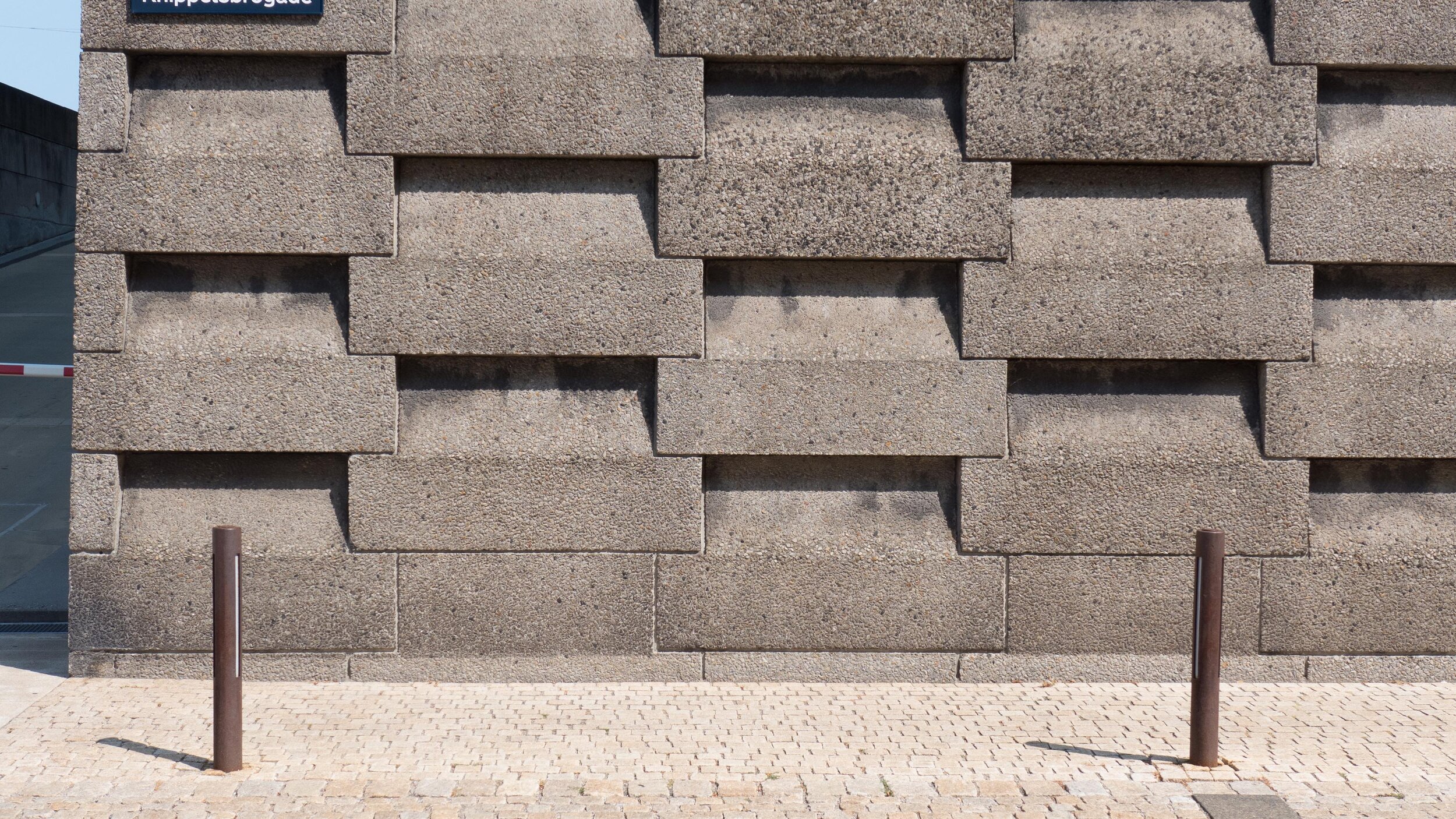
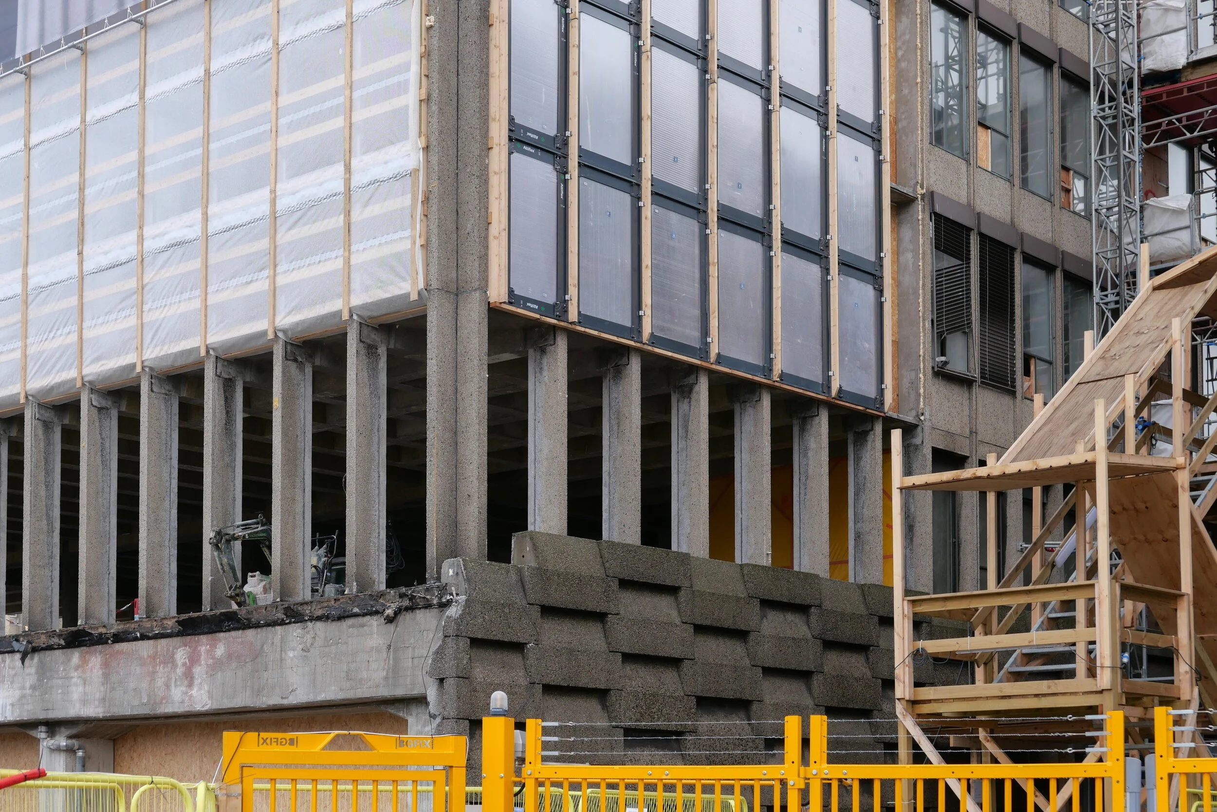
The interior at all levels has been gutted and all original windows and all external cladding have been removed. Work has started on cutting down new internal courtyards or light wells within the concrete structure of the block and on removing hefty concrete retaining walls along both the street frontage towards Torvegade and at the level of the quay on the end of the building towards the harbour that formed a base for the building.

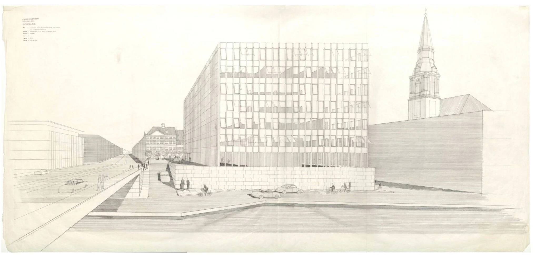
Ørkenfortet was designed by Palle Suenson (1904-1987) and was completed in 1962 as offices for Burmeister & Wain who were a well-established and major engineering and ship-building company in the city.

They had been established under that name in 1865 and, by the middle of the last century, their main ship yards were at Reshaleøen - at the north end of the harbour - where the main dry dock survives along with the some of the huge sheds and buildings of the yards but the engine works were here at the south end of Christianshavn, immediately south of this office building.

These extensive engineering yards on Christianshavn shut in 1993. Although some of the earlier buildings - including former drawing offices and the works' gates - survive, most of the buildings along the quay towards the harbour were demolished and wharves and docks were filled in for the site to be redeveloped with large new apartment buildings and extensive office buildings that were designed by the architects Henning Larsen.

Several of these office buildings along the harbour were occupied by the Danish headquarters of Nordea Bank including the office building by Suenson but in 2017, the bank moved their offices to a new site, close to the metro station at DR Byen, and the main office building from the 1960s became available for redevelopment.

This is all fairly straightforward history - the recent history of the site and of the building - but what I don't understand is the planning decisions then made for this key site at the very centre of the harbour.

Of course, I can see the logic and the reasons for planning decisions made in the 1950s. As Denmark emerged from the war, the priorities were for economic recovery. These ship-building and engineering works were not only a major employer in the city but these were highly skilled and, presumably, relatively well-paid jobs. The company was well established and, if nothing else, emerging from the widespread destruction of the war, there was an obvious market for new engines and new ships to replace what had been lost. Perhaps, and even more significant at that stage, although the harbour was, in terms of topography, at the heart of the historic city, attitudes to the harbour then were very different.

Then , north of Knippelsbro, were the working naval docks, with all that meant, and with the only road access through Christianshavn. Through the centre of the harbour and below or south of Knippelsbro was a working port with all that meant. Polite, middle-class society in the city would have seen the harbour as a major resource but that was as a major financial resource, so a massive new office building for Burmeister & Wain would not have been seen as an eye sore … even though its within sight of the 17th-century buildings of the exchange, on the other side of the harbour, and close to the magnificent warehouses from the 18th century, of the Asiatic Quay and Gammel Dok, on the other side of the road … but it would have been seen as an astute and positive show of confidence in the industries of the city and in their future.

It has only been with the decline of the dockyard and the working port and those industries that the harbour had to look for and has certainly found a new purpose at the heart of the city but I'm not sure how this massive hotel development actually makes a positive contribution.

On the side away from the harbour, the existing building looms over Strandgade - an exceptionally important street of historic buildings with many that date back to the early 17th century - and it overshadows the stunning Christians Church by Nicolai Eigtved that was built in the 1750s.

The block of the existing building is massive - one of the largest and certainly one of the most prominent at the centre of the harbour. It's 90 metres long by 31 metres deep and about 30 metres high. It's not a bad building as such but simply a product of its period and certainly not the best building for this location.

In terms of planning, the retention of the building and its conversion to a hotel by the Hilton Group, raises lots of issues.

It will have about 400 rooms so how will Christianshavn cope with the amount of traffic a hotel of this size generates with visitors coming and going, staff arriving and leaving and delivery lorries coming and going?

And why, when it is such a large building anyway, has permission been given to add a whole extra floor on the top that will increase the visual impact of the building and ensure that it overlooks even more properties. I can see that a roof-top dining room and roof terraces are a huge bonus for the hotel but I cannot see what they contribute to the harbour or to the neighbourhood.

Consent has been given to remove the hefty concrete retaining wall along the lowest level towards the quay but this means that the hotel can colonise and make use of the quayside as an asset for the hotel although citizens gain little from this apart from some new steps up from the quay to the bridge on this side. Note there are already steps up to the bridge on the other side of Torvegade and steps on both sides of the bridge on the city side so access from the bridge to the quay is actually adequate.

Almost-certainly, the city would not have given permission for a building of this size and prominence if the site had been empty land or there had been much lower buildings here.

Surely, it would have been better for the city and for the harbour if the building from the 1960s had been demolished and replaced with buildings that were lower and more compact, and with new buildings that reinstated or created a reasonable street frontage to the road up to the bridge and a more appropriate and more respectful frontage towards Strandgade.

Planning Statement - appendix to the Local Plan

notes:

In Danmarks Kunstbilbliotek / the Danish Art Library in Copenhagen there is a drawing of the building by Palle Suenson Inv. nr. 53296 - a perspective from Knippelsbro

While tracking down information on the building I came across a web site that revealed that the building was given a nickname by locals who called it Røven or The Arse. Initially, I assumed that was because the building was thought to be butt ugly but actually it was because at lunchtime workers in the office came out onto the forecourt and sat along the parapet of the wall along Torvegade and, for people walking along the pavement below, the only thing that could be seen from the street was a line of backsides.


photograph from 1965 showing Knippelsbro and Torvegade with the office building designed by Palle Suenson in the foreground and the engineering works of Burmeister & Wain beyond - along the harbour as far as the canal and around the south and east side of Christians Church


waste collection on Nyhavn

The photograph of rubbish piled around a street bin - posted with a quotation from Paul Mazur on Black Friday - was actually taken on the morning of Black Friday.

I had planned to post the quote because it seemed appropriate for this odd day that was contrived by marketing men in the States to make people spend. It’s the day after Thanksgiving - that public holiday when you spend time with families rather than spend money shopping - so presumably Black Friday is the bargain sale to hook you back into spending, just in case you forgot how spend having just had a day off. Is the message here that if you buy something you don't need then at least buy it at a knock-down price? Or maybe if you don't actually need it then by offering it at a sale price you might be persuaded to change your mind.

Anyway, I was heading out to take a photograph at the recycle centre on Amager - to go with the quote - but then there was this on the quay right outside my front door.

Everything had been abandoned - including a large and fairly new suitcase along with a good small metal case and various pictures in frames - so it looked as if someone is moving on from one of the apartments around here and what they were not taking with them had been dumped on the pavement sometime during the night. At least it gave me as good an image as any to represent our throw-away society.

Nyhavn, or New Harbour, was constructed in the 1670s for ships to load and unload goods. Over 400 metres long and 28 metres wide - it runs back from the main open harbour to the large public square of Kongens Nytorv

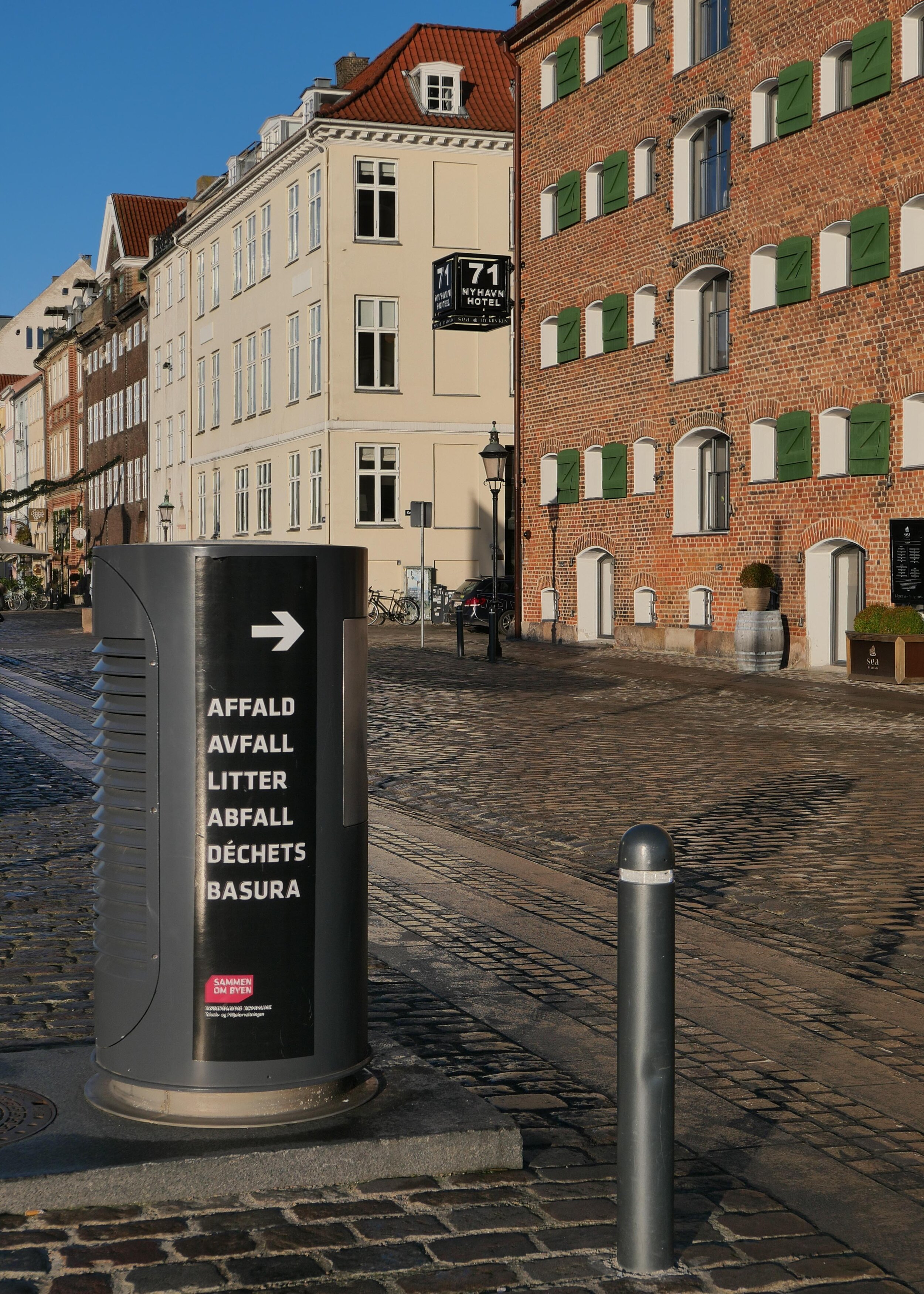
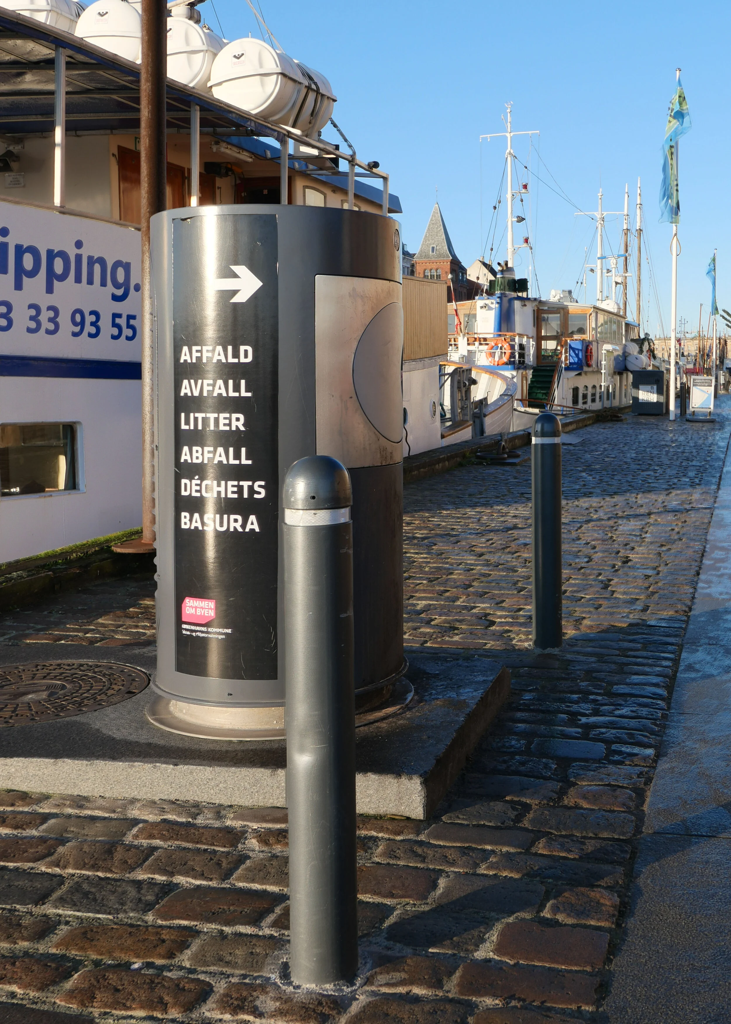
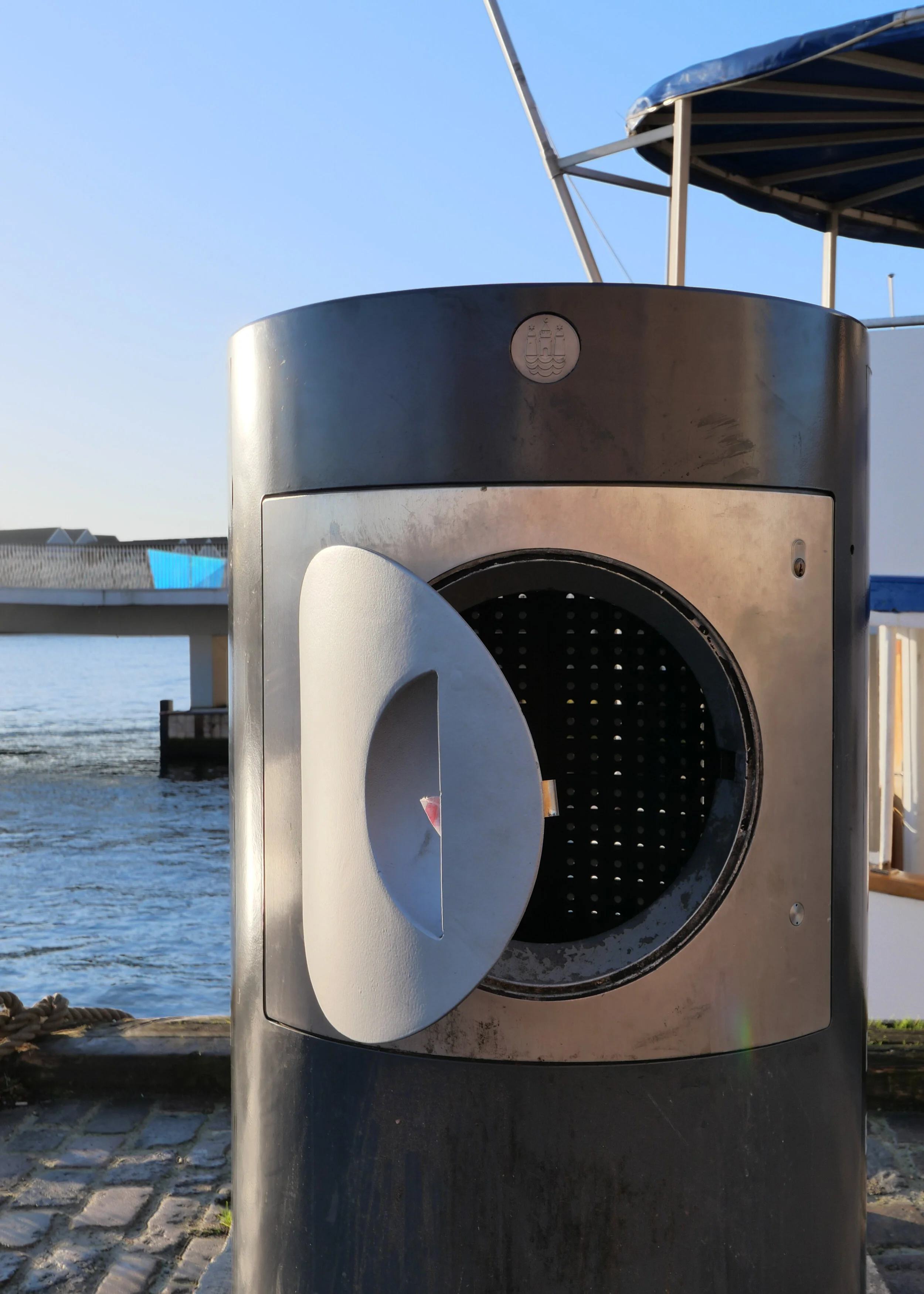
In any case, the bin system here is of interest and I had been thinking about a post for some time. It might look like an ordinary street bin but it's one of a line of bins along the quay that are the above-ground part of a sophisticated waste system from ENVAC.

When rubbish is dropped in, it doesn't go into a basket or inner bin that has to be emptied but it drops down into a buried pipe that is 500 mm in diameter and when the bin is full, triggered bt a level sensor, the waste is drawn through by vacuum to a service access point set down into the road at the end of the quay.

Nyhavn has large city blocks running back from the harbour on either side and is one of the most densely built up parts of the city with tightly-packed back buildings and small courtyards with homes and offices behind the street frontages. Not only is there little space for large modern waste bins in these yards but there is also a problem getting to the courtyards to empty any bins to take away waste. The quay, on this the north side of Nyhavn, was pedestrianised in the 1980s and although there is access for deliveries, the quay is normally thronged with tourists and there are around thirty restaurants just along this side and most of them have umbrellas and chairs and tables outside that are tightly packed together and most are there year round, so getting through to the archways, to get into and out of the courtyards, is difficult.

The only clue that the bins might not be ordinary street bins is the size - large for a street bin - and the slightly unusual port-hole style door but, presumably, very few tourists stop to wonder why.

They are 1.36 metres high and just over 70cm in diameter and are designed to take all the household waste from the apartments above the restaurants and from the apartments in the inner courtyard buildings - so some 150 apartments in total. That waste is dropped in through the small round hatch. For commercial waste - from the restaurants and bars - they have keys to open the full square opening to put in larger bags of rubbish and packaging.

Designed by Erik Brandt Dam and installed in May 2012 - when the system was upgraded - there are eight large waste bins along the quay - along the 760 metres from Kongens Nytorv to the harbour - with eight smaller bins at intermediate intervals for street litter. These smaller bins look more like traditional street bins, with narrow slots for rubbish on each side, but they also drop their contents down into the system.

The Nyhavn waste system, with sixteen bins and the service point down at the theatre end of the quay, deals with 60 tonnes of waste a week.

bins for the new ENVAC waste system in the Bella Quarter in Copenhagen

The advantage is that the waste is dealt with quickly and cleanly and few people are disturbed when the system is emptied but one drawback is that there is less incentive, with this Nyhavn set up, for people to sort their rubbish for recycling. On the quay, there is now one large standard recycle bin for glass, tucked away round a corner, close to the Theatre, down near the main harbour, but otherwise plastic, paper and cardboard, metal and batteries have to be taken to recycle points several blocks away - the nearest are on the other side of the harbour - or people will put everything through the ENVAC system to end at the incinerator.

A decade ago this system was seen as cutting-edge for waste disposal - good because waste was not going to landfill but to a district incinerator as fuel for the generation of hot water for the district heating system - but for new residential areas in Copenhagen there is now an opportunity to build in more ambitious waste collection systems.

In a new development in Ørestad - for the courtyards and pedestrian streets in the Bella Quarter - ENVAC are installing a waste system where there are not single bins but five separate bins at each waste collection point and each marked for separate and different waste to be recycled so residents can sort out waste quickly and easily - just outside their apartment. Then, as with the Nyhavn set up, it is drawn by vacuum to a service point where it is collected for processing.

This keeps the area close to homes free of smells and free of the lorries that take away the waste. According to the company web site, the system can daw rubbish through a distance up to 2 kilometres.

Another problem in Nyhavn is that restaurant staff, for understandable reasons, tired and at the end of a long work shift, drag out rubbish and force it down through the hatch so the bins do get blocked. It triggers a sort of waste indigestion with lots of weird noises coming up from underground.

Restaurants should use smaller rubbish bags but that would mean more trips between the kitchen and the bin.

Some people fail to realise that underground, just below the bin, the vertical drop has to take the waste through a right angle to go into the horizontal pipe that runs along to the service point so I have seen some ridiculously long and inflexible things being forced through the hatch and then the service team have to come out and sort out the blockage. It was only recently that I realised that they can control the pumps for the pneumatics remotely from the van … so clear a bit … suck a bit … repack a bit …. suck a bit until the blockage is cleared. In Danish the vacuum system is called affaldssug and Google translates this rather literally as ‘waste sucks’ ….. a good motto for any movement lobbying against conspicuous consumption.

ENVAC


a new library for Nørrebro

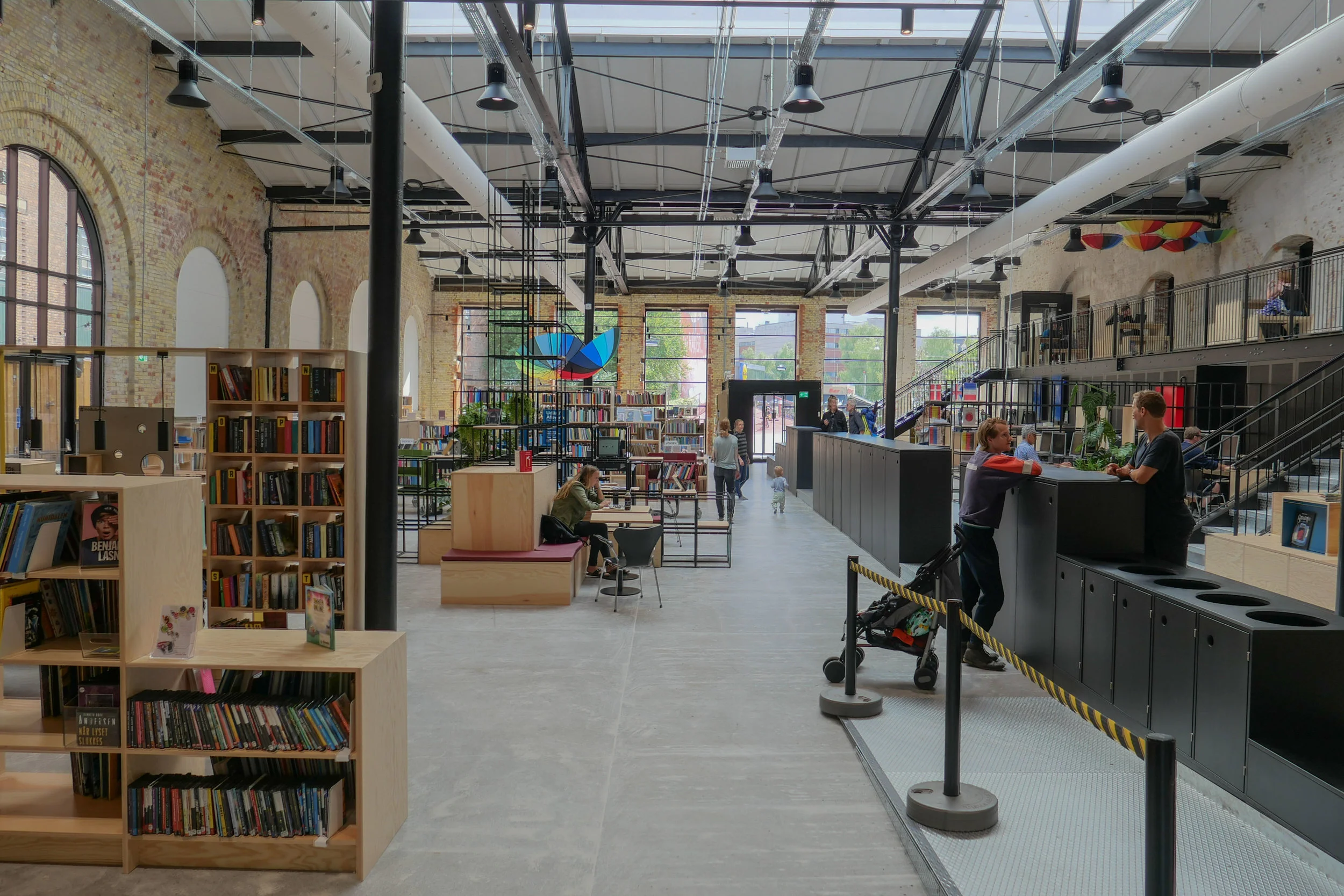
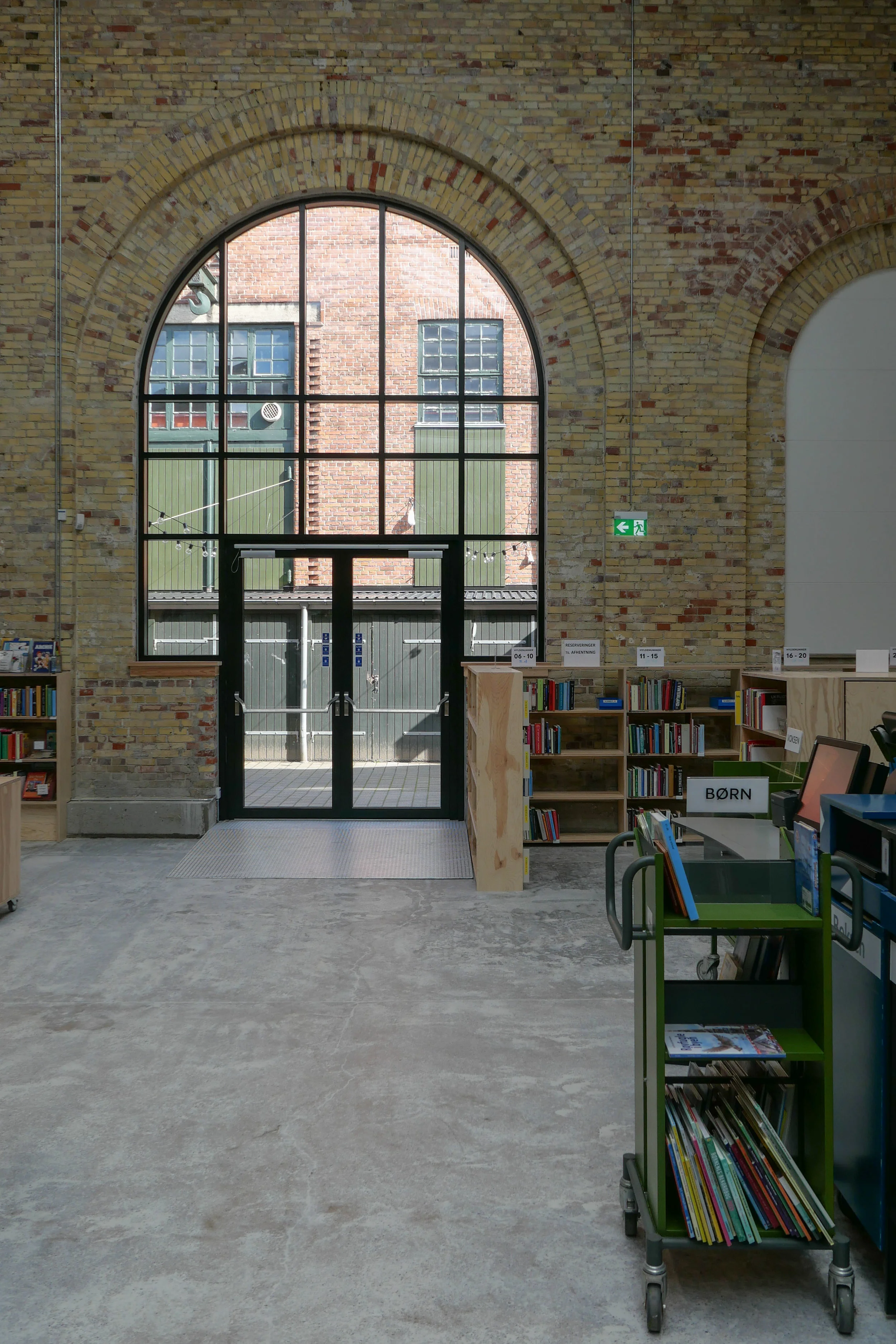
At the beginning of August a new public library opened in the old tram sheds in Nørrebro.

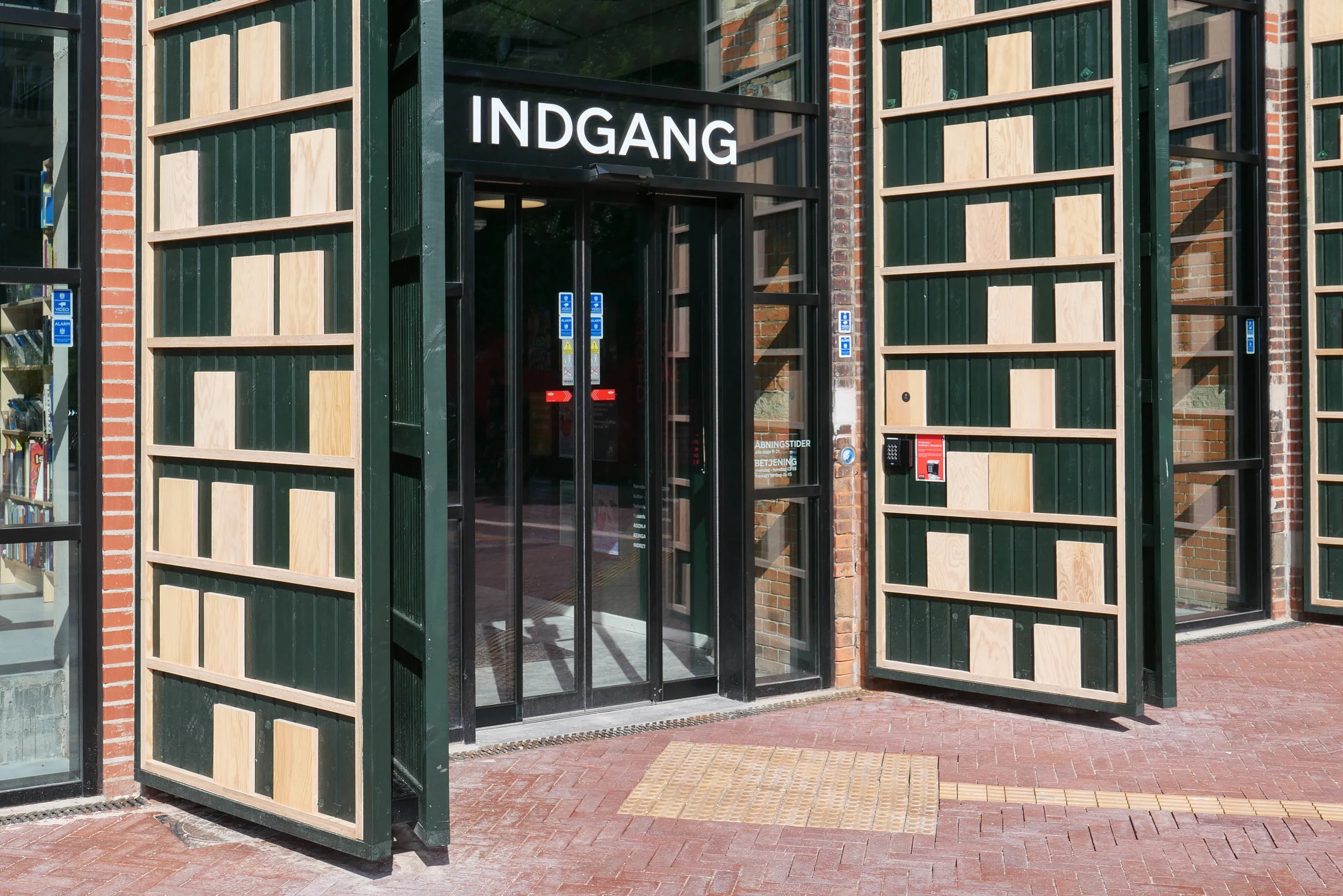
The building is set back from Nørrebrogade with a large square at the front where trams originally turned into the sheds and the original high and narrow openings towards the road have been retained but with new doors that have stylised versions of giant book cases.

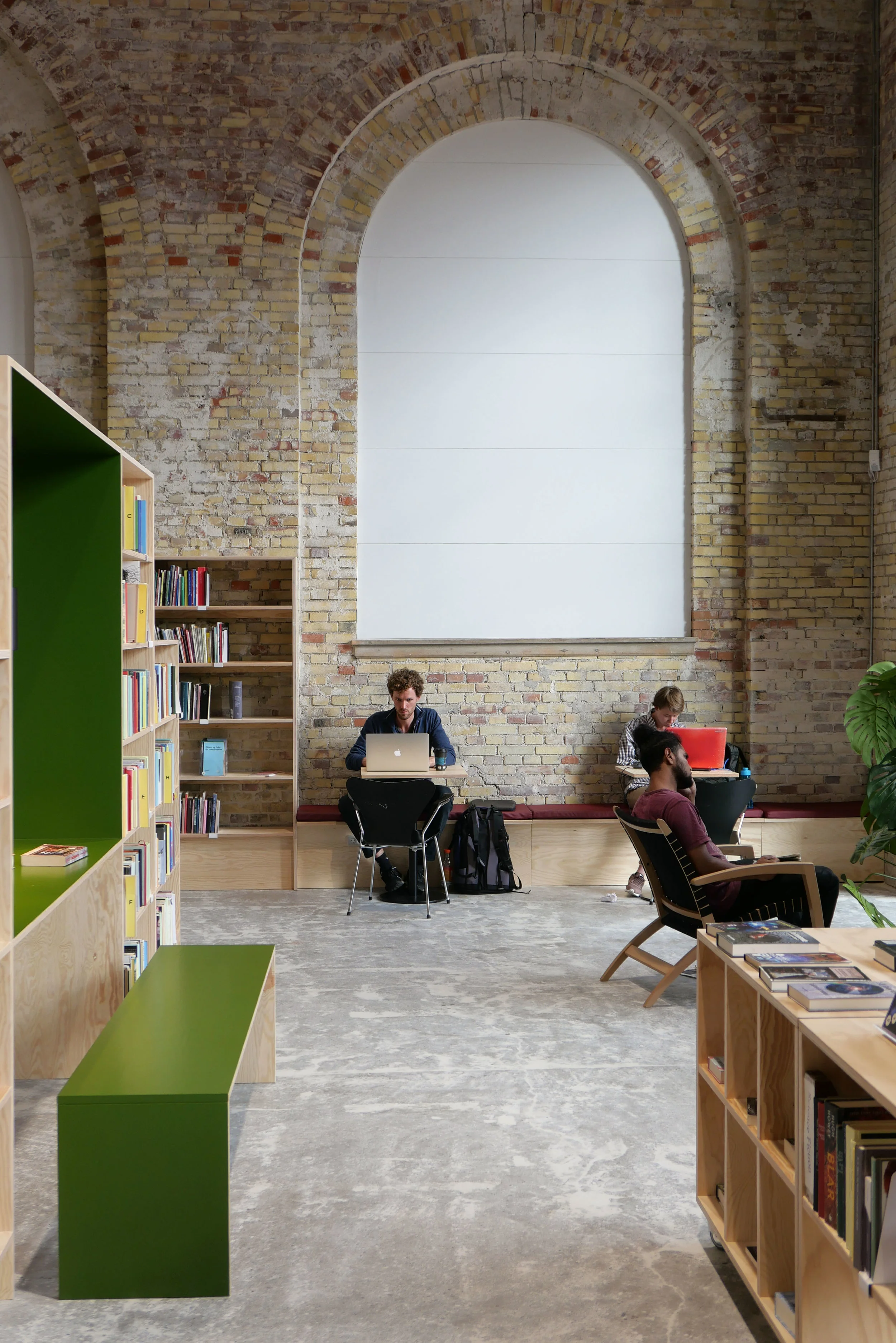
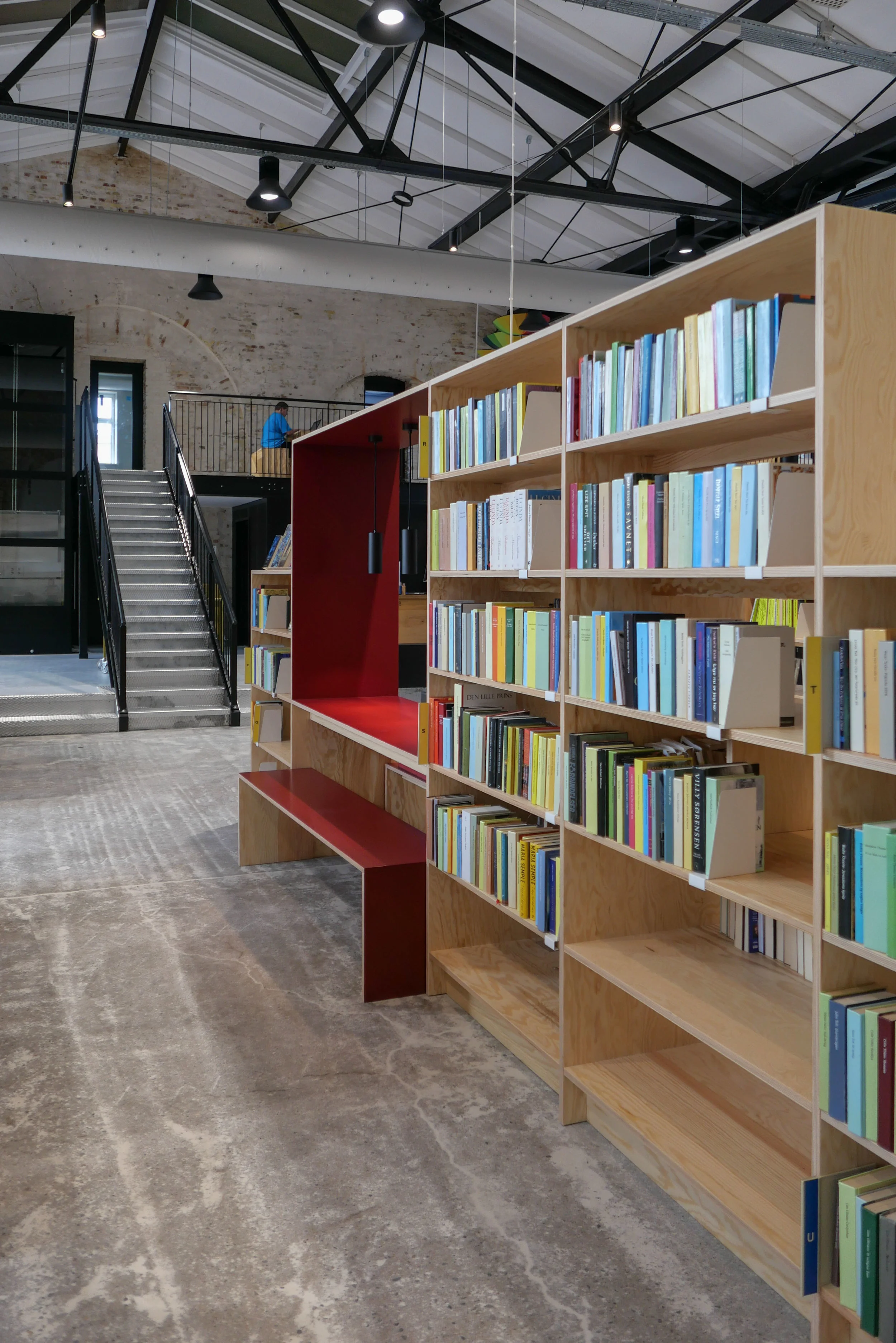
Inside, the single huge space of the shed has been retained with arched openings in the brickwork along the east side towards Bragesgade kept as a strong architectural feature and to flood the space with light. The industrial roof has been kept and is now painted black.

Fittings are in pale plywood and divide up the space and there are integral breaks in the shelving with desk spaces and benches that create quiet places to work but also form views through the space.

Across the west side of the library are smaller spaces on two levels with meeting rooms above for meetings and teaching that the community can use and, like all libraries in the city, there is a play area for children to encourage even the youngest to see the library as a fun place to visit.

Further back from the road is a second huge tram shed and that was converted some years ago to a sports hall - Nørrebrohallen - and there is now a large entrance area and large cafe between the two - between the library and the sports halls - as a place where people can meet.

Running back from the road and along the west side of the buildings is the famous city park - Superkilen - with its outdoor play and sports so this area is now a major hub for the community around. It is anticipated that visitor numbers to the library could soon exceed 1,000 a day.


select any image to open the set of photographs as a slide show

sport and space consultancy KEINGART have published a pdf file on line with plans of the library and cafe area


grim or brutal or rude and insensitive?

the Radisson Blu Hotel on Amager Boulevard manages to loom over Christianshavn. Lurking at the end of the street, this could have a bit part in a spy film about an ominous state watching every move of its citizens

walking along the canal from the back or south side of the Opera House, it is there, at the end of the view from nearly 2 kilometres away


walking down towards Højbro Plads you get your first view of Christiansborg and there is the hotel, well over a kilometre away but filling the gap. Maybe not looming but there and once you see it there then you can’t unsee it


There are very obvious problems with the design of the new office building at Østerport - its unrelenting horizontality, odd raspberry ice cream colour and insensitivity to the good historic buildings nearby and the important green space of the Citadel opposite for a start - but, for me, by far the ugliest building in the city is still the Radisson Blu Hotel on Amager Boulevard by Ejner Graae and Bent Severin that was completed in 1973.

It is an ugly and brutal tower that dominates it's location overlooking the trees and the water of Stadsgraven - the historic outer defences across the south side of the old city - but, worse, it is a thug of a building that can be seen from all over this part of the city. It is like a infeasibly tall and scruffy waiter at a wedding celebration and when the guests look back at their photographs they find that somehow he manages to be there, looming in the background, of most of them.

About the only time it looks anywhere near presentable - the hotel not the waiter - is when there is mist and frost hanging over the water or at night when looking down Frederiksholms Canal and the lights of the rooms form a bit of a book end to the view.

…. hardly a ringing endorsement and what really is astounding is that for a time last year there was a planning application, sort of hanging over the city, for permission to add another ten floors to the tower … permission that had been part of the original design but had somehow been omitted as the hotel went up as if even the builders ran out of energy or malice.

On the canal through Christianshavn, look down one side and perhaps the only criticism you could make is that it is too nice to the point of being bland - I wouldn’t agree but you could argue that a bit of spice improves a dish but look down the other side and there is the Radisson breaking the roof line even when you get lower on the quay and try to cut it out


On Frederiksholm Canal you are over a kilometre from the hotel. Look north and the tallest building - a marker on the skyline to get your sense of place and orientation - is Vor Fruhe Church in a view barely changed since the Thorvaldsens Museum opened further along the canal in the 19th century. Look south and there, dead centre, is the Radisson. Only at night does it seem to contribute something to the view but it is hardly good architecture if it is best seen in the dark.


the forecourt of the design museum


Work continues at Designmuseum Danmark where the entrance gates, railings and stone piers along the street are being rebuilt and the setts of the forecourt relaid to form a new ramp to replace the steps up to the front entrance door and to install lighting and so on for new outdoor exhibition cases. 

The project - designed by the architectural practice COBE - includes a new ticket area, book shop and new cafe in the lower part of the old pharmacy … that’s the pavilion to the right of the forecourt.


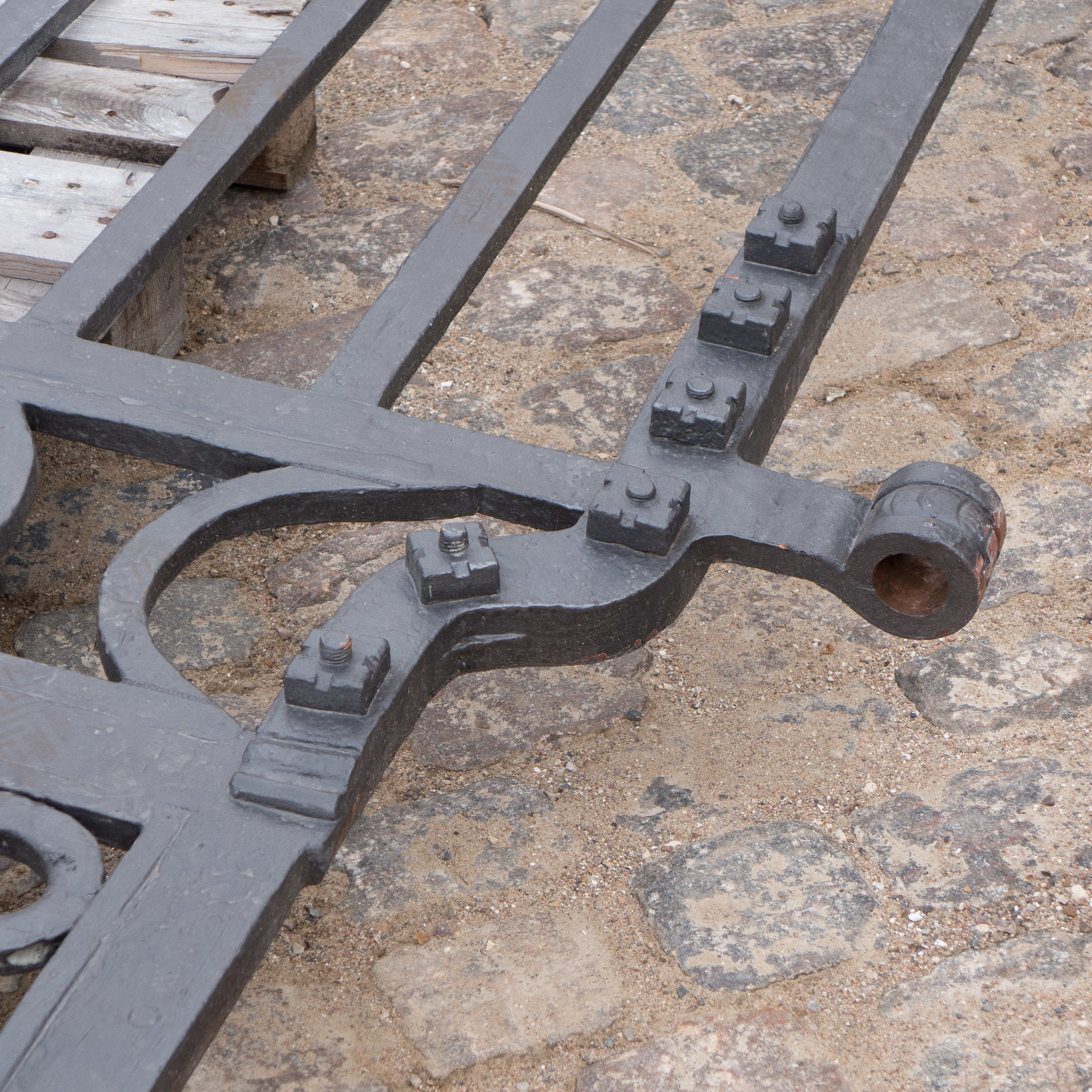
As new blocks of stone have been brought to the site and set up, the work is an opportunity to see some of the details of 18th-century stone masons’ techniques that have been replicated … so it is possible to see the way bold mouldings are cut across large blocks to form plinths and caps to the piers.

The large ashlar blocks of the stone piers and the blocks that form the moulded bases and caps are dressed back with strong vertical tooling which contributes a distinct surface texture and gives a darker tone to the architectural details. Note how at each end of the ironwork screen the outer piers are not butted against the brickwork of the pavilions but are set into them which would suggest that the brickwork and stonework were built up at the same time … not one built against the other.

top left - the door into the former pharmacy of the hospital which will be the access to a new arrival space with ticket desk, book shop and new cafe. Note the silhouette in the brickwork of the ball finial and moulded cap of the stone pier that has been dismantled.

top centre - an iron pintel, set into the stonework of the pier, that will hold the strap of the lower hinge of the gate


Heavy spiked or barbed railings and the ornate iron gates are held in sockets cut into the blocks.

At this stage the gates are back on site but are on pallets so it is possible to see the robust quality of the iron work and to see how the straps of the gate hinges form a loop that will be dropped over hefty iron ‘pintels’ set into the stonework. 

This major project has also been an opportunity to repair some of the stonework on the entrance front of the main building and it is interesting to see around the doorway that although the stone frame or architrave of the door looks hefty or robust, it is, in fact, made up with relatively thin slips of stone with pieces forming the moulded front and separate pieces forming the reveal or jamb running back to the door frame and the brickwork behind is surprisingly crude.


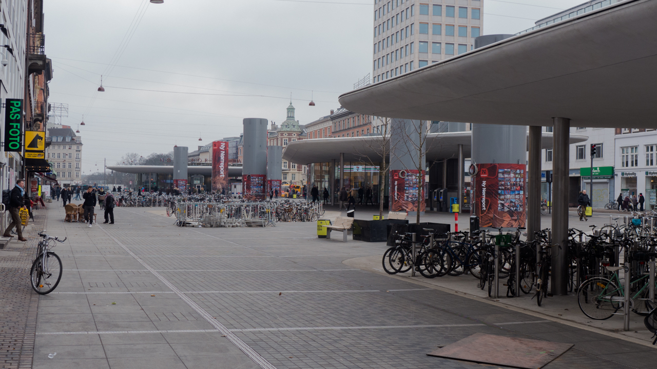
Nørreport streetscape


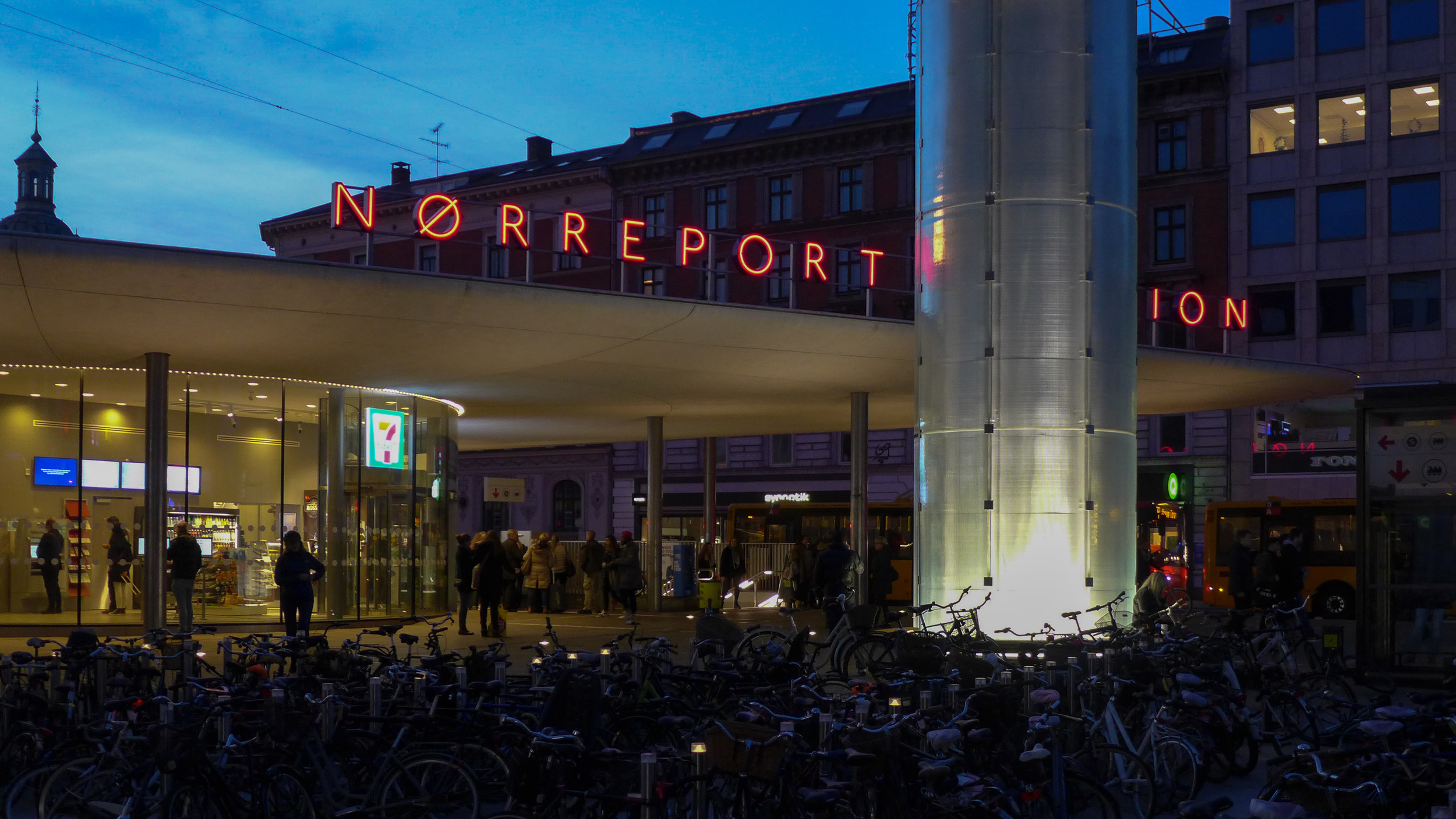
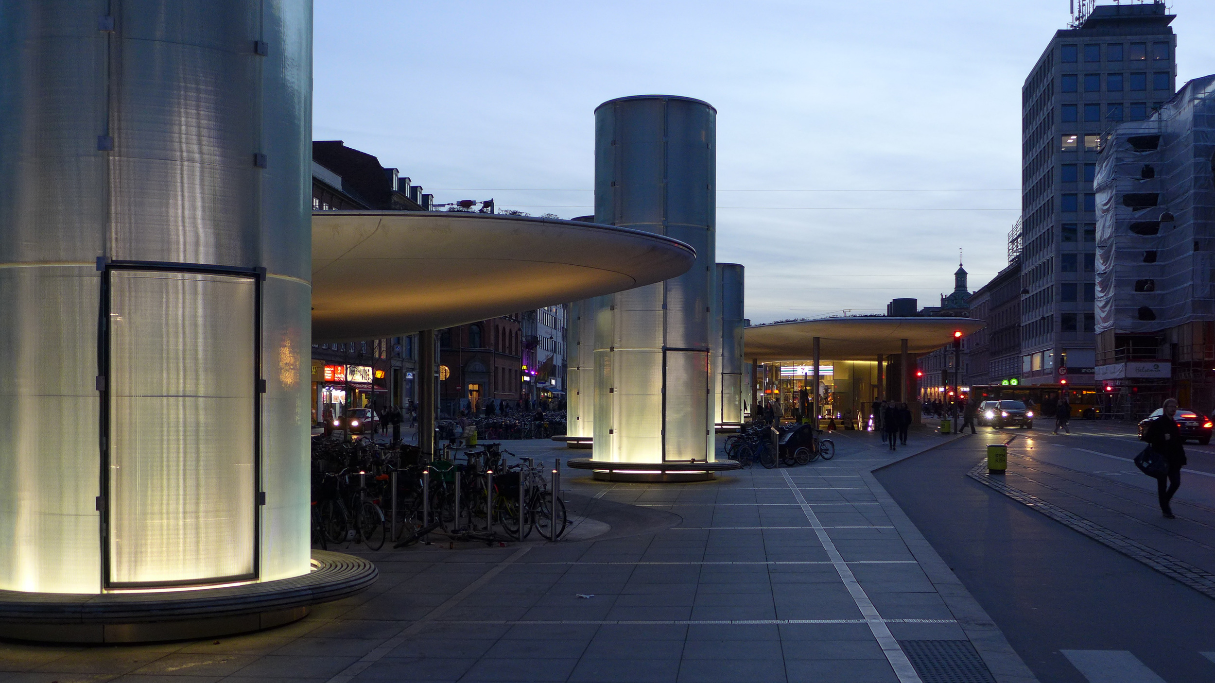
In an earlier post I wrote about extensive improvements that have been made to the railway and metro station at Nørreport in Copenhagen.

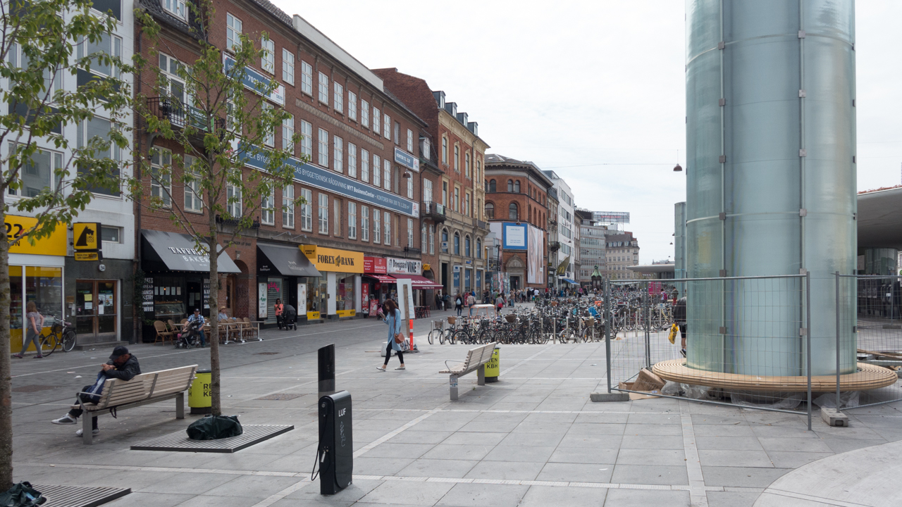
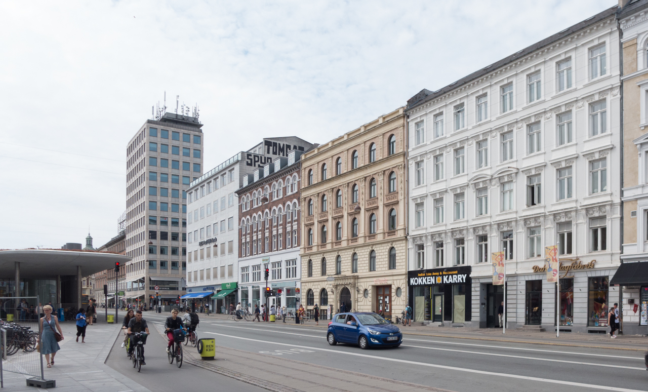
As the final parts of that major scheme of rebuilding are completed, there is now a clear incentive to restore or improve the buildings that line Nørre Voldgade and form the streetscape or backdrop to the new paved area that covers the three blocks from Gothersgade to Linnésgade.

When the street was set out in its present form in the 1870s, it was described as a boulevard and formed a wide elegant boundary between the old city and the new streets and squares with their large new apartment buildings that were laid out between here and the lakes.

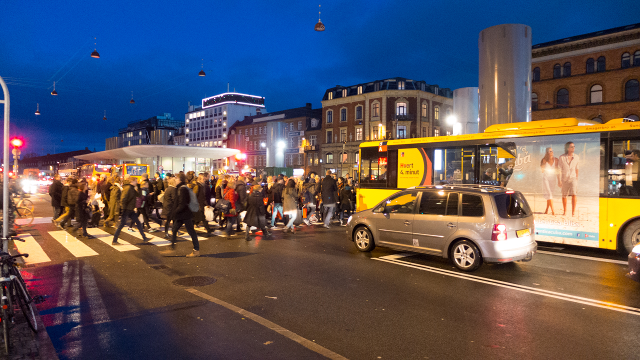
In 1917 when a new railway line was constructed to link the central railway station with Østerport station - then a terminal stop on the railway from the north - it was called the boulevard line. The tracks were sunk well below street level by excavating a deep cutting and were then covered over and the street and pavements reinstated. From the start, the station at Nørreport was underground with round pavilions at street level to give access to the platforms.

The area declined in the post-war period and some rebuilding and redevelopment was allowed that is of relatively poor design and many of the shops and offices on either side around the station became rather scruffy.

The present buildings would certainly be improved by a careful programme of repainting and by tidying up signs, lettering and advertising.

This is not to suggest that the area becomes neat and prim …. just that bold, simple, well-chosen colours provide a better background to the busy crowds of people and the often visually confusing hubbub of life here.

Extensive rebuilding of the metro station and the square at Kongens Nytorv and the new metro station in the square in front of the city hall are also close to completion and will, with Nørreport, provide three very different transport hubs and entry points into the centre of the city that correspond appropriately with the three historic gateways into the old city.

These three areas are very different in character: 

The large square in front of the city hall, on the site of the old west gate, is a major public space and the route into the city from the main central railway station cuts across the centre. Crowds of people working in the centre and visitors pass through the square and the nightlife of nearby Tivoli means that the neon signs and the commercial appearance of the square are lively and absolutely appropriate.

When the planting of the square is re-installed at Kongens Nytorv, just outside the old east gate, it will restore this grand square lined with important historic buildings - an important open green space - and reinstate it as a crucial a hub between the packed shopping area of the Walking Street, the tourist bustle of Nyhavn and the dignified grandeur of the new town around the royal palace.

Nørreport, although it will still be a major entrance into the city centre from the station, with new steps up from the platforms for an exit directly onto the main shopping street Købmagergade, it will also become the gateway to the major galleries and museums in this part of the city and to the botanic gardens and the attractions of Israels Plads and the food halls. 

This will re-establish what appears to have been the original intention from the 1870s that the boulevard would be Copenhagen’s version of the Opera Ring in Vienna. With careful restoration of the facades along Nørre Voldgade, the area will form the central part of an inner ring of galleries and public spaces running around the city from the 17th-century citadel through Østerport, to the National Gallery, to a new museum of earth science, the entrance to the King's Garden and Rosenborg, the main entrance to the botanic gardens and on to the south to the inner park of Ørstedsparken and then further to the city hall, past Tivoli, the Glyptotek, a new site for the Museum of Copenhagen and on back to the harbour and the National Library and a new building for the Danish Architecture Centre.