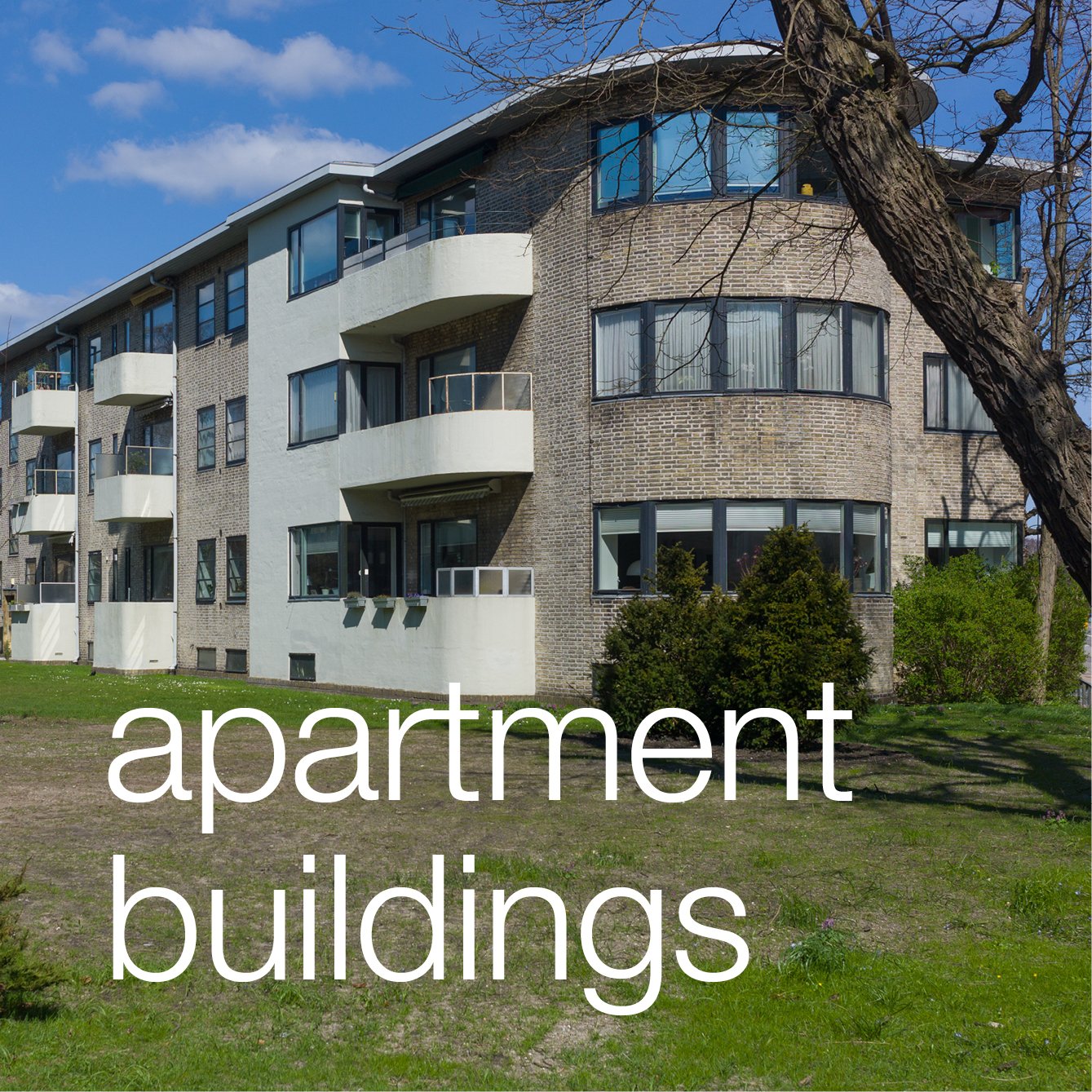
Lyngbyvej Housing

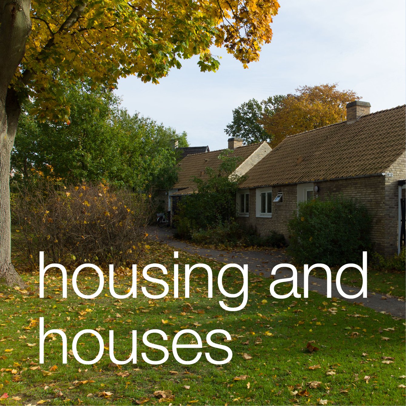
The row houses in Lyngbyvejskvartet / Lingbyvej Quarter were built by the Workers Building Association between 1906 and 1929 for workers from Burmeister Wain and the architect was Christen Larsen who had replaced Frederik Boettger as architect to the association.

Lyngbyvej - the King's highway - is an important and historic road that runs out north from the city to Lyngby and from there on to the royal castle at Frederiksborg.

The housing is about 4 kilometres from the centre of Copenhagen. In a modern city this might not seem far but until the city defences were dismantled around 1870, the historic core of Copenhagen, on this side of the harbour, was confined to an area little more than a kilometre from the wharves to the north gate and around 1.5 kilometres across from the east gate to the west gate with remarkably little building outside the defences …. so this was quite a long way out of the centre for workers employed at the engineering works of Burmeister Wain on Christianshavn on the far side of the city or for men working at their ship yards at Refshaleøen.

read more

Trianglen

Trianglen in Østerbro is a busy triangle-shaped public space immediately to the east of the new metro station and the south entrance to Fælledparken - the large public park in Østerbro. 

This is where two main roads in the city cross at an angle rather than at 90 degrees and it illustrates well how a dynamic townscape evolves over what is often centuries through a combination of factors including, of course, topography but also military and strategic history, wider patterns of roads and transport - so where people are travelling to or from either away from the city or within the city - and inevitably ownership and property boundaries and, in many cases, the direct involvement of a monarch, a city council and - from the 20th century onwards - planning authorities and transport companies. 

Oh … and as much as anything it’s often about the way people use a space or even how they cut across corners that over time ends up fixed in the position and line of roads, pavements and buildings.

read more

Bien at Trianglen

This is one of the more extraordinary buildings in Copenhagen. 

It is at the east end of Trianglen on the traffic island and was a tram car stop with a kiosk; a room for a traffic controller and public toilets and with benches not only in the recessed spaces on the east and west sides but also around the outside where people could wait if they had to change trams at this busy interchange.

The architect was PV Jensen-Klint and it was commissioned in 1904 by the Østerbro Grundejerforening or Landowners Association to replace a wooden hut on the same site. A number of designs were presented before a final design was approved and the building was completed in 1907.

It has a sort of exuberance and delight in playing with variations of shape and form that is associated with Art Nouveau architecture but here the columns on each side with strong entasis - the bowing out in the middle - and the almost Baroque elements with curved shaped heads to windows and doors picked up in the line of glazing bars makes it more robust and strongly architectural than buildings you would find from the same period in Paris or Brussels.

The oval shape of the building and its copper roof meant that it was soon given the nickname of the Super Terrin or Terrinen although it is also known as Bien from the name of the kiosk here at one stage.

the Caritas Well

In 1608, the Caritasbrønden or Caritas Well on Gammel Torv was constructed for Christian IV as his gift to the citizens of Copenhagen when a new city hall was built across the south side of this open space to replace a medieval city hall that had been on the east side of the square.

Just over a century later, that 17th-century building was destroyed in the Great Fire of 1728 and a new city hall was built on the same site. When that building was, in turn, destroyed in the fire of 1795, a new city hall was built on the west side of Nytorv and the two squares were joined into a single open space.

An outline of the 17th-century hall is marked with stones set into the cobbles of the square.

The group of figures in the centre of the basin of the fountain - representing the virtue of love or charity - was first carved in wood by the German artist Statius Otto but later was cast in bronze.

The fountain was not just ornamental but was part of a system supplying fresh drinking water to the city.

This photograph was taken on the 16th April - on the Queen’s birthday - just after the royal carriage had progressed along Strøget to take the Queen from the palace to a reception at the city hall.

18th-century map that shows Gammeltorv - the Old Market - with its fountain and Nytorv or New Market with the old city hall in the centre between the two public spaces


Caritas Well and the city hall from the upper end of the square in the 18th century


Nørreport streetscape

In an earlier post I wrote about extensive improvements that have been made to the railway and metro station at Nørreport in Copenhagen.

As the final parts of this major scheme of improvement are completed, there is now a clear incentive to restore or improve the buildings that line Nørre Voldgade and form the streetscape or backdrop to the new paved area that covers three blocks from Gothersgade to Linnésgade.

read more


open space in Vesterbro

Because Vesterbro is such a densely built up residential area, green open space with grass and trees seems, somehow, much more important but when compared with other districts of Copenhagen, there appear to be few large open areas here.

The most important open space is Skydebanen, a large rectangular park has the backs of apartment buildings on both sides so that in some ways it is more like a large courtyard. Its on the site of a private shooting range so presumably originally it was just grass or perhaps gravel but now has mature trees. At the south end It has been extended and opened out to the west but it still seems like a well-kept local secret, hidden away behind the apartment buildings and from the north entered through a narrow gateway beside a school and from the south, from Istedgade, approached through a doorway in a forbidding high blank brick wall that closes off a short street of apartment buildings. 

read more

Vesterbro

In the second half of the 19th century, as the city grew, Vesterbro was one of the first areas that developed outside the city ramparts with new houses, apartment buildings, shops and churches built on either side of the roads running out from the old west gate to the royal palace and gardens on the hill at Frederiksberg. Construction work spread south from Vesterbrogade and streets and small squares and building plots were laid out on either side of what is now Istedgade. Many of the apartment buildings date from the 1880s and 1890s although the blocks along the railway are later. Many were poorly built and were divided up into small apartments and lodgings.  

read more

older houses surviving in the city

Møntergade

Ny Kongensgade

Magstræde, parallel to Gammel Strand but one block back showing clearly the narrow plot width

By the late middle ages, Copenhagen was enclosed by high embankments with outer ditches and the city could only be entered through gateways that were closed at night. Within these defences there was a tightly packed network of streets and alleyways with small squares and market places and with open areas around the major churches. Few buildings were allowed outside the ramparts so, as the population increased, many gardens and courtyards were built over and then buildings were raised in height or rebuilt as taller and more substantial or more fashionable houses.

With a number of devastating and extensive fires in the city and also with commercial pressure to improve buildings, to create shops and administrative buildings, few early houses survive. 

There are some timber-framed houses dating from the 16th or 17th centuries in the north part of the old city and in Christianshavn. These are relatively low and narrow but deep so they have large high-pitched roofs either running back from the street or more often with the ridge parallel to the street but with additional front gables or high gabled dormers to increase head height within the attic space. The timber framing generally forms square panels and the building are usually rendered and most painted traditional colours - usually deep ochre or a dark iron oxide red. Some of the framed houses show clear evidence that they were raised in height with new floors added and new roofs built or the old roof ridge was kept but the outer eaves raised to form a shallower pitch of roof so that a series of dormers could be amalgamated to form a new complete top floor. 

There are large merchants houses along Gammel Strand, along the quays of Nyhavn and in Christianshavn but it seems clear that as the population of the city increased then many of the older houses were crudely divided up into apartments or in some cases subdivided for single rooms for a whole family.

Fine town houses for the wealthy were built on either side of the main streets through a new area, laid out in the 18th century beyond the king’s square - Kongens Nytorv, and there are substantial houses overlooking the King’s Garden but in the older part of the city, where there was new building, they are often purpose-built apartments, and to the west and north after the city defences were removed in the second half of the 19th century, almost all new buildings are apartment blocks rather than houses for single separate families however wealthy.

There are some curious examples where smaller houses in a street were replaced by large apartment buildings, presumably working from opposite ends of a block by buying and amalgamating narrow plots, but somehow a narrow plot was left so there is now a small house flanked by much taller apartment buildings.


Houses along the quayside of Nyhavn


a small house on Rigensgade near the King's Garden between later and much taller apartment buildings

town houses of the wealthy overlooking the King's Garden

Nyboder

Christian IV understood well that the men in his navy and in his army might be more loyal if they had reasonable accommodation and some rights to housing after they left his service.

Construction of the naval accommodation of the Nyboder housing scheme, designed by the Flemish stone mason and architect Hans van Steenwinkel the younger, began in 1631 and by 1648, the year that Christian died, there were 600 housing units in the streets laid out north of the city, on land just beyond the king’s house and garden of Rosenborg. 

read more

In the late 19th century some of the earlier rows were demolished and new larger brick houses were built -

see separate post


streetscape

In Copenhagen the streetscape - the buildings and street furniture of the urban landscape - can be amazing. This was Åboulevard yesterday afternoon.

There are so many elements that contribute visually to the success of this block of buildings and to so many other areas of the city. It is in part the high quality of the buildings themselves; in part the variety of building materials, within a relatively restrained range of colours and tones, and it is the subtle variation of the horizontal and vertical arrangement of architectural elements but again with a discipline that shows a respect for neighbours and respect for more general conventions of design in the city.

The group builds up to the centre to the church designed by Kaare Klint in the 1930s that is the tallest but also the most important building in the group.

As in so many streets in the city there is a slight curve to its line so that the view is contained … the sight line is gently closed off as it would not be with a long straight road … and the curve presents different angles of view as you progress along the street and also creates a greater variety of effects from the shadow and light on the facades as the sun moves round.

There are other obvious features or rather, I suppose, a lack of features as there are few intrusive signs, either for traffic or for individual businesses, and street lights are suspended from wires across the road so there are few posts or stanchions either blocking the pavement or interrupting the view.

What cannot be seen in this photograph of course is the quality of the paving … as in most  streets in the city there are paving stones set along the direction of movement with stone setts or cobbles along the kerb and immediately in front of the buildings. These are in shades of grey and buff so form a consistent but sombre base to the buildings and add some texture. That the stones and cobbles run with the line of the pavement might seem obvious but in so many cities not only is paving of poor quality and a jarring colour but is set across the pavement breaking the line and direction of movement.

This street follows the course of a river that was created in the 16th century along a dry valley to take water from a lake, fed from the natural drainage of the wooded hills north of the city, but diverted with damns to feed the lakes around the west side of the historic city and bring in fresh drinking water. This is now in a culvert below the road but there are plans in hand to reinstate the open river as part of contingency plans to cope with heavier rain falls and more dramatic storms because of climate change. There will be more planting and far fewer cars that will probably be taken down into new tunnels below the street. 

Åboulevard is one of the main roads out of the city on the west side. In the historic centre of the city and in streets of small private homes you see the same care and the same investment of thought and money in the finish of the urban landscape. As with so much else with architecture and design in Denmark, Danes rarely comment … or rather they comment if it is wrong or done badly because the assumption is that it should and will be done properly.
Nybrogade - looking across the canal from Thorvaldsens Plads


buildings on the north side of Åboulevard with Bethlehems Kirken by Kaare Klint


Krusemyntegade looking towards the Jerusalem Church. It is common in the city to find that people move seating and planting out onto the pavement. 


Rysegade beyond the lakes looking west - a subtle rhythm of vertical features and horizontal lines

the Caritas Well

The Caritasbrønden or Caritas Well on Gammel Torv was constructed for the King, for Christian IV, in 1608 when a new city hall was built across the centre of this open space to replace a medieval city hall that had been on the east side of the square.

Just over a century later, that 17th-century building was destroyed in the Great Fire of 1728 and a new city hall was built on the same site. When that building in turn was destroyed - in the fire of 1795 - a new city hall was built on the west side of Nytorv and the two squares were joined into a single open space. An outline of the 17th-century hall is marked with stones set into the cobbles of the square.

The group of figures in the centre of the basin of the fountain, representing the virtue of love or charity, was first carved in wood by the German artist Statius Otto before it was cast in bronze.

The fountain was not just ornamental but was part of a system supplying fresh water to the city.

This photograph was taken on the Queen’s birthday, on the 16th April, just after the royal carriage had progressed along Strøget to take the Queen from the palace to a reception at the city hall.


Caritas Well and the city hall from the upper end of the square in the 18th century


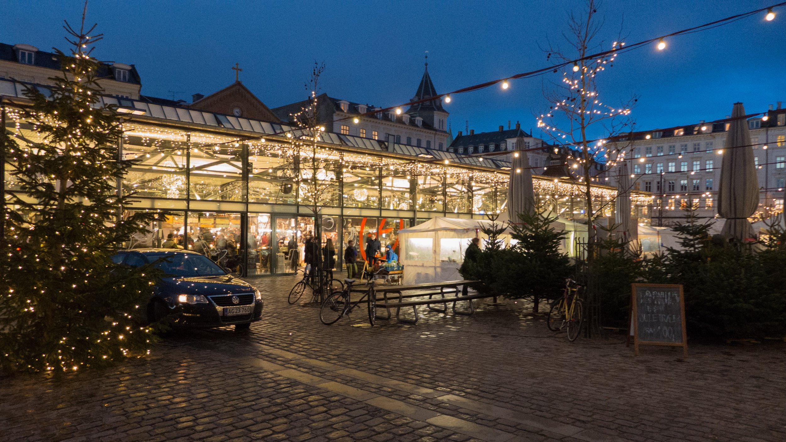
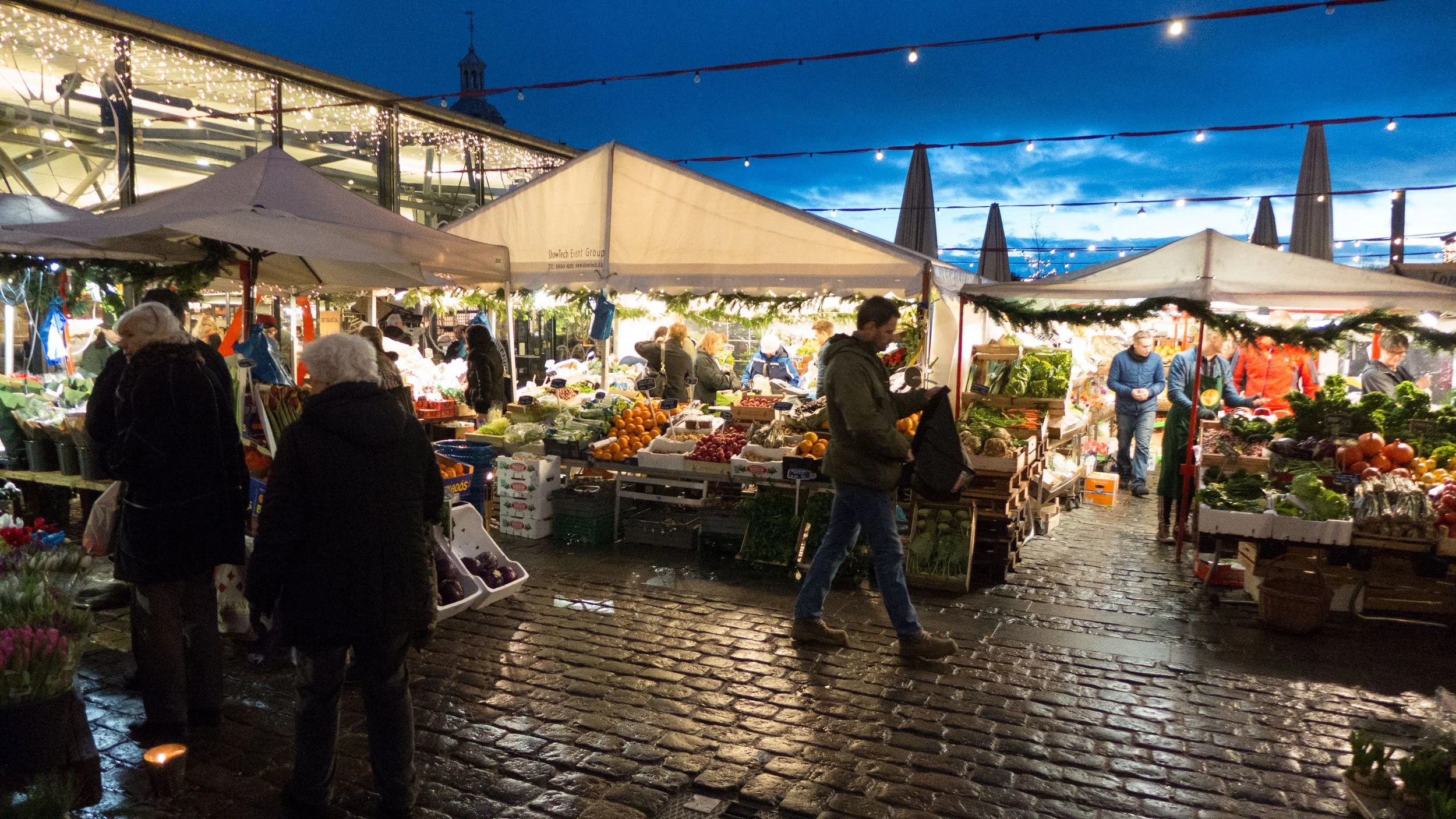
Torvehallerne, Israels Plads


Just a block to the west of Norreport metro and railway station is Israels Plads - a large square that was laid out in the late 19th century once building immediately outside the defensive walls of the city was allowed.

Across the north side of the square is Frederiksborggade, a busy road of shops and apartments leading out to the lakes and the bridge to Nørrebro. There are large and quite grand apartment buildings on the two long sides of square but the south end is open to Ørstedsparken - a green space with mature trees and a large lake that remains from a section of the moat that ran around the outer side of the city defences. 

There was a greengrocers’ market on the square from 1889 until 1958 when a large new vegetable market opened at Valby.

As part of a major upgrading of the area, two new food halls designed by Peter Hagens and between an area of outside market opened in September 2011 at the north end of the square. The buildings have simple thin elegant framing supporting shallow pitched roofs and are completely glazed creating good large light spaces that are divided into aisles lined with stalls like many traditional indoor markets.

The food halls are now well established and extremely popular with stalls outside for vegetables and flowers and stalls inside for bread, coffee, wine, fresh meat, cheese and of course fish, along with stalls for cake and drinks. 

Cafes and restaurants in the halls and around the square are particularly busy for lunch and in the evenings when people stop here for a drink on the way home from work and the food halls are now a popular destination for tourists.