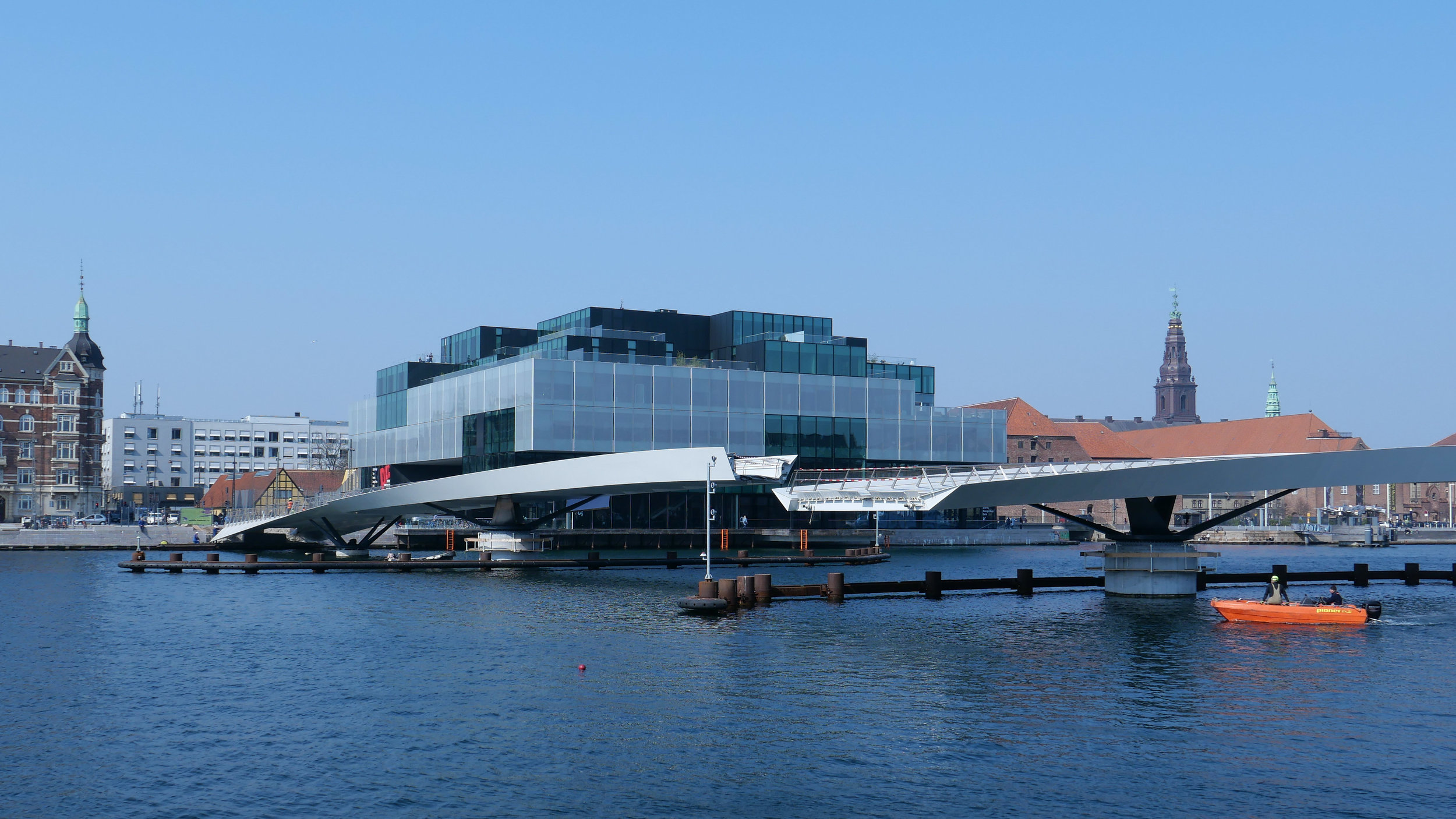
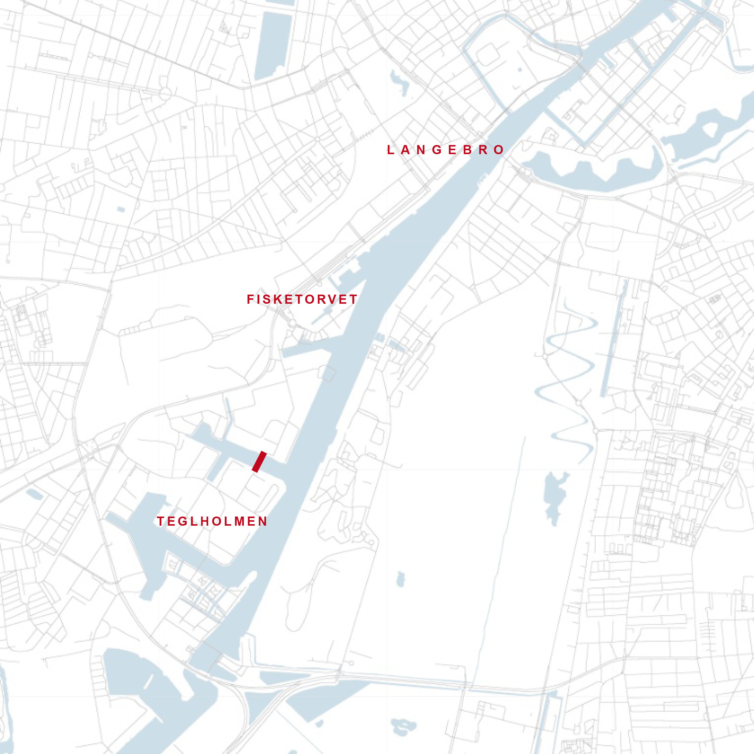
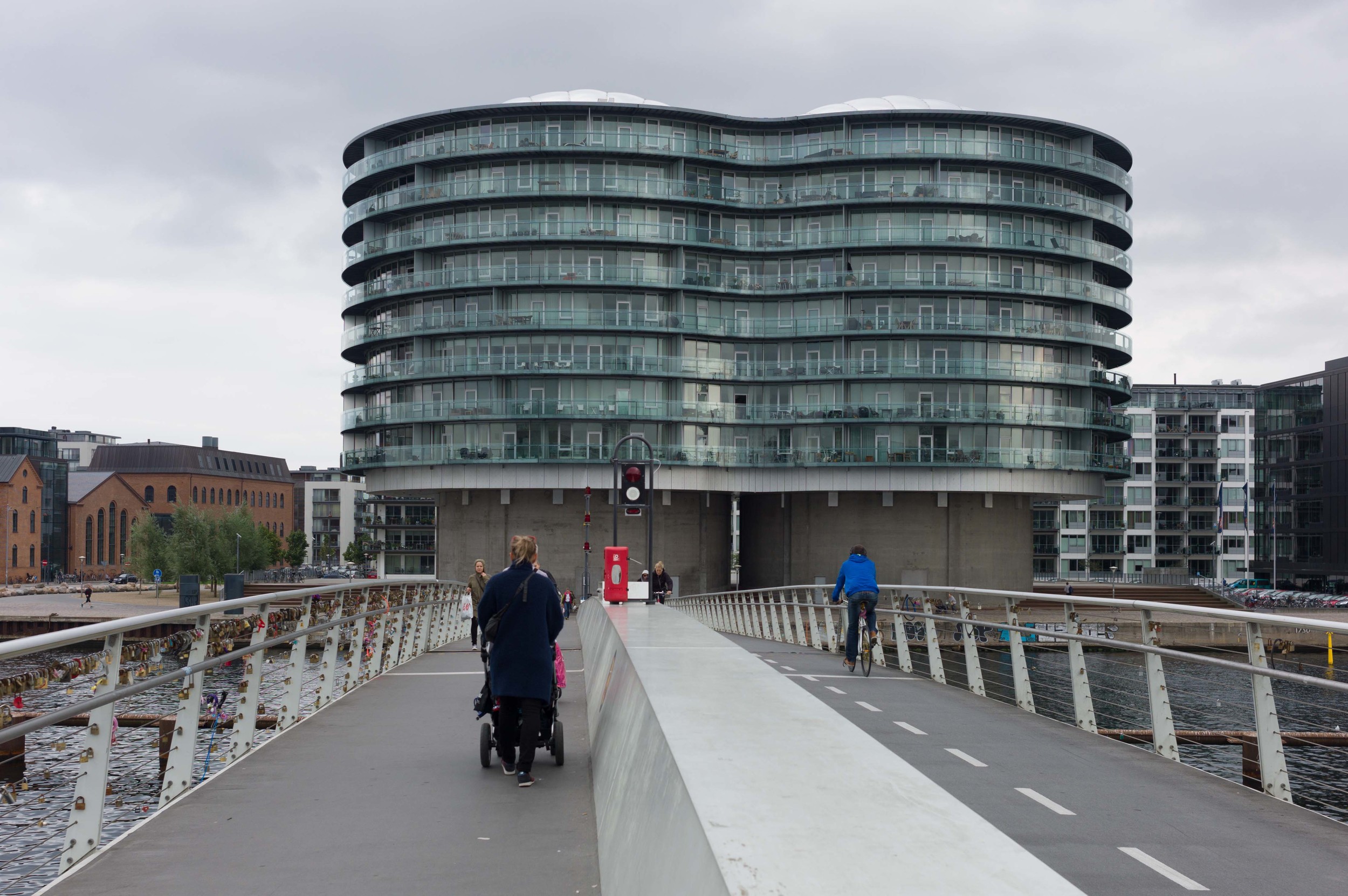
Inderhavnsbroen / the inner harbour bridge
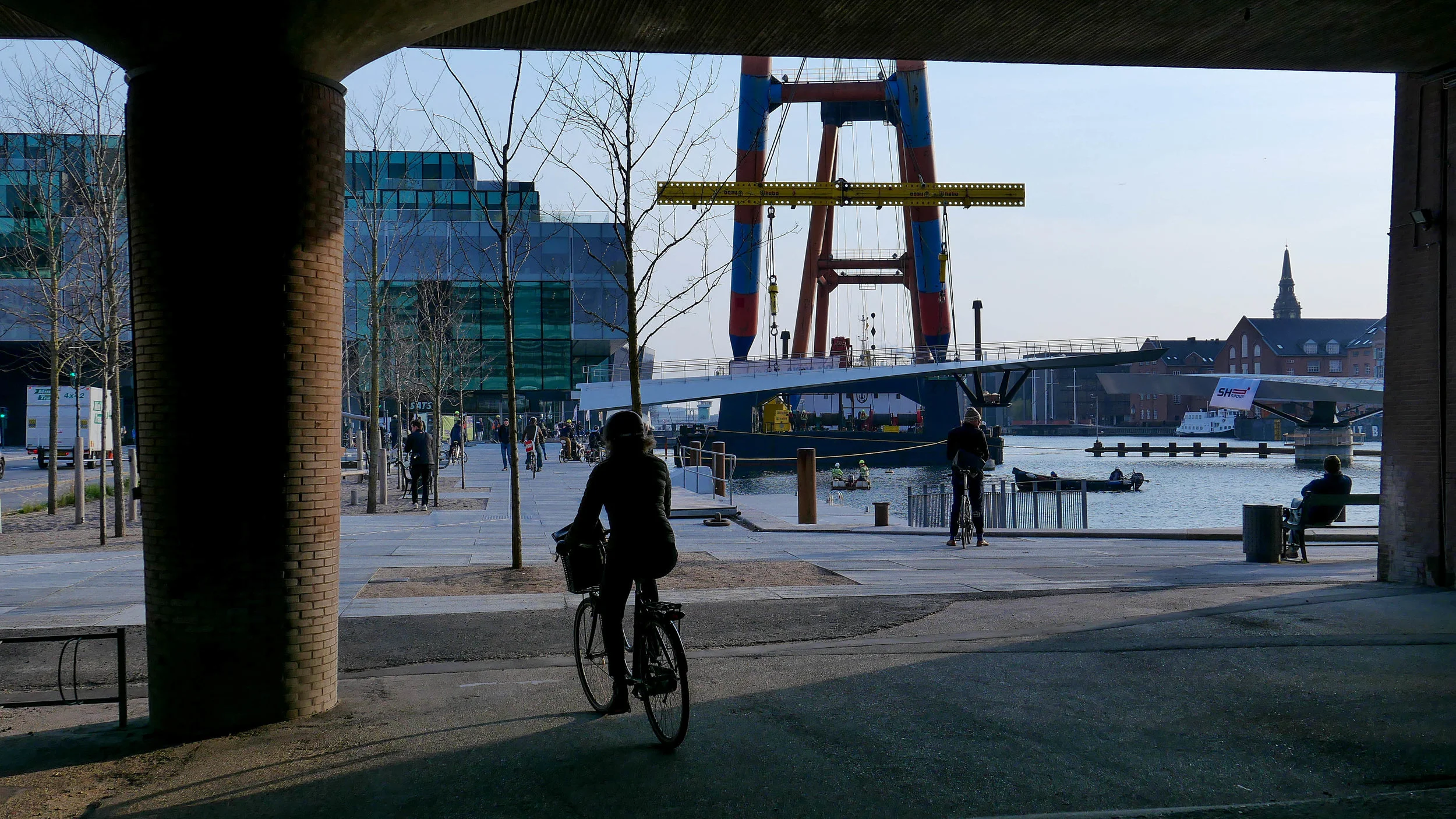
Inderhavnsbroen - the inner harbour bridge for pedestrians and bikes that crosses from Nyhavn to Christianshavn - opened in the summer of 2016.

It provides an important and fast link between the old city, on the west side of the harbour, and Christianshavn, Christiania, Holmen and the opera house on the east side of the harbour.

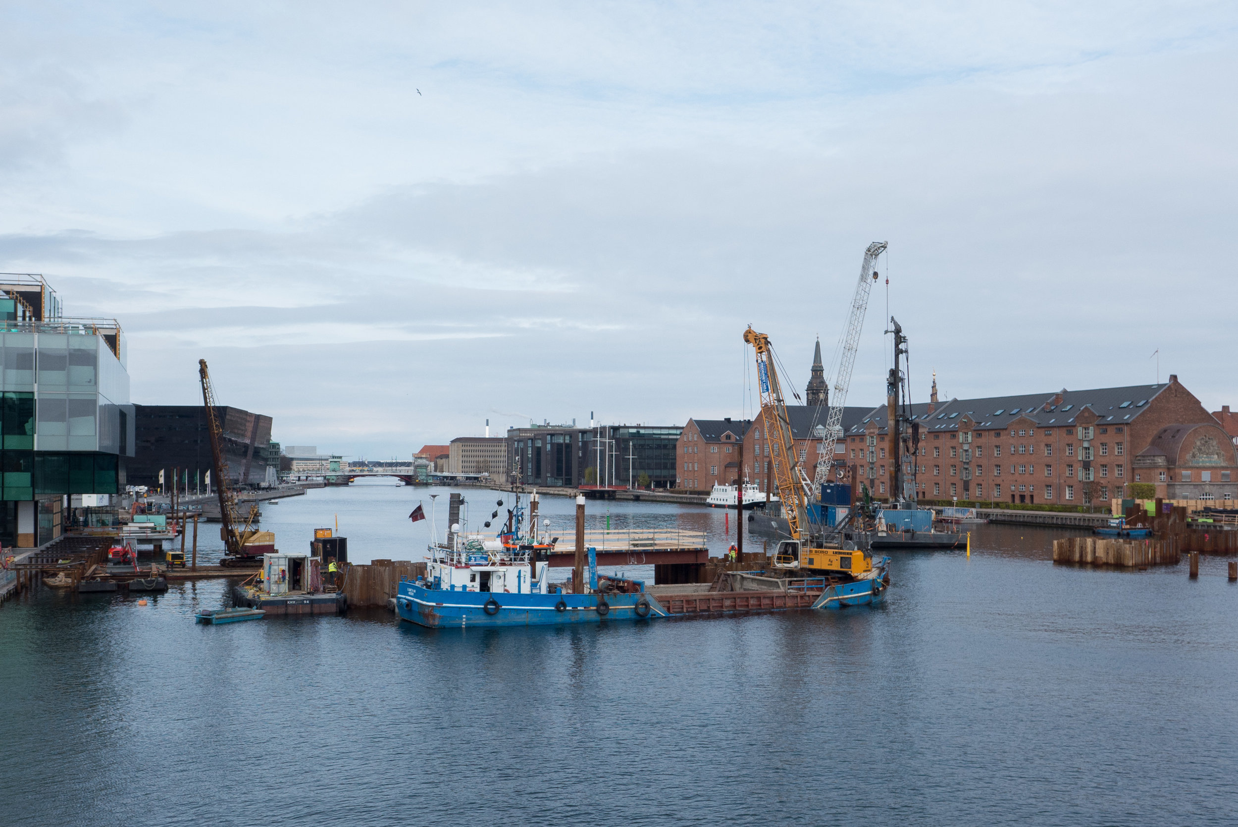
Until the completion of the bridge, the simple way to cross the harbour was to use the ferry between the Skuespilhuset - the National Theatre - and the opera house - a distance of about 600 metres door to door by foot and boat.

To walk or to ride a bike from the theatre to the opera house without using the ferry meant going down to Knippelsbro and then back up to Holmen - a distance of just over 3 kilometres.

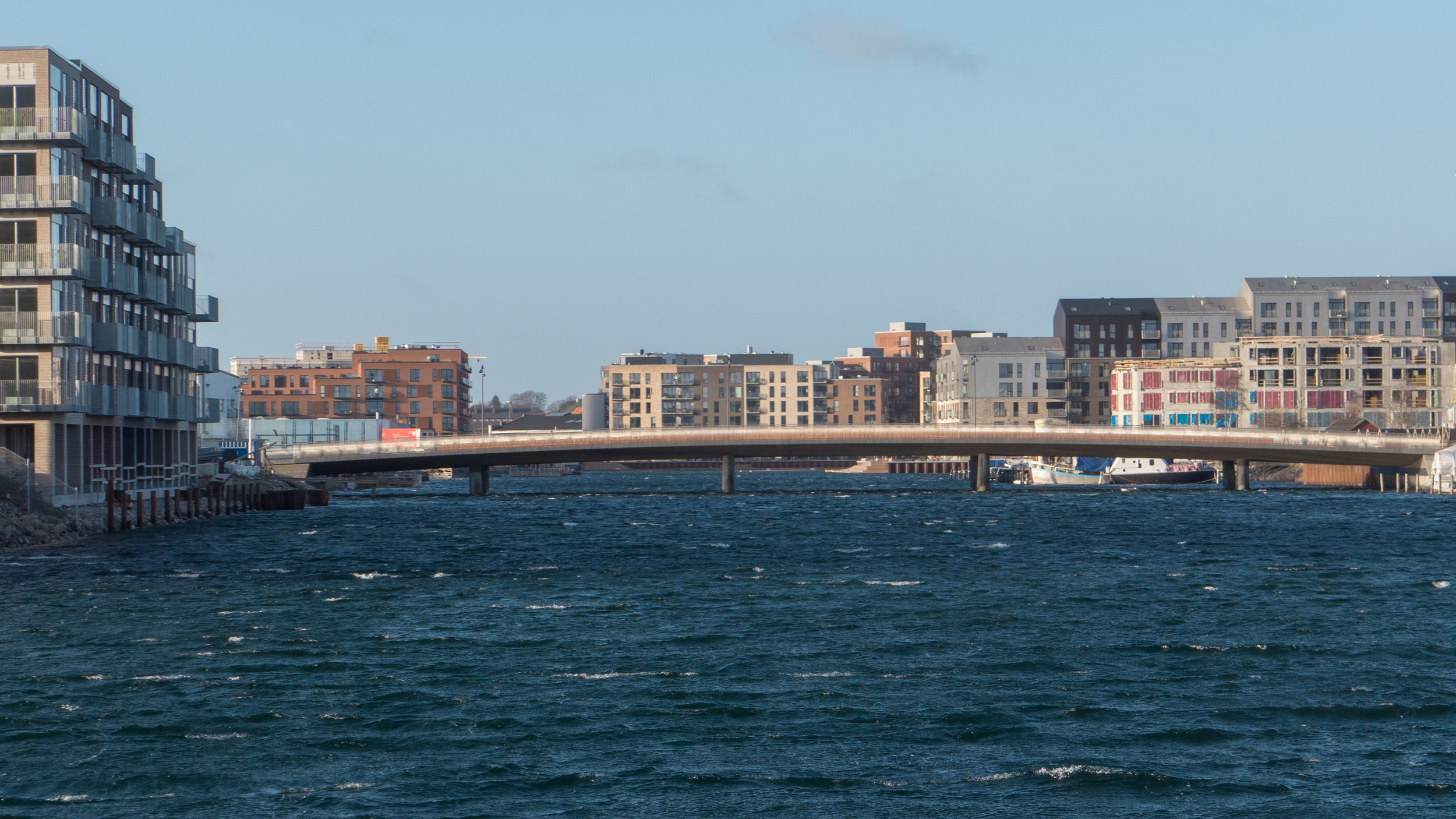
With the Inner Harbour Bridge and the new three-way Transgravsbroen, it is still 1,500 metres from the door of the theatre to the door of the opera house.

By car it was even further. When I first moved to Copenhagen, cars could not drive over the bridge from Christianshavn to Holmen so, by car. the route meant driving over to Amager and then across the north side of Kløvermarken and up to the causeway at Minebådsgraven and from there to Holmen and the Opera House ..... a distance of well over 6 kilometres.

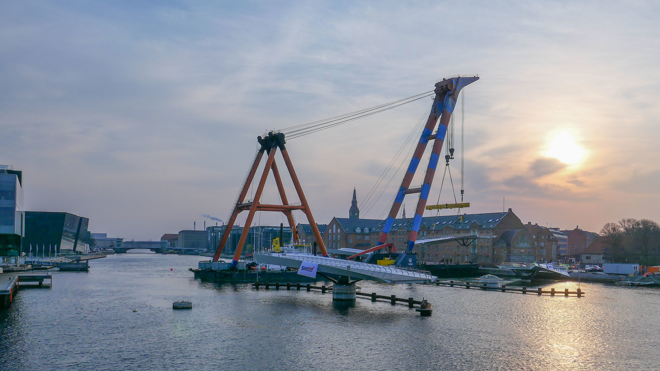
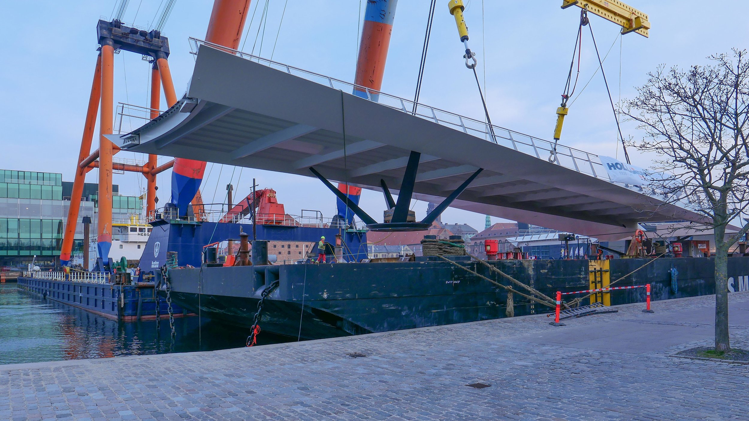
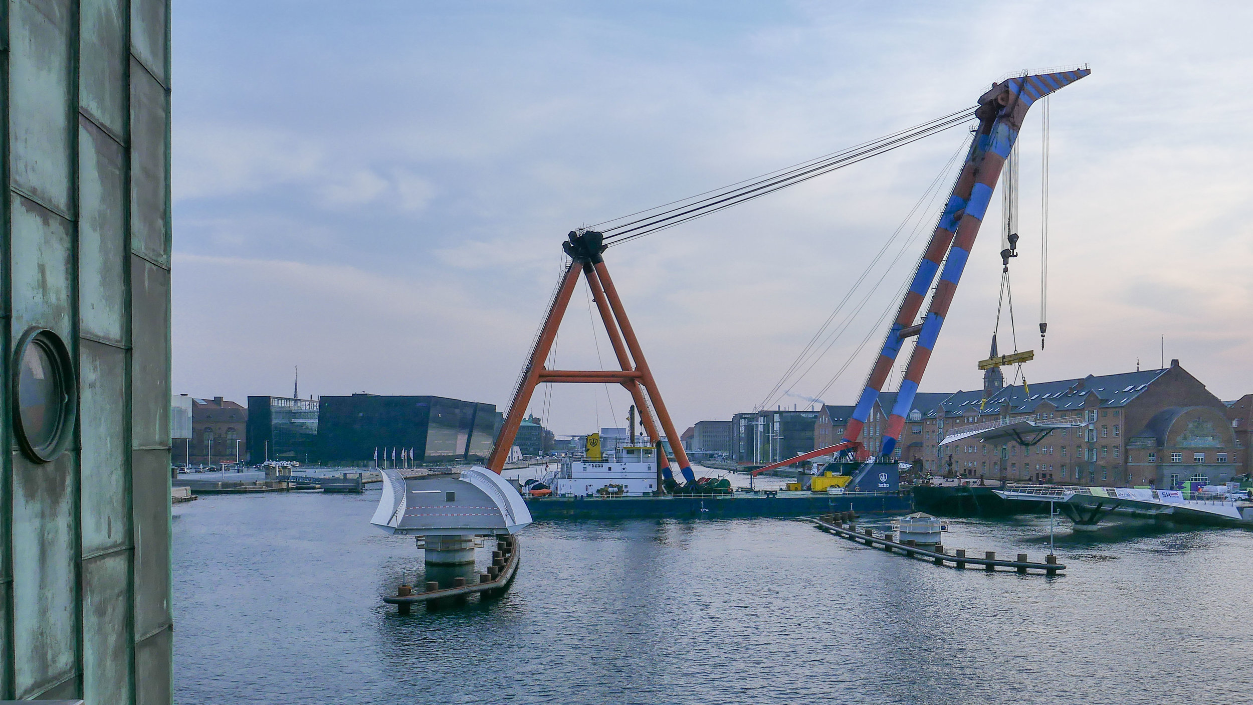
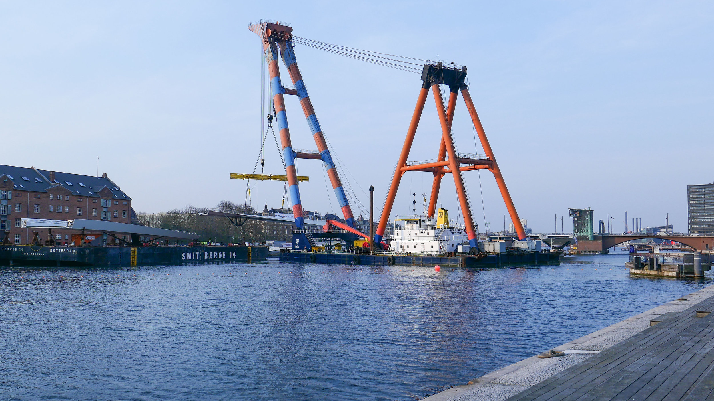
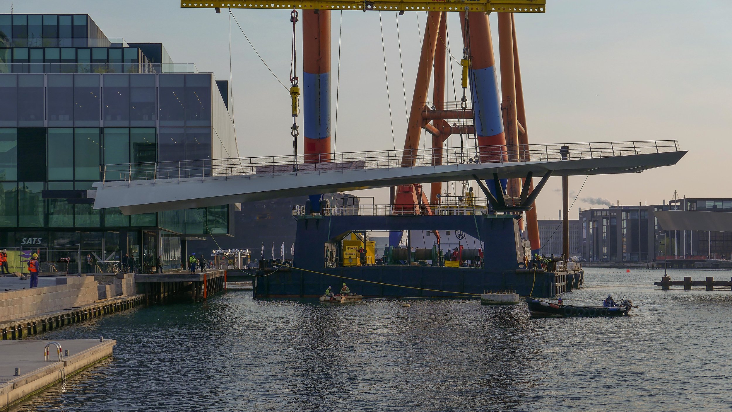
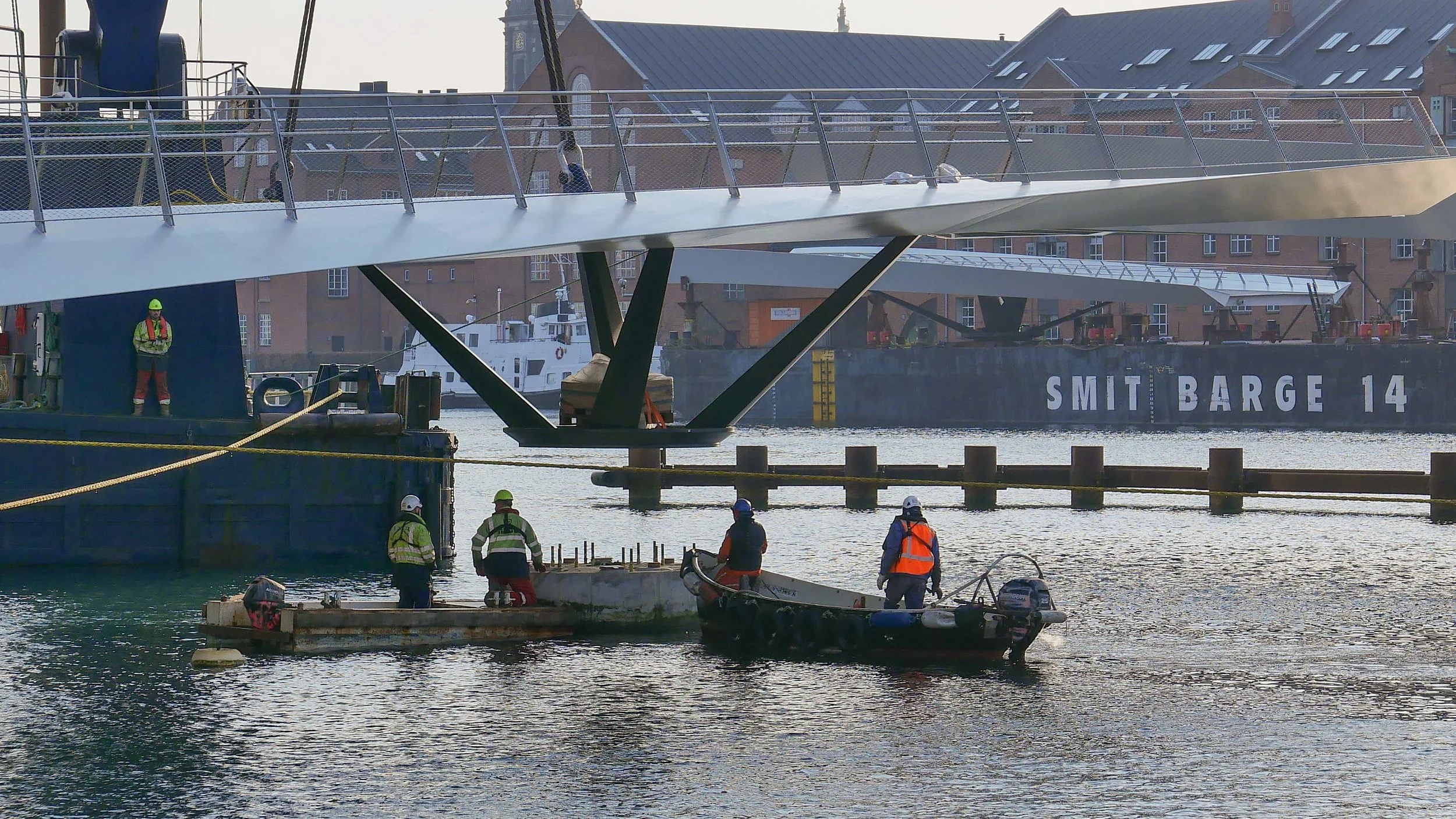
Inderhavnsbroen was designed by the English engineers Flint & Neill who are now a subsidiary of the Danish engineering group COWI.

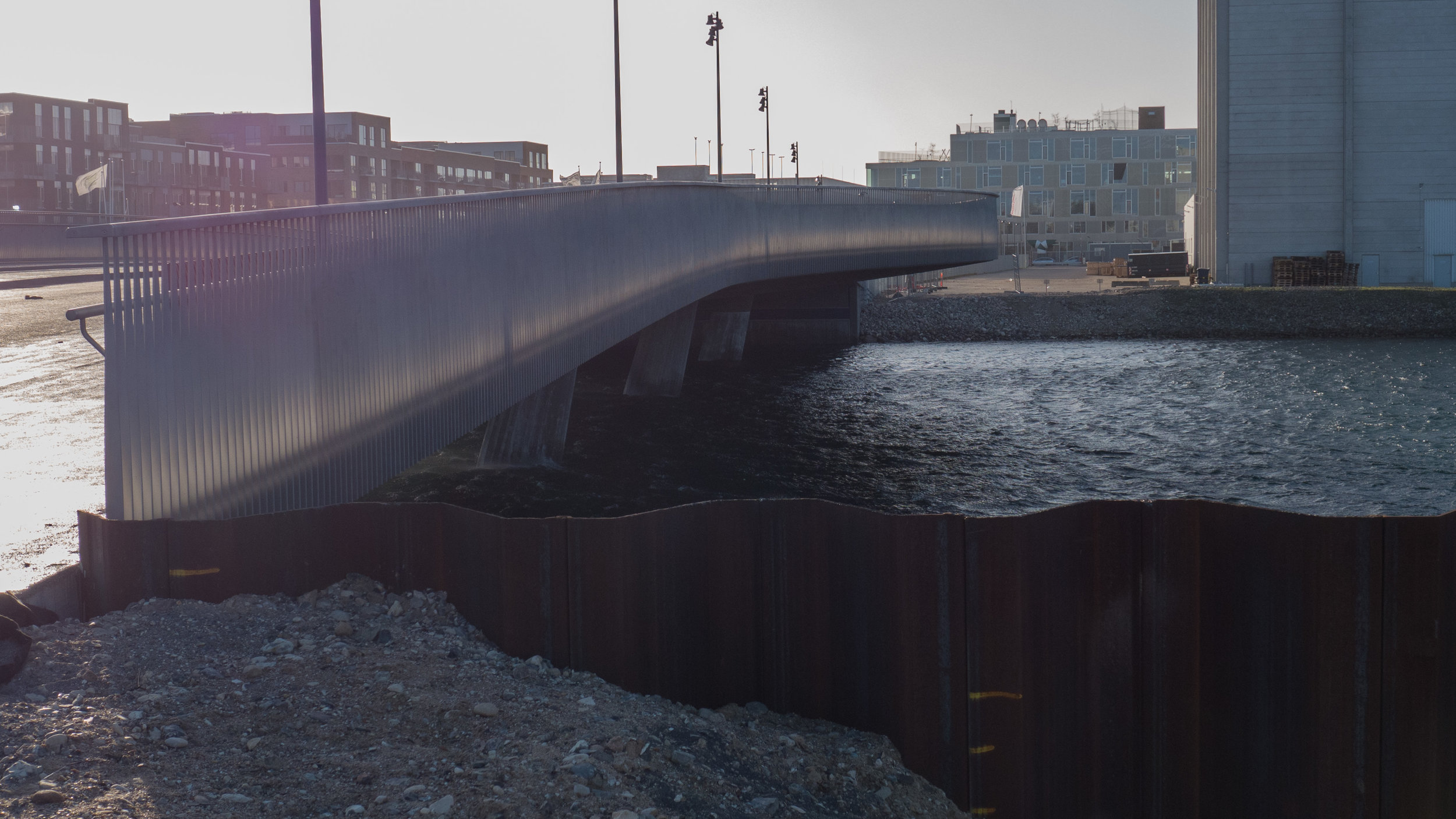
It has been nicknamed ‘the Kissing Bridge’ because of the unusual way that it opens and closes to let large ships move up and down the harbour.

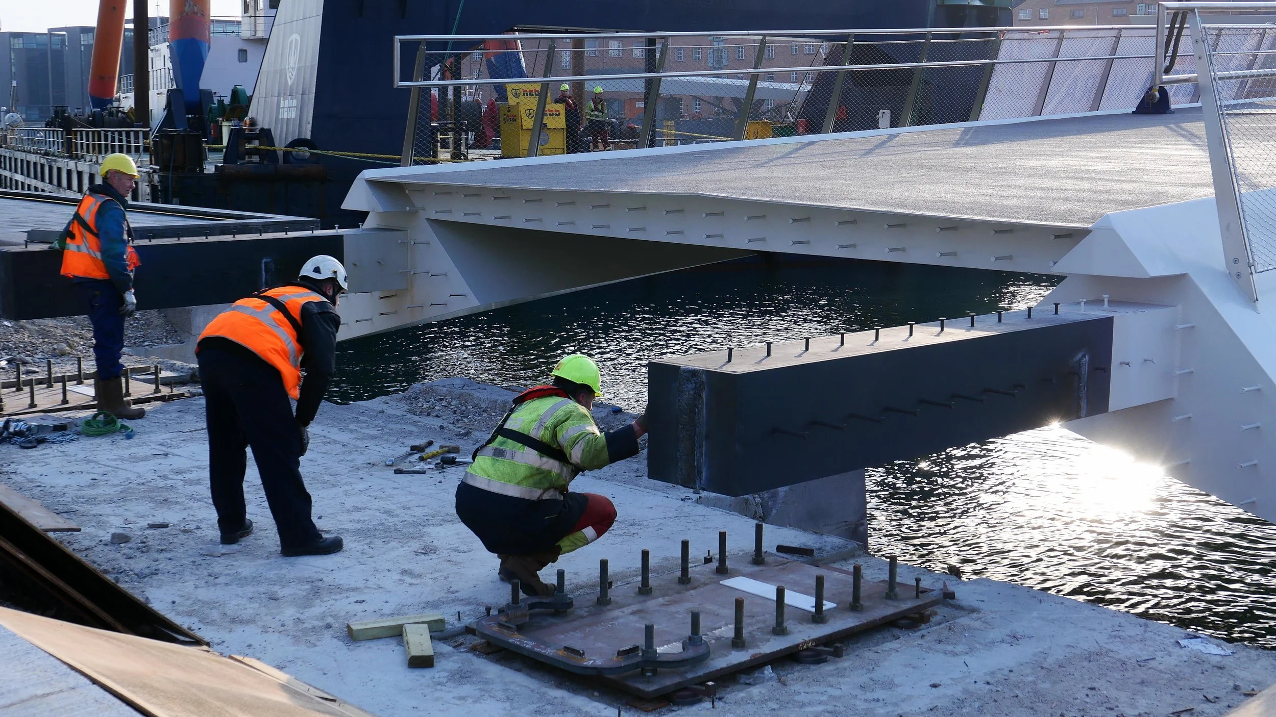
There are paired sections of bridge from either quay - rather like giant tuning forks with a viewing platform at each outer end where pedestrians can stand to watch shipping come through. The centre span is in two halves - cut across at the centre - so, when the bridge opens, the two halves slide apart on rollers, sliding back in between the prongs of the forks. When the bridge closes, the two halves slowly roll back to meet in the centre so kiss.

Compared with other bridges across the harbour, the Inner Harbour Bridge seems over engineered and over heavy … too complicated and cumbersome.

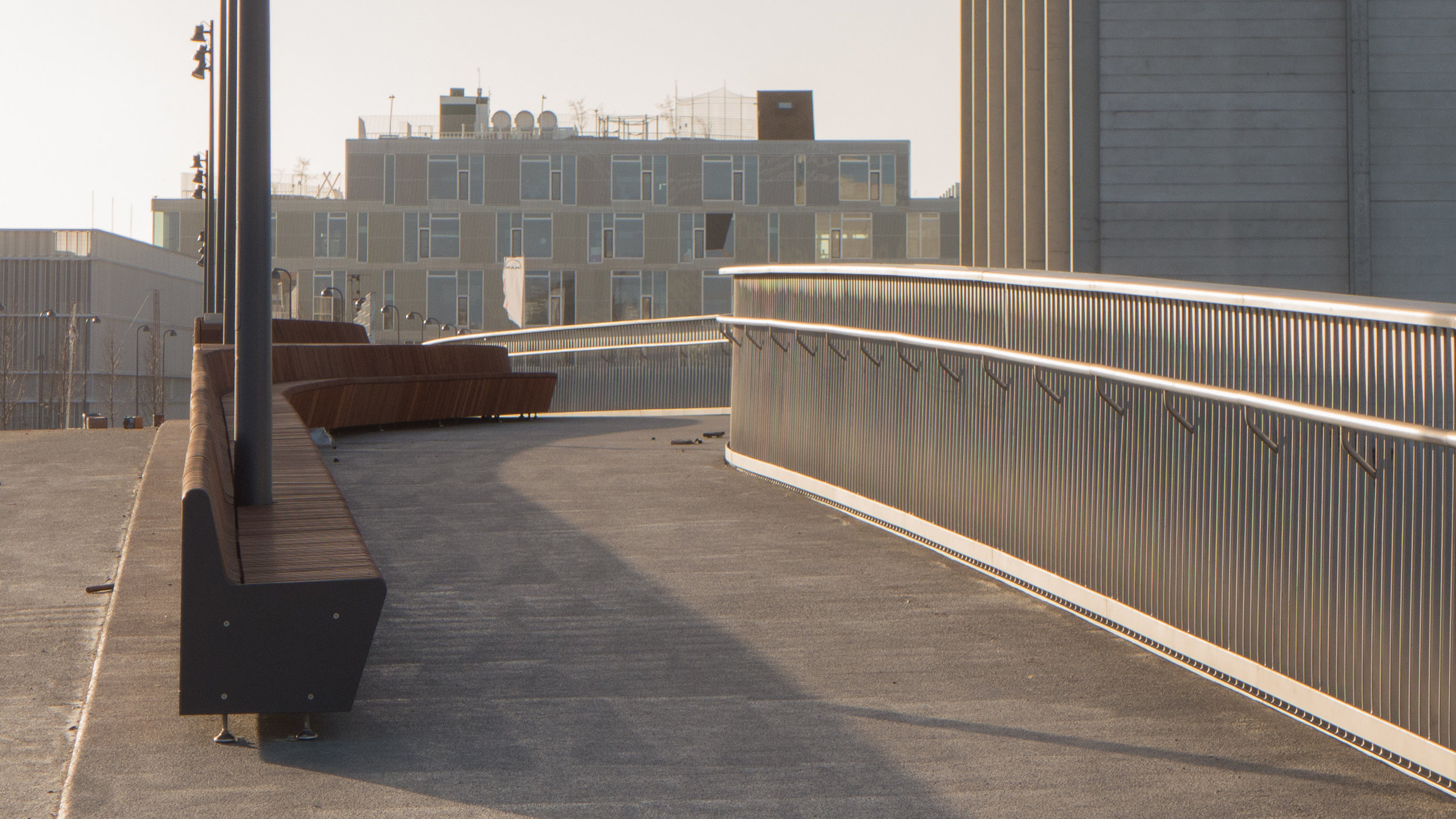
There are broad steps up onto the bridge for pedestrians and, at the centre, people walking are kept to the south side.

There are fairly narrow and fairly steep slopes up onto the bridge for cyclists and at the centre cyclists are kept to the north side with a relatively narrow lane in each direction. The problem is that the transition from the fixed section on either side to the central section is sharp and forms what is, in effect, a chicane and when the bridge is fully closed coming off the centre, cyclists have to do a quick turn first one way and then the other with a coloured glass barrier straight ahead. Cyclists have to get up speed to get up the slope of the bridge, to get to the centre, and then gain momentum coming down the other side and they tend to cut the angles so some have ended up hitting the glass at speed ... enough to crack the glass so that is quite a nasty accident.

It is not much easier for pedestrians. Many people walking over the bridge are tourists and they fail to appreciate just how quickly cyclists are moving. Walking from the city side, most pedestrians keep to the quay side of Nyhavn, rather than to the pavement immediately in front of the buildings, but that pavement is too narrow so people are forced to step out into the cycle lane and, at the bridge, they have to cross over the stream of fast-moving bikes to cut across to either a narrow slope up for people with push chairs or wheel chairs or further across to the steps up on the south side.

Even when they are safely on the south side of the bridge, there are problems because tourists want to stand on the north side to look up to the opera house and beyond and, again, fail to appreciate how quickly the cyclists are moving or see how little room there is for a cyclist to manoeuvre round pedestrians trying to get to the viewing platforms on the north side or, worse, pedestrians trying to stand at the centre against the railing on the north side to take photographs.

There are also problems with the way that cyclists and pedestrians approach the bridge .... so serious that major work is planned for this summer to change road markings and to reverse the direction of the one-way system for cars on the city side.

Now, cars drive north along Havnegade - along the quay - and then turn left into Nyhavn, which is one way, to get to either the Nyhavn bridge, where cars and bikes can turn left or right, or to drive on to the square at Kongens Nytorv.

Along that section, along the south quay of Nyhavn, there is a pavement against the buildings, then a cycle path heading east towards the bridge and then a line of parking bays before a single lane for vehicles heading in the direction of Kongens Nytorv with a cycle lane for cyclists heading in the same direction as the cars and finally the narrow pavement along the quay. That's basically 6 different sections - two footpaths, two cycle lanes, a car lane and a lane for parked cars and all within an overall width of about 14 metres. Add to that the fact that there have to be bins and seats and a payment point for boats moored at the quay and you can see that the layout is very tight.

In the new layout of lanes, the direction for cars will be reversed so they will go from the Nyhavn bridge towards the quay of the main harbour and bikes heading towards the bridge will occupy the same space rather than have a separate lane and the parking spaces will be moved inwards against the south pavement in front of the buildings.

Cycle lanes down from the bridge to Nyhavn will be more tightly marked with a turning lane for cyclists wanting to come down the bridge and turn down the main harbour and there will be an attempt to make all pedestrians cross from the edge of the Nyhavn quay towards the south pavement before crossing to the bridge and with an intermediate island between the cycle lane going west and the road and the bikes going east.

On the east or Christianshavn side of the bridge there are no vehicles in the mix but more distinct markings for the bike lanes will move the cyclists out to the north with a narrow island wth planting between the bikes going east and those going west and with marked lanes for bikes turning into and out of Strandgade.

Now there is an area for street food between the canal and the large brick warehouse - Nordatlantens Brygge - so the immediate problem will be to stop people with food and drinks trying to get to the edge of the water and the area that tends to keep in the sun. The use of this large triangular space in the future is uncertain, after new food halls open in the new development on Papirøen.

All this might seem to be incredibly complicated but, right now, the way that the bike lanes and foot paths up to and across the bridge are laid out do not work well and are potentially dangerous. It is an interesting design problem in trying to do something that in the end feels intuitive for cyclists and pedestrians and works smoothly without traffic lights.

The reality is that in Copenhagen bikes move fast and with a distinct purpose and pedestrians, particularly tourists, drift out onto the road and underestimate the speed of the bikes because they are looking around and looking at other things. Add to that the cars and vans trying to make deliveries and that is a lot to fit into a tight and crowded space.

Inderhavnsbroen from the south …. Havngade and then Nyhavn are to the left and on the right is Nordatlantens Brygge -the warehouse on the east or Christianshavn side of the harbour
the cranes are for the new apartments on Papirøen

the bridge from the east or Christianshavn side looking up Nyhavn towards Kongens Nytorv
below with the bridge open for a ship to come through

the massive piers supporting the bridge with the viewing platforms on either side …. the centre section rolls back between the viewing platforms when the bridge is opened

the bridge from the east with Nyhavn beyond

the approach to the bridge from the west - from the Nyhavn side

proposed changes to the road markings and the arrangement of the bike lanes on the west or city side of the bridge

proposed changes to the road markings and the arrangement of the bike lanes on the east or Christianshavn side of the bridge


Lille Langebro


The four sections of the new cycle and pedestrian bridge have arrived from the Netherlands on a gigantic barge and are being lifted into place … the work started yesterday and it looks as if all the sections will be in place today.

These photographs show what will be the first fixed section from the city side as it was taken off the barge by a huge floating crane and swung across the harbour and lowered into place to be guided down by engineers on the quayside by BLOX and engineers in two small boats by the pier in the harbour. The sections in place, in the photographs, are the first section from the Amager side and the part that swings open on the the city side - general views are photographed here from Langebro.

The bridge will be completed by late summer and then the opening and closing of the swing sections will be controlled from the bridge house on the existing road bridge.

just a couple of thoughts:
It was impressive watching all this play through so quietly and smoothly - sort of flat pack for the the real pro - and I guess they didn’t find there were bits missing when they unpacked it at this end.
More serious though is a rhetorical question …….
… this bridge is all about cycling, here in the city of bikes, but the cyclists are just shifting from one bridge to another. The numbers are pretty amazing - up to 40,000 cyclists are said to cross the harbour each day using the existing bridge - but will Lille Langebro encourage otherwise reluctant cyclists to abandon their car for a bike to travel between Amager and City Hall? It will be interesting to see figures for the bike traffic using the bridge over the next few years.
As new and very substantial infrastructure, this has to be a big debit on the carbon account.

earlier post
earlier thought

publication on Lille Langebro from Realdania

Alfred Nobels Bro

 
Alfreds Bro Map.jpg
 

A new harbour bridge, Alfred Nobels Bro, was opened in the middle of December.

In the south harbour, south-west of the centre, the bridge crosses Frederiksholmsløbet - a wide canal off the main harbour - and links Enghave Brygge and the area around the shopping centre of Fisketorvet - to the large area of new apartment buildings of Teglholmen.

The north side of the bridge is close to the power station H C Ørsted Værket and close to the site for a new metro station. Until the excavations and work for the metro are completed in 2023, the new bridge can only be used by cyclists and pedestrians but it will then take all vehicles.

This is the final link that completes the 13 kilometre circuit around the inner harbour for bikes and walkers and runners.

The canal here is 90 metres wide and the bridge deck is wide with two lanes for traffic at the centre; wide lanes for bikes on both sides and wide pavements. The pavement on the side looking inwards, down the canal, is bowed outwards and has a broad single bench, with its back hard against the road, 70 metres long and with a bowed shape that follows the plan of the bridge itself.

It's not clear why the bench faces down the canal rather than towards the open harbour unless the idea is that people will sit here to catch the last of the evening sun - an attempt to repeat the way that Dronning Louises Bro over the lakes to the west of the city is used as a popular place for people to sit in the evening before they head home from work.

The deck is supported on pairs of concrete columns that lean outwards but the structure is so large that it can hardly be called elegant and until the new apartment buildings are completed it really would be difficult to describe the views from the bridge as attractive.

The team behind the design of the bridge were COBE Architects, the engineers MOE, Arkil Holding A/S and G9 Landscape who made the mahogany bench.


Lille Langebro

Over the Summer, work has progressed on the new cycle and pedestrian bridge over the harbour. Substantial piles have been driven in on the Christianshavn side for the south approach to the bridge and shuttering is in place and the intermediate piers across the river are being constructed.

The bridge for bicycles and for pedestrians will link Langebrogade on the Christianshavn side to Christians Brygge on the city side and in plan will follow a gentle curve starting on the line of Langebrogade which is set at an angle as it approaches the harbour from the south but will align with Vester Voldgade on the city side. The harbour at this point is just under 150 metres wide and the bridge will rise to provide a clearance of 5.4 metres towards the middle so smaller boats can pass under but two sections will pivot apart to provide a clear passage 35 metres wide when open for higher vessels to move up and down the harbour.

The design is by the London architectural practice of WilkinsonEyre with the engineers Buro Happold and Urban Agency who have offices in Copenhagen and whose projects in the city include their work on the Kalvebod Wave close to the site of the new bridge but on the other side of Langebro.

In profile, as well as in it’s plan, drawing indicate that the new bridge will be rather more elegant than the new central harbour bridge … so closer in style to Bryggebroen - the bridge by Dissing + Weitling that was completed in 2006 to cross the harbour from Amager to the shopping centre of Fisketorvet on the city side.

WilkinsonEyre, on their internet site, state that they "love to make dynamic use of space, light and materials, focusing on proportions to create something memorable that lifts the spirits and has a logic and sense of place." 

The bridge deck will have edge beams with a triangular section and rather as with Belverderebroen these will change or ‘flex’ from horizontal at the quay to more upright at the centre - to provide a stronger sense of a parapet at the highest point - before dropping back as the bridge reaches the opposite shore. A section of the bridge was shown on site last summer but the Urban Agency site has a good sequence of drawings that shows how the cross section of the bridge alters towards the centre.

WilkinsonEyre

Urban Agency

illustrations from WilkinsonEyre and Urban Agency


map from the 19th century showing clearly the bastions and the water between the city and the gardens at Tivoli. H C Andersens Boulevard was built here in the late 19th century

the alignment of the new bridge on an aerial view from Google


view c.1860 before the wharves on the city side were constructed. The new bridge will be approximately on the line of the timber bridge shown here and Langebro bridge - completed in 1954 - is closer to the line of groins further out at what was then the entrance to the harbour

Langebro crossing the harbour from the city side to Amager Boulevard. The bridge designed by Kaj Gottlob was completed in 1954. The separate swing bridge for the railway has been demolished. Langebrogade, on the Christianshavn side of the city defences, is the road running away from the viewpoint top left in the photograph.

In terms of planning - both modern planning and the historic street plan - the new bridge is fascinating. The main bridge across the harbour until the 1950s - certainly in terms of traffic was Knippelsbro. There had been a bridge linking the historic centre of the city with Christianshavn in that location - give or take 20 metres - from the early 17th century.

Below, to the south of Knippelsbro, the harbour was actually much much wider than it is now, like a broad estuary although there had been long narrow timber bridges across linking the defences around the west side of the city with the fortifications around Christianshavn, so connecting Kalvebod Bastion on the city side to Rysensteen Bastion on the Amager side. 

Through the late 19th and early 20th century, the banks on either side at this south end of the harbour were altered, with quays and wharves constructed on both sides, that narrowed the channel, and there were a series of more important bridges, including rail bridges, at this point. 

As the defensive embankment around the city was removed - from the 1870s onwards - the water outside the embankment was filled in - apart from short sections that survive in the Tivoli gardens - and the new broad strip of newly drained and infilled land was built across with major new civic buildings including the city hall and the city hall square and on round towards the harbour - along what was then the new boulevard - were the Glyptotek and a number of city institutions so in the mid 1870s the bridge over the harbour was widened.

That was replaced by a swing bridge in 1903 but after the war, in the early 1950s, that bridge and an adjoining rail bridge were demolished. A temporary bridge had been constructed and then, in 1954, the present wide road bridge - Langebro - designed by Kaj Gottlob was completed. This took traffic from H C Andersens Boulevard not to Christianshavn but to Amager Boulevard, a major new road outside the defences.

The bridge has heavy use by road traffic- including up to 35,000 bikes crossing Langebro EACH DAY - so the new bridge is designed to encourage cyclists to take a separate route.

There has been extensive development lower down the harbour, with new apartment buildings on the Amager side below Islands Brygge, so the main approach ramp to the bridge on that side of the harbour will be turned in that direction although many from Christianshavn and from the east side of Amager also cycle into the city so the diagonal run of Langebrogade, inside the old defence works, should become a much more important cycle route.

On the city side of the new bridge, Vester Voldgade has been re landscaped to provide a safer and more attractive route into the centre with a wide bike lane for a way into the city centre that is parallel to H C Andersens Boulevard and will take cyclists directly to the City Hall Square and the new major metro interchange that will open there next year or it will give them a route on round to the central station where there are plans to rebuild and extend the cycle storage facilities there. 

You can see now how the integrated bicycle and metro and train systems are being linked together.


from Christianshavn with the new building, BLOX, to the right and in the distance, at the end of Vester Voldgade, the tower of City Hall. Shuttering is where the intermediate piers of the new bridge are being constructed.


from Langebro in May with BLOX to the left, the old sugar company building and Christianshavn to the right and Knippelsbro in the distance


engineering works for one of the piers of the new bridge photographed from the harbour ferry in August with the old sugar company building on the Christianshavn side 


Knippelsbro - KULTURTÅRNET


At the centre of the harbour is Knippelsbro - the bridge between the historic centre of the city and Christianshavn. There has been a bridge here since the early 17th century when houses and warehouses were first built on land claimed from the sea in what was then a wide stretch of open water between the walled settlement of Copenhagen and the island of Amager.

The present bridge was completed in 1937 - designed by Kaj Gottlob and built by Wright, Thomsen & Kier with Burmeister & Wain - an engineering company whose works were just to the west of the bridge and whose ship yards were then to the east at Refshaleøen.

Earlier bridges had been at the level of the quay so had to be raised for most shipping to pass and were relatively narrow. As the port expanded, traffic crossing over and passing under the bridge increased so the new bridge, with a deck well over 27 metres wide, meant there could be tram tracks in each direction down the centre, wide lanes for traffic and wide pavements and, set much higher, with long approach ramps on both sides, the bridge only had to be raised for the larger ships passing through to the quays where the National Library now stands and to a long line of quays along the Islands Brygge side.

With its two copper-clad towers on distinctive stone piers, set just out from the quays, the bridge is an iconic and perhaps the iconic feature of the inner harbour.

Those towers held control rooms and sleeping accommodation for the men who supervised and opened the bridge but with the decline in harbour traffic the bridge is now controlled from the tower on the city side and the tower on the south or Christianshavn side of the bridge has been redundant for many years. A long campaign of lobbying and a serious programme of restoration work has lead to the south tower reopening as a new cultural attraction in the city. Visitors can climb up to the upper viewing gallery for amazing views up and down the harbour and in the process appreciate the quality of the well-thought through and careful design of the tower itself … now restored as one of the major monuments in the city from the 1930s that can be seen in its original form.

Some facilities were upgraded, including the fitting out of a new kitchen, so the tower can be used for social and cultural events including as a venue for meetings and meals and there have even been a couple of jazz concerts.

For information - Kulturtårnet or email l.lyndgaard@gmail.com


Belvederebroen


A new bridge for cyclists and pedestrians was opened in the south harbour area of Copenhagen in October last year. 

Constructed over the Belvedere inlet - a narrow cut at the end of Frederiksholmsløbet - it connects Frederiks Brygge with Enghave Bryyge and completes a 13 kilometre circuit around the inner harbour for walkers, runners and cyclists and allows local cyclists to avoid heavy traffic on Vasbygade.

Designed by the architect SLA, this bridge is 25 metres long and is a generous width at 6 metres across. 

The sides or parapets are formed with large but thin tabs of steel that appear to have been folded upwards at different angles so they are close to vertical at the centre of the span but drop outwards and downwards in stages until they are almost horizontal towards the banks. It feels as if the bridge is open and welcoming as you approach and then gradually encloses you and protects you as you cross before opening out again as you reach the far side.

This folding is reminiscent of origami, of course, but it also looks a bit like the effect you get as pages of a book drop open.

There are three folds … the first just up from the bottom to form vertical at the bottom where the panel is attached to the side of the deck of the bridge so the next part is angled out. Then there is a fold up to form a vertical section that is more pronounced towards the centre and then, except on the outer tabs, a fold for a narrow almost horizontal section outwards to make what is, at the centre, the handrail of the bridge.

There is a striking contrast between the colour of the outside of the parapet in deep shiny iron-oxide red - rather like a Chinese lacquer red - and a matt grey inner surface and deck that is rubberised to reduce noise and provide better grip for bike tyres.

Sydhavnen - South Harbour - is an extensive area of new and ongoing redevelopment below HC Ørstedsværket - the power station at the south end of the harbour. The bridge is actually temporary and will only be here for about eighteen months before a permanent bridge - designed by the architectural practice COBE - is built to cross Frederiksholmsløbet to connect Enghave Brygge and Teglholmen.

SLA

a new bridge over the harbour

Work has just started on a new bridge over the harbour for cyclists and pedestrians that will curve across the water parallel to and north of Langebro to provide a new route from Christianshavn or Islands Brygge to the city centre so that cyclists can avoid the heavy road traffic of H C Andersens Boulevard by encouraging people to use the quieter road - Vester Voldgade - that runs parallel up to the city hall.

unnamed.jpg

Cirkelbroen


Last Saturday there was an official opening for the most recent bridge to be completed in Copenhagen … the Cirkelbroen that crosses the south end of Christianshavns Kanal where it re-enters the harbour opposite the Royal Library.

Cirkelbroen is part of a much wider plan to link together routes for cyclists to cross the harbour and for pedestrians to walk through Christianshavn and Holmen. Two new bike and pedestrian bridges opened on Holmen this summer. Another major bridge over the harbour for cyclists and pedestrians near the Skuespilhuset, the Royal Danish Theatre, is close to being finished and the construction of another bike bridge further south down the harbour has just been announced.

Last night, walking back from supper out, I cut around Christianshavn to see the finished bridge and to take photographs. Cirkelbroen was designed by the Olafur Eliasson Studio in Berlin and has a very unusual construction with a series of interlocking circles forming the bridge deck. These are supported by what look like a series of ships' masts and the circles will pivot apart to allow taller boats to leave or enter the canal from the main harbour.

Olafur Eliasson, the Icelandic/Danish artist, explained the form of the bridge in an interview published on the archdaily site and there are diagrams and videos on the artists own site show how the bridge opens.

“While working on the bridge, I remembered the fishing boats I saw as a child in Iceland. In the harbour, the boats were often moored right next to each other, and it sometimes seemed that you could even cross the harbour just by walking from boat to boat.”

“As many as 5,000 people will cross this bridge each day. I hope that these people will use Cirkelbroen as a meeting place, and that the zigzag design of the bridge will make them reduce their speed and take a break. To hesitate on our way is to engage in bodily thought. I see such introspection as an essential part of a vibrant city.”

When I visited Your Rainbow Panorama by Eliasson at ARoS in Aarhus I had expected children to be running around the circuit - the art gallery was packed out with school parties who were all really well behaved but even so … Then when I got up to the roof-top walkway I was amazed that people slowed right down, walking slowly, talking quietly, looking out over the city. It can’t always be like that but the calm and peace were impressive.

Equally, at Louisiana last summer with his Riverbed installation, I have rarely seen so many people quietly lost in thought as they walked slowly through the galleries. Amazing.

Last night I expected a tangle of cyclists and walkers - it is unusual for cyclists in Copenhagen to slow down for anything - but again people were standing around in small groups admiring the engineering, talking quietly, or leaning against the railing of the bridge to admire this new place to stop to look out over the harbour. Cyclists slowed down. Great. Long may it last.


Cykelslangen / The Cycle Snake

This is Cykelslangent or the Cycle Snake … the most recent bridge to open in Copenhagen.

Designed by the architectural practice Dissing+Weitling, it forms a crucial part of the rapidly expanding network of cycle routes around the city and forms an important link between the west and east sides of the harbour. 

Coming from the city side, the new bridge curves out and over one of the boat basins on the west or Havneholmen side and crosses in front of the Fisketorvet shopping centre, before linking with the older pedestrian and cycle bridge, the Brygge Broen or Brew Bridge, that crosses over the harbour itself and was completed in 2006.

That older bridge was also designed by Dissing+Weitling and is shown here from the west side looking towards the distinctive Gemini Residence - converted from grain silos that were originally part of a soy-bean-cake factory - but now with 84 apartments designed by MVDV / JJW Architects and completed in 2005.

The cycle route links the Vesterbro quarter of the city, immediately west of the main railway station, with extensive new blocks of apartments on the Islands Brygge side of the harbour and, beyond the apartment buildings, with the new part of the university, on the Amager campus.