cycle city copenhagen

It has been said many times and in many places that there are a lot of bikes in Copenhagen but, even so, it's worth repeating because there really is an amazing number of bikes in the city.

Certainly more bikes than there are cars but the statistics actually show that there are more bikes than people ... approximately five bikes for every four people.

Four out of ten Danes own a car but nine out of ten Danes own a bike and, in Copenhagen, around half of all journeys to work or to school or college are by bicycle.

Bikes first appeared on roads in the city in the late 19th century and by the 1920s and 1930s bikes had become a common and popular form of transport for ordinary people.

The city is relatively flat and, even now, Copenhagen is relatively compact so it is about 15 kilometres (or 9 miles) from Charlottenlund, in the north, to Ørestad or Kastrup on Amager in the south and 13 kilometres (or 8 miles) from Brøndby on the old western defences of the city to the beach on the Sound on the east side of Copenhagen.

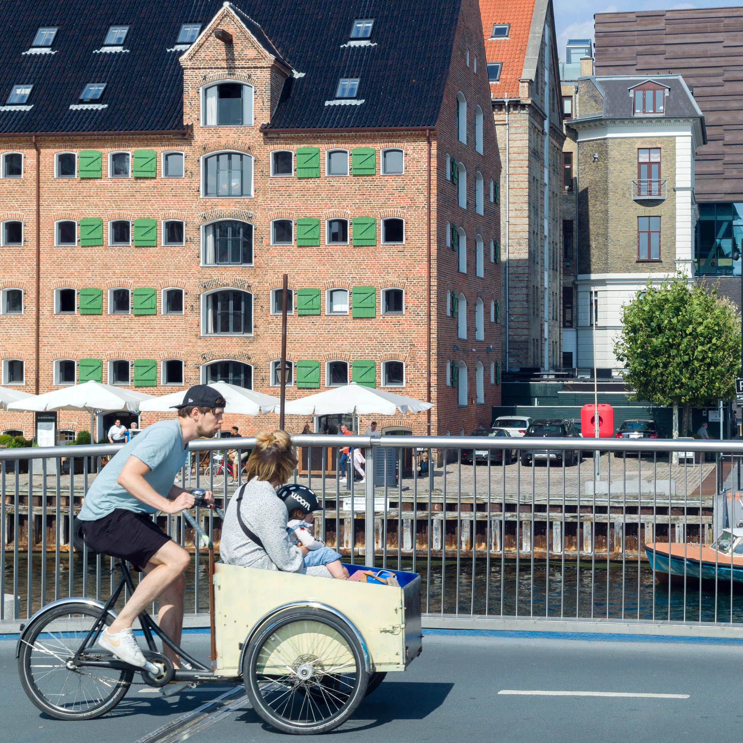
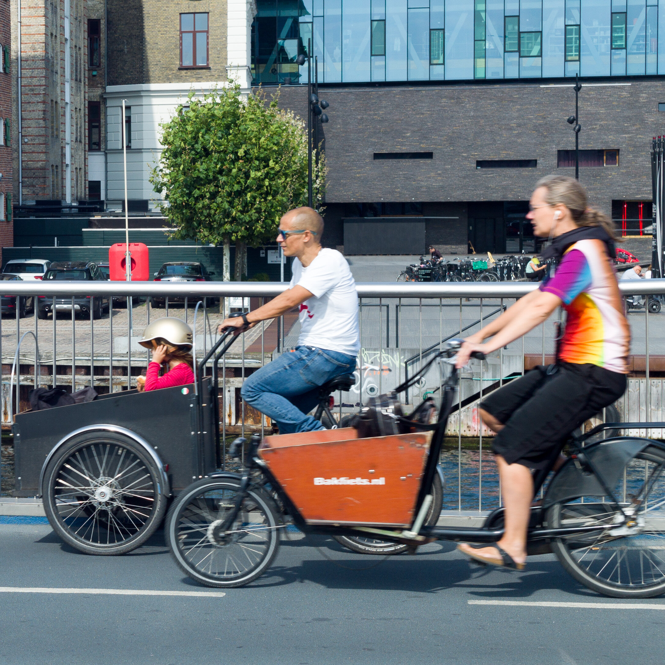
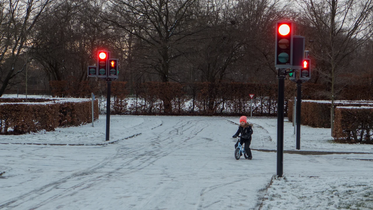
Children here learn to ride a bike when they are very, very young and many, from the age of seven, cycle to school alone. Teenagers, with several friends, are happy to pile onto a cargo bike to head out for the evening and everyday you see parents on bikes taking very small kids to nursery school or picking up a bike basket of food at the local shop. As many elderly people continue to use bicycles, they are clearly the popular choice for easy and cheap transport across all age groups.

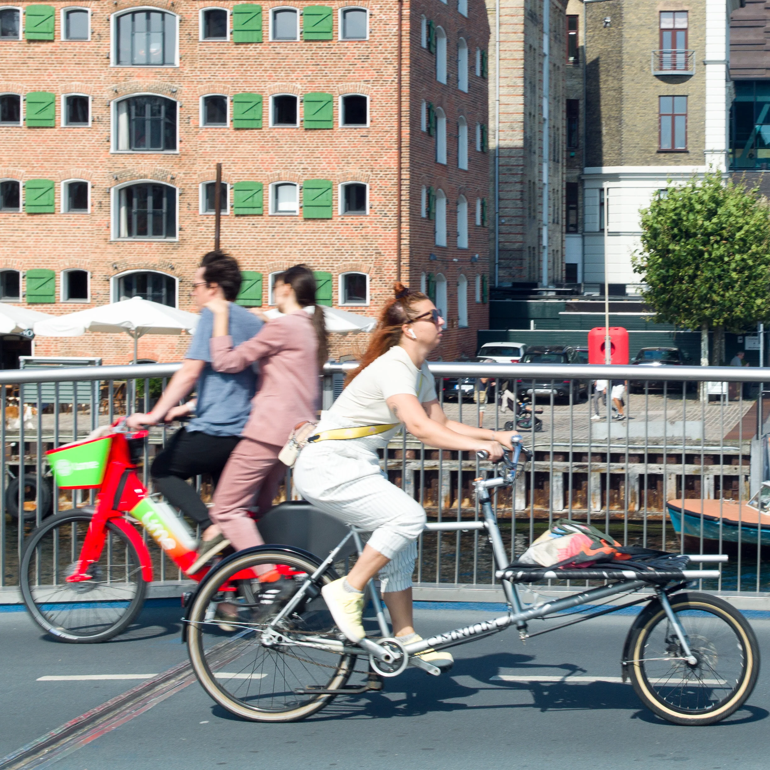
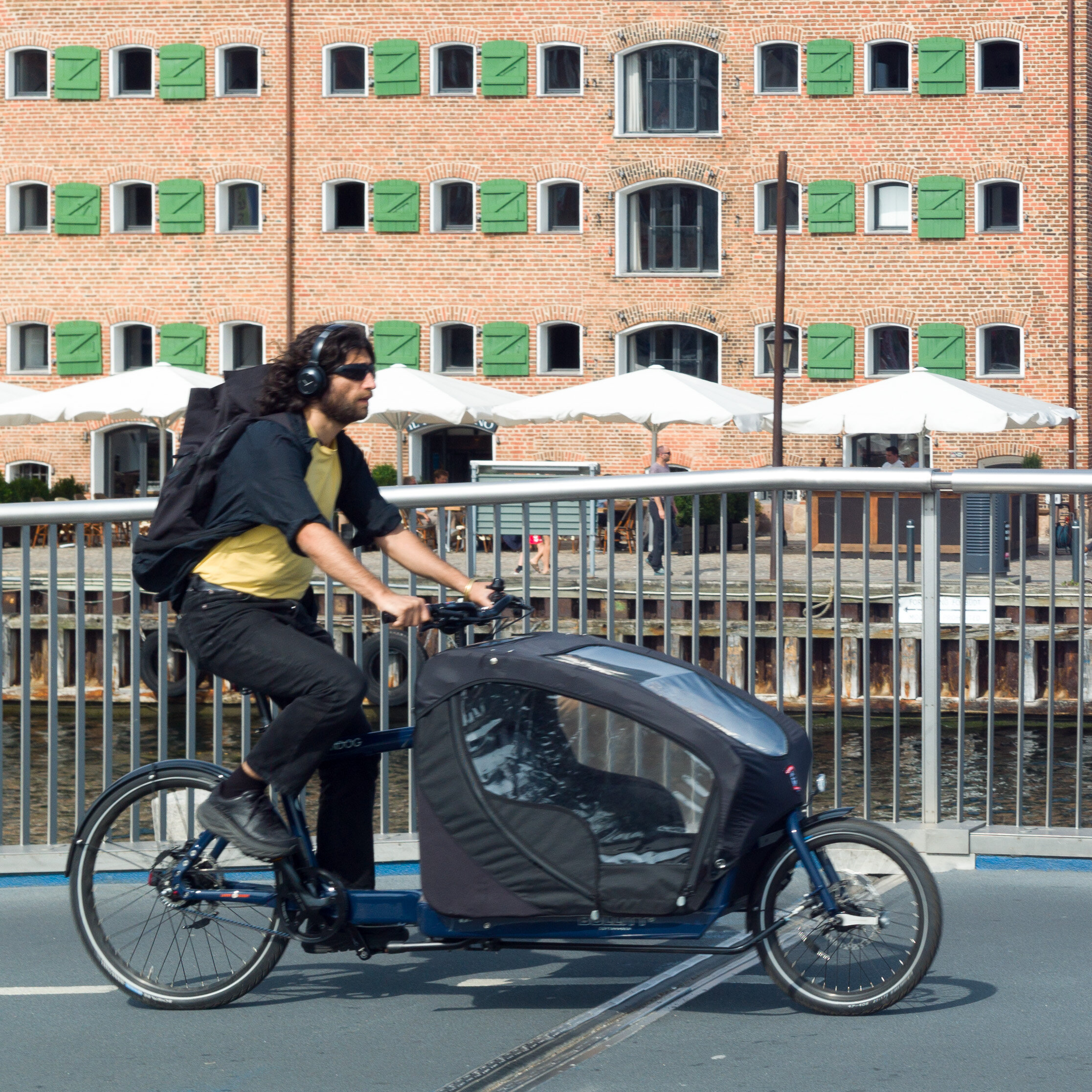
Bikes are not just used for practical everyday trips but at weekends you see whole families or large groups of friends heading out on trips and racing clubs and bike events, like triathlons, are incredibly popular both with participants but also with large crowds of spectators.

In the inner city, with its narrow cobbled streets, bikes can certainly be quicker and easier than using a car and if you think that finding a bike rack is a hassle then try to find a place to park a car.

If you live in an inner-city apartment building then finding on-street parking for a car is almost impossible but most courtyards have bike racks and, if push comes to shove, or if you have a much cherished and very expensive bike, then carrying the bike up into your entrance hall or up and out onto a balcony, if you have one, is an option.

Each year about 500,000 bikes are bought in Denmark with a population of 5.6 million and I presume most of those are upgrades rather than replacements for bikes that have been lost or stolen although, to be honest, dredging the canals and the harbour for discarded bikes is a well-organised annual event. 

Statistics taken from Cycling Embassy of Denmark
Bicycle statistics from Denmark

Nørrebrogade in the 1950s


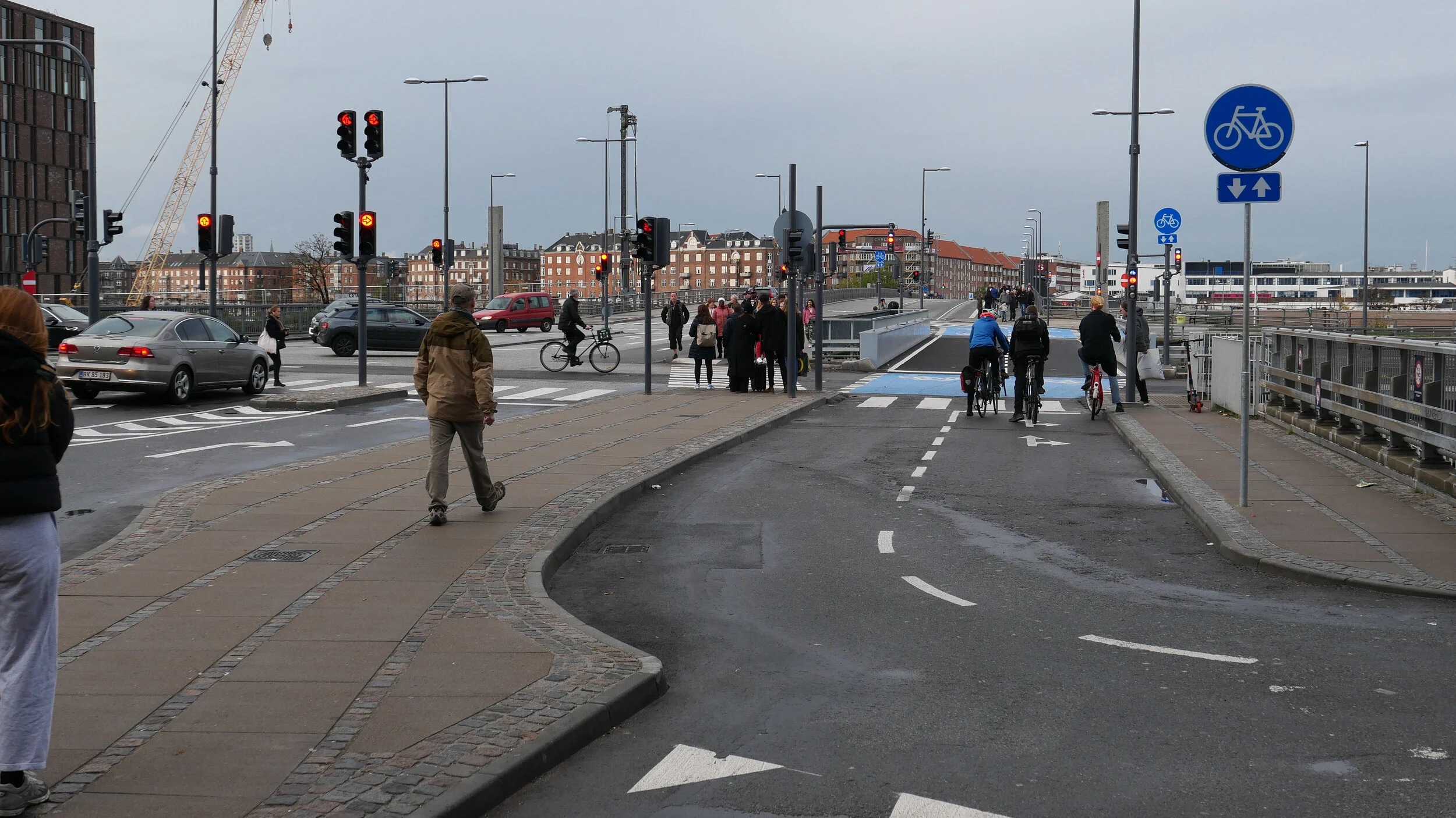
the bike lane on Vester Voldgade is well used but here, on this particular day, slightly less frantic than Nørrebrogade

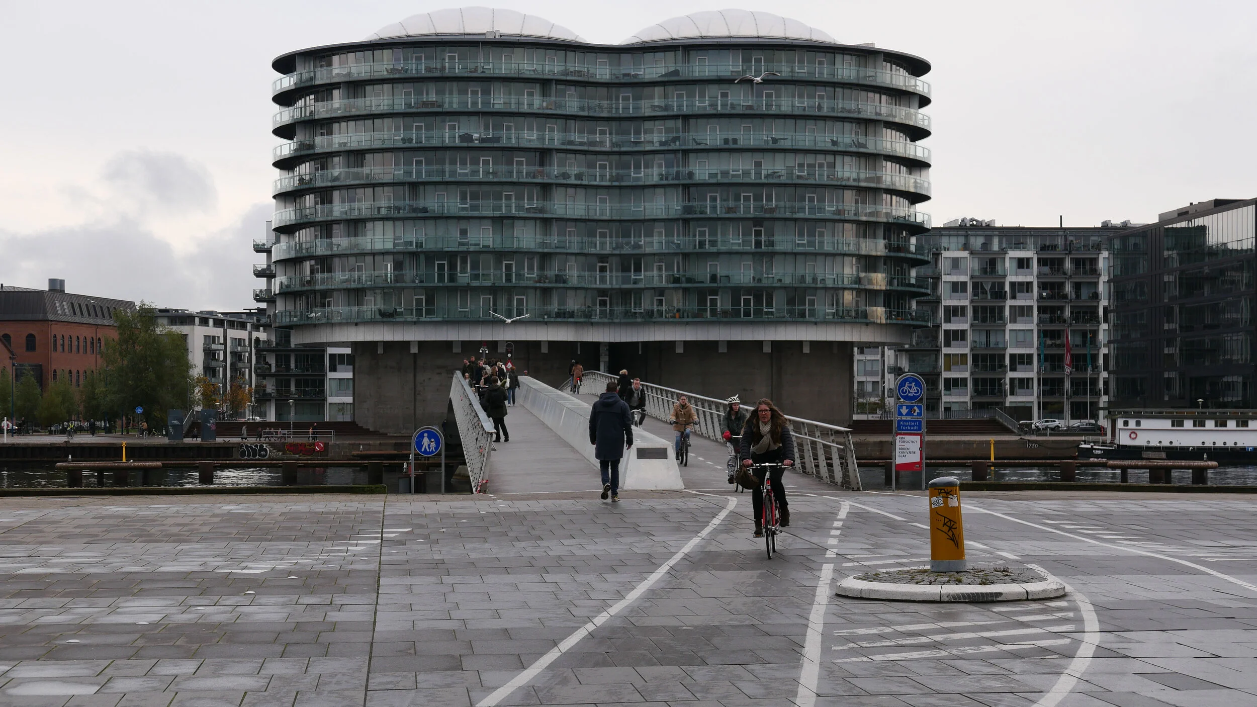
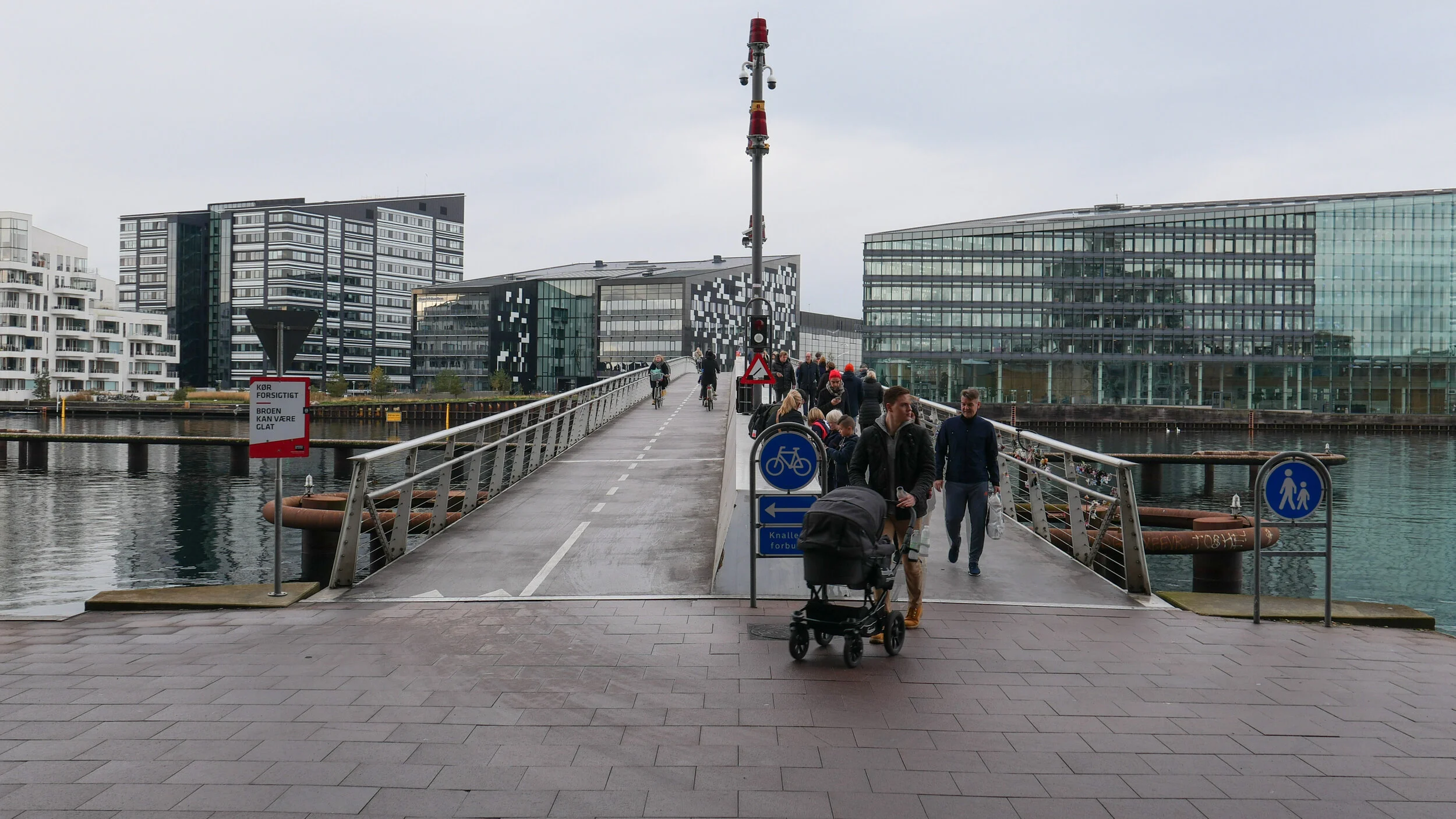
this is the route from Lille Langebro, the new bike and pedestrian bridge over the harbour, to Rådhuspladsen - the City Hall and the square in front of the city hall

Lille Langebro


Københavnerkortet / The Copenhagen Map

What makes cycling in the city easy and popular is the infrastructure for bikes ... that's the network of designated bike lanes along roads - to separate cyclists from other traffic - that makes being on a bike as safe as possible and there are also green bike lanes, with bikes segregated from vehicles, that make riding a bike fast, safe and a pleasure.

The first bike lane was laid out along Esplanaden, below the citadel, in 1892 so, this year, that's an astounding 130 years ago.

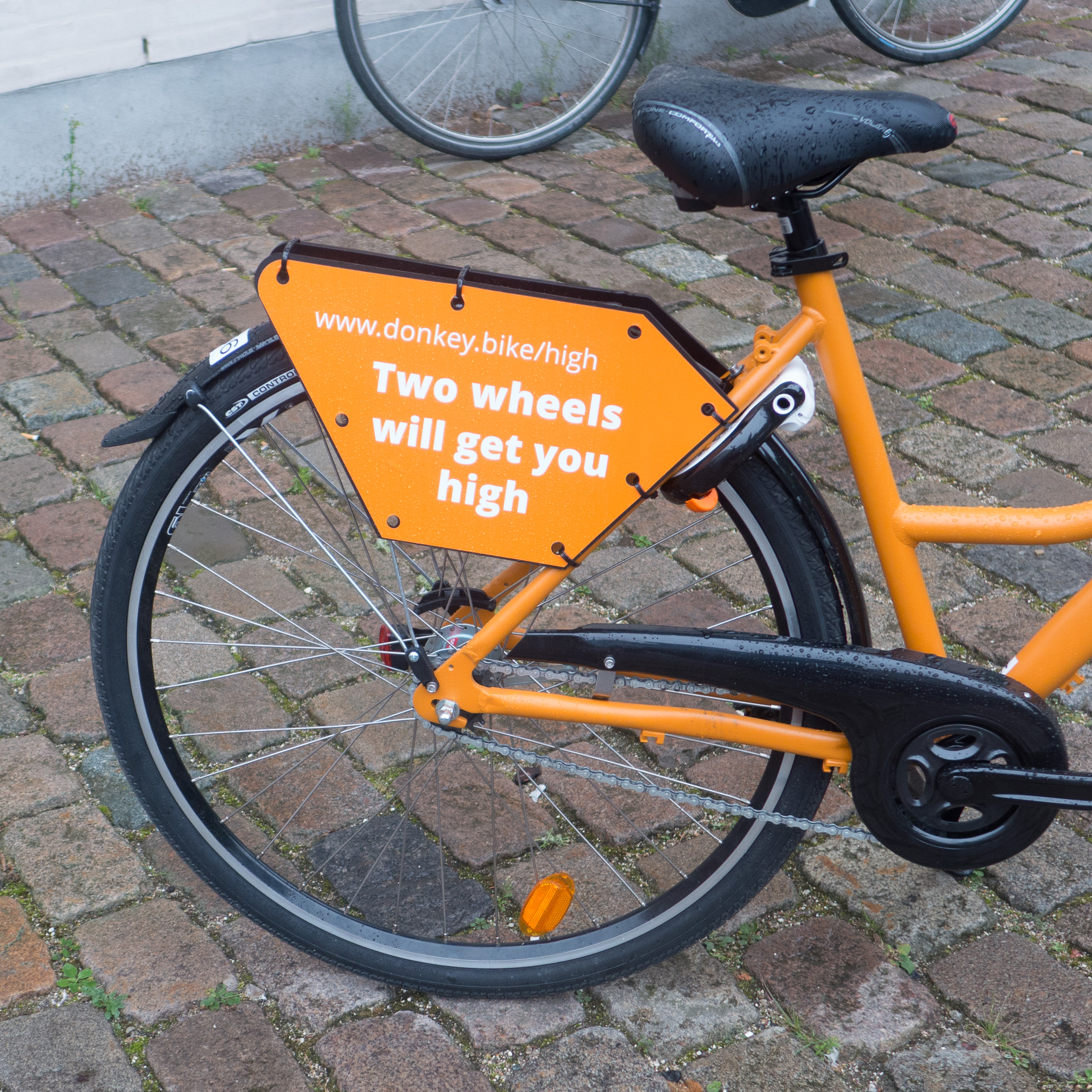
But, of course, there is also a win-win situation for cyclists where the more bikes that there are in the city then the more bike shops and bike repair shops there are and the more enthusiasts and the more bike makers there are and the more chance there is to find exactly the right bike for you.

Perhaps, the only serious problem for cyclists in the city is finding somewhere to leave a bike while you are at work or shopping or when you're out for the evening.

For people commuting every day, cyclists who have lived much of their lives or all their lives in the city, they know exactly where they are going and how they are getting there. That is why cyclists here move fast and get frustrated with tourists or pedestrians who drift around on bike lanes or dither and saunter across at pedestrian crossings .... but, even if you know the city well, keeping track of new bike lanes or plotting a route out to a new place can be a bit of a problem.

I have been meaning to post about Københavnerkortet - The Copenhagen Map - that is an amazing on-line resource.

It's a dynamic map site that is great for planning analysis but you can select features such as bike lanes with bike parking and zoom in or out and turn and save jpg images or even print out maps. It's a great way to understand an area that is new to you or to plan a bike trip out.

Københavnerkortet


bike racks at Nørreport on the north edge of the historic centre … a major transport interchange with local buses, a metro station and the busiest train station in the country with suburban and inter-city trains


cycle routes across the city with “existing bike path” in maroon and planned bike paths dotted

A “Green Bicycle Route” is marked in green, appropriately, and you can also find the location of racks for City Bikes - the rental bikes - and find bike racks

bike lanes are getting wider .... they are generally 2.3 metres wide, so two people can ride side by side, but the most recent lanes in Copenhagen have set a new standard being 2.8 metres wide which means that a fast-moving cyclist can get past a cargo bike or two cyclists side by side without moving out into car traffic.

it has been shown that when a new bicycle lane is constructed, bike traffic on the road increases by between 10% and 20%

cycle lanes around the historic centre with bike racks … with narrow cobbled streets in the centre of the city, there are very few designated bike lanes although recommended routes are marked

coming into the city there are fast bike lanes into the centre from the north east along Store Kongensgade and out of the city along Bredgade, and from the harbour and the south part of the city to the city hall along Vester Voldgade.

new, better, cycle-friendly lanes are being laid out from Nørreport down Nørregade and, further out, recent road works have improved the bike lanes and road markings on Østerbrogade and along the city end of Amagerbrogade

bikes are given priority or separate time intervals for crossing at busy junctions with traffic lights and blue lanes across junctions are used both to mark clear routes for bikes and to warn drivers in cards and vans and lorries of the danger if they are turning across lanes where bikes have priority


cargo bikes

Yesterday, there was an interesting article in The Guardian about using cargo bikes rather than vans for deliveries in urban areas.

It was prompted by the recent publication of a report on the benefit of using cargo bikes in London that was compiled by Ersilia Verlinghieri, Irena Itova, Nicolas Collignon and Rachel Aldred, and has been published by Possible - a UK based climate charity that is working towards a zero carbon society.

The article summarised important key conclusions from the report:

  • electric cargo bikes can deliver parcels faster than vans in a city centre - some 60% faster … cargo bikes can drop off, on average, 10 parcels in an hour to six parcels by a van driver

  • a delivery bike can pick up and deliver by tighter routes - taking more short cuts - and bikes can often cut around traffic congestion

  • delivery bikes can usually get closer, door to door, and waste less time trying to find somewhere to park

  • even with a power-assisted bike, there are considerable reductions in emissions and pollution

Research for the report included an assessment of routes used by the delivery service Pedal Me with deliveries from 100 random days over a season analysed and then compared with calculations of the equivalent mileage and time that vans would have clocked up.

For that sample alone, over just 100 days, cargo bikes saved four tonnes of CO2.

The conclusion was that "with the 100,000 cargo bikes introduced in Europe between 2018 and 2020 they are estimated to be saving, each month, the same amount of CO2 needed to fly about 24,000 people from London to New York and back."

I presume the conclusion was not that if there were more delivery bikes then more travellers could make more trips to New York because that really would be a particularly perverse form of carbon offset.

The important conclusion of the report was that "estimates from Europe suggest that up to 51% of all freight journeys in cities could be replaced by cargo bikes."

These photographs were taken on the inner harbour bridge and I thought that was a clever idea … most cyclists in the city move fast and the idea was that the slope, on the run up to the bridge, would slow them down a bit but I’d underestimated just how fit and fast the local cyclists are.

So it’s not my finest set of photos.

For a start, I should have set a wider aperture and shallower depth of field but then I’m more used to taking photographs of buildings and chairs that do not move.

And it was frustrating because, as I walked up to the bridge, three girls, dressed in their best, came past in the box of a Christiania that was decked out in pink ribbons and flowers on the way to a hen party and, as I headed for home, a bike came past with a second-hand Arne Jacobsen Swan Chair strapped to the front and I missed that too.

If I have time, I might have a second go at this and will update the gallery.


The report has some useful graphics with one (reproduced above) showing different types of cargo bike with possible loads and average widths .... a crucial consideration for planning departments when upgrading busy cycle routes that may need wider lanes and wider spacing for any bollards that are there to deter or block access by motor vehicles.

Replacing just 10% of motorised deliveries in London could save “133,300 tonnes of CO2 and 190.4 thousand Kg of NOx a year” and "would reduce urban congestion and free a total of 384,000 square metres of public space usually occupied by parked vans and 16,980 hours of vehicle traffic per day."

By 2019, there were 4.1 million vans registered in the UK with 58% of all vans owned by a business but 46% of the kilometres covered by van deliveries are in urban areas and a Department for Transport survey shows a proportion of daily journeys - 39% of those collecting or delivering goods and 43% of vans delivering materials - were no further than 25 kms from their home base and that makes more deliveries by cargo bike feasible.

Cargo bikes deliver faster and cleaner than vans, study finds,
by Damian Carrington, The Guardian Thursday 5 Aug 2021
Possible
The Promise of Low-Carbon Freight: Benefits of cargo bikes in London


new cycle lanes at Dybbølsbro

New and very wide cycle lanes have been added between two existing bridges that cross the main railway close to Dybbølsbro railway station. The work was completed at the end of October but there have been a few problems.

Not structural problems but working out how to deal with very large numbers of cyclists and how to separate out vehicles, pedestrians and bikes.

The work has meant extensive alterations to the existing bridges … one bridge with a road for traffic in both directions and an outer footpath and also bikes heading away from the city centre and, to its east, a separate narrow bridge for pedestrians and a lane for bikes heading into the city with a gap between the two bridges.

That arrangement could no longer cope with the rapidly growing number of pedestrians and cyclists crossing over the railway.

A large new area of housing at the south harbour, below Fisketorvet, means more and more people use the route over the railway to get to Vesterbro and from there to the central railway station and beyond that to the city centre. In addition, the construction of extensive developments of housing and apartments along the harbour on the Amager side, in Havnestad and Bryggen Syd, are now being completed so, again, this has meant a growing number of cyclists using Dybbølsbro to reach the city.

The remodelled bridge is not complicated in itself, being a straight run of just over 300 metres between the area of Vesterbro and a shopping centre called Fisketorvet and from there, by way of two relatively new bridges that cross the harbour, cyclists can get across the harbour to Amager.

Fisketorvet, the shopping centre, is about to undergo major remodelling to add outward-facing shops around the outside of present covered shopping mall and that work will coincide with the completion of a new metro link with a new metro station at the south end of the shopping centre. There is to be a new inner-city IKEA along a narrow plot of land between the railway and Kalvebod Brygge and, in addition, a new bus station is planned for a narrow strip of land along the railway below the bridge on the harbour side.

Added to all this is the unusual topography and what appears to be an ad hoc approach to planning in this area in the middle of the 20th century so the problems are compounded.

The main railway line that heads into the central station to the east is in a deep cutting with the main platforms of the Dybbølsbro station reached by separate staircases down from the east pavement of the bridge. In fact, this is not a cutting down for the railway but a massive building up of infill on either side because the railway must be close to the level of the sea bed in a wide bay here through to the late 19th century. 

The original line of the beach was along what is now Sønder Boulevard so over 700 metres back from the current quay of the harbour.

The first railway line into Copenhagen, built in the 1840s, followed the beach and then, through the last decades of the 19th century, new wharves, a meat market and gas works were constructed on new land claimed from the bay beyond the railway. The main rail lines were moved outwards, to the present course, with engine works to the west and with a dock road - Kalvebod Brygge - beyond. Then further new wharves and smaller boat yards and industrial buildings on down beyond a power station built in the 1930s below the site of what is now Fisketorvet.

Fisketorvet was the site of the main Copenhagen fish market from 1958 until 1999 - hence the name of the the shopping centre built on the site. Docks and wharves here and on the Amager side, along Islands Brygge, were busy through the 1950s and 1960s but then began a relatively rapid decline and that released the land for massive areas of new housing with some as close as a kilometre but none further than 3 kilometres from the central railway station.

It is the massive increase in the number of people living around the south harbour that explains why there are now more and more cyclists crossing Dybbølsbro.

looking from the south towards Vesterbro with the new cycle lanes


Dybbolsbro.jpg
 

view from Google Earth that shows the previous arrangement with two bridge over the main railway at Dybbølsbro
- the gap between the two parts is now a 10 metre wide cycle route with lanes in both direction

But coping with the massive numbers of cyclists is not a simple problem.

The previous arrangement at Dybbølsbro had two bridges with a gap between them. The narrower east bridge had a single direction cycle way for bikes heading towards Vesterbro and a relatively narrow pavement on the city side with the steps down to the station platform so it was very busy for most of the day. The wider bridge to the west had a road with cars going in both directions and, on the outside or west side, a cycle track for bikes heading south from Vesterbro to Fisketorvet and Amager.

Add to this four busy roads with bike and car traffic converging on the north end of the bridge and, at the south end, slip roads up from Kalvebod Brygge for cars heading to Veterbro or for cars wanting to drop off people or pick up people from a tight round-a-bout in front of the main entrance to the shopping centre.

Then, finally, the planners had to take into account the cyclists who regularly use the bridges. A new bridge for pedestrians and cyclists was built over the harbour between Amager and Fisketorvet in 2006 and this has a straight and wide lane for bikes separated from the pedestrian side by a high solid spine so bikes can move quickly but safely over the bridge. Then, in 2014, a new bridge just for bikes - Cykelslangen or Cycle Snake - was built to take them from the front of the shopping centre and in high sweeping curves above the water of part of the harbour and a swimming pool to the bridge over the harbour. Those banked and sweeping curves have meant that cyclists get up quite a speed and maintain that all the way across.

The solution for Dybbølsbro was to fill in the gap between the bridges. The outer west side of the old bridge is now a foot path and the east path, formerly for bikes, is now for pedestrians but the real gain is 10 metres in the middle for the widest cycle track in the city with bikes going in both directions. That is not the problem. The problem is, in part, the number of bikes and, in part, the speed of the bikes …. although that’s fair enough when you find out just how far some cyclists ride on their commute. Then add the very complicated junctions at each end with cars, pedestrians and bikes crossing and recrossing each others lanes.

1 the turning circle in front of the entrance to the shopping centre looking north to the bridge
2 crossing over Kalvebod Brygge
3 the bikes in the foreground have just come over the harbour heading to Dybbølsbro


In the last two months there have been several changes to lane markings and an unusually bewildering number of new road signs have appeared and it is still not right.

Maybe it needs fewer signs and simpler bold road markings or possibly no road markings.

At the Amager side of the harbour bridge there are bikes coming in from all directions; bikes coming over the bridge fast and pedestrians crossing backwards and forwards to get to the harbour ferry that has a stop close to the east side of the bridge on the Amager side and as long as no one dawdles and no one dithers and changes their mind then there don’t seem to be any accidents. 


looking across Bryggebroen - the bridge over the harbour - towards Amager from the Fisketorvet side

from the Amager side - the view over Bryggebroen - the harbour bridge - looking towards Fisketorvet

the way to Islands Brygge from the harbour bridge on the Amager side


Donkey bikes


I guess I spend too much time looking up at buildings as I walk around Copenhagen and don’t give enough attention to things on the pavement because I have only just noticed these bright orange hire bikes from Donkey Republic that have appeared around the city. Actually, I only noticed these ones because a clutch of three were left near the front of the apartment. Is there a collective term for bikes? Presumably not a fleet ... like for cars when they are for hire.

The design of their web page is pretty good with clear instructions for how to set up a hire and unlock the bikes, some advice about rules for riding a bike in the city and some good recommendations for places to visit but I was a bit curious about the text on the bike carriers. Several Danish friends have told me that they don’t understand English puns … or rather their grasp of the meaning of the words is spot on … it's just that they can’t understand why the English find puns quite so funny. But then I suspect that these are aimed at tourists and visitors and not so much the locals. 

Looking at the map on the Donkey app this evening one bike seems to have got as far as the airport and another to Ballerup so if I’m bored I might keep tracking that one to see if it is heading for the west coast.

Donkey Republic


you can now cycle ... or run ... around the harbour in Copenhagen

the information panel at Nyhavn


on the far side of Inderhavnsbroen looking across to Paper Island


With the opening of Belvederebroen at the south end of the harbour at the end of last year … along with Cirkelbroen or Circle Bridge designed by Olafur Eliasson that opened in August 2015 to cross the canal on the Amager side of the harbour and the Inderhavnsbroen that opened in July 2016 to link across the harbour between Nyhavn and Holmen … it is now possible to bike, run or walk around the harbour in Copenhagen. 

The complete circuit is 13 kilometres although shorter loops around smaller chunks using the older bridges at Knippelsbro or Langebro or by crossing over Bryggebroen - the bridge at Fisketorvet - there are shorter circuits of two or four or seven kilometres.

At intervals there are distinct signs in dark blue … appropriately close to the paint colour called Copenhagen Blue. Each post is at a key point on the route and they give, in Danish and in English, a short description of the immediate area and its history. If I was running the circuit I’d probably be using the sign for support as a tried to regain my breath … well beyond taking in the information but trying to pretend I was doing a few stretches before lurching off on the next section. My guess would be that most Danes running and certainly all Danes on bikes are going much too fast to read anything as they dash by.

These signs also have a map that shows the route and the stops of the harbour ferry - the Havnebus - if you feel like seeing the harbour from the water. But what is interesting, and more important, is that the maps mark the dedicated cycle routes into and across the city. This tells you something significant about the planning policy in Copenhagen … there is a historic core where transport has to be co-ordinated and there is the well-known and well-established and coherent policy to encourage cycling rather than car use but, more than that, the cycle routes and the harbour circuit are about linking the city together, to make places accessible to everyone so this circuit is about much more than the regeneration of the docks.

A map of the harbour can be downloaded if you want to plan your route but why not live dangerously and just go for it ... follow the signs ... you could end up back where you started ... or somewhere you hadn't planned to end up ... so much more interesting.

down by Belvederebroen

265,700 bikes in Copenhagen and counting

Cars in Copenhagen are now outnumbered by bikes … it must be official because it was in a recent article in the Guardian.

Someone has calculated that 35,080 bikes have been added to the total this year alone so that means that there are 252,600 cars in the city and 265,700 bikes and half of them are at Nørreport railway station.


Two-wheel takeover: bikes outnumber cars for the first time in Copenhagen, Athlyn Cathcart-Keays, Guardian, Wednesday 30 November 2016

Bike City Copenhagen

Trafiklegepladsen in Copenhagen

Writing about Blinkenbikes I mentioned Trafiklegepladsen. It’s on the edge of a large park called Fælledparken on the north side of Copenhagen and is close to the main football stadium. It’s laid out with an extensive and fairly complex arrangement of roads with round-a-bouts and crossings and traffic lights but all scaled down and it is where Copenhagen children learn about riding on roads. There are classes there but there seems to be open access most of the time so you see parents with their kids at weekends and in all sorts of weather.

A new building was completed last year at the entrance that was designed by the architecture practice MLRP with toilets and large areas under cover that can be opened up by folding back doorways for teaching and repair spaces and there are stores for go karts. The area also has picnic tables, play equipment and fun things like vertical rotating brushes of a car wash though I’m sure most parents are relieved to find there is no water.


I liked the idea that clearly the little boy was teaching his dad to use a scooter.

Just after I took the photo of the little girl in a pink hat I had to leap for the pavement as she came racing past. Admittedly she had the green light at the cross roads and the little man on the crossing light was on red and my Danish is not up to arguing the point that actually she was on the wrong side of the road ... better to just get out of the way when a Copenhagen cyclist gets up a bit of speed.


Schools and nursery schools around the city often have their own miniature road layouts in their playgrounds. Children in Copenhagen start riding bikes on the public roads at a very early age and this is a good way to teach them to be confident and safe.

 Above is the road system laid out in the playground of Kastanie Huset nursery and kindergarten on the north edge of De Gamle By in Copenhagen.
All the bikes upturned by the kids, presumably for servicing, made me smile.


Close to Kastanie Huset is the new Forfatterhuset kindergarten designed by the architectural practice COBE completed last year and also with its own road layout in the playground.


Bästa Cykelstad!

There wasn’t a major exhibition at Form Design Center in Malmö when I went over to the city last week … they were setting up the next big exhibition in the gallery … but in the courtyard there was an interesting exhibition that is part of an ongoing campaign to promote cycling in the city. This display is mobile and has been seen at several sites around Malmö.

There are early photographs of cyclists in Malmö from the late 19th century through the “golden age” from 1930 to 1950. There are curious and interesting facts and information about cycling and the current campaign to encourage more people to use a bike.

Free maps were given out showing cycle routes around the city marked with useful things like places to get tyres inflated and the position of public toilets, with practical information about the traffic laws for cyclists, and advice about repairing bikes and recommendations about training for young cyclists along with funny cartoon drawings of hand signals

The city are seeking opinions and ideas for a public bike ownership scheme that has been proposed and that will be tied in with park and ride schemes. A new bike is being awarded to the best suggestion.

The Design Centre has a snazzy bike rack for visitors to use that spells out the name of the city and there is a clever bike rack set up on a parking bay on the large square to the south that has an outer frame forming the outline of a car to show just how many bikes fit into a single car-park space.

So this is a story about using good striking graphic design and in a clever and light way to promote a serious planning issue.

Cycling, Form Design Center Malmö
4 November to 30 November 2014