Donkey bikes


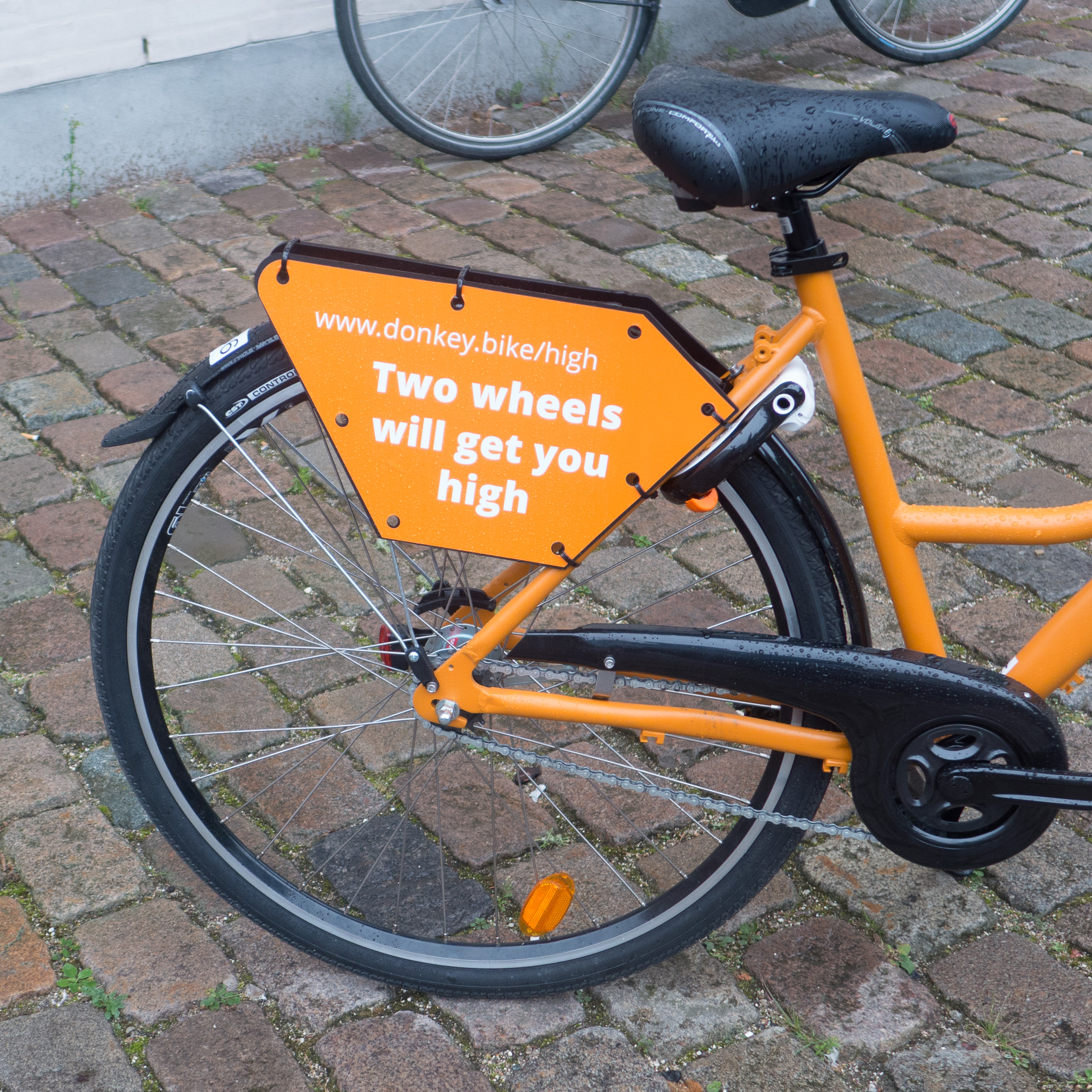
I guess I spend too much time looking up at buildings as I walk around Copenhagen and don’t give enough attention to things on the pavement because I have only just noticed these bright orange hire bikes from Donkey Republic that have appeared around the city. Actually, I only noticed these ones because a clutch of three were left near the front of the apartment. Is there a collective term for bikes? Presumably not a fleet ... like for cars when they are for hire.

The design of their web page is pretty good with clear instructions for how to set up a hire and unlock the bikes, some advice about rules for riding a bike in the city and some good recommendations for places to visit but I was a bit curious about the text on the bike carriers. Several Danish friends have told me that they don’t understand English puns … or rather their grasp of the meaning of the words is spot on … it's just that they can’t understand why the English find puns quite so funny. But then I suspect that these are aimed at tourists and visitors and not so much the locals. 

Looking at the map on the Donkey app this evening one bike seems to have got as far as the airport and another to Ballerup so if I’m bored I might keep tracking that one to see if it is heading for the west coast.

Donkey Republic


you can now cycle ... or run ... around the harbour in Copenhagen

the information panel at Nyhavn


on the far side of Inderhavnsbroen looking across to Paper Island


With the opening of Belvederebroen at the south end of the harbour at the end of last year … along with Cirkelbroen or Circle Bridge designed by Olafur Eliasson that opened in August 2015 to cross the canal on the Amager side of the harbour and the Inderhavnsbroen that opened in July 2016 to link across the harbour between Nyhavn and Holmen … it is now possible to bike, run or walk around the harbour in Copenhagen. 

The complete circuit is 13 kilometres although shorter loops around smaller chunks using the older bridges at Knippelsbro or Langebro or by crossing over Bryggebroen - the bridge at Fisketorvet - there are shorter circuits of two or four or seven kilometres.

At intervals there are distinct signs in dark blue … appropriately close to the paint colour called Copenhagen Blue. Each post is at a key point on the route and they give, in Danish and in English, a short description of the immediate area and its history. If I was running the circuit I’d probably be using the sign for support as a tried to regain my breath … well beyond taking in the information but trying to pretend I was doing a few stretches before lurching off on the next section. My guess would be that most Danes running and certainly all Danes on bikes are going much too fast to read anything as they dash by.

These signs also have a map that shows the route and the stops of the harbour ferry - the Havnebus - if you feel like seeing the harbour from the water. But what is interesting, and more important, is that the maps mark the dedicated cycle routes into and across the city. This tells you something significant about the planning policy in Copenhagen … there is a historic core where transport has to be co-ordinated and there is the well-known and well-established and coherent policy to encourage cycling rather than car use but, more than that, the cycle routes and the harbour circuit are about linking the city together, to make places accessible to everyone so this circuit is about much more than the regeneration of the docks.

A map of the harbour can be downloaded if you want to plan your route but why not live dangerously and just go for it ... follow the signs ... you could end up back where you started ... or somewhere you hadn't planned to end up ... so much more interesting.

down by Belvederebroen