new cycle lanes at Dybbølsbro
/New and very wide cycle lanes have been added between two existing bridges that cross the main railway close to Dybbølsbro railway station. The work was completed at the end of October but there have been a few problems.
Not structural problems but working out how to deal with very large numbers of cyclists and how to separate out vehicles, pedestrians and bikes.
The work has meant extensive alterations to the existing bridges … one bridge with a road for traffic in both directions and an outer footpath and also bikes heading away from the city centre and, to its east, a separate narrow bridge for pedestrians and a lane for bikes heading into the city with a gap between the two bridges.
That arrangement could no longer cope with the rapidly growing number of pedestrians and cyclists crossing over the railway.
A large new area of housing at the south harbour, below Fisketorvet, means more and more people use the route over the railway to get to Vesterbro and from there to the central railway station and beyond that to the city centre. In addition, the construction of extensive developments of housing and apartments along the harbour on the Amager side, in Havnestad and Bryggen Syd, are now being completed so, again, this has meant a growing number of cyclists using Dybbølsbro to reach the city.
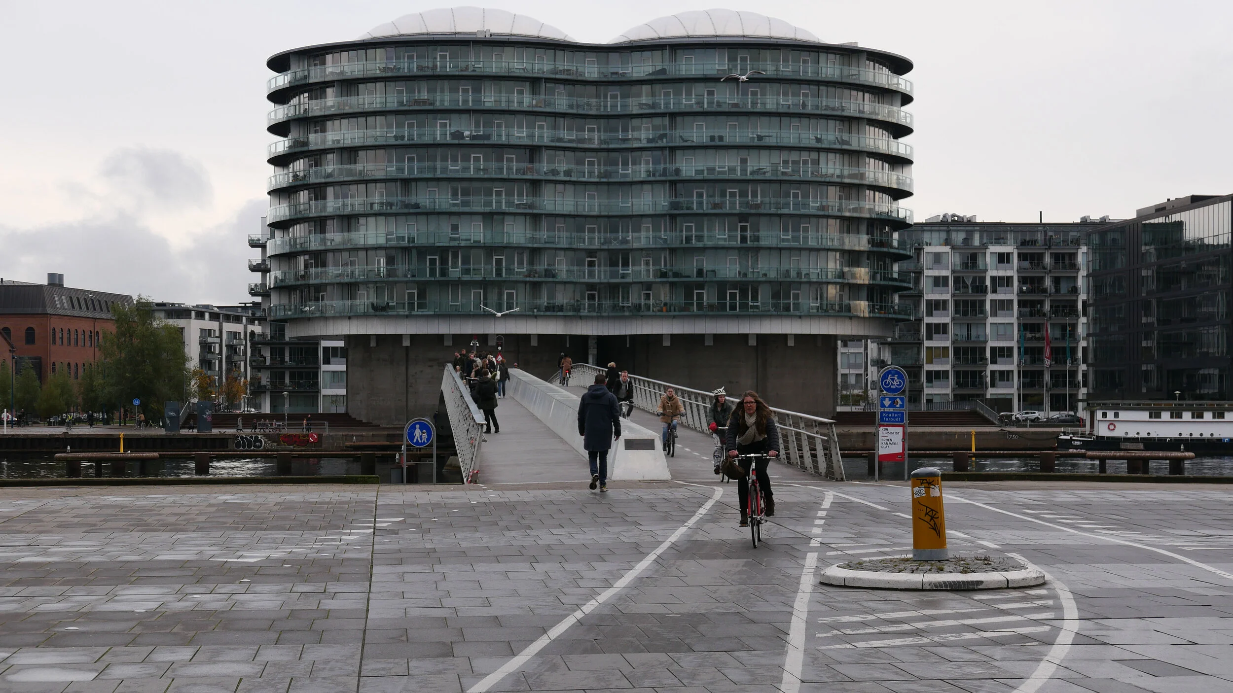
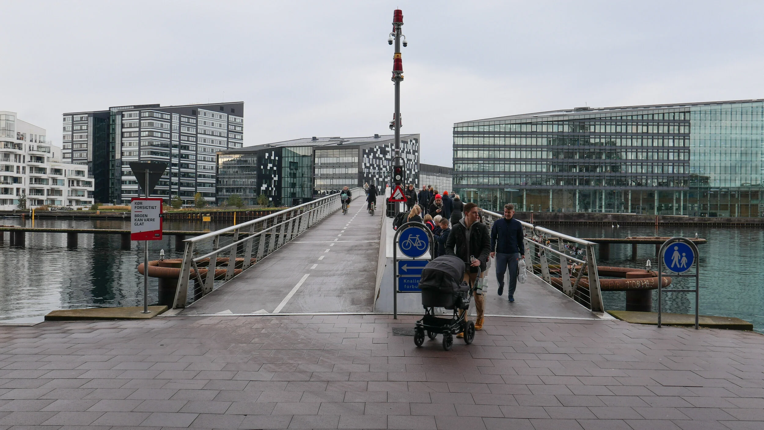
The remodelled bridge is not complicated in itself, being a straight run of just over 300 metres between the area of Vesterbro and a shopping centre called Fisketorvet and from there, by way of two relatively new bridges that cross the harbour, cyclists can get across the harbour to Amager.
Fisketorvet, the shopping centre, is about to undergo major remodelling to add outward-facing shops around the outside of present covered shopping mall and that work will coincide with the completion of a new metro link with a new metro station at the south end of the shopping centre. There is to be a new inner-city IKEA along a narrow plot of land between the railway and Kalvebod Brygge and, in addition, a new bus station is planned for a narrow strip of land along the railway below the bridge on the harbour side.
Added to all this is the unusual topography and what appears to be an ad hoc approach to planning in this area in the middle of the 20th century so the problems are compounded.
The main railway line that heads into the central station to the east is in a deep cutting with the main platforms of the Dybbølsbro station reached by separate staircases down from the east pavement of the bridge. In fact, this is not a cutting down for the railway but a massive building up of infill on either side because the railway must be close to the level of the sea bed in a wide bay here through to the late 19th century.
The original line of the beach was along what is now Sønder Boulevard so over 700 metres back from the current quay of the harbour.
The first railway line into Copenhagen, built in the 1840s, followed the beach and then, through the last decades of the 19th century, new wharves, a meat market and gas works were constructed on new land claimed from the bay beyond the railway. The main rail lines were moved outwards, to the present course, with engine works to the west and with a dock road - Kalvebod Brygge - beyond. Then further new wharves and smaller boat yards and industrial buildings on down beyond a power station built in the 1930s below the site of what is now Fisketorvet.
Fisketorvet was the site of the main Copenhagen fish market from 1958 until 1999 - hence the name of the the shopping centre built on the site. Docks and wharves here and on the Amager side, along Islands Brygge, were busy through the 1950s and 1960s but then began a relatively rapid decline and that released the land for massive areas of new housing with some as close as a kilometre but none further than 3 kilometres from the central railway station.
It is the massive increase in the number of people living around the south harbour that explains why there are now more and more cyclists crossing Dybbølsbro.
looking from the south towards Vesterbro with the new cycle lanes

view from Google Earth that shows the previous arrangement with two bridge over the main railway at Dybbølsbro
- the gap between the two parts is now a 10 metre wide cycle route with lanes in both direction


But coping with the massive numbers of cyclists is not a simple problem.
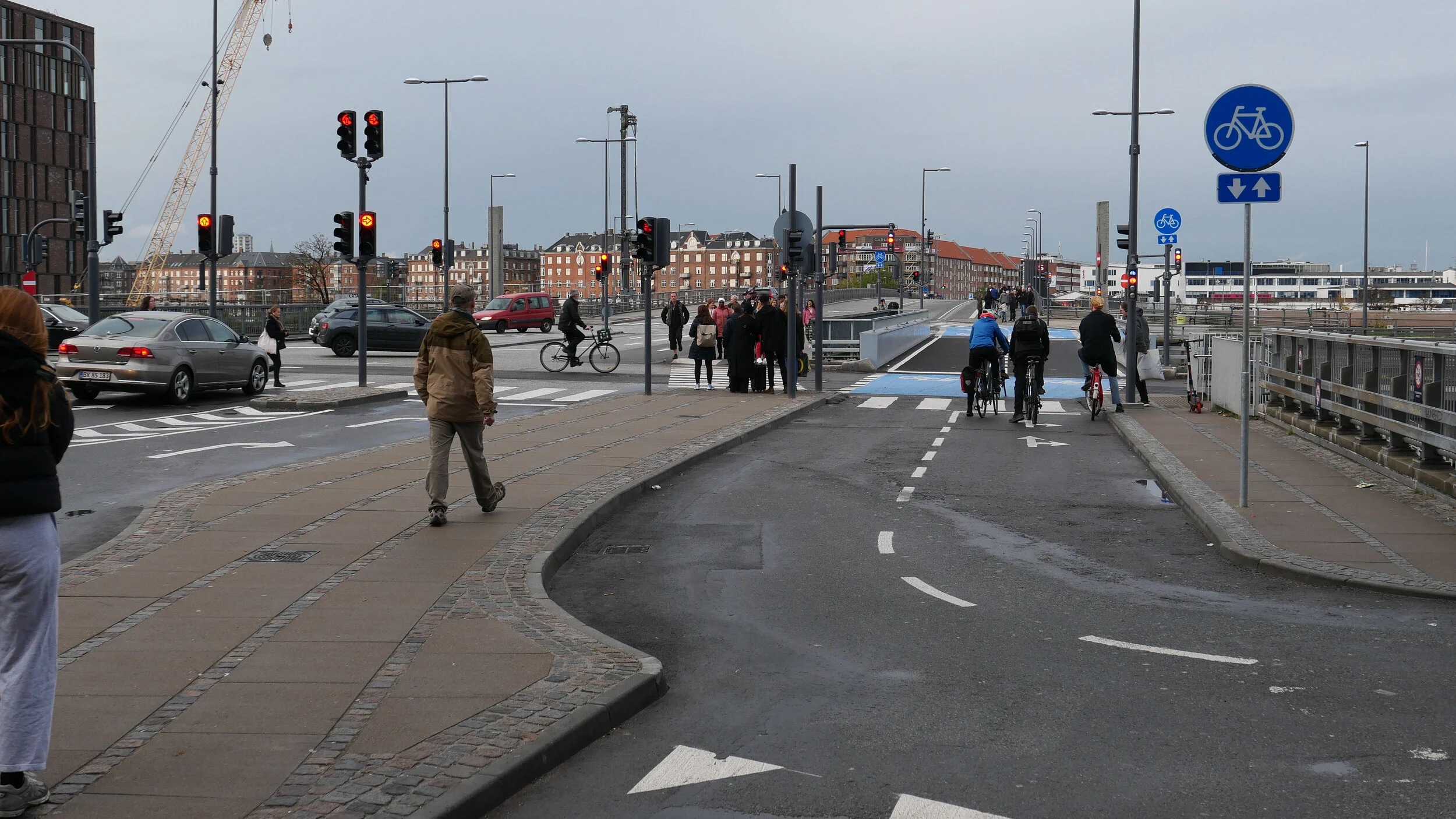
The previous arrangement at Dybbølsbro had two bridges with a gap between them. The narrower east bridge had a single direction cycle way for bikes heading towards Vesterbro and a relatively narrow pavement on the city side with the steps down to the station platform so it was very busy for most of the day. The wider bridge to the west had a road with cars going in both directions and, on the outside or west side, a cycle track for bikes heading south from Vesterbro to Fisketorvet and Amager.
Add to this four busy roads with bike and car traffic converging on the north end of the bridge and, at the south end, slip roads up from Kalvebod Brygge for cars heading to Veterbro or for cars wanting to drop off people or pick up people from a tight round-a-bout in front of the main entrance to the shopping centre.
Then, finally, the planners had to take into account the cyclists who regularly use the bridges. A new bridge for pedestrians and cyclists was built over the harbour between Amager and Fisketorvet in 2006 and this has a straight and wide lane for bikes separated from the pedestrian side by a high solid spine so bikes can move quickly but safely over the bridge. Then, in 2014, a new bridge just for bikes - Cykelslangen or Cycle Snake - was built to take them from the front of the shopping centre and in high sweeping curves above the water of part of the harbour and a swimming pool to the bridge over the harbour. Those banked and sweeping curves have meant that cyclists get up quite a speed and maintain that all the way across.
The solution for Dybbølsbro was to fill in the gap between the bridges. The outer west side of the old bridge is now a foot path and the east path, formerly for bikes, is now for pedestrians but the real gain is 10 metres in the middle for the widest cycle track in the city with bikes going in both directions. That is not the problem. The problem is, in part, the number of bikes and, in part, the speed of the bikes …. although that’s fair enough when you find out just how far some cyclists ride on their commute. Then add the very complicated junctions at each end with cars, pedestrians and bikes crossing and recrossing each others lanes.
1 the turning circle in front of the entrance to the shopping centre looking north to the bridge
2 crossing over Kalvebod Brygge
3 the bikes in the foreground have just come over the harbour heading to Dybbølsbro
In the last two months there have been several changes to lane markings and an unusually bewildering number of new road signs have appeared and it is still not right.
Maybe it needs fewer signs and simpler bold road markings or possibly no road markings.
At the Amager side of the harbour bridge there are bikes coming in from all directions; bikes coming over the bridge fast and pedestrians crossing backwards and forwards to get to the harbour ferry that has a stop close to the east side of the bridge on the Amager side and as long as no one dawdles and no one dithers and changes their mind then there don’t seem to be any accidents.