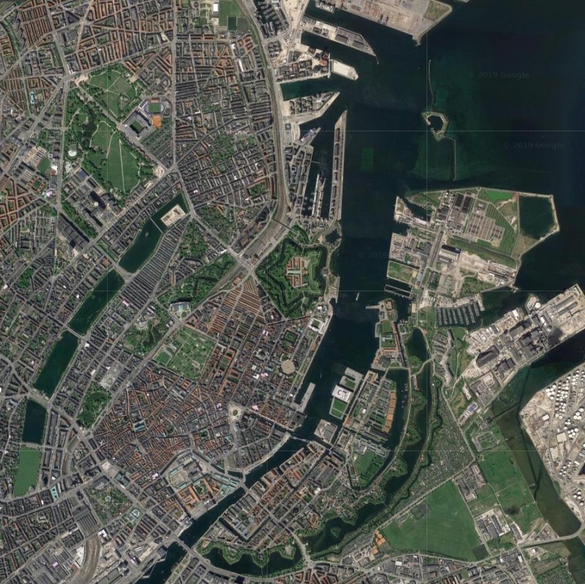
clapping for Lynetteholm stops

Work on dredging in the entrance to the harbour, for the construction of the man-made island of Lynetteholm, has been stopped because further reports are now required on the environmental impact of dredging polluted sludge from the site and taking it down the coast to the bay at Køge to dump.

There is growing criticism of the new island and it has become a contentious issue in both parliament and in the press because criticisms or, at the very least least concern, from the Swedish government about the construction work and the island itself was not revealed when a construction act for the work was debated and passed in the Danish parliament.

work to start on dredging for the construction of Lynetteholm January 2022

note:
When I wrote about Lynetteholm in the New Year, I had to confess then that I was not sure what the Danish term klapning meant or rather what it means specifically in this context when clearing the sea bed of sludge by dredging.

The word used in all newspaper articles was klapning but dictionaries and Google always gave me clapping as the English translation but neither word was used in general articles on dredging.

Finally I tracked down the answer.

When sludge is dredged up to clear a channel or, as here, to form a stable base for constructing a man-made island, the sand and mud can be loaded onto large open barges or ships and they sail down the coast where, over a designated site, they open large flaps on the underside of the hull to release the sludge. Those flaps can be opened and closed several times to dislodge everything .... hence clapping. Obvious now I know.

looking out from Nordhavn to the Sound
at the centre of the view is Trekroner Fortet - the Three Crowns Fortress - built in the 1780s to guard the entrance to the harbour

the new island will fill the whole horizon beyond the fort with just a narrow channel for boats to enter and leave the inner harbour

by 2070, when building work on the island is set to be completed, this view will be filled by the skyline of new housing for 35,000 people


the Dragon Fountain is on the move again

Dragesprinvandet - The Dragon Fountain - the ornate bronze fountain on Rådhuspladsen - is on the move.

Today, work starts on dismantling the large sculpture of a bull fighting a dragon and it will be taken to the workshop of Skulptur Støberiet for restoration and repair. Then, on Friday, the bronze basin supporting the sculpture will be removed from the square and it too will be taken to the workshops.

The fountain has had a complicated history.

In 1889, there was a competition for a new fountain on Amagertorv - the public square about a kilometre to the east of the city hall - and Joakim Skovgaard submitted a design. That design was then modified by the artist Thorvald Bindesbøll but the competition was won by a design for a fountain by Edvard Petersen and Vilhelm Bissen.

Then, in 1901, as part of the Town Hall Exhibition of Danish Art, the Dragon Fountain design by Skovgaard was resurrected, in a simpler form, cast in bronze in the foundry of Lauritz Rasmussen and installed in front of the city hall but with just a basin and the dragons around its rim.

A large outer basin was added in 1908 and then, in 1915, a central group for the top of the fountain with a bull and a dragon in combat was shown to the public as a plaster version but it was not until June 1923 that the bull and dragon were finally cast in bronze and installed.

In 1954, when H C Andersens Boulevard was widened, the fountain was moved further into the square by 25 metres and at that stage the outer basin was removed.

Once the bronze work of the fountain has been restored - with the work planned to take about two years - the fountain will be reinstalled in a more central position in the square, on the axis of the main entrance into the city hall, and set further out from the city hall, on the cross axis of the Walking Street.

A stone outer basin will also be reinstated to make the fountain a much more prominent feature of the public space.

Skulptur Støberiet

the fountain with its outer basin in the earlier position, about 25 metres further west, before H C Andersens Boulevard, the main street running across the west side the city hall, was widened

the fountain earlier in the summer in its present location in front of the city hall
when restoration work has been completed the fountain will be returned to Rådhuspladsen but will be in a new position on the axis of the main entrance to city hall and with the outer basin reinstated

photographed yesterday, Sunday 1 November, with boarding in place ready for work to start today

Amagertorv with the Stork Fountain by Edvard Petersen and Vilhelm Bissen …. the Dragon Fountain was designed for this square but did not win that competition in 1889 but was installed on Rådhuspladsen - the square in front of the city hall - twelve years later


the harbour and the future of Nyholm

The Danish Navy maintain an important though reduced presence in Copenhagen - with the main naval bases for the country now in Frederikshaven and Korsør - but there are plans for much that is still here to be moved away from the city and recently there have been discussions to decide on the most appropriate use for the historic naval buildings on Nyholm.

This is an important part of the harbour and not just because Nyholm is prominent on the east side of the entrance to the historic inner harbour but also because the island has an important and symbolic place in the history of the city … on the emplacement at the north end of the islands are guns for official salutes to mark royal and national occasions; the flag flown here has huge significance and when the royal yacht returns to Copenhagen, it is moored immediately north of Nyholm.

There are important historic buildings here including two of the most extraordinary buildings in the city … the Mast Crane that is an amazing example of maritime engineering and the Hovedvagt, or Main Guard House, with a feature on the roof that looks like a giant chess piece. Both date from the middle of the 18th century and both are by the important architect Philip de Lange.

photograph taken from the harbour ferry as it pulled in at the landing stage just below Skuespilhuset - the National Theatre.

Nyholm is the island between the Opera House and Refshaleøen and at the centre of this view is the distinct silhouette of the 17th-century Mast Crane

note:
the cormorants are on an artificial reef that was created in 2017 to encourage biodiversity in the harbour. The University of Aarhus has produced a report on the Restoration of Stone Reefs in Denmark


land from the sea

With the ongoing development of Nordhavn - the north harbour - and plans for a large, man-made island to, in effect, link Nordhavn with Refshaleøen, it is too easy to think that claiming large areas of new land from the sea for building is a modern phenomenon that is possible only now with modern engineering and modern technology but, in reality, of course, the city has been building out into the sea for over 400 years.

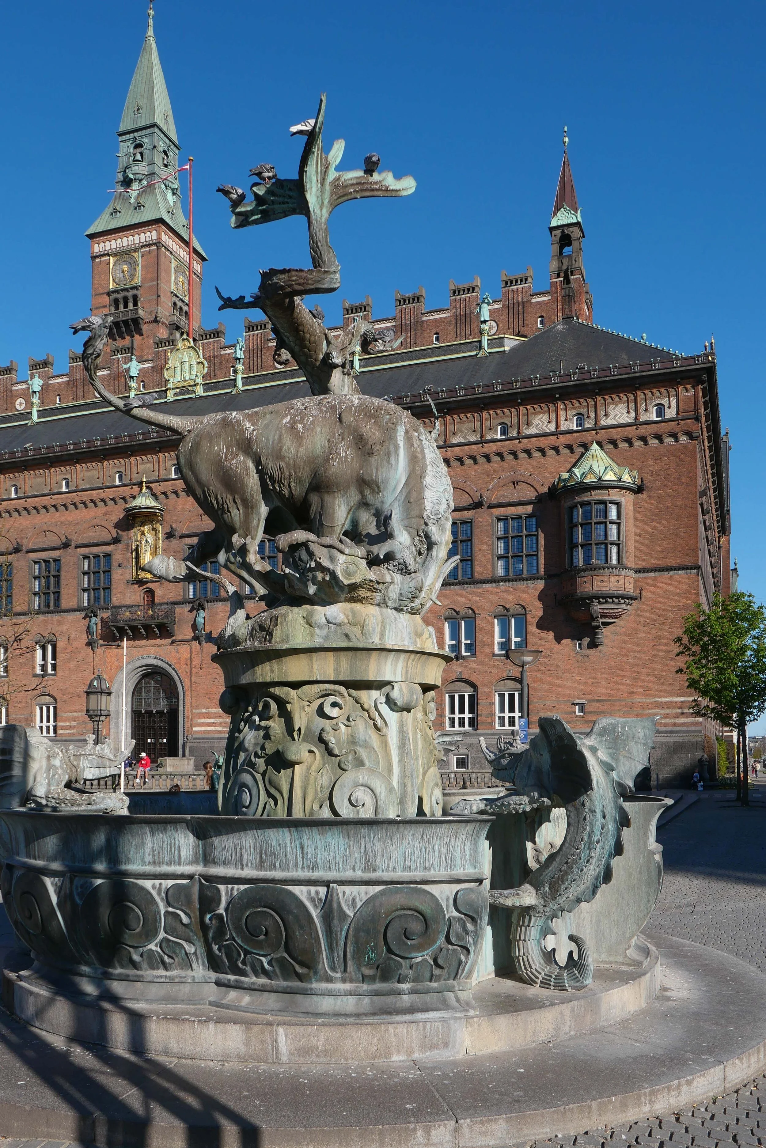
If you stand on Gammel Strand now, then you are right in the centre of the built-up city but if you had stood there at the end of the 16th century you would have looked across a wide area of open water to the low-lying island of Amager about 2 kilometres away and with just a few islands between including the island of the royal castle standing just off the shore.

Even then, Gammel Strand could not be described as being on rock-solid ground as wharves and warehouses had been built out from the shore as the importance of the port meant more and ever bigger ships were trading here but it was Christian IV who deliberately, and with foresight, developed the naval dock and boat yards below the castle and used Dutch engineers to set out and construct a series of canals and islands for a new town for merchants in the water between the castle and the island of Amager that is still at the heart of Christianshavn.

Initially, naval docks were developed on either side of the castle with a new arsenal and warehousing for supplies and shipyards including rope works and sail-making workshops.

Christianshavn was protected across its east and south sides by high banks and with a defended gate to get to and from Amager - in case armies landed on the island and attack the city from the south - but the main development of the harbour came in the middle and the late 17th century when these defences were extended in a great arc eastwards and north to provided sheltered and defended moorings for the naval fleet … a segment shaped area that is over 1.5 kilometres from, Christianshavn to the entrance to the harbour at Nyholm, and, at the widest point, almost a kilometre across. Work was given permission to proceed in 1682 and by 1692 the defences and new ship-building yards at Nyholm were far enough advanced for the first ships to be completed and launched.

Through the 18th and 19th centuries, more and more islands were constructed within this area leaving canals and areas of open water so that naval stores, shipyards, barracks and so on could be moved out from the area around the castle.

With all this major work, commercial merchant shipping also moved out from the centre both north, first to Nyhavn constructed between 1670 and 1675 and then along new quays between Nyhavn and Kastellet, close to the royal palace, and eventually as far out as the Free Harbour opened in 1904. There was also enlargement of the harbour to the south with coal and timber yards along the city side of Kalvebod and new wharves built out from Islands Brygge that remained busy until the 1960s. The last stage of the development, in terms of claiming land from the sea, was as recent as the 1950s with the development of Refshaleøen and its ship yards beyond the naval area and later again, at the north edge of Amager, oil facilities and waste and sewage and water treatment works.

If you are looking for the source of the wealth and the political and economic strength of the city, and therefore, by extension, the wealth of the country, then the greatest single resource, over half a millennium, has been relatively shallow and relatively sheltered coastal waters where it has been possible to construct artificial islands so the city can expand and prosper.

That is precisely why any future development out into the sea has to be debated and considered and questioned because it is an exceptionally important resource and like so much else it is running out … or at least the areas close to the city has been exploited. New islands will be more of a challenge, will demand more infrastructure - as they are further from the centre - and will have at least some impact on the character of the city as it is now.


future development on Nyholm

In Danmarks hovedstad Initiativer til styrkelse af hovestadsrådet / Denmark's capital city Initiatives to strengthen the metropolitan area - a government report published in January 2019 - it was suggested that there could be housing on Nyholm but surely the island is too important to be relegated to an expensive development plot unless perhaps new buildings are linked back to the navy so, for instance, for a naval hospital or naval retirement home.

Intensive development on Amager and at the South Harbour was justified because releasing land there for dense housing developments was lucrative for the port and city authority and money raised was used directly to finance the construction of the Metro. There is no such financial imperative for Nyholm and very expensive and, presumably, very exclusive apartment buildings should surely not be the immediate go-to solution for any and every planning scheme in the city.


1624

1685

1692

detail of map from 1860
this shows the Nye Dok - the first stage of what is now the island of the Opera House - and ‘Toldbod Bom’ which restricted access to the moorings of the inner harbour but was also a foot bridge from the city side of the harbour to Nyholm … at the beginning of each working day men would wait at Toldbod and if selected would cross to the dockyard but If not selected there was a possibility of work in the afternoon although only if they waited
What is now Reshaleøen was then open water so from the Kastellet there was a clear view out to the sound and guns could be fired across the entrance to the harbour if the city and the harbour were attacked


1  Rigets flag og batteriet Sixtus / Kingdom Flag and Battery of Christian VI
2  Elefanten / the Elephant - the quay or mole 1728
3  Hovedvagten / Main Guard House “Under the Crown” by Philip de Lange 1744
4  Masterkranen / Mast Crane by Philp de Lange 1749
5  Planbygningen / The Plan or Drawing Building 1764
6  Marinekaserne / Marine Barracks of 1910 by Valdemar Birkmand
7  Arresten / Judgement? 1891
8  Spanteloftsbygningenby 1742
9  Østre Takkeladshus  / East Wareouse store for rigging 1723-1729
10  Vestre  Takkeladshus / West Warehouse 1729
11  Søminevæsntes værksted / Sailmakers' workshops 1878

view across to Nyholm from the south - from the canal to the east of the opera house

Spanteloftsbygningen looking across the canal from the south east

above, the Mast Crane from the south with the low but wide Drawing Building to its east

Søminegraven - the canal along the east side of Nyholm from the south

Hovedvagt - Main Guard House or ‘Under the Crown’ from the east designed by Philip de Lange

Workshops at the south-east corner of Nyholm built in the late 19th-century


the Caritas Well

In 1608, the Caritasbrønden or Caritas Well on Gammel Torv was constructed for Christian IV as his gift to the citizens of Copenhagen when a new city hall was built across the south side of this open space to replace a medieval city hall that had been on the east side of the square.

Just over a century later, that 17th-century building was destroyed in the Great Fire of 1728 and a new city hall was built on the same site. When that building was, in turn, destroyed in the fire of 1795, a new city hall was built on the west side of Nytorv and the two squares were joined into a single open space.

An outline of the 17th-century hall is marked with stones set into the cobbles of the square.

The group of figures in the centre of the basin of the fountain - representing the virtue of love or charity - was first carved in wood by the German artist Statius Otto but later was cast in bronze.

The fountain was not just ornamental but was part of a system supplying fresh drinking water to the city.

This photograph was taken on the 16th April - on the Queen’s birthday - just after the royal carriage had progressed along Strøget to take the Queen from the palace to a reception at the city hall.

18th-century map that shows Gammeltorv - the Old Market - with its fountain and Nytorv or New Market with the old city hall in the centre between the two public spaces


Caritas Well and the city hall from the upper end of the square in the 18th century