Karen Blixens Plads

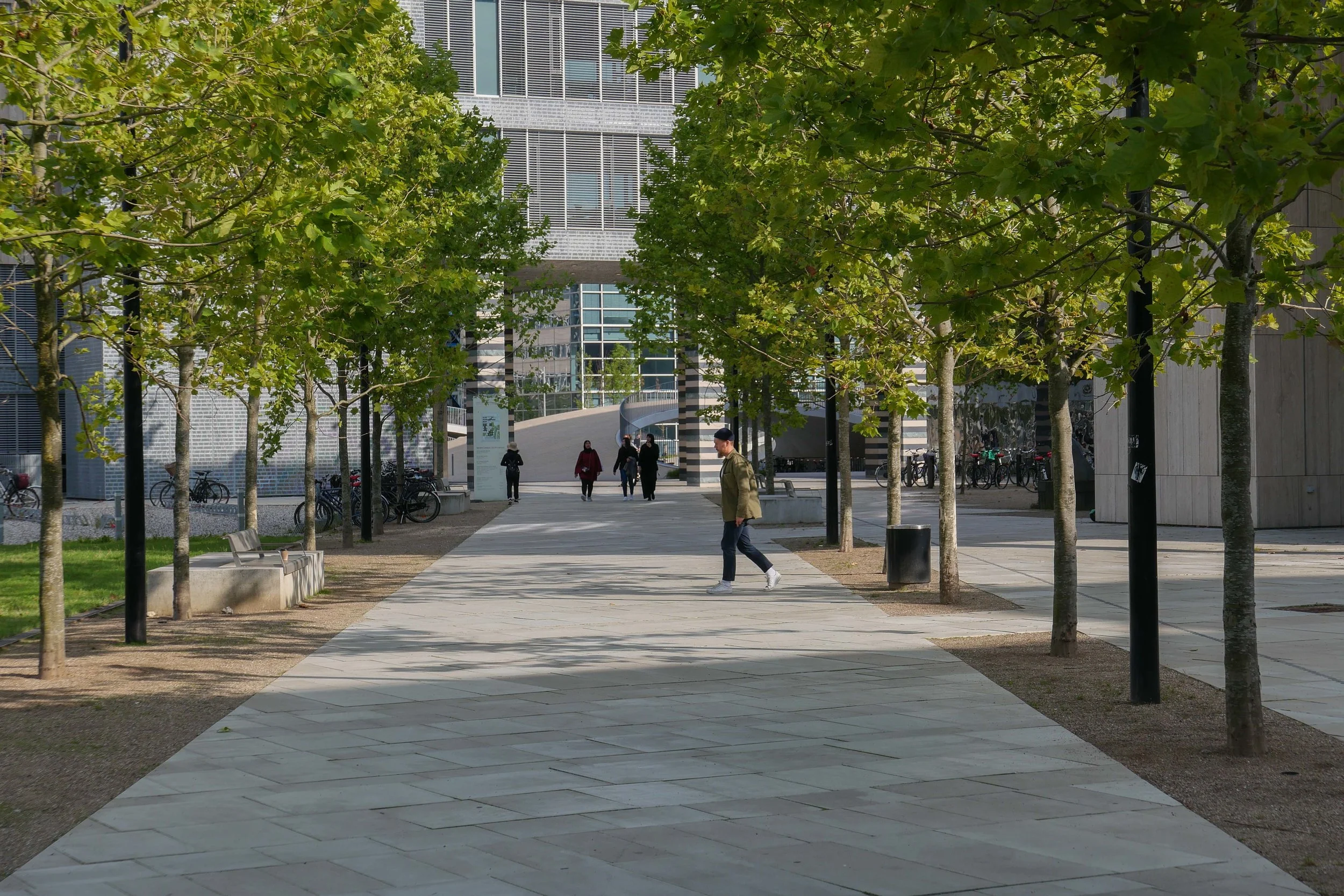
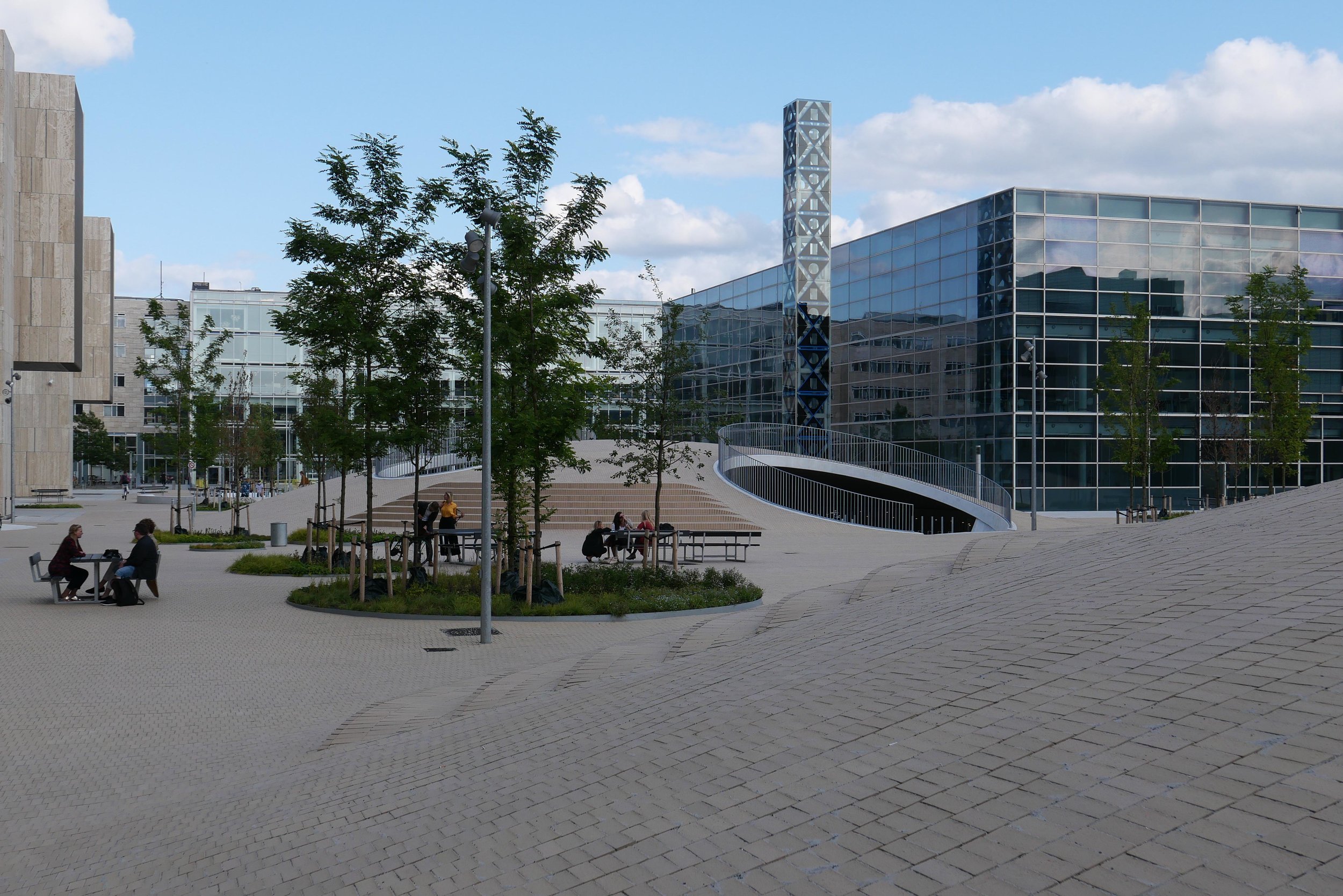
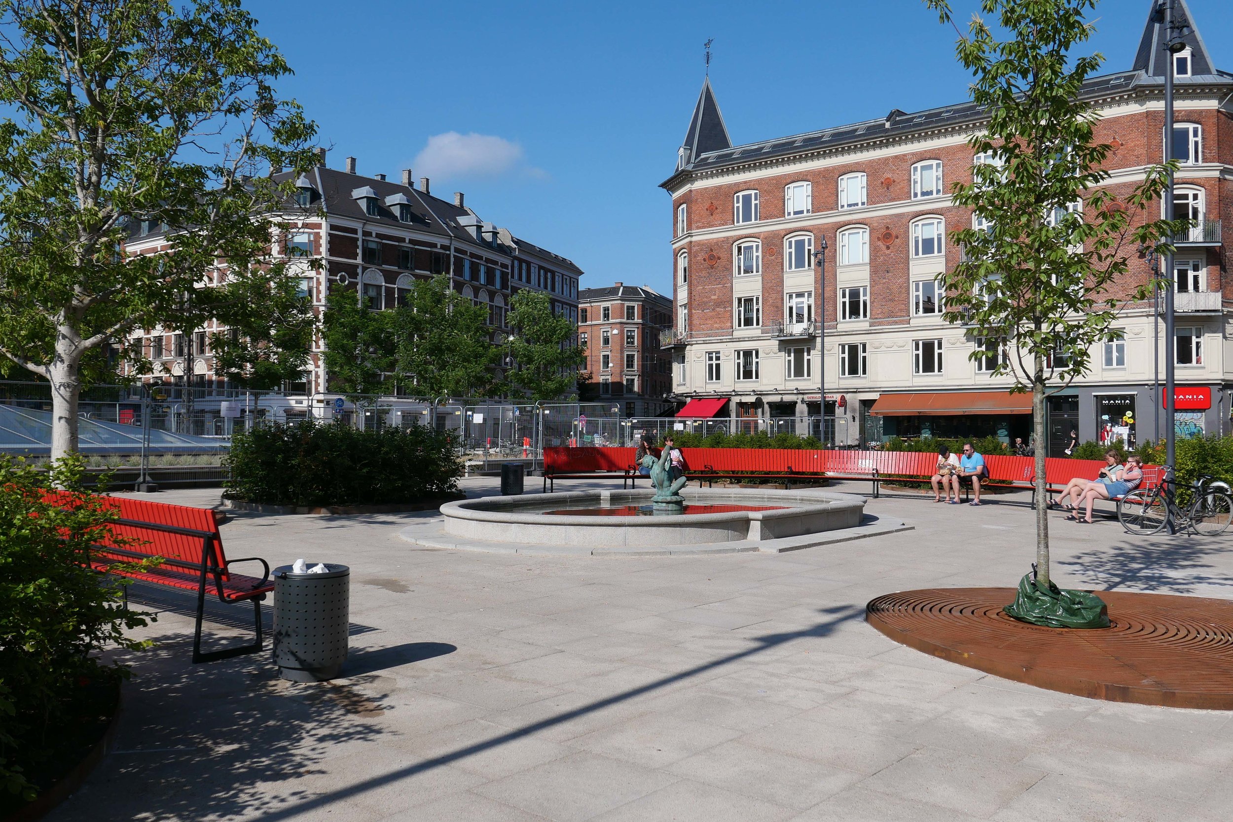
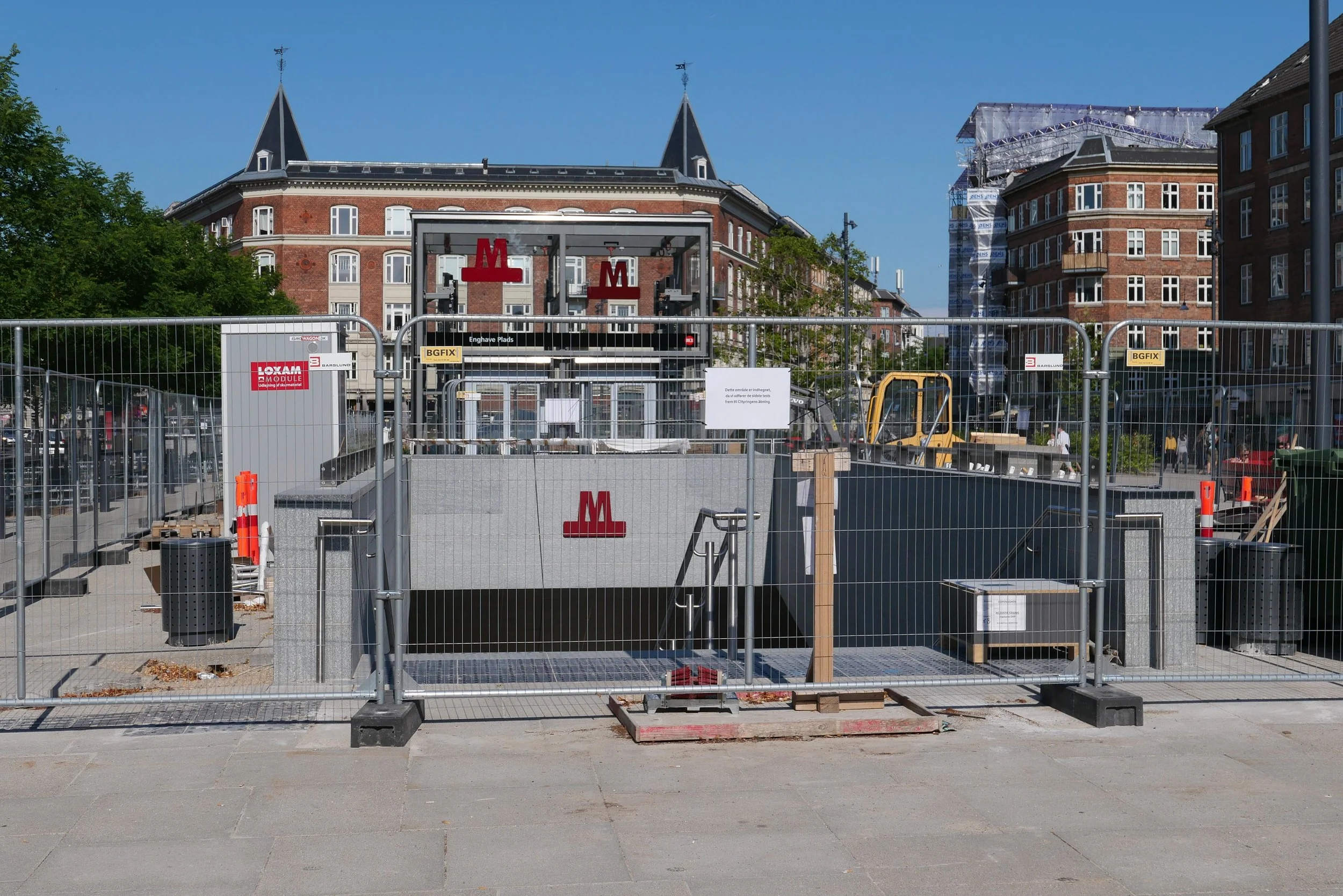
approaching the square from the metro station at Islands Brygge


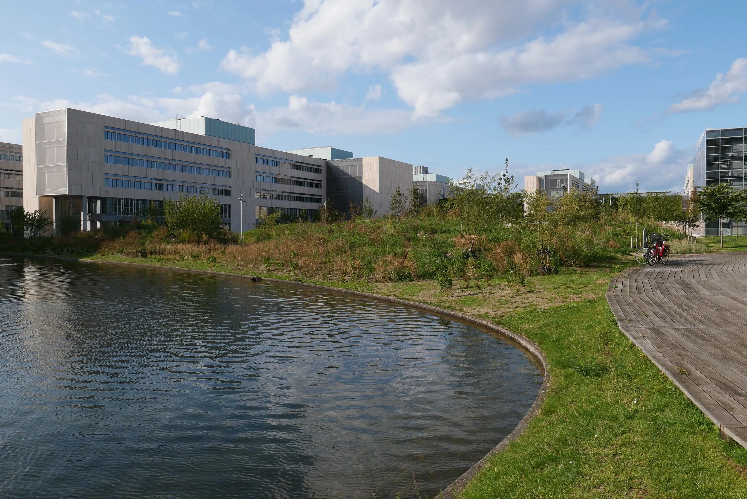
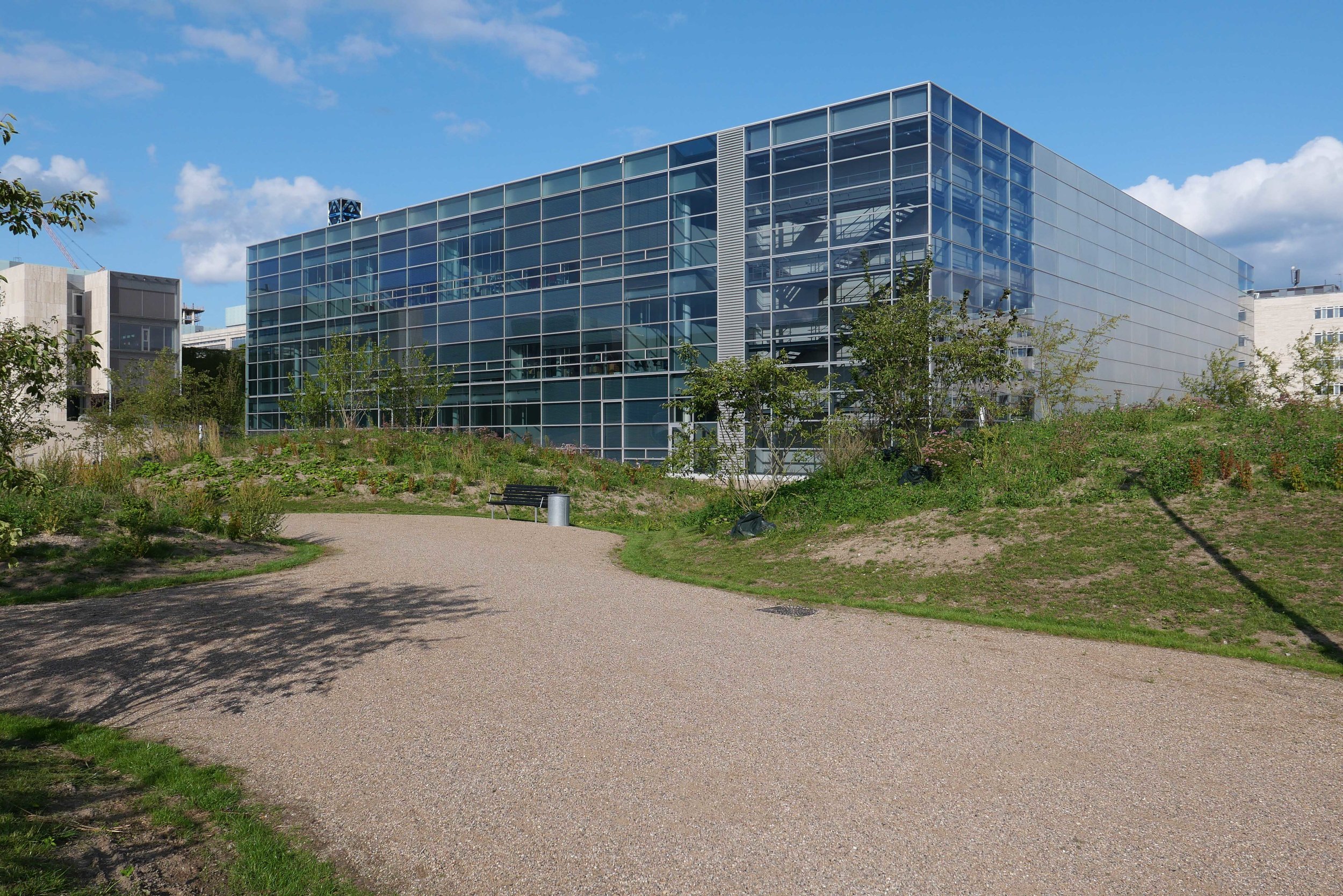
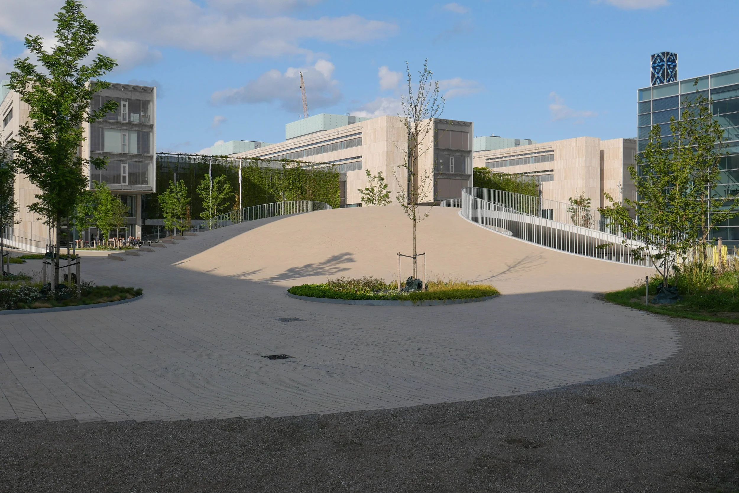
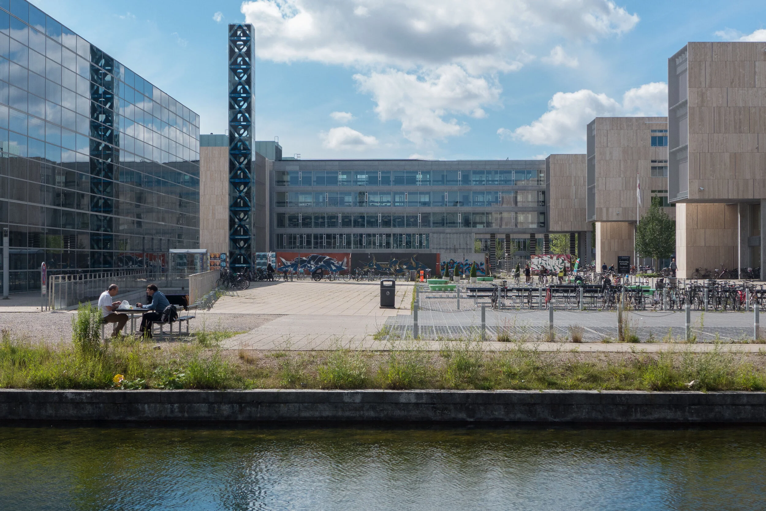
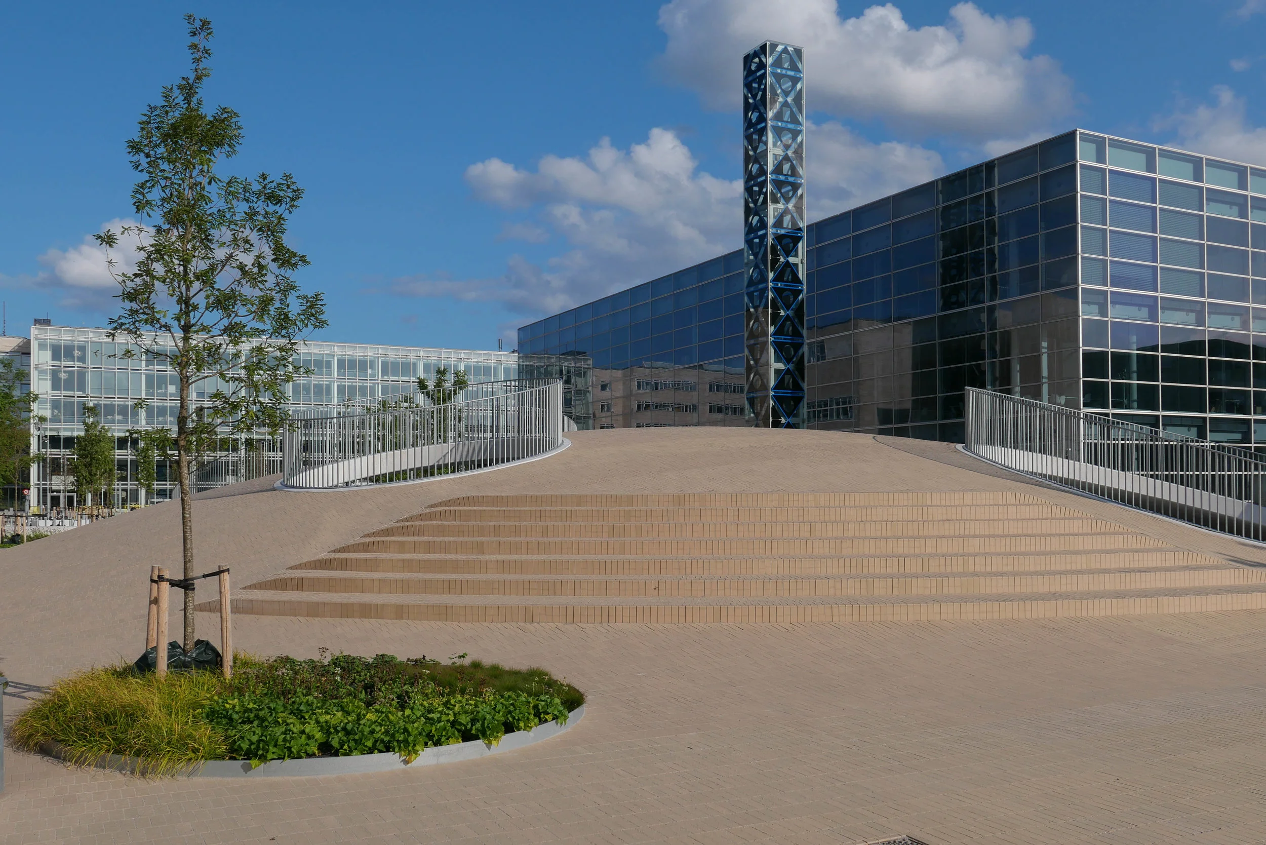
Designed by the landscape and architecture studio COBE, Karen Blixens Plads is at the centre of the south campus of the University of Copenhagen and is one of the largest public spaces in the city.

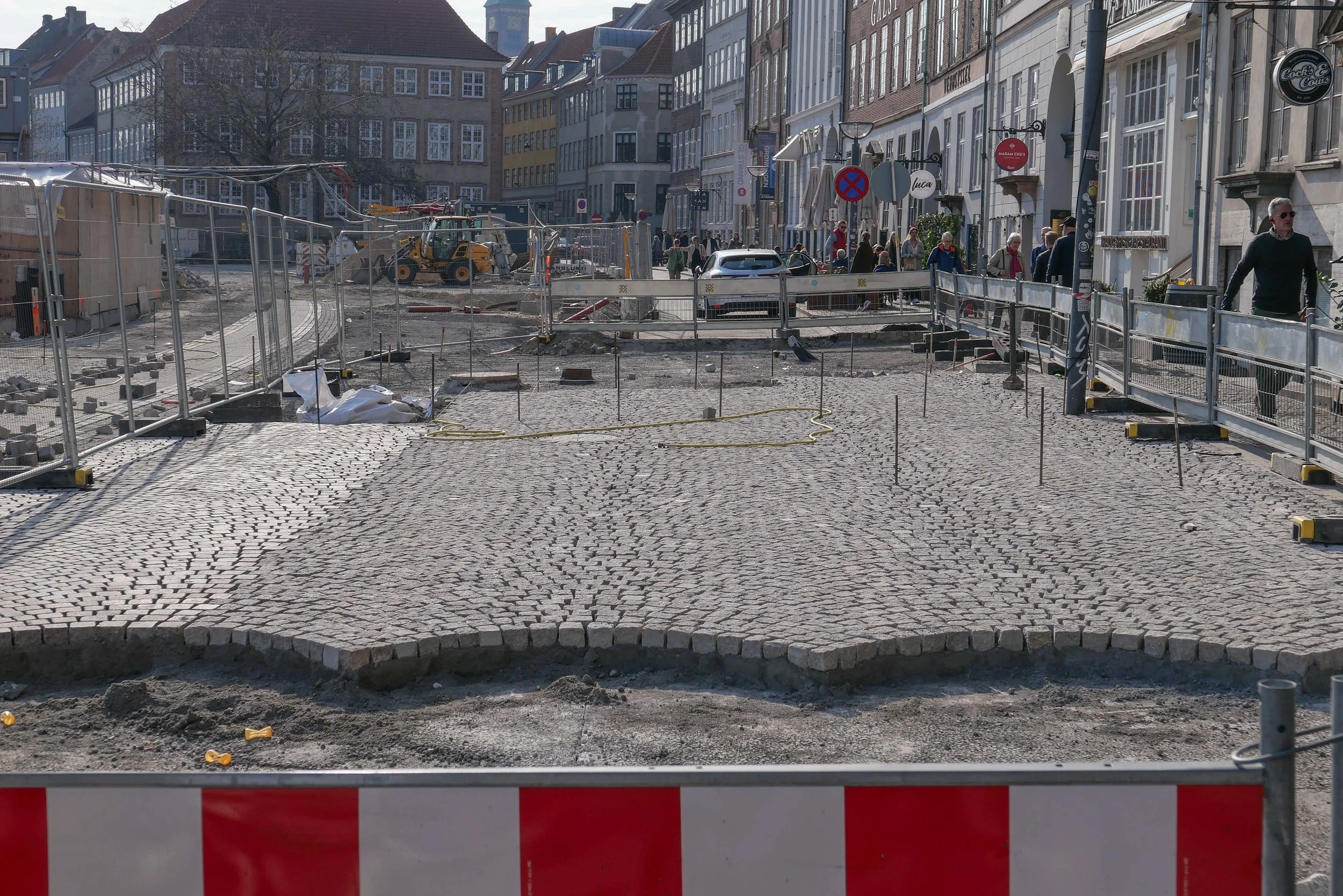
The square, with work just completed and now open, is approached either from the north - from the metro station at Islands Brygge - or from the south from the direction of Amager Fælled.

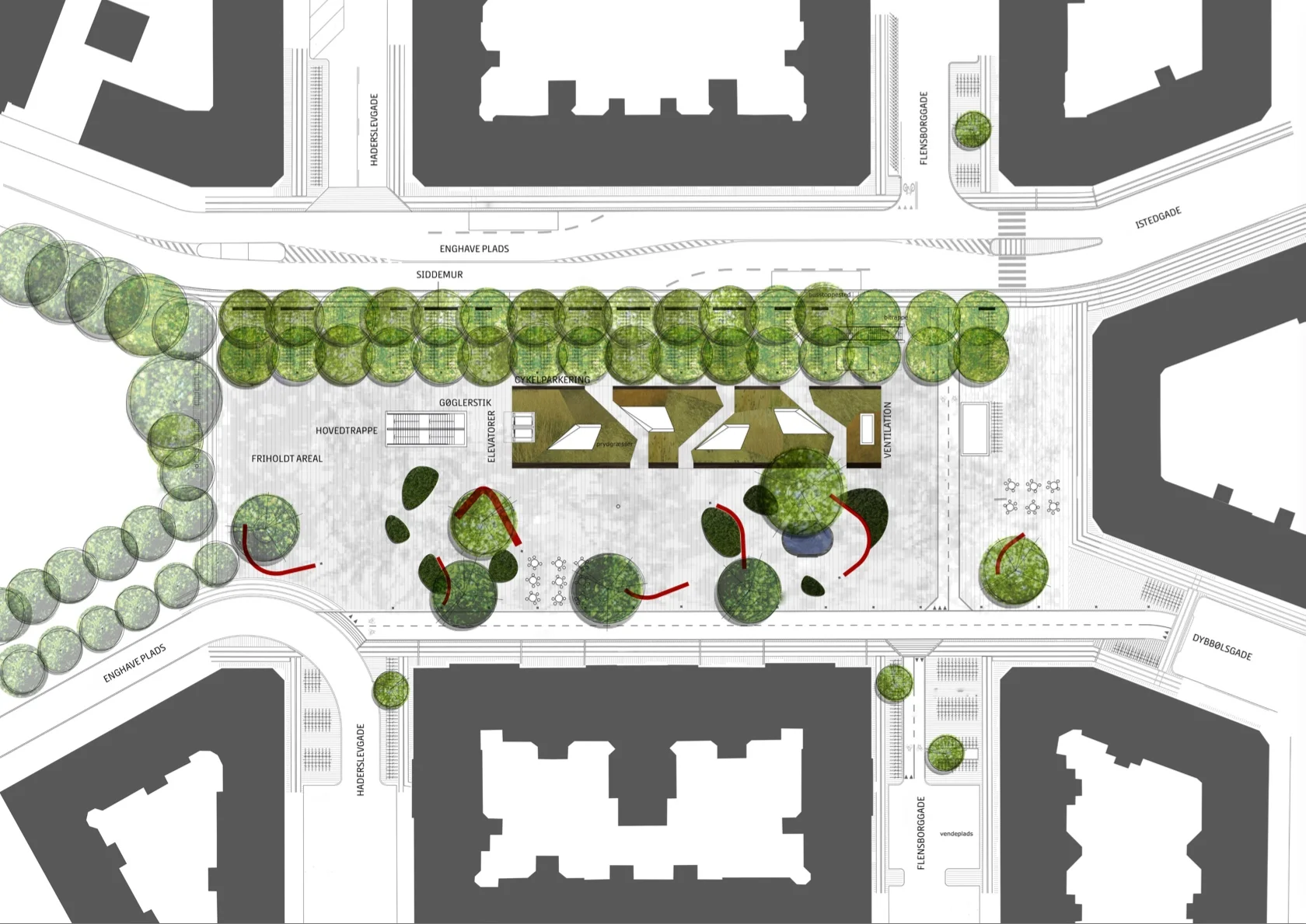
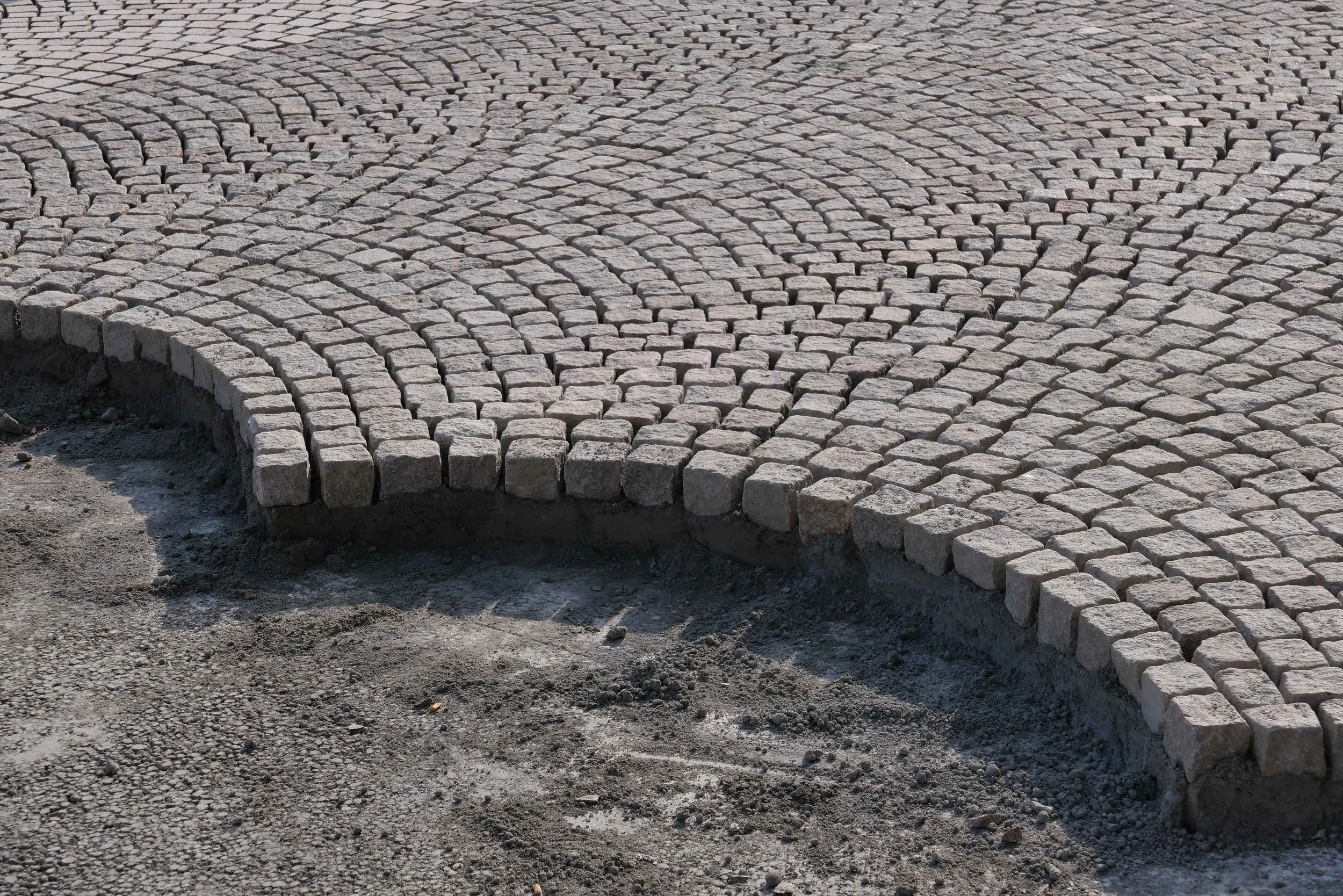
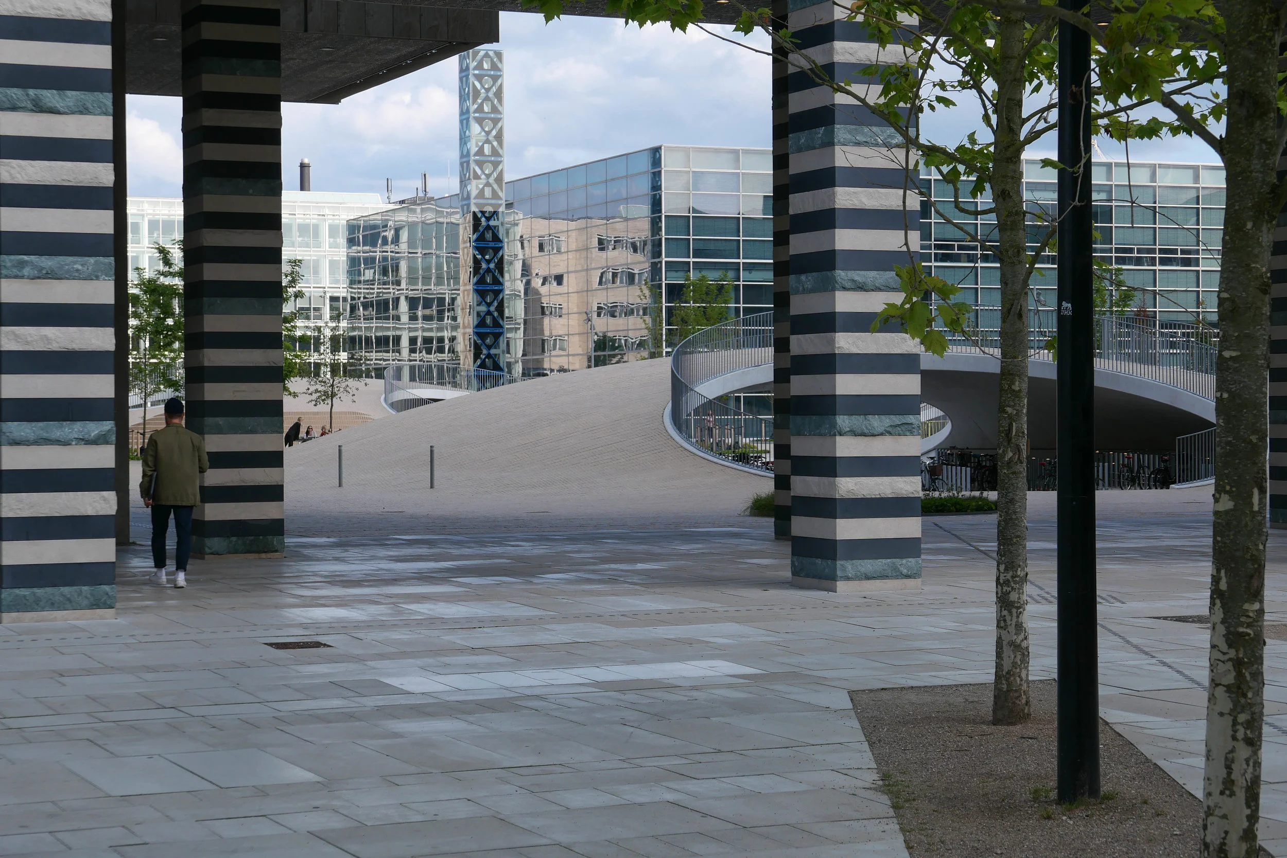
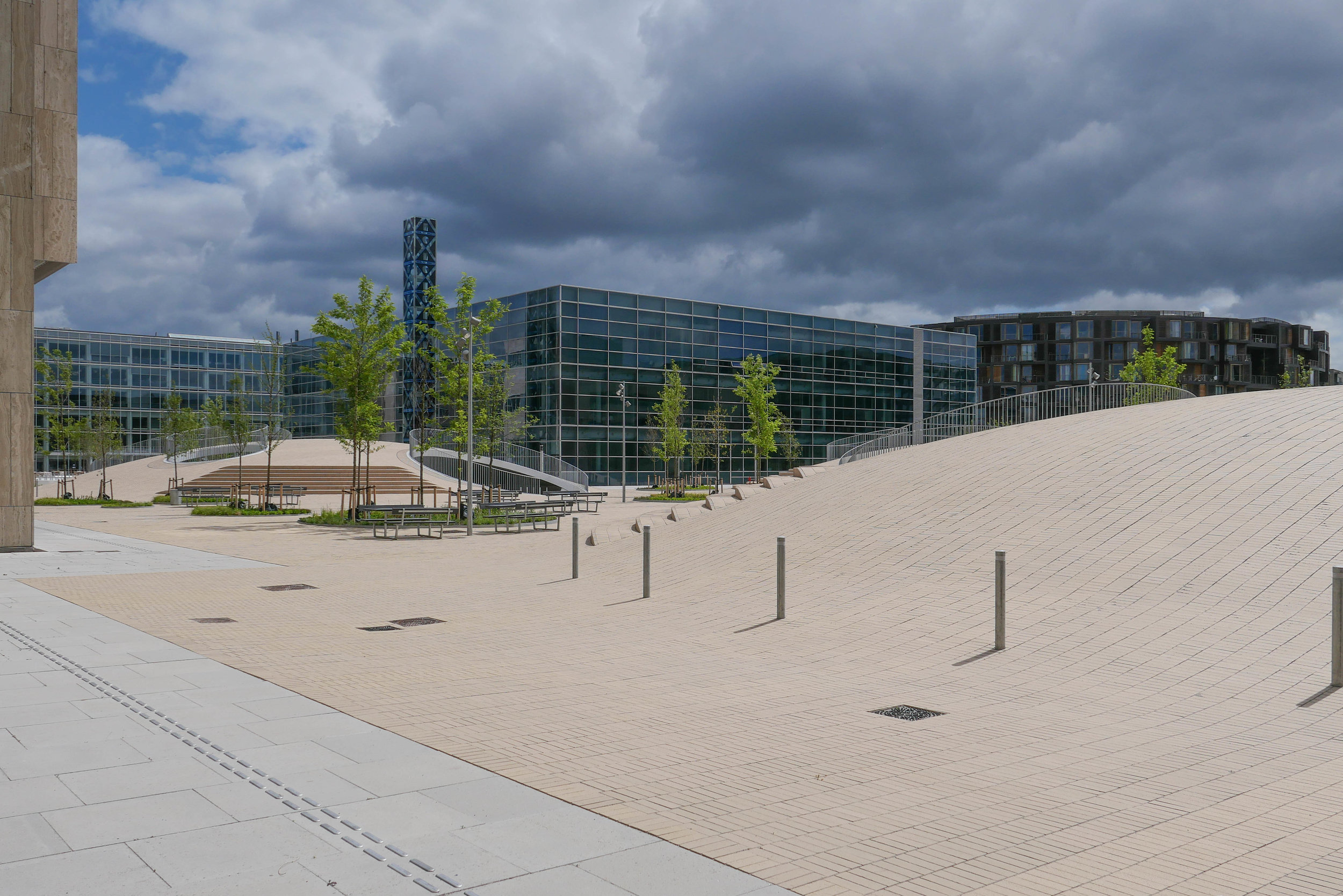
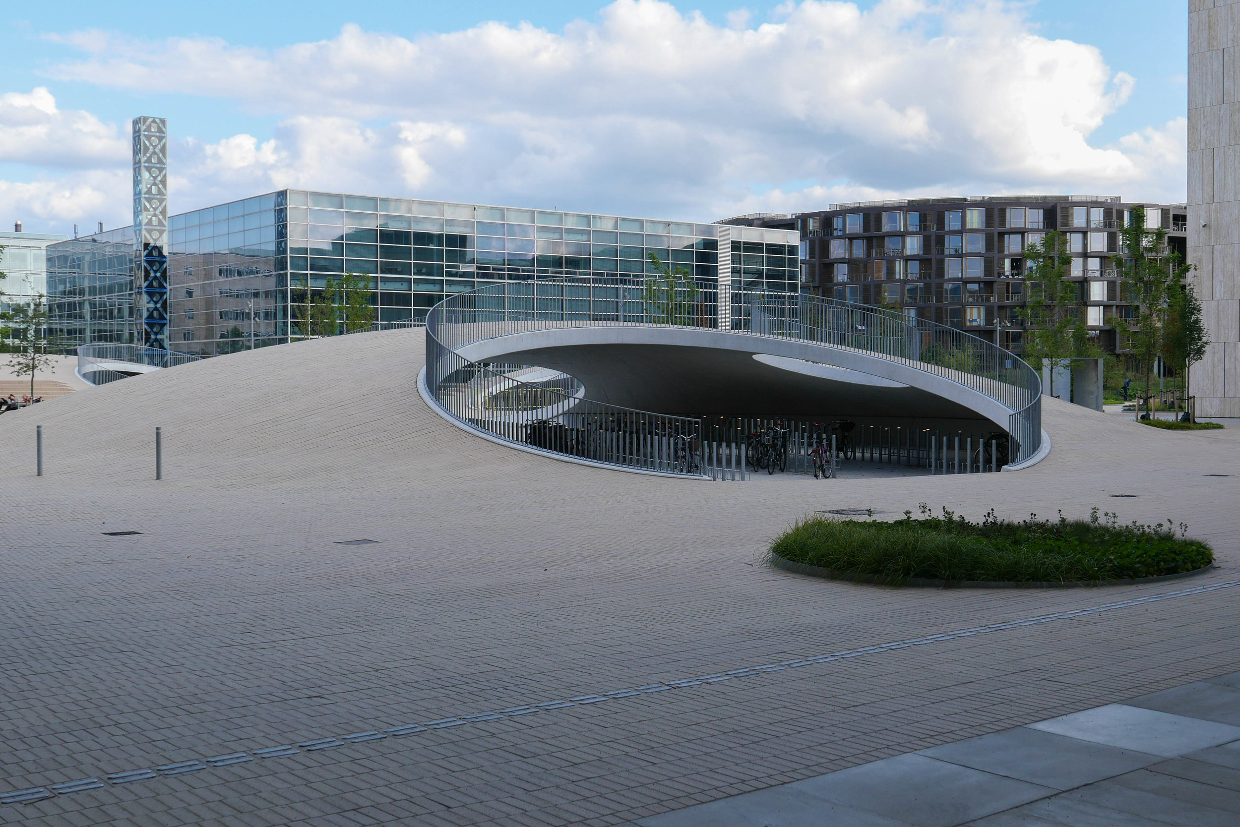
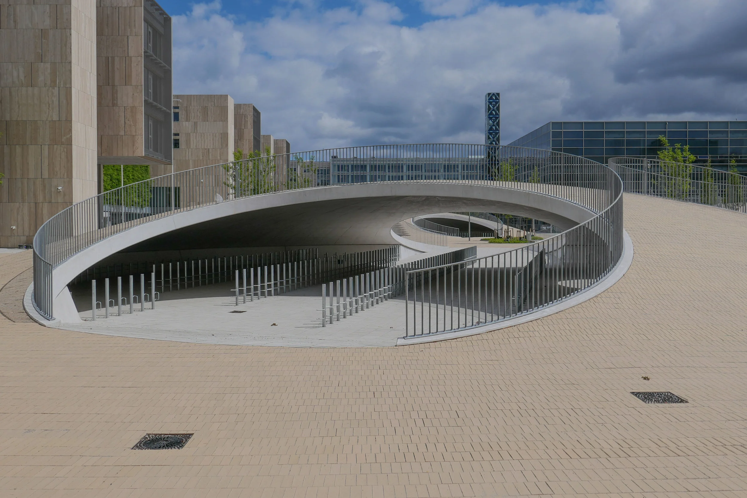
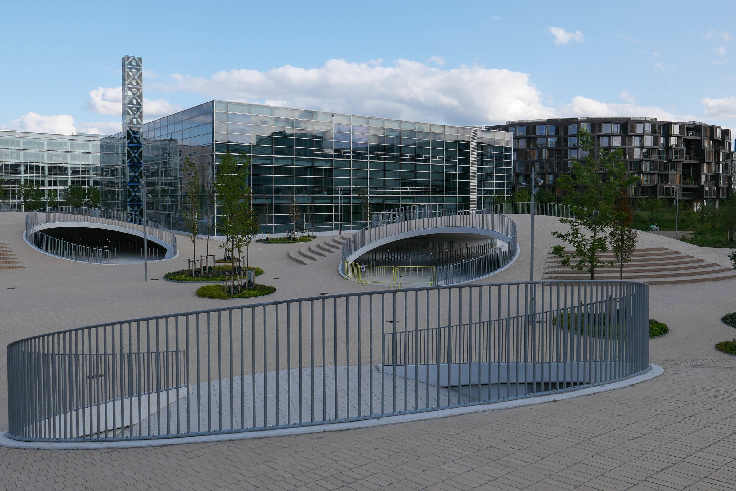
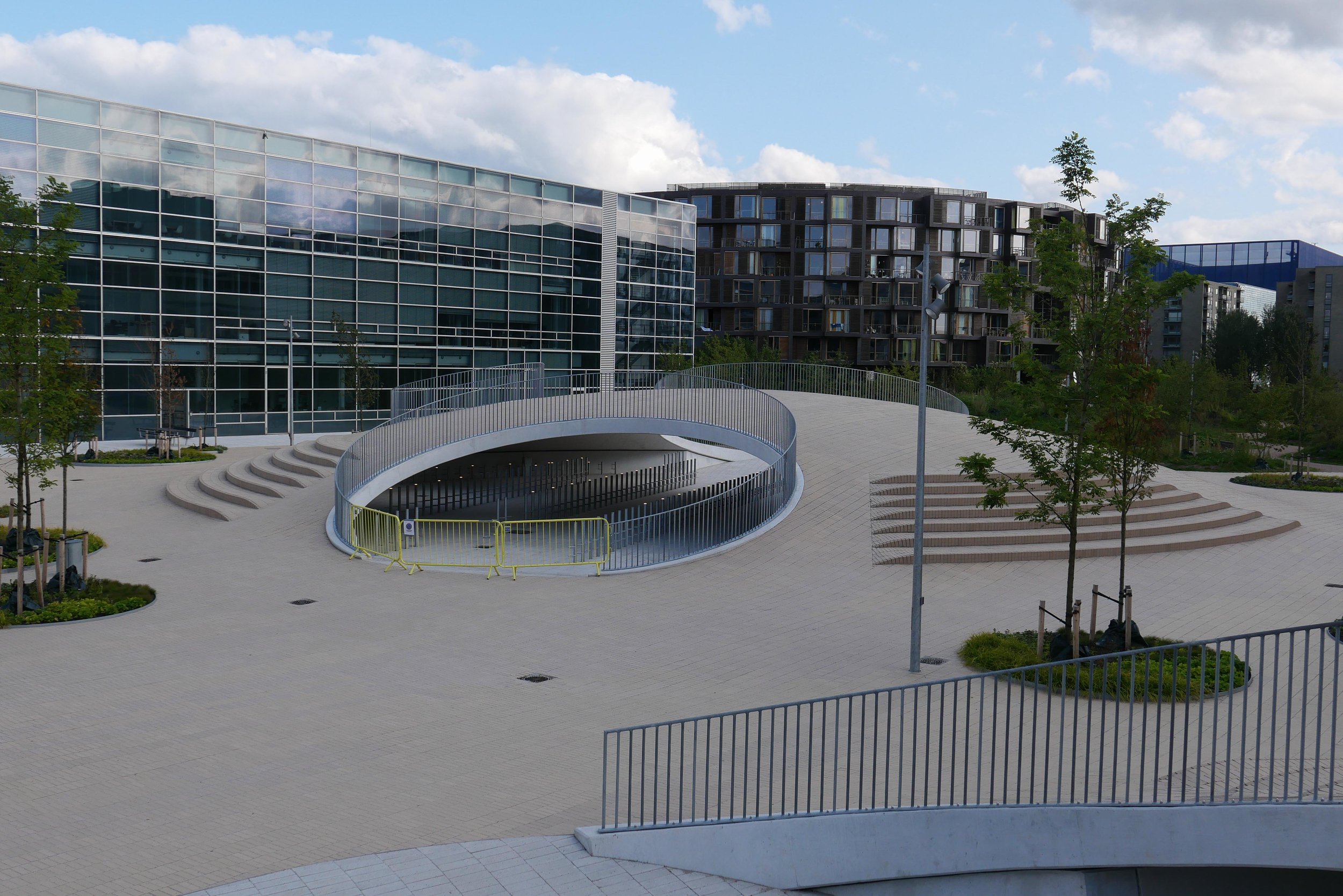
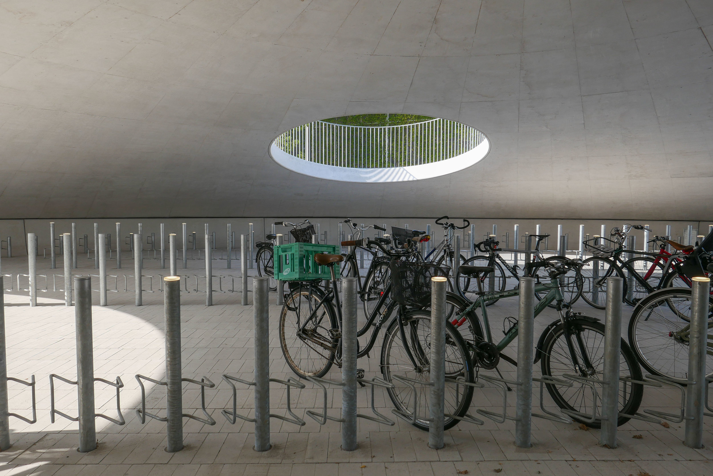
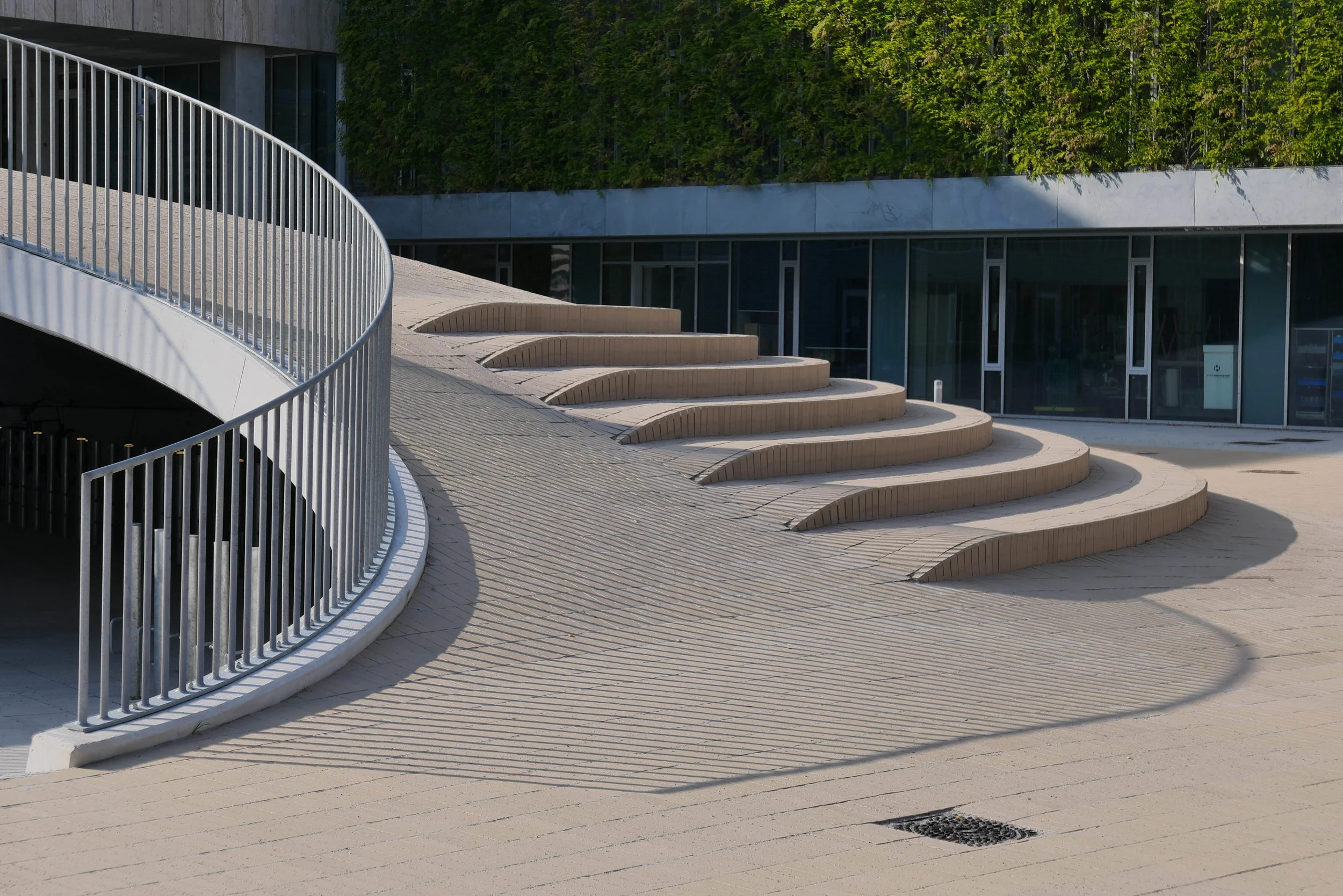
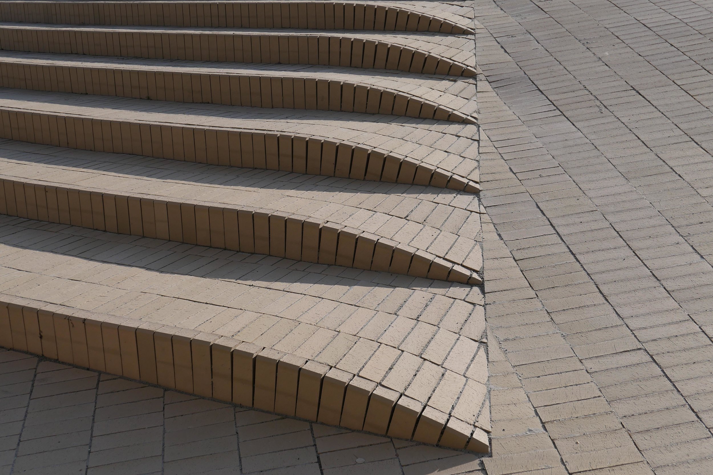
The main area is paved with pale bricks and the main feature is shallow brick domes that cover part-sunken areas for leaving bicycles but they also form areas for sitting out and reduce what was a bleak and almost overwhelming space simply because of the size of the open area.

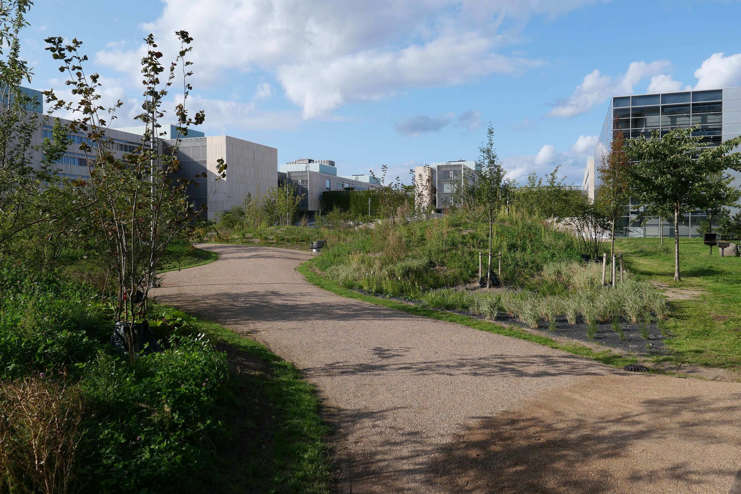
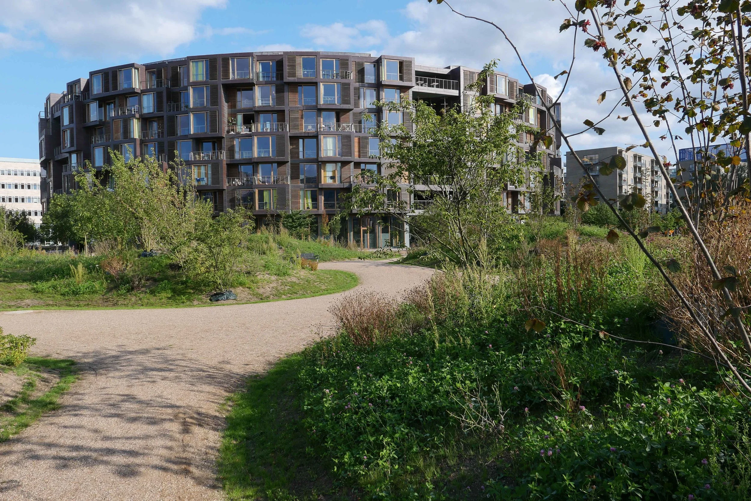
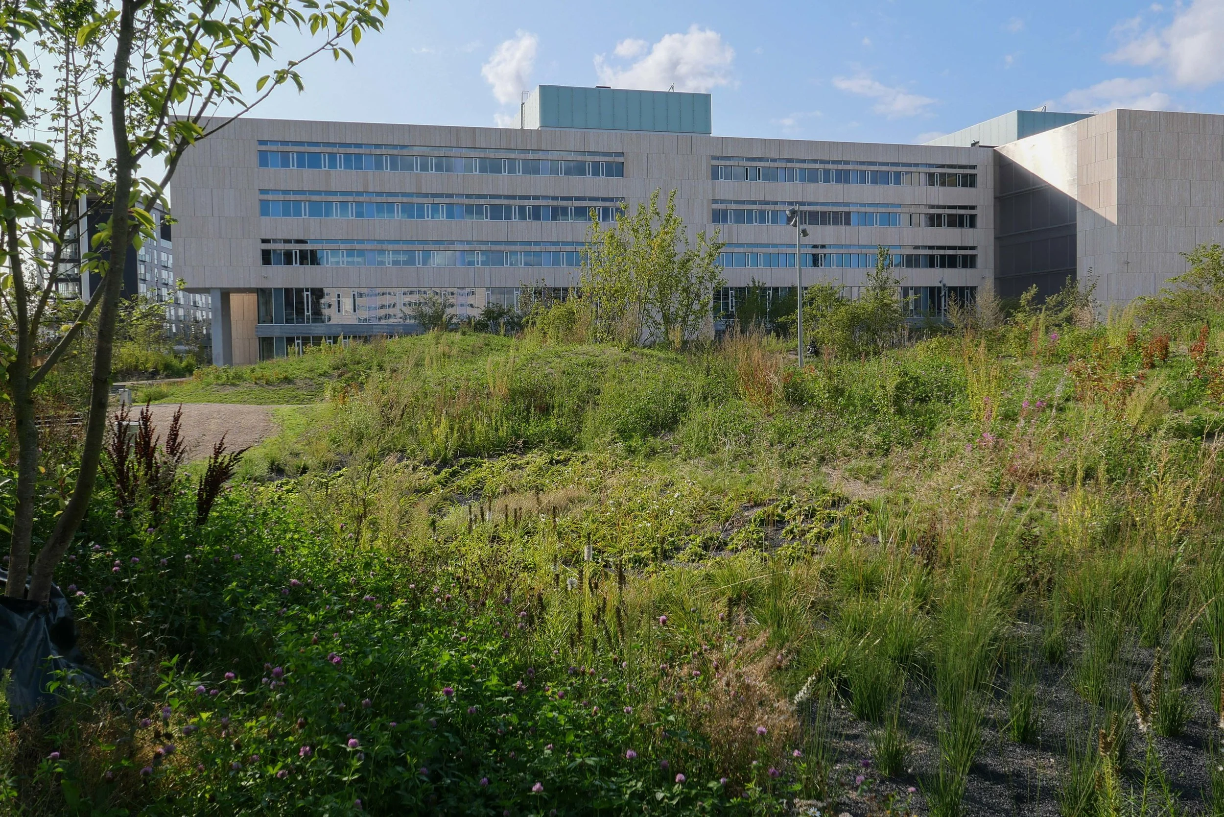
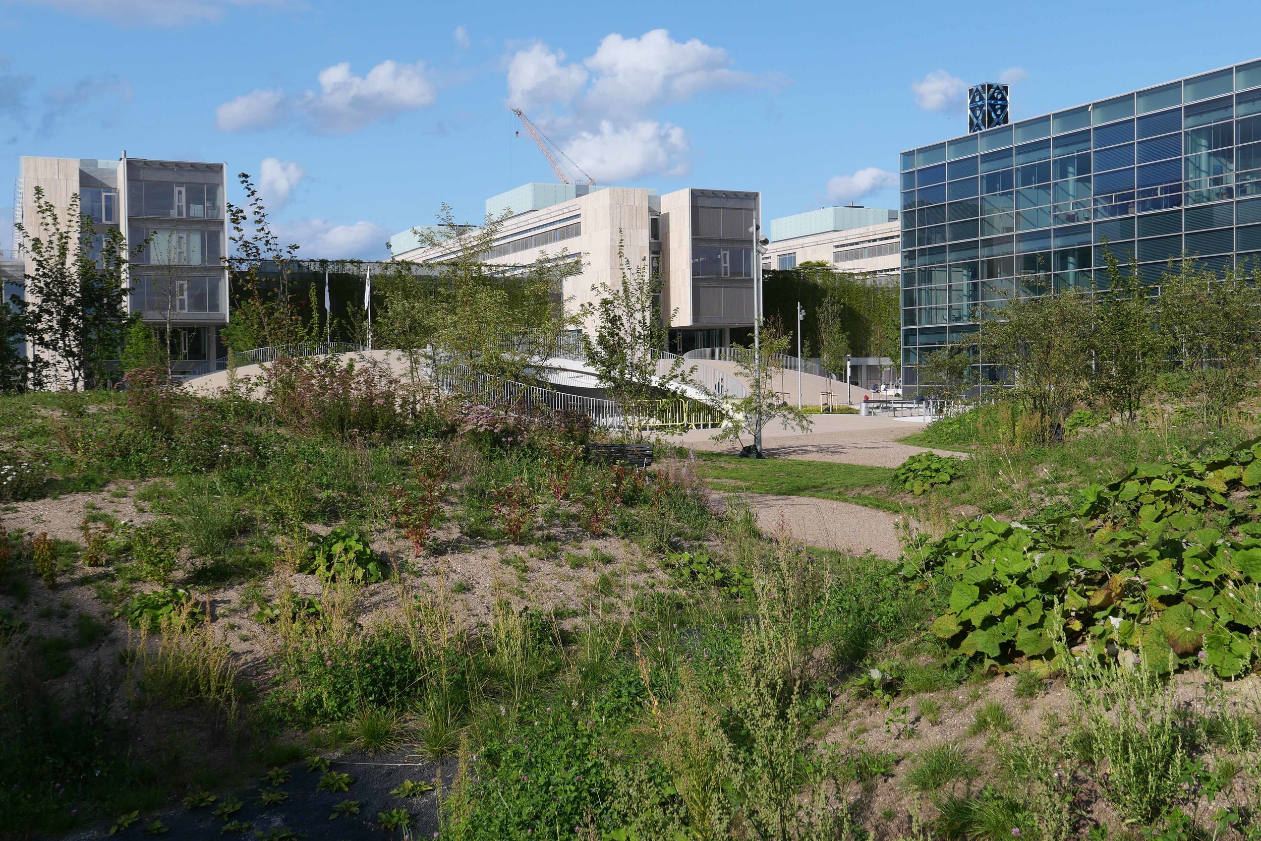
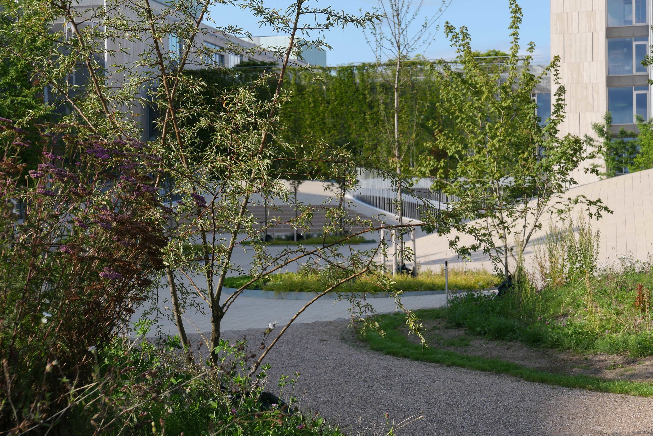
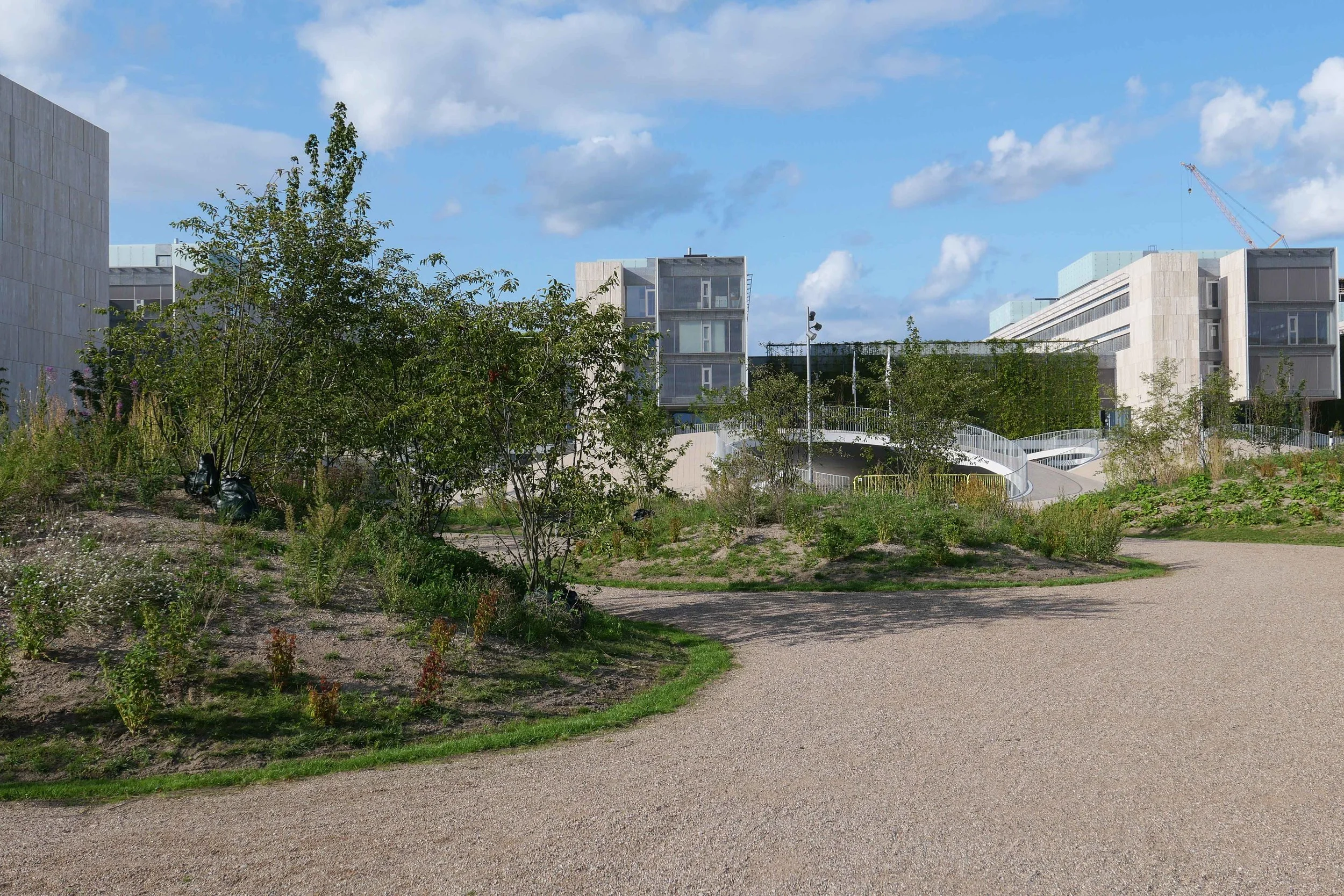
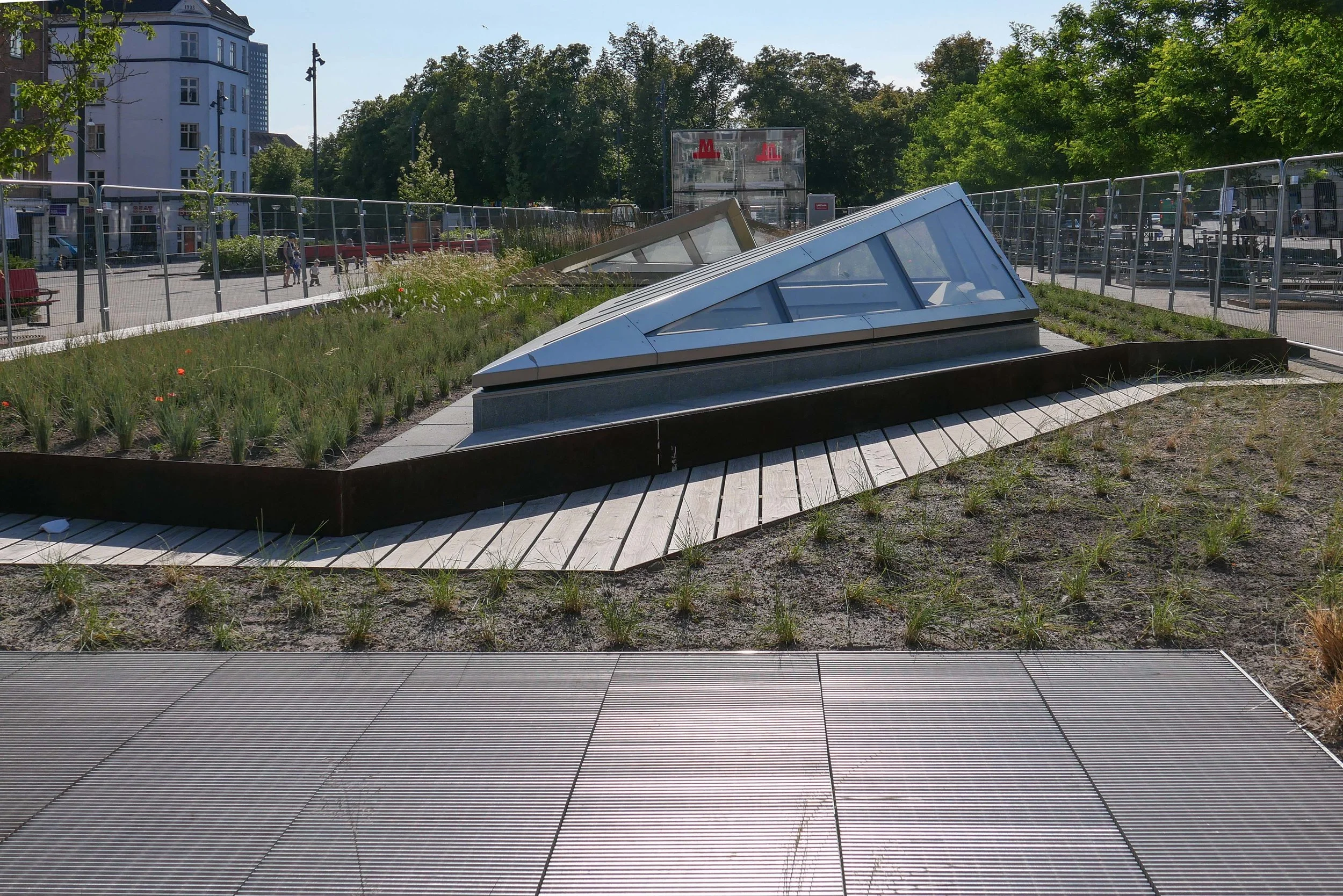
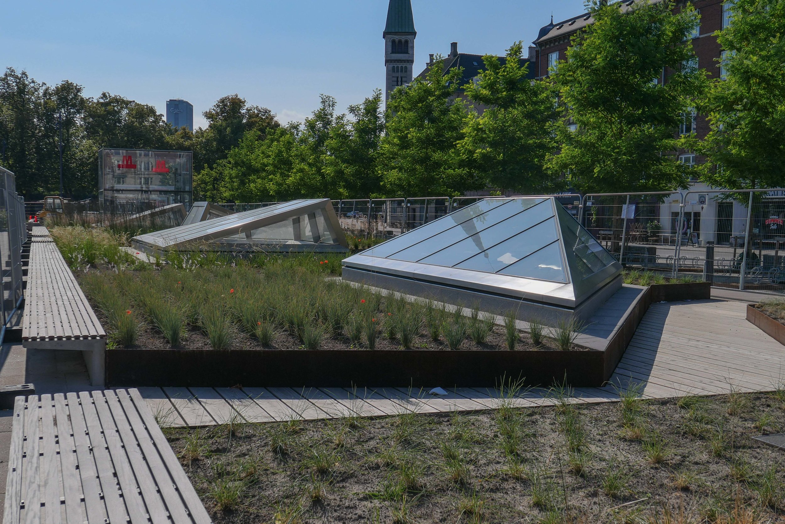
To the south the shallow circular mounds are repeated but are heavily planted and with winding pathways between them that create more sheltered areas. Several sunken areas have wetland planting and control the run off of rainwater.

earlier post on Karen Blixens Plads from June 2017 when work began

above - approaching the square from the south - from Amager Fælled

below - the main area north of the library before work started

select any image to enlarge and open as a slide show


Enghave Plads

Vesterbro - the part of the city immediately west of the central railway station - is a densely-occupied area of apartment buildings with most dating from around 1900.

This was a strongly working class part of the city with the main rail line forming the southern boundary and with the meat markets, gas works and the harbour presumably supplying much of the work and the Carlsberg brewery was, until a few years ago, to the west.

The street pattern of the district is complicated with two main roads - Istedgade and Sønder Boulevard - running out at an angle from the railway station at the north-east to the south east but with secondary cross streets of traditional apartment buildings running north to south and there are also several streets running across the area from south east to north west so it a complex pattern of a grid but overlaid with a Saint Andrew cross so some streets meet or cross at odd angles.

At the south end of Istedgade is Enghave Plads - a large open square much wider east to west than the distance across from north to south and it narrows at the centre. This square is where several tram routes met so it was always an important point in the area and immediately to the west is a very large square with a major public garden - Enghave Parken - that has large apartment buildings on the north, west and south sides so the two spaces run together though divided by a busy main road - Enghavevej.

Enghave Plads is the site of one of the major new metro stations on the new circle line that will open at the end of September. The east end of the square and some of the surrounding streets have been boarded off for about a decade with major construction work for the metro but the boarding has just been taken down and the space with it's new landscaping opened officially.

There are large areas for leaving bicycles across the north or darker side of the entrance steps to the metro station but across the south side of the metro entrance there are raised beds with Corten edging and long raised bench seats and then to the west more open space for events. This area has striking new seating that has deep red slats on a black metal frame and these form great bold curves though the initial reaction to the seating has been mixed - some asking exactly why people would want to sit next to each other in long rows even if they are curved. Mature trees to the west, along the main road, have been kept and provide a baffle against the sound of traffic and shade for more seating and an area that is fenced for ball games.

Copenhagen Metro

Vesterbro with the main railway line to the south, the MeatPacking district in the cirve of the railway and the main railway station top right
Enghave Plads just left of centre and Enghave Parken towards the left side

Enghave Plads from the east with the square of Enghave Parken beyond

tram leaving the square and heading along Istedgade towards the railway station … the area between the buildings and the central space has been paved over and the main through traffic has been restricted to the north side of the square


Gammel Strand


the official site for the city Metro has news, general information, drawings and a short description of the new stations along with pdf plans of the area around each station at street level

Work is moving forward fast on the hard landscaping at street level above the new metro station at Gammel Strand … a station on the new circle line that will open later in the summer.

The steps down to the platforms and the glass covered lift tower are in place and setts are now being laid in the traditional scallop pattern across the main area so the new arrangement for this important historic street is becoming clear.

There was consultation with local businesses and local residents. Vehicles will be excluded, apart from deliveries, so the only through traffic will be a new narrow bike lane but with markings showing lanes to cycle in both directions.

The existing road, now being removed, runs parallel to the building frontages with just a narrow pavement so with little space for outside tables and chairs for the restaurants here. With the bike lane set forward closer to and parallel to the canal there should be much more space for people to sit outside and the gentle curve of the bike lane takes that bike traffic along the side of the canal further west rather than running as the road does now through in a straight line to Snaregade.

There will be steps down from the street level of Gammel Strand to a lower canal-side level for access to boats but as a sun trap it will certainly be used by people simply wanting to sit and watch what is happening on the water.


The work at street level around each station is crucial. People will quickly get used to the new arrangements of steps and paved areas and new road alignments and, inevitably, find it difficult to remember what each area looked like before …. particularly as the disruption of major engineering work has meant temporary arrangements and high hoardings around many parts of the city for many years.

The precise arrangement of steps and lifts and the crucial bike stands will be important not just for how each station deals with the numbers of passengers each day - estimates suggest that 18,000 passengers a day will use Gammel Strand - but the planning will determine the way people use the area immediately around each station.

Here at Gammel Strand, many using the Metro will be heading to or coming from the parliament buildings at Christiansborg on the other side of the canal so the steps up and down from the east end of the platform are double width. It seems that, in part to respect the historic quay side, and reduce the impact of the new station superstructure, Gammel Strand will not have skylights found on most of the existing stations to throw light down, between the escalators, to bring as much natural light to the platform as possible.

Gammel Strand was a commercial quay backed by warehouses and merchants’ houses but for many years it was also the fish market until it was moved out south down the harbour to Fisketorvet.

Fishwife by the sculptor Svejstrup Madsen - set up on the parapet wall of the quay in 1940

Fishwives continued to trade here long after the main fish market was moved


Frederiksberg Allé

when seen in the Winter, it is easier to understand the way in which the lime trees are pruned to keep the candelabra shape
the photographs were chosen to show just how important the paving is along the pavements but also across Sankt Thomas Plads - the circus at the city end of the Allé


above - the stone piers and the gates that closed the Allé at the east end n the approach from the city

below - Sankt Thomas Plads - the circus towards the east end of the Allé

There has just be an announcement that Frederiksberg Allé is to be given special protection and the policy will be to not only retain its present character and to maintain controls on hard landscaping and planting but also to allow appropriate interventions to enhance the urban landscape.

The Allé is a fascinating street with a clear and well-recorded history but it also has a wider significance in the history of the city because it represents a distinct and important phase of urban planning in Copenhagen and it remains as clear evidence for how the royal family used and moved between their palaces in and around the city.

Laid out in 1704 , the road runs west from Vesterbro to the main entrance to the park and gardens of the royal palace of Frederiksberg. It was a private road that was closed by a gate with substantial stone gate piers at the city end.

Maps from the 18th century show the road as a broad tree-lined avenue with open fields on either side but, even then, the circle or circus of Sankt Thomas Plads is obvious and there was a large open space at the west end, in front of the gates to the gardens of the palace.

The avenue is now famous for the double lines of lime trees that are pruned to a candelabra shape.

There is a wide central road with the double avenue of trees on each side, each with a broad pavement down the centre between the trees, and then secondary or service roads, outside the lines of trees, with wide pavements immediately in front of the buildings. From Sankt Thomas Plads to the gates into the palace gardens is just over a kilometre and the avenue from building front to building front is around 40 metres wide.

the gateway to Frederiksberg at the west end of the Allé

around Christmas, the square in front of the gates to the palace park and gardens is flooded and frozen for ice skating 

apartment buildings on the north side of the Allé and a detail of the elaborate architectural decoration

looking across the Allé and down a side street shows how, immediately behind the apartment buildings, the scale of housing changes with villas set in well-established gardens

Most of the buildings along the road are large apartment blocks that date from the 19th century with many having ornate facades and they are particularly fine examples of the type so clearly the avenue was considered to be a prestigious place to live.

It was established, from an early stage, that this was an area for people to walk - to promenade - and to be entertained so there were theatres, pleasure gardens and cafes along the street.


above - the Alhambra pleasure gardens that were on the north side of the Allé
below - the surviving theatre on the south side of the Allé


To either side of the avenue are well-kept streets that run back from the Allé with villas, many of a high quality, in terms of their architecture, and most with well-established and well-planted gardens.

note:
The route of the new metro line cuts across the Allé near the centre where there will be a new metro station. As with so many other areas of Copenhagen, the metro station will create a new dynamic to the Allé itself and to the area around.


Karen Blixens Plads


Work has now started on clearing the ground and erecting temporary hoardings on Karen Blixens Plads at the centre of the south campus of the University of Copenhagen in North Ørested. The reorganisation of this important urban space by COBE will create sunken areas and low man-made hills over them to provide storage for over 2,000 bikes but also create 

“a central urban living room connecting the three main entrances of the university buildings. The new square will be a campus landscape, offering high functional performance as well as recreational resource. The necessary infrastructure is turned into a three-dimensional student hang out.”

quote from Our Urban Living Room - Learning from Copenhagen Arvinius+Orfeus 2016

Walking from the metro station at Islands Brygge, going through the wide opening under the buildings and entering the square at the north-west corner then the space seems vast. From there to the canal to the east it is 185 metres and in width, from the blocks of the humanities buildings to the north front of the library – the square building at the centre of the area – is over 40 metres and from those northern buildings down to the arc of water in front of Tietgenkollegiet – student housing by Lundgaard and Tranberg built around a circular courtyard – is around 170 metres.