
Statens Museum for Kunst - the historic setting
/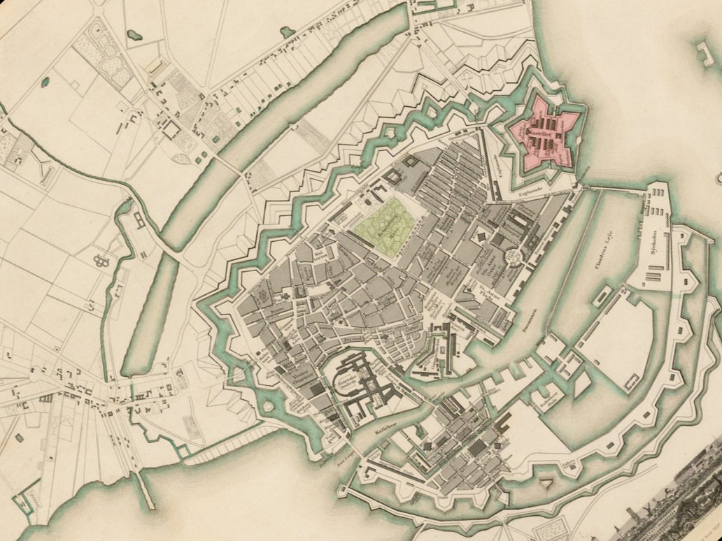
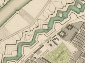
Until the 1860s Copenhagen was enclosed by high embankments, bastions and moats with only four points of access into the city through gateways. As the population increased in the early 19th century, some areas of the city became very overcrowded and when, in 1853, there was an outbreak of cholera and through that summer over 5,000 people died, it was clear that something had to be done and work started on removing the defences and building on the land between the embankments and the lakes. One of the first major buildings to be constructed on level ground beyond Rosenborg Castle and close to the lakes was a new city hospital designed by Christian Hansen and completed in 1863.
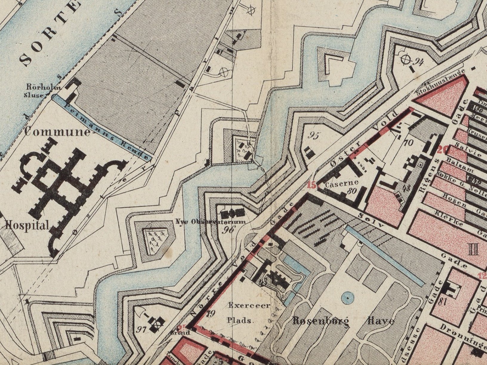
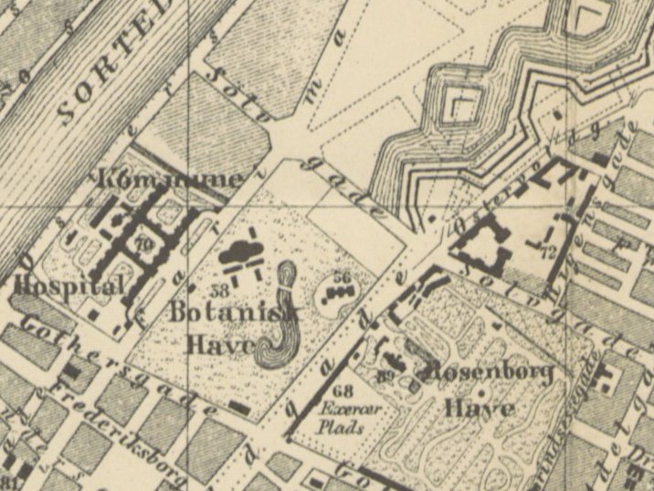
Sølvgade and Gothersgade, the streets on either side of Rosenborg and the King’s Garden were extended down to the lake and the section of the moat and embankments between Rosenborg and the new hospital became the new botanical gardens. The Observatory at the south corner of the gardens was completed in 1861 and the Greenhouse was built in 1874.
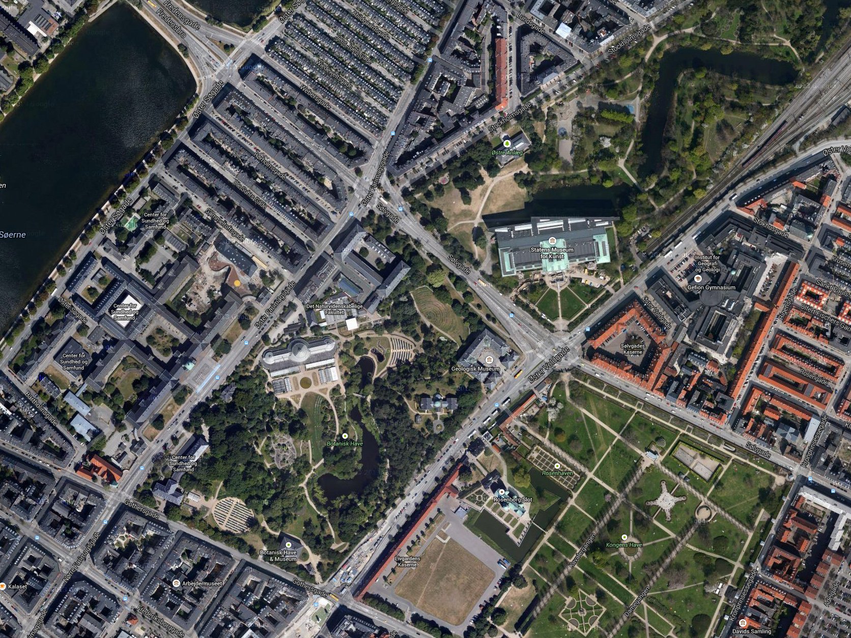
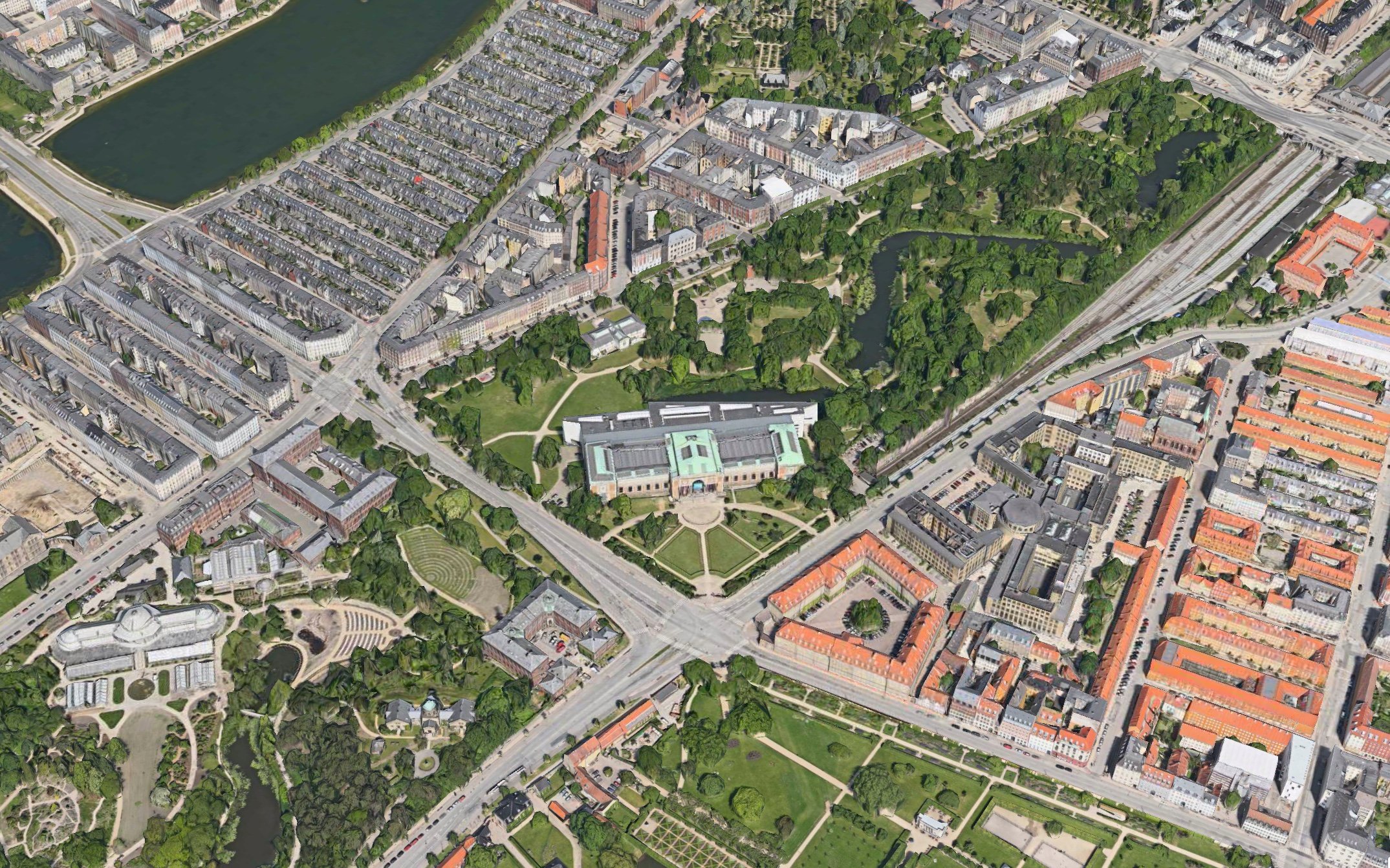
Initially, there were plans to lay out new roads and build across the next section of the defences - there are dotted lines on the map of 1887 - but following a fire at Christiansborg Palace in 1884 - which left the royal collection of paintings displaced - it was decided to build a new national gallery here and to leave this section of the moat and embankments as one of three new large parks around the city.
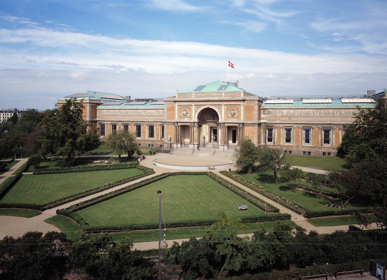
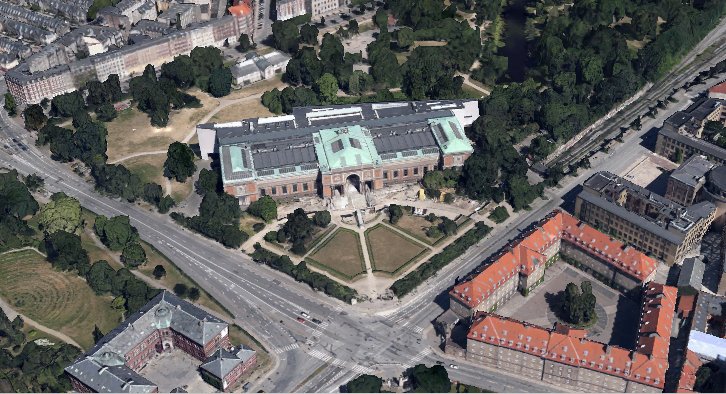
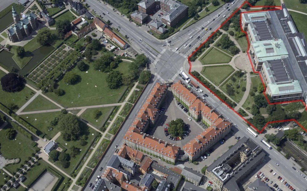
Statens Museum for Kunst, the national art gallery, designed by Vilhelm Dahlerup and Georg E W Møller, was completed and opened in 1896. The large brick and stone building is set across the angle of the plot, in part because it respects the alignment of the secion of moat that was retained as a lake in the park. As a consequence, the area of the forecourt is triangular.
It was laid out as a formal garden with a long main pathway to the centre of the building from the corner, from the junction of Øster Voldgade and Sølvgade, and with curved paths out from the front to each side forming quadrants. These in turn were bisected by straight paths and the area in front of the steps and the area at the corner were also curved.
Pathways were lined with low planting but the main areas were lawn but with a screen of higher planting separating the forecourt from the traffic of the street and taller planting at each end that, in effect, isolated the forecourt and the gallery itself from the informal park behind.
The gravel quadrant across the corner of the road junction was echoed by the set back of the entrance gate to the King’s Garden diagonally opposite and a short length of diagonal path continued the axis of the main gallery path into the garden before running into the grid of avenues and trees in the main part of the garden itself. This created a visual and physical link between the garden and the gallery and suggests that the main line of approach to the gallery was intended to be through the garden. However, the traffic on these roads is now so heavy that it must be quite some time since anyone attempted to walk diagonally across the intersection.
The front of the former barracks at the south-east quarter of the crossroads is also curved so only the Geology Museum seems to have resolutely turned to face away and refused to play as part of the broken circle.
When first constructed, the railway from the north part of the island terminated at Østerport but in 1917 the line was extended on to the Central Station. The first section follows the south-east edge of the park but just before the national gallery it is taken down and through a tunnel that continues on to Nørreport Station before emerging again just before Vesterport Station.
a major remodelling of the museum forecourt has just been completed


