
Nordhaleøen
/
the new island - as proposed by Urban Power
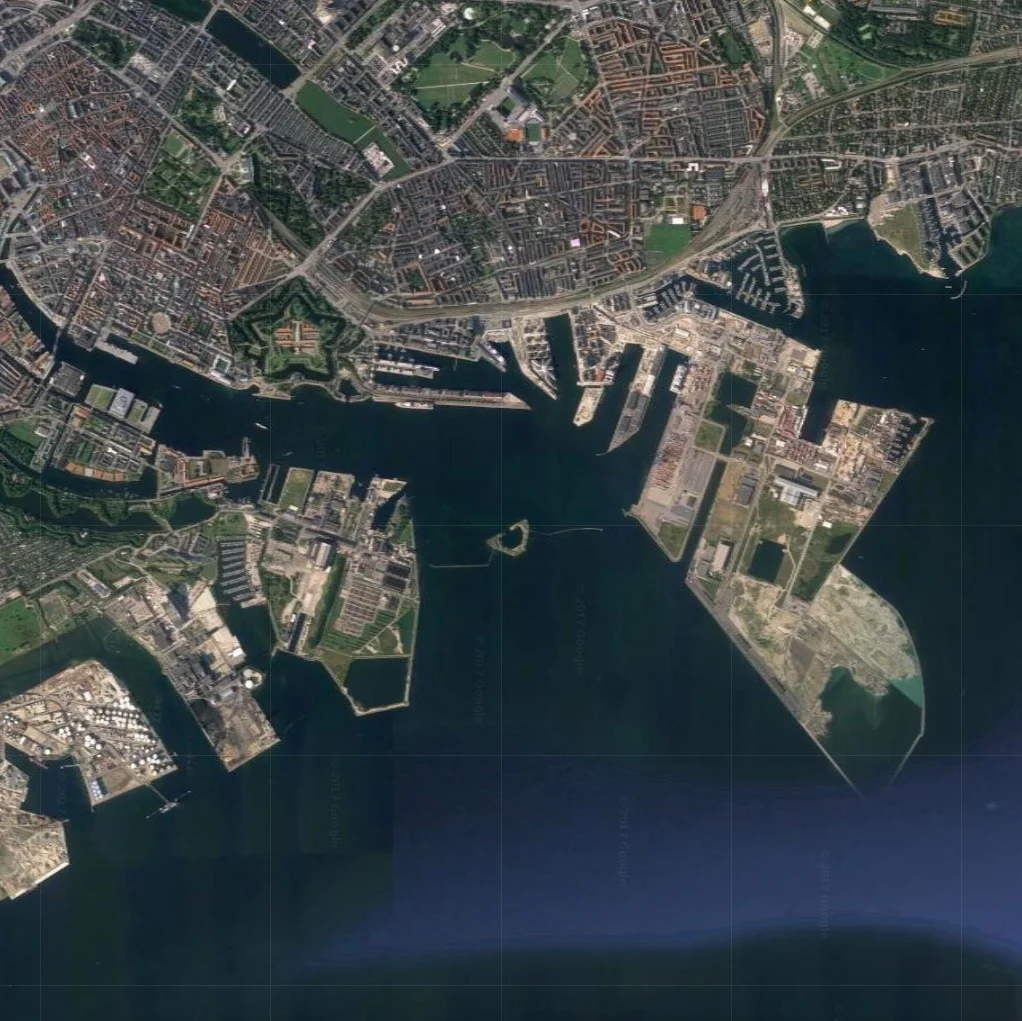
air view of the entrance to the harbour and map from Google ... reorientated with north to the right to make it easier to relate the island proposed by Urban Power to the existing entrance to the harbour
A dramatic reminder of the problems caused by changes in the pattern of weather in and around Copenhagen came at the end of the celebrations for the 850th anniversary when, on the last day, last Sunday, the Copenhagen half marathon, a major annual event, had to be abandoned just as it was finishing because there was a sudden and massive storm.
There are photographs on the internet that show just how dramatic that was … two runners were struck by lightning and, on the long straight run to the finish line, along a very wide and well-surfaced road, competitors found themselves running against fast-flowing water, coming in the opposite direction, when it had been completely dry just an hour before.
The city is developing important and innovative ideas to tackle the problems from sudden and heavy rain storms by constructing deep holding tanks to control the release of water into the harbour - to protect sewers - and by developing new absorbent road and pavement surfaces that along with natural areas of greenery can deal with temporary inundation to help to protect property. One good example of a recently-completed scheme was the installation of drainage down Sankt Annæ Plads and the construction of a substantial holding tank for flood water but this was also seen as an opportunity to improve the street to create a more prominent and more attractive public gardens down the centre of the street and to construct a new public area over the holding tank that is next to a new public square on the harbour.
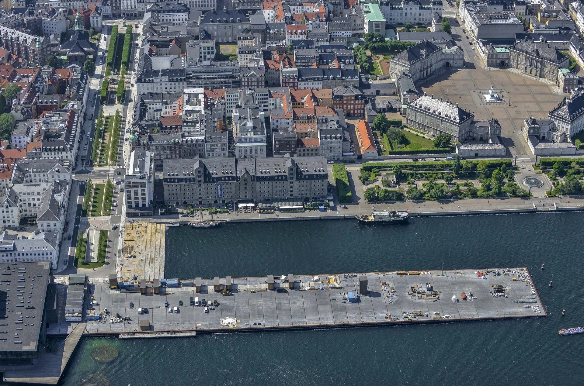
Sankt Annæ Plads - the long wide street running back from the harbour with new drainage to take rain water away from the area of Bredgade to holding tanks on the quay so release of flood water into the harbour can be controlled.
The large new public square - Ofelia Plads - is the former quay where ferries from Oslo docked until a new ferry terminal was built. In building the square the old quay was excavated and there are now three floors of car parking below the quay.
Initial studies of climate change indicated that flooding from rising sea levels was not an imminent problem but recent research has indicated that changes in sea levels, when combined with changes in weather patterns, could cause tidal surges that would drive storm water into the funnel shape of the inner harbour with devastating consequences.

Map of the city and the Island of Amager. The position for proposed tidal defences that was published in the Danish newspaper Politiken.
The main works marked in green, to protect the south-west coast of Amager, have been planned; the red section extending the line of the defence into Amger is in the design stage and the tidal barriers marked in yellow are proposed to protect the harbour from storm surges.
Again the city is being proactive so there are now plans in hand to construct tidal defences across the the south end of the island of Amager - to protect the south end of the inner harbour and the land on either side that is barely above sea level - and there are initial plans for defences in the form of a tidal barrier across the north entrance to the harbour to protect the centre of the city.
Urban Power - a young architectural partnership in the city - have appreciated the possibilities there could be with the construction of a new harbour barrier and they have taken the idea forward to suggest that these barriers could be the starting point for a new man-made island across the harbour between Nordhavn and Refshaleøen.
Housing and businesses on this new land could be an extension of the development now well under way on the reclaimed land of Nordhavn and it would make a more coherent long-term plan for the redevelopment of former ship yards and industrial areas on Refshaleøen.
The scheme could also resolves some potential problems with a proposed tunnel under the harbour at this point. Not only would a road tunnel be expensive but many in the city have expressed concern that it would pull substantial road traffic in to the city - particularly to Amager and along the coast to the airport - and local roads and the local community could not cope.
At this point the entrance to the harbour is about 1.3 kilometres across. In the proposal from Urban Power the framework of the island would be two transport arcs. The inner line, towards the city, would be a cycle and walking route - linking Nordhavn and Refshaleøen - and the outer arc a road for traffic and, crucially, a line for the metro to complete a new outer loop by extending the Nordhavn spur - now under construction to serve the new area of housing and the cruise ship terminal - and taking that across the new island to link in with the existing metro line running up from the airport to the city centre.
The area between these two traffic arcs, now open sea, would be reclaimed for extensive new development and at both the Nordhavn and at the Refshaleøen ends of the new island there would be wide entrance channels to the inner harbour but with flood barriers that could be raised to provide the protection from tidal surges … the primary reason for the work. They suggest that the ferry terminal for boats to and from Oslo - now at the dock between the old Free Port and Marble Quay - could be moved to the outer side of the new island, on the side towards the Sound so it would not be disrupted if the barriers had to be raised.
At this stage it is simply a proposal but, as so often in the city, this seems like rational, proactive and grown-up thinking.


