celebrating the 90th anniversary of S-tog

Journeys today on suburban trains through and around Copenhagen will be free to mark the 90th anniversary of S-tog, the S-train system that serves the city and its suburbs and outer towns.

The first train line in Denmark, from Roskilde to what is now the central station in Copenhagen, opened in 1847 and then, through the second half of the 19th century and the first decades of the 20th century, a network of train tracks were constructed to run around and across the city.

In 1926 a commission was set up to look at electrification of the train service. They presented their report in 1929 and the first sections, with electric trains running from Klampenborg to Hellerup and from from Vanløse to Frederiksberg, opened on 3 April 1934.

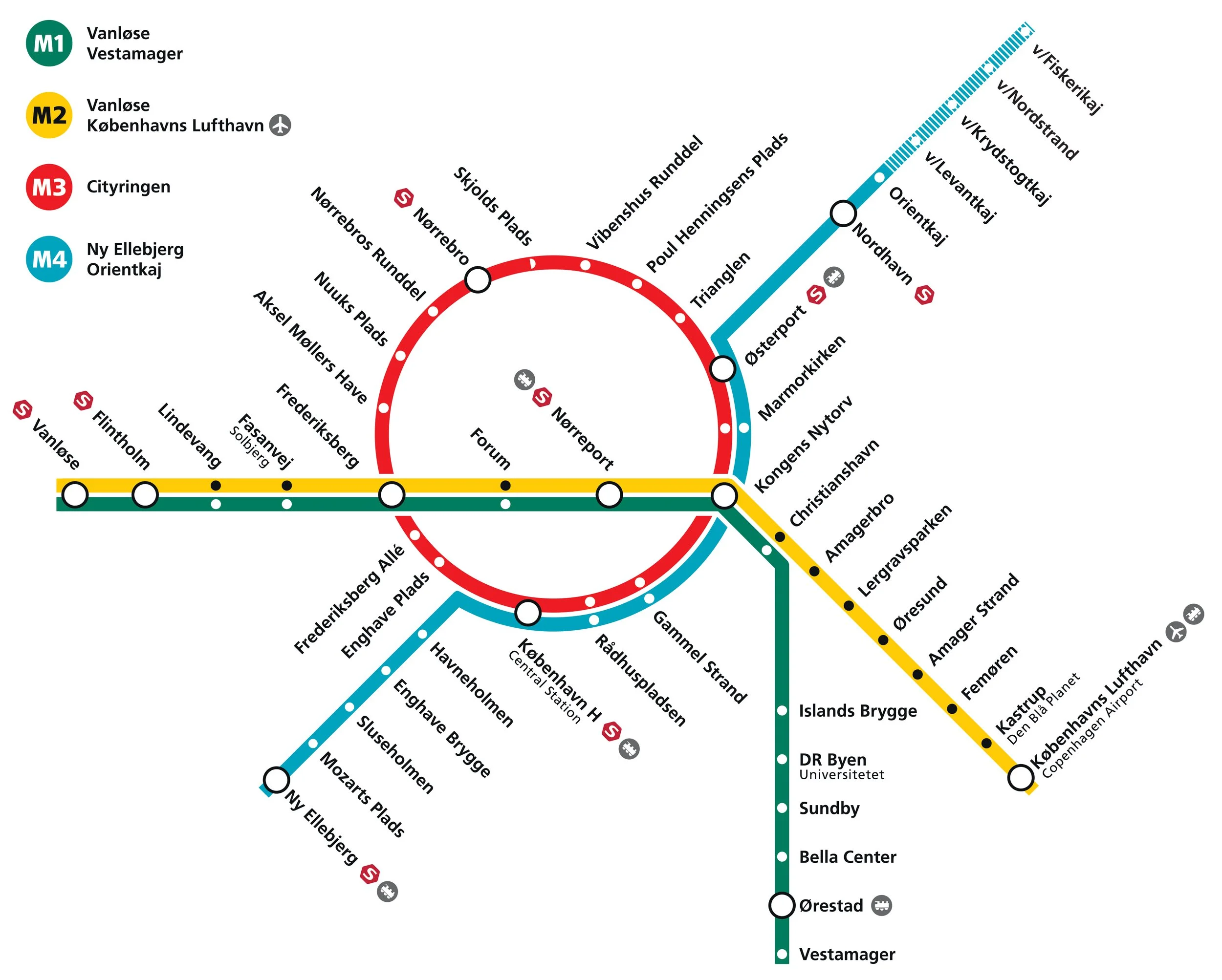
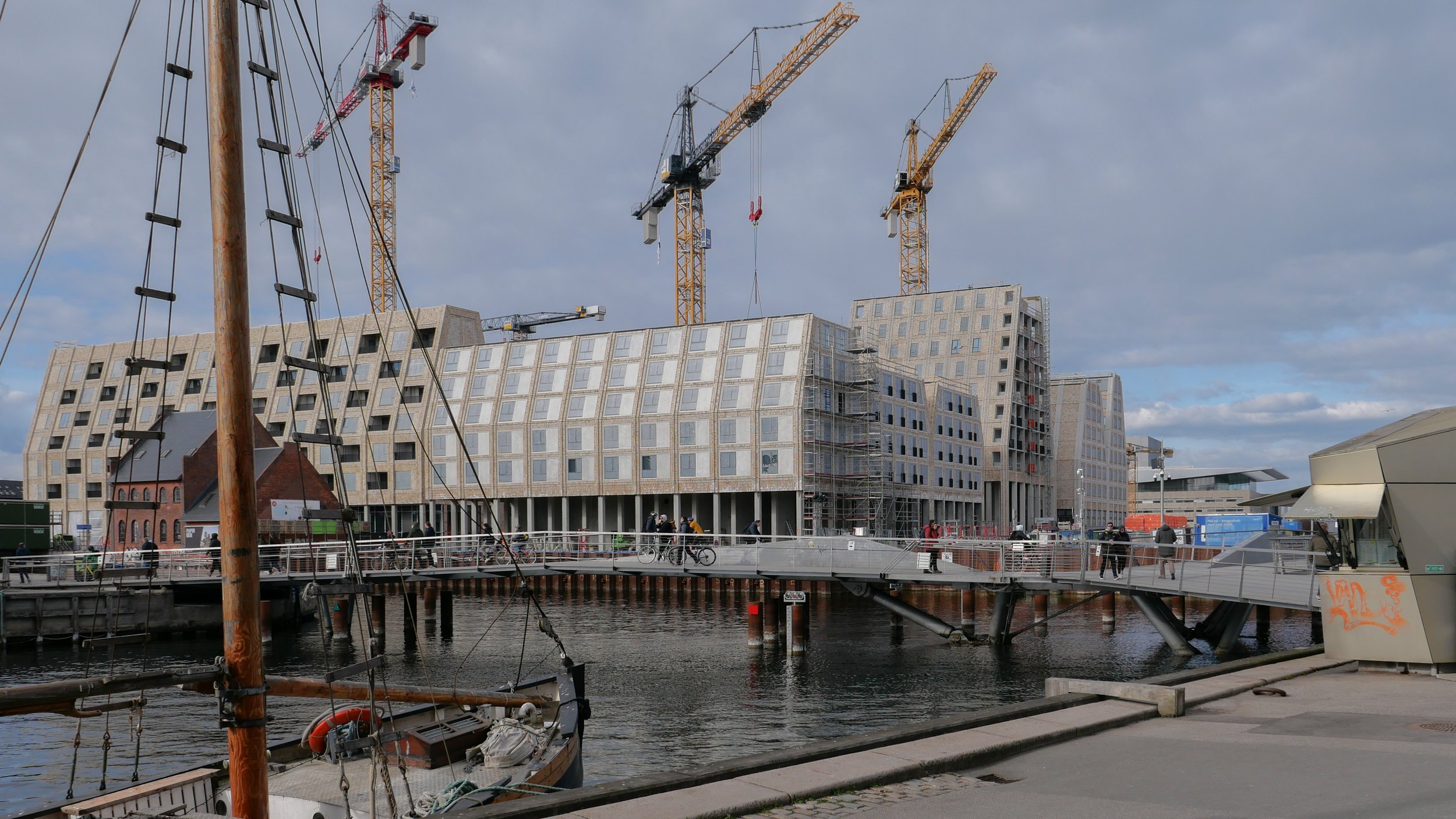
S-tog now has 170 kilometres (110 miles) of track and with 87 S-train stations … with 104 electric trains with eight cars and 31 trains with four cars … S-trains and the metro system together carry around half a million passengers a day.

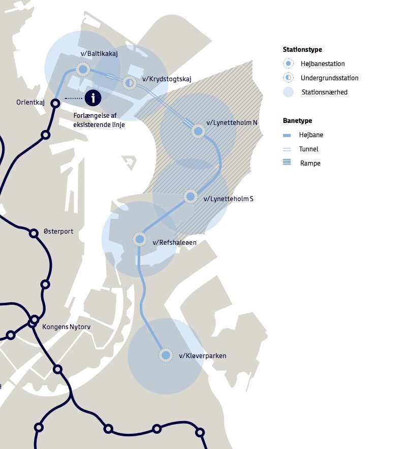
To the north of the city centre there are S-tog lines out to Farum, Hillerød and Klampenborg with lines out to Køge to the south, to Høje Taastrup to the west, and out to Frederikssund to the north west of the city. These lines meet and cross through the central station that is still the main traffic hub with interchanges to regional and international trains but there is also an outer S-tog service that runs in a wide arc across the west and north parts of the city from what is now called København Syd (formerly Ny Ellebjerg) to Hellerup and that crosses and links all the radial lines.

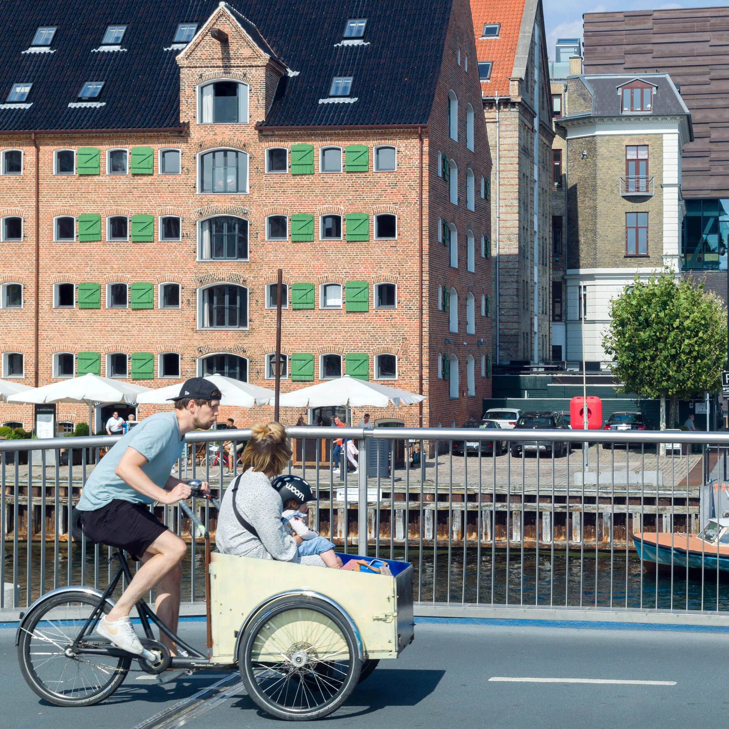
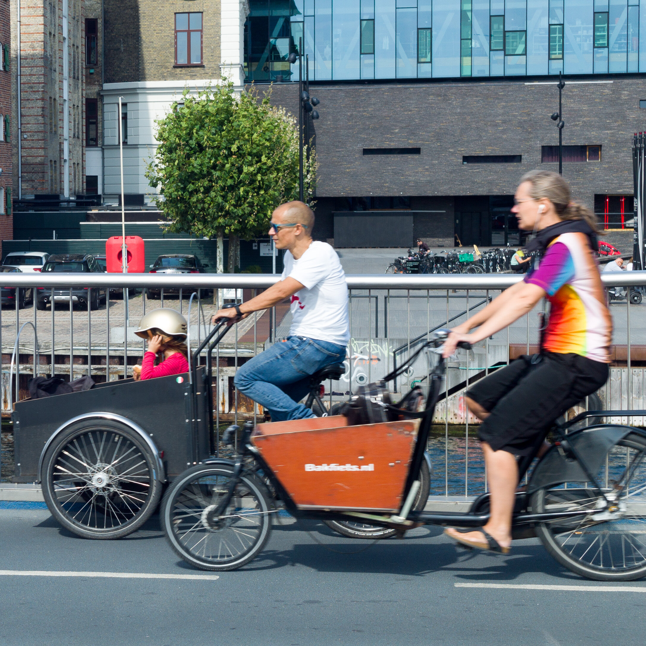
From the start, S-tog trains were promoted as not just a transport system for workers coming into the city in the morning and heading back home in the evening but also as a reliable and cheap way for citizens to get out into the countryside or out to beaches and the coast.

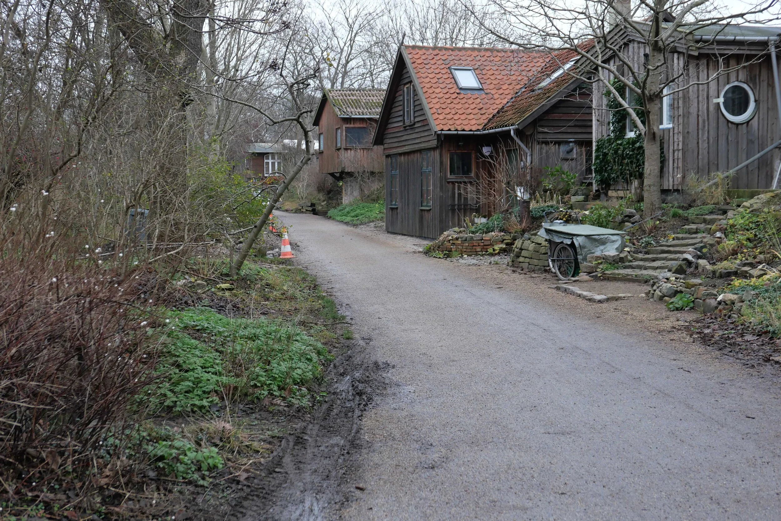
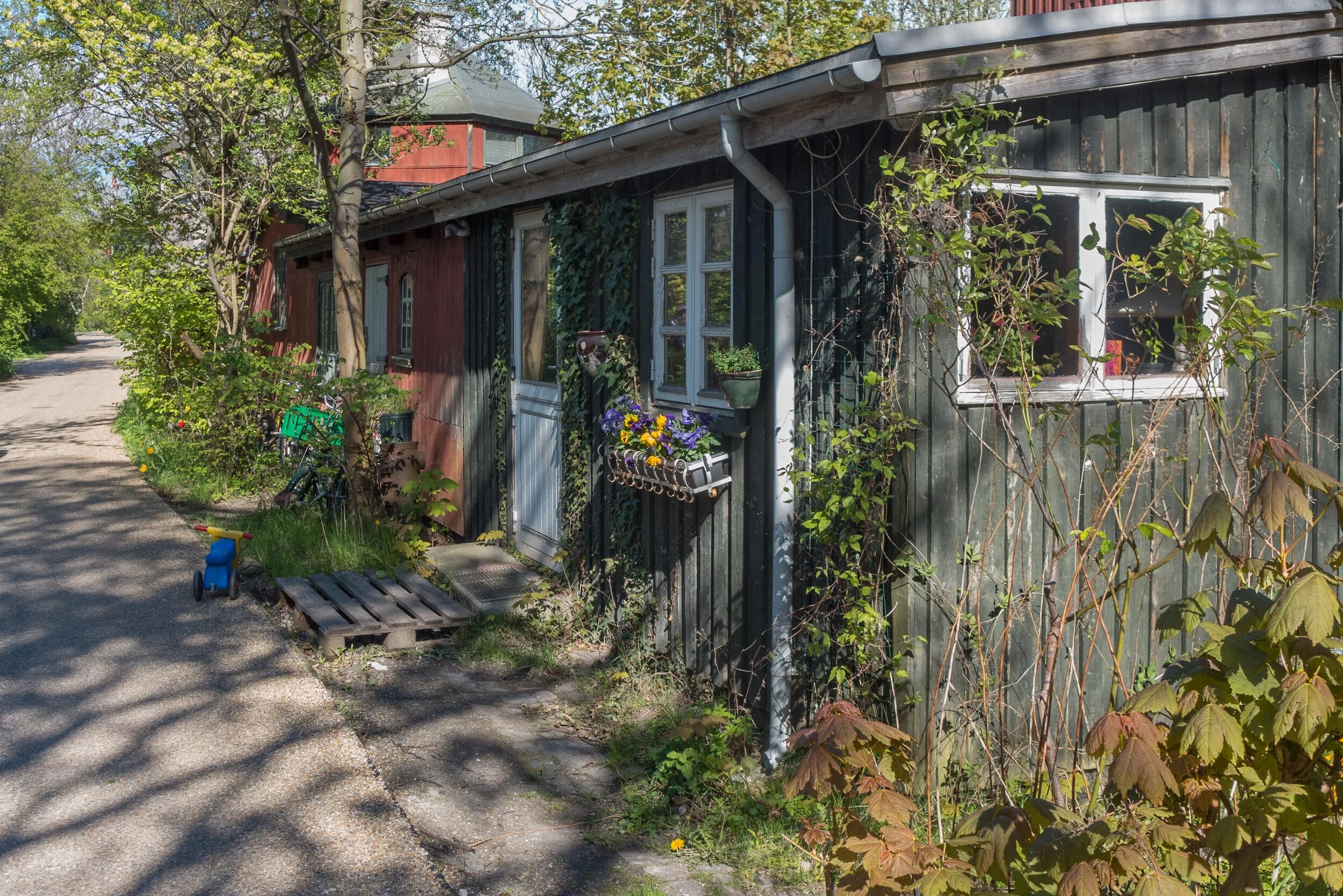
In 1947 this radial system of train lines became the framework for a crucial new planning proposal for Copenhagen that was to control urban development and prevent sprawl. Stations along the lines were to be nodes for commercial development or were to serve new areas of housing. It was called the Finger Plan as on maps - or at least on schematic maps - it looked like a hand spread out with the old centre of the city as the palm and new development along the fingers - each with an S-tog line - and with green spaces between the fingers that were, where possible, protected from development.

S trains today at the station at Østerport

a "dark store" in Copenhagen has to close

A grocery store on the south side of Holmbladsgade - on the corner of Geislersgade - has been ordered to close by the city council.

It's a large retail space across the ground floor of a relatively new apartment building and it has been open since December 2021.

Although, looking in from the pavement, this appears to be a fairly standard supermarket but there are no tills or check.out counters. This is not a traditional retail space but a Wolt grocery store so the problem for the city council is that the shop is not open to the public and is, to all intents and purposes, a warehouse where groceries, ordered on line through the Wolt App, are taken from the shelves and packed by warehouse staff and then collected and delivered to customers by bike riders.

It does not comply with the local plan for this part of Amager -designated as residential with appropriate retail - and there have also been complaints from nearby residents about noise and specifically about loud mopeds some of the riders use to deliver groceries.

From what I have seen, fast electric trikes used by some of the riders are much more dangerous. Recently, I heard some choice Danish words and even saw a fist raised in Christiania as a delivery driver from Wolt, riding on a wide electric trike with hefty tyres, raced through lanes packed with pedestrians to cross over the foot bridge to Amager at a fair lick and, believe me, it takes a bit to make the laid back residents of Christiania that angry about anything.

In 2023 planners closed an other Wolt Store on Enghavevej after complaints from the local residents committee.

When notified, Wolt appealed the decision by planners to close the Holmbladsgade store and suggested that they could sell hot drinks and baked goods to customers coming in from the street but it appears that that solution has been rejected so, sometime before Easter, this particular dark store will go permanently dark.

At Wolt the delivery riders are called partners - because they are not employed directly by the company - and they claim that they can not dictate what sort of bike or moped their riders use.

The company started in Finland in 2014 but in 2022 the business was sold to the American DoorDash. Wolt came to Copenhagen in 2017 and there are now 10 Wolt stores across Denmark, in main cities, so this type of store with bike deliveries has created a new planning problem.

These stores are defined as "dark" because they are not open to customers although that is a misnomer because this store is open until late - much later than other shops along the street - and it is brightly lit which is, I presume, for the security of the young warehouse workers and the delivery riders coming and going late into the night.


Along with groceries, Wolt delivers meals from restaurants that have been ordered on line and the app also has flowers and sex toys so they bring to your door almost everything you could want if you are staying in for an evening.

Before writing this post, I checked out the Wolt App - I don't use delivery services - and spotted immediately a glaring irony. The delivery riders I've seen racing around the city with their distinct pale blue delivery boxes are generally fairly fit - they have to work hard and fast to earn their money - but for customers this is such an easy way to bulk load calories because you only have to walk from the sofa to the front door and back with your delivery of your large hit of calories on demand.

Dark stores have been banned in Amsterdam so presumably problems there have been enough to prompt strong action by planners.


Ufortalte Historier - om kvinder, kon og arkitektur i Danmark

Ufortalte Historier - om kvinder, kon og arkitektur i Danmark
Untold Stories - on Women, Gender and Architecture in Denmark
Jannie Rosenberg Bendsen, Svava Riesto and Henriette Steiner
Strandberg Publishing
ISBN: 978-87-94102 67-4

Published 18 June 2023

A week or so ago, the Copenhagen publisher Strandberg sent me their press release for a new book on women in architecture in Denmark that was released today.

It covers the period from 1930 to 1980 that is generally recognised as the classic period for modern Danish design. Here the focus is on the architecture and the buildings linked with the emergence of the Danish welfare state and the key role played by women, working as architects and designers, in “creative collaborations that cut across genders and professional disciplines” and included the design of houses, major civic buildings, landscape architecture and urban planning.

The authors are part of an ongoing research project Women in Danish Architecture at the University of Copenhagen. Last summer they were part of the team that curated a major exhibition at the Danish Architecture Center on Women in Architecture in Denmark.

The book is published both in Danish and in an English edition for sale internationally.

Kvinder skaber rum / Women in architecture
at the Danish Architecture Center from 13 May 2022 to 23 October 2022

Strandberg Publishing

a new metro line across Amager

Reports in newspapers this week suggest that politicians at city hall have agreed on a new route for the next new line to be added to the metro system in Copenhagen.

Identified as the M5 line in previous plans, it is to run from the central railway station to serve Amager and Refshaleøen and the controversial new island of Lynetteholm.

Back in the Autumn of 2020, several options were published by Metroselskabet - the company that runs the metro - as they explored possible ways to extend the metro on from Orientkaj on Nordhavn to the new island of Lynetteholm and then, from there, down to Refshaeløen.

In a tight arc, the new line would have continued across Amager with major interchanges with the existing metro lines at Amagerbro and Islands Brygge before going under the harbour to the central railway station. It was also suggested, in the report, that there was also the possibility to extend the line on from the central station to serve the inner area of Nørrebro and the main hospital.

Two years ago, the priorities were to provide a metro service for the cruise ship terminal on Nordhavn and to serve the proposed housing on Lynneteholm along with an alternative route to reach the centre of the city from Amager that would relieve pressure on the original metro line from the airport and from Ørestad through Christianshavn to Kongens Nytorv that is now close to maximum capacity.

An obvious problem with those schemes was that there was a great gap in the middle where the new island might or might not be constructed ... the loop would only be fully operational when the two stations on Lynetteholm were open and it's housing completed and, current estimates suggest that will be sometime after 2070.

In addition, in order to work at optimal efficiency, any new line should have it's own service centre for it's own trains .... comparable to the service area at Metrovej in Ørestad for the original metro lines and Metro Service between Otto Busses Vej and Vasbygade for trains from the Cityringen.

In this, the most recent proposal for a new metro line from the central railway station, the line would take a wider curve across Amager to serve extensive areas of housing - both new developments and the revitalisation of older housing - where the only public transport is the bus services.

A new metro line from the central station would go under the harbour to a new station at Bryggebroen, at the south end of Islands Brygge, and then on to the existing metro station at DR Byen - rather than the original plan for an interchange at Islands Brygge metro station - and then to a new station on Amagerbrogade - further south than the interchange at the Amagerbro shopping centre proposed in earlier plans - and then on to an interchange at Lergravsparken - where passengers could change trains to get out to the airport. This new route would then continue north, close to the line of earlier route, to Prags Boulevard and Refshaleøen.

An area where the trains from this metro line could be serviced would be constructed out on the island of Prøvestenen.

This new metro line could be completed by 2035 but could then be extended on to Lynetteholm - if and when the island is finished - and, at the city end, the line could be extended on from the central station to inner Nørrebro and Rigshospitalet.

This is an important example of just how plans for major infrastructure projects have to evolve as other problems or other demands come to the fore or as the economic situation dictates.


an introduction to Kalvebod Brygge

Planning is about the future. That's in the very word itself. We plan to do something ... planning is not retrospective. But it really is important to understand how we got here - why a street or group of buildings is as it is - to understand how and why what we have is good or bad and to use that to inform what happens next.

The history of Kalvebod Brygge is fascinating and complicated but, in terms of history, all relatively recent and all recorded on the maps produced over the last 100 years or so.

Primarily, the development of the south harbour is a lesson in how economic and political events often move faster than the best-laid plans for our streets and squares and, too often, a complicated scheme of renewal or development can take so long to realise that it is redundant or inappropriate by the time it is completed.


1912

1945

1967

Until the late 19th century, the harbour south of what is now Langebro was a wide bay.

In the middle of the 19th century a new railway from Copenhagen to Roskilde was laid out along the north beach of the bay, along what is now Sønder Boulevard. In commercial terms, the close proximity of water and railways is catnip for development … as much back then in the 19th century as it is now.

First a meat market and gas works were built out into the bay with wharves for the delivery of coal for both the gas works and then for a new electricity works built immediately south of Tivoli. That was superseded in 1932, when the coal-fired power station of HC Ørstedværket opened.

There were wood yards between the harbour and Ny Glyptotek when it was built in the 1890s but these were rapidly replaced with new streets and apartment buildings.

A new central railway station was built in 1911 and the railway was taken out on a wider curve on yet more land claimed from the bay and, for the first time, Bernstorffsgade, between the new station and Tivoli, became a main road though, initially, it did not continue much further than the south-west corner of Tivoli and certainly not as far as the harbour.

At about the same time, so from about 1890, the line of the shore of Amager, opposite, was also being pushed further and further out into the bay and both sides of the approach to Langebro became docks.

If you use the word port it usually conjurers up the image of ocean-going liners but this was docks .... vital, hard working but fairly grubby commercial quays for coal, grain, sand and building materials and soy beans and sugar. The sort of goods carried in freighters.

On the city side, these  commercial docks continued all the way up to Knipplesbro so across where the National Library and BLOX are now.

Rail tracks came off the outside curve of the main railway and ran all the way up the city side as far as Nyhavn and at Langebro the railway crossed over to Amager and ran down quays on the Islands Brygge side … all for goods and not for passengers.

The area where Kalvebod Brygge is now was mainly rail sidings and marshalling yards and, although it might seem incredible now, this was where, around 1969,  the city built the first container port. The main area for transferring containers from ships to railway trucks - then a very new system for shipping goods - was on new yards where the service depot of the metro is now.

There were soon huge new cranes along the quay for transferring containers but it was early days for this new form of shipping and there are accounts of early attempts to pick up and move containers with a fork-lift truck on each side in, what sounds like, a dangerous balancing act or containers were lifted up from the end which blocked the driver’s view of where he was going and it can’t have been that good for the cargo to have the container tipped up at an angle.

There was still a large building of circa 1910 that had been a pig market on the quayside although it had been used as a garage for some time. It was demolished in 1966 and work started on extending Bernstorffsgade down across the site of the market as far as the quay and then a main road, a dual carriageway, was constructed along the quay - and that is what is now Kalvebod Brygge - to be the main fast route into and out of the city.

This was part of wider plans to modernise radically the road system of the old city with wide and fast new roads. It was the period when there were even plans to build a motorway down the lakes as an inner ring road and the period when large blocks of old buildings in the north corner of the old city were demolished and the first glass and steel office buildings were constructed within the old defences.

But events and world economics and technology were moving faster than the plans and the dock was in decline. Not least, the problem was that the docks had to deal with larger and larger ships and these would all have meant the raising of Knipplesbro and Langebro and the opening of the rail bridge at Langebro to let them through. The docks in the south harbour went into decline and the focus turned to large new facilities at Nordhavn and on the expansion of other ports in Denmark

If the office buildings along Kalvebod Brygge can be criticised, it is because they are uninspiring and waste an amazing location but, by the late 1980s and into the 1990s, the city was facing bankruptcy and a new business area and any way to revitalise the harbour was better than any alternative. Award-winning architecture was not a priority.

on the city side, the commercial quays continued as far as Knippelsbro

the pig market that was demolished in 1966 for the extension of Bernstorffsgade as far as Kalvebode Brygge - Copenhagen Archive 42126

construction work for Kalvebod Brygge - Copenhagen Archive 91920
the building immediately below the end of the crane is what is now KB32

Bernstorffsage and Kalvebod Brygge in 1989 - the tower block is now a hotel and the car park to its right is the site of the new Scandic Spectrum hotel
the area of grass to the left is where the SEB offices are now
note the commercial/industrial building north of the police station - the building with a circular courtyard
that site too is now a hotel

the site of Carlsberg Brewery

When JC Jacobsen decided to build a new brewery outside the city, one reason would have been a need for more space to expand the business …. his first brewery was in a courtyard in Brolæggerstræde - close to Nytorv in the centre of Copenhagen - in a property that had been purchased by his father in 1826.

However, he must also have been concerned about finding a clean and consistent source of fresh water and for ways to discard the waste from the brewing process - not easy in the densely packed streets of the old city.

By 1847, Jacobsen had found what we would call now a greenfield site nearly 3 kilometres outside the city and built his new brewery there, alongside a new railway so, then, his next problem must surely have been finding men prepared to go that far out of the city to work. The story of Carlsberg is an important example that shows how Danish manufacturers moved production and labour from small urban workshops to new and rapidly expanding and rapidly developing factories outside the city.

read more

JC Jacobsen opened his new brewery in 1847 on an open site outside the city and alongside the new railway from Copenhagen to Roskilde that was finished that same year - detail from a map of 1860

update: a reprieve for Palads Teatret

Today, several newspapers and a couple of online architecture sites published the news that Palads - the cinema in Copenhagen close to Vesterport suburban railway station - has been given a reprieve and will not be demolished.

That means that two earlier schemes - one from Danish railways to build across the top of the railway trench and across the road and the Palads site and the second by the Bjarke Ingels Group BIG for a high tower on the Palads site - have been abandoned.

Nordisk Film Biografer, who own Palads Teatret, have just announced that COBE, the Copenhagen planning and architecture studio, have been appointed to draw up new plans for an extensive updating and refurbishment of the building.

is the redevelopment of Vesterport still on track?
another scheme for the cinema site


new apartment buildings on Papirøen at the centre of the inner harbour

On Papirøen - Paper Island - the new apartment buildings designed by COBE are now rising rapidly and beginning to dominate the inner harbour.

The square island is in a prominent position opposite the entrance into Nyhavn from the inner harbour and opposite Skuespilhuset - the national theatre - and  just north of the inner harbour bridge and just south of the opera house and the new opera park that was also designed by COBE.

The recent growth spurt of the construction work on the apartments is easy to understand. Massive excavations, for foundations and piling to support the new buildings, seemed to take a very long time but now, having reached the level of the quay, it has simply been a matter of bringing in all the slabs of concrete and the ready-formed balconies and the facing panels of fawn brick and lifting them into place.

It's the ubiquitous method for building now ....
drop off and slot in building.

But now most of the blocks are close to their final height, you get a sense of just how much this massive development will dominate this part of the harbour.

The distinct tapered silhouette with, what are in effect, abnormally extended roof slopes, cannot disguise the fact that the main block, set above a very high main floor, rises to the equivalent of 12 floors and on the east side, the side away from the harbour, the new buildings now swamp the 18th-century naval buildings of the Arsenal and the mast sheds beyond.

It is now even more difficult to appreciate the overall scale and the importance of the naval buildings that, over a distance of more than 700 metres, would have formed such an impressive backdrop to the vast area of open water where, through the 18th century, the great Danish naval fleet was anchored.

What is now called Papirøen actually had a second mast crane on the west side, towards the city, but otherwise seems to have been relatively open and was where naval officers arrived as they came by boat to join their ships ... coming over from the administrative buildings of the navy and the main ship yards that were then north of the royal castle in the area of the city between Holmens Kirke and Nyhavn.

the 18th-century warehouse of Nordatlens Brygge from the south west with the development of Kroyers Plads, also by COBE, to the right and the site of the Papirøen development to the north of the warehouse to the left of this view

COBE, on their web site, imply that the main inspiration for the new buildings came from looking at the old warehouses along the harbour although the new blocks have none of the dignified and restrained grandeur of, for instance, Nordatlantens Brygge just to the south of the Papirøen site and the very deep balconies framed by concrete uprights and the slightly odd shifting across of the position of windows and balconies on alternate floors across the south side - to create a slightly restless chequerboard effect - are closer in visual effect to the large development on Dronningens Tværgade from around 1950 that were designed  by Kay Fisker. Certainly not a bad model but possibly not a good one as Fisker was clearly and openly proud of his tall blocks whereas the Papirøen blocks are trying to disguise their height and, to some extent, must be trying to mitigate the shadows these very large buildings will throw across surrounding properties and across the courtyard at the centre of the development. 

the new apartments looking across the harbour from Skuespilhuset - from the board walk of the national theatre - two views from the Holmen side of the harbour - from the north east and from the south east - and the development from the south west - from the inner harbour bridge with the opera house beyond

the west side of the devlopment with the opera house beyond and (below) the apartments at Dronningens Tværgade by Kaj Fisker

the south side of the new apartments (above) and the north side of the square at Dronningens Tværgade by Kaj Fisker (below)

Newspaper printing works in the city stored their paper in the post-war concrete warehouses here - hence the popular name of the island- but after the warehouses closed, the buildings were used for car parks, for temporary gallery spaces - Copenhagen Contemporary, now out at Refshaleøen, started life here - and &Tradition had their first store out here and the COBE studio themselves had studio space in the warehouses.

But the main use for the concrete buildings on the side towards the harbour was for an incredibly popular food hall that thrived despite being in a slightly awkward place ... it was quite a long walk to get here before Inderhavnsbroen - the inner harbour bridge - was finished.

The food halls are set to return to the island - to the spaces on the ground floor - but these apartments will be some of the most expensive in the city so it will be interesting to see if they can coexist happily as neighbours.

It's probably unfair to criticise the building while so much is unfinished and a wide board walk around the buildings and a new swimming pool complex at the north-west corner will contribute much to this part of the city ... but visually I'm not sure the reality will match the romanticised and possibly over optimistic CAD drawings for the scheme. I’m always suspicious about proposals for buildings that are shown to look amazing in the dusk or in the dark.

Cobe on Paper Island

Papirøen - Paper Island from the inner harbour bridge in August 2017 (left)

the paper warehouses on the island were not attractive and certainly not in such a prominent position but, with the opening of the gallery space occupied by Copenhagen Contemporary and with the incredibly popular food hall that opened here, there was a vitality that will be hard to replicate once the expensive apartments are occupied


Inderhavnsbroen / the inner harbour bridge

Inderhavnsbroen - the inner harbour bridge for pedestrians and bikes that crosses from Nyhavn to Christianshavn - opened in the summer of 2016.

It provides an important and fast link between the old city, on the west side of the harbour, and Christianshavn, Christiania, Holmen and the opera house on the east side of the harbour.

Until the completion of the bridge, the simple way to cross the harbour was to use the ferry between the Skuespilhuset - the National Theatre - and the opera house - a distance of about 600 metres door to door by foot and boat.

To walk or to ride a bike from the theatre to the opera house without using the ferry meant going down to Knippelsbro and then back up to Holmen - a distance of just over 3 kilometres.

With the Inner Harbour Bridge and the new three-way Transgravsbroen, it is still 1,500 metres from the door of the theatre to the door of the opera house.

By car it was even further. When I first moved to Copenhagen, cars could not drive over the bridge from Christianshavn to Holmen so the route meant driving over to Amager and then across the north side Kløvermarken and up to the causeway at Minebådsgraven and from there to Holmen and the Opera House ..... a distance of well over 6 kilometres.

Inderhavnsbroen was designed by the English engineers Flint & Neill who are now a subsidiary of the Danish engineering group COWI.

It has been nicknamed the Kissing Bridge because of the unusual way that it opens and closes to let large ships move up and down the harbour.

read more

Inderhavnsbroen from the south …. Havngade and then Nyhavn are to the left and on the right is Nordatlantens Brygge - the warehouse on the east or Christianshavn side of the harbour
the cranes are for new apartment buildings on Papirøen


the bridge from the east or Christianshavn side looking up Nyhavn towards Kongens Nytorv

the bridge from the east with Nyhavn beyond with the centre sections open for a ship to come through


cycle city Copenhagen

It has been said many times and in many places that there are a lot of bikes in Copenhagen but, even so, it's worth repeating because there really is an amazing number of bikes in the city.

Certainly more bikes than there are cars but the statistics actually show that there are more bikes than people ... approximately five bikes for every four people.

Four out of ten Danes own a car but nine out of ten Danes own a bike and, in Copenhagen, around half of all journeys to work or to school or college are by bicycle.

Bikes first appeared on roads in the city in the late 19th century and by the 1920s and 1930s bikes had become a common and popular form of transport for ordinary people.

The city is relatively flat and, even now, Copenhagen is relatively compact so it is about 15 kilometres (or 9 miles) from Charlottenlund, in the north, to Ørestad or Kastrup on Amager in the south and 13 kilometres (or 8 miles) from Brøndby on the old western defences of the city to the beach on the Sound on the east side of Copenhagen.

Children here learn to ride a bike when they are very, very young and many, from the age of seven, cycle to school alone. Teenagers, with several friends, are happy to pile onto a cargo bike to head out for the evening and everyday you see parents on bikes taking very small kids to nursery school or picking up a bike basket of food at the local shop. As many elderly people continue to use bicycles, they are clearly the popular choice for easy and cheap transport across all age groups.

Bikes are not just used for practical everyday trips but at weekends you see whole families or large groups of friends heading out on trips and racing clubs and bike events, like triathlons, are incredibly popular both with participants but also with large crowds of spectators.

In the inner city, with its narrow cobbled streets, bikes can certainly be quicker and easier than using a car and if you think that finding a bike rack is a hassle then try to find a place to park a car.

If you live in an inner-city apartment building then finding on-street parking for a car is almost impossible but most courtyards have bike racks and, if push comes to shove, or if you have a much cherished and very expensive bike, then carrying the bike up into your entrance hall or up and out onto a balcony, if you have one, is an option.

Each year about 500,000 bikes are bought in Denmark with a population of 5.6 million and I presume most of those are upgrades rather than replacements for bikes that have been lost or stolen although, to be honest, dredging the canals and the harbour for discarded bikes is a well-organised annual event. 

Statistics taken from Cycling Embassy of Denmark
Bicycle statistics from Denmark

Nørrebrogade in the 1950s


the bike lane on Vester Voldgade is well used but here, on this particular day, slightly less frantic than Nørrebrogade

this is the route from Lille Langebro, the new bike and pedestrian bridge over the harbour, to Rådhuspladsen - the City Hall and the square in front of the city hall

Lille Langebro


Københavnerkortet / The Copenhagen Map

What makes cycling in the city easy and popular is the infrastructure for bikes ... that's the network of designated bike lanes along roads - to separate cyclists from other traffic - that makes being on a bike as safe as possible and there are also green bike lanes, with bikes segregated from vehicles, that make riding a bike fast, safe and a pleasure.

The first bike lane was laid out along Esplanaden, below the citadel, in 1892 so, this year, that's an astounding 130 years ago.

But, of course, there is also a win-win situation for cyclists where the more bikes that there are in the city then the more bike shops and bike repair shops there are and the more enthusiasts and the more bike makers there are and the more chance there is to find exactly the right bike for you.

Perhaps, the only serious problem for cyclists in the city is finding somewhere to leave a bike while you are at work or shopping or when you're out for the evening.

For people commuting every day, cyclists who have lived much of their lives or all their lives in the city, they know exactly where they are going and how they are getting there. That is why cyclists here move fast and get frustrated with tourists or pedestrians who drift around on bike lanes or dither and saunter across at pedestrian crossings .... but, even if you know the city well, keeping track of new bike lanes or plotting a route out to a new place can be a bit of a problem.

I have been meaning to post about Københavnerkortet - The Copenhagen Map - that is an amazing on-line resource.

It's a dynamic map site that is great for planning analysis but you can select features such as bike lanes with bike parking and zoom in or out and turn and save jpg images or even print out maps. It's a great way to understand an area that is new to you or to plan a bike trip out.

Københavnerkortet


bike racks at Nørreport on the north edge of the historic centre … a major transport interchange with local buses, a metro station and the busiest train station in the country with suburban and inter-city trains


cycle routes across the city with “existing bike path” in maroon and planned bike paths dotted

A “Green Bicycle Route” is marked in green, appropriately, and you can also find the location of racks for City Bikes - the rental bikes - and find bike racks

bike lanes are getting wider .... they are generally 2.3 metres wide, so two people can ride side by side, but the most recent lanes in Copenhagen have set a new standard being 2.8 metres wide which means that a fast-moving cyclist can get past a cargo bike or two cyclists side by side without moving out into car traffic.

it has been shown that when a new bicycle lane is constructed, bike traffic on the road increases by between 10% and 20%

cycle lanes around the historic centre with bike racks … with narrow cobbled streets in the centre of the city, there are very few designated bike lanes although recommended routes are marked

coming into the city there are fast bike lanes into the centre from the north east along Store Kongensgade and out of the city along Bredgade, and from the harbour and the south part of the city to the city hall along Vester Voldgade.

new, better, cycle-friendly lanes are being laid out from Nørreport down Nørregade and, further out, recent road works have improved the bike lanes and road markings on Østerbrogade and along the city end of Amagerbrogade

bikes are given priority or separate time intervals for crossing at busy junctions with traffic lights and blue lanes across junctions are used both to mark clear routes for bikes and to warn drivers in cards and vans and lorries of the danger if they are turning across lanes where bikes have priority


is the growth of tourism in the city a threat?

In a number of posts on this blog, I have written that I feel that the rapid rise in the number of tourists visiting Copenhagen and the construction of a large number of new and very large hotels over the last decade could be a serious threat to the character of the city and one that is barely discussed by politicians.

Arguments for the growth of the tourist industry in Copenhagen that are usually put forward include the creation of jobs, the suggestion that the tourist industry attracts inward investment and that money spent by tourists in the city, in shops and at tourist destinations, is crucial for the local economy.

Arguments against what appears to be uncontrolled growth, is that the huge number of tourists with, of course, the astounding number of passengers from the cruise ships that come to the harbour - just under a million in 2019 in the year before the pandemic - are swamping Copenhagen and changing the character of the city. There is a certain irony in this because the visitors, by their sheer numbers, are damaging and changing what they have come to see.

Jobs are certainly created by the hotels but how many of those jobs are short term rather than long-term careers and where do hotel workers live? In the big hotels in the past, chamber maids and porters might well have lived in the hotel, in garrets and dormitories. That's hardly a positive thing but do short-term workers in the modern hotel industry add to serious problems caused by the shortage of affordable housing in the city?

Those jobs fuelled by tourism are not just those working directly for hotels and the tourism service industry such as guides but there are also jobs in supplying food, cleaning and servicing the hotels and restaurants and, of course, in general retail - many of the stores in the city have departments that are deliberately geared up to dealing with foreign visitors. Popular destinations for tourists including the city museums and galleries now depend on tourists coming through the doors and not only paying for entrance but spending in cafes or restaurants and souvenir shops. The argument then is that tourism subsidises facilities for local people that could not be supported on local spending alone.

When Coronavirus-19 struck the city, museums and galleries had to close and even when the lockdown was eased, the number of visitors has been slow to recover.

Designmuseum Danmark had serious financial problems as a consequence and they revealed that 90% of their income came from tourists. However, that should not be an argument for returning as quickly as possible to the pre pandemic numbers of tourists but a warning that the government and the city have left the museum vulnerable with a funding model that may well continue to be unreliable if coronavirus returns or if people are concerned about the possible and ongoing dangers of travel.

The tourist sector generates work for architects, engineers and interior designers who build and refurbish hotels and restaurants and there is an argument for soft-power influence for Danish design and manufacturing with tourists who visit hotels and design stores and see and use furniture and so on that they admire and they are then more likely to buy Danish designs when they return home.

Are there statistics to back this up?

There is certainly a strong market in high-quality Danish furniture that is purchased here in antique shops and second-hand stores and flea markets and then exported by the container load but that is not directly a byproduct of tourism.

Even foreign investment might not always be positive .... investment money coming into the country may well be offset by profits going out and many investors may well be blind to local issues and not susceptible to local pressure however well founded.

Even the amount of money spent by tourists may not actually be as much as assumed - how many passengers from a cruise ship buy little more than ice cream and a post card - and is there also a sort of escalator here? Successful tourist shops or successful restaurants aimed at visitors rather than local people can be profitable and then attract more businesses to jump on the band wagon. In recent criticism of the state of the Walking Street, local people commented that is now full of shops that sell tourist tat and that they avoided the area as much as possible.

Airbnb is a specific facet of tourism that has to be addressed at a political and planning level and stricter legal controls have to be introduced. The initial concept - with people using a spare bedroom to earn a little extra income and gain from entertaining visitors and proudly showing them their city - is fine and if people have to or want to move abroad for a short period and need to retain their home but have it work for them then Airbnb is one possible solution. The problem is when properties are bought to let as a portfolio investment because that is removing far too many homes from the normal rental market. Looking at maps of the distribution of Airbnb properties across the city then there are over 20,000 complete properties to let - rather than single rooms. If those homes were returned to the rental market then that would be close to the total of new homes that will be built on Lynetteholm - the contentious new island that will be constructed across the entrance to the harbour that is being promoted as a place to build housing for 35,000 people. One possible solution for the Airbnb problem would be to levy an additional tax based on profit that would be ring fenced for funding the construction of more social housing.

the distribution of Airbnb properties across the city

Copenhagen has always been a city that welcomed visitors but an important part of the appeal of the city is that so many people actually live in the historic centre. Large new hotels have taken over buildings or plots of land that could have been used for student accommodation or for social housing. There is a danger that if the number of tourists grows without more controls then the city will change from a place where people live who welcome visitors to a city that is a tourist destination where people live.


still threatened with demolition?

the Palads cinema building alongside the railway trench at Vesterport suburban rail station (above) and proposal from BIG for the Palads site (below)

With the pandemic hanging over the city, much of day-to-day life seems to have been put on hold although building work - particularly on the site of the old Carlsberg brewery on the west side of the city - seems to have continued.

Decisions about two very different buildings appear to have been suspended but for very different reasons.

The first is the Palads cinema, close to Vesterport suburban railway station and alongside the railway trench. It dates from the early 20th century although it is probably best known for it's bright colours when the exterior was painted in 1989 in a scheme by Poul Gernes in dark pastels but primarily in pinks and deep sky blue.

The building itself has been altered extensively over the years, so cannot claim to be of great architectural significance so there have been two applications to demolish with two separate schemes for redevelopment of this prime site - one with the railway trench built over and with a large group of towers, including a new hotel, and the other scheme by BIG - the Bjarke Ingels Group - with a cinema below ground and with a huge glass tower of offices and apartments above that would be as high as the SAS Royal Hotel nearby.

Both schemes mean the total demolition the existing building in order to develop the whole site but both seem to have underestimated just how many people in the city feel that the present cinema should be kept. They have fond and happy memories of coming to the cinema and restaurants here that, for many, go back decades and, for some, back through several generations.

The second building that is, apparently, awaiting a final decision about its survival, is very different.

It is an apartment tower on Amager that is immediately north of the south campus of the university and is part of a large development by the Bach Group.

Before work was completed, it was discovered that there were serious problems with the concrete of the foundations and then suggestions that there were also problems with the concrete structure above ground.

The developers have claimed that the concrete can be reinforced but since then there have been no further reports in the newspapers so, presumably, a final decision - to demolish or to reinforce the tower and complete the fitting out - is still to be resolved.

is the redevelopment of Vesterport still on track?
another scheme for the cinema site

update:
22 March 2022. An article yesterday, on the Byrummonitor site, stated that the sale of the tower to a large Swedish property group has been cancelled by mutual agreement. The article also said that remedial work on the foundations of the tower were completed last year.


Njals Tårn from the west

World Toilet Day

Today is World Toilet Day.

Almost certainly, if you are reading this, you live in a country where easy access to a toilet is something most people can take for granted but when 3.6 billion people do not have access to sanitation then we cannot be complacent about what is clearly a serious world-wide problem.

Dealing with sewage and waste water, in huge quantities, efficiently and effectively, is a surprisingly recent development in even our wealthiest cities so the history of dealing with the effluence of the affluent is a fascinating one.

In Copenhagen, the construct of pump houses and pipes for a safe supply of drinking water and building new sewers - for toilets flushed with water - only became a priority after a devastating outbreak of cholera in the city in 1853 when, over that summer, nearly 5,000 people died. Work began almost immediately on a new water works that opened in 1859 but the first indoor toilet in the city - or, rather, the first private toilet in the city that was flushed with water - was installed in an apartment building in Stockholmsgade in 1894 when there were well over 300,000 people living in the city.

Stockholmsgade was then a new street on the north edge of the city, on the north side of the park of Østre Anlæg, and there, even in those large and expensive apartments, the toilet could only be flushed because a new sewage pipe had been constructed that ran straight down the slope to the east and straight out into the Sound.

As recently as 1952, the well-used swimming areas - the bathing stations - in the inner harbour were closed because there was too much raw sewage going straight into the harbour and swimming, or, at least, officially sanctioned swimming in the harbour, did not return until early this century with improvements to the city drains and with the building of a new public swimming area at Islands Brygge.

Even now, in the city, cloud bursts - floods from sudden and heavy rain storms - can mean that the system is overwhelmed and raw, untreated sewage, has to be released out into the harbour and sound to stop it flowing back into basements or out into the streets.

I’m not getting in a dig against the city …. the same story, or very similar problems, will be found in every European city. It’s simply that large urban settlements are only possible and only safe if water supplies and sewage systems are in place and are not only well maintained but are also improved and updated as the city grows.


from the grandest to the most humble thunder box …

In Copenhagen , until the middle of the 19th century, human waste from the densely-packed city was either emptied into open street drains or it was collected by cart and taken over to the island of Amager to be spread onto fields there as fertiliser … from the early 16th century Amager was an area of small farms that produced food for the city.

Those open street drains emptied out into the harbour and into the lakes immediately beyond the northern defences - actually the source of the city drinking water - or out into the defensive ditches so It was not just the width and depth of the water in the outer ditches that would have put off attacking troops.

For the wealthy, living in larger houses and apartments in the city, there would have been commodes or chamber pots and servants who would take the contents down the back staircases to empty in the courtyard but most citizens, if they had access to a toilet, would have gone down to the yard and used some form of earth closet.

The toilet at the top is in a courtyard behind one of the Nyboder houses that were built in the early 17th century for the navy. Under the wooden seat is a bucket - although barrels were also used - and these would have been emptied onto an open cart and taken away to Amager.

The more refined commode and washbasin are - how can I put this delicately - the en suite for the royal pew in the gallery on the first floor and directly opposite the preaching desk in Vor Frue Kirke - Copenhagen’s cathedral.

In contrast, the double cubicle in a quadrant-shaped structure, with ventilation panels above the doors, was in a courtyard off Adelgade - between the royal palace and the King’s Garden - in an area of slums that was cleared in the middle of the 20th century. The main problems there must have been the lines of neighbours standing outside, waiting for you to finish, or, conversely, everyone having to stand and wait in the cold and rain for someone to come out.

At least the Adelgade toilets seem to have been modernised with water-flushed porcelain bowls that would have been connected to the main sewer system.

Buckets and barrels were used until well into the 20th century - in 1907 there were said to be 32,000 flushing toilets in the city and about the same number of toilets with buckets so how did the city deal with buckets of sewage?

In 1898 a new company was established called Københavns Grundejeres Reholdningsselskab af 1998 - the Landowners’ Cleaning Company of 1898 - but generally referred to as R98 - and it was their job to collect toilet buckets from around the city and take them out to Amager where they were emptied and washed and the contents were either dried and sold to farmers on the island for their fields or it was diluted before being pumped out into the sound.

Apparently, that crucial service was called “night renovation”.

The R98 depot on Amager (below) was on Herjedalsgade - just over the bridge from Christianshavn and to the east of the main road. There is still a water pumping station there and a large recycling station although now it is glass and plastics and paper and discarded furniture that are recycled rather than the contents of the city toilets.

Over the years, so much “night soil” was taken out to Amager that it was called, by locals, Lørteøen or Shit Island and, knowing that now, I look forward to the day when a pilot on an incoming plane, landing at Kastrup, announces “Ladies and gentlemen, we will be landing shortly at Lørteøen. Would you please put your seats back ..……..”

World Toilet Day


Christiania at fifty

the main entrance into Christiania

If visitors to the city know about Christiania, then it is usually because they have heard of Pusher Street but the history of the old barracks here - the buildings that were occupied fifty years ago - and the topography of this area - between the old city and the island of Amager - and, of course, the subsequent history of the community here is so much more interesting than the drug trade.

From the 1830s through to the 1970s this part of the city, close to Christianshavn and immediately south of the naval dock yards, was a major military establishment for the artillery.

Called Bådsmandsstrædes Kaserne, there were barracks; training grounds; stables for the horses that pulled gun carriages; a large riding hall and workshops for producing weapons for the artillery as well as  stores for supplies; weapons and gunpowder.

When the army moved out in the Spring of 1971, local people broke down the boundary wall, at first to make use of open space here as a play area for children who lived in the densely-packed housing of Christianshavn but then people realised they could occupy and make use of the buildings and on 26 September 1971 the settlement of Christiania was declared to be a free and independent town ... free of the laws and regulations of not just the city but also free of the laws of the state.

Back then, politicians and the police must have believed that this new community would survive for weeks or, at most but, fifty years later, Christiania is still here.

Sitting just inside the south entrance to Christiania, is the giant figure of Green George that was created from scrap wood in 2019 by the Copenhagen artist Thomas Dambo
the mural behind was painted by Rasmus Balstrøm.


graffiti and posters are important in the art work produced in the settlement …. here (above) on the outer wall of one of the main buildings that faces directly onto Prinsessegade and (below) on the boundary wall further north along Prinsessegade on the side of the boundary fence that faces out to the road

Christiania is not just the area within the former barracks but it extends north along the outer defences so encloses a large and important green area of the city.

The old buildings along the defences include stable blocks and gunpowder stores but also a number of self-built houses. There is public access to the lanes down the inner line of bastions and down the outer defence and it is a popular route for people walking between the city and Refshaleøen.

The main area of Christiania is remarkably close to the centre of the city and would be extremely valuable if redeveloped so there are occasionally rumours that the area is to be be cleared for social housing to be built here.


cargo bikes

Yesterday, there was an interesting article in The Guardian about using cargo bikes rather than vans for deliveries in urban areas.

It was prompted by the recent publication of a report on the benefit of using cargo bikes in London that was compiled by Ersilia Verlinghieri, Irena Itova, Nicolas Collignon and Rachel Aldred, and has been published by Possible - a UK based climate charity that is working towards a zero carbon society.

The article summarised important key conclusions from the report:

  • electric cargo bikes can deliver parcels faster than vans in a city centre - some 60% faster … cargo bikes can drop off, on average, 10 parcels in an hour to six parcels by a van driver

  • a delivery bike can pick up and deliver by tighter routes - taking more short cuts - and bikes can often cut around traffic congestion

  • delivery bikes can usually get closer, door to door, and waste less time trying to find somewhere to park

  • even with a power-assisted bike, there are considerable reductions in emissions and pollution

Research for the report included an assessment of routes used by the delivery service Pedal Me with deliveries from 100 random days over a season analysed and then compared with calculations of the equivalent mileage and time that vans would have clocked up.

For that sample alone, over just 100 days, cargo bikes saved four tonnes of CO2.

The conclusion was that "with the 100,000 cargo bikes introduced in Europe between 2018 and 2020 they are estimated to be saving, each month, the same amount of CO2 needed to fly about 24,000 people from London to New York and back."

I presume the conclusion was not that if there were more delivery bikes then more travellers could make more trips to New York because that really would be a particularly perverse form of carbon offset.

The important conclusion of the report was that "estimates from Europe suggest that up to 51% of all freight journeys in cities could be replaced by cargo bikes."

These photographs were taken on the inner harbour bridge and I thought that was a clever idea … most cyclists in the city move fast and the idea was that the slope, on the run up to the bridge, would slow them down a bit but I’d underestimated just how fit and fast the local cyclists are.

So it’s not my finest set of photos.

For a start, I should have set a wider aperture and shallower depth of field but then I’m more used to taking photographs of buildings and chairs that do not move.

And it was frustrating because, as I walked up to the bridge, three girls, dressed in their best, came past in the box of a Christiania that was decked out in pink ribbons and flowers on the way to a hen party and, as I headed for home, a bike came past with a second-hand Arne Jacobsen Swan Chair strapped to the front and I missed that too.

If I have time, I might have a second go at this and will update the gallery.


The report has some useful graphics with one (reproduced above) showing different types of cargo bike with possible loads and average widths .... a crucial consideration for planning departments when upgrading busy cycle routes that may need wider lanes and wider spacing for any bollards that are there to deter or block access by motor vehicles.

Replacing just 10% of motorised deliveries in London could save “133,300 tonnes of CO2 and 190.4 thousand Kg of NOx a year” and "would reduce urban congestion and free a total of 384,000 square metres of public space usually occupied by parked vans and 16,980 hours of vehicle traffic per day."

By 2019, there were 4.1 million vans registered in the UK with 58% of all vans owned by a business but 46% of the kilometres covered by van deliveries are in urban areas and a Department for Transport survey shows a proportion of daily journeys - 39% of those collecting or delivering goods and 43% of vans delivering materials - were no further than 25 kms from their home base and that makes more deliveries by cargo bike feasible.

Cargo bikes deliver faster and cleaner than vans, study finds,
by Damian Carrington, The Guardian Thursday 5 Aug 2021
Possible
The Promise of Low-Carbon Freight: Benefits of cargo bikes in London


Solutions at Royal Danish Academy

Architecture Design Conservation: graduate projects 2021

Shown here are 220 projects from the students in the schools of architecture, design and conservation who have graduated from the Royal Danish Academy in 2021.

This is an opportunity to see the work of the Academy schools, with their focus on the UN Sustainability goals, and these projects show clearly the ways in which teaching has taken onboard the challenge of climate change and the need to reassess our approach to materials for new developments and our approach to the increasing need to conserve or adapt existing buildings.

Here are the young architects and designers of the next generation whose designs for buildings and for furniture, industrial products, fashion and graphics will have to provide solutions to the new challenges.

As last year, the graduate projects can also be seen on line.

note:
after an initial opening in late June, the exhibition closed through July but then reopened on 2 August and can be seen daily from 10.00 to 17.00 through to 20 August 2021

Royal Danish Academy Architecture Design Conservation
Philip de Langes Allé 10
1435 Copenhagen K

Graduation 2021: SOLUTIONS
the exhibition on line

 
Solutions Grid.jpeg
 

new buildings on the roof of Det Danske Filminstitut / the Danish Film Institute

Det Danske Film Institute from the King’s Garden

Planning permission has just been granted for an extensive new development on the roof of the Danish Film Institute.

With two courtyards, this large building that covers a complete block in the centre of the city was built in two stages for the great Danish media company Egmont.

The first part - the west half of the block with a frontage to Vognmagergade - dates from 1912-1914 and was designed by the architect Bernard Ingemann. The second part - the east half that faces onto Gothersgade and looks over Kongens Have - the King's Garden - dates from 1926-1928 and was designed by the architect Alf Cock-Clausen. Egmont have a large office building opposite on the other side of Vognmagergade.

By the late 19th century, this part of the city, just inside the old defences, was tightly-packed with old houses around narrow and crowded courtyards that had become notorious slums. In the 1890s and into the 20th century the area was rebuilt. The courtyards and buildings were demolished and a major new street, Christian IX's Gade, was laid out, at an angle, to cut through the old area to the corner of the royal gardens, with new offices, new institutional buildings and large new apartment blocks were built on either side.

Gothersgade 55 - the east part of the Egmont building - is now occupied by Det Danske Filminstitut who have three cinemas here to show classic films under the name Cinemateket and there is also the library of the national museum of film with its reference archive of magazines, books and film posters.

The extensive work on the roof will create a new, cinema with 127 seats and there will be extensive terraces and pavilions for a cinema foyer and a café and areas for displays and exhibitions of historic film artefacts from the film museum.


Det Danske Filminstitut
Tagterrasse med filmmuseum
Egmont

the view from the roof of the Danish Film Institute looking towards Nyhavn
and the trees on the outer defences of Christianshavn


the Dragon Fountain is on the move again

The Dragon Fountain - the ornate bronze fountain on Rådhuspladsen - is on the move.

Today, work starts on dismantling the large sculpture of a bull fighting a dragon and it will be taken to the workshop of Skulptur Støberiet for restoration and repair. Then, on Friday, the bronze basin supporting the sculpture will be removed from the square and it too will be taken to the workshops.

The fountain has had a complicated history.

In 1889, there was a competition for a new fountain on Amagertorv - the public square about a kilometre to the east - and Joakim Skovgaard submitted a design. That design was then modified by Thorvald Bindesbøll but the competition was won by a design for a fountain by Edvard Petersen and Vilhelm Bissen.

Then, in 1901 as part of the Town Hall Exhibition of Danish Art, the Dragon Fountain design by Skovgaard was resurrected, cast in bronze in the foundry of Lauritz Rasmussen and installed in front of the city hall but with just a basin and the dragons around its rim.

A large outer basin was added in 1908 and then, in 1915, a central group for the top of the fountain with a bull and a dragon in combat was shown to the public as a plaster version but it was not until June 1923 that the bull and dragon were finally cast in bronze and installed.

In 1954, when H C Andersens Boulevard was widened, the fountain was moved further into the square by 25 metres and at that stage the outer basin was removed.

Once the bronze work of the fountain has been restored - with the work planned to take about two years - it will be reinstalled in a more central position in the square, on the axis of the main entrance into the city hall, and set further out from the city hall, on the cross axis of the Walking Street.

The outer basin will also be reinstated to make the fountain a much more prominent feature of the public space.

Skulptur Støberiet

the fountain with its outer basin in the earlier position, about 25 metres further west, before H C Andersens Boulevard, the main street running across the west side the city hall, was widened

the fountain earlier in the summer in its present location in front of the city hall
when restoration work has been completed the fountain will be returned to Rådhuspladsen but will be in a new position on the axis of the main entrance to city hall and with the outer basin reinstated

photographed yesterday, Sunday 1 November, with boarding in place ready for work to start today

Amagertorv with the Stork Fountain by Edvard Petersen and Vilhelm Bissen …. the Dragon Fountain was designed for this square but did not win that competition and was only installed 12 years later on Rådhuspladsen - the square in front of the city hall


the if or when and the how much and why of new islands and tunnels under the sea

This week, politicians in Copenhagen have to agree a budget for the city for the next financial period and the main item on their agenda will, presumably, be discussions about moving to the next stage their ambitious plans to construct a large new island across the entrance to the harbour …. a major engineering project that has been agreed in principle by both the national government and by the city and agreed across most political parties.

Initial plans set the new island immediately beyond and close to the Trekroner Fort - built in the late 18th century to guard the entrance to the harbour - but the most recent drawings published show that it will now be further out into the Sound and will cover a larger area of about 3 square kilometres. There will be a large park along the eastern edge - planned to be larger than the well used and popular Fælledparken on the north side of the city - with homes on the island for 35,000 people and work there for at least 12,000 people although some assessments have suggested that as many as 20,000 new jobs will be created.

But the new  island is not simply the next version of Nordhavn - just larger and further out - but it is also an integral part of an expansion of traffic infrastructure on this side of the city and there will be extensive flood defences on the east or outer side of the island that faces out across the open Sound …. defences that will be an important part of the protection against storm surges that could flood the inner harbour as the climate changes and as sea levels rise.

The name for the new island - Lynetteholm - was, In part, inspired by the shape with a broad curve to the east side - the side facing out across the Sound - and is from the Danish version of the French word lunette and that has been combined with the Norse word holm for a low island that was usually in a river or estuary and was often meadow.

However, Lynette is not a new name in this area of the outer harbour because it was the name of a curved outer fortress built in the Sound in the 1760s that, with large guns set up there, was an important part of outer defences that protected the entrance to the harbour.

read more

① road link and tunnel to Nordhavn - north of Svanemølle and south of Hellerup
② tunnel to link Nordhavn to Lynetteholm and then on to the bridge to Sweden
③ alternative route for a traffic tunnel below the coast road of Amager
④ route for tunnel from Nordhavn to Sjællandsbroen - bridge over the harbour

⑤ if the elevated motorway at Bispeengbuen is demolished then there is a plan
to construct a road tunnel from Fuglebakken to Amager - including a tunnel
under Åboulevard and under HC Andersens Boulevard and on under the
harbour and possibly as far as Artilerivej


the end of the line for now but from here does the metro go north or east?

60 metres beyond the platform at Orientkaj - this is the end of the line for now

In March 2020, a new section of the metro in Copenhagen opened …. the north end of the new M4 line with new stations beyond Østerport at Nordhavn and Orientkaj.

From Østerport, trains for Orientkaj follow the existing M3 track - the metro inner ring north towards Trianglen - but 500 Metres from Østerport, below the north end of the lakes, they branch off onto the new line and follow a curve to the east.

The new Nordhavn metro station is just under 2 kilometres from Østerport, below ground on the east or sea side of the suburban railway line so it’s on the east side of the suburban train station at Nordhavn and actually on the east side of the main coast road.

Immediately after the metro station at Nordhavn, trains rise rapidly up a steep slope and up onto a section of elevated track immediately before the second new metro station at the inner end of the Orientkaj dock.

For now, just beyond the platforms of Orientkaj, the track ends abruptly waiting for the next phase of work.

Maps of the metro - even those from as recently as last Spring - show the next stage of the metro line running on to new stations at Levantkaj, Krydstogtkaj, Nordstrand and then, finally, to Fiskerikaj, at the end of the line … so four new stations that will not only serve new housing that will be constructed in the last phase of building for Nordhavn but would also take passengers out to the terminal for cruise ships at Oceankaj.

That new line, as proposed, would form a large curve - running first east out to the cruise ship terminals and then north and west in a large arc - so it has been nicknamed “Lille Spørdmålstegn” or the Little Question Mark.

But now there is a real and a very large question mark over this whole next stage for the metro because all decisions are on hold waiting to see if a recent proposal to construct a large new island for housing across the entrance to the harbour goes ahead.

Constructing that large artificial island would not be completed until 2070 but it is also entangled with a complicated series of planning decisions that have to be made in the next year:

  • A new tunnel is to be built north of Svanemølle power station for road access to Nordhavn from the north but this could be extended down the east side of Amager, in a tunnel, to the airport and the bridge to Sweden. It would not only be a major eastern bypass for the city but would also provide road access to the new island from the north and south.

  • If the island is constructed across the entrance to the harbour then it would also be part of new storm-surge protection to stop water from the Sound flooding into the inner harbour and flooding the inner city. That flood barrier has not been allocated a budget and, already, some have raised doubts about an island being the best form for storm protection.

  • A large and expensive and relatively new sewage and water treatment plant to the east of Refshaleøen would have to be relocated and again that is not in the budget.

  • Because the island would be built out in to the Sound and because a major road bypassing the city would link to the airport and the Øresundsbroen - the rail and road bridge between Copenhagen and Malmo - an eastern ring road should be seen as part of a wider regional transport policy - including a proposal to build a rail and road link at the north end of the Sound, between Helsingør and Helsinborg - so both regional planning and environmental concerns in Sweden have to be taken into account.

This is becoming one of the most complicated and, certainly, the most contentious infrastructure plan for the city.

new metro stations at Nordhavn and Orientkaj
Lynetteholm
the if, when, how much and why of the new island


Forundersøgelse Metrobetjening af Lynetteholm /
Metro Services for Lynnetholm Preliminary Study

If you want to follow and to understand the planning issues that are involved or if you are interested in the engineering problems that will have to be resolved then I would recommend a report from the metro company - Forundersøgelse Metrobetjening af Lynetteholm / Preliminary Investigation of Metro Service to Lynetteholm.

It can be downloaded from their web site and sets out in some detail and with good maps and illustrations, the options and possible routes for extending the metro line on from Ørientkaj.

This is far from a simple matter of drawing lines across a map.

Any new metro lines will have to link into the current service and this means also looking at an opportunity to extend the metro system into parts of the old city that are not served by the current metro lines.

In addition, the current line out to Ørientkaj runs in sections along existing lines and uses existing service facilities but there is now an opportunity to build new depots and to make sure that new services do not have an impact on the running of the existing lines.

Not only could a new service out to the new island form important new and fast links across the city but it will have to thread it’s way through and under or over existing infrastructure and any new interchanges will have to work in a rational way with what is happening in the streets and squares above.

For some new interchanges on the system - like at Islands Brygge - there are three or four options for the site of a new station above ground and several options for how connections and platforms will link below ground.

If the construction of Lynetteholm does get approval, the island will not be completed until 2070 so any new lines or new stations would either have to wait until then or new lines might be phased and built so that the line out to stations on the island would be simply the last stage that closed the loop.

Forundersøgelse Metrobetjening af Lynetteholm /
Metro Services for Lynnetholm Preliminary Study


If Lynetteholm is given a green light then the new island will influence any future extension of the metro


Before the construction of a new island was proposed, this was plan for the new M4 line of the metro system.

It shares a long section of track with the metro ring between the central station and Østerport. A short new section of track out to Ørientkaj has just opened and the long south section of the line that will provide a service out to the south harbour and on to the major railway interchange at Ny Ellebjerg is underconstruction but will not open until 2024.

The new stations will have distinct designs that reflect the character of the areas that they serve. The station at Havneholmen is on the south side of the shopping centre at Fisketorvet and work has started on an extensive restoration and upgrading of the centre. It is also close to the site for a new bus station for the city on Carsten Niebuhrs Gade on a site parallel to the railway and on the opposite side of the tracks to the station at Dybbølsbro.


M4 Blå linje

This option to extend the M4 line to the new island is possibly the most straightforward.

A line out the north coast of Nordhavn might or might not be constructed but the M4 line would be re aligned to go first to a new station at Baltkakaj and then on to the cruise ship terminal and then, when the island was constructed, trains would go in tunnels under the new and constricted entrance channel for the harbour to two new stations on Lyntteholm and then on to Refshaleøen and Klovermarken that are not served by the current metro but will have extensive new areas of development and housing over the next twenty years.

The line could be extended beyond Klovermarken to provide a fast service across the top of Amager and then back under the inner harbour to the central railway station to relieve pressure on the existing metro stations at Christianshavn and Islands Brygge where passenger numbers are close to capacity.


M5 Lilla linje


This option is more radical.

The metro line out to Nordhavn would be completed as planned but there would be a new and potentially faster service out to Lynetteholm directly from Østerport station with a new long tunnel under the inner harbour.

If Lynetteholm gets approval then the plan is for housing for 35,000 people and work for almost as many so passenger numbers would be large.

From Lynetteholm, the new line would also be extended down to Refshaleøen and on across Amager to the central railway station to form a sweeping curve that forms a large reverse C.


M5 Vest Orange linje

This option takes the curve of the new metro line the other way so in effect starts on Lynetteholm (or ends on Lynetteholm as the last stage of a phased construction ending in 2070).

It would serve the major regional hospital - the Rigshospitalet on the south side of Fælledparken - and part of the inner area of Nørrebro that are not served by the current metro lines and with a new interchange at Forum where the exhibition centre may be redeveloped and the line will then go on to the central railway station and again across the top of Amager but in this option it will end at Prags Boulevard where there is extensive new housing.

A new metro station at the central railway station may be constructed on the inner, city side of the railway tracks and would be under Bernstorfsgade …. under the very busy street and the bus station between the railway station and Tivoli.

Whichever option is chosen, it looks as if the citizens of Copenhagen can look forward to 40 years or more of engineering works, earth moving and high green hoardings.