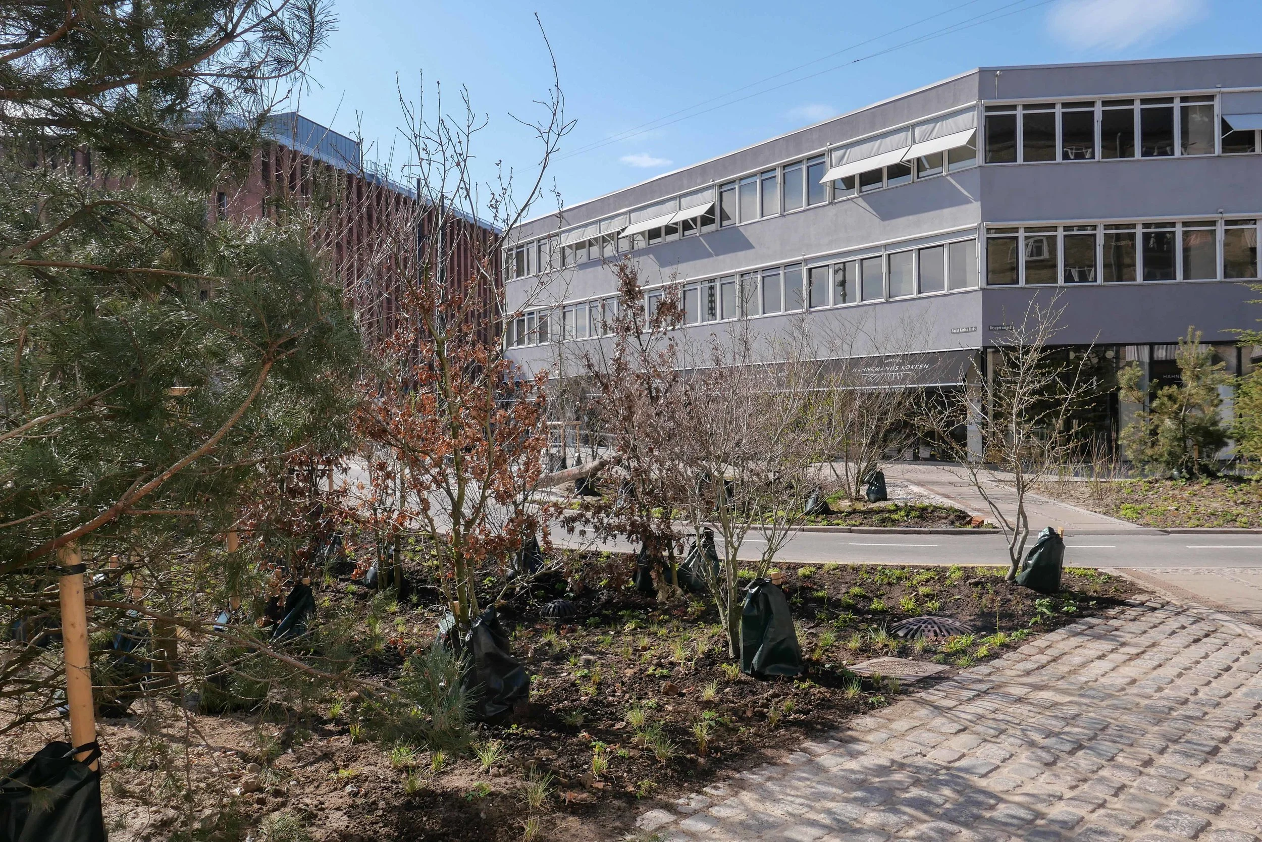
update - Sankt Kjelds Plads - climate change landscape
/Sankt Kjelds Plads in July 2018 - looking towards Hahnemanns Køkken - the cafe on the north side of the square
the same view in April 2019
Sankt Kjelds Plads is in a densely-built area of older apartment buildings about 4 kilometres directly north from the city hall.
Many of the buildings here date from the 1930s but there are large modern office buildings and large and relatively recent industrial buildings and a large supermarket to the west.
The area has a distinct urban character with relatively wide streets but little planting and not just on street parking but also fairly heavy through traffic. From the air you can see that most of the large apartment blocks have extremely pleasant courtyards with planting but the real problem for this area is that climate change has meant occasional but very destructive flooding from sudden rain storms with traditional street drainage unable to deal with surface water on the streets and with rain running off the roofs of the large buildings.
The solution has been to put in fast-flowing storm drains, surface channels to take water away to tanks or sumps where it can be controlled, and, where necessary, filtered and then released into the drainage system but at an appropriate rate. These sudden storms may last for only an hour but in that time there can be a depth of 30 centimetres of water across the road that stops traffic, floods basements and ground-floor apartments and businesses and takes road-level pollution through the drains and to the harbour and the sound.
Along with this hard landscaping of drains and surface gullies, the other solution is extensive planting that absorbs rainfall - apart from the most severe storms - and adds considerably to the amenity value of the street scape.
Here at Sankt Kjelds Plads, seven roads converge at what was a very large traffic round-a-bout. That was planted with shrubs and trees but it certainly was not a place to sit. In fact, with the heavy traffic, it was not a place where many people even cut across.
With the current scheme, small areas of pavement in front of the buildings have been pulled forward and the traffic discouraged and the round-a-bout reduced significantly in size. The new areas are densely planted and have pathways curving through them with seats . Sunken areas will flood when there are storms, to act as holding tanks, but have planting that will cope with short periods of partial submersion.
This will be the first full growing season for the trees and shrubs and ground cover so it is not fair to judge the scheme until everything becomes more established but already the transformation is obvious.
This large open space links through with the climate-change landscaping of Tåsinge Plads, about 85 metres away to the east, and the main north south road through Sankt Kjelds Plads - Bryggervangen - is also being planted to form a green corridor from the large park - Fælledparken - to the south and continuing through to an open area and pond to the north beyond Kildevældskirke.
post on Sankt Kjelds Plads July 2018
post on Tåsinge Plads July 2018


