Enghave Plads

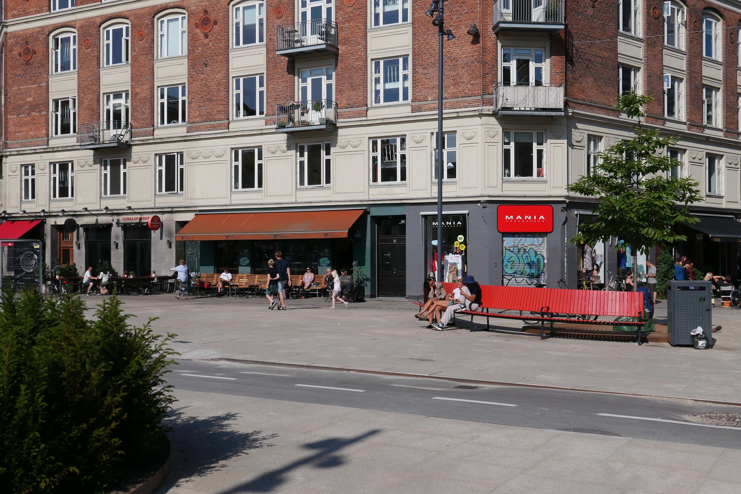
Vesterbro - the part of the city immediately west of the central railway station - is a densely-occupied area of apartment buildings with most dating from around 1900.

This was a strongly working class part of the city with the main rail line forming the southern boundary and with the meat markets, gas works and the harbour presumably supplying much of the work and the Carlsberg brewery was, until a few years ago, to the west.

The street pattern of the district is complicated with two main roads - Istedgade and Sønder Boulevard - running out at an angle from the railway station at the north-east to the south east but with secondary cross streets of traditional apartment buildings running north to south and there are also several streets running across the area from south east to north west so it a complex pattern of a grid but overlaid with a Saint Andrew cross so some streets meet or cross at odd angles.

At the south end of Istedgade is Enghave Plads - a large open square much wider east to west than the distance across from north to south and it narrows at the centre. This square is where several tram routes met so it was always an important point in the area and immediately to the west is a very large square with a major public garden - Enghave Parken - that has large apartment buildings on the north, west and south sides so the two spaces run together though divided by a busy main road - Enghavevej.

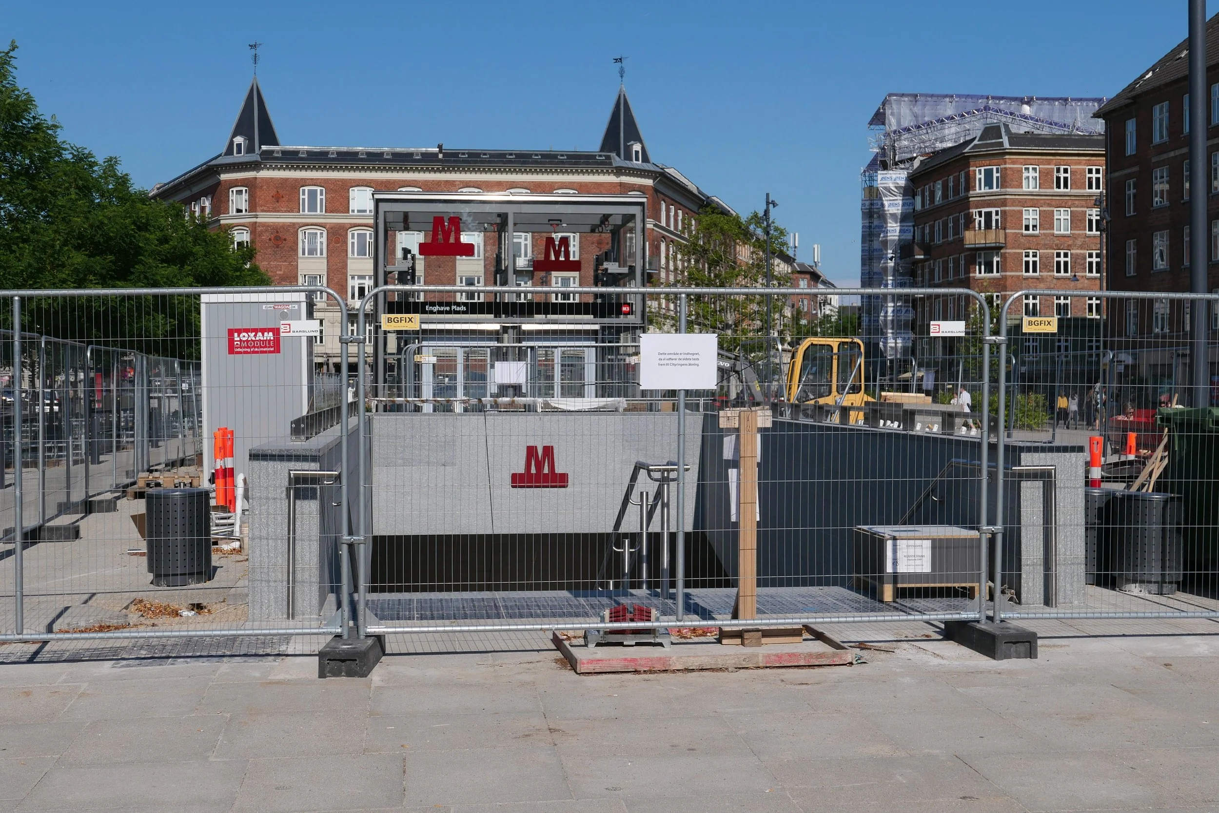
Enghave Plads is the site of one of the major new metro stations on the new circle line that will open at the end of September. The east end of the square and some of the surrounding streets have been boarded off for about a decade with major construction work for the metro but the boarding has just been taken down and the space with it's new landscaping opened officially.

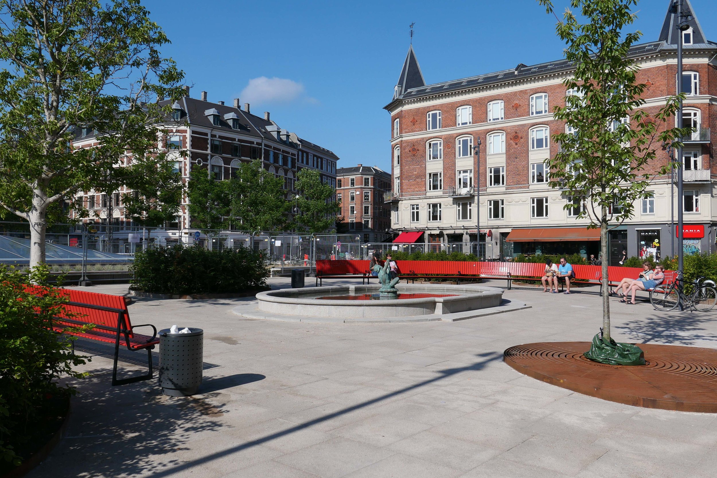
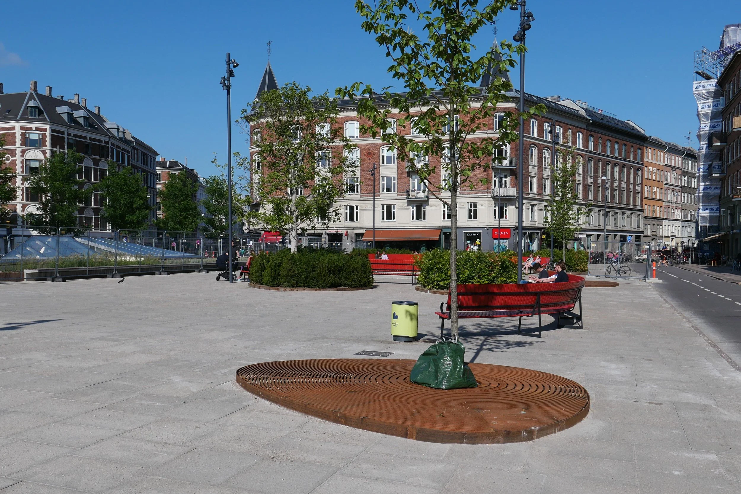
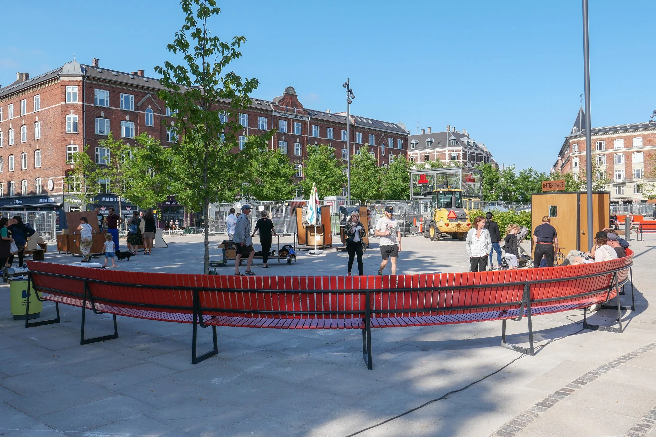
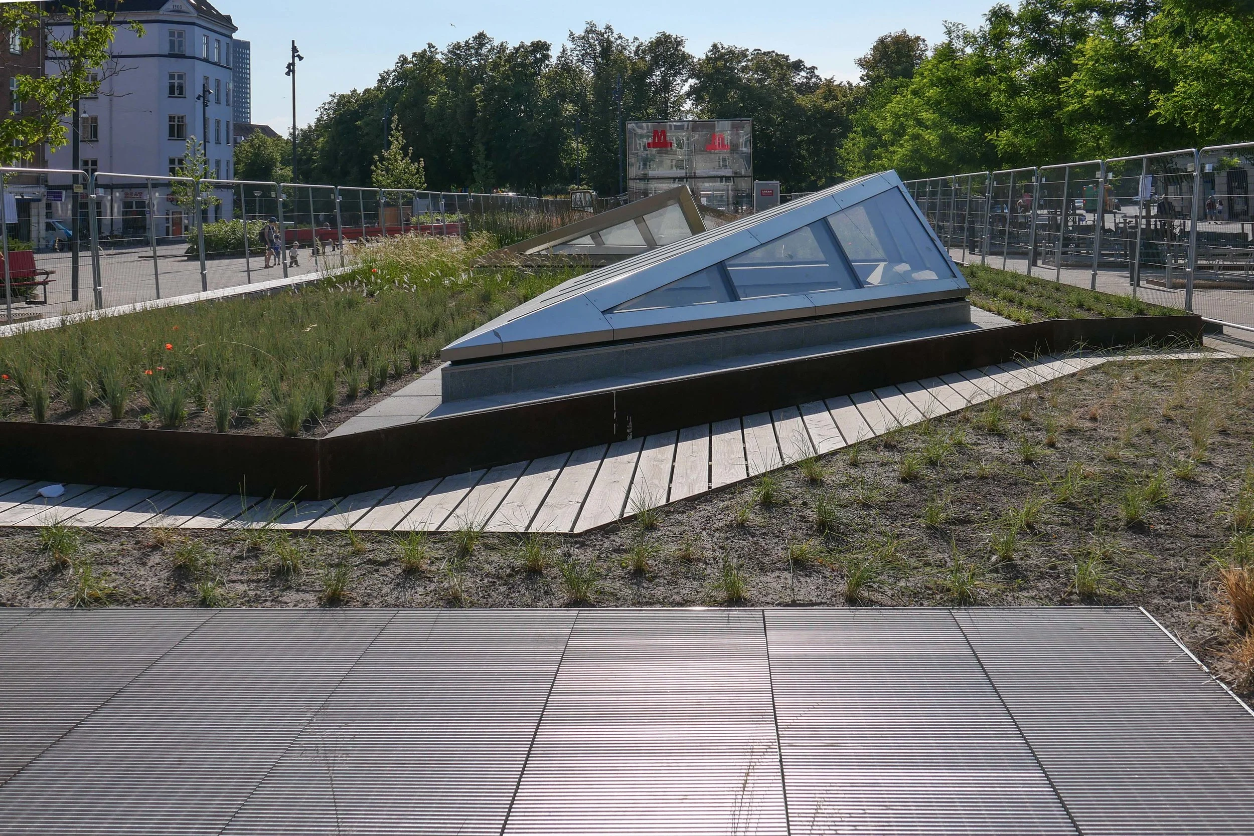
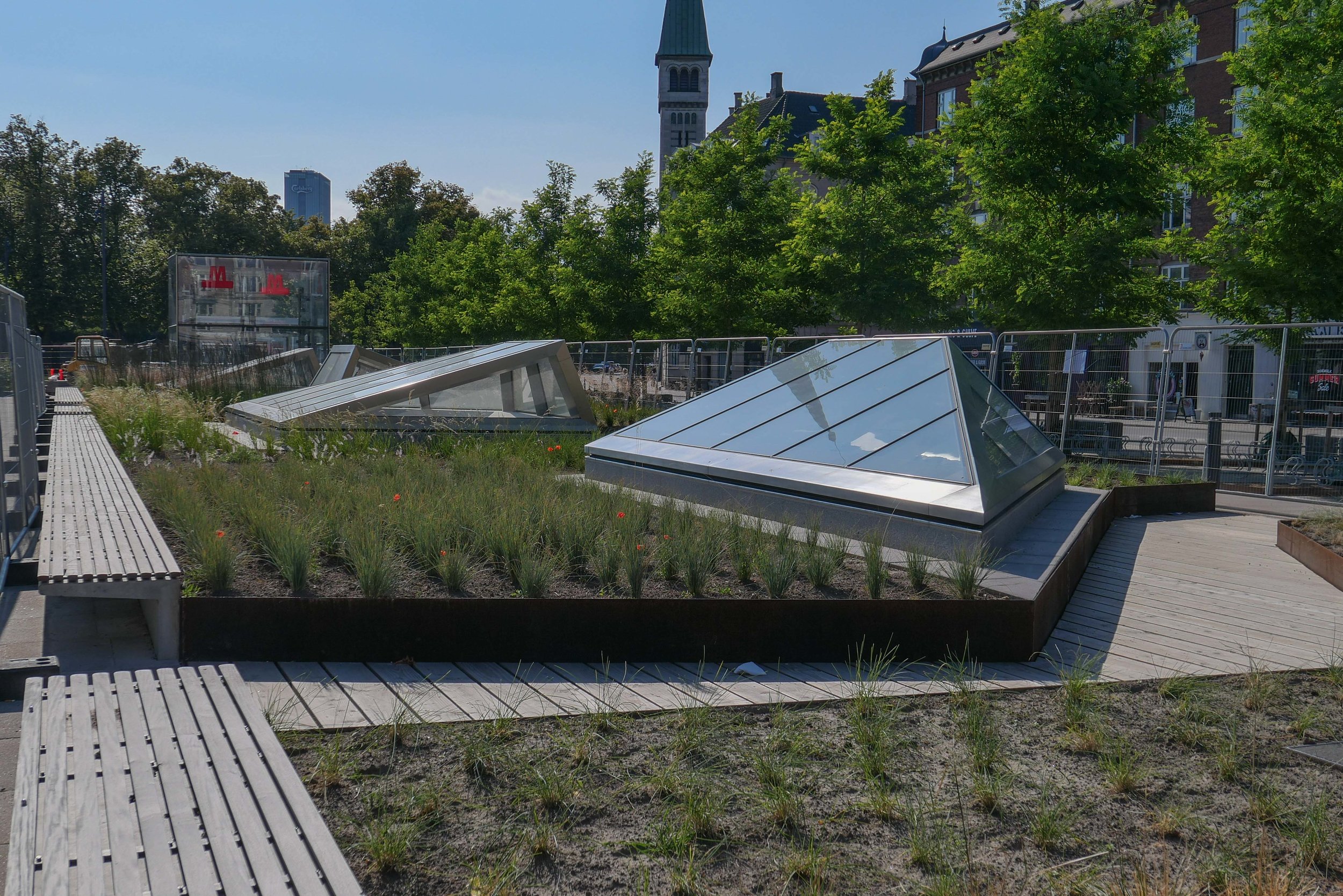
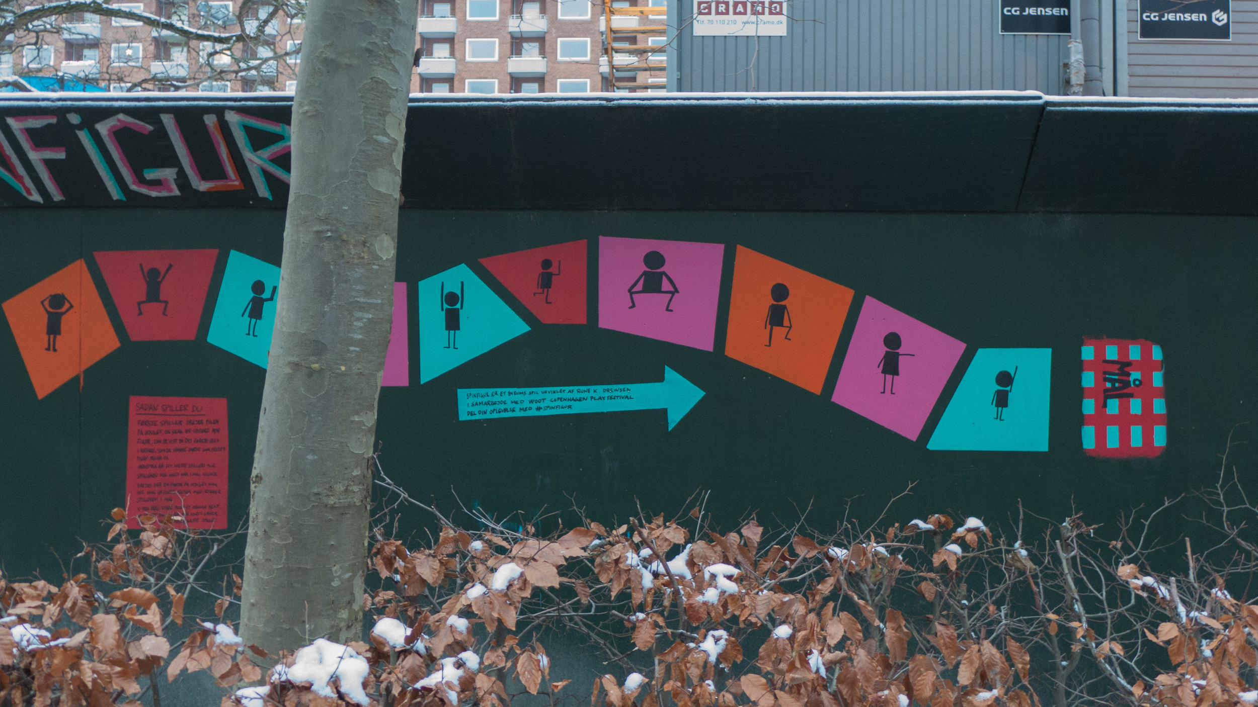
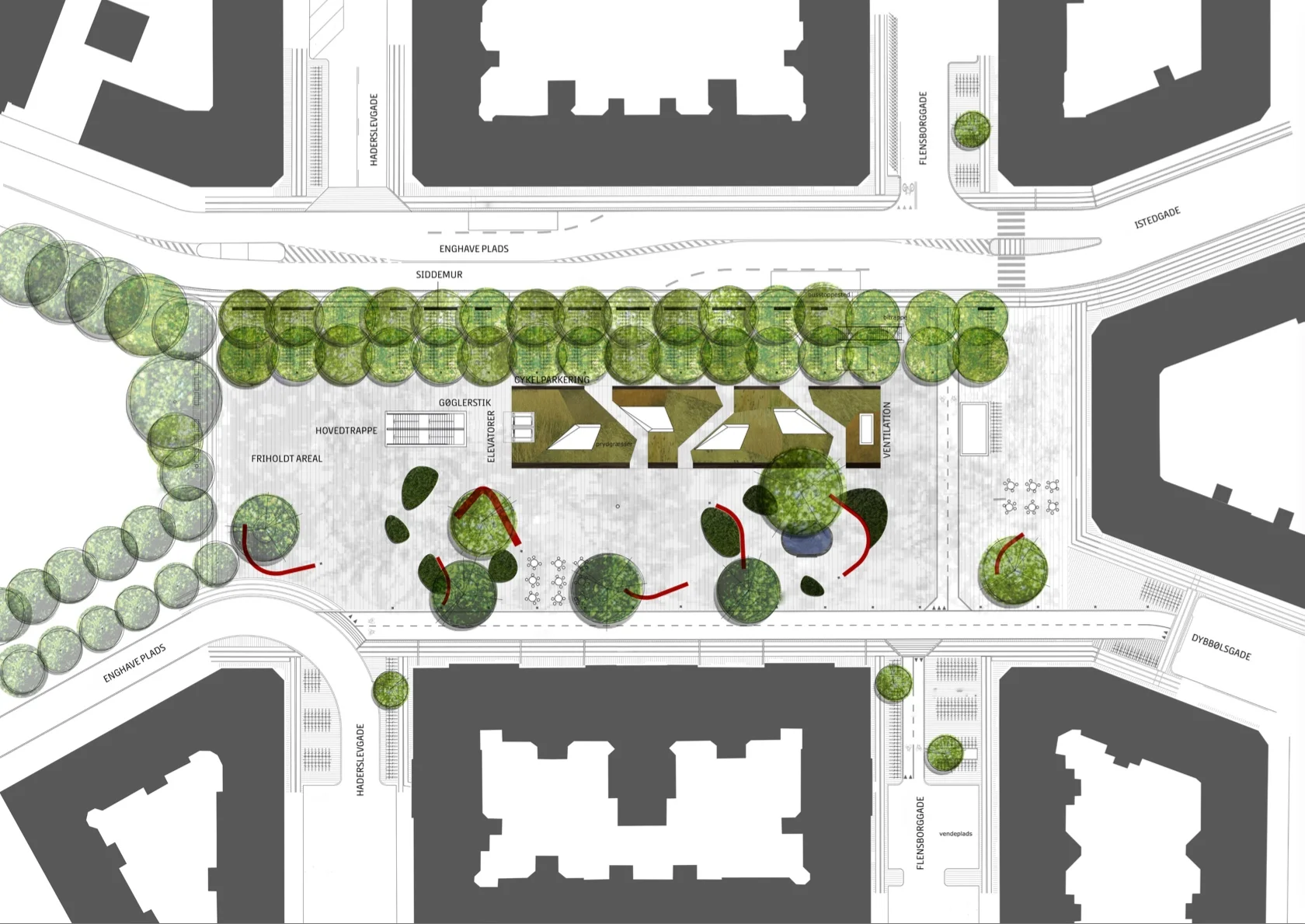
There are large areas for leaving bicycles across the north or darker side of the entrance steps to the metro station but across the south side of the metro entrance there are raised beds with Corten edging and long raised bench seats and then to the west more open space for events. This area has striking new seating that has deep red slats on a black metal frame and these form great bold curves though the initial reaction to the seating has been mixed - some asking exactly why people would want to sit next to each other in long rows even if they are curved. Mature trees to the west, along the main road, have been kept and provide a baffle against the sound of traffic and shade for more seating and an area that is fenced for ball games.

Copenhagen Metro

Vesterbro with the main railway line to the south, the MeatPacking district in the cirve of the railway and the main railway station top right
Enghave Plads just left of centre and Enghave Parken towards the left side

Enghave Plads from the east with the square of Enghave Parken beyond

tram leaving the square and heading along Istedgade towards the railway station … the area between the buildings and the central space has been paved over and the main through traffic has been restricted to the north side of the square


the metro, the bus and the harbour ferry in Copenhagen


With the start of a new year this is clearly a time for new plans and new schemes in the city. On the 24th January, the government launched a reorganisation of public transport in Copenhagen.

Metroselskabet - the company who now control the city Metro - will be combined with Movia who run city bus services and the Havnebuser or harbour ferry service.

The new overarching organisation is to be called Hovestadens Offentlige Transport / Metropolitan Public Transport or HOT for short and will cover the provision of transport across 34 municipalities.

Will HOT replace or at least change the responsibilities of DOT - Din Offentlige Transport / Your Public Transport that was set up in 2014? This was formed by DSB - the operators of regional trains - with Movia and Metroselskabet in order to coordinate strategy and to provide a single access point for passengers who need information about ticketing and times and so on across the system.

The reorganisation appears to be a sensible attempt to coordinate transport across the city and certainly at a sensible time … so before the completion and the opening of the new inner ring of the metro. Metroselskabet was set up by the city and by the port authority and has been organised primarily for the construction work and for the completion and opening of the metro system and not for the ongoing running of the metro system.

However, there has already been criticism - not least from Movia.

Current transport is organised across the region - so across Sjæland - and includes the suburban rail system but at this stage, as far as I can see, the S trains will not be included in the remit of the new body. Some have also been critical because this does not include any new money so seems to be simply about co-ordination and synchronisation and does not tackle capacity or improvements as such with no provision for additional equipment. This is important because the current metro line is running at almost full capacity … good in terms of the economics but not so good for passenger comfort.

To be fair, it may well be better to make further decisions after the new metro line opens this summer because the new line is bound to establish very different travel patterns for people in the city … at the very least it creates important new interchange points for swapping between one mode of transport and another and in the months after the opening will certainly reveal new congestion points in the system.

Metroselskabet
Movia
DOT

note:

Back in June, Movia announced that new harbour ferries will go into service in January 2020. These will be electric - recharging overnight but also topping up batteries at both ends of the route at Refshaleøen and Teglholmen. The new service will run every 30 minutes. As the service carries 425,000 passengers each year, this is an important and - with so many new apartments being built at the south harbour - a significant part of the city transport system.

Copenhagen Metro


Copenhagen Metro can be seen as a single design project - be it a complicated, ambitious and well-integrated design project - that has brought together design skills in electrical and mechanical engineering for the systems that control the driverless trains; advanced civil engineering for the construction of the tunnel system; engineering and industrial design in the trains themselves; architecture and structural engineering in the elevated tracks, the stations, and the canopies over the tracks and of course landscape and urban design and planning in the setting of the stations and tracks above ground along with graphic design and typography to give the whole transport system a strong and clear visual identity.

There have been a few mistakes and so some things have been changed … for instance fixed glazed barriers along the edge of platforms with doors that line up with the carriage doors have been added for safety as the number of passengers has increased or the changes that have been made as the ticketing system has moved on from clip cards to the credit-card style Rejsekort or to passengers using travel passes on their smart phone which effects how groups of people move into and through the lobby and escalator areas and determines the number of ticket machines and scanners needed and their position.

Often, of course, what initially determined design options might not be that obvious now.

Compared with many metro systems, the stations in Copenhagen are further apart so, in what seems to be a counter-intuitive piece of logic, the trains can be smaller and run closer together. That’s simply because there is a greater distance between stations for the train to get up to an efficient speed and still keep within safety margins if the train in front should be held up by people taking longer to get on or off. Slower trains are more efficient if they are longer whereas faster and more regular trains can be shorter. Having made that decision, the size of the train with a standard unit of three carriages then determined the design of the station. 

In Copenhagen for below-ground stations there are a sunken rectangular box built in concrete and are the same length as a train and the width is the width of the single central platform between the two tracks. The main space for tickets and so on are below ground, reached by external uncovered steps down from the pavement and the roof at pavement level, over this space, has distinctive triangular glass pyramids to throw natural daylight down through the construction to the platform below … although electric lighting is also needed because of the depth below ground of the platform level and because intermediate landings and the escalators cut across the space and block some light.


Just to focus on one interesting design problem and solution, the layout of the escalators at the main below-ground stations seems to be particularly good … well designed in terms of managing the movement of people in a safe and relatively rational way … relatively rational because it makes sense for regular users but can be confusing initially for visitors.

Escalators are inset from the outer walls and have glass sides to allow as much light as possible to get down to the platform from above. A common arrangement in other metro systems is to have pairs of escalators side by side with one going up and one down and with the same arrangement repeated at either end of a long platform. In the Copenhagen system, within the tight space of the box, there are two escalators going down at one end and two moving up at the other. To go down you start at the outside edge of the space and go down to a landing where you move towards the centre and double back with two escalators together side by side going down to the centre of the platform … if it was laid out the other way, with the two upper escalators together, the lower flights would be on the outside against the track. Passengers familiar with the layout use the landing to swap to the right side for the platform they want to use below. The escalators also act as a barrier along the centre line of the platform separating out people taking trains in different directions. There is the same arrangement at the other end of the station with two sets of escalators rising up to the ticket hall. The only slight problem for the passenger is if they get off a train from doors towards the middle of a train when it may take a couple of seconds to work out which pair of escalators are going up and which pair are coming down.

concept sketch for escalators from KHR Architecture


The Metro has been constructed in phases starting with the 1992 Ørestad Act that was necessary to organise the programme, acquire land and give the development a legislative and financial base.

Construction work started in 1994 and the first section opened in October 2009 to run from Nørreport to Vestamager. Almost immediately after that, in May 2003, the extension of that line out from Nørreport to Frederiksberg opened. 

A crucial line was constructed out to the airport and that opened in 2007 giving the metro plan it’s distinctive inverted Y arrangement with the junction at Christianshavn and two lines running down through Amager with one to the west serving the new town of Ørestad and the other to the east following the coast of Amager to the airport. Both the southern lines emerge from tunnels south of Christianshavn and continue as raised section above street level. In the opposite direction, beyond Fasanvej Station, the rail is again elevated. The Metro has major interchanges with the suburban rail service at Nørreport and Flintholm.

The next and certainly the most complicated addition in terms of construction will be the Cityringen - City Circle - where work began in 2009 and is due to be completed by 2018. That leaves a relatively short spur out to the North Harbour that is to be opened in 2019 and a line out the South Harbour to be completed by 2023 with the possibility of further lines. This Cityringen will establish further major transport interchanges for the Metro at the central station, at Kongens Nytorv and at Østerport with links to suburban and regional trains.


Sundby Station

Bella Centre Station


the elevated track between Bella Centre and Ørestad


Presumably, as the Metro expands, signs and colour coding will become more important so that people who are unfamiliar with the system or distracted by the press of people around them don’t find themselves heading in the wrong direction on the wrong line. This is a more general design problem that effects not just the lost individual but the system could start to clog up if people freeze to look at maps or guides or start asking people for help while blocking a crucial area at the top or bottom of staircases or blocking exit doors … then bad design could actually foul up the smooth running of the operation and be dangerous. In those cases designers and planners try and avoid problems but it’s quite a challenge to design something to deal with the amazing ability for some humans to be lost, short-sighted, stupid and selfish all at the same time. As with the extensive remodelling of the transport interchange at Nørreport station, good design works best when people do not realise just how much they are being directed and manipulated by a successful design.

the interchange with suburban train services at Flintholm


 architects for the Metro were Vilhelm Lauritzen Arkitekter, Nille Juul-Sørensen and KHR Architecture
design for station furniture and fittings by Knud Holscher
engineering by Rambøll A/S, Grontmij I Carl Bro A/S and Cowi


Byens Hegn ... more paintings from Metro hoardings in Copenhagen

Engineering works for the extension of the Metro in Copenhagen are due to be completed in 2018 but until then there are 19 large sites in streets and squares and parks in the city that are surrounded by high hoardings that have become a well-established feature. In some places the hoardings have blocked streets completely and for some sites they are hard against buildings.


To give these hoardings a more positive role in the urban landscape they have been used as a gallery space for very large paintings and for information panels and for community schemes. As the hoardings have been realigned, as work progressed, some art works have been moved around the city and new works have been added.

For many of the artists, this was the first opportunity they have had to work at this scale.

Two prizes of 10,000 kroner have been awarded each year for the best designs, one by popular vote and one awarded by a team of judges.


The first photographs are of the works at Gammel Strand on the south side of the circuit of new stations because they illustrate well the range of designs and concepts accepted for the scheme. The hoardings there include a major piece by the designer Henrik Viskov called Wooden Jigsaw Puzzle and a dramatic monochrome design by the young artist Mads Thomsen. There are also a series of gigantic photographs of major finds from the archaeological excavations by a team from Københavns Museum … this was after all, before the city expanded out onto reclaimed land, the line of the wharf of the medieval city.

A few photographs were posted here but today, with clear light from the snow-covered ground and with less traffic around because of the Christmas holiday, I walked in a long arc around the streets of the north and west parts of Copenhagen following the line of the new metro stations from Trianglen to Vibenshus Rundel through Skjolds Plads with its hoardings covered with photographs of beech forests to the huge area fenced off in Nørrebroparken and then to Nuks Plads, Aksel Møllers Have and ending at Fredericksberg to join up with the existing metro line to get a train home.


The photographs here are published in sequence as I walked from Øster Søgade to Frederiksberg. Not all the works are included but the selection here shows the huge range of ideas and styles and subjects. Some works include 3D elements and there are some with lighting but most are painted or are produced photographically.


At each of the sites, as well as the art works, there are maps, information panels and drawings of the new station.

There is also a good web site with information about the artists and the works and for many of the sites there are short films of interviews with artists or local people talking about the impact the works have had.

What's on my fence?

art on the metro hoardings

Engineering works for the major extension of the Metro in Copenhagen has meant that many streets and squares have been blocked or screened off with hoarding, said to be in total 6 kilometres long, and in some places the hoardings are 4 metres high. This has become almost a permanent part of the city streetscape and the work is not scheduled for completion until 2018.

Metroselskabet, the company behind the project, came up with a scheme for artists and children in the city to use the hoardings as a canvas not only for street art but for communication and as a backdrop to installations.

A section at Kongens Nytorv has a series of hinged flaps with black on one side and sharp strong colours on the other. A ladder is provided and kids seem to have great fun flipping over various combinations to form letters (usually their name) or patterns. There is usually a dotting parent there with camera ready to record the result.